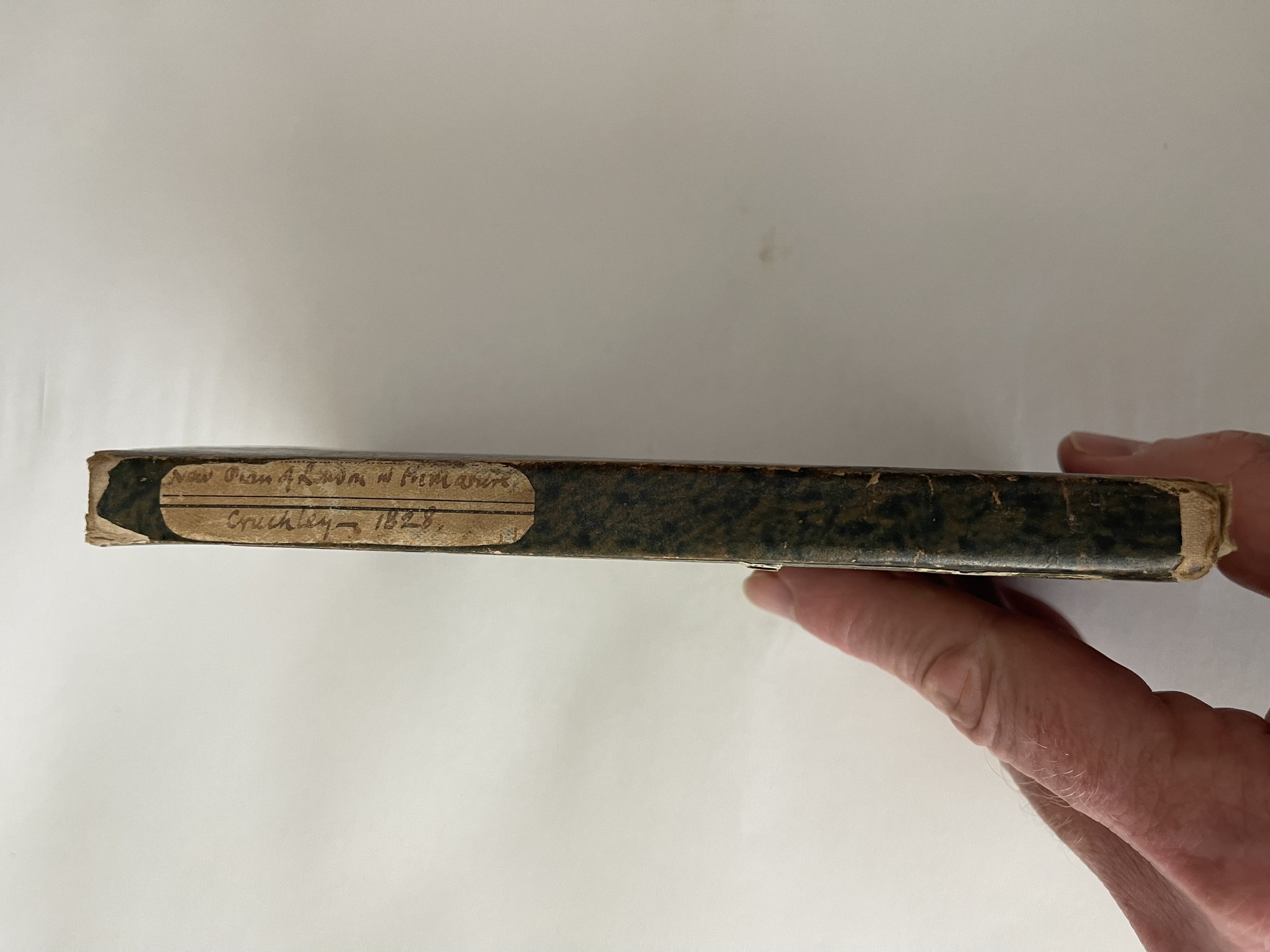

New Plan of London map - Cruchley / Arrowsmith - dated 1828 - RARE edition
Always wanted a ‘Cruchley’s plan of London’ Map but could never really find a copy that was in good enough condition and for the right price. This rare 1828 version is in exceptional condition for its near 200yr age.
George Frederick Crutchley (1796-1880) was an engraver, map and globe maker in London in the 19th century. He began as an apprentice to the mapmaker Aaron Arrowsmith (1750-1823) and eventually opened his own firm in 1823 upon Arrowsmiths passing.
This map was constructed in the first 5 years of the inauguration of Crutchley’s business. Crutchley acquired and amended Arrowsmith’s plates upon his death. Crutchley’s primary business was map trading however, he also offered engraving and surveying services within his portfolio of work. He was known for publishing popular maps of London and its environs, along with maps of the British Isles and other European countries. Around 1844, he purchased the plates of map and globe maker John Cary. He produced maps under his own and Cary’s name, until 1876. His business operated for around 53 years between 1823-1876.
Interestingly, George Frederick Crutchley witnessed 4 reigning British monarchs in his lifetime. When born, King George III was on the throne until 1820. During Crutchleys time as a map maker, King George the IV reigned until 1830 and then King William IV (1830-1837). Queen Victoria was the reigning British monarch at the time of Crutchleys passing.
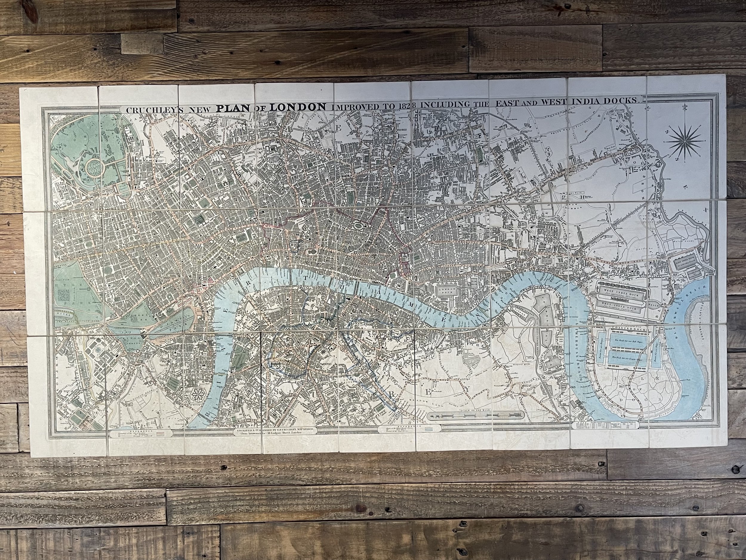
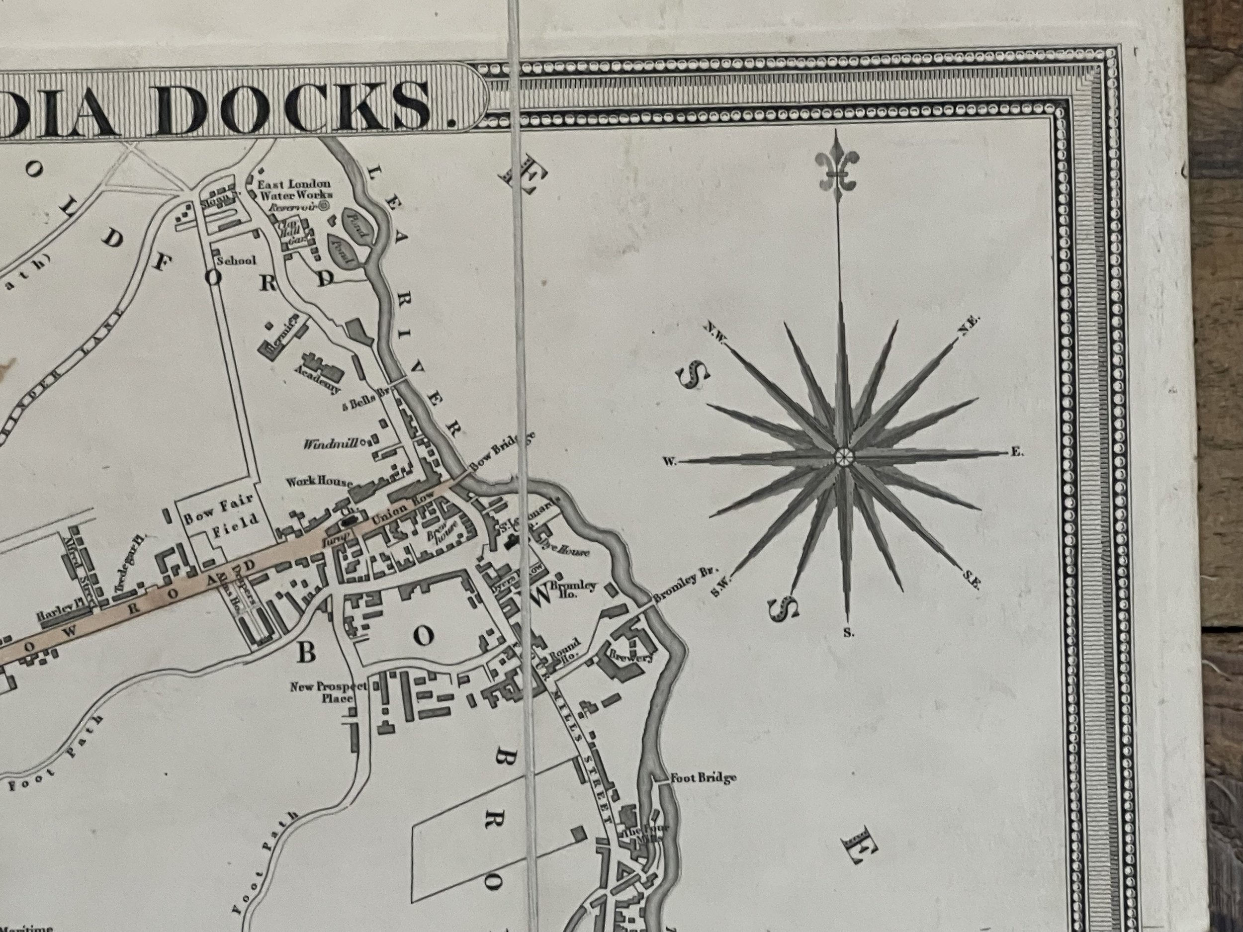
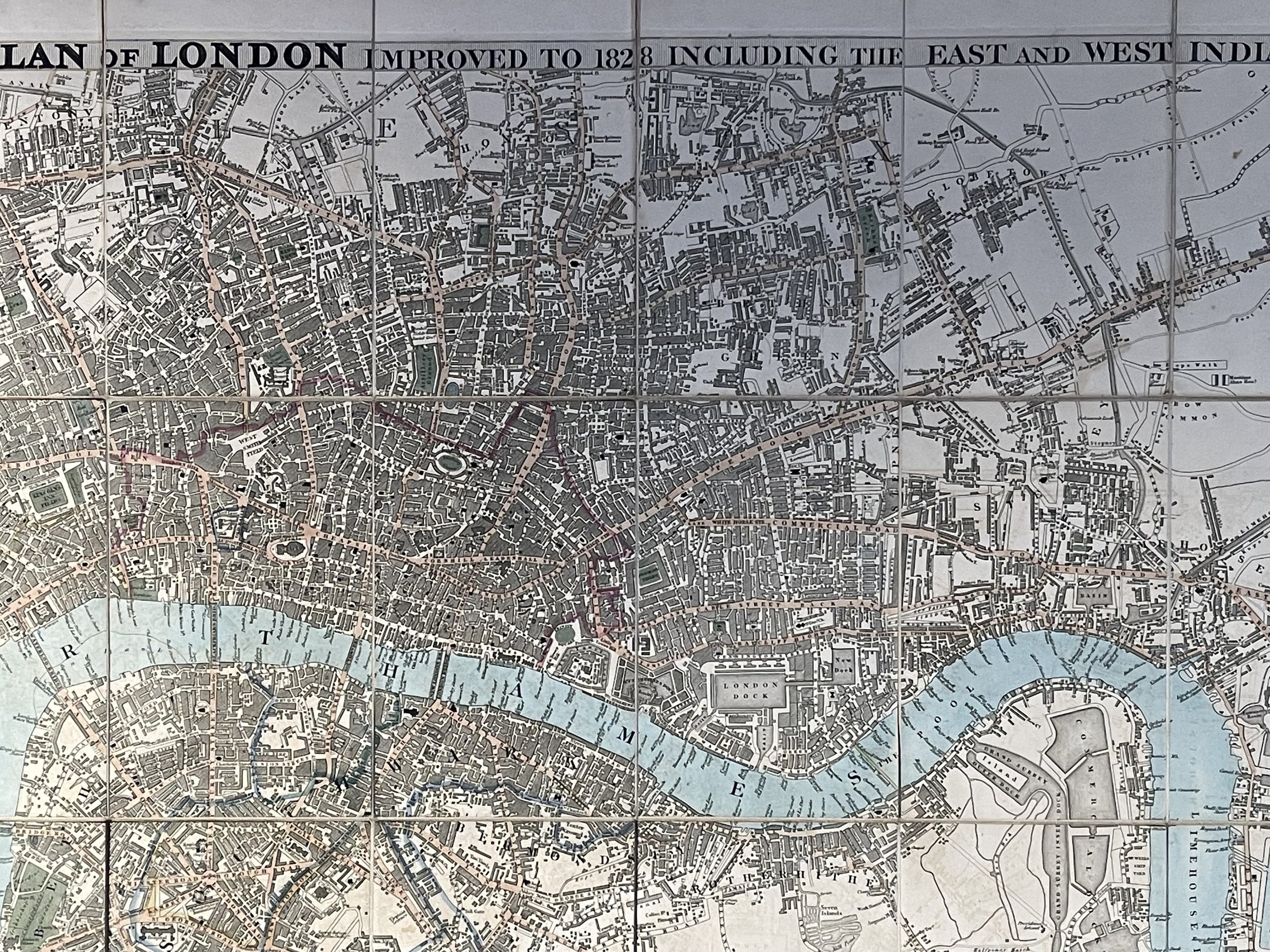
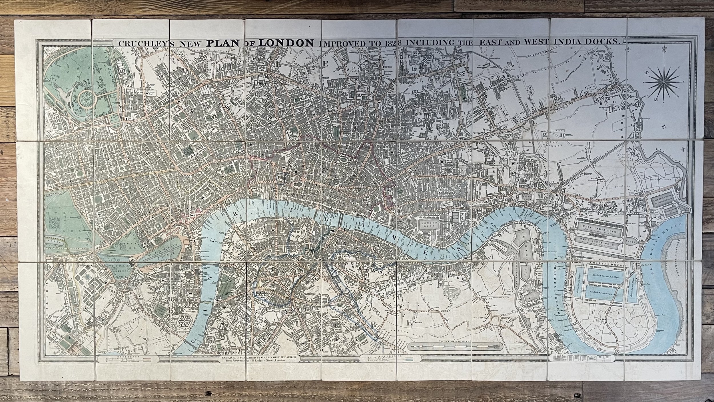
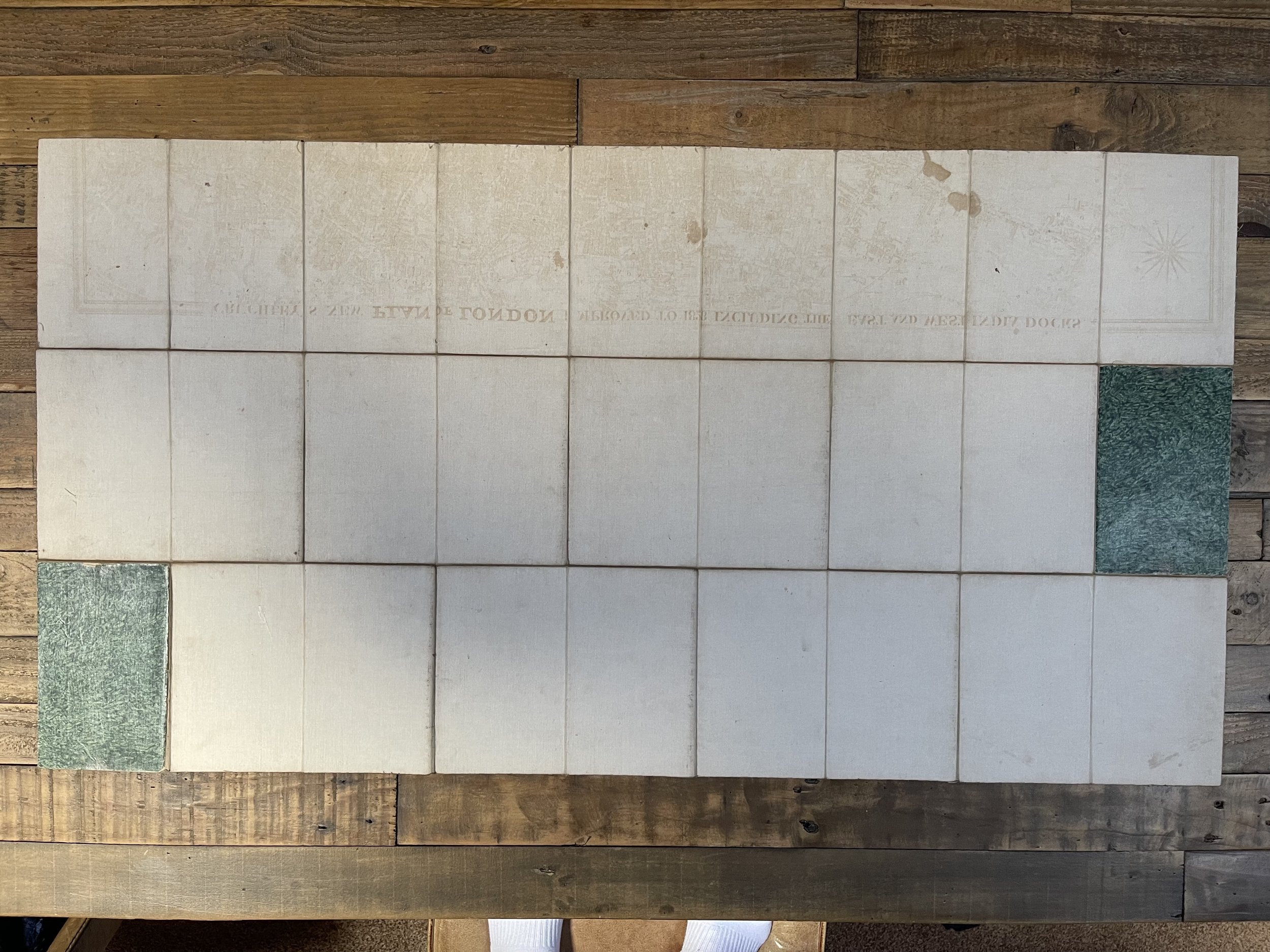
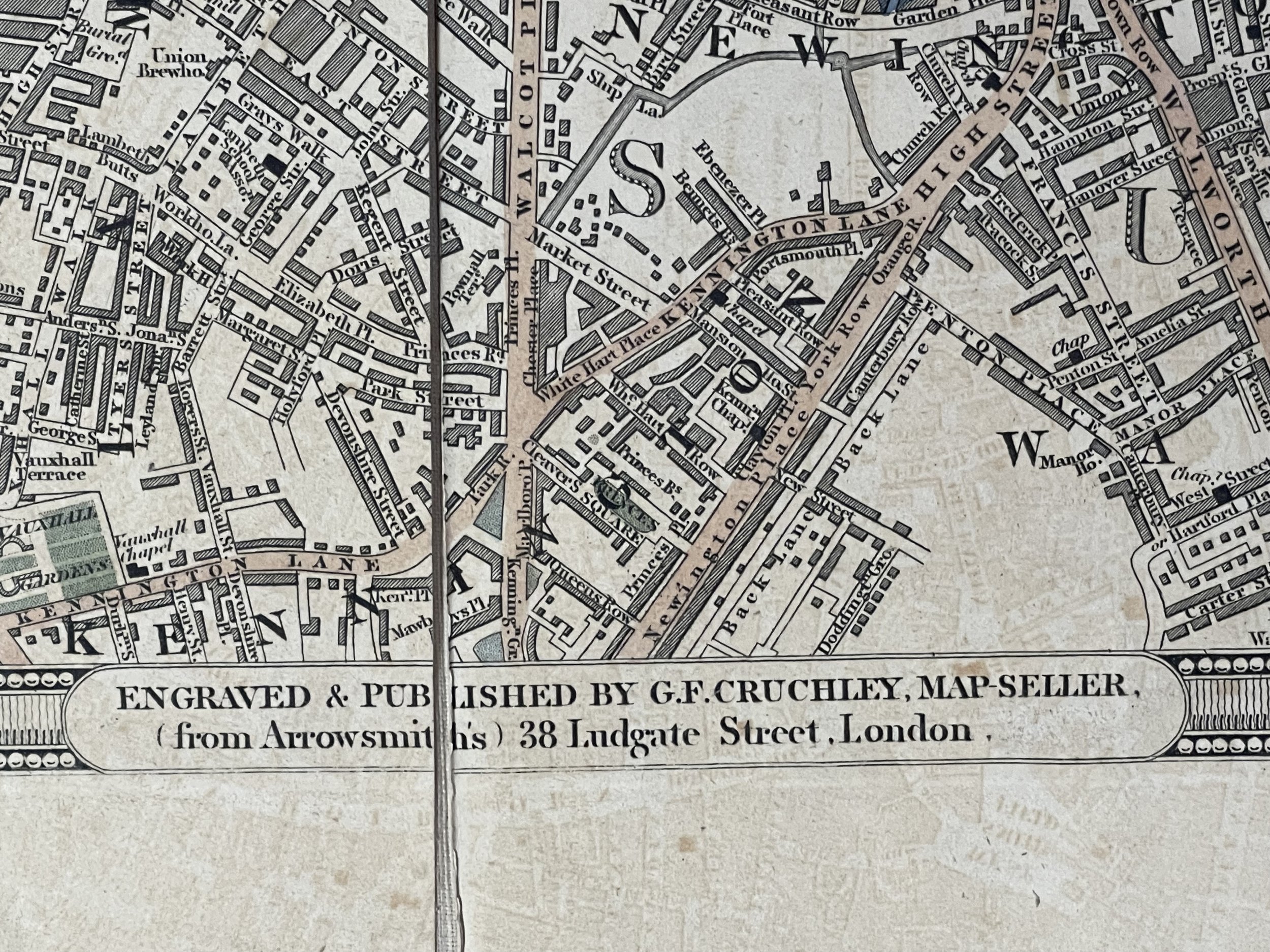
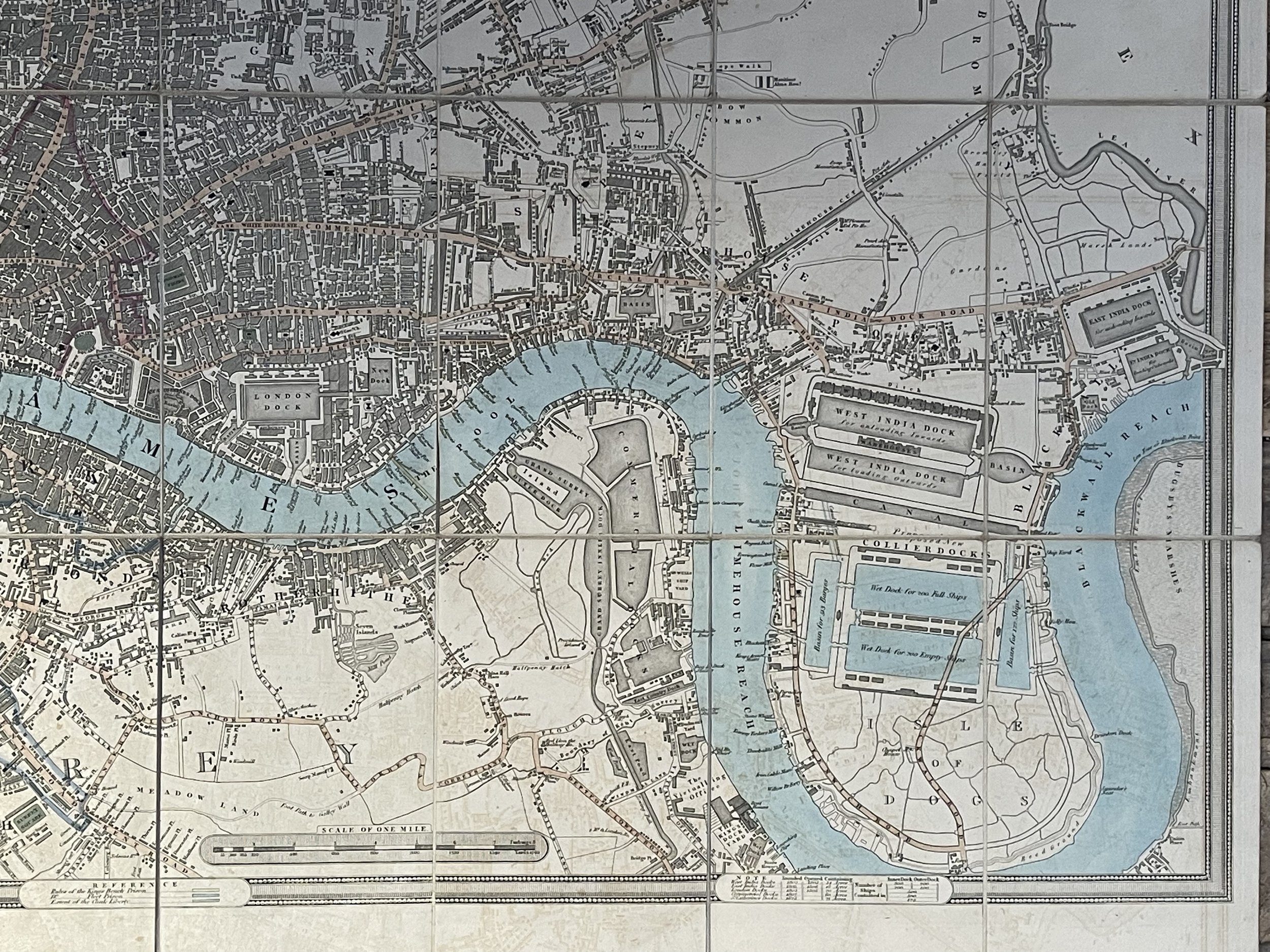
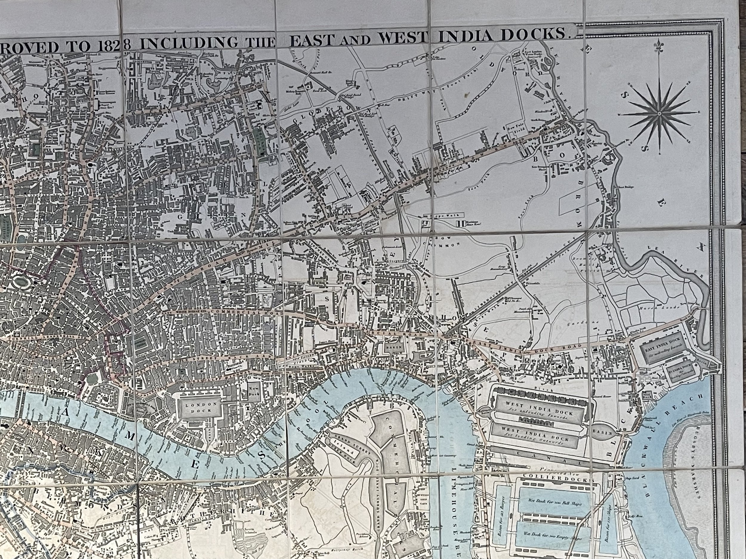
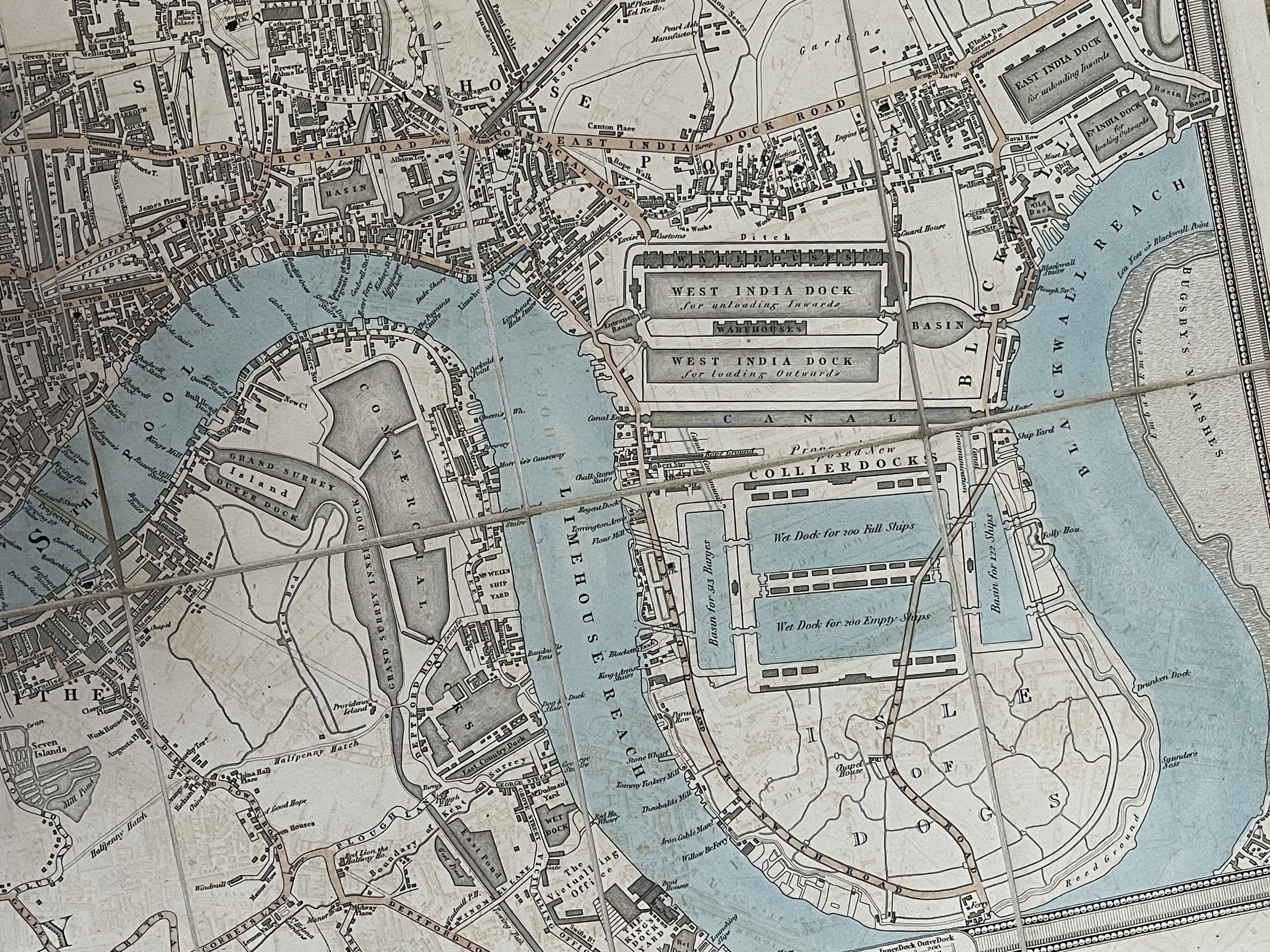
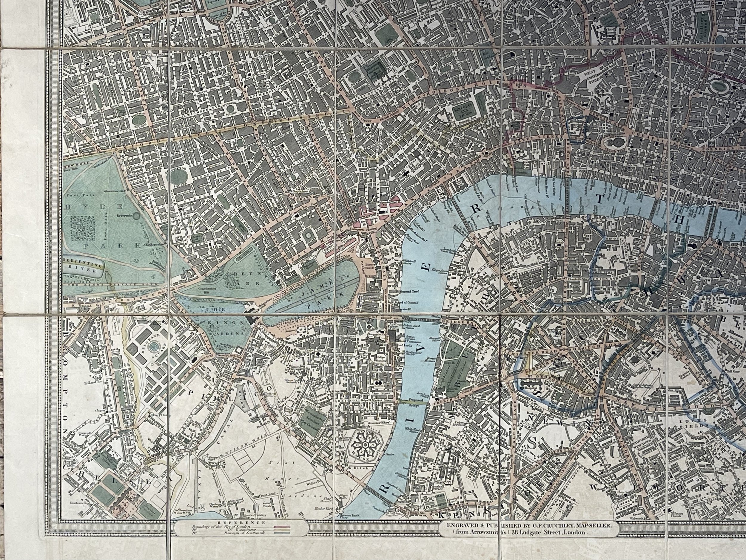
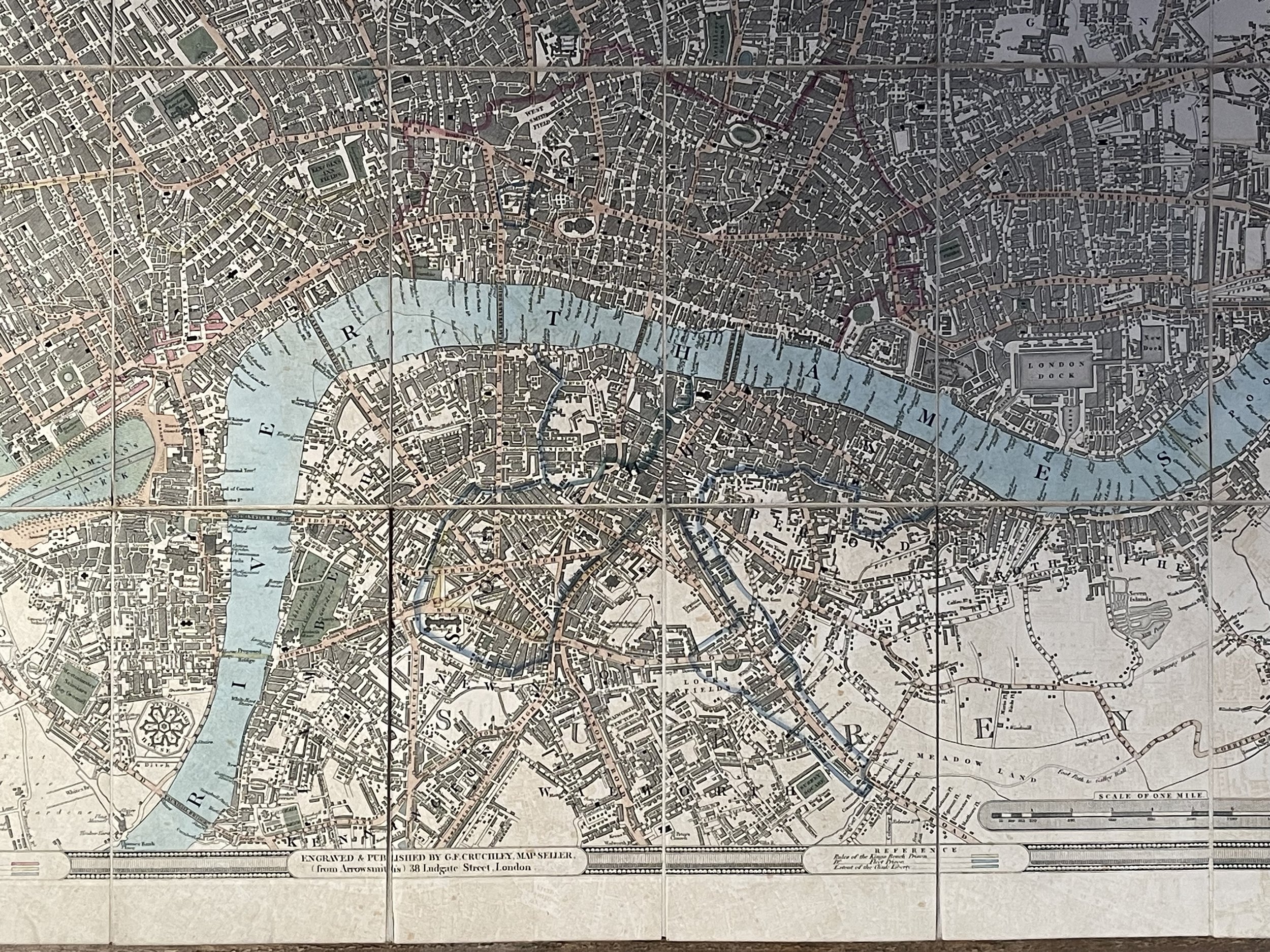
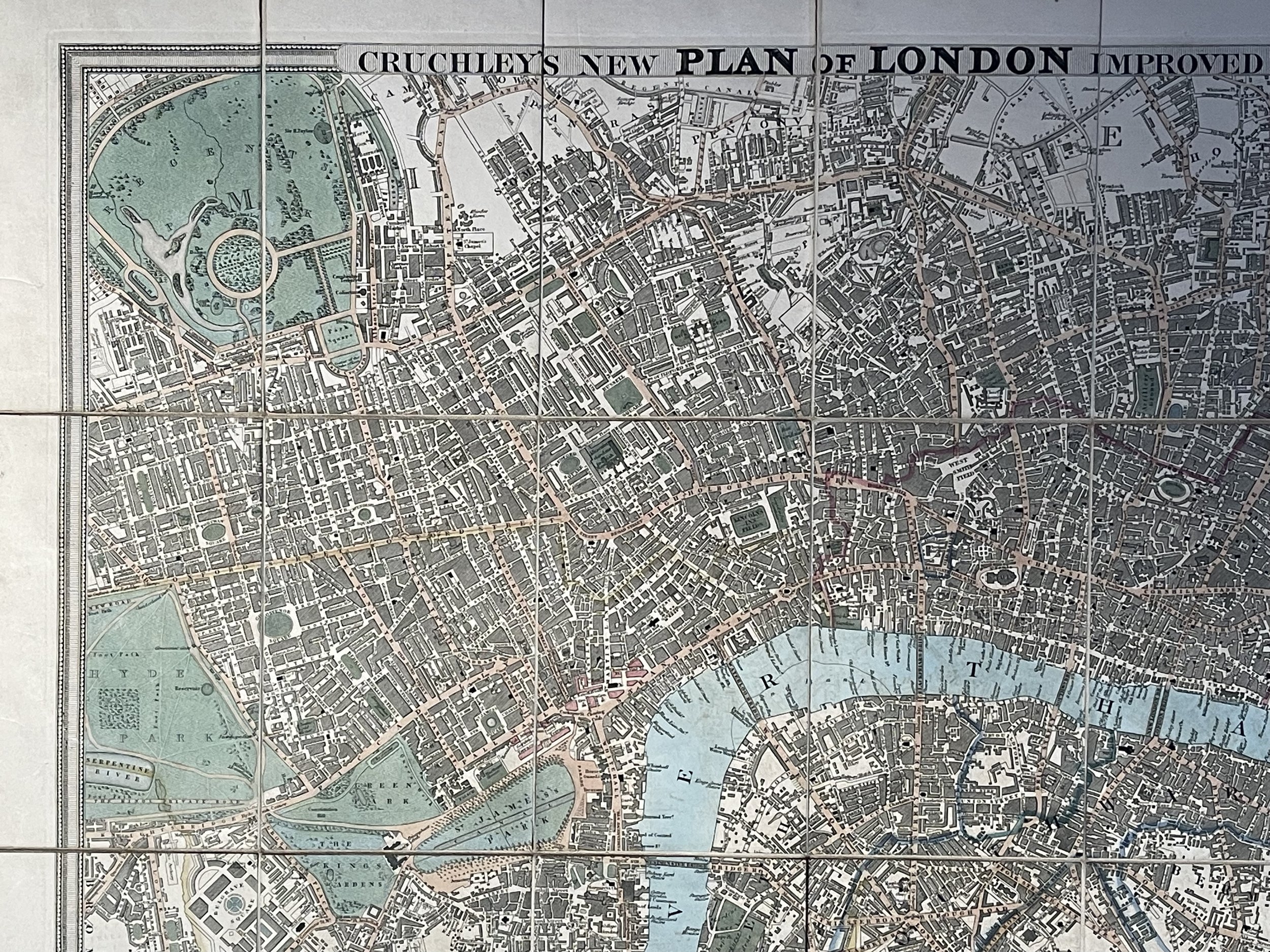
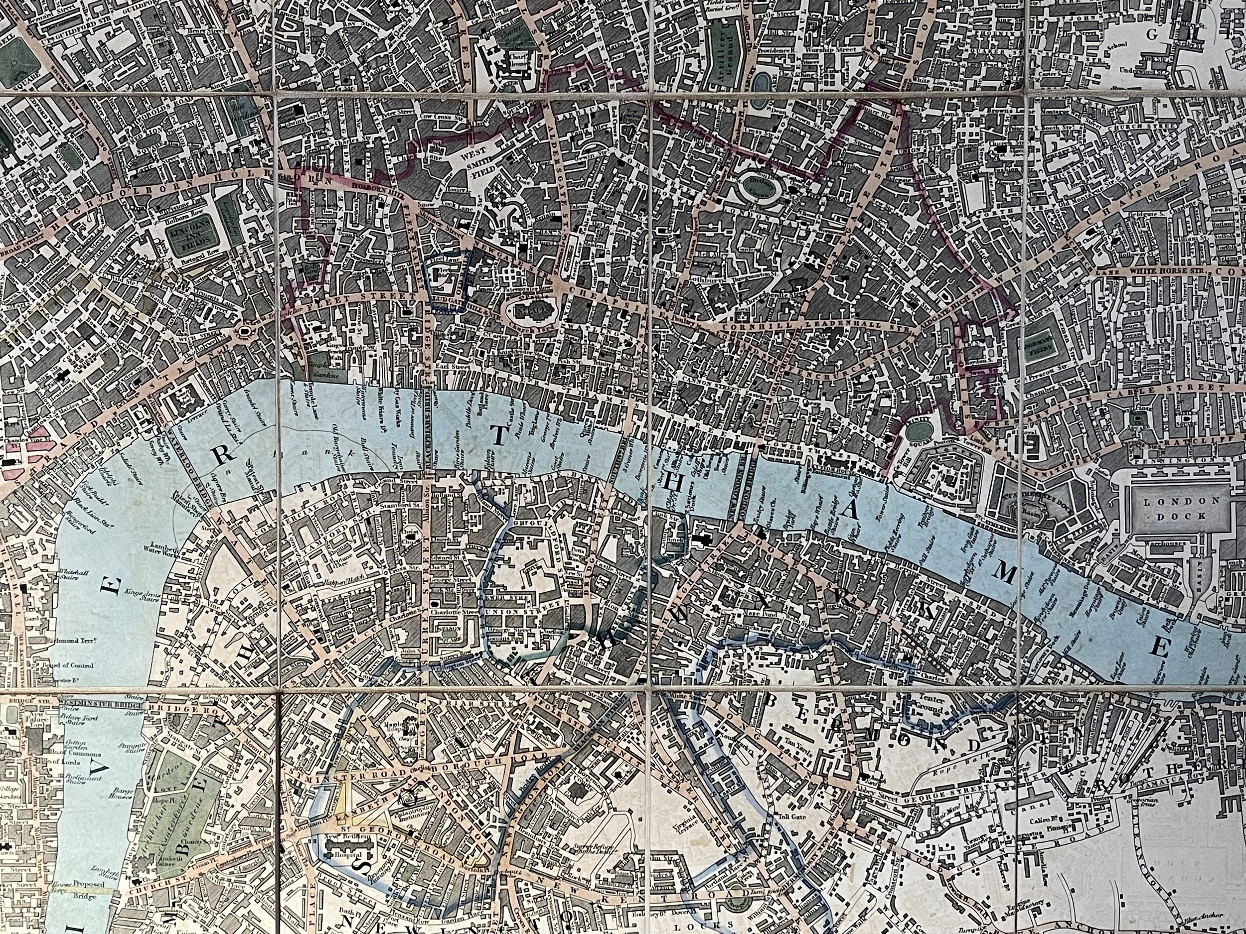
The title of this folding map of London is inset in top border, with the publisher's imprint and key to symbols in bottom border, scale bar near bottom right, and compass rose at top right. The river and open spaces are highlighted in colour. The map extends eastward on an added sheet to include the East and West India Docks. Cruchley, who first published the map in 1826, added the proposed Collier Docks in the Isle of Dogs to this later edition. The docks were never built and Millwall Docks now occupy part of the site.
George Frederick Cruchley (1796-1880) was an engraver and map and globe maker in London. He began his long career as an apprentice to the mapmaker Aaron Arrowsmith opened his own firm in 1823. He also acquired and updated some of Arrowsmith's plates. Although his primary business was as a map seller and publisher, he also offered general engraving services and surveying. He published popular maps of London and environs and travel maps and guides to the British Isles and European countries. Around 1844, he purchased the plates of map and globe maker John Cary. He produced maps and globes under the Cary name, as well as under his own name, until 1876.
Cruchley, George Fredrick (worked 1823-1876) London published maps and manufactured globes.
Always wanted a ‘Cruchley’s plan of London’ Map but could never really find a copy that was in good enough condition and for the right price. This rare 1828 version is in exceptional condition for its near 200yr age.
George Frederick Crutchley (1796-1880) was an engraver, map and globe maker in London in the 19th century. He began as an apprentice to the mapmaker Aaron Arrowsmith (1750-1823) and eventually opened his own firm in 1823 upon Arrowsmiths passing.
This map was constructed in the first 5 years of the inauguration of Crutchley’s business. Crutchley acquired and amended Arrowsmith’s plates upon his death. Crutchley’s primary business was map trading however, he also offered engraving and surveying services within his portfolio of work. He was known for publishing popular maps of London and its environs, along with maps of the British Isles and other European countries. Around 1844, he purchased the plates of map and globe maker John Cary. He produced maps under his own and Cary’s name, until 1876. His business operated for around 53 years between 1823-1876.
Interestingly, George Frederick Crutchley witnessed 4 reigning British monarchs in his lifetime. When born, King George III was on the throne until 1820. During Crutchleys time as a map maker, King George the IV reigned until 1830 and then King William IV (1830-1837). Queen Victoria was the reigning British monarch at the time of Crutchleys passing.
The title of this folding map of London is inset in top border, with the publisher's imprint and key to symbols in bottom border, scale bar near bottom right, and compass rose at top right. The river and open spaces are highlighted in colour. The map extends eastward on an added sheet to include the East and West India Docks. Cruchley, who first published the map in 1826, added the proposed Collier Docks in the Isle of Dogs to this later edition. The docks were never built and Millwall Docks now occupy part of the site.
George Frederick Cruchley (1796-1880) was an engraver and map and globe maker in London. He began his long career as an apprentice to the mapmaker Aaron Arrowsmith opened his own firm in 1823. He also acquired and updated some of Arrowsmith's plates. Although his primary business was as a map seller and publisher, he also offered general engraving services and surveying. He published popular maps of London and environs and travel maps and guides to the British Isles and European countries. Around 1844, he purchased the plates of map and globe maker John Cary. He produced maps and globes under the Cary name, as well as under his own name, until 1876.
Cruchley, George Fredrick (worked 1823-1876) London published maps and manufactured globes.
Code : A822
Cartographer : Cartographer / Engraver / Publisher: Cruchley, George Fredrick / Aaron Arrowsmith
Date : Publication Place / Date - 1828 approx
Size : Sheet size: Image Size: 92 X 52 cm
Availability : Available
Type - Genuine - Antique
Grading A+
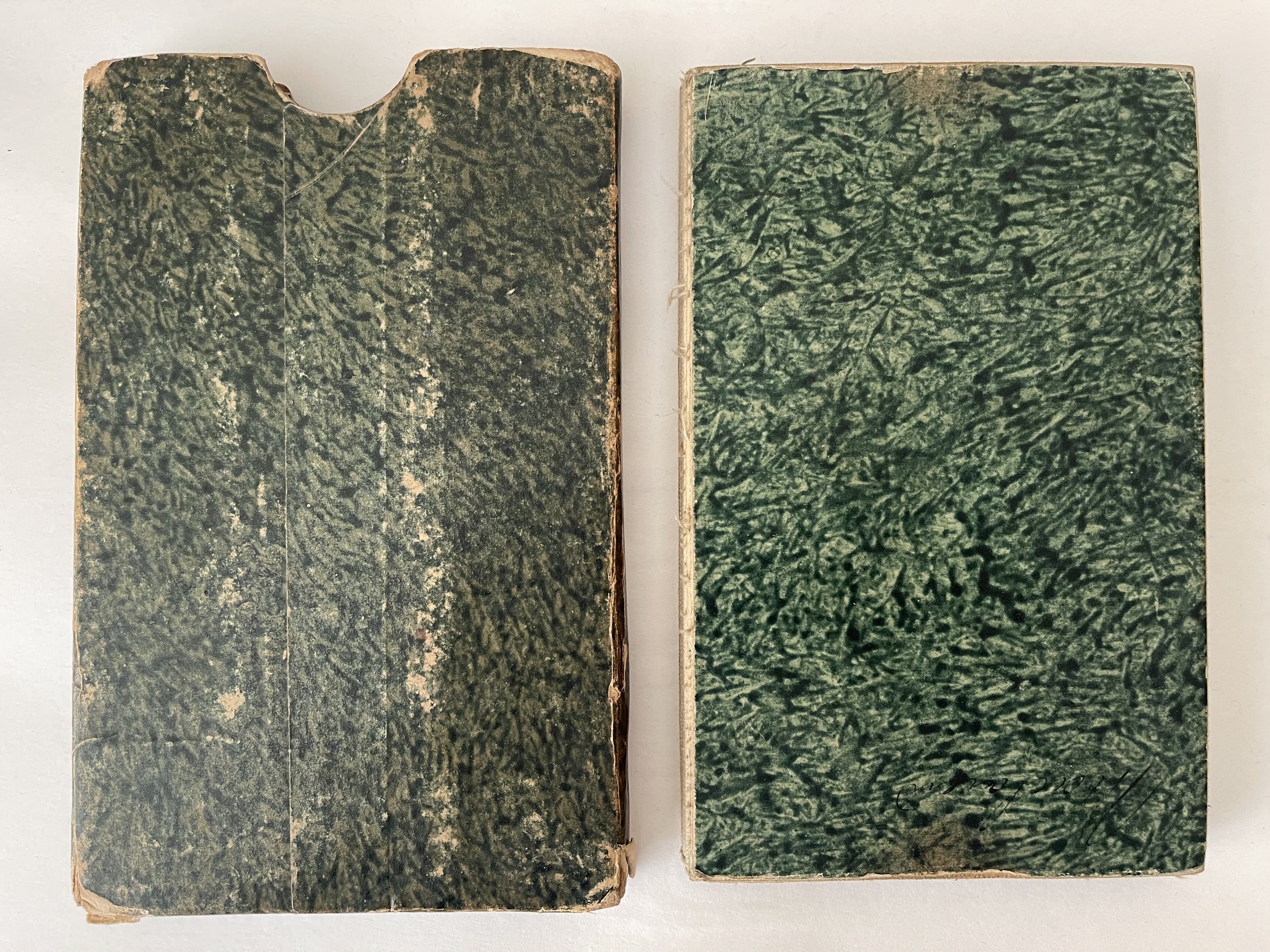
Where Applicable - Folds as issued. Light box photo shows the folio leaf centre margin hinge ‘glue’, this is not visible otherwise.
Tracked postage, in casement. Please contact me for postal quotation outside of the UK.