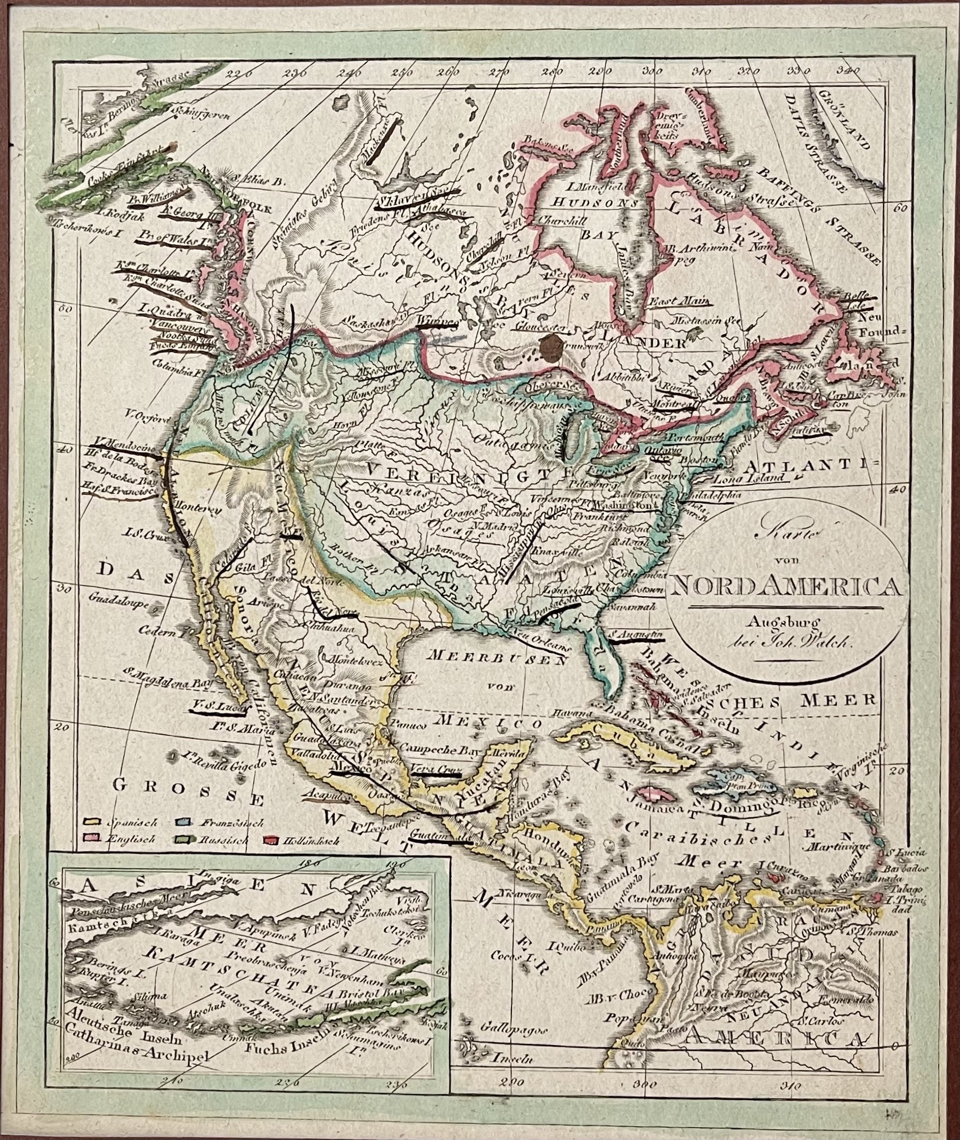
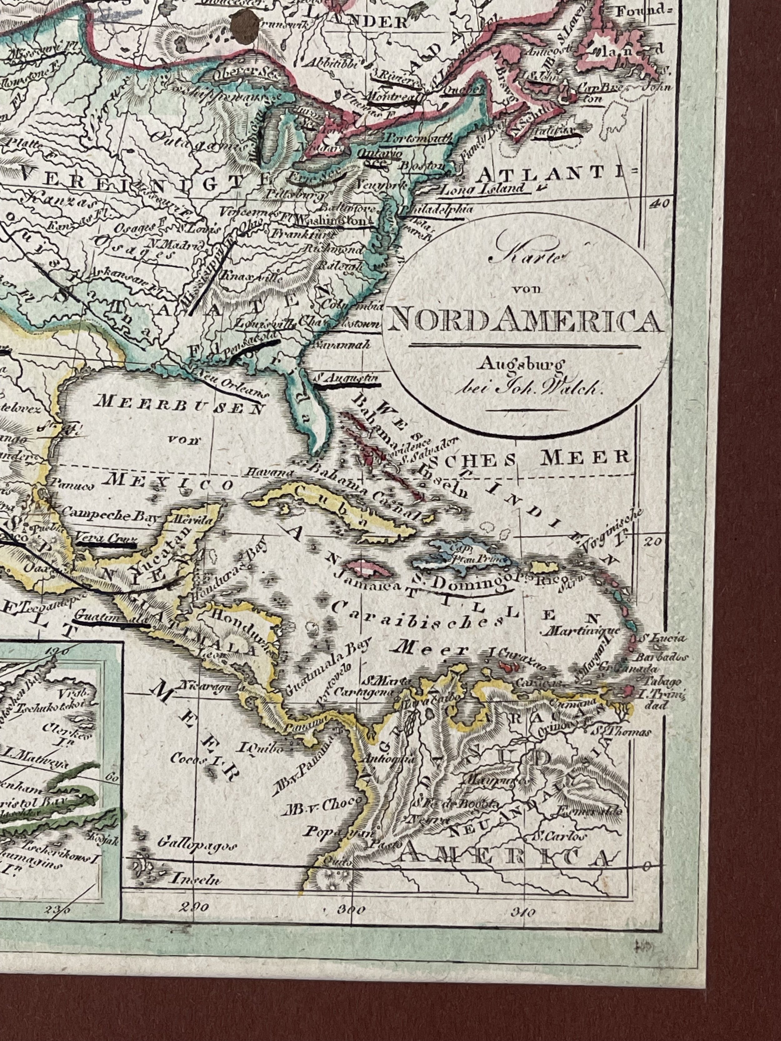
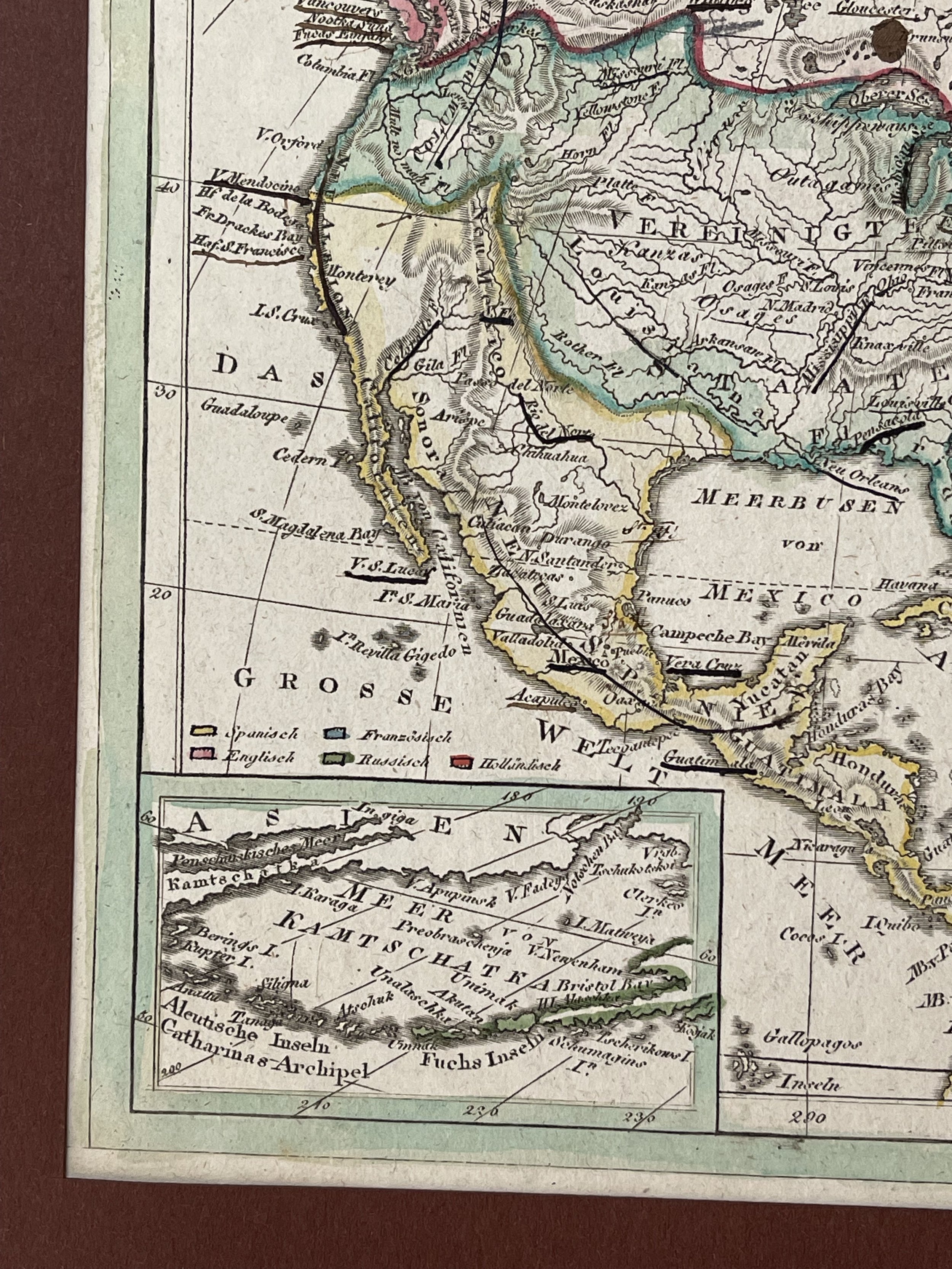
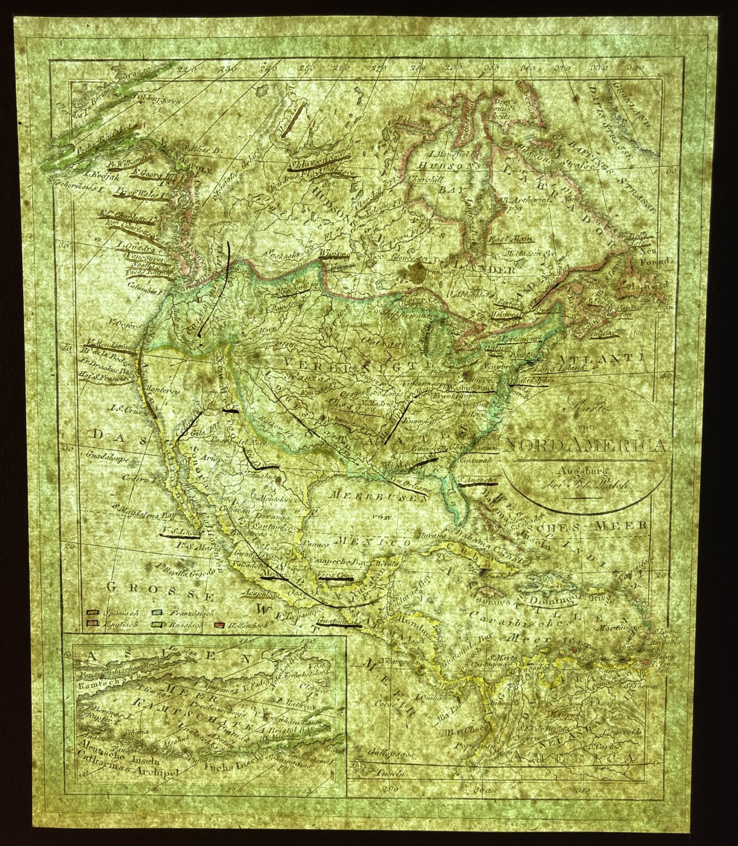
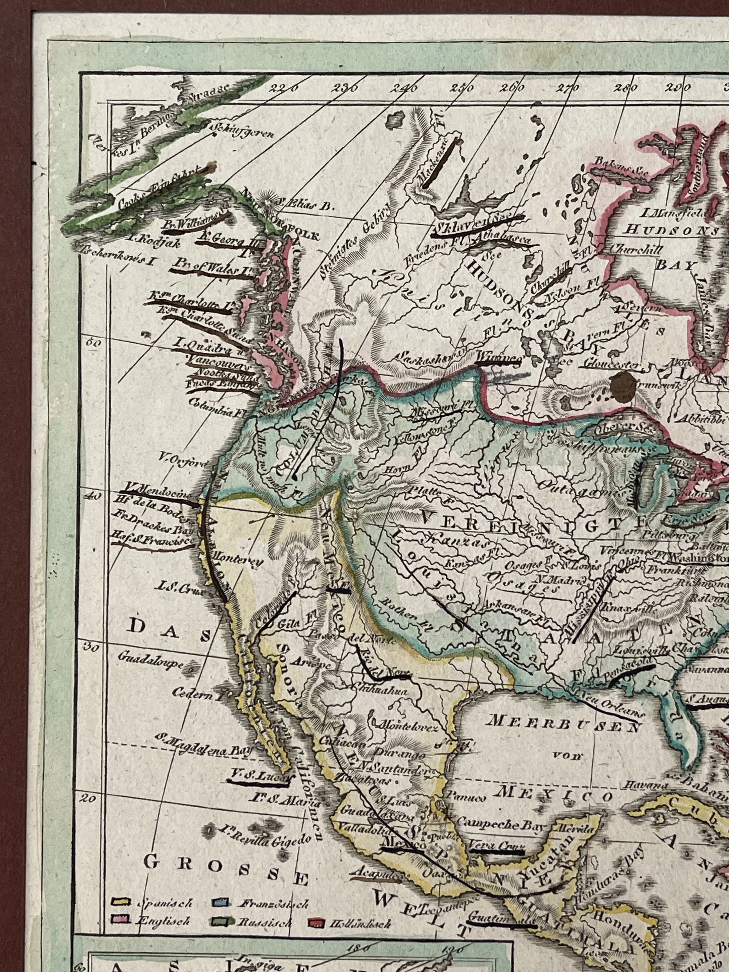
North America - Johannes Walch - 1810
America, Noord-Amerika; Johan Walch - Karte von NORD AMERICA
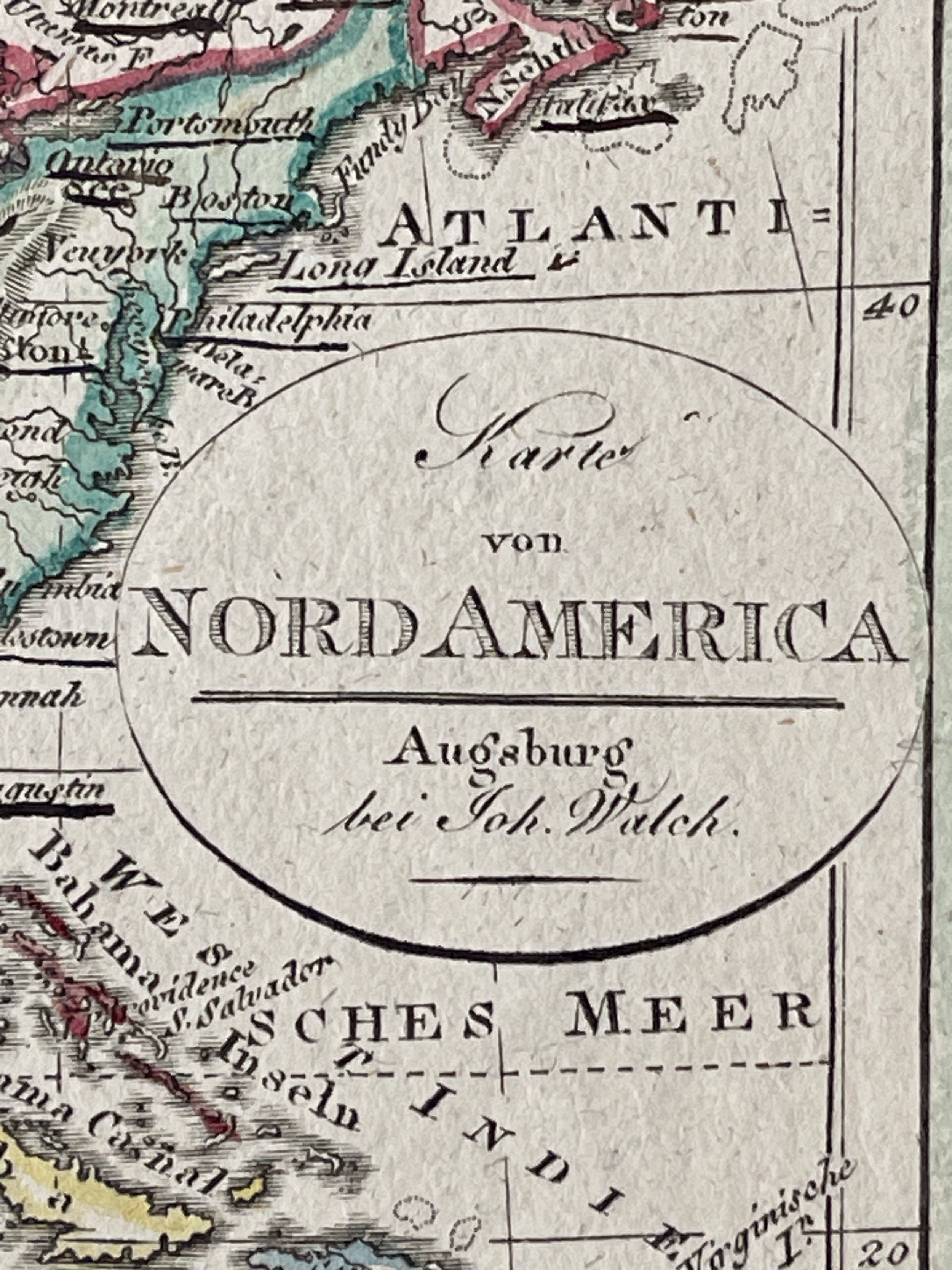
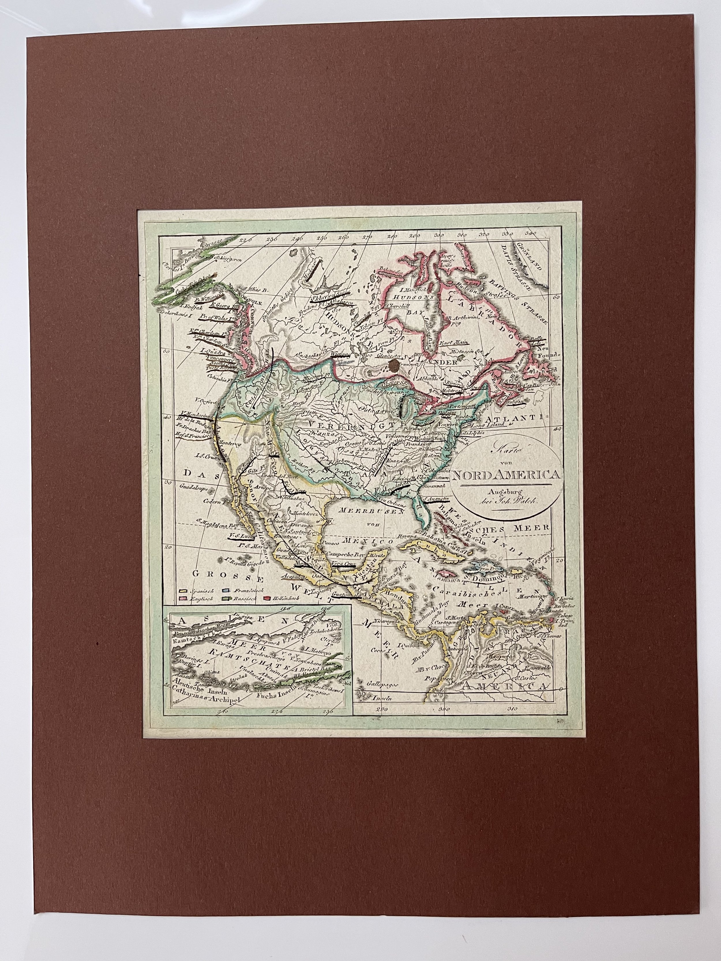
Karte von Nord Amerika.(Old Maps, 19th Century Maps, North America, United States, Canada, Alaska, Aleutian Islands, Mexico, Caribbean). Issued 1810, Augsburg, Germany by Johann Walch.
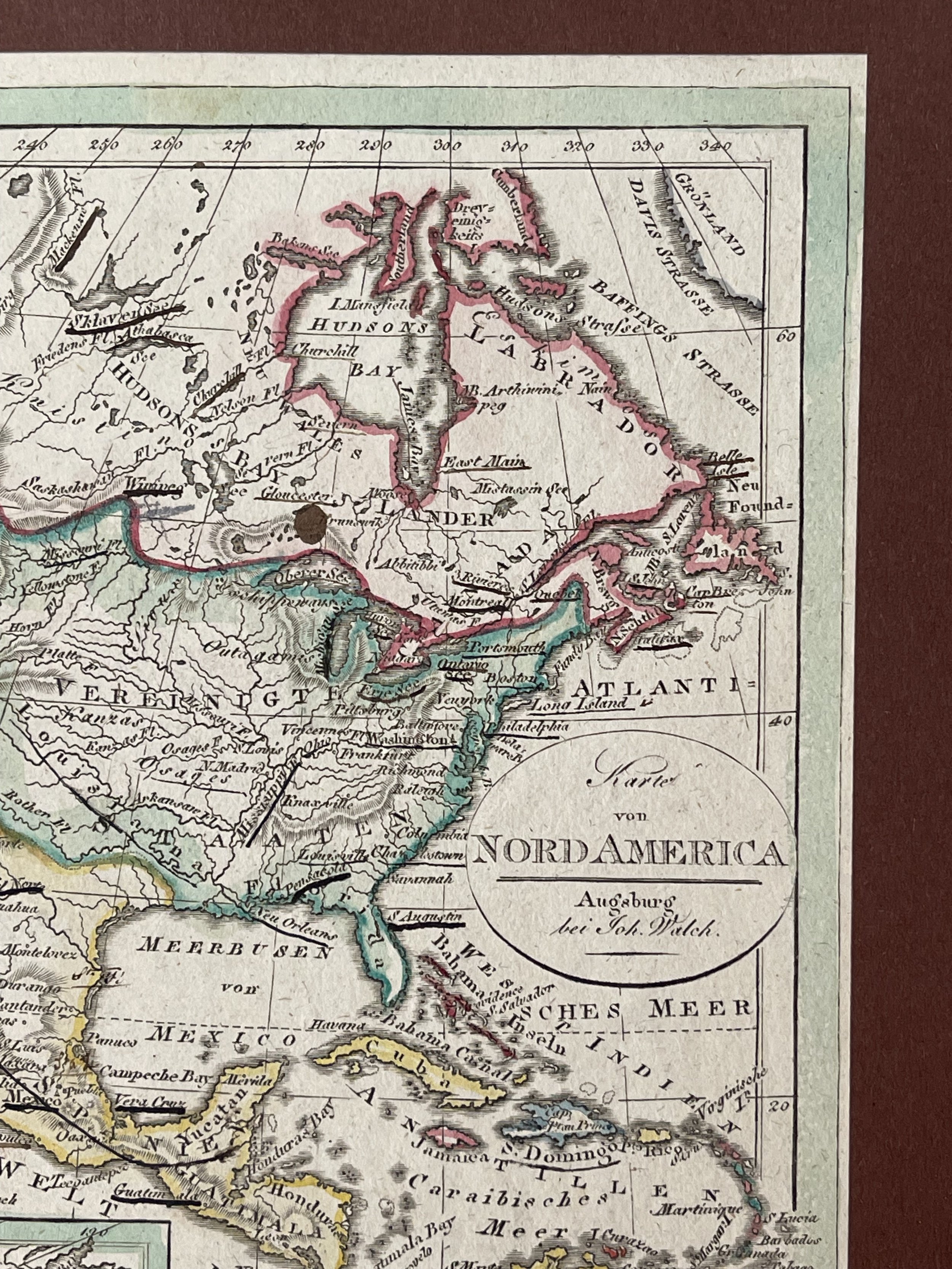
Rare early 19th century engraved map with attractive hand color. California is labelled "New Albion", San Francisco labelled "Fr. Drakes Bay" the Northwest is Columbia, strange meandering border with Canada, Alaska grossly elongated, etc. Remains a beautiful example with a pleasing age patina. Any age flaws mostly minor and easy to overlook or forgive. Sheet Measures c. 8 1/2" H x 10 1/4"W. Engraved Area Measures c. 7 1/4" H x 8 3/4" W. Cartographic Reference (s):Tooley's Dictionary of Mapmakers, vol. 4.[R31738].
The map illustrates North America shortly after the dissemination of the discoveries of Lewis & Clark, with "Clarke's" River clearly depicted on the map in the region called Columbiathal. The Multhomah River also makes and early appearance on this map.
In the mid-Continent, several Indian Tribes are shown in the Louisiana region, which had just become of part of America. The boundary between Louisiana and New Mexico does not yet reflect the boundary set by the United States and Spain in the Adams Onis Treaty. The configuration of Alaska is interesting.
Johannes Walch (November 25, 1757 - March 23, 1815) was a German painter, draftsman, engraver, cartographer and publisher. He was the son of a businessman, amateur painter and engraver Sebastian Walch; he received training as a miniature painter in Augsburg, Geneva and the Vienna Art Academy.
After a two-year trip to Italy, he settled in Augsburg, where he married the eldest daughter of the Augsburg-based engraver and publisher Johann Martin Will and worked in his father-in-law's publishing house. His contributions led the publisher to focus more heavily on as a result, the publisher increasingly turned to map production, heavily supported by the acquisition of material from Lotter and Seutter. After Will's death in 1806, Walch inherited the firm and continued to increase its importance as a map publish-er. His son Johann Sebastian Walch (1787-1840) would inherit the publishing house.He was well-known for painting miniature portraits, having trained in Geneva, Venice, and Rome. Walch published several atlases and sheet maps. As with his atlases, many of Walch’s maps were reprinted after his death.
Map in excellent condition with surrounding mount included. Pricing and grading commensurate.
America, Noord-Amerika; Johan Walch - Karte von NORD AMERICA
Karte von Nord Amerika.(Old Maps, 19th Century Maps, North America, United States, Canada, Alaska, Aleutian Islands, Mexico, Caribbean). Issued 1810, Augsburg, Germany by Johann Walch.
Rare early 19th century engraved map with attractive hand color. California is labelled "New Albion", San Francisco labelled "Fr. Drakes Bay" the Northwest is Columbia, strange meandering border with Canada, Alaska grossly elongated, etc. Remains a beautiful example with a pleasing age patina. Any age flaws mostly minor and easy to overlook or forgive. Sheet Measures c. 8 1/2" H x 10 1/4"W. Engraved Area Measures c. 7 1/4" H x 8 3/4" W. Cartographic Reference (s):Tooley's Dictionary of Mapmakers, vol. 4.[R31738].
The map illustrates North America shortly after the dissemination of the discoveries of Lewis & Clark, with "Clarke's" River clearly depicted on the map in the region called Columbiathal. The Multhomah River also makes and early appearance on this map.
In the mid-Continent, several Indian Tribes are shown in the Louisiana region, which had just become of part of America. The boundary between Louisiana and New Mexico does not yet reflect the boundary set by the United States and Spain in the Adams Onis Treaty. The configuration of Alaska is interesting.
Johannes Walch (November 25, 1757 - March 23, 1815) was a German painter, draftsman, engraver, cartographer and publisher. He was the son of a businessman, amateur painter and engraver Sebastian Walch; he received training as a miniature painter in Augsburg, Geneva and the Vienna Art Academy.
After a two-year trip to Italy, he settled in Augsburg, where he married the eldest daughter of the Augsburg-based engraver and publisher Johann Martin Will and worked in his father-in-law's publishing house. His contributions led the publisher to focus more heavily on as a result, the publisher increasingly turned to map production, heavily supported by the acquisition of material from Lotter and Seutter. After Will's death in 1806, Walch inherited the firm and continued to increase its importance as a map publish-er. His son Johann Sebastian Walch (1787-1840) would inherit the publishing house.He was well-known for painting miniature portraits, having trained in Geneva, Venice, and Rome. Walch published several atlases and sheet maps. As with his atlases, many of Walch’s maps were reprinted after his death.
Map in excellent condition with surrounding mount included. Pricing and grading commensurate.
Code : A425
Cartographer : Cartographer / Engraver / Publisher: Johann Walch
Date : Publication Place / Date - Circa 1810
Size : Sheet size: 8.5 x 10.25 Inch
Availability : Available
Type - Genuine - Antique
Grading A
Where Applicable - Folds as issued. Light box photo shows the folio leaf centre margin hinge ‘glue’, this is not visible otherwise.
Tracked postage, in casement. Please contact me for postal quotation outside of the UK.