

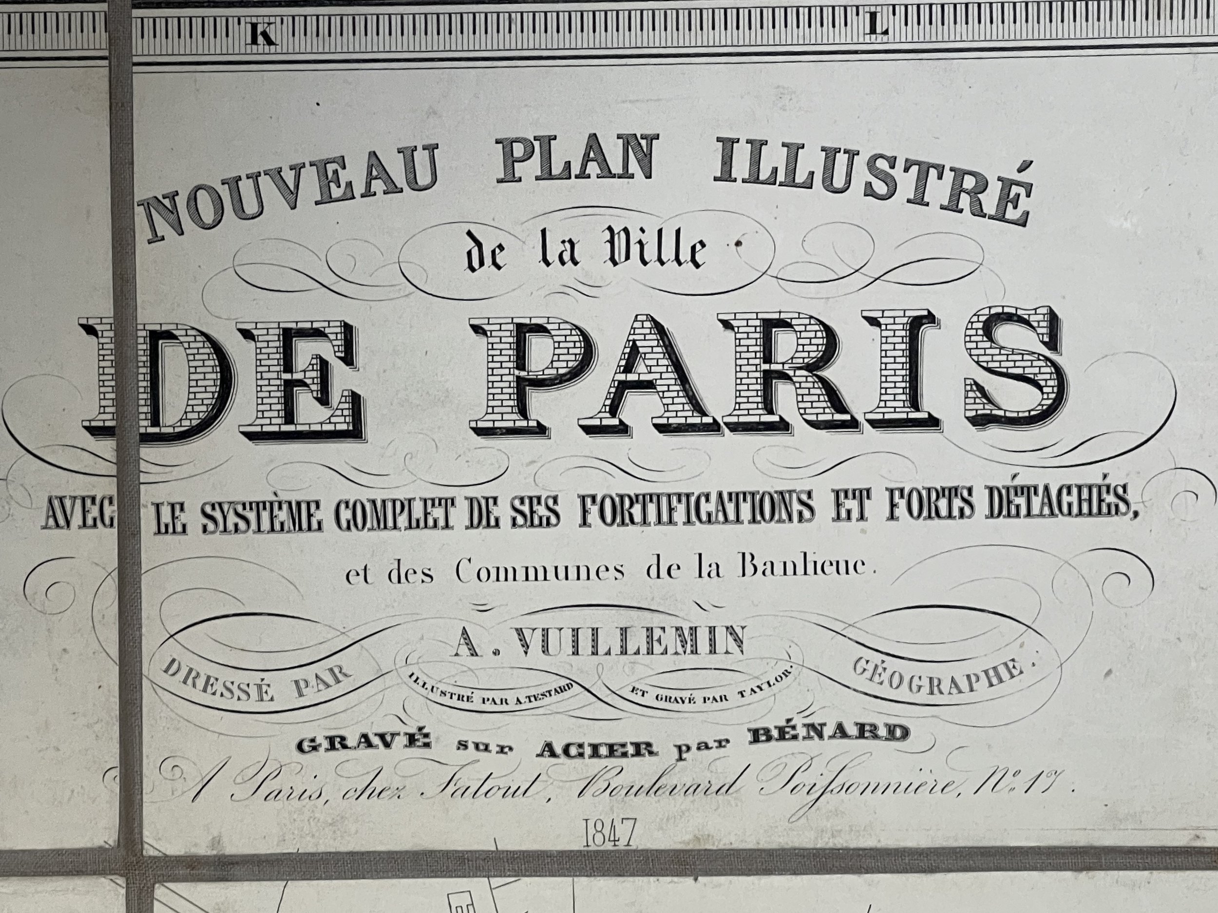


Nouveau plan illustré de la ville de Paris - Alexandre Vuillemin - 1847
A large, beautiful and RARE 1847 edition by Alexandre Vuillemin pictorial city plan or map of Paris, France.
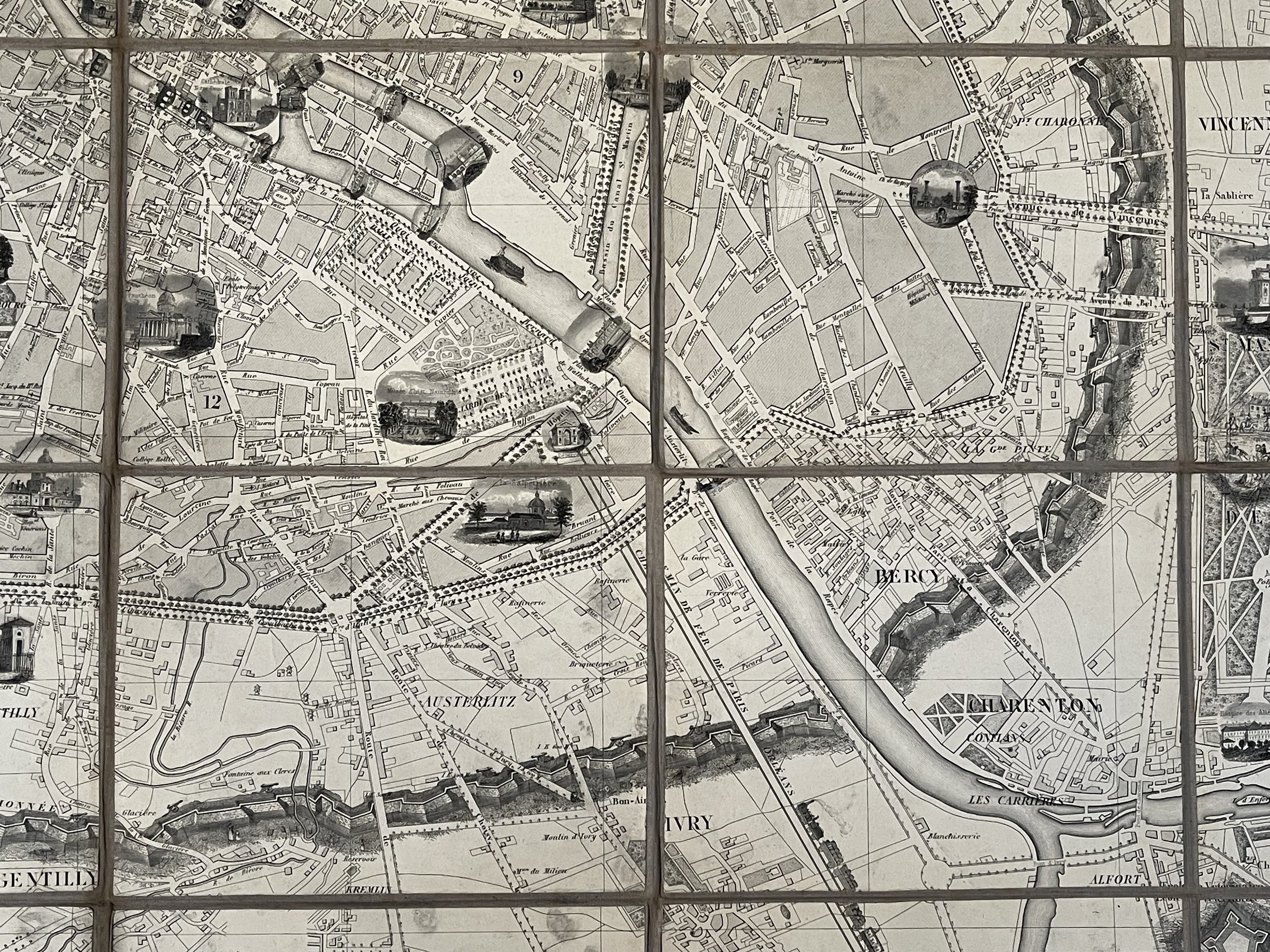
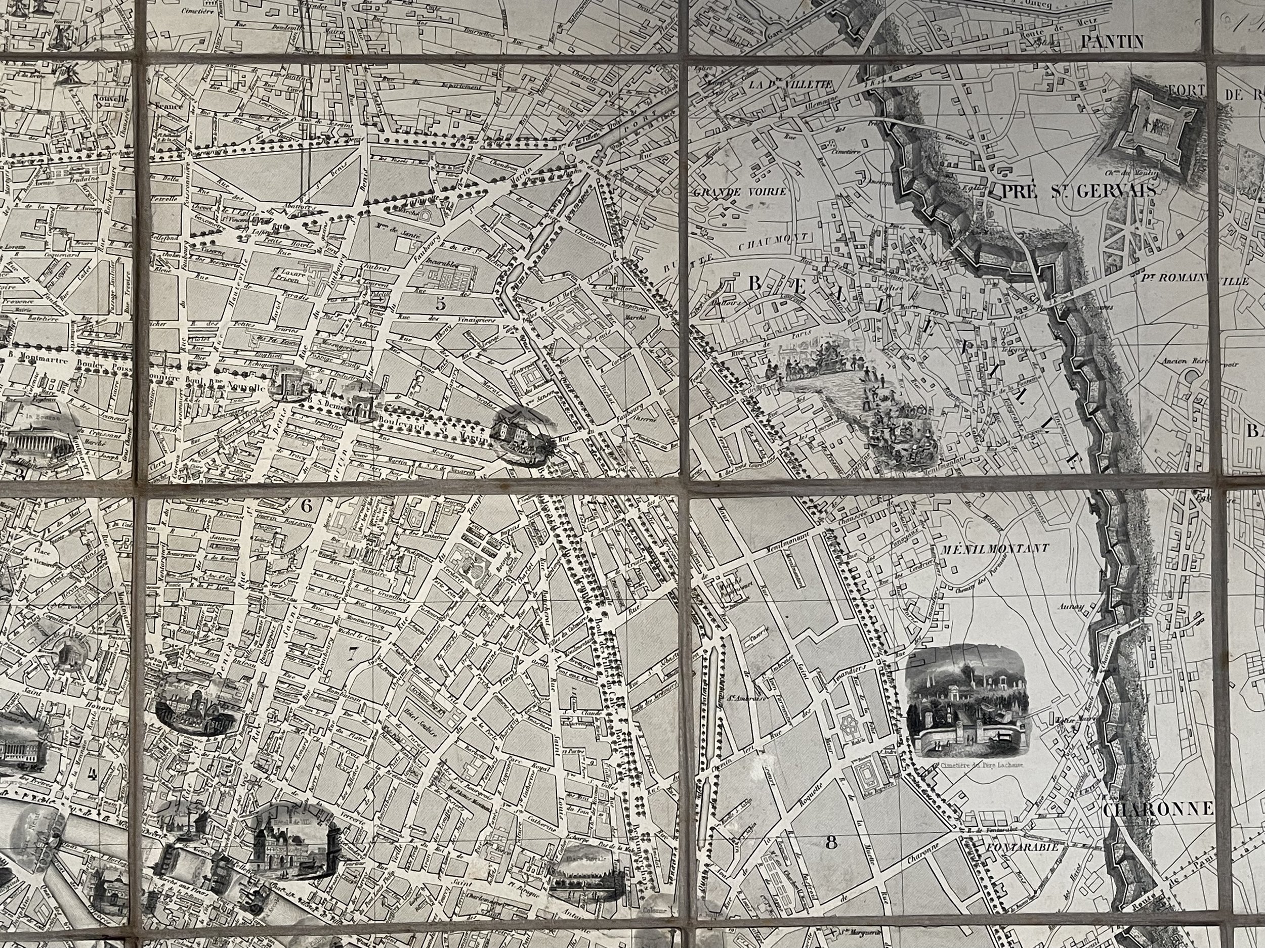
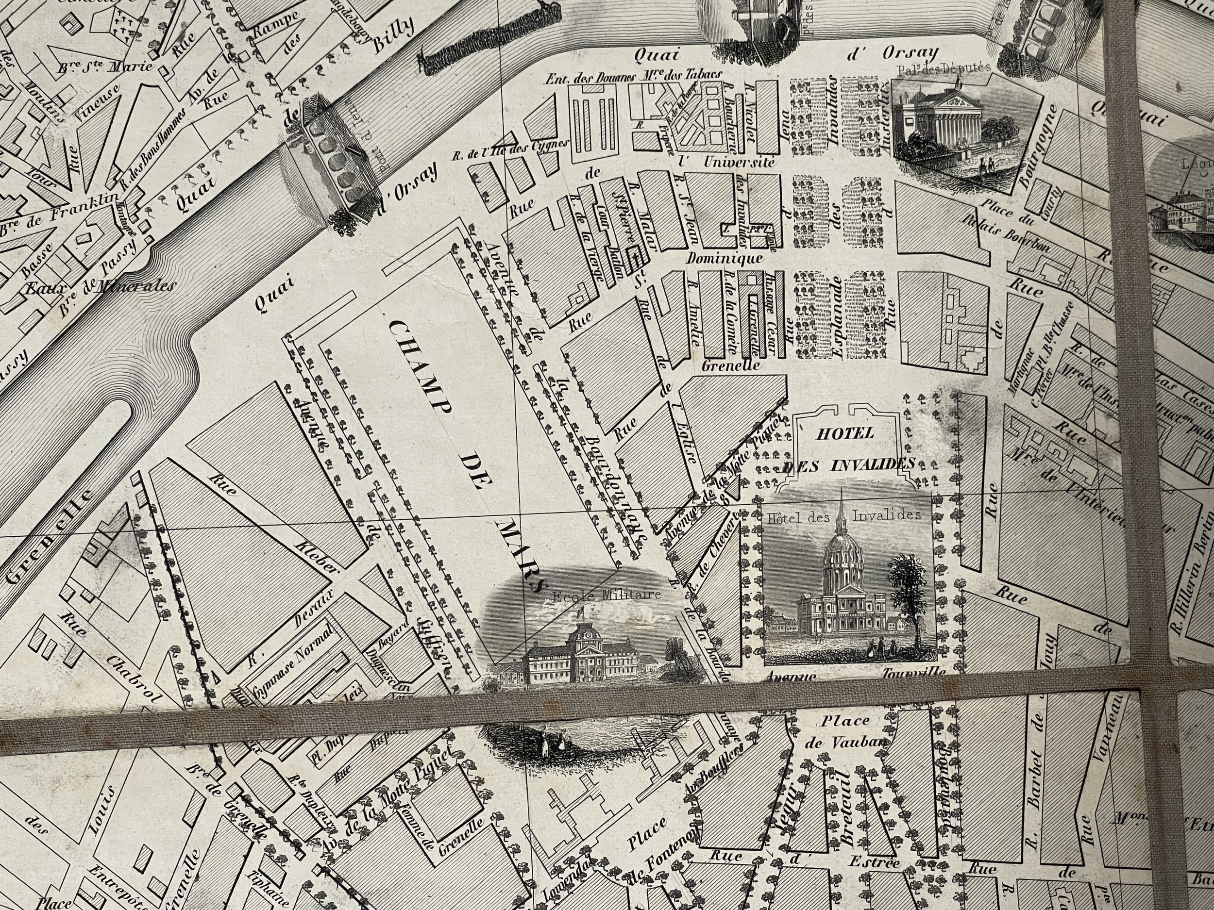
Engraved well before the iron truss Eiffel Tower was constructed in the grounds of the Champ de Mars (Field of Mars), a large public green-space in Paris, located in the seventh arrondissement, between the Eiffel Tower to the northwest and the École Militaire to the southeast. Constructed the year before Louis-Napoleon Bonaparte was elected President of France in December 1848. In 1847 when this map was constructed, there was an economic crisis in France which resulted in the citizens of France revolting against their King in the following year, 1848.
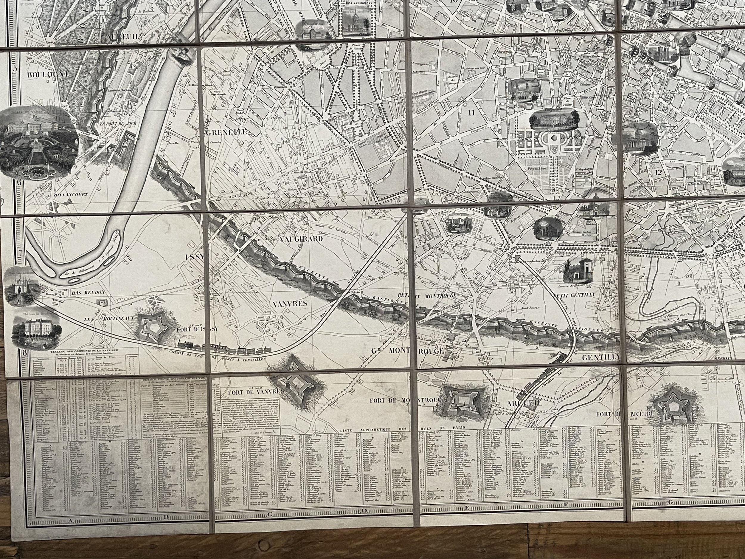
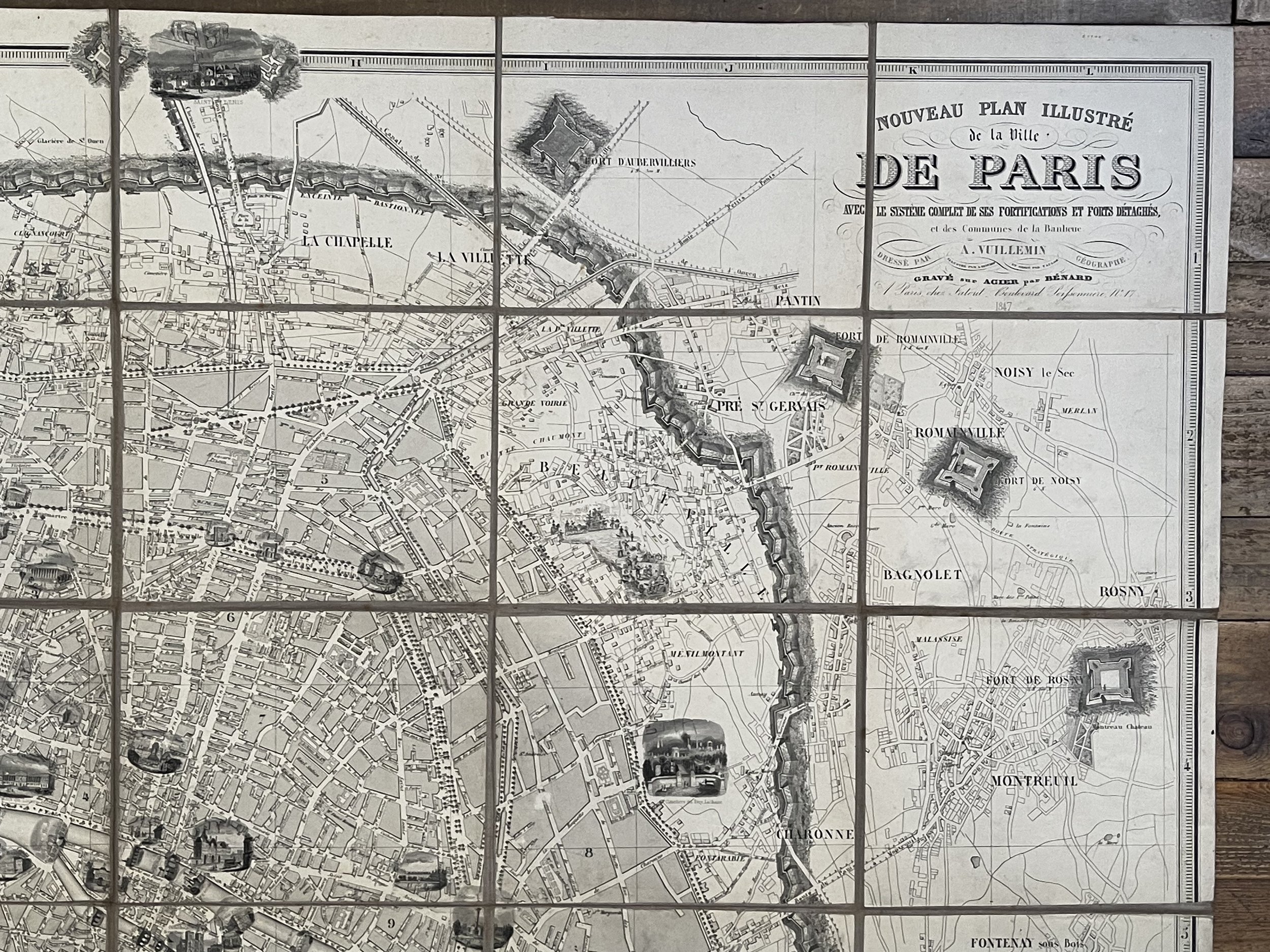
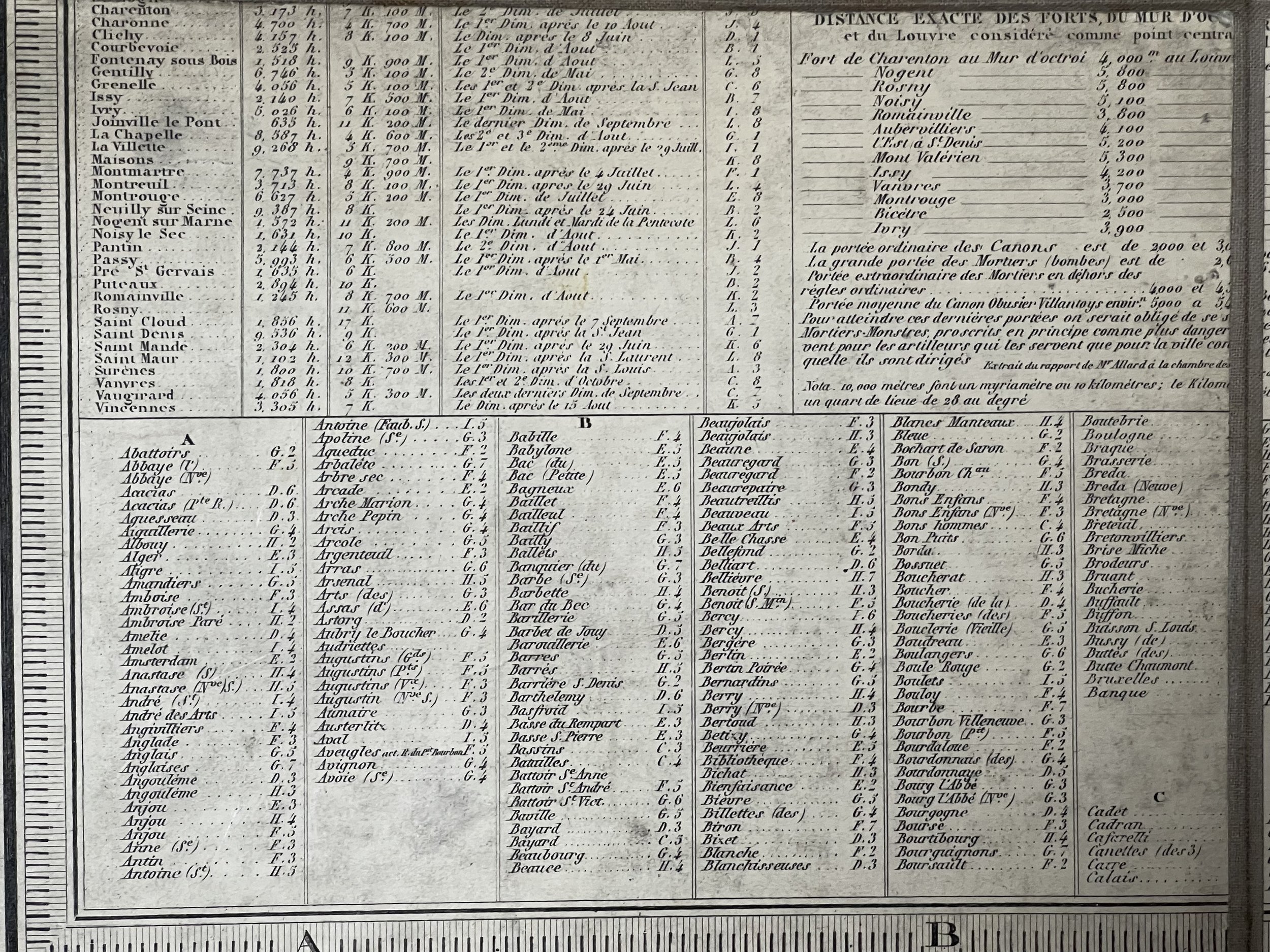
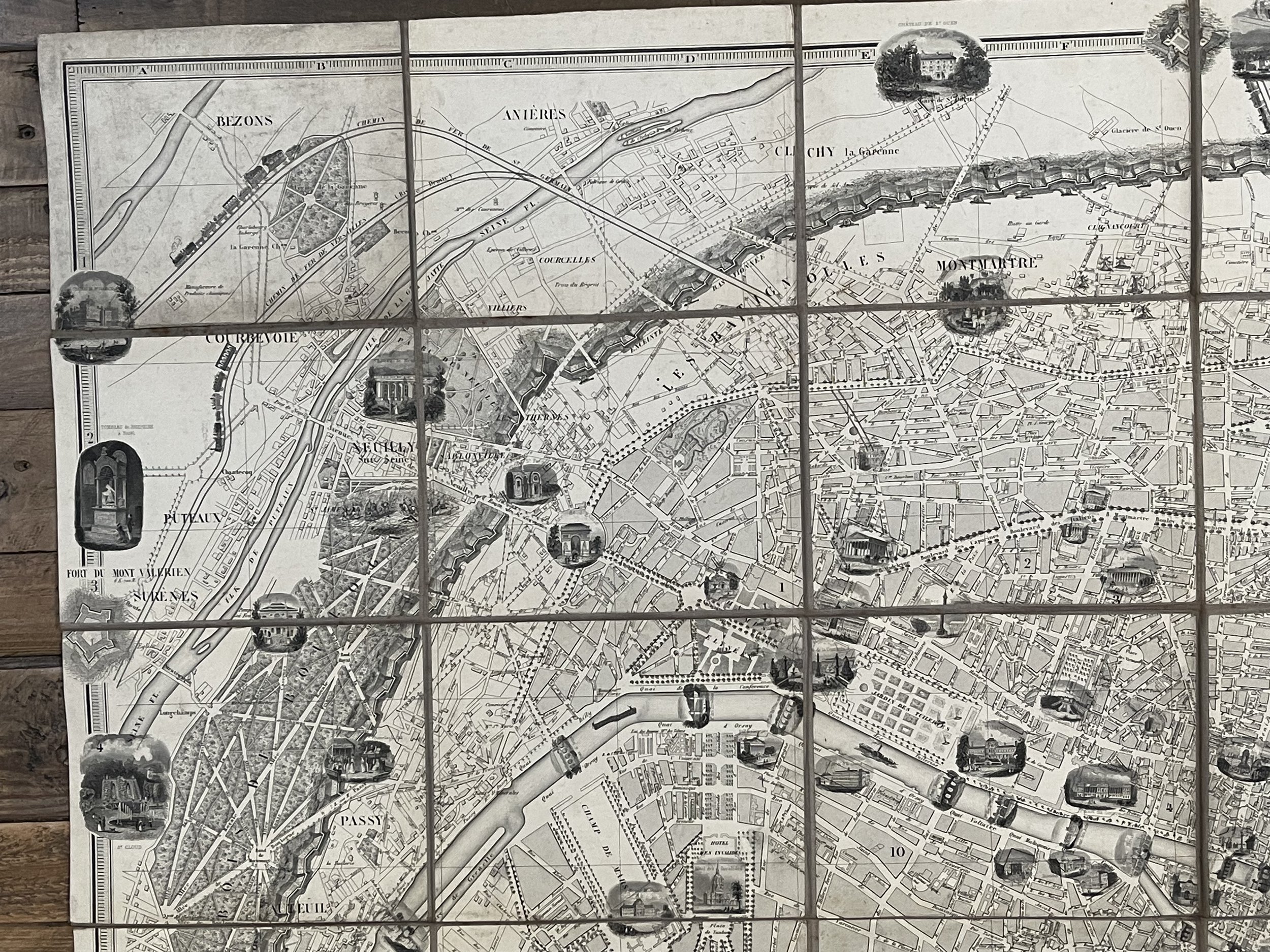
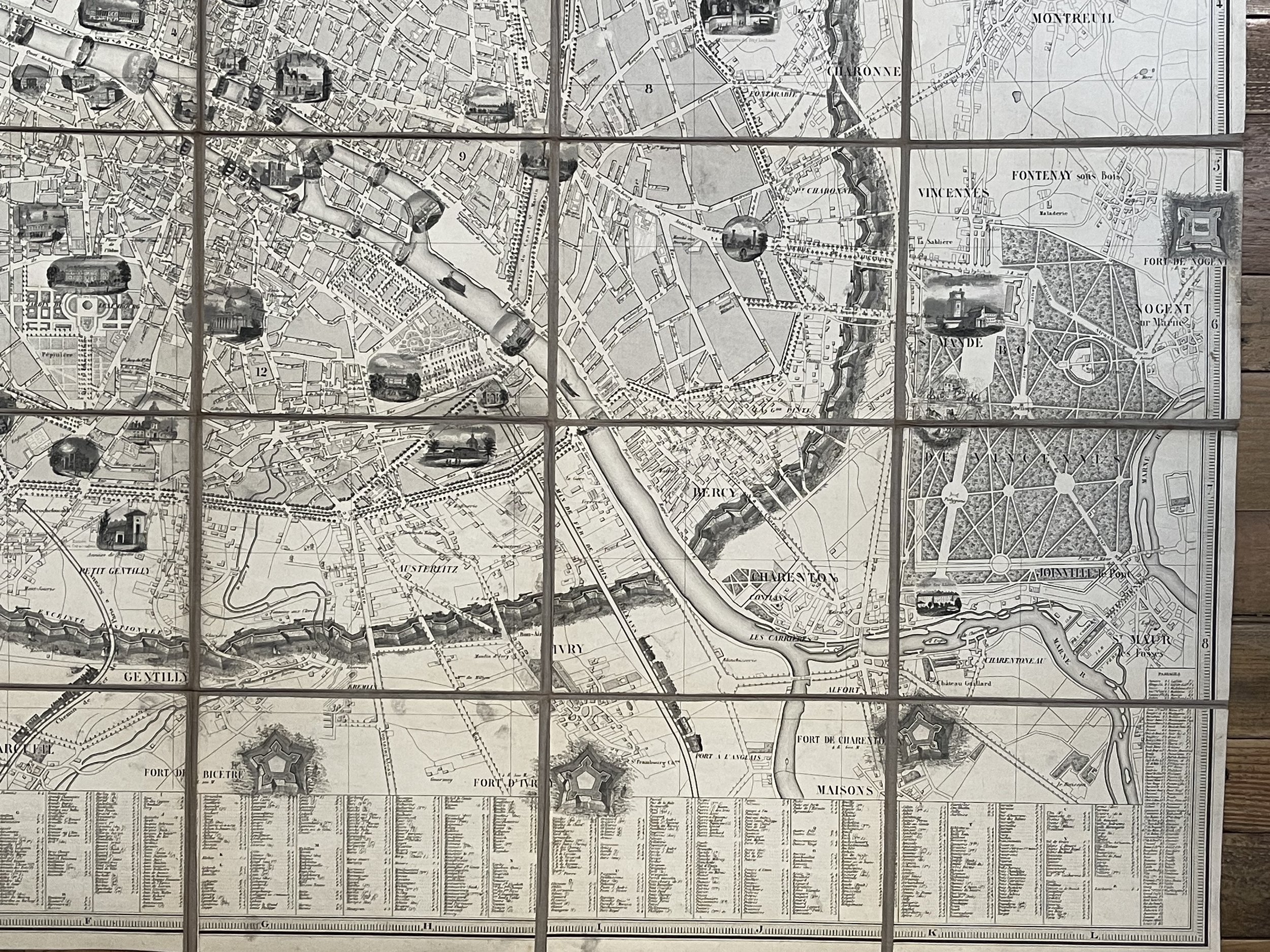
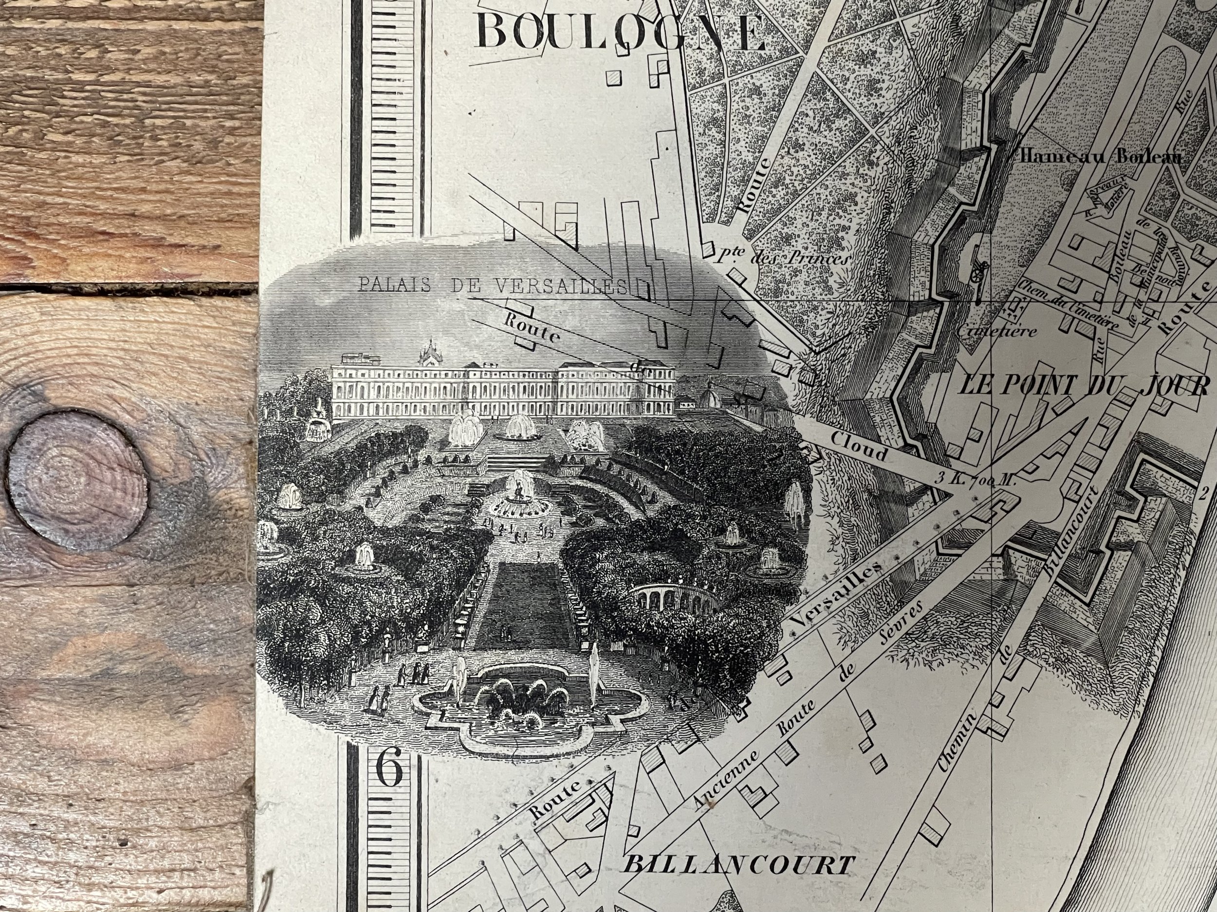
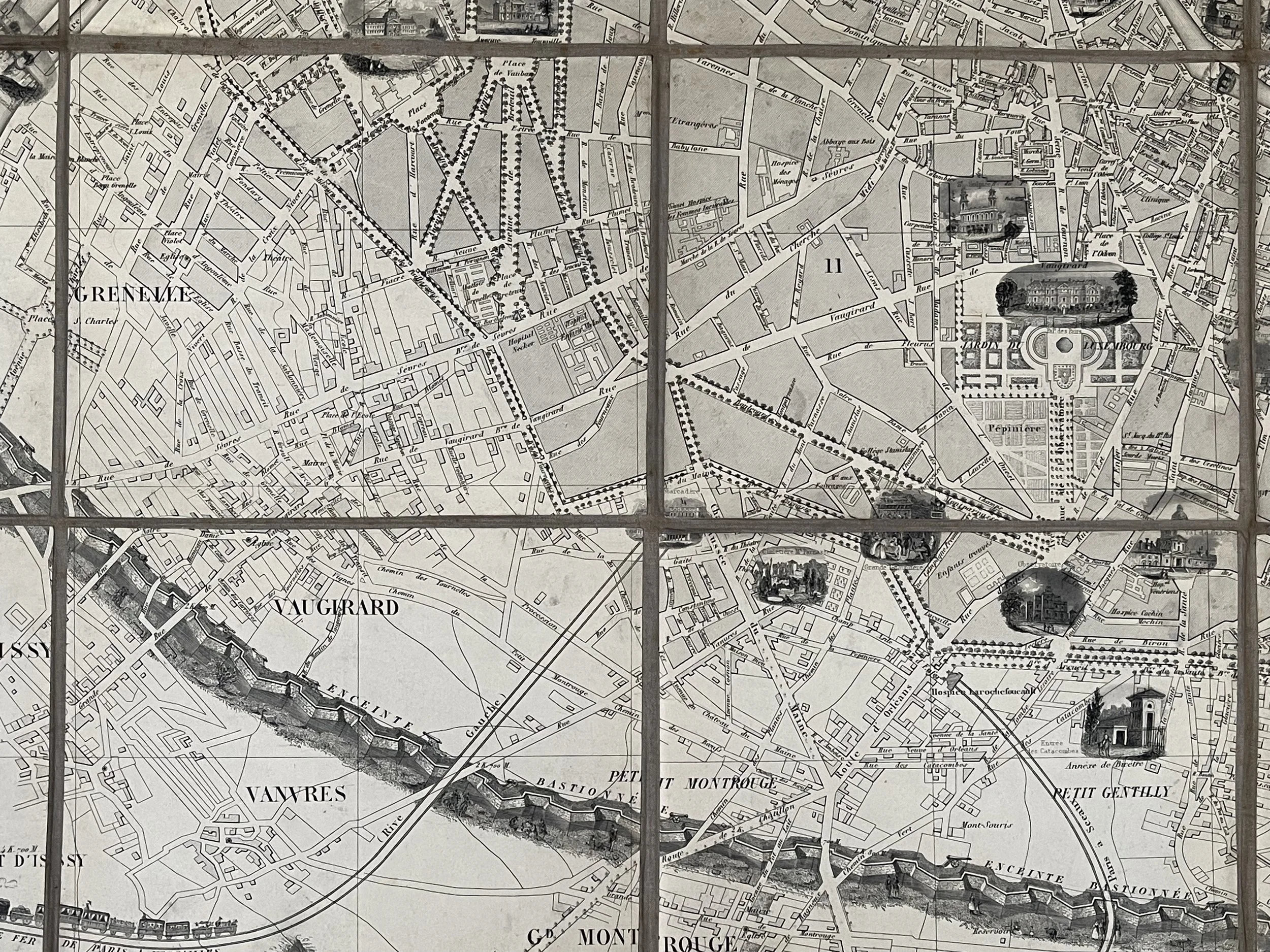
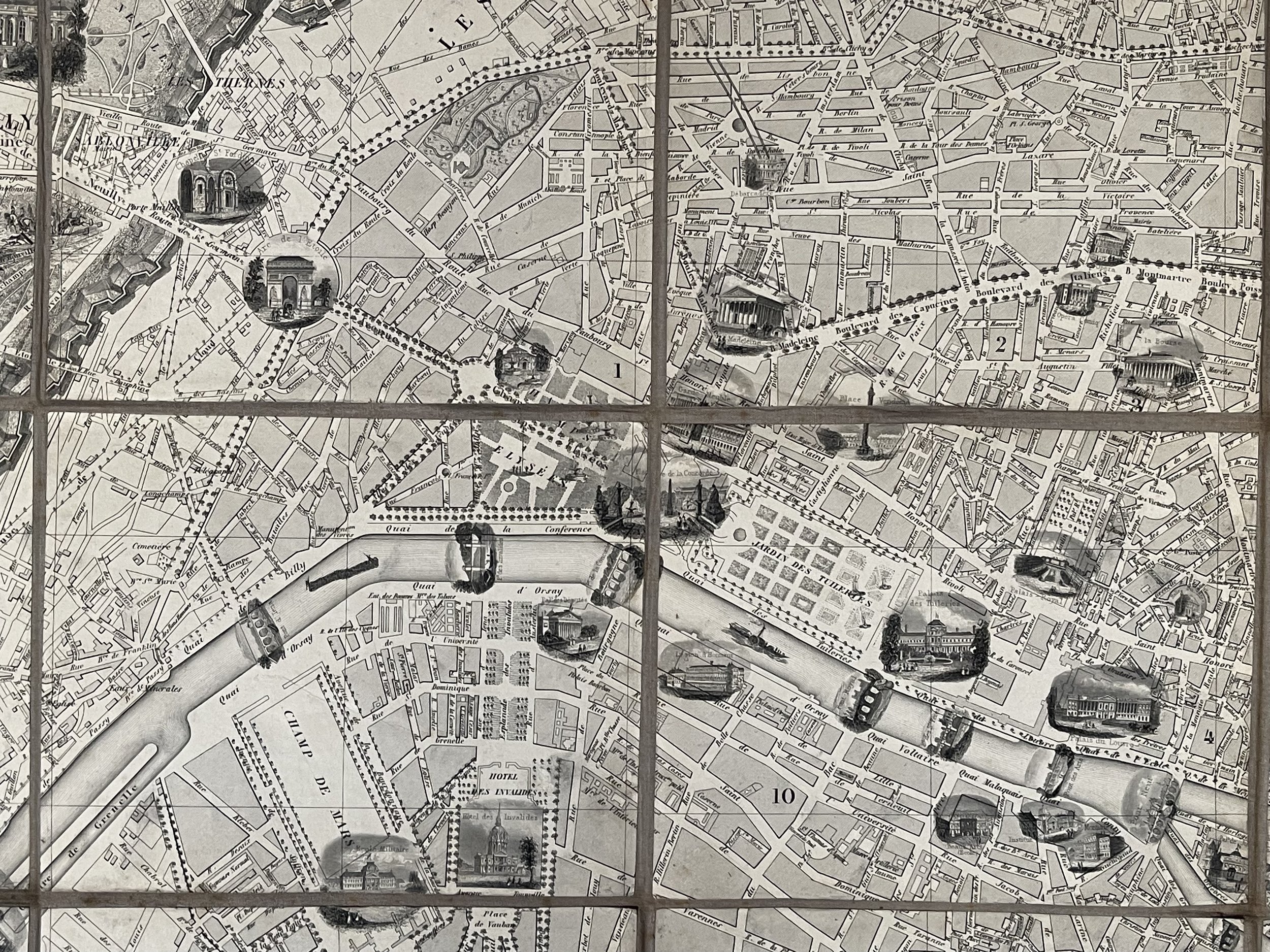
Pictorial views highlight Paris's many spectacular monuments, including the Louvre, the Place de la Concorde, the Arc de Triomphe, les Invalides, Notre Dame, and the Panthéon. Streets throughout the city are illustrated and labelled, along with numerous other sites not illustrated with views. Each arrondissement is labelled as well.
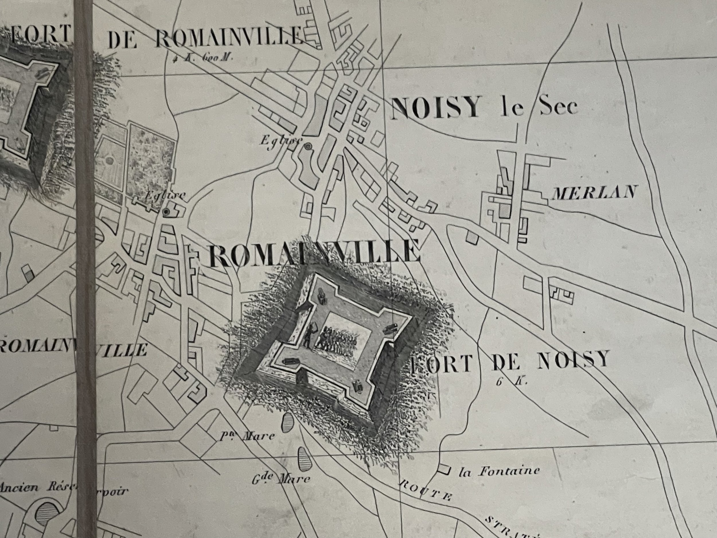
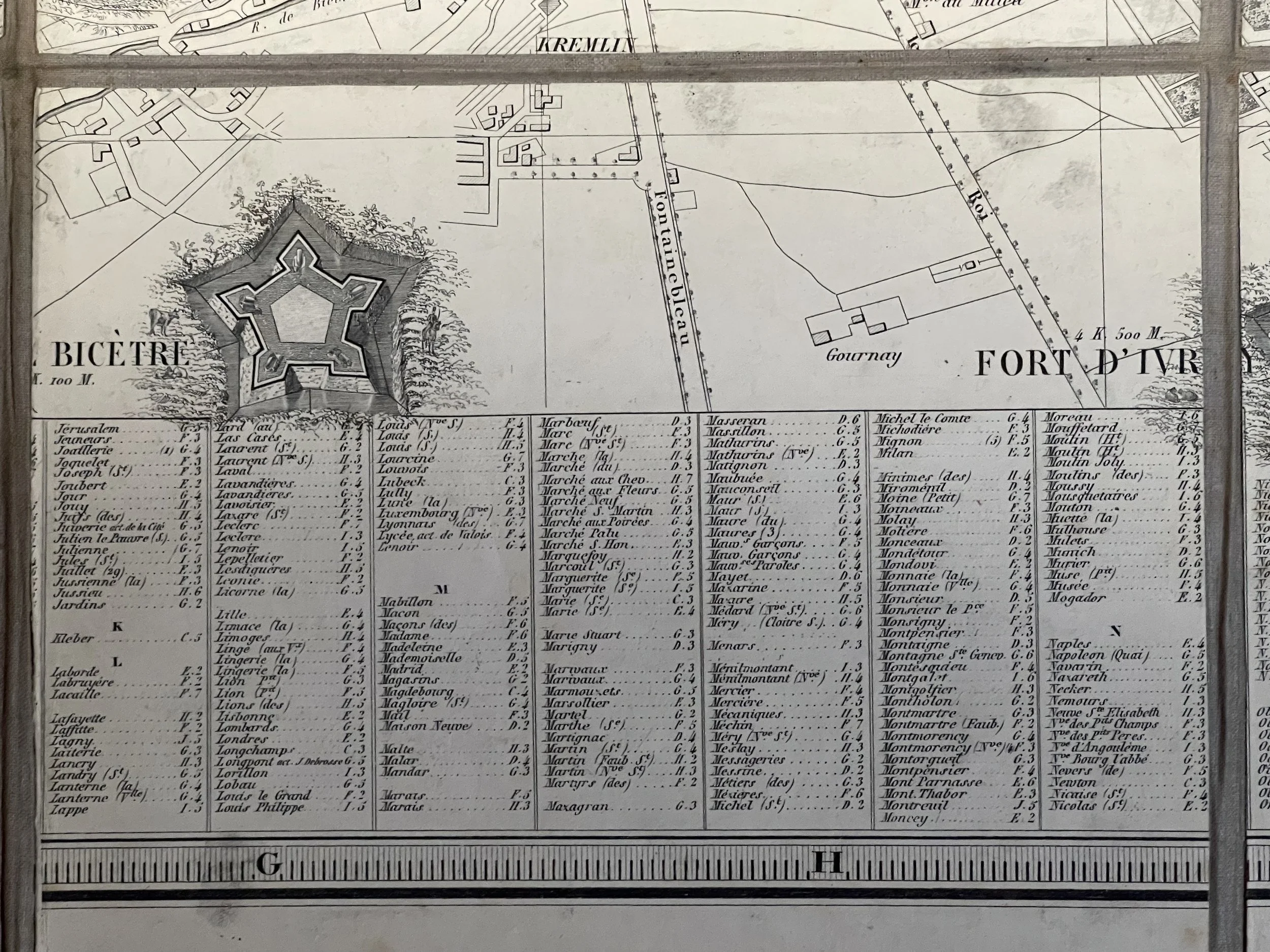
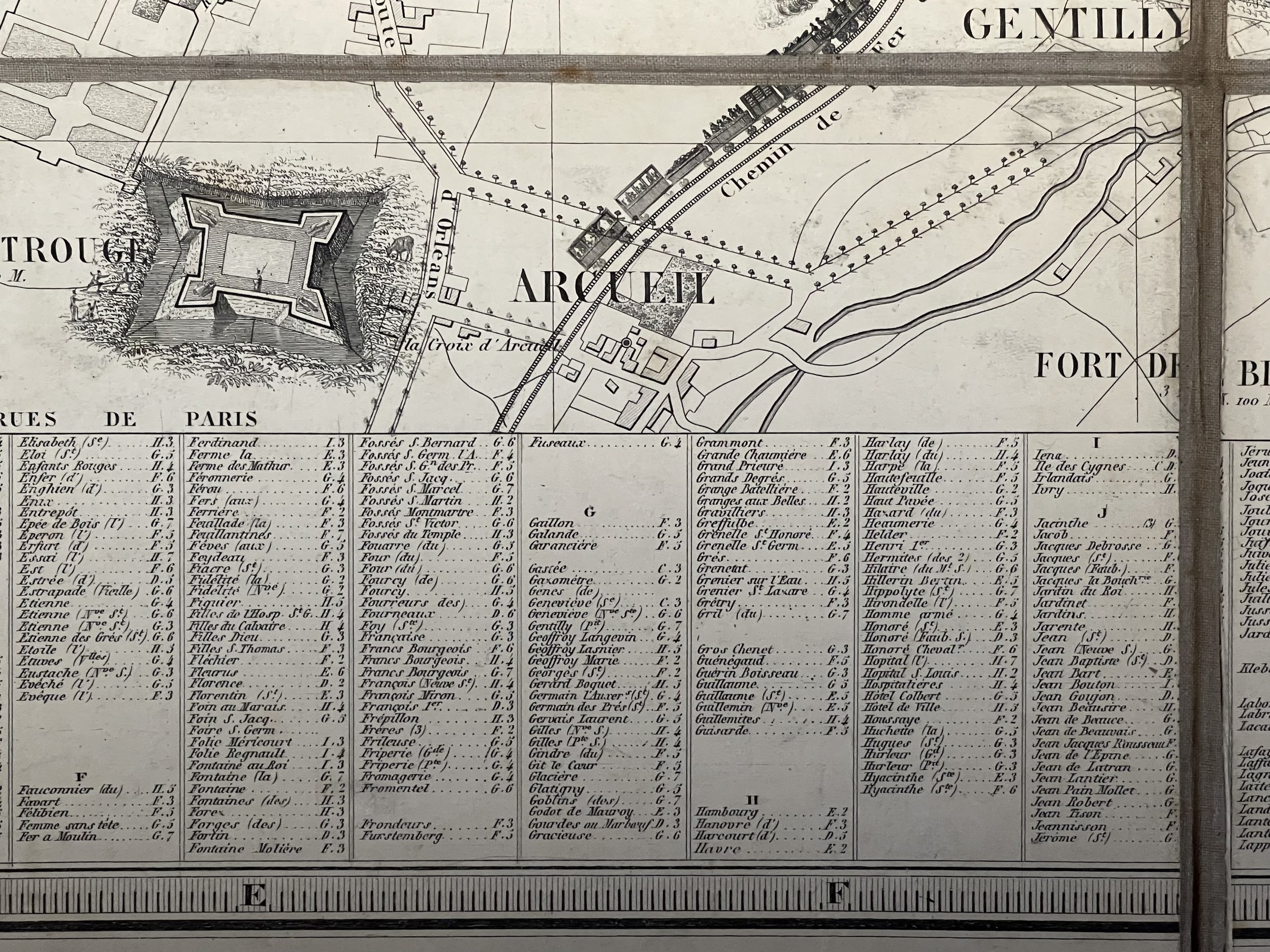
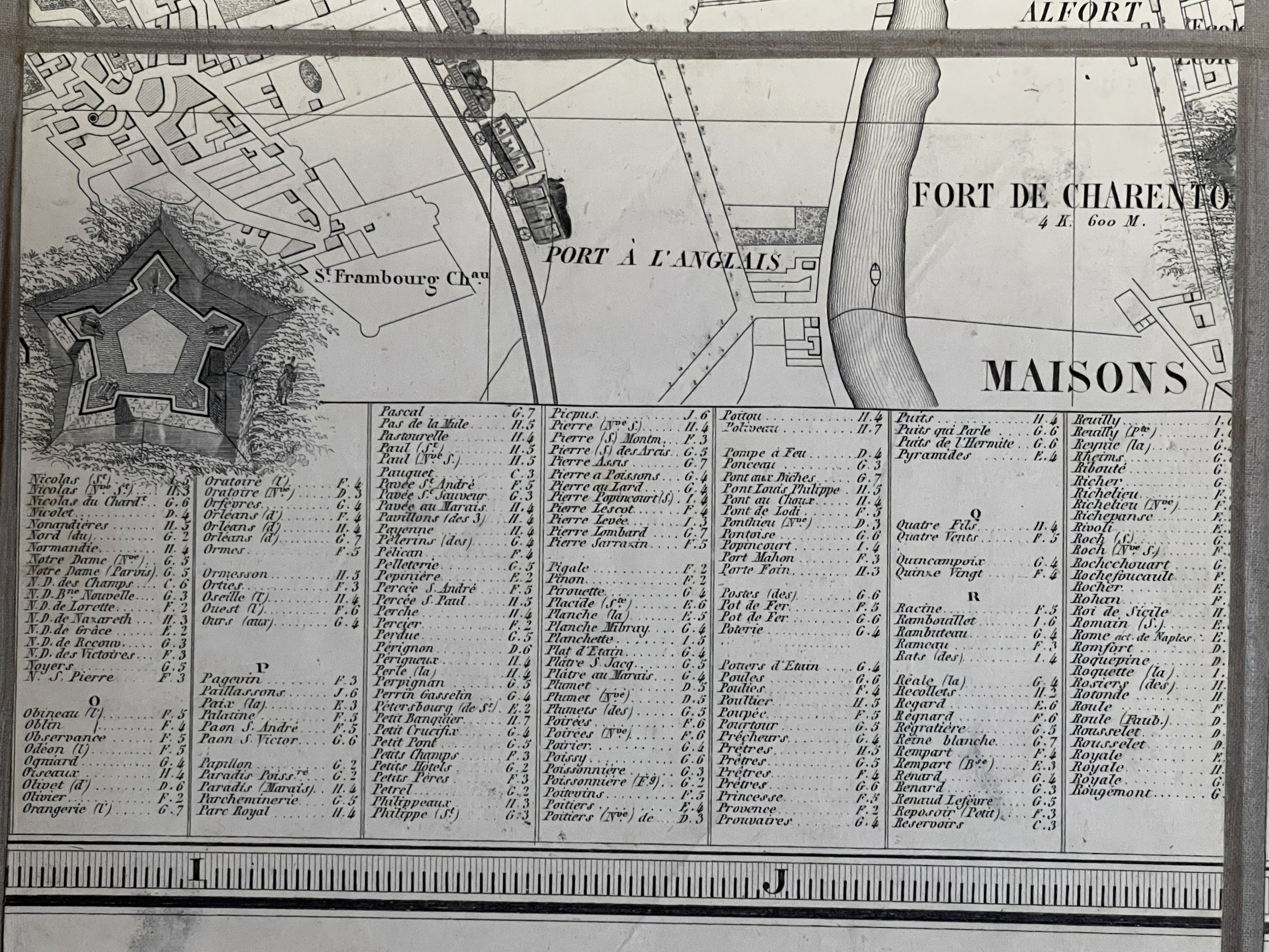
The Fortification of Paris - The map's most striking feature is its bold pictorial depiction of Paris's city walls, the Theirs Wall. This map exhibits the Theirs Wall shortly after it was completed in 1844. Shocked seizure of Paris by foreign enemies during the 1814 Battle of Paris, the French King at the time, Louis-Philippe (1830 - 1848), conceived of a board network of walls and forts he believed would make Paris impregnable. The project was met with immediate opposition, some of which claimed that the walls were not defensive, but rather intended to control Parisians in the event of an anti-monarchal rebellion. Nonetheless, under a plan prepared by Marshal General Jean-de-Dieu Soult (1759 - 1861), construction began in 1841. The completed fortifications, named the Thiers Wall after the French Prime Minister at the time, Adolphe Theirs (1797 - 1877), were completed at enormous expense in 1844. The walls were 33 kilometers long and consisted of 94 bastions, 17 gates, 23 minor road crossings, and eight railroad gates. By 1919, advancements in military technology made the walls obsolete, leading them to be fully deconstructed by 1929 and replaced with the Boulevard Périphérique. People are illustrated throughout in the shadow of the walls, highlighting the wealth disparity between those living in central Paris and those outside its walls.
Alexandre Aimé Vuillemin (1812 - 1880) was an engraver, publisher, and editor based in Paris, France in the middle of the 19th century. Despite a prolific publishing career, much of Vuillemin's life is shrouded in mystery. In 1852, he married Josephine Caroline Goret and they had at least one child, Ernestine Adèle Vuillemin, later in the same year. What is known is that his studied under the prominent French Auguste Henri Dufour (1798 - 1865). Vuillemin's most important work his detailed, highly decorative large format Atlas Illustre de Geographie Commerciale et Industrielle.
Jacques-Alphonse Testard (1810 - 18??) was a French artist and engraver active in Paris during the mid- and late-19th century. He is credited with more works as the artist than as the engraver.
Incredibly clean map and in very good condition indeed with only the odd foxing mark. Folding plan, mounted on canvas in 32 segments. Blank on verso. Would look exceptional framed.
A large, beautiful and RARE 1847 edition by Alexandre Vuillemin pictorial city plan or map of Paris, France.
Engraved well before the iron truss Eiffel Tower was constructed in the grounds of the Champ de Mars (Field of Mars), a large public green-space in Paris, located in the seventh arrondissement, between the Eiffel Tower to the northwest and the École Militaire to the southeast. Constructed the year before Louis-Napoleon Bonaparte was elected President of France in December 1848. In 1847 when this map was constructed, there was an economic crisis in France which resulted in the citizens of France revolting against their King in the following year, 1848.
Pictorial views highlight Paris's many spectacular monuments, including the Louvre, the Place de la Concorde, the Arc de Triomphe, les Invalides, Notre Dame, and the Panthéon. Streets throughout the city are illustrated and labelled, along with numerous other sites not illustrated with views. Each arrondissement is labelled as well.
The Fortification of Paris - The map's most striking feature is its bold pictorial depiction of Paris's city walls, the Theirs Wall. This map exhibits the Theirs Wall shortly after it was completed in 1844. Shocked seizure of Paris by foreign enemies during the 1814 Battle of Paris, the French King at the time, Louis-Philippe (1830 - 1848), conceived of a board network of walls and forts he believed would make Paris impregnable. The project was met with immediate opposition, some of which claimed that the walls were not defensive, but rather intended to control Parisians in the event of an anti-monarchal rebellion. Nonetheless, under a plan prepared by Marshal General Jean-de-Dieu Soult (1759 - 1861), construction began in 1841. The completed fortifications, named the Thiers Wall after the French Prime Minister at the time, Adolphe Theirs (1797 - 1877), were completed at enormous expense in 1844. The walls were 33 kilometers long and consisted of 94 bastions, 17 gates, 23 minor road crossings, and eight railroad gates. By 1919, advancements in military technology made the walls obsolete, leading them to be fully deconstructed by 1929 and replaced with the Boulevard Périphérique. People are illustrated throughout in the shadow of the walls, highlighting the wealth disparity between those living in central Paris and those outside its walls.
Alexandre Aimé Vuillemin (1812 - 1880) was an engraver, publisher, and editor based in Paris, France in the middle of the 19th century. Despite a prolific publishing career, much of Vuillemin's life is shrouded in mystery. In 1852, he married Josephine Caroline Goret and they had at least one child, Ernestine Adèle Vuillemin, later in the same year. What is known is that his studied under the prominent French Auguste Henri Dufour (1798 - 1865). Vuillemin's most important work his detailed, highly decorative large format Atlas Illustre de Geographie Commerciale et Industrielle.
Jacques-Alphonse Testard (1810 - 18??) was a French artist and engraver active in Paris during the mid- and late-19th century. He is credited with more works as the artist than as the engraver.
Incredibly clean map and in very good condition indeed with only the odd foxing mark. Folding plan, mounted on canvas in 32 segments. Blank on verso. Would look exceptional framed.