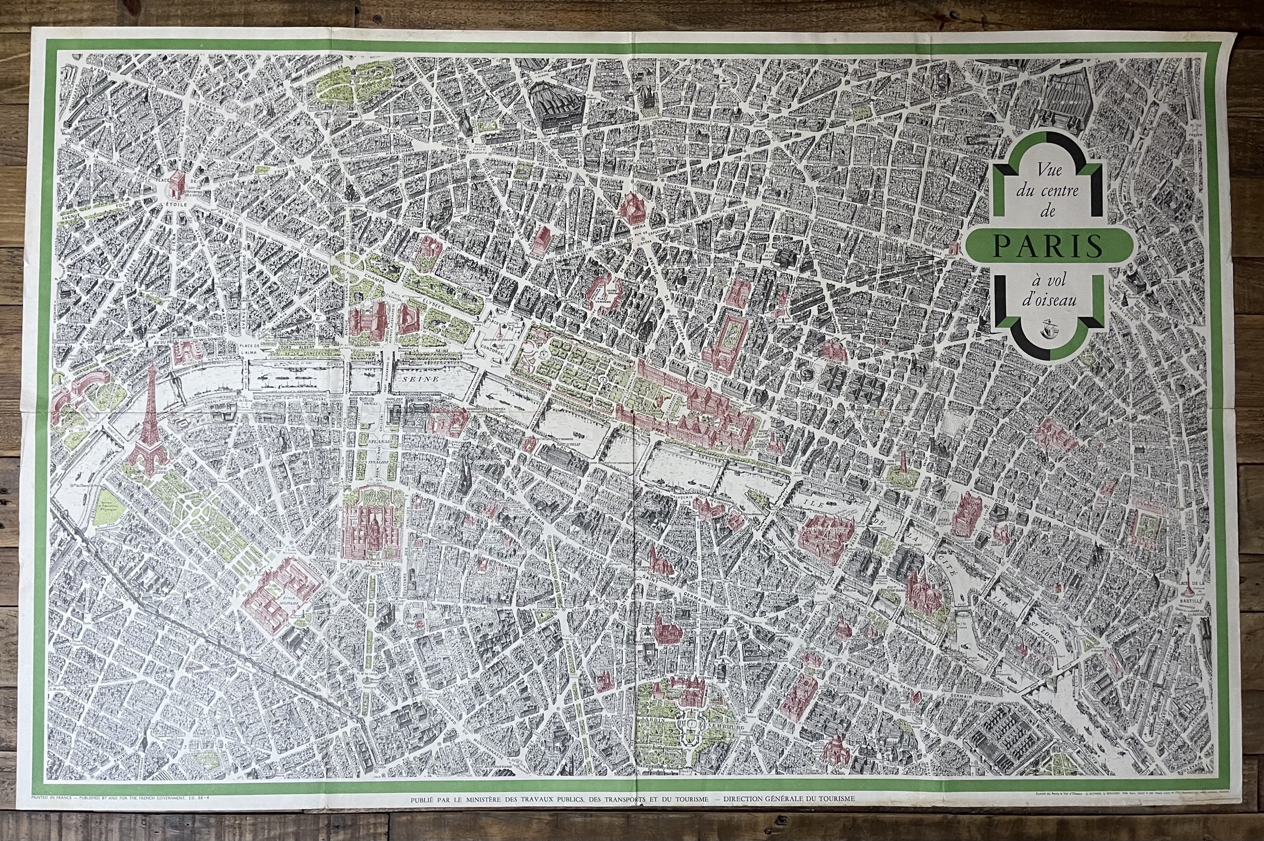


Paris Pictorial Aerial Tourist Map - Georges Peltier / Blondel La Rougery - 1950
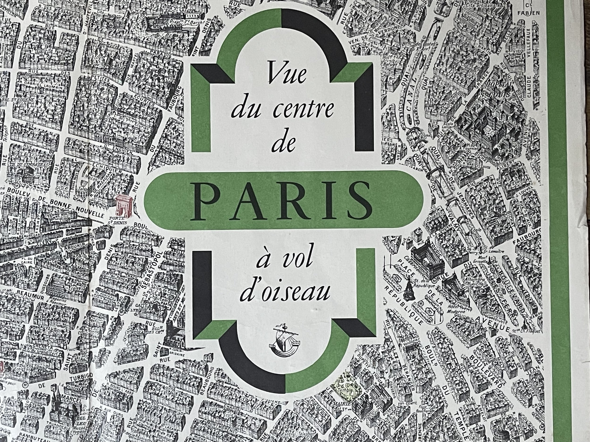
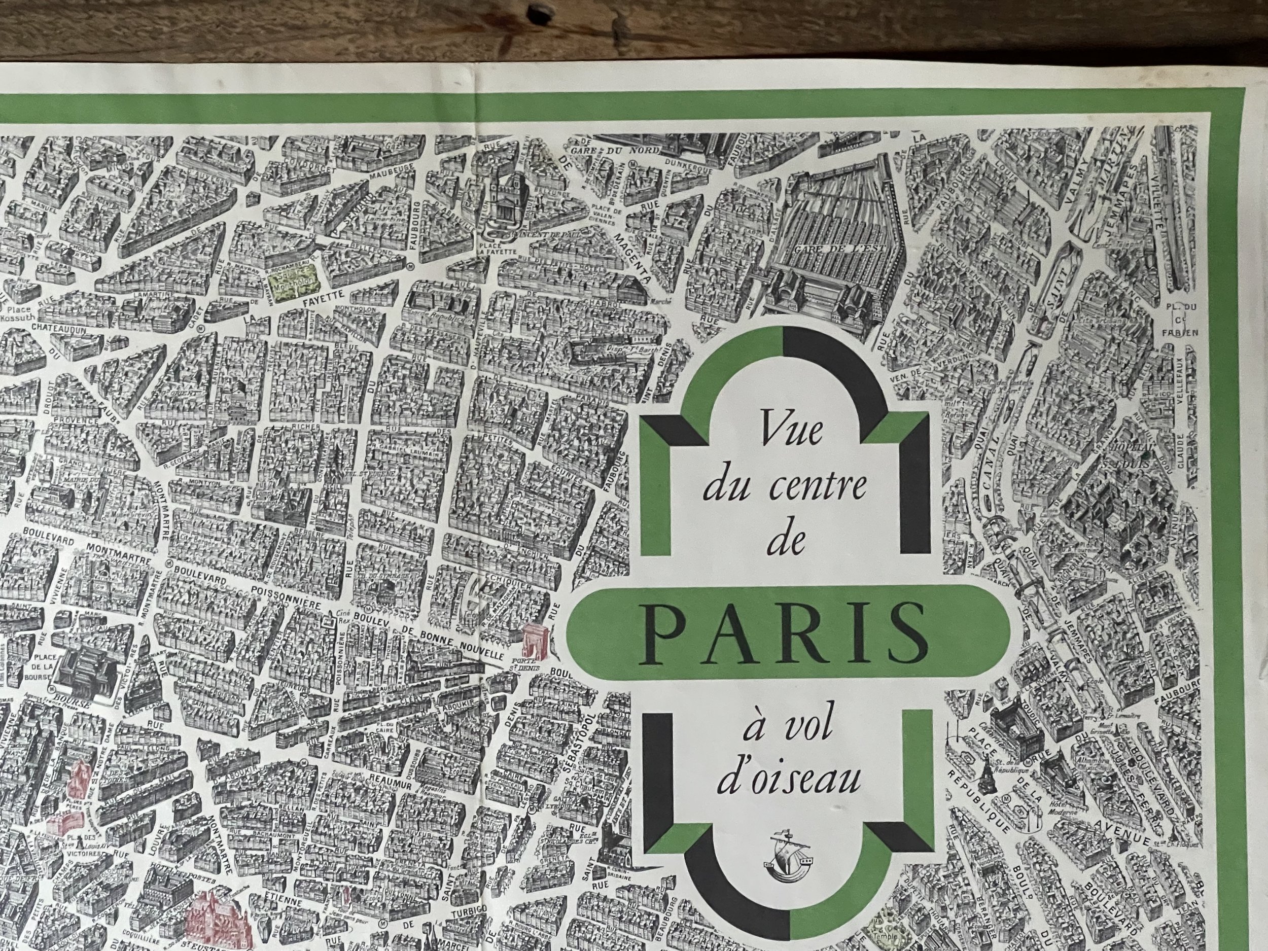
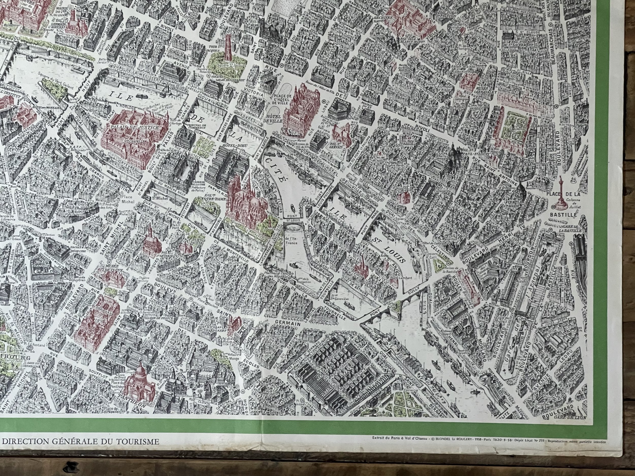
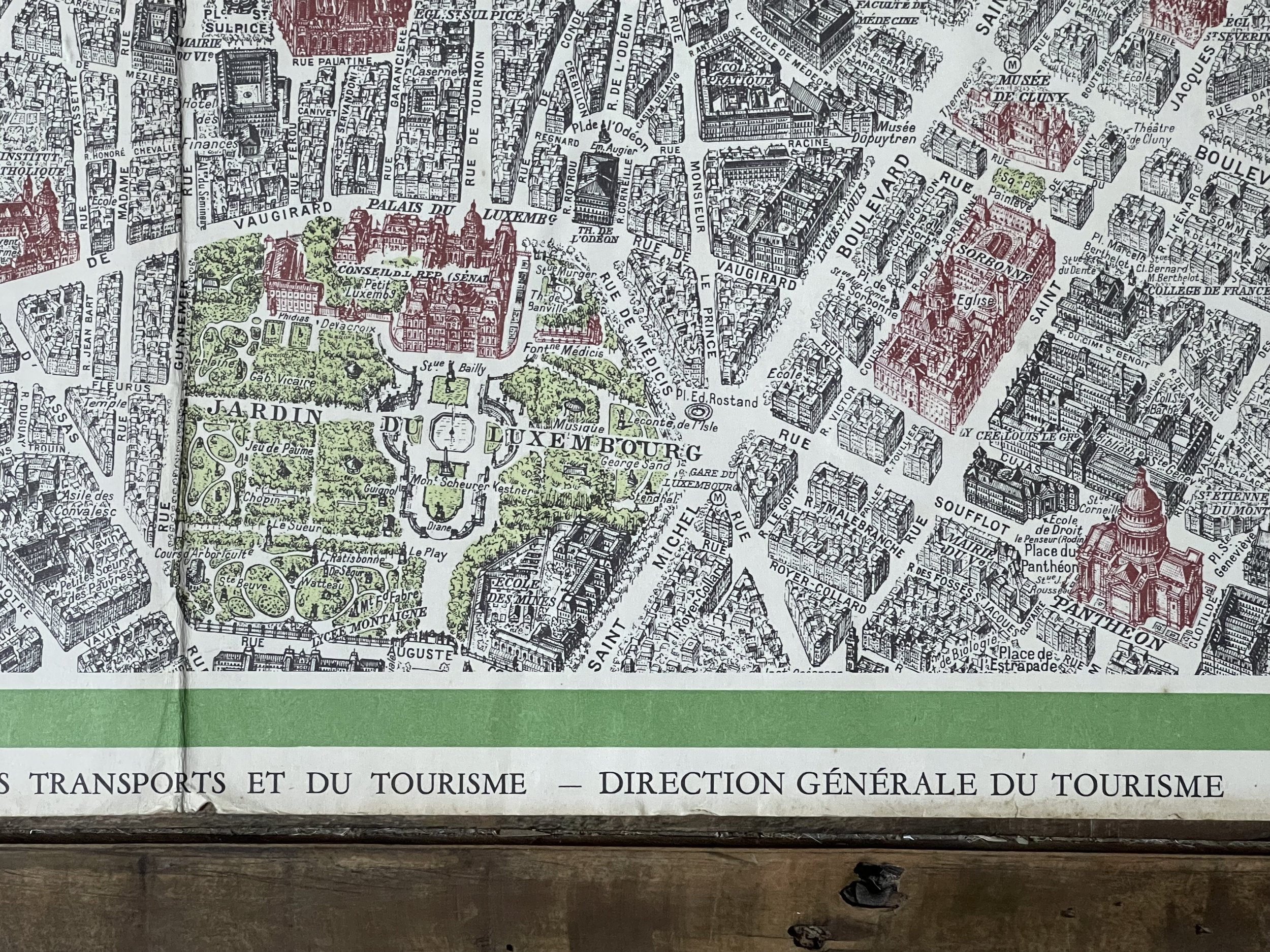
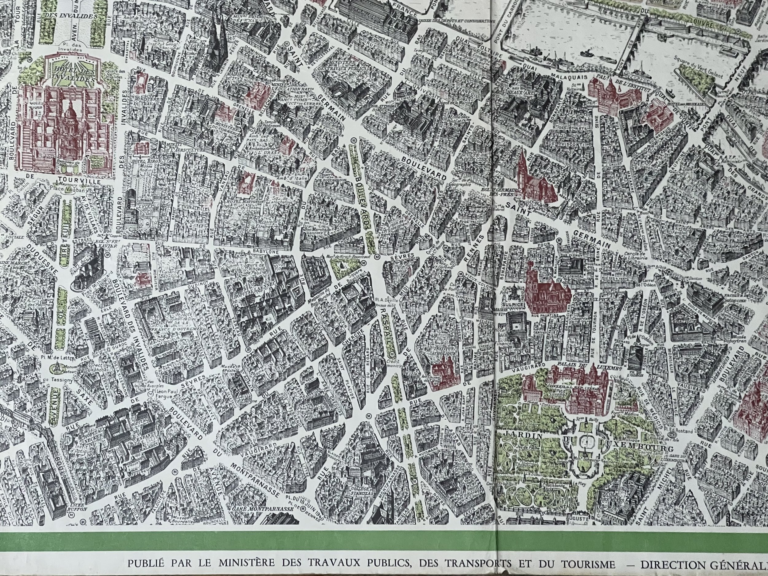
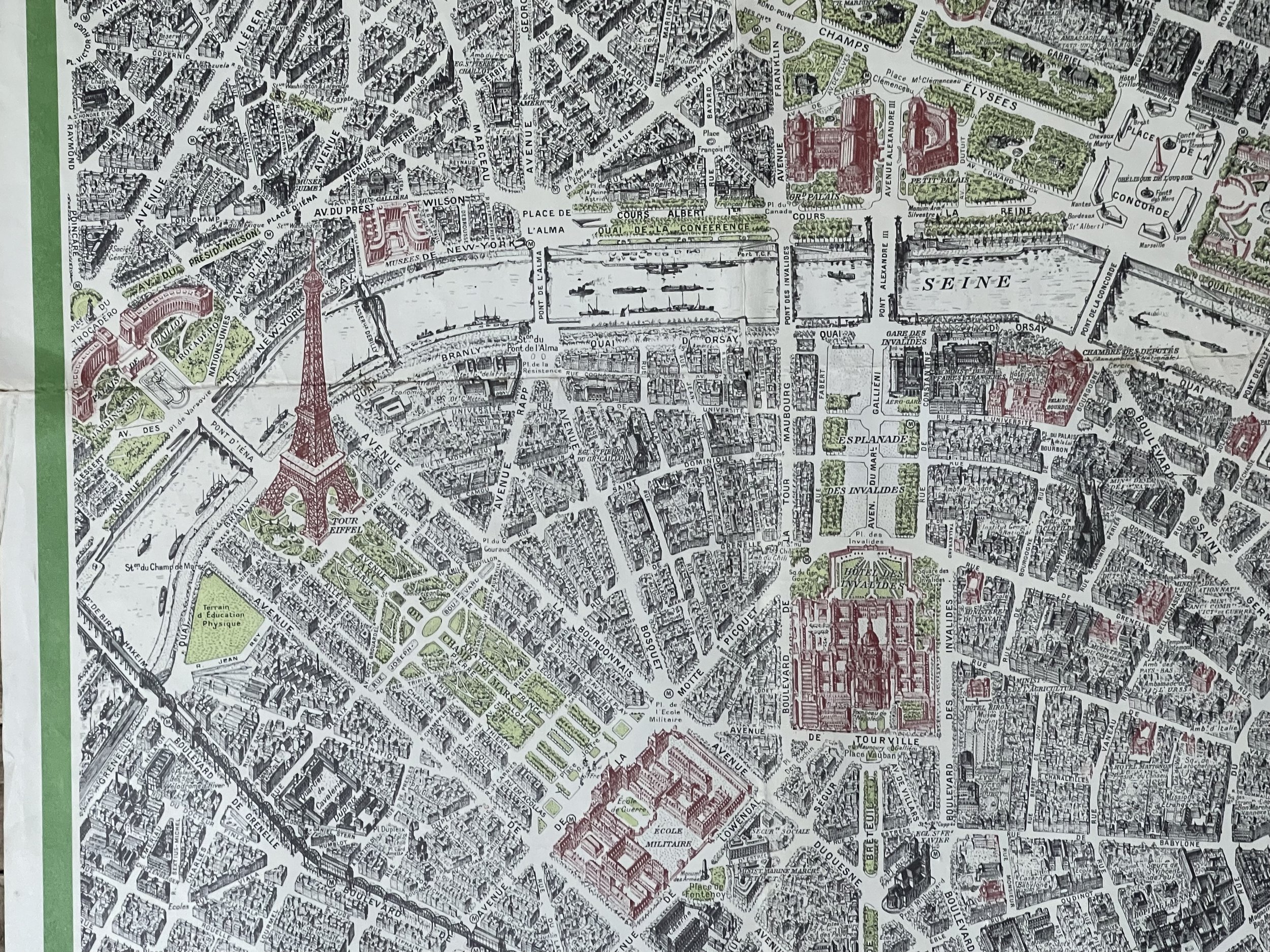
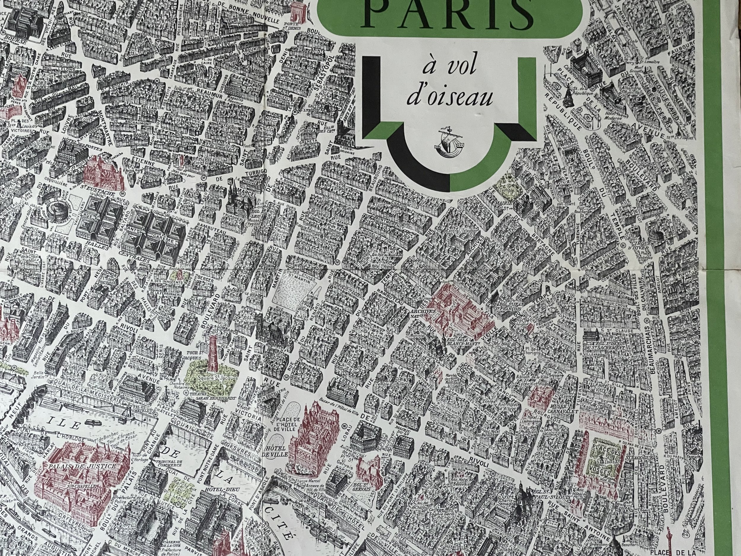
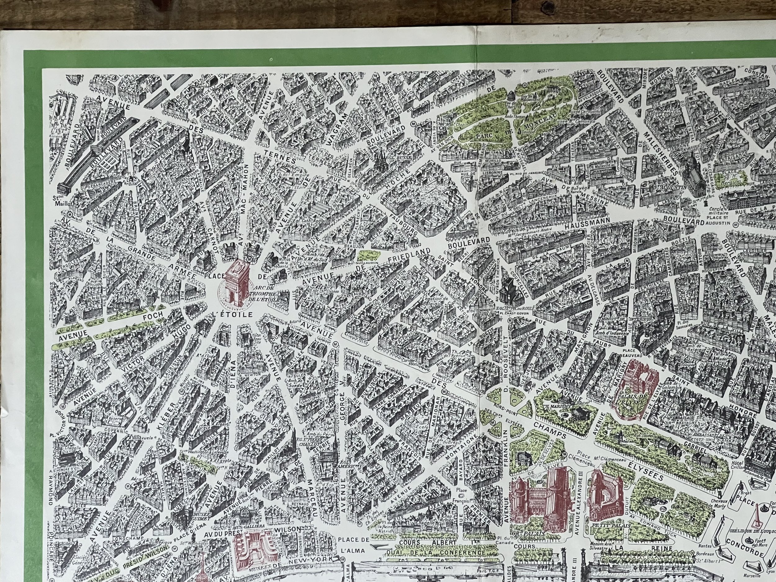
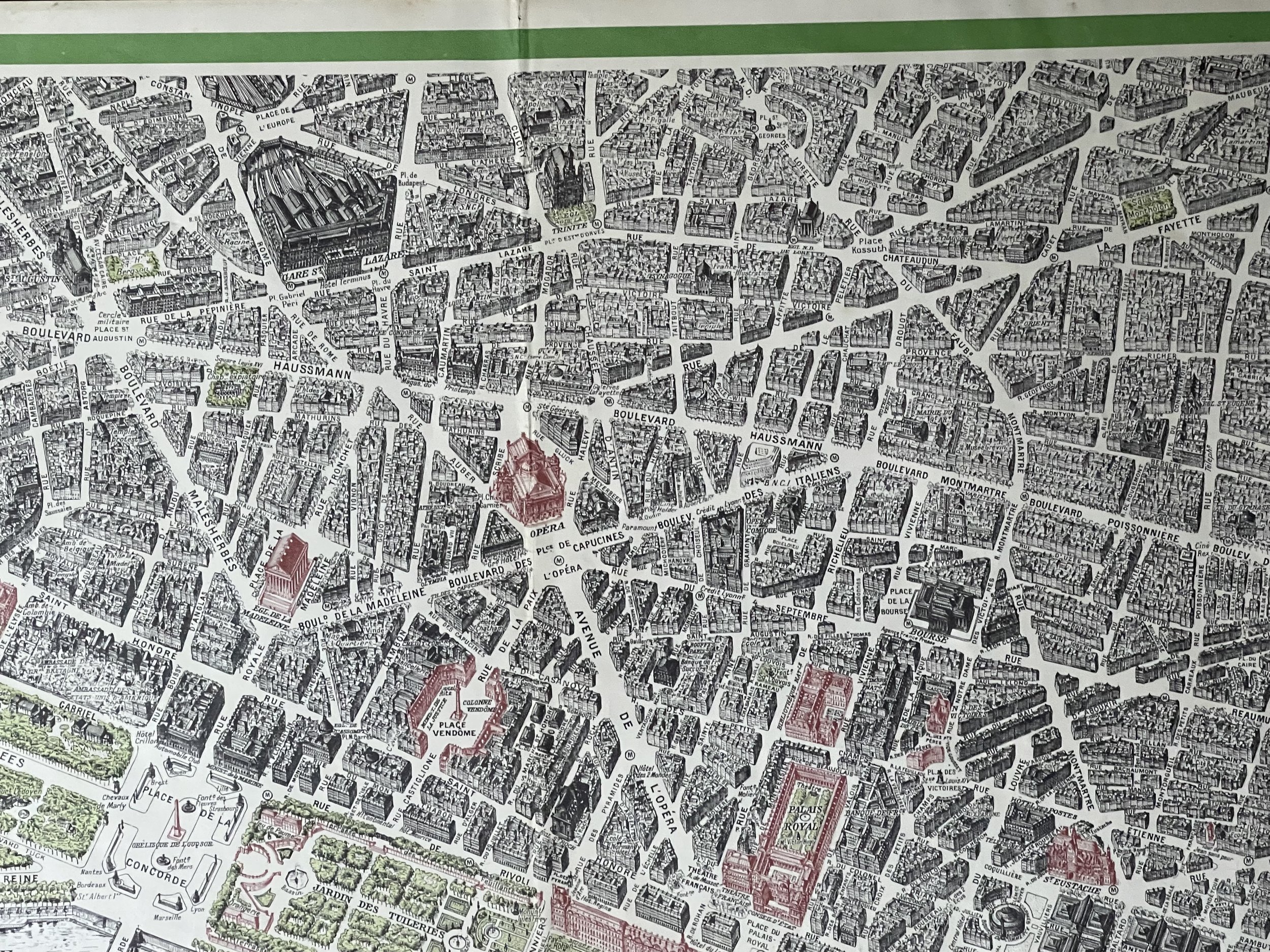
"Vue du centre de Paris à vol d'oiseau / Publié par le Ministère des Travauc Publics, des Transports et du Tourisme - Direction Générale du Tourisme". - View of the centre of Paris taken from the air.
Extremely hard to procure, this oversized bird's-eye-view map was created by French map maker Blondel del Rougery and engraved by Georges Peltier.
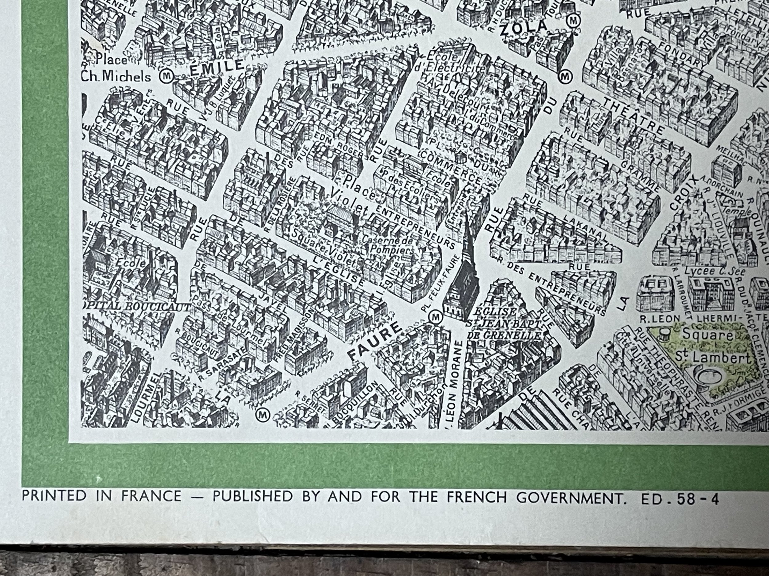
The various landmarks of the famous city are shown in red such as the Eiffel Tower, the Palais de Justice, and the Arc de Triomphe. The detailed renditions of buildings and streets make this map a great piece to own and display. For 20 years, Georges Peltier worked on making the most remarkable map of Paris. Started in 1920 and finished in 1940, and representing 30,000 man hours of research and sketching.
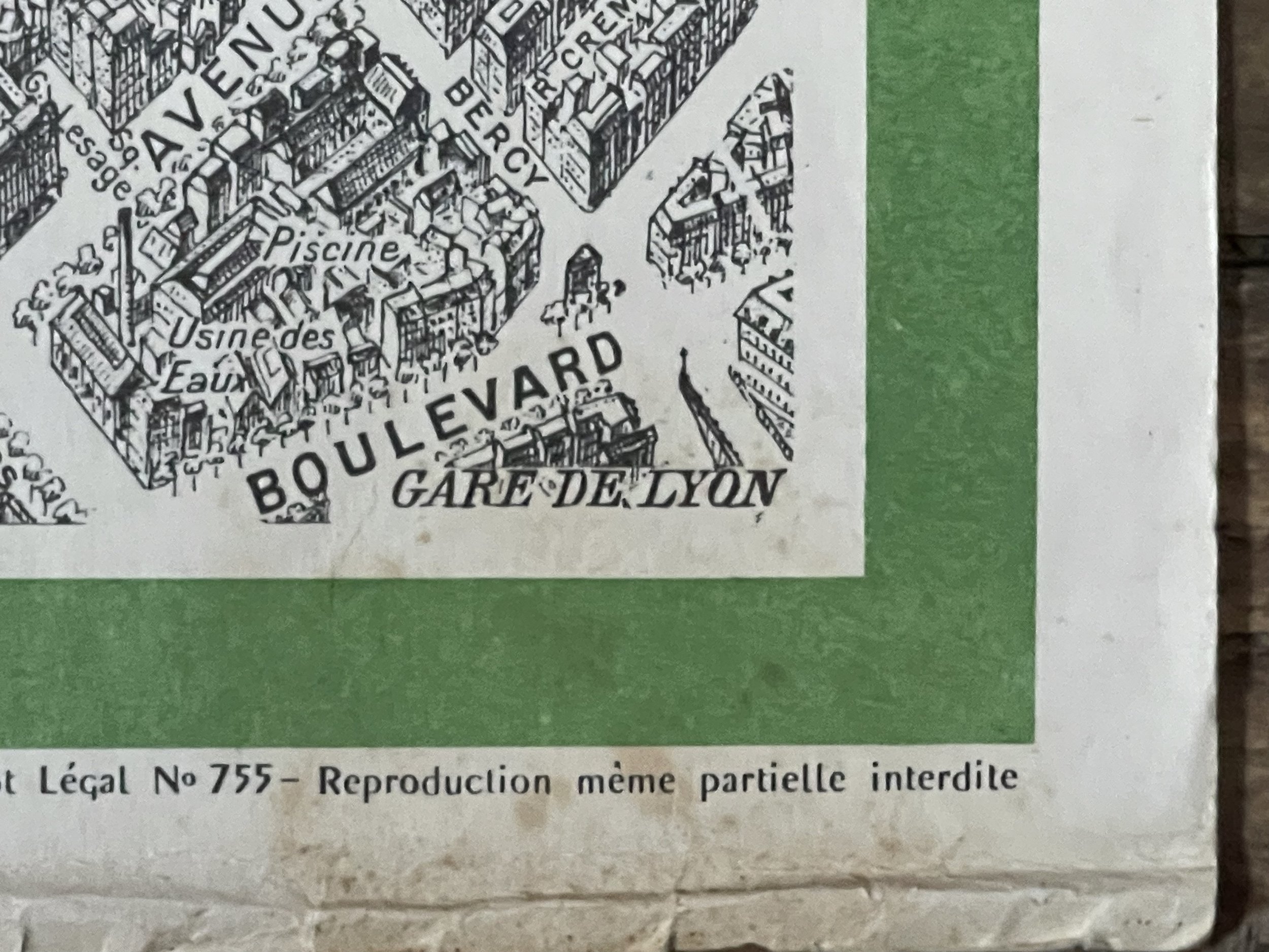
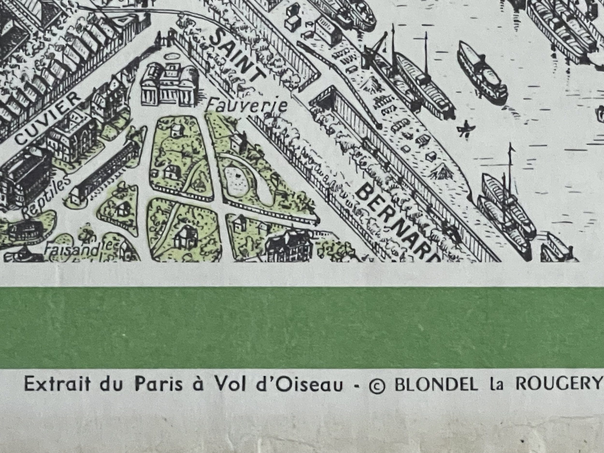
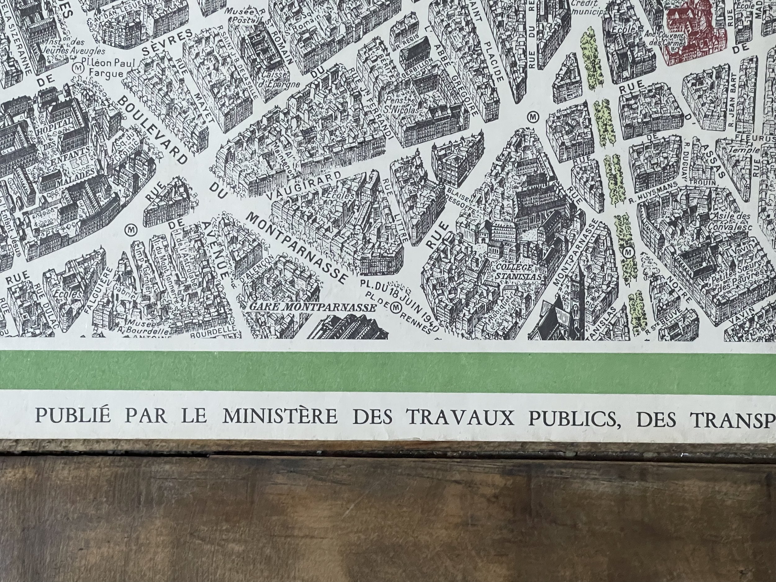
Every single street is on the map including the tiniest ones. Parisian lovers will recognize famous landmarks such as the Eiffel Tower, the Bastille and all train stations.
Nine editions are published between 1920 and 1985. Peltier's name is removed from later editions.
Printed in France by and for the French Government - Circa: 1950
Blondel la Rougery (c. 1902 - 2002)
Was a Parisian publisher of maps and books, primarily relating to aviation and maritime themes. It was founded in 1902 by Edouard Blondel la Rougery, who was succeeded around the year 1955 by Max Blondel la Rougery, who ran the firm until 1976. It continued to operate after-wards, primarily publishing maps, with decreasing frequency until the early 21st century, when its output stopped altogether.
Very good condition, slight staining in bottom right hand border (see photo) - Colours: Green , black and red on heavy white paper. Pricing and grading commensurate.
"Vue du centre de Paris à vol d'oiseau / Publié par le Ministère des Travauc Publics, des Transports et du Tourisme - Direction Générale du Tourisme". - View of the centre of Paris taken from the air.
Extremely hard to procure, this oversized bird's-eye-view map was created by French map maker Blondel del Rougery and engraved by Georges Peltier.
The various landmarks of the famous city are shown in red such as the Eiffel Tower, the Palais de Justice, and the Arc de Triomphe. The detailed renditions of buildings and streets make this map a great piece to own and display. For 20 years, Georges Peltier worked on making the most remarkable map of Paris. Started in 1920 and finished in 1940, and representing 30,000 man hours of research and sketching.
Every single street is on the map including the tiniest ones. Parisian lovers will recognize famous landmarks such as the Eiffel Tower, the Bastille and all train stations.
Nine editions are published between 1920 and 1985. Peltier's name is removed from later editions.
Printed in France by and for the French Government - Circa: 1950
Blondel la Rougery (c. 1902 - 2002)
Was a Parisian publisher of maps and books, primarily relating to aviation and maritime themes. It was founded in 1902 by Edouard Blondel la Rougery, who was succeeded around the year 1955 by Max Blondel la Rougery, who ran the firm until 1976. It continued to operate after-wards, primarily publishing maps, with decreasing frequency until the early 21st century, when its output stopped altogether.
Very good condition, slight staining in bottom right hand border (see photo) - Colours: Green , black and red on heavy white paper. Pricing and grading commensurate.
Code : A821
Cartographer : Cartographer / Engraver / Publisher: Georges Peltier / Blondel La Rougery
Date : Publication Place / Date - Circa 1950
Size : Sheet size: Image Size: 108 x 69 cm
Availability : Available
Type - Genuine - Vintage
Grading A
Where Applicable - Folds as issued. Light box photo shows the folio leaf centre margin hinge ‘glue’, this is not visible otherwise.
Tracked postage, in casement. Please contact me for postal quotation outside of the UK.