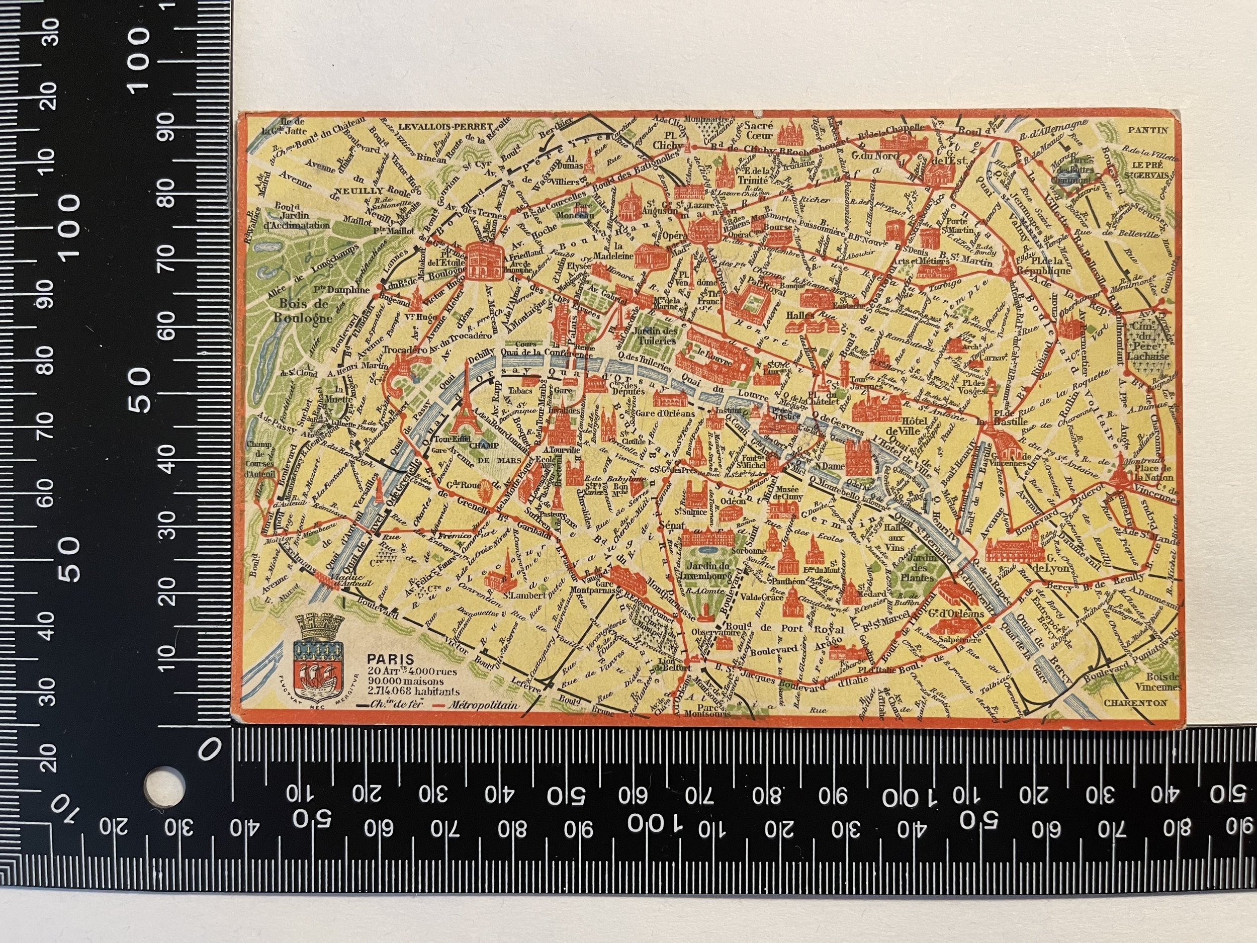

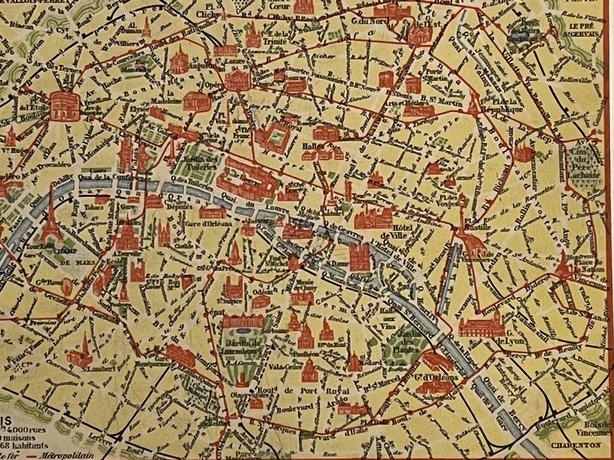
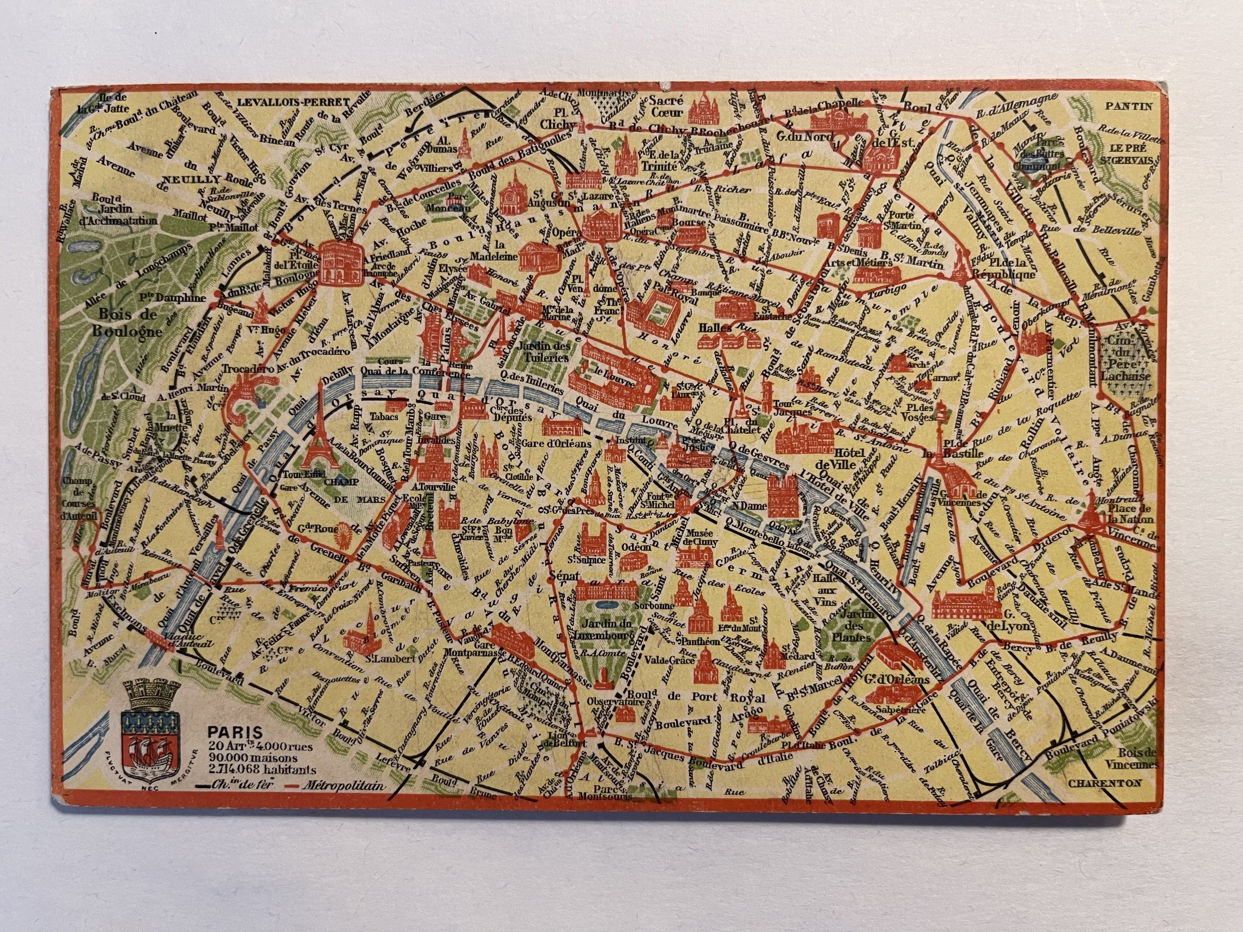
PARIS Postcard Map RAILWAYS & UNDERGROUND - Metropolitain & Ch. de Fer - 1910
Postcard Map of Paris with a key detailing No. of Arrondisements, Roads, Houses, Inhabitants, and showing the routes of the "Ch. de Fer" (Railways) & "Metropolitain" (Underground). (based on the Population of 2,714,068).
The Compagnie du chemin de fer métropolitain de Paris S.A. (Paris Metropolitan Railway Company Ltd.), or CMP, was the forerunner of the RATP, the company managing the Paris Métro.
So as not to be dependent on the Chemin de fer de l'État (State Railways) for its rail transport, the City of Paris decided in 1883 on the construction of a subway network. There were some tensions between the national government and the city for the control of the operation, but the approach of the World Fair of 1900 speeded the decisions. In 1895, Louis Barthou, minister for public works, accepted that the construction work should be carried out by the city. That included building the tunnels, viaducts and stations and contracting for the operation. In 1897 the city council chose the General Traction Company, owned by the Belgian Baron Édouard Louis Joseph Empain. An act of 30 March 1898 declared a public utility for "the construction of a metropolitan railway by electric traction, intended for the transport of the travelers and their hand luggage". The General Traction Company formed the CMP in April 1898.
Excellent condition.
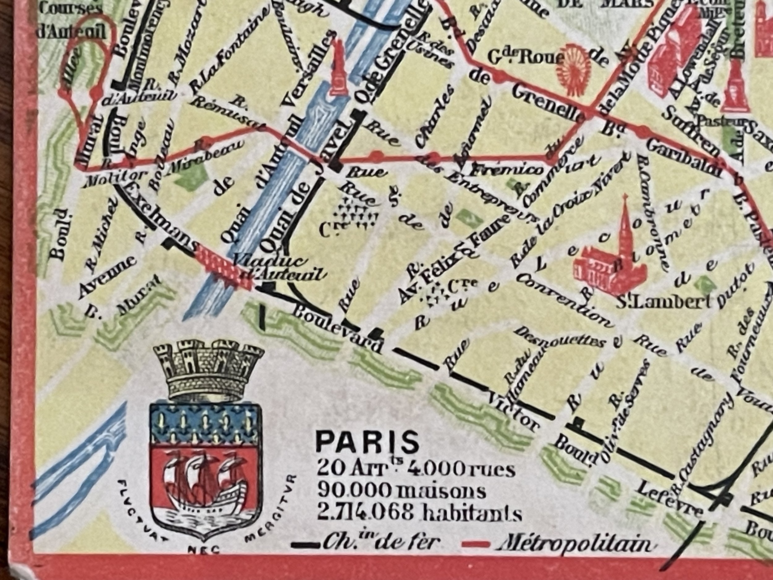
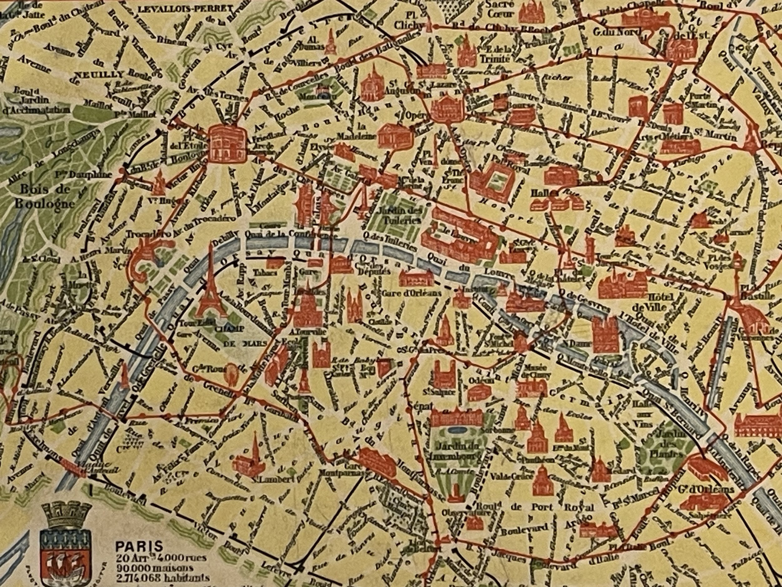
Code : A838
Cartographer : Cartographer / Engraver / Publisher: Metropolitain & Ch. de Fer
Date : Publication Place / Date - 1910 approx
Size : Sheet size: Image Size: 14 X 9 cm
Availability : Available
Type - Genuine - Antique
Grading A
Where Applicable - Folds as issued. Light box photo shows the folio leaf centre margin hinge ‘glue’, this is not visible otherwise.
Tracked postage, in casement. Please contact me for postal quotation outside of the UK.