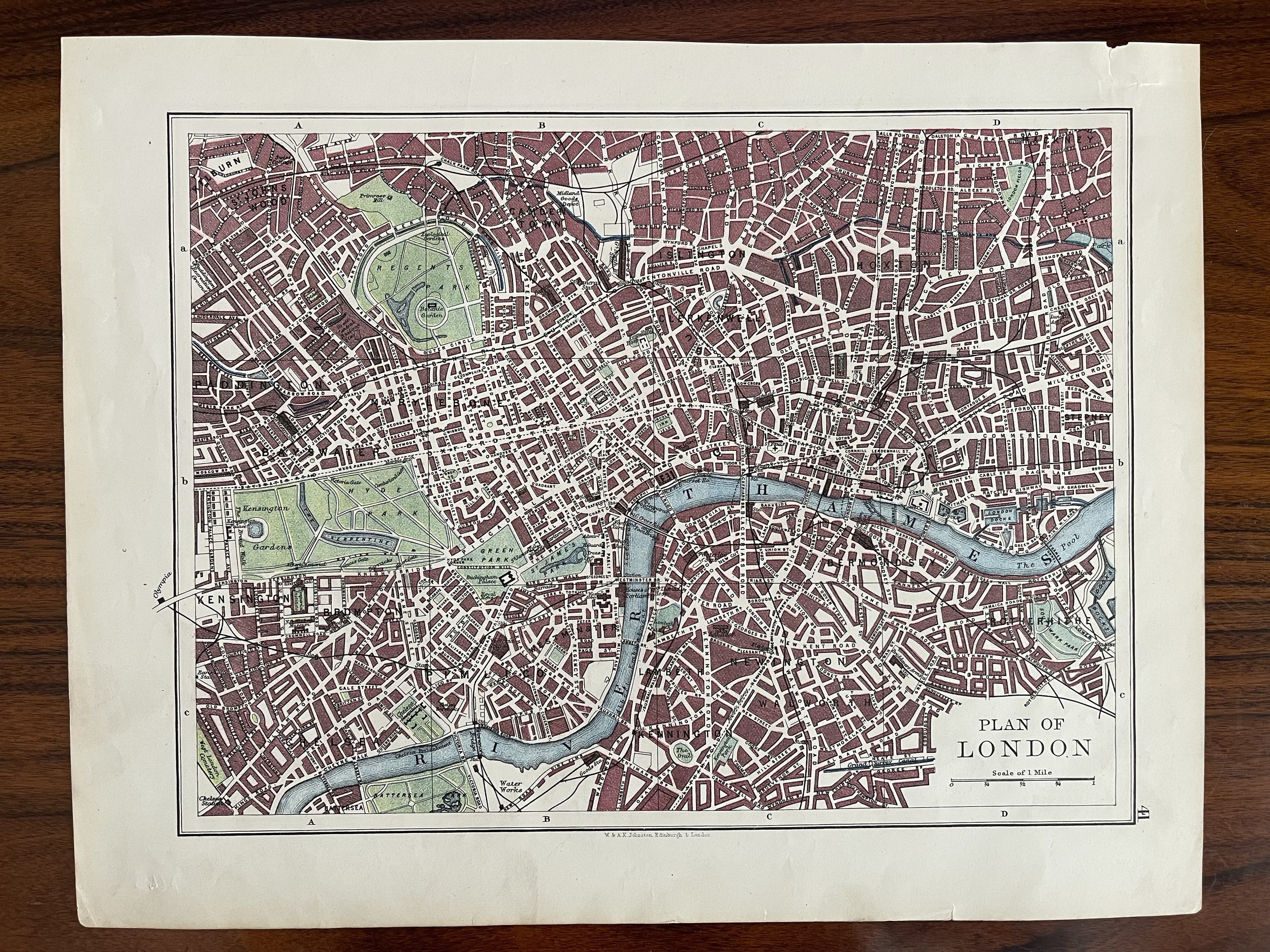
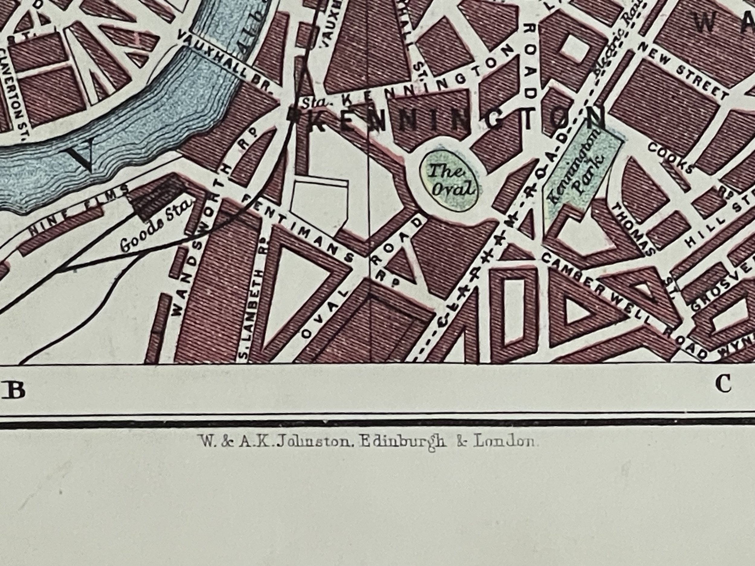
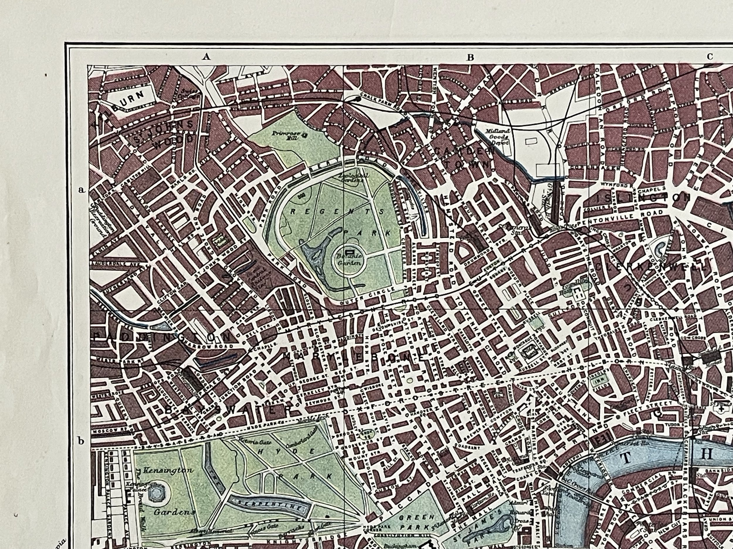
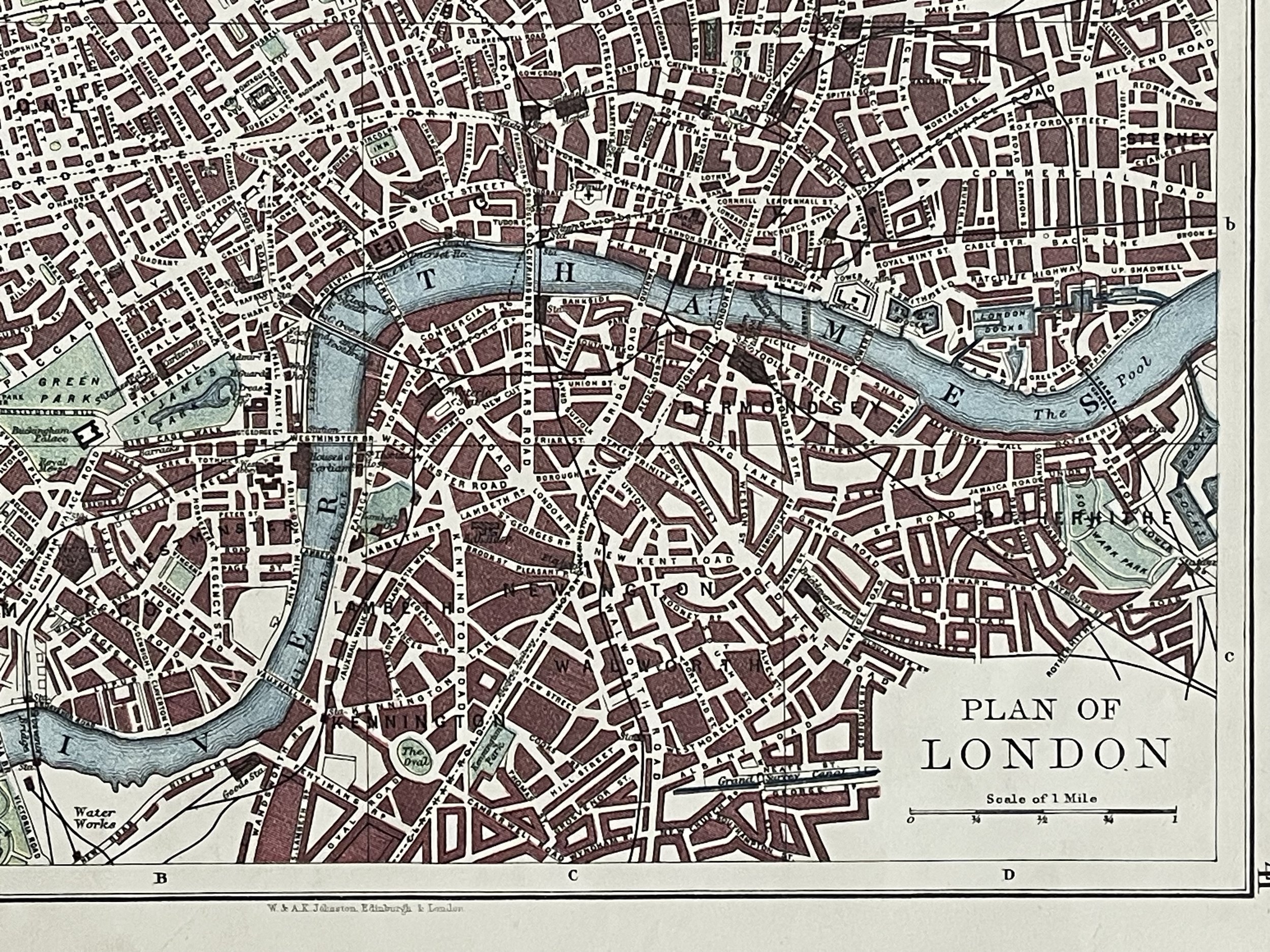
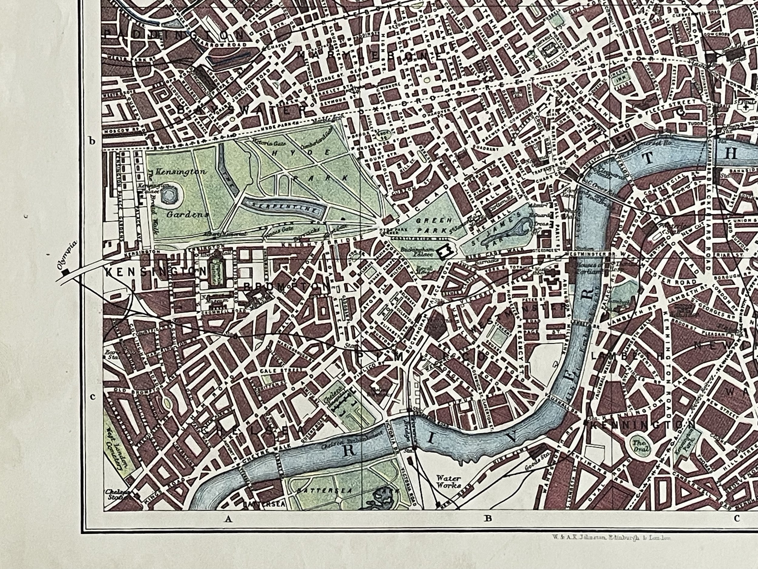
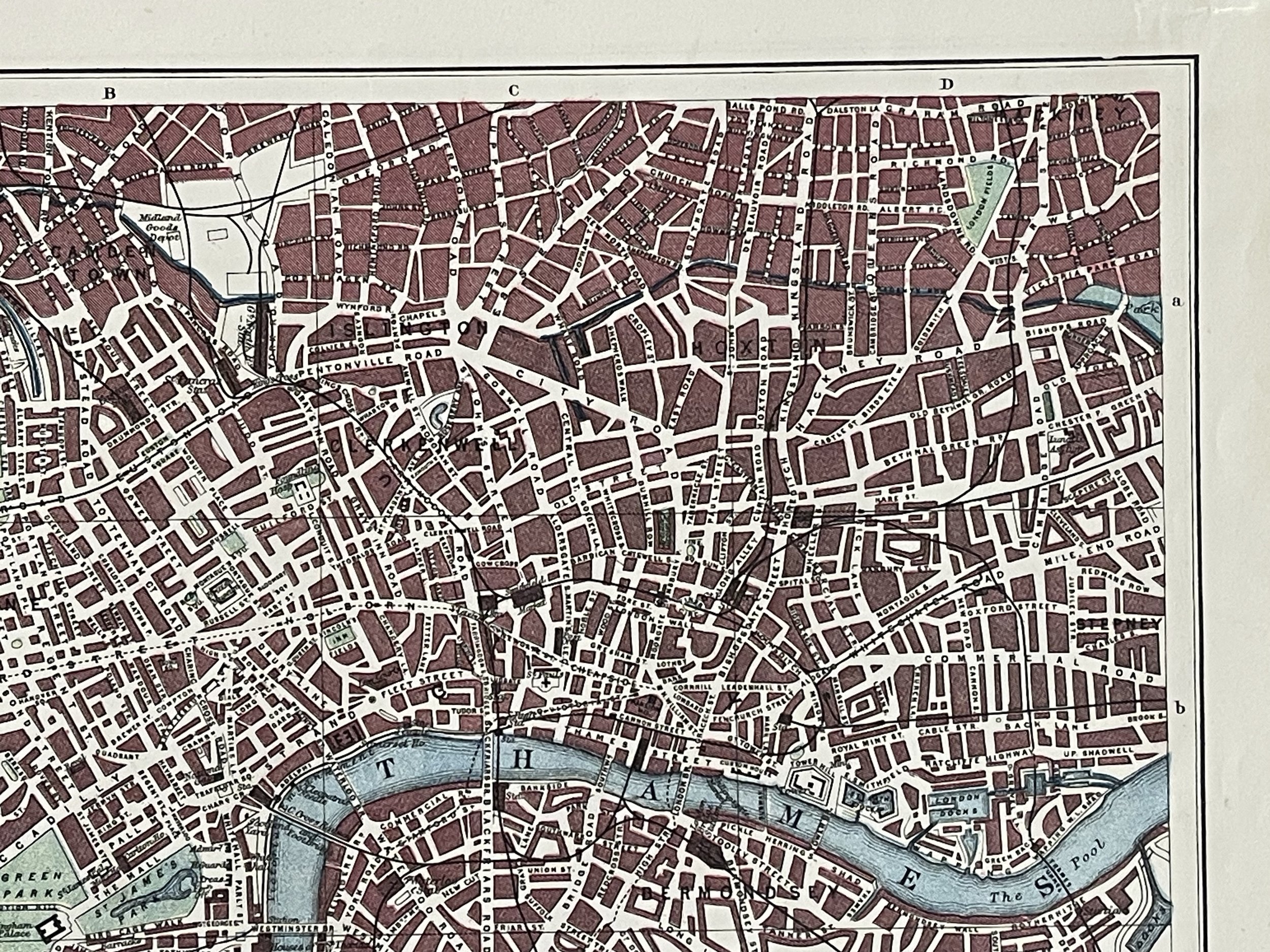
Plan of London - W & A.K Johnston - Edinburgh - Circa 1900
LONDON PLAN. West End Pimlico City Southwark Islington Lambeth. JOHNSTON 1900 map. Antique colour map.
W. & A.K. Johnston, Limited, Edinburgh & London (1900). Condition: Very Good.
The firm of W. & A.K. Johnston was to become one of the major publishing houses of the 19th century. Co-founders, brothers William and Alexander Keith (1804-1871) Johnston, started out as apprentices to the Scottish globe maker and publisher James Kirkwood in his Edinburgh workshop. Having learned their trade there, they set up their own business, also in the city.
The Johnston’s very astutely acquired the established Scottish printing publishing house of William Lizars, and began, first printing by contract, and slowly expanding their repertoire into not only maps, but also atlases, gazetteers, guidebooks, globes and much more. In amongst the brothers' many achievements, and one of their major claims, was that of the first physical globe, which won them several awards at the Great Exhibition of 1851. The globe-making element of the business continued well into the 20th century on both sides of the Atlantic.
Some of the Johnston's exceptional map collections include the National Atlas of General Geography, first struck in 1843, The Handy Royal Atlas of Modern Geography published 1874, various scientific and statistical atlases, such as Johnston’s School Astronomical Atlas (1877), The Statistical Atlas of England and Wales (1882) and The Royal Atlas of Modern Geography. The business continued to function under the Johnston name until the 1960s.
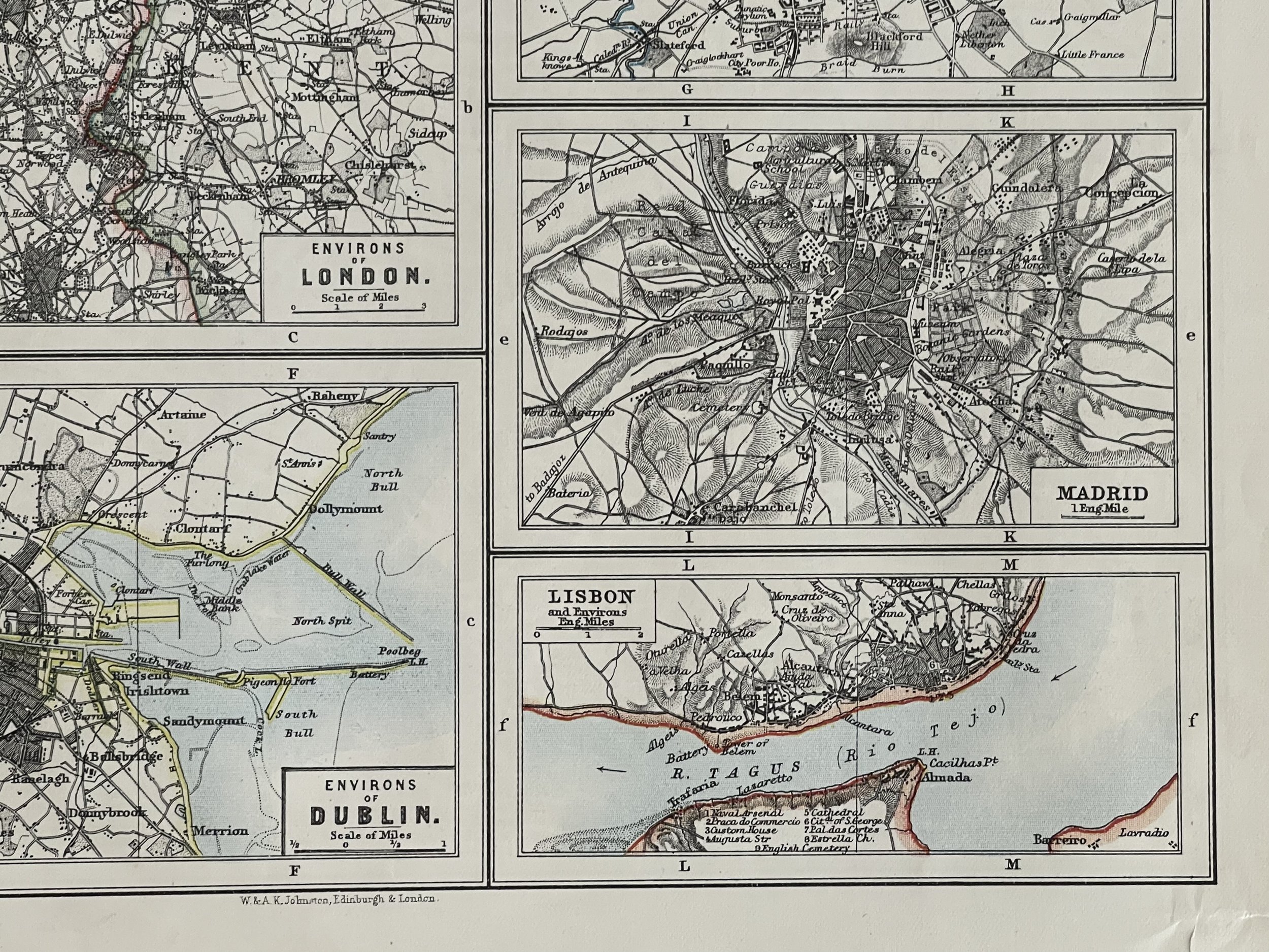
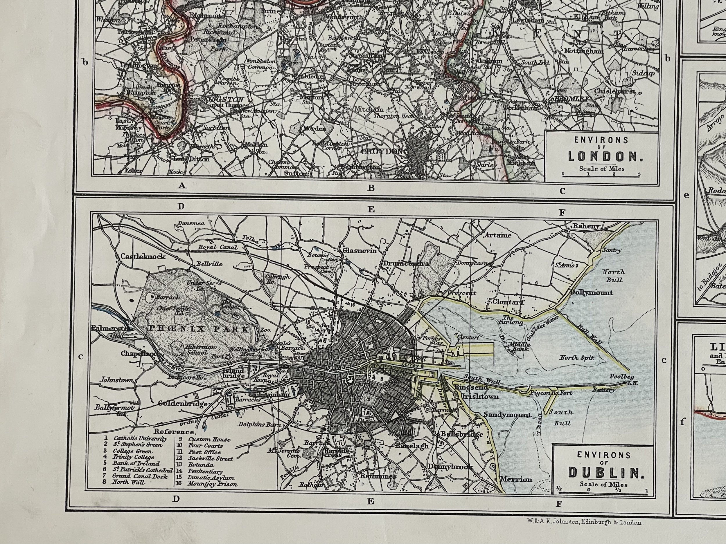
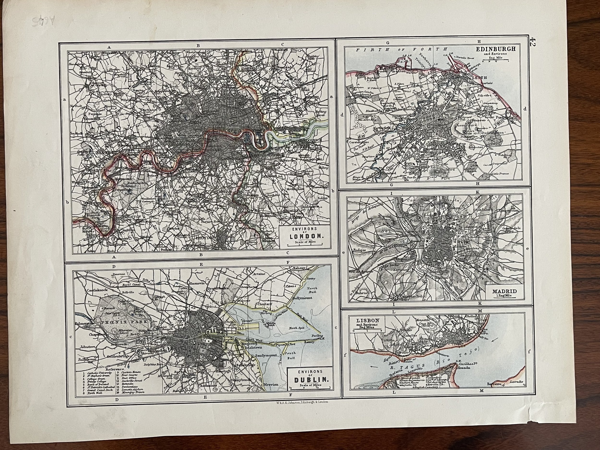
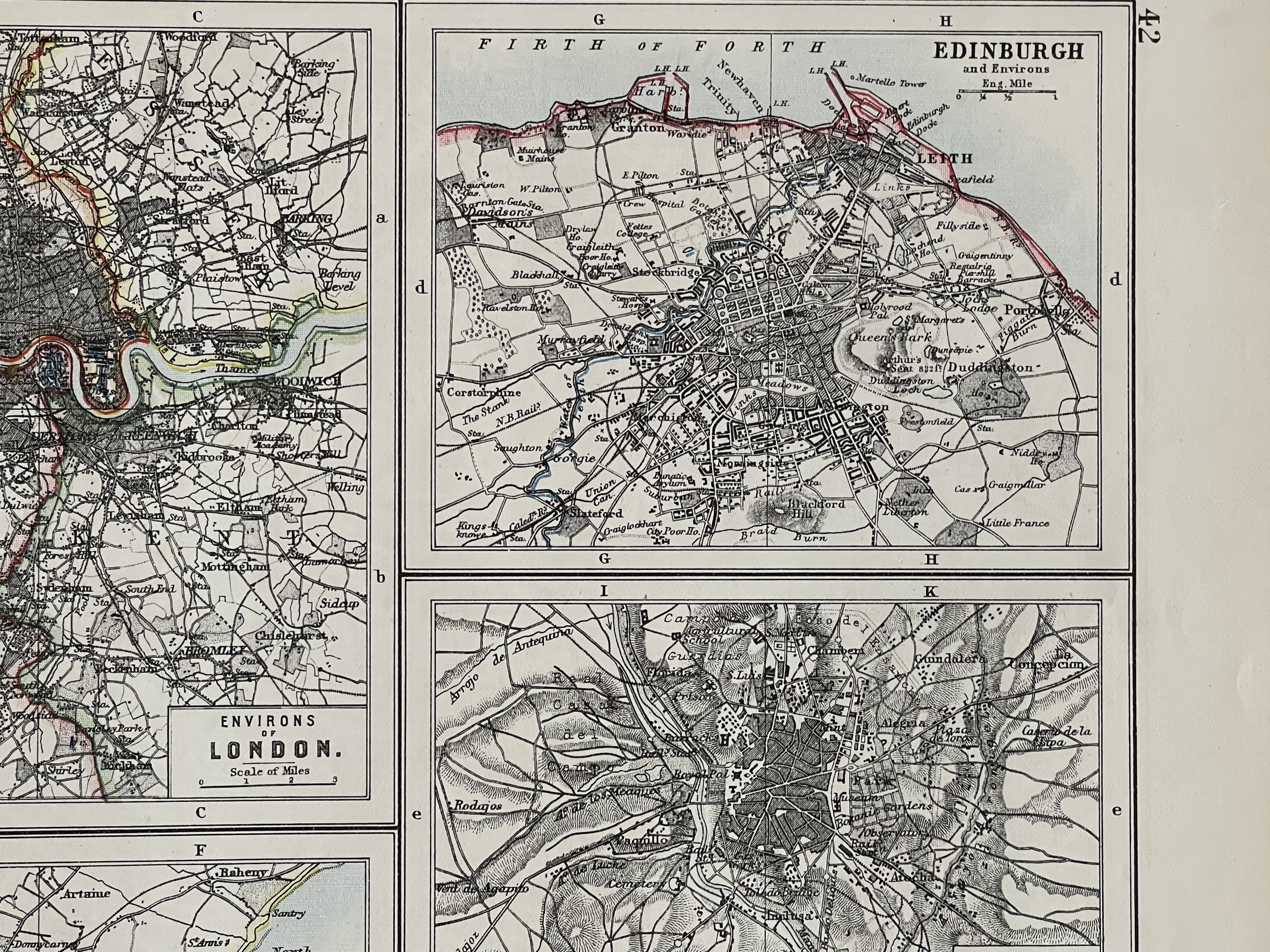
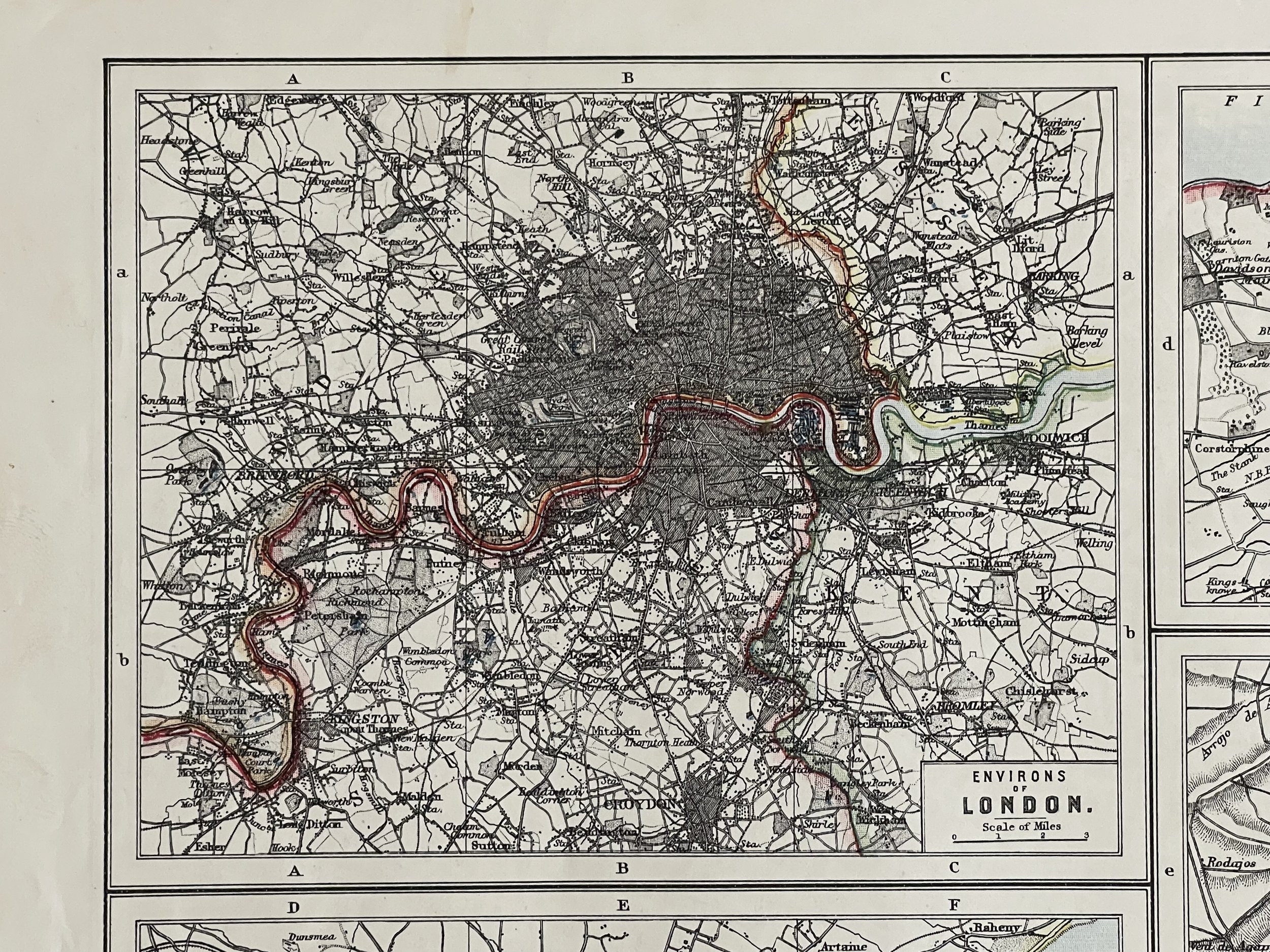
There are images and/or text maps of Edinburgh, Dublin, Madrid, Lisbon and London Environs printed on the reverse side of the plate.
Pricing and grading commensurate.
LONDON PLAN. West End Pimlico City Southwark Islington Lambeth. JOHNSTON 1900 map. Antique colour map.
W. & A.K. Johnston, Limited, Edinburgh & London (1900). Condition: Very Good.
The firm of W. & A.K. Johnston was to become one of the major publishing houses of the 19th century. Co-founders, brothers William and Alexander Keith (1804-1871) Johnston, started out as apprentices to the Scottish globe maker and publisher James Kirkwood in his Edinburgh workshop. Having learned their trade there, they set up their own business, also in the city.
The Johnston’s very astutely acquired the established Scottish printing publishing house of William Lizars, and began, first printing by contract, and slowly expanding their repertoire into not only maps, but also atlases, gazetteers, guidebooks, globes and much more. In amongst the brothers' many achievements, and one of their major claims, was that of the first physical globe, which won them several awards at the Great Exhibition of 1851. The globe-making element of the business continued well into the 20th century on both sides of the Atlantic.
Some of the Johnston's exceptional map collections include the National Atlas of General Geography, first struck in 1843, The Handy Royal Atlas of Modern Geography published 1874, various scientific and statistical atlases, such as Johnston’s School Astronomical Atlas (1877), The Statistical Atlas of England and Wales (1882) and The Royal Atlas of Modern Geography. The business continued to function under the Johnston name until the 1960s.
There are images and/or text maps of Edinburgh, Dublin, Madrid, Lisbon and London Environs printed on the reverse side of the plate.
Pricing and grading commensurate.
Code : A645/485
Cartographer : Cartographer / Engraver / Publisher: W & A.K Johnston
Date : Publication Place / Date - Circa 1900
Size : Sheet size: Image Size: 31 x 24 cm
Availability : Available
Type - Genuine - Antique
Grading A to A+
Where Applicable - Folds as issued. Light box photo shows the folio leaf centre margin hinge ‘glue’, this is not visible otherwise.
Tracked postage, in casement. Please contact me for postal quotation outside of the UK.