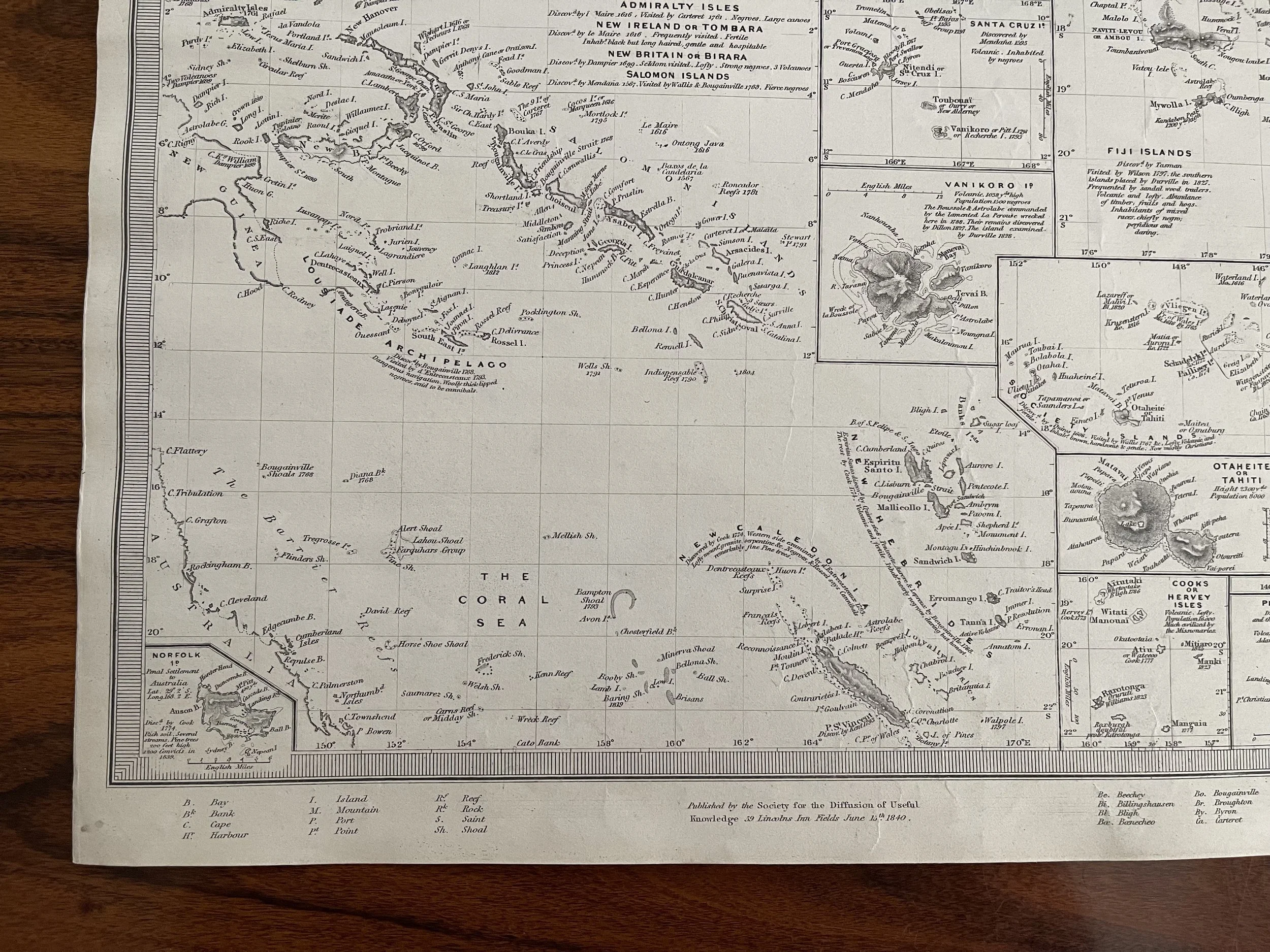
Polynesia, Pacific Ocean, Coral Sea, Tahiti, SDUK/Society for the Diffusion of Useful Knowledge. 1840-1844
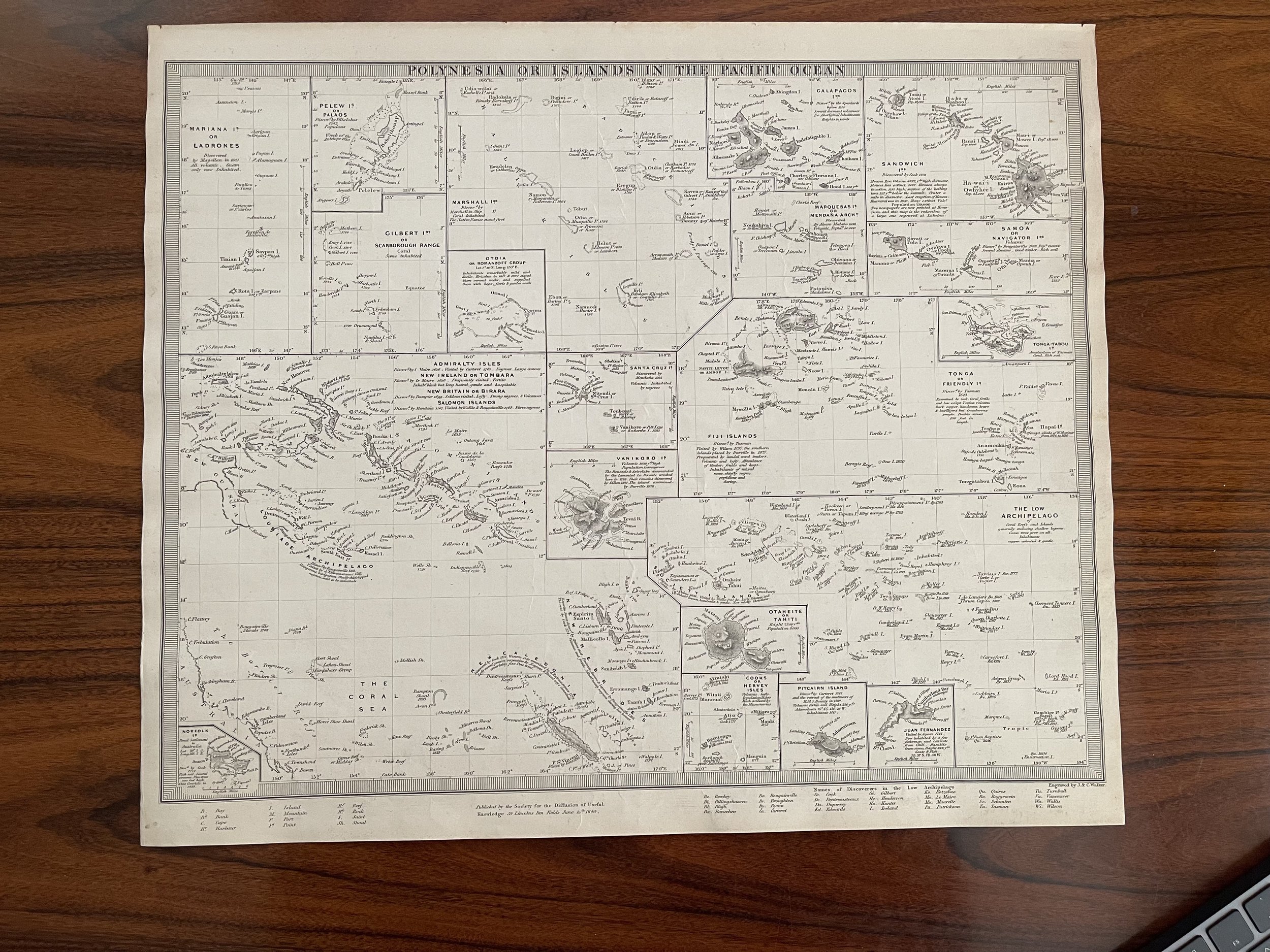
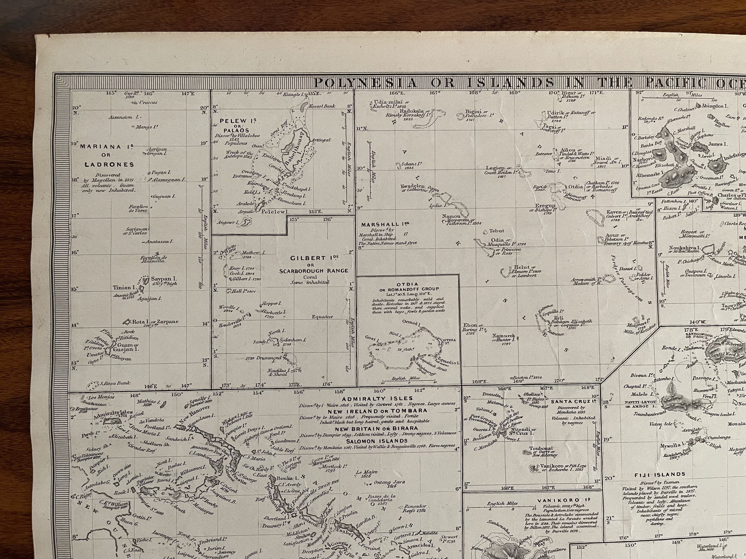
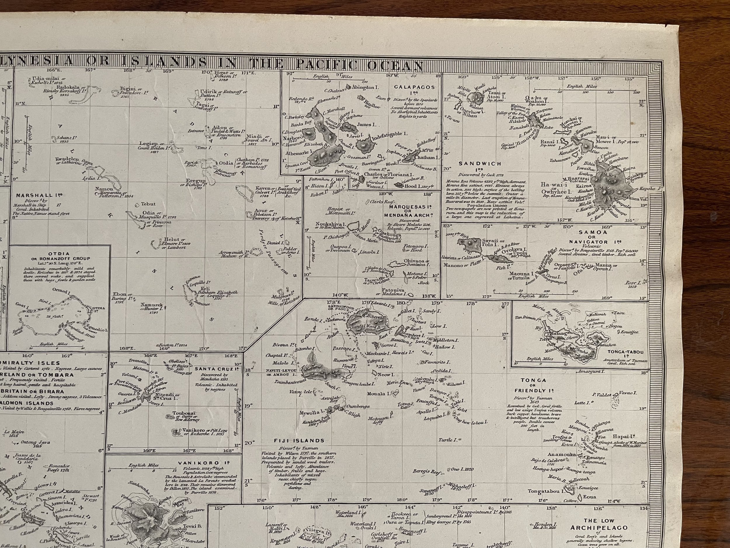
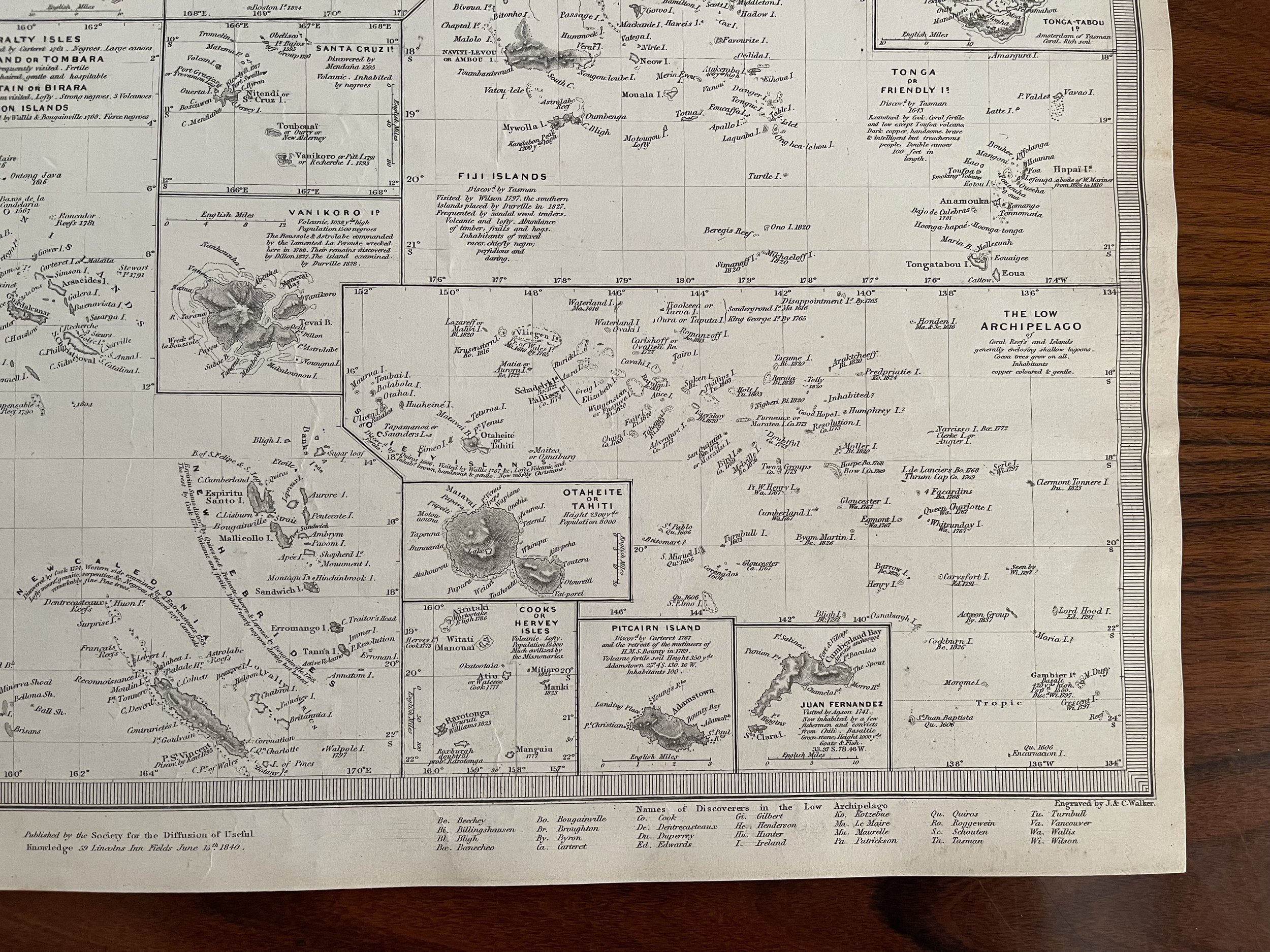
Antique map of the various island groups in the Pacific Ocean, published by the SDUK/Society for the Diffusion of Useful Knowledge. Includes the Mariana Islands, the Salomon Islands, New Caledonia, New Hebrides, the Gilbert Islands, Sandwich Islands (Hawaii), the Marquesas, the Fiji Islands, Tahiti, Tonga, Samoa, the Galapagos, among others. Very Good condition, light toning around the periphery commensurate of age as shown, 12.25 x 15.5 inches.
Antique map of the various island groups in the Pacific Ocean, published by the SDUK/Society for the Diffusion of Useful Knowledge. Includes the Mariana Islands, the Salomon Islands, New Caledonia, New Hebrides, the Gilbert Islands, Sandwich Islands (Hawaii), the Marquesas, the Fiji Islands, Tahiti, Tonga, Samoa, the Galapagos, among others. Very Good condition, light toning around the periphery commensurate of age as shown, 12.25 x 15.5 inches.
Antique map of the various island groups in the Pacific Ocean, published by the SDUK/Society for the Diffusion of Useful Knowledge. Includes the Mariana Islands, the Salomon Islands, New Caledonia, New Hebrides, the Gilbert Islands, Sandwich Islands (Hawaii), the Marquesas, the Fiji Islands, Tahiti, Tonga, Samoa, the Galapagos, among others. Very Good condition, light toning around the periphery commensurate of age as shown, 12.25 x 15.5 inches.
Code : A789
Cartographer : SDUK/Society for the Diffusion of Useful Knowledge.
Date : 1844
Size : Sheet size: 12.25 x 15.5 inches.
Availability : Available
Type - Genuine Antique. Grading - A