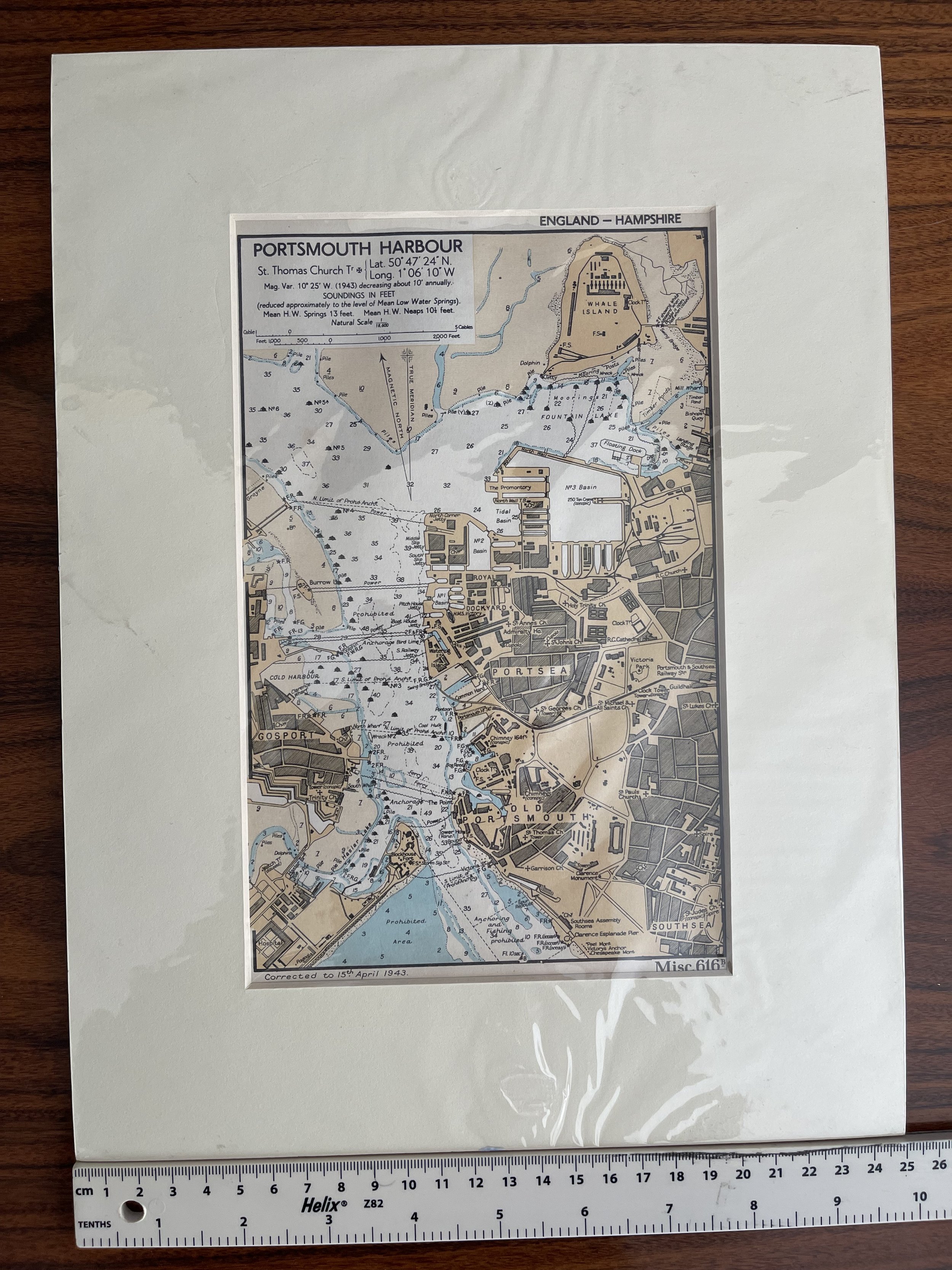
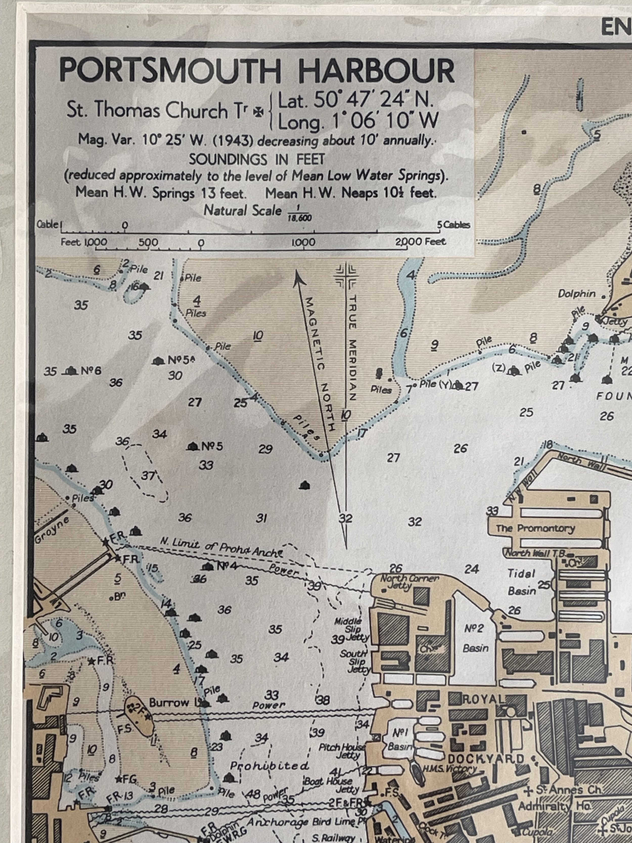
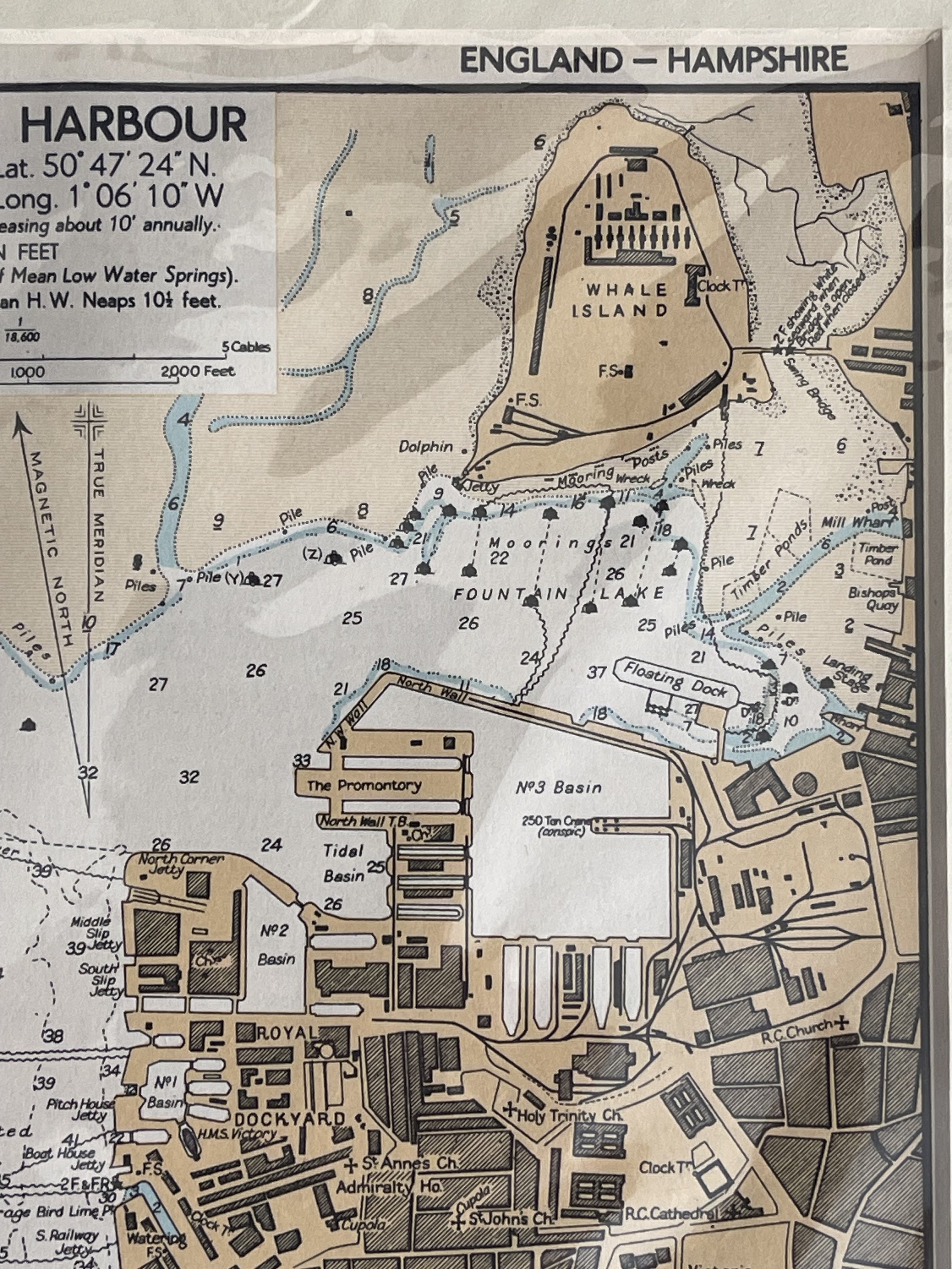
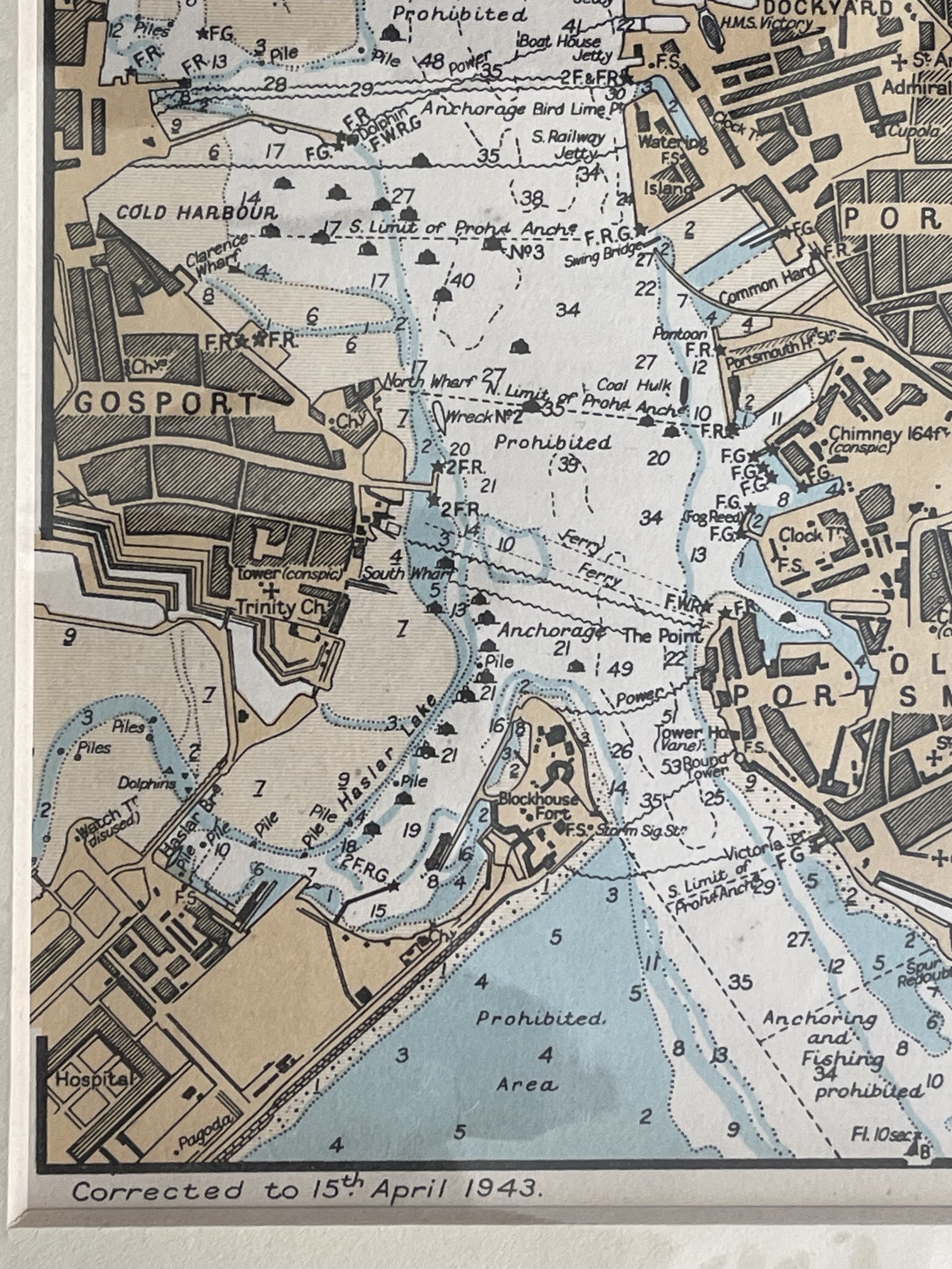
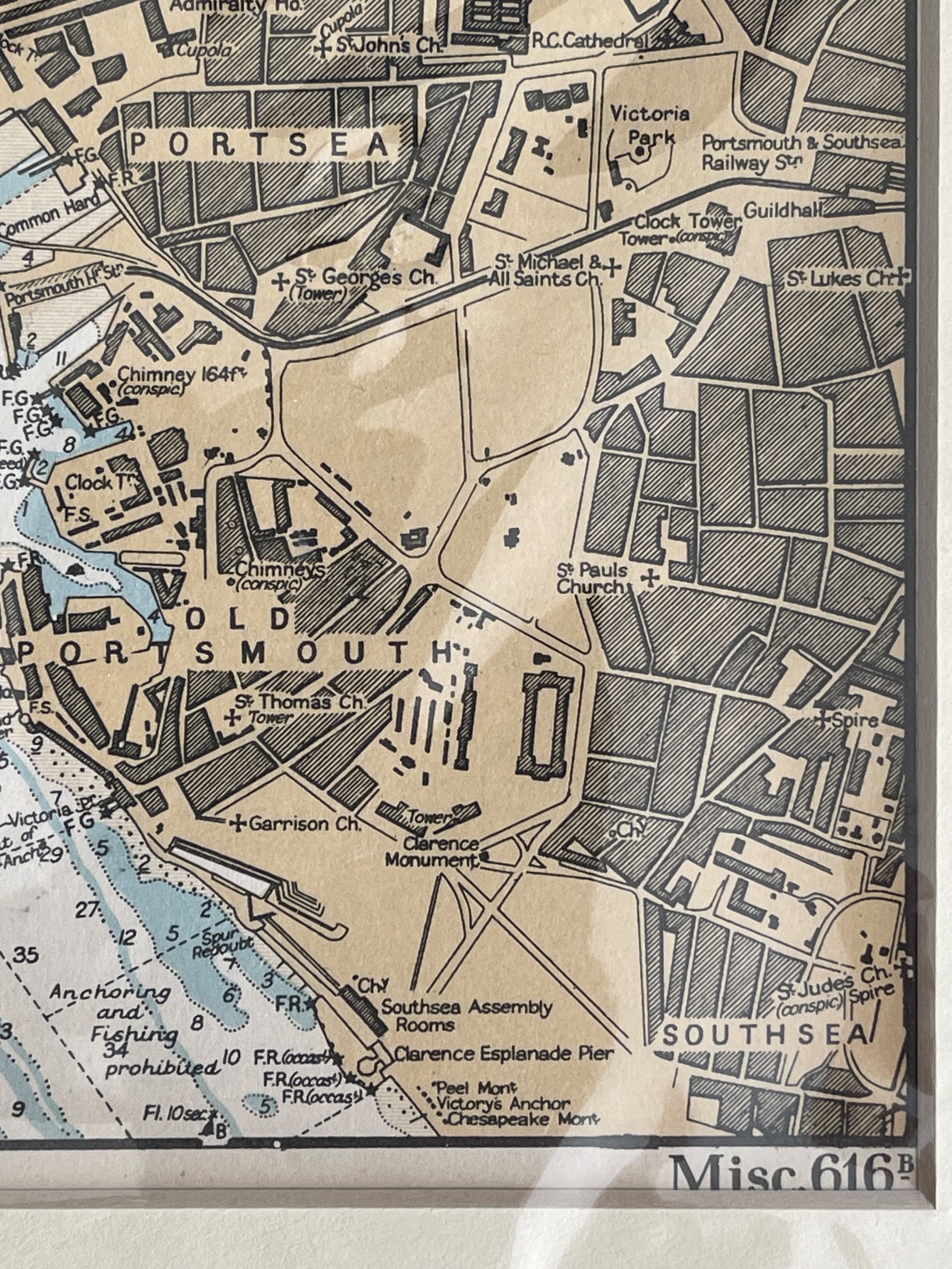
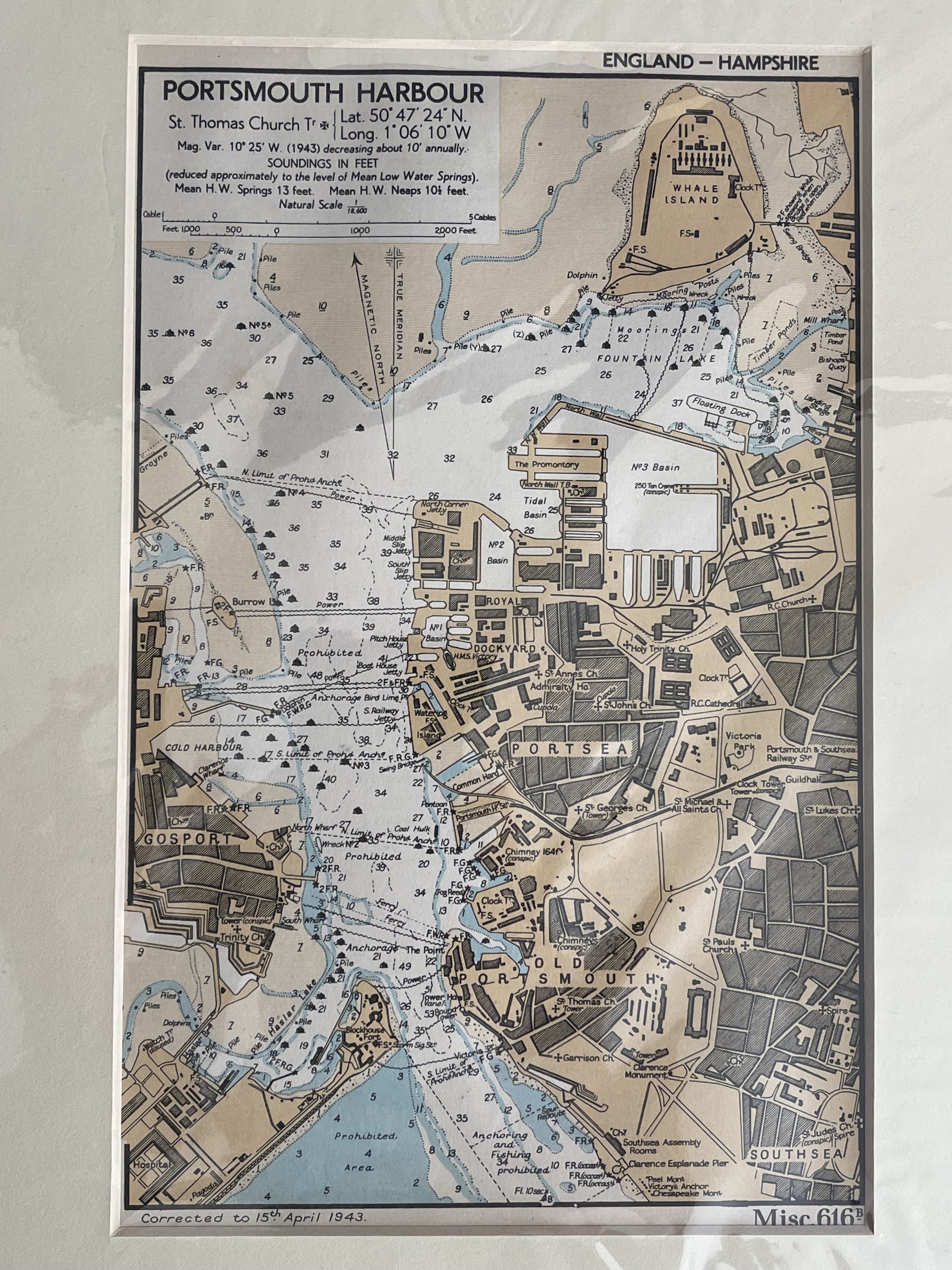
Portsmouth Harbour - WW2 Admiralty Chart - 1943
Published by the Hydrographic Department of the Admiralty, for a Naval Handbook.
Originally RESTRICTED but now declassified.
In good condition showing amazing detail. Used for Coastal defence. Delightful example of fine cartography.
Corrected to 15th April 1943. Complete with border mount and protective sleeve.
Code : A461
Cartographer : Cartographer / Engraver / Publisher: British Admiralty
Date : Publication Place / Date - 1943
Size : Sheet size: Image Size: 25 by 33 cms.
Availability : Available
Type - Genuine - Vintage WW2
Grading A+
Where Applicable - Folds as issued. Light box photo shows the folio leaf centre margin hinge ‘glue’, this is not visible otherwise.
Tracked postage, in casement. Please contact me for postal quotation outside of the UK.