
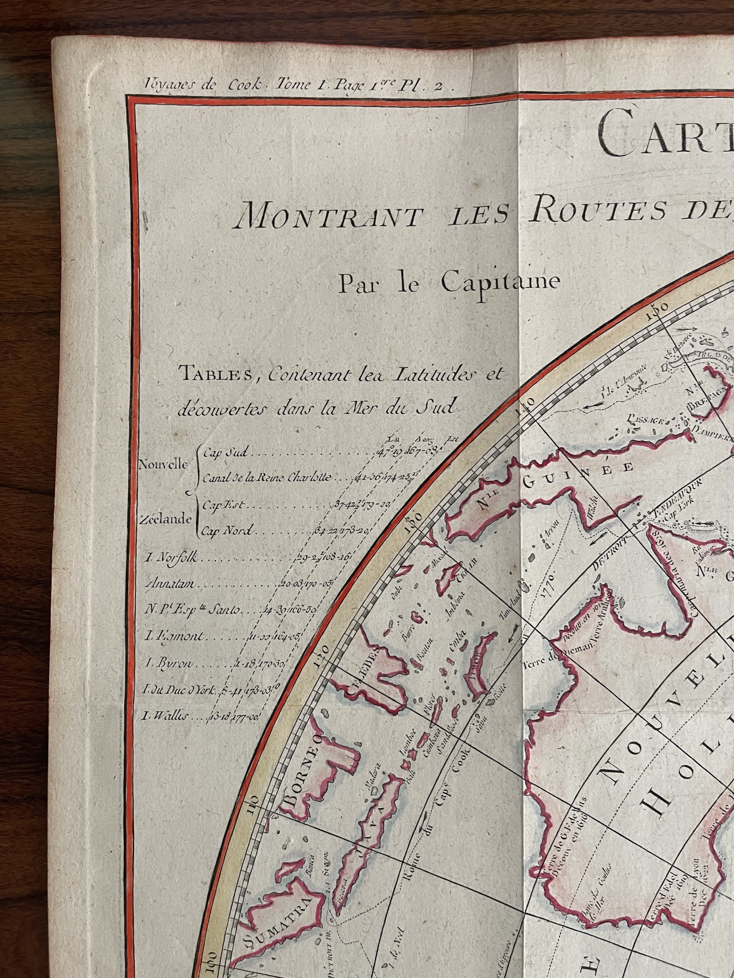

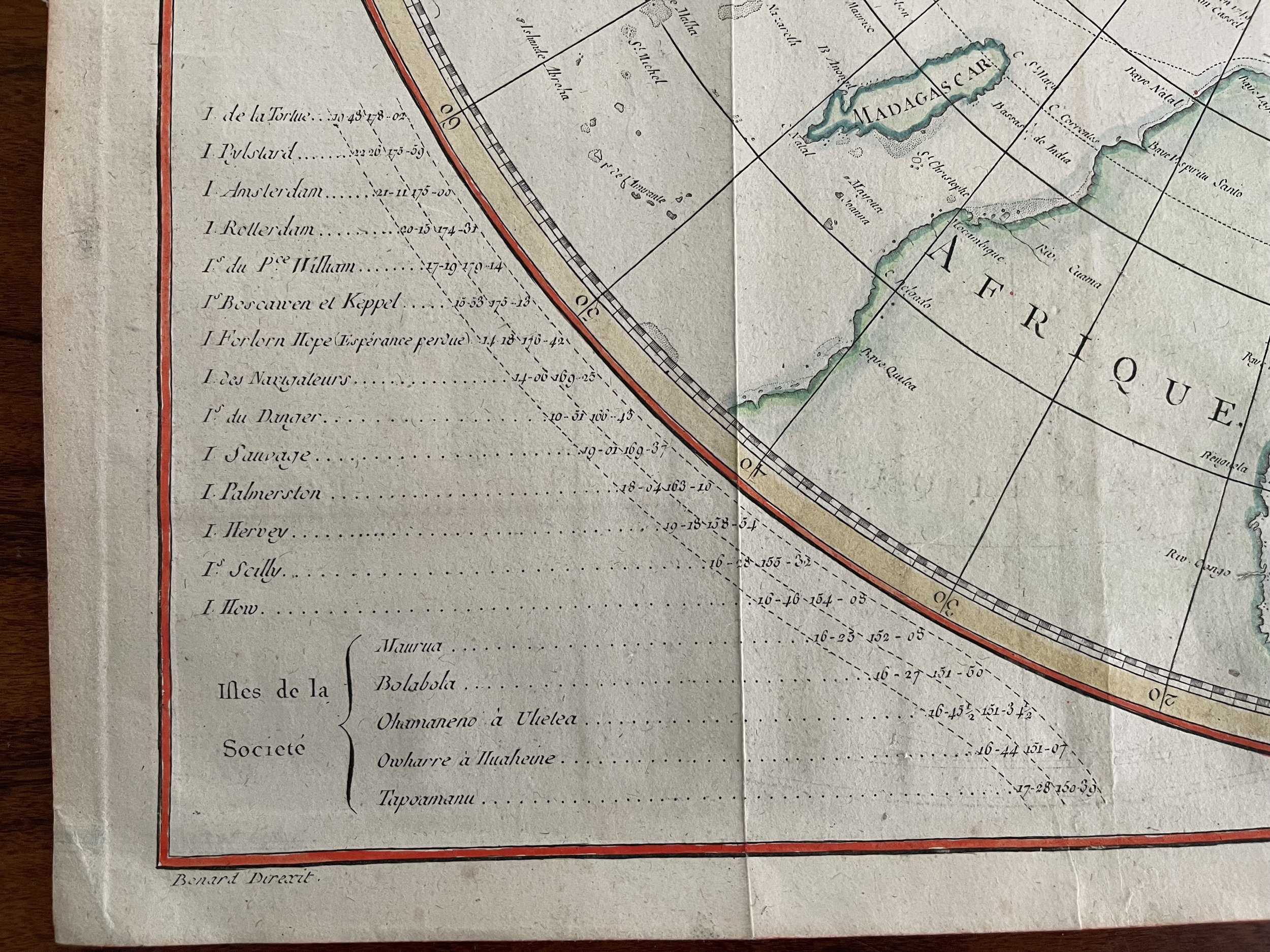
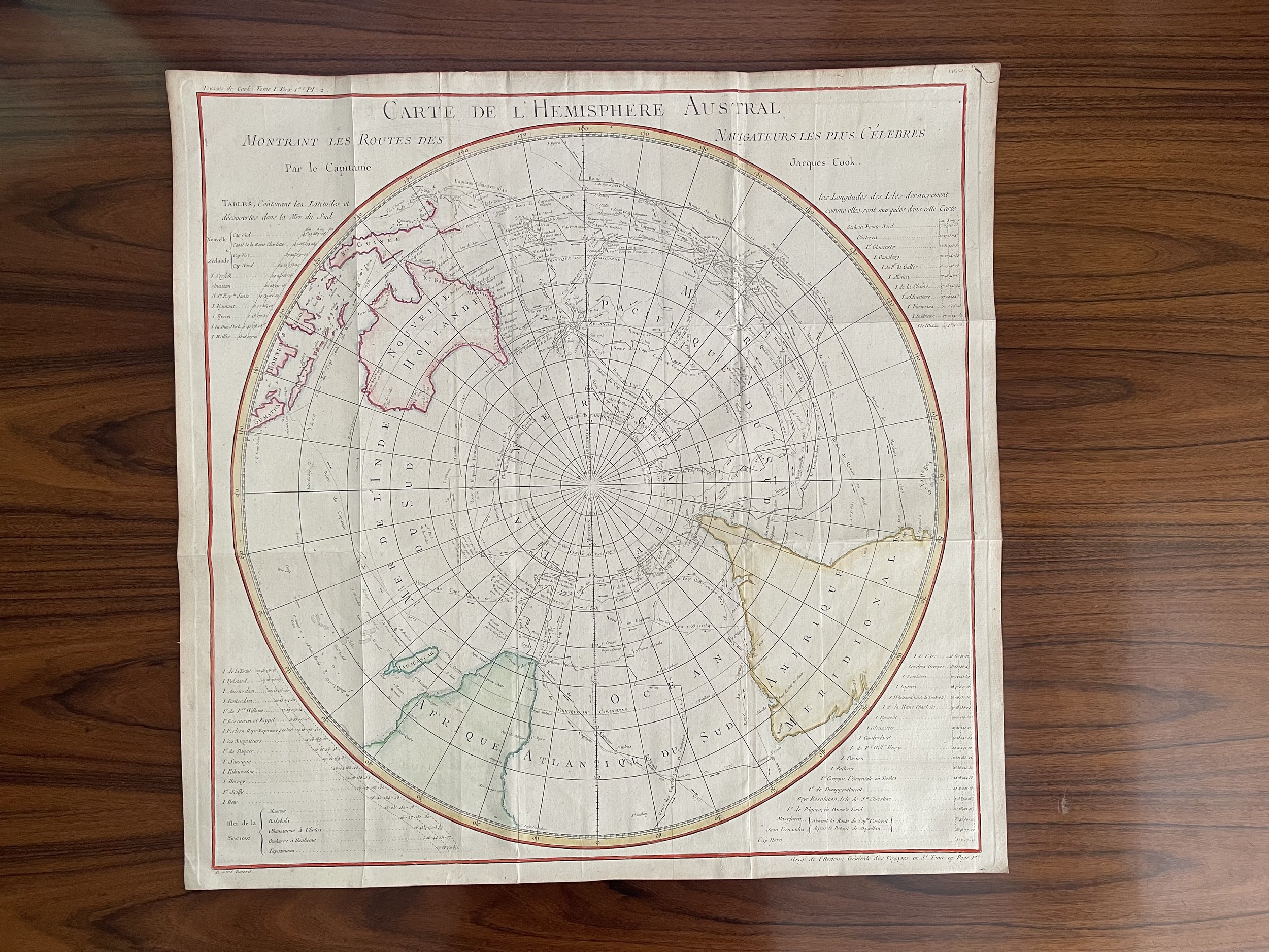
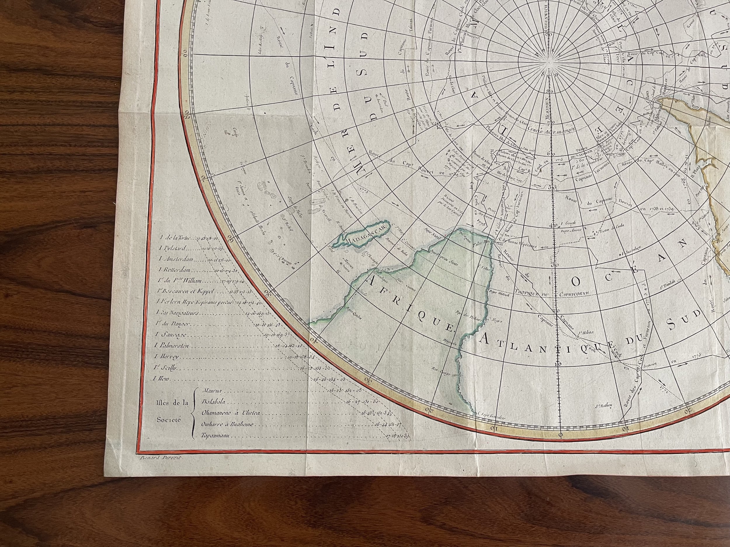
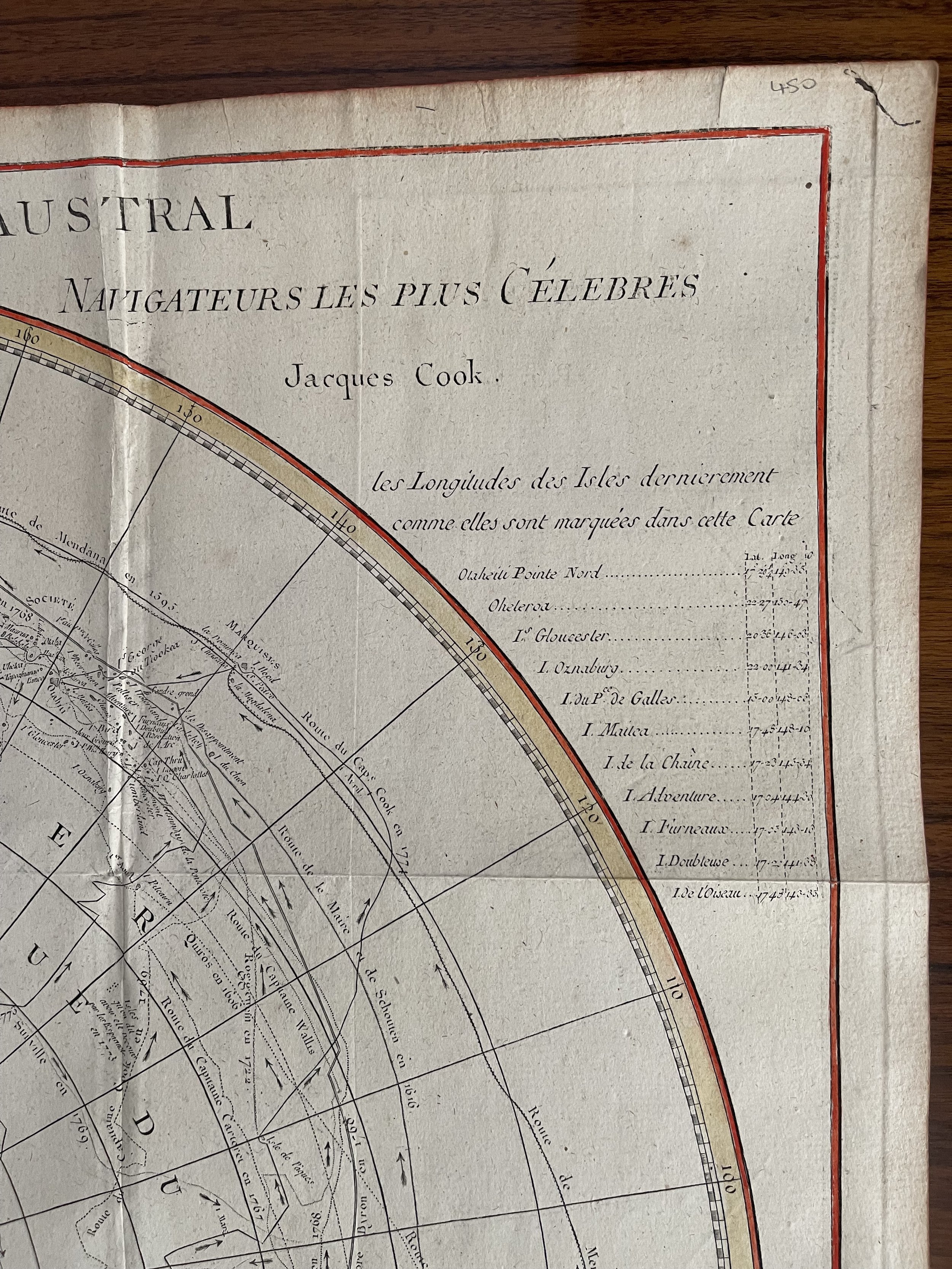
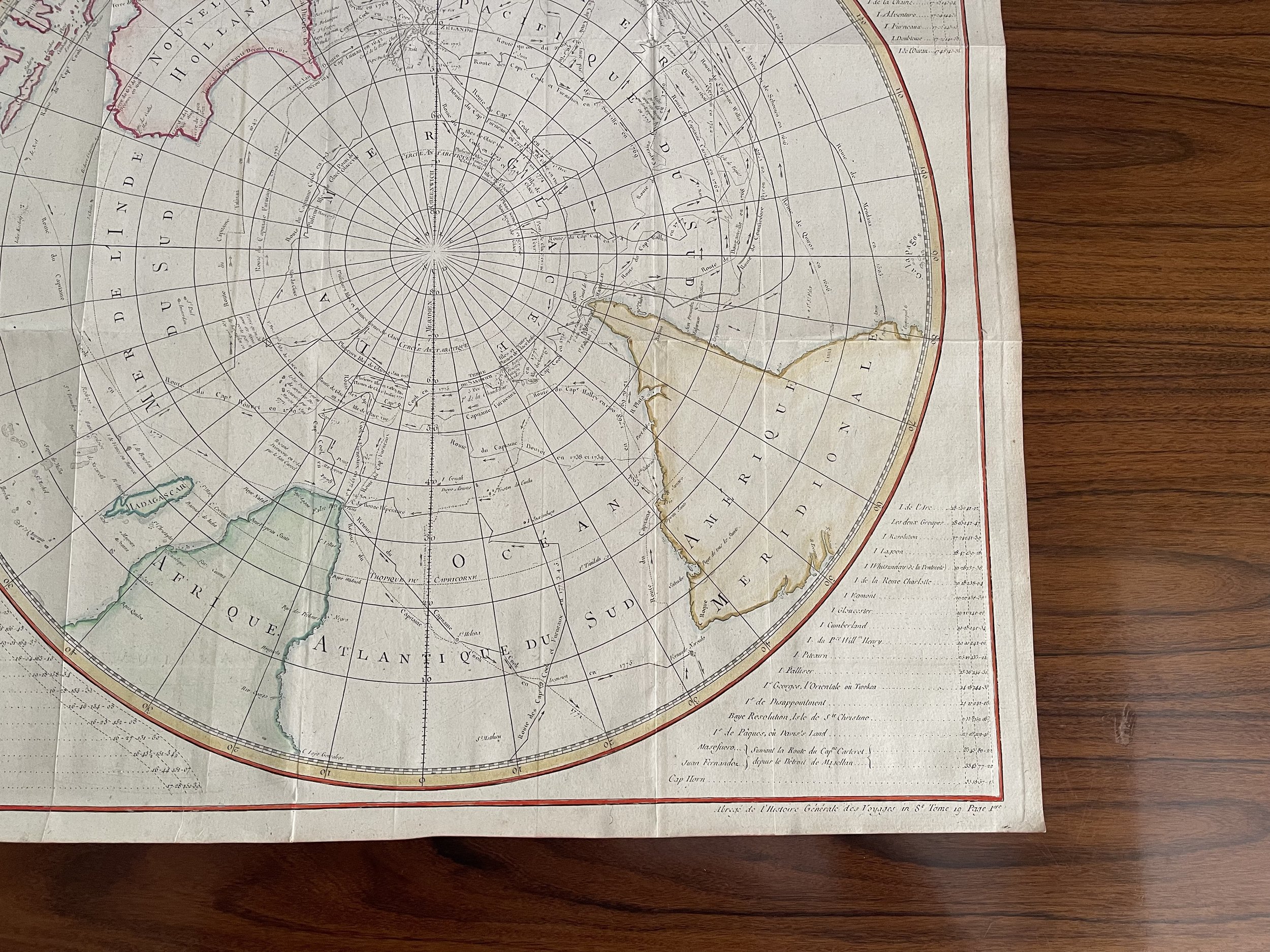
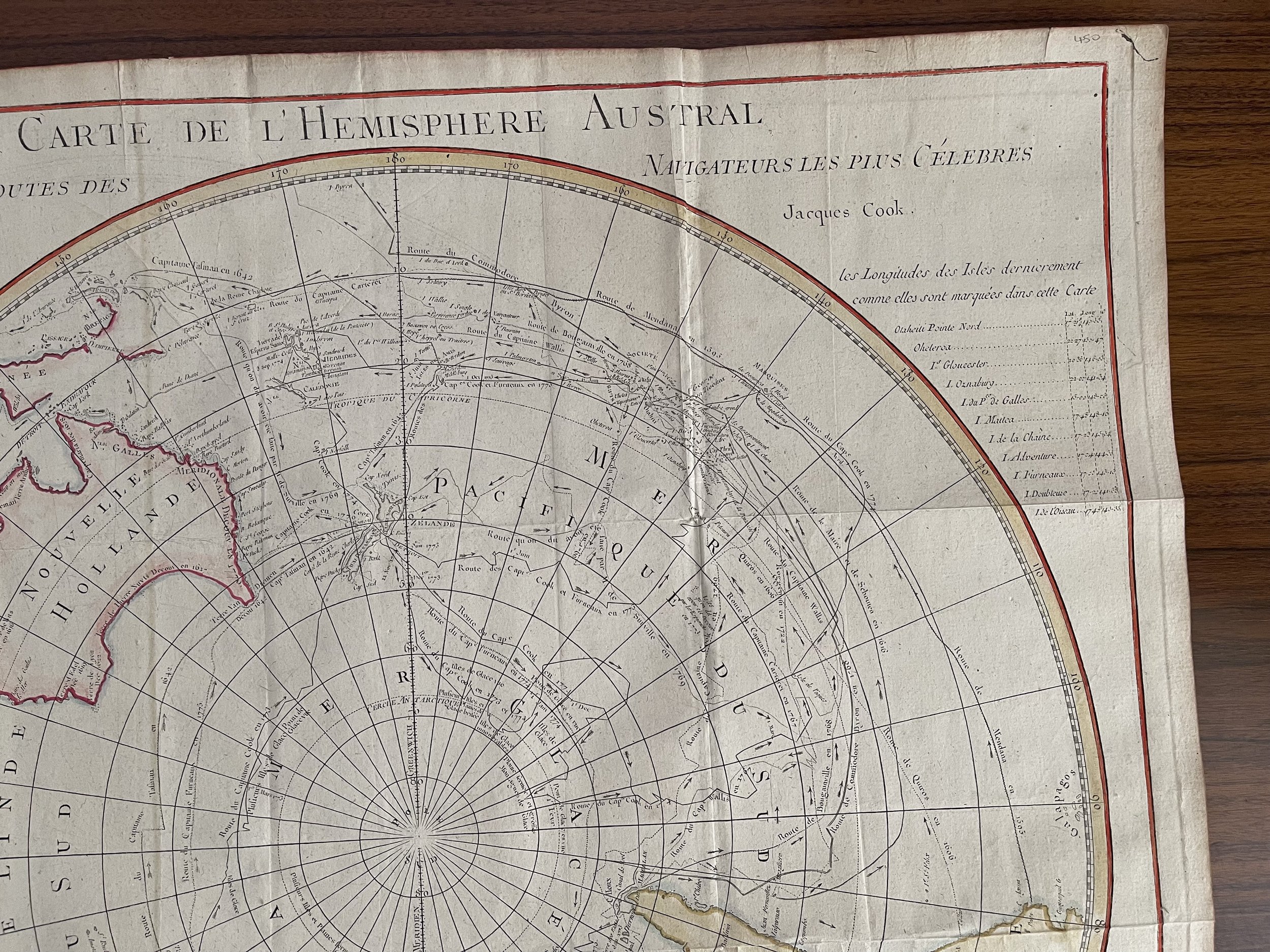
World Map - Southern Hemisphere, Australia, Africa, South America, map by Cook/Benard, Circa 1775
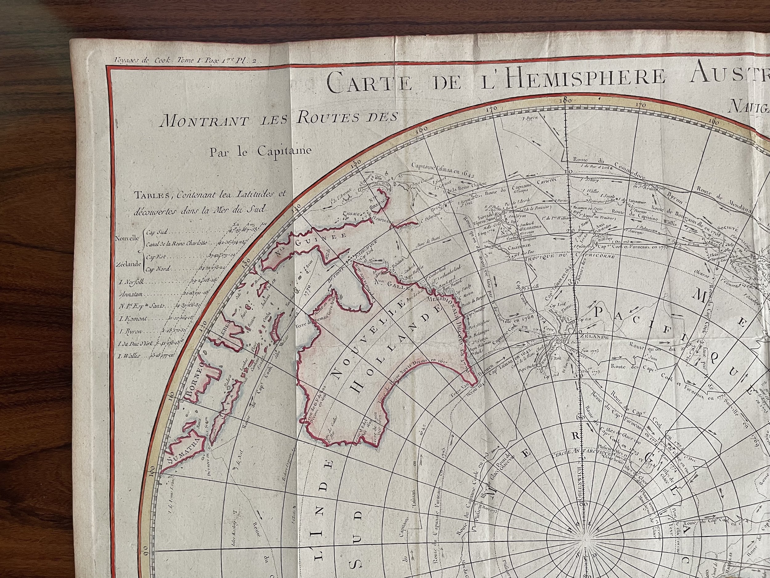
Beautiful chart of the South Pole / Southern Hemisphere - Coloured.
By Cook/Benard, 1775 Carte de l`Hemisphere Austral Montrant les Routes des Navigateurs les plus Celebres par le Capitaine Jacques Cook
This scarce chart is a French edition of Cooks voyage in the southern hemisphere that is drawn in a circular polar projection. Lists beside the map provide details of discoveries and destinations in the southern hemisphere. The chart includes the routes of other explorers including Tasman, Dampierre, Carteret, Byron, Bougainville, Furneaux and others. The copper-engraved chart shows all of Australia (Nouvelle Hollande) with Tasmania attached to the mainland. There is good detail of the East Indies and the Celebes. An important chart for any collector of Antarctic material. This is a large map and would grace any wall as a centre piece / talking point.
Robert Bénard (1734 in Paris – 1777) was a French engraver.
Specialized in the technique of engraving, Robert Bénard is mainly famous for having supplied a significant number of plates (at least 1,800) to the Encyclopédie by Diderot & d'Alembert from 1751.
Later, publisher Charles-Joseph Panckoucke reused many of his productions to illustrate the works of his catalog.
Biographical research established in 2019 that his real name was Jacques Renaud Benard, that he was born in 1731 at Rosny-sous-Bois, and that he died in Paris in 1794.
The signature "Benard fecit" on plates probably indicates the work of his own hand; the signatures "Benard Direx" and "Benard Direxit" indicate the work of the atelier of engravers he directed for many years.
Tracked postage. in tubular casement. Please contact me for postal quotation outside of the UK.
Code : A900
Cartographer : Captain Cook / Robert Benard
Date : 1775-1778
Size : Length 57cm, height 56cm
Grading A
Availability : Available
Type - Genuine Antique