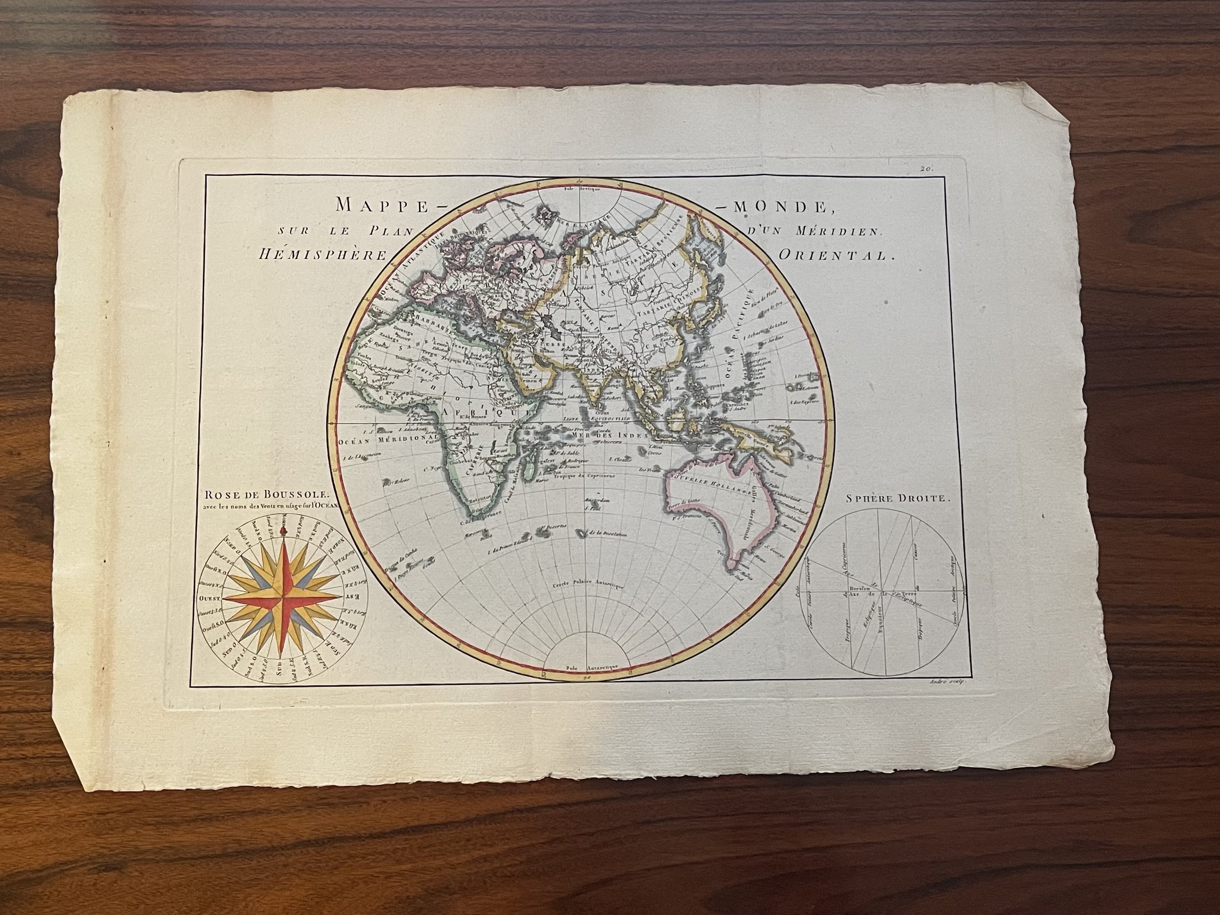

World Map - Eastern Hemisphere -Africa -Asia-Bonne-1787
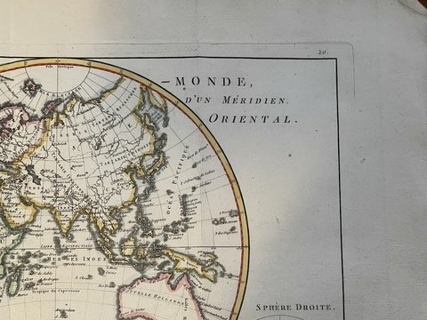
Detailed map of the Eastern Hemisphere, illustrating the cartographic updates provided by Cook, including Hawaii, nice detail in New Zealand, and a largely corrected NW Coast of America, including the NW Passage.
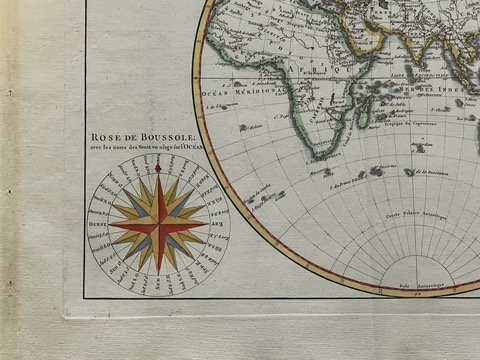
Includes a decorative 16 point compass rose. Decoratively coloured.
Attractive map of the Eastern Hemisphere, from ‘Atlas Encyclopedique, contenant la Geographie Ancienne, et Quelques Cartes sur la Geographie du Moyen Age, la Geographie Moderne…’ by Bonne & Desmarest, Paris; middle fold.
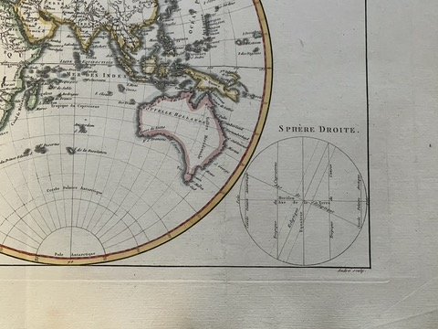
Detailed map of the Eastern Hemisphere, illustrating the cartographic updates provided by Cook, including Hawaii, nice detail in New Zealand, and a largely corrected NW Coast of America, including the NW Passage.
Includes a decorative 16 point compass rose. Decoratively coloured.
Attractive map of the Eastern Hemisphere, from ‘Atlas Encyclopedique, contenant la Geographie Ancienne, et Quelques Cartes sur la Geographie du Moyen Age, la Geographie Moderne…’ by Bonne & Desmarest, Paris; middle fold.
Rigobert Bonne (France, 1727–1795), Royal Cartographer to France in the office of the Hydrographer at Depot de la Marine
Rigobert Bonne (1727-1794) was an influential French cartographer of the late-eighteenth century. Born in the Lorraine region of France, Bonne came to Paris to study and practice cartography. He was a skilled cartographer and hydrographer and succeeded Jacques Nicolas Bellin as Royal Hydrographer at the Depot de la Marine in 1773. He published many charts for the Depot, including some of those for the Atlas Maritime of 1762. In addition to his work at the Depot, he is best known for his work on the maps of the Atlas Encyclopedique (1788) which he did with Nicholas Desmarest. He also made the maps for the Abbe Raynals’ famous Atlas de Toutes Les Parties Connues du Globe Terrestre (1780).
Code : A899
Cartographer : Rigobert Bonne - 1727-1795
Date : 1787
Size : Sheet size: 41,7 x 28 cm. (16,4 x 11 inch). Image size: 34,2 x 23,2 cm. (13,5 x 9,1 inch)
Availability : Available
Type - Genuine Antique
Grading A