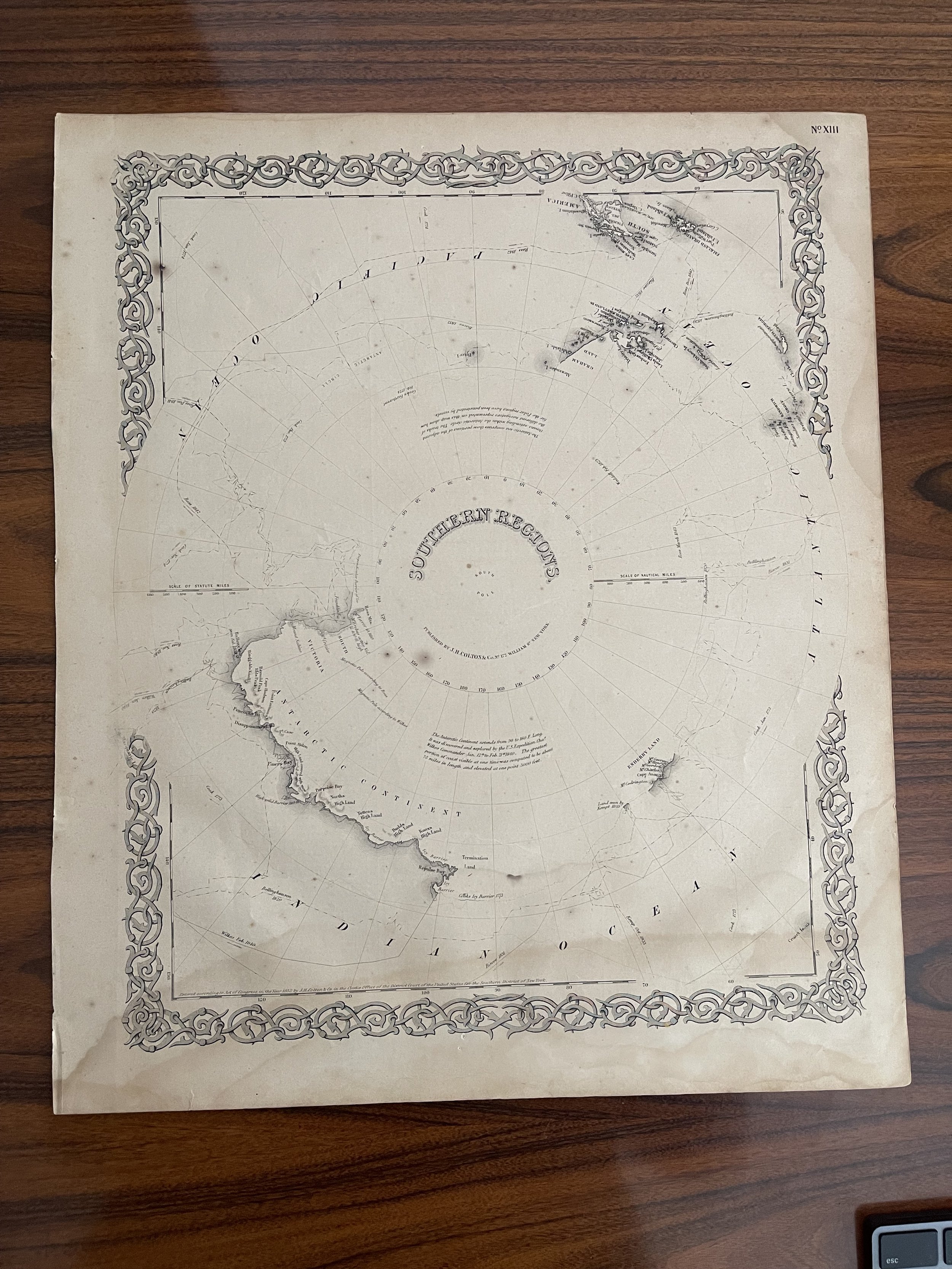

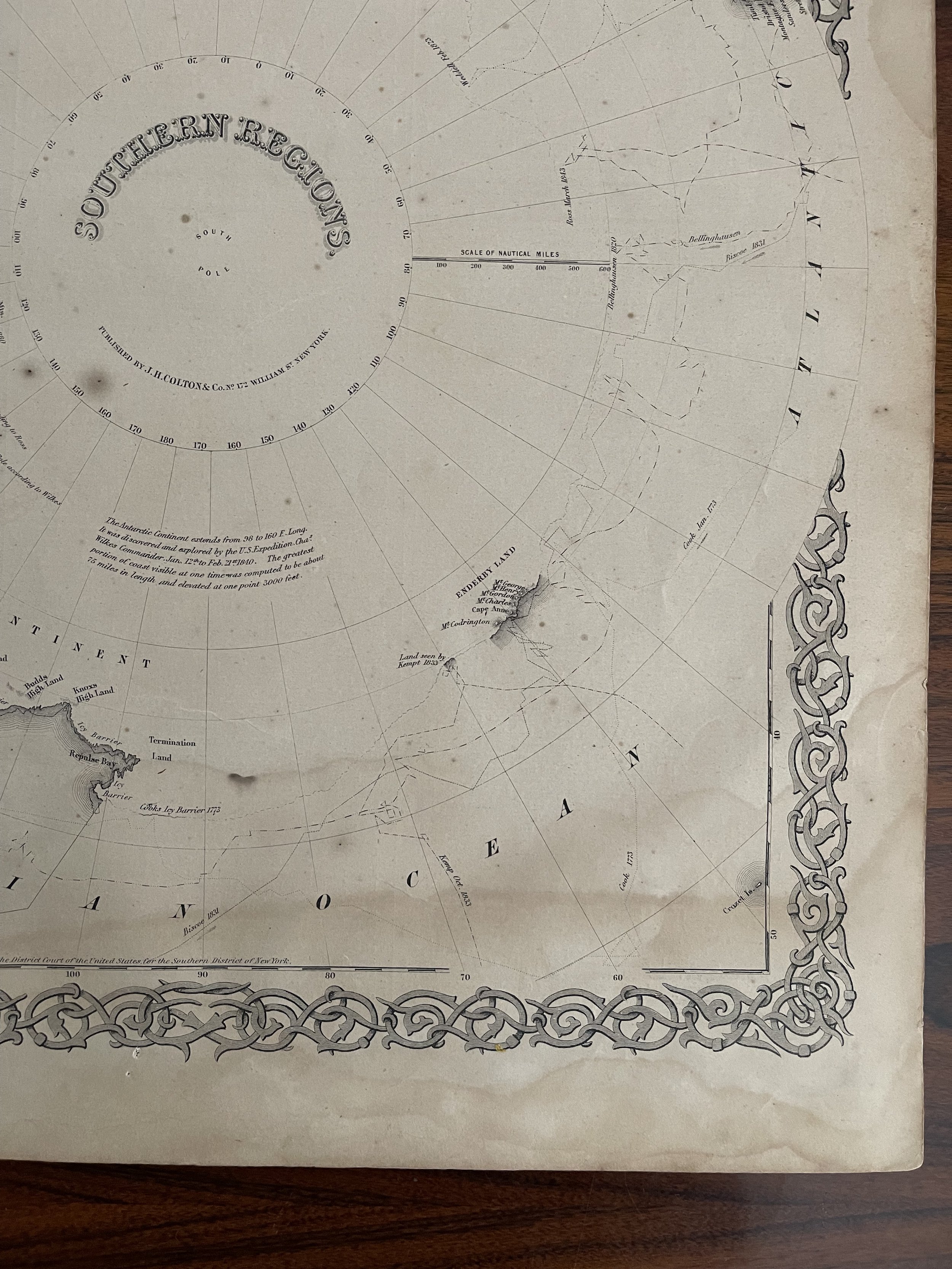
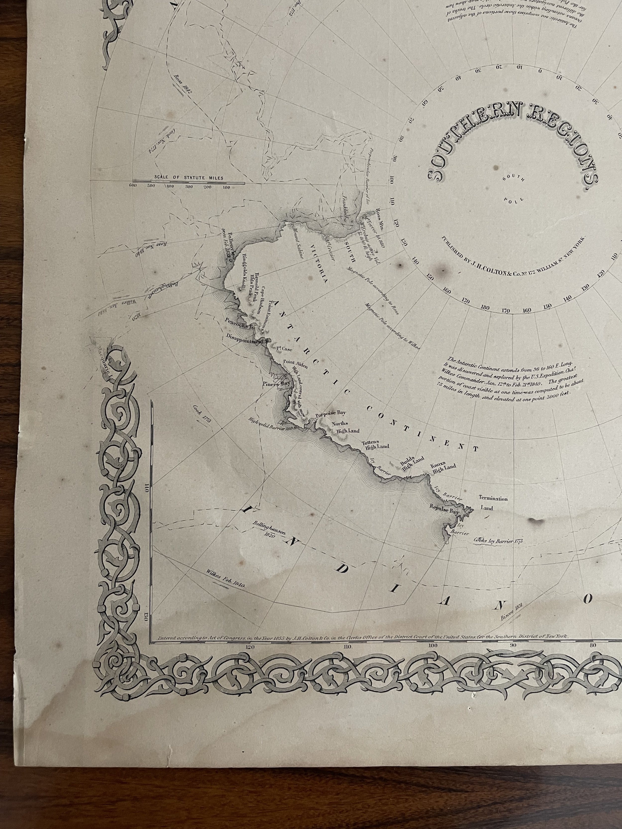
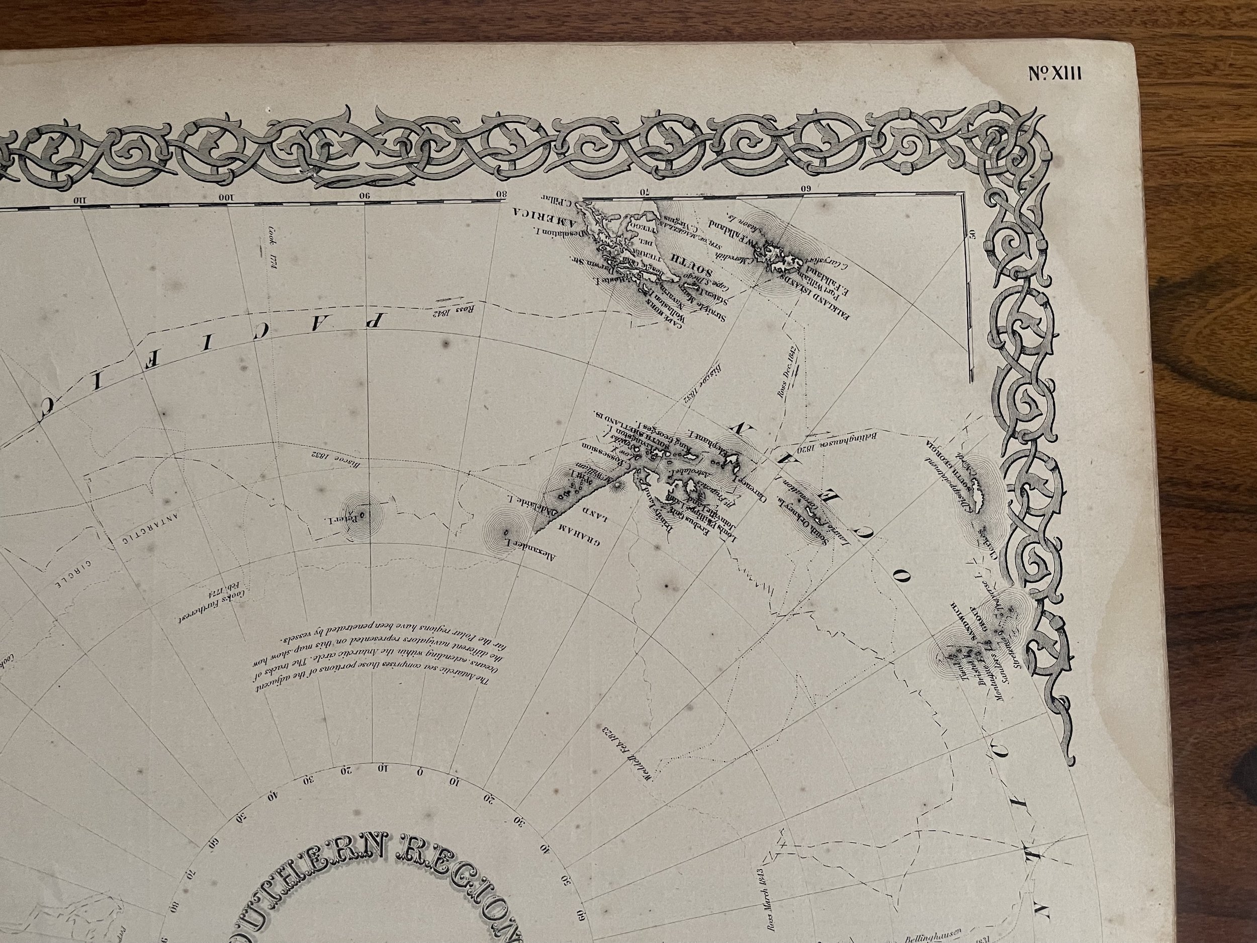
Atlas Map South Pole - Antarctic Continent - Graham Land - 1855 - J. H. Colton
Title: Southern Regions
Publication: J.H Colton’s Atlas of the World, page No. 13. - Steel Plate Engraving
Date: circa 1855
A good example of Colton's c. 1855 map of the South Pole, Antarctica, or the Southern Polar Regions. Shows the Great Southern Continent with both solid and tentatively sketched in borders. Notes the travels of important Antarctic explorers of the previous 20 years or so, including Wilkes (1840), Bellinghausen. Some foxing spots and a little water staining accross the bottom of the map.
(1820), Ross (1840 - 1843), KIempt (1833), Cook (1773 - 1774 ) and Biscoe (1831). Generally gives an excellent overview of the state Antarctic exploration and discovery around 1855. Prepared by J. H. Colton as map no XIII in the 1855 or 1856 edition of Colton's Atlas of The World. Published from Colton's 172 William. Size: 370 x 440mm, approx.
Joseph Hutchins Colton (July 5, 1800 - July 29, 1893), often publishing as J. H. Colton, was an important American map and atlas publisher active from 1833 to 1897. Colton's firm arose from humble beginnings when he moved to New York in 1831 and befriended the established engraver, Samuel Stiles. He worked under Stiles as the 'Co.' in Stiles and Co. from 1833 to 1836. Colton quickly recognized an emerging market in railroad maps and immigrant guides. Not a cartographer or engraver himself, Colton's initial business practice mostly involved purchasing the copyrights of other cartographers
Code : A800
Cartographer : Joseph Hutchins Colton
Date : 1855
Size : Sheet size: 370 x 440mm, approx.
Availability : Available
Type - Genuine Antique
Grading B