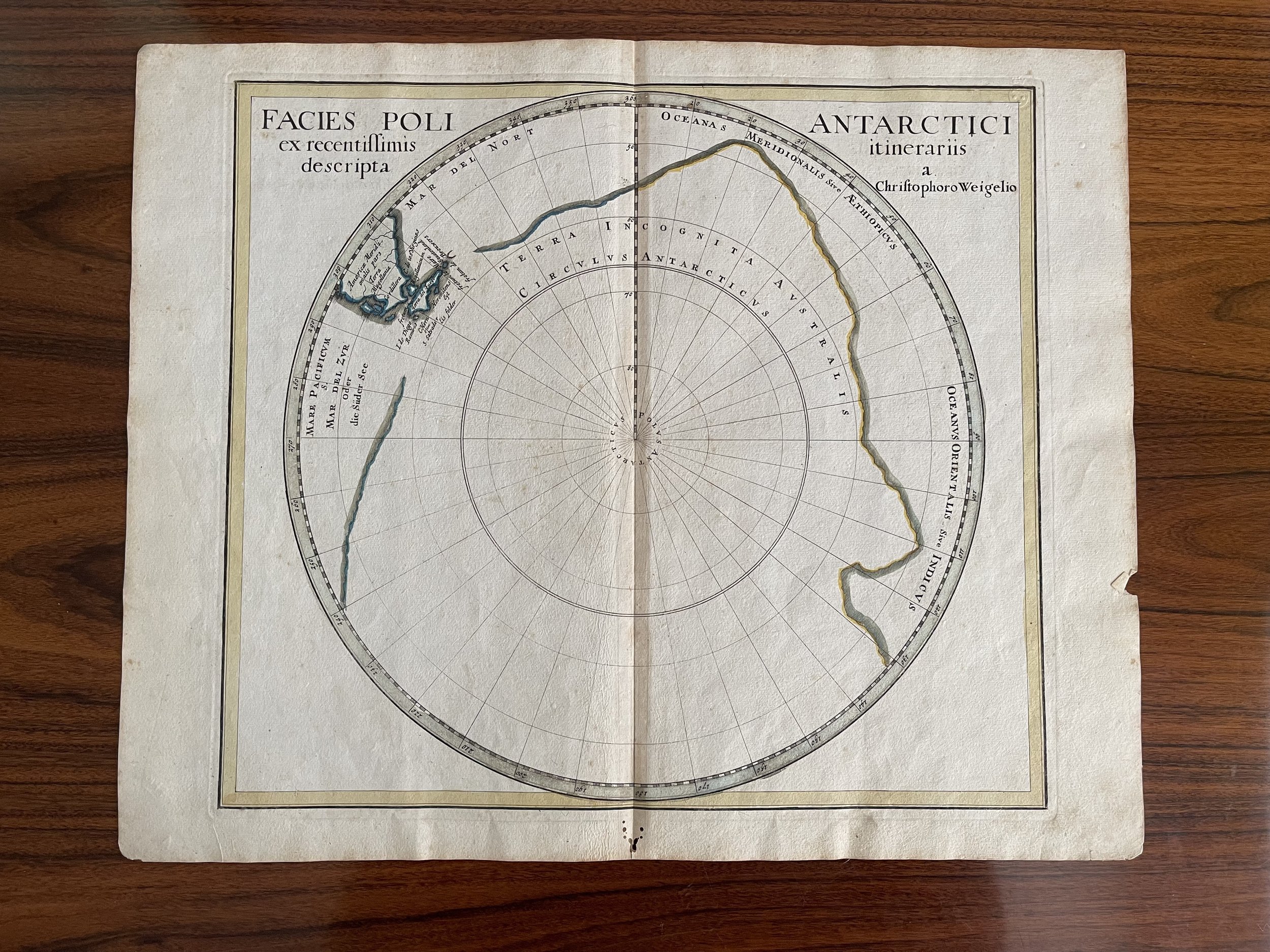
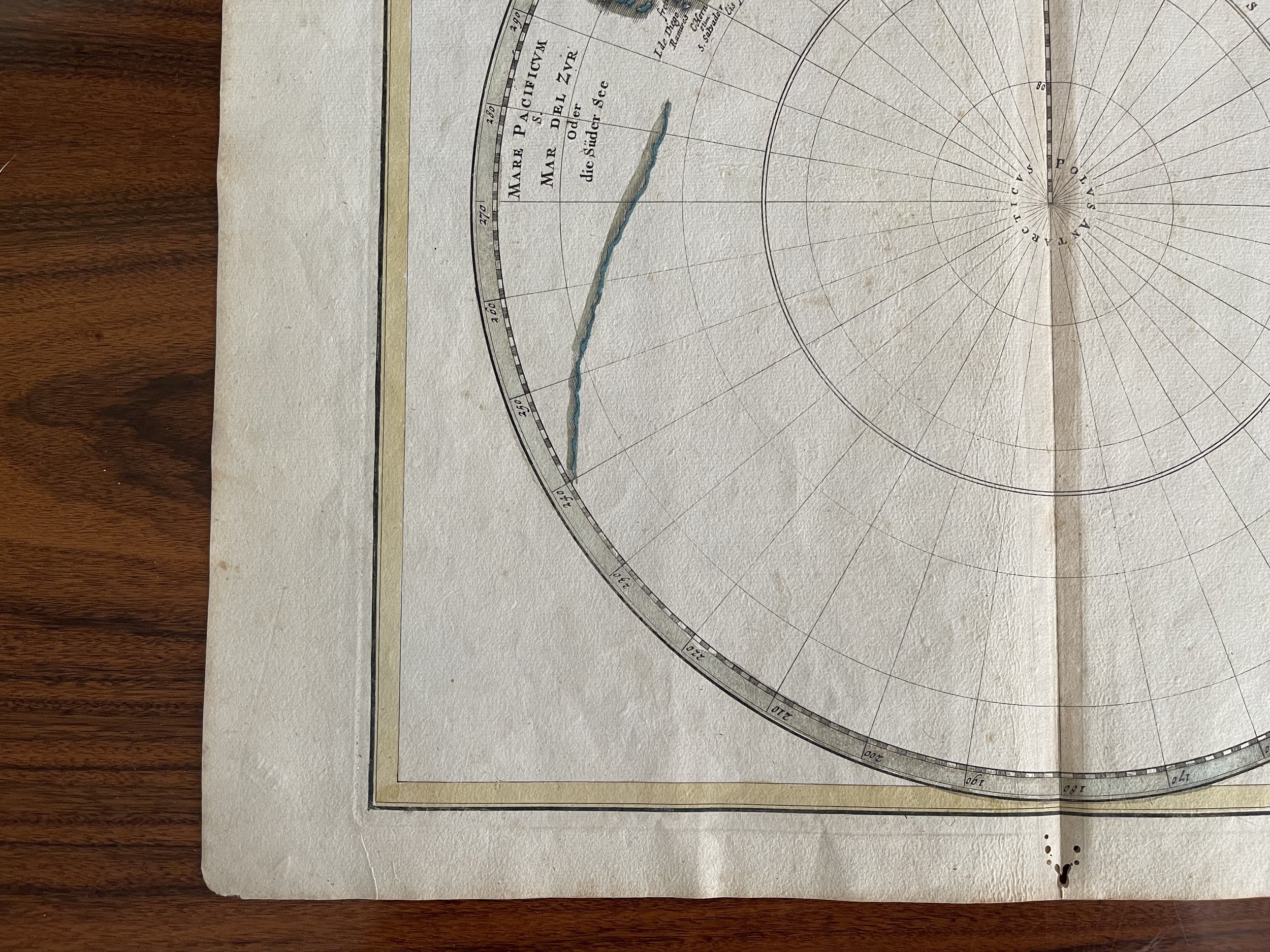
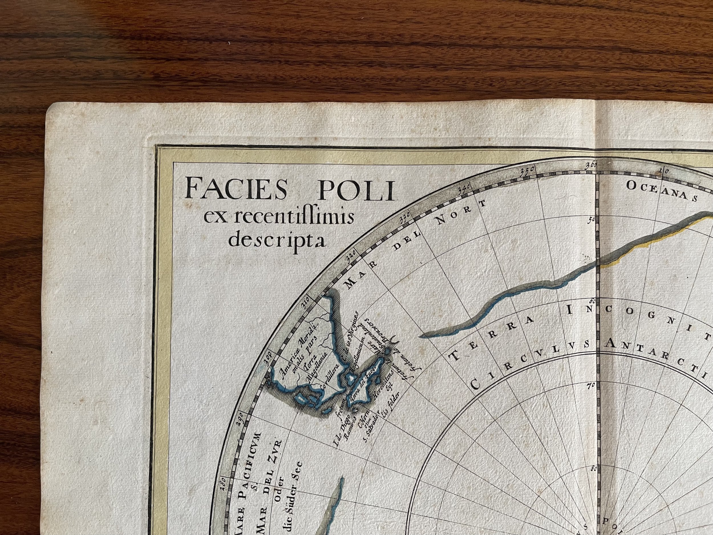
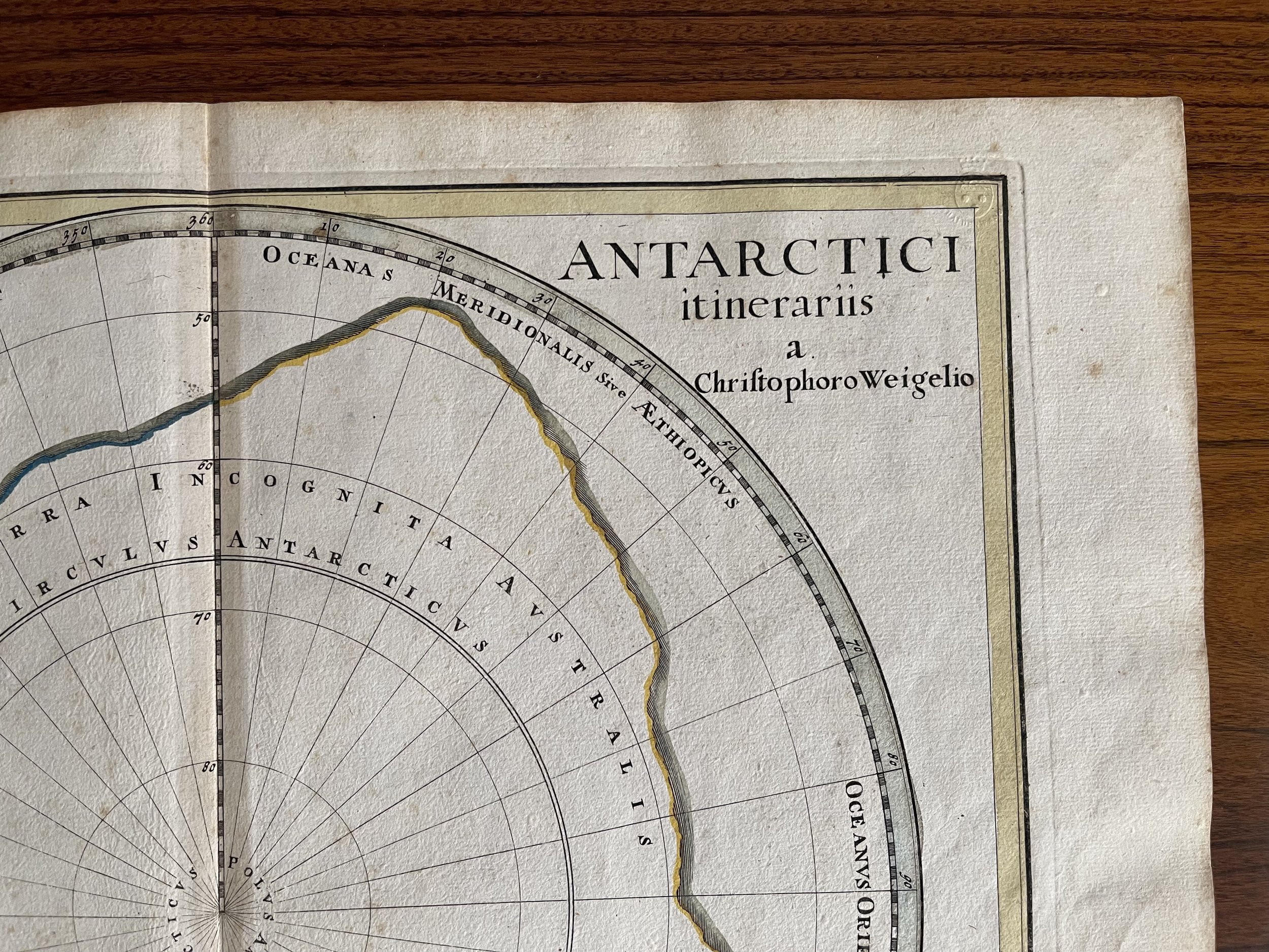
South Pole (Antarctica). "Facies Poli Antarctici ex recentissimis itinerariis descripta". Orig. copperplate engraving, Christoph Weigel, Nuremberg, Approx 1718
South Pole (Antarctica). "Facies Poli Antarctici ex recentissimis itinerariis descripta". Orig. copperplate engraving, Ch. Weigel, Nuremberg, Approx 1718. Orig. old colouring. With title in upper corners of the map. 32:36 cm (12 1/2 x 14 1/4 inch.).
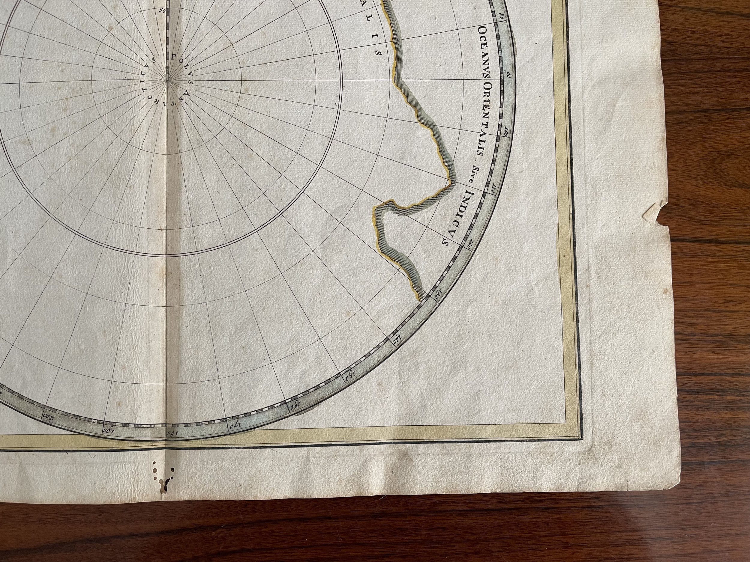
Rare and hard to find map of the southern hemisphere ("Terra Incognita Australis") with the tip of South America and Tierra Del Fuego upper left.
Interesting and nearly completely conjectural map of the South Pole from Davide Kohler's Descriptio Orbis Antiqui…engraved 1718 - published by Weigel in 1720. The map shows the prevailing belief in a massive southern hemisphere, which extended to just south of the Straits of Magellan and Le Maire, both of which are shown on the map.
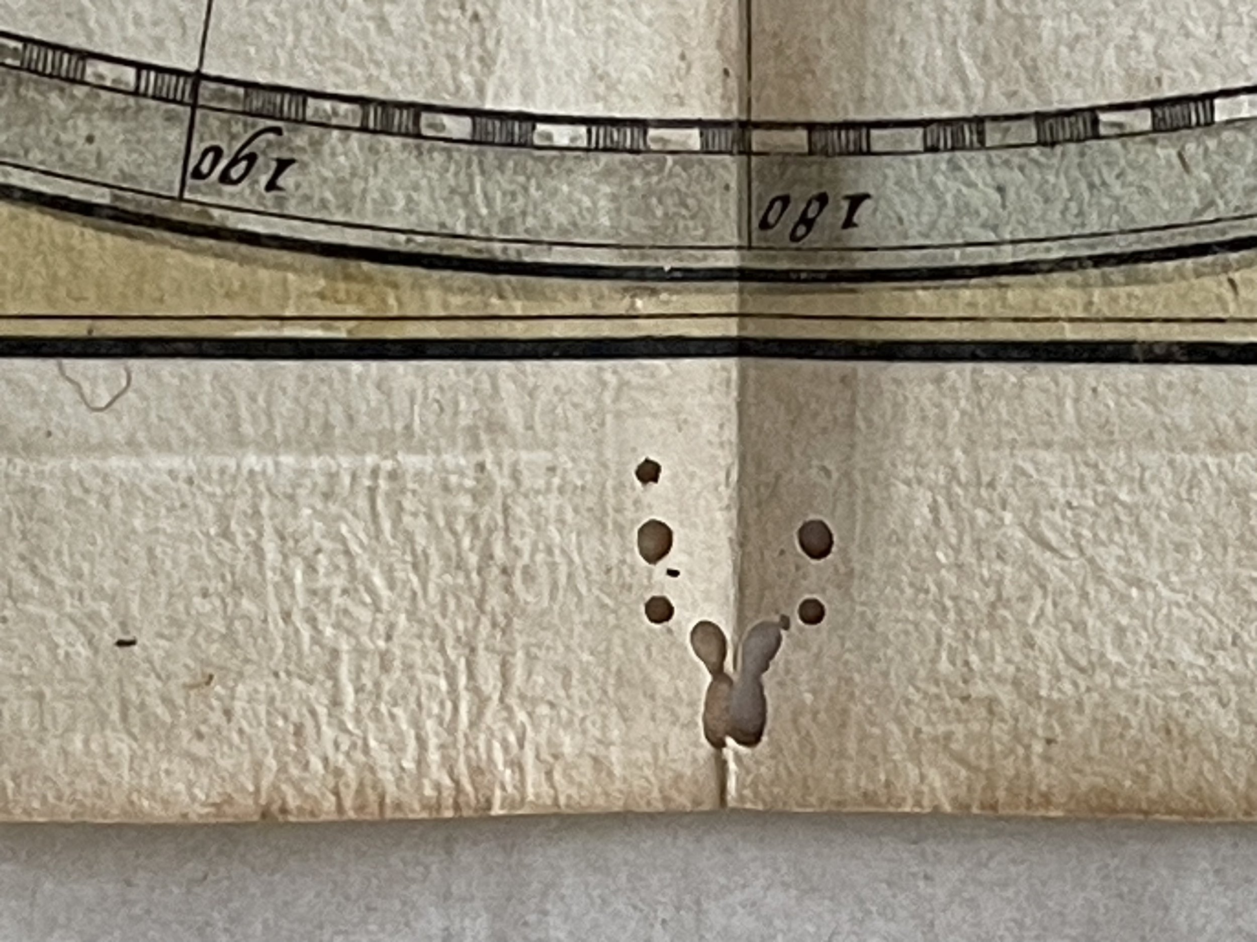
Small amount of foxing in a few areas but genuinely a clean image commiserate with age . Worm holes (see photo) at the bottom border hinge outside of the neatline and printed line or plate block mark, that has not affected the map or general context. Wormholes are commonly found on plates of this age.
South Pole (Antarctica). "Facies Poli Antarctici ex recentissimis itinerariis descripta". Orig. copperplate engraving, Ch. Weigel, Nuremberg, Approx 1718. Orig. old colouring. With title in upper corners of the map. 32:36 cm (12 1/2 x 14 1/4 inch.).
Rare and hard to find map of the southern hemisphere ("Terra Incognita Australis") with the tip of South America and Tierra Del Fuego upper left.
Interesting and nearly completely conjectural map of the South Pole from Davide Kohler's Descriptio Orbis Antiqui…engraved 1718 - published by Weigel in 1720. The map shows the prevailing belief in a massive southern hemisphere, which extended to just south of the Straits of Magellan and Le Maire, both of which are shown on the map.
Small amount of foxing in a few areas but genuinely a clean image commiserate with age . Worm holes (see photo) at the bottom border hinge outside of the neatline and printed line or plate block mark, that has not affected the map or general context. Wormholes are commonly found on plates of this age.
Code : A790
Cartographer : Weigel, Christoph
Date : 1718
Size : Sheet size: 32:36 cm (12 1/2 x 14 1/4 inch.).
Availability : Available
Type - Genuine Antique
Grade B+