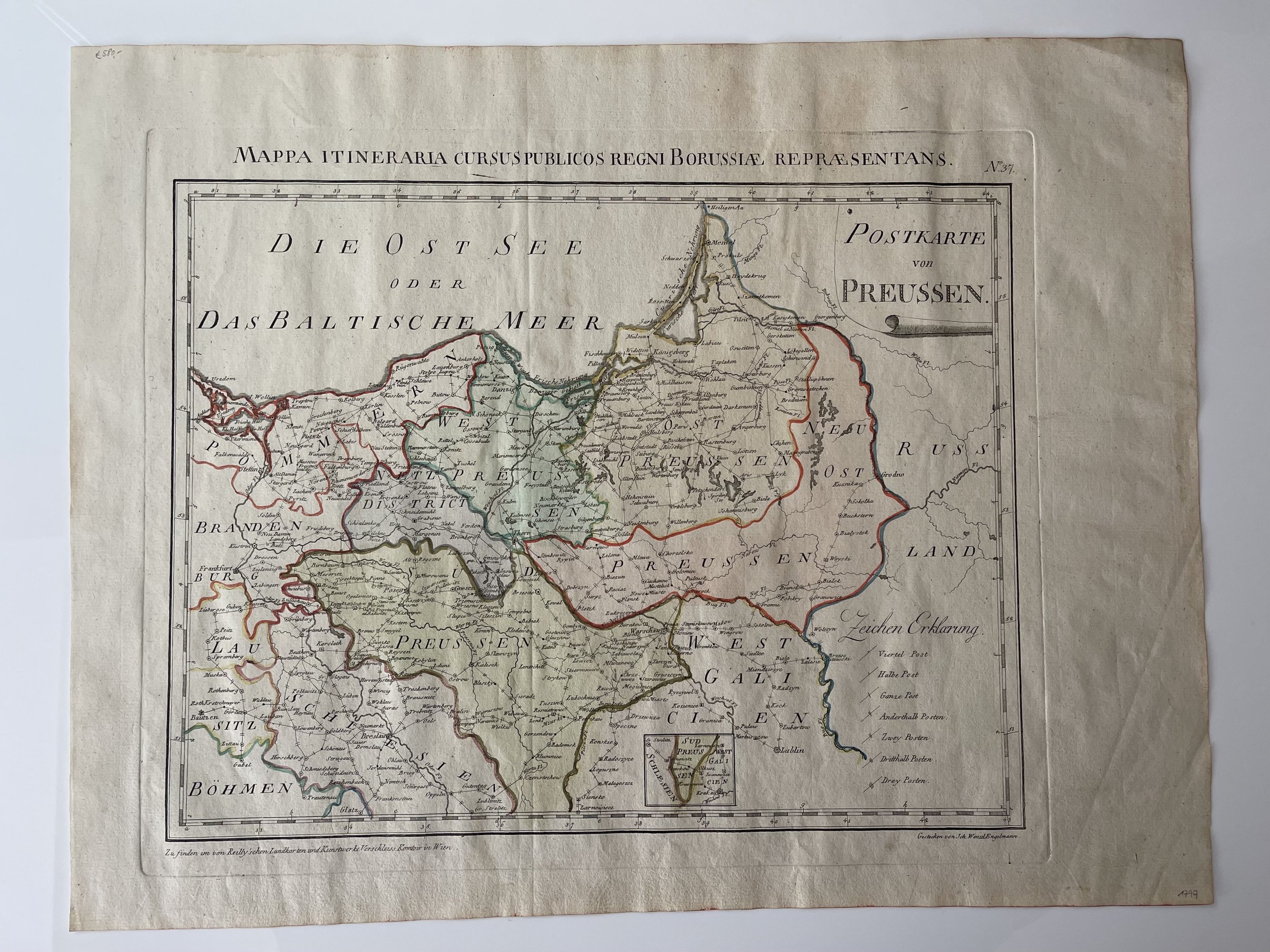
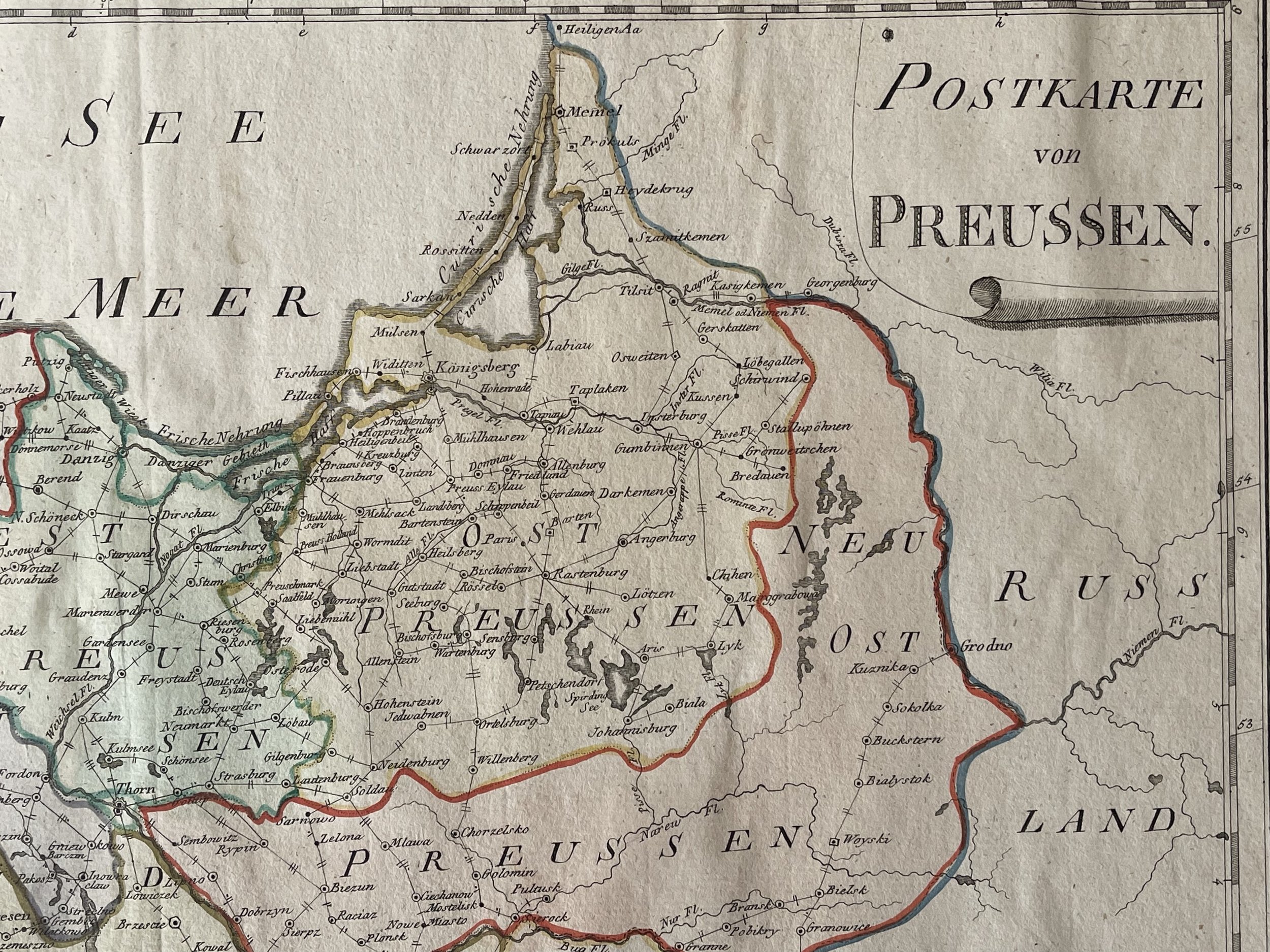
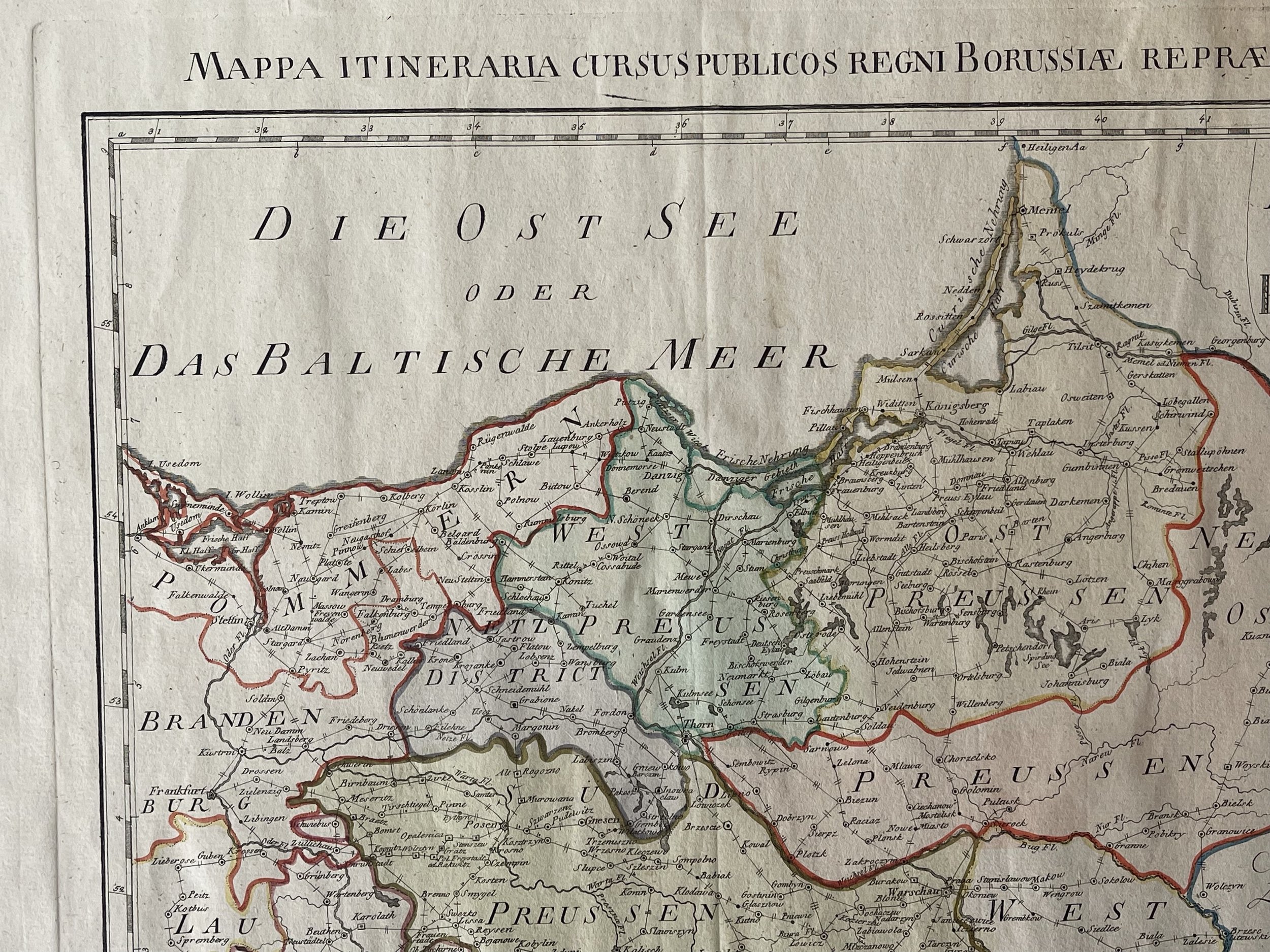
Prussia, Modern day Poland and surrounding areas - Johann Wenzel Engelmann - 1799
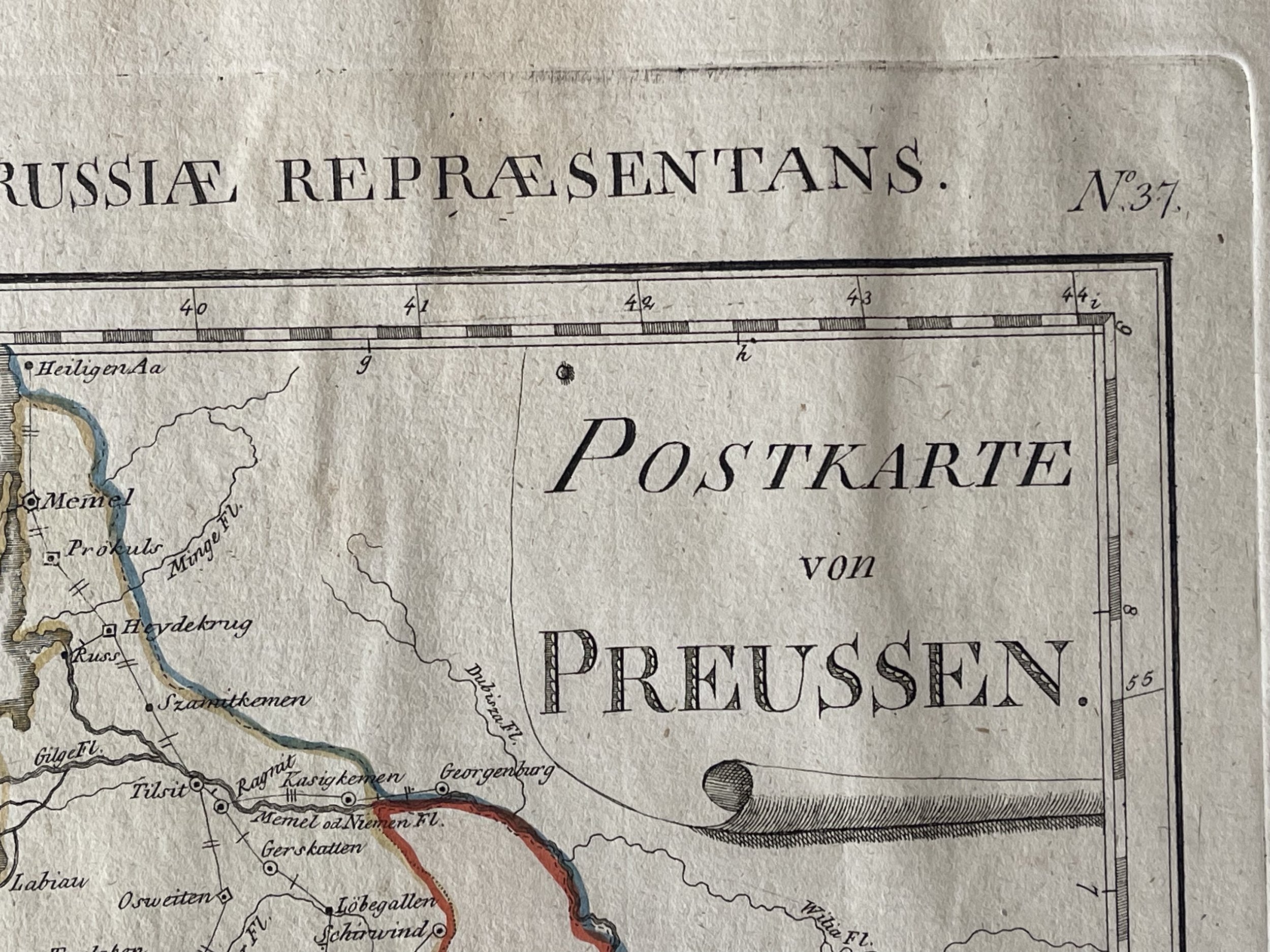
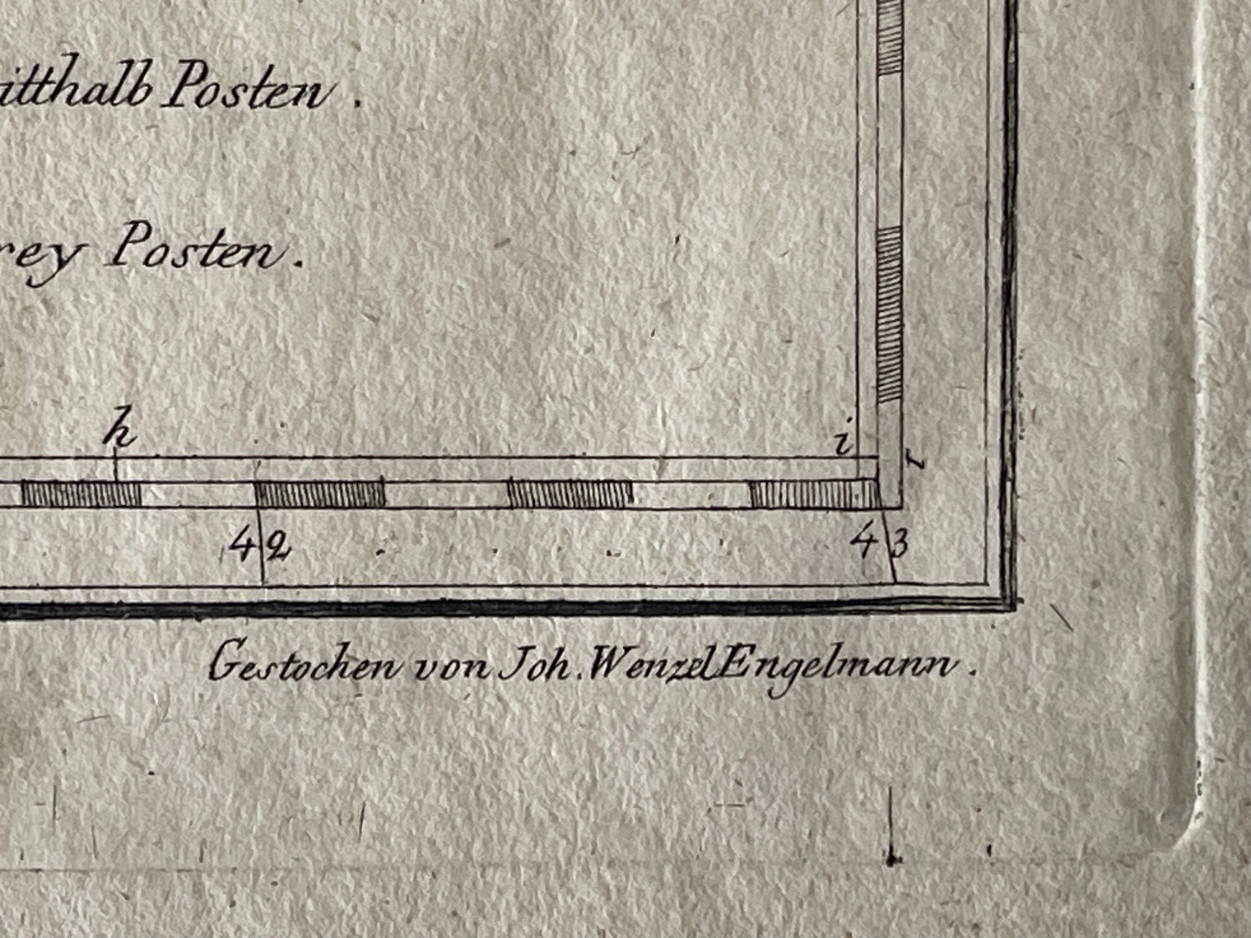
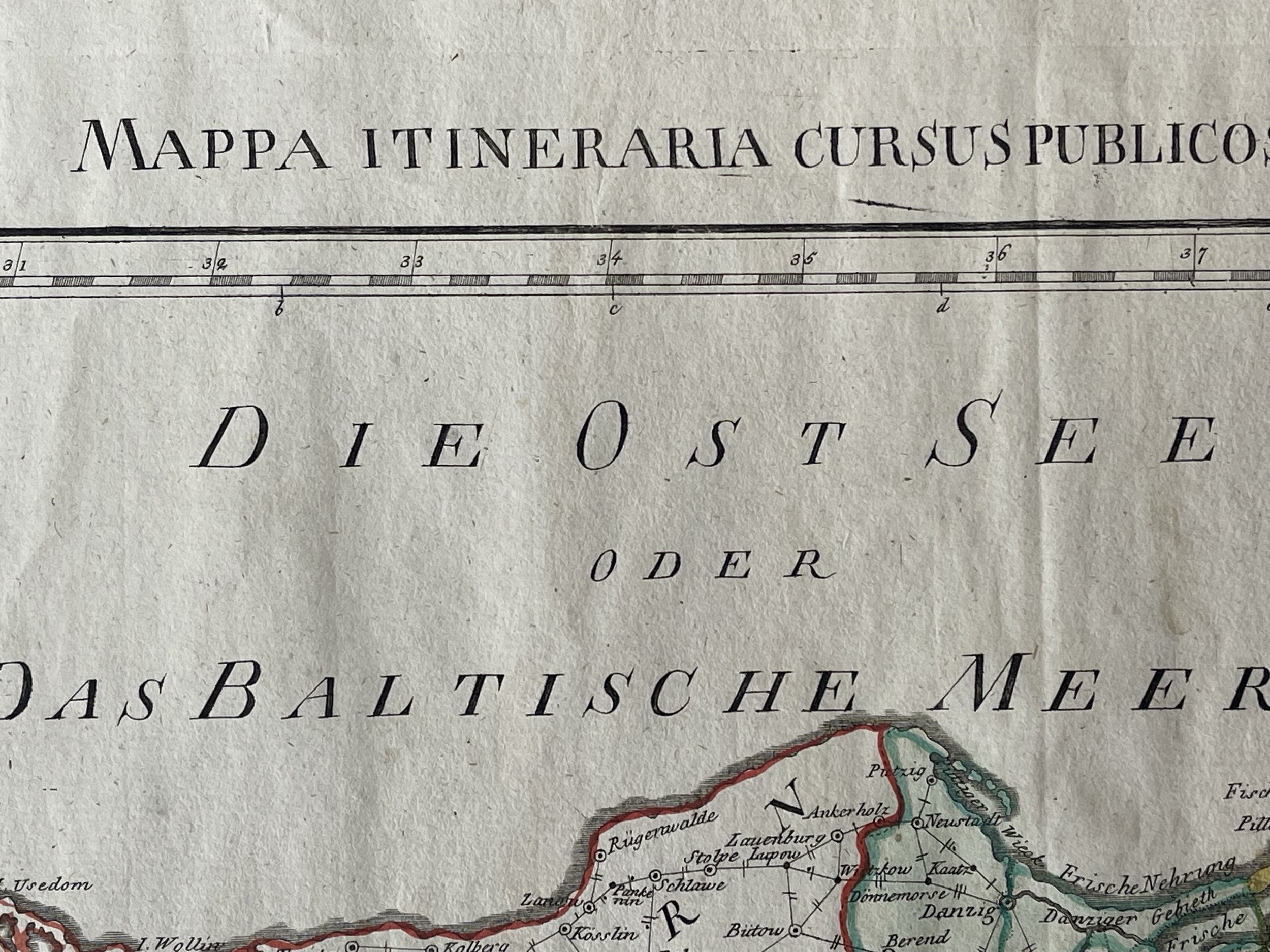
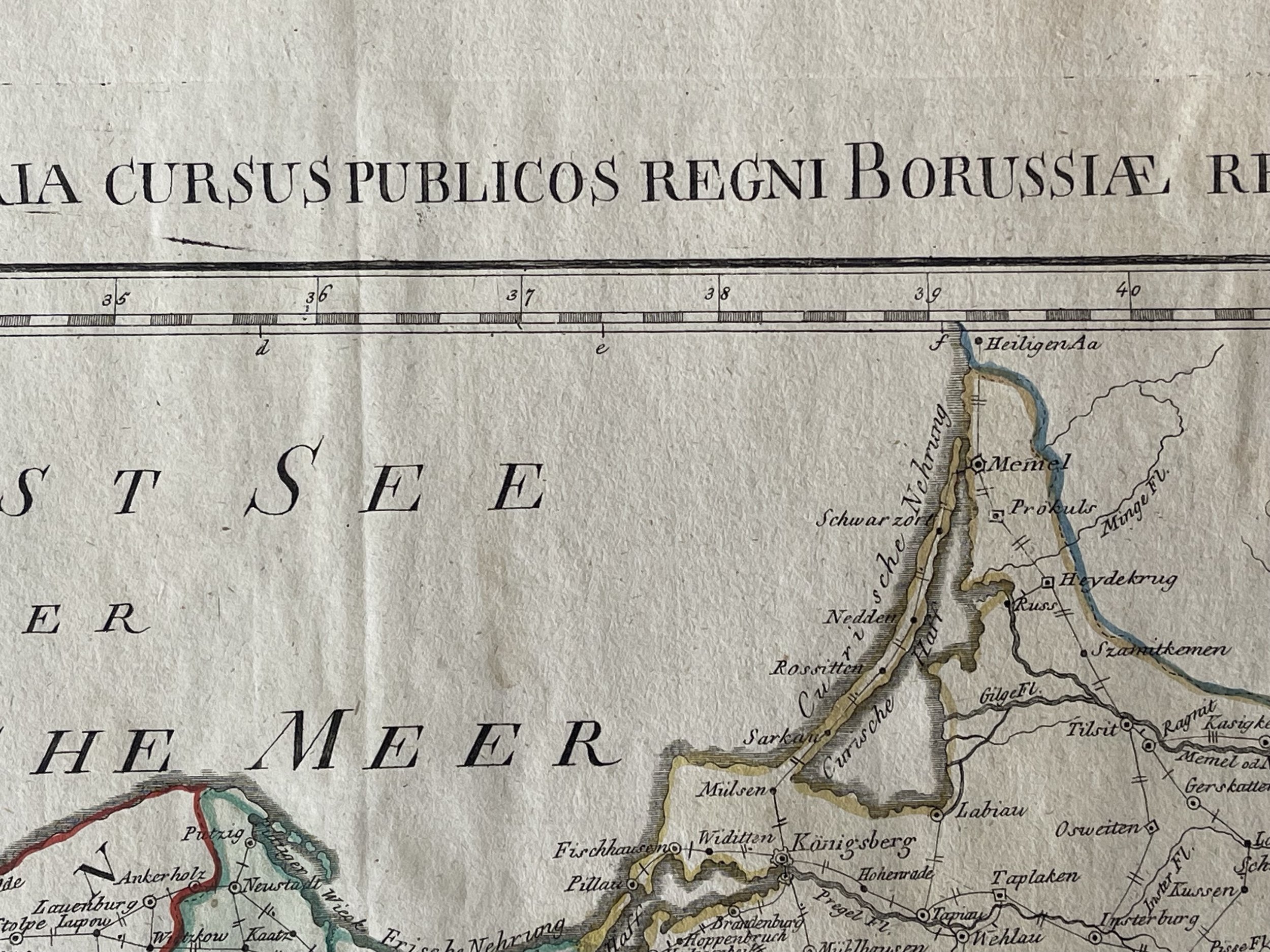
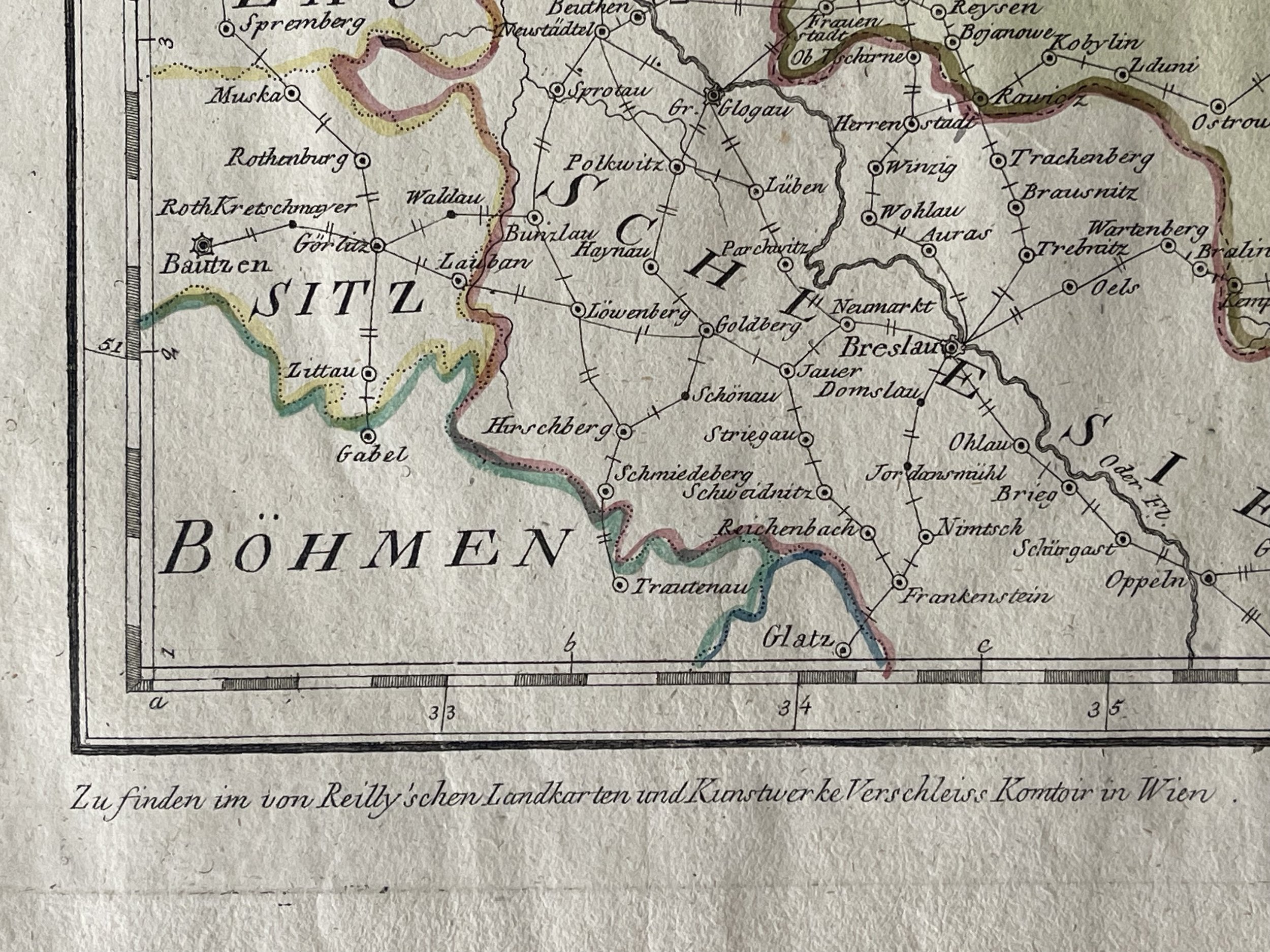
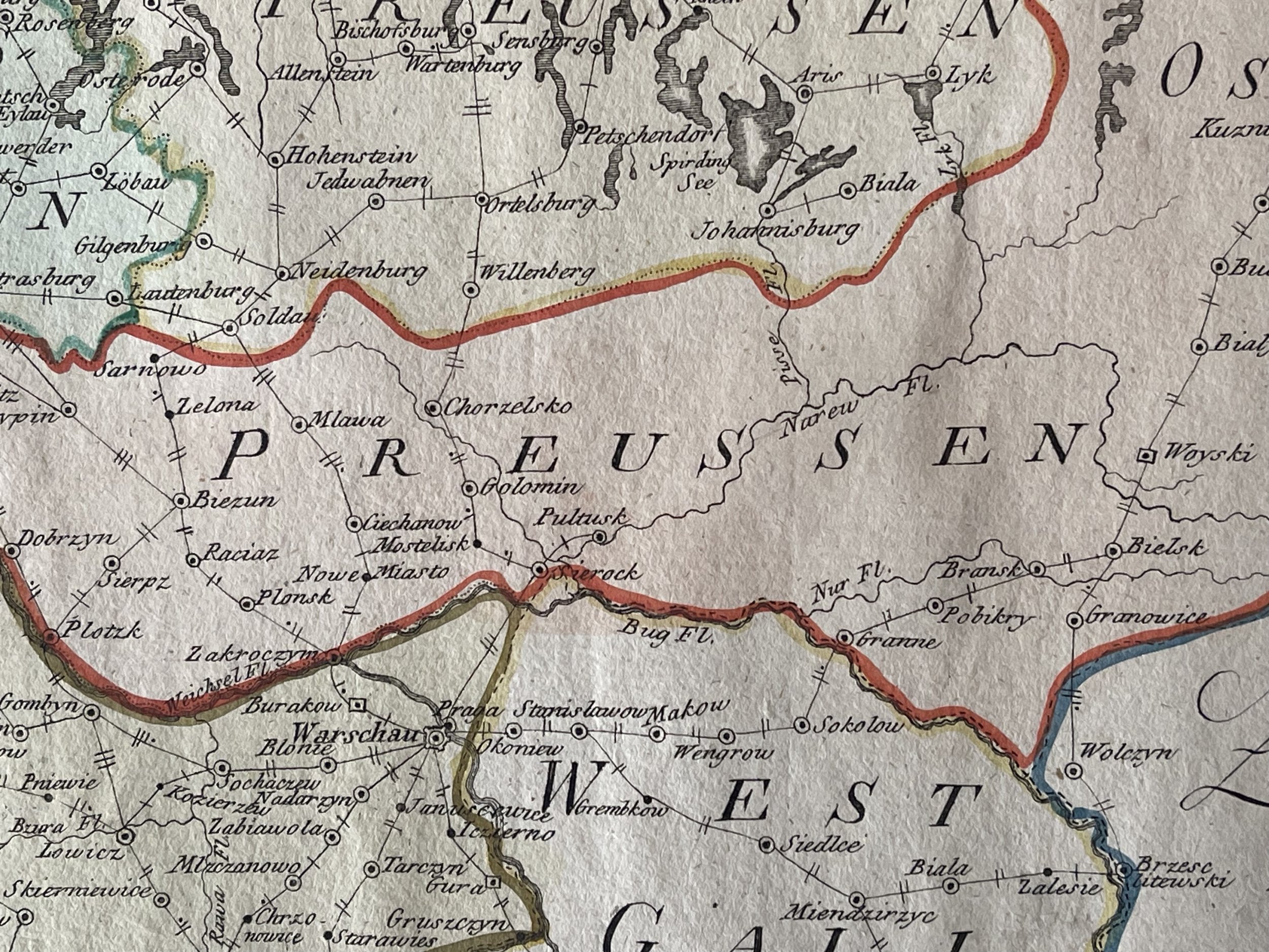
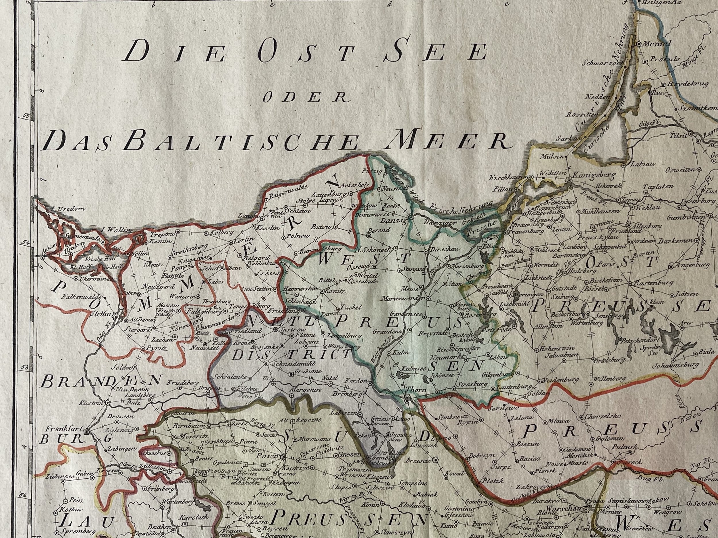
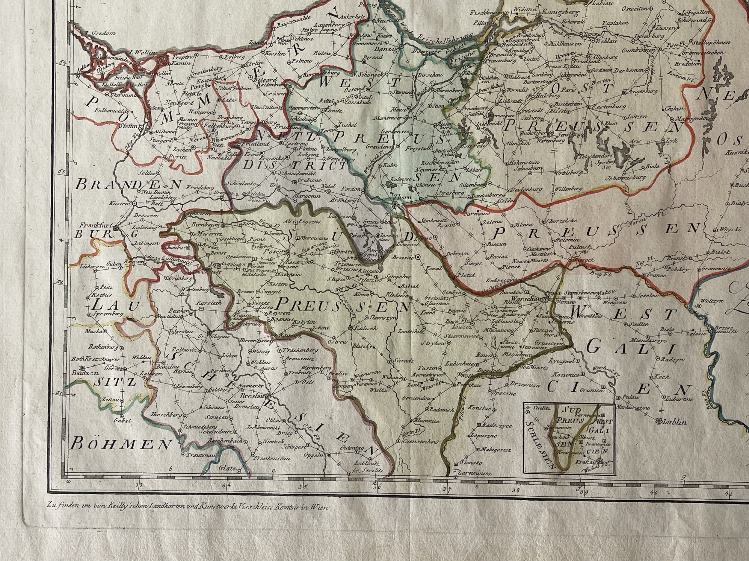
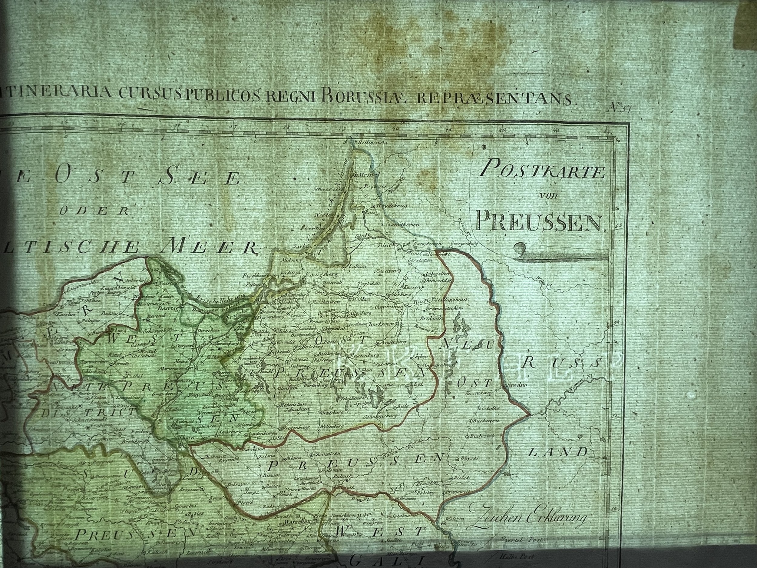
Prussia, Modern day Poland and surrounding areas - Copperplate map, by Johann. Wenzel Engelmann at Reilly, "Mappa Itineraria Cursus Publicos Regni Borussiae Repraesentans. - Map of Prussia".
Engraved in Vienna - A wonderfully clear impression, prominent plate mark. Watermarked hand-laid paper with wide margins. A few small stains and light toning. Highly detailed map of Sweden and Finland, including parts of Norway, Russia, Latvia, and Estonia. Decorative colouring and with a large title cartouche.
A rare postal map of Poland printed in Vienna. Extends from Usedom (Germany) until Memel and Lublin. It includes Breslau, Warsaw, Grodno, Danzig. The towns are connected by lines and the legend explains the postal types.
Johann Wenzel Engelmann (also E. Wenzel st., 1713-1762) a member of the Viennese family of copper-engravers, who figures in bohemian book culture as the author of four frontispieces to the Geschichte des Hussitenkriegs by the French Protestant theologian Jacques Lenfant (Bratislava 1783-1784 in four volumes). These are portraits of the protagonists of the Hussite Wars. He also engraved a map of Moravia dated 1784 based on Jan Venut's model for the second volume of František Josef Schwoy's Topographische Schilderung des Markgrafthum Mähren (Prague-Leipzig 1786). Engelmann's vignette on the title page of Allgemeine Land- und Hausökonomie (Olomouc 1787) is marked "fecit" in the signature . The son Wenzel Engelmann Jr. also stood out from the Viennese Engelmann family . (1748-1803) and grandson Franz Engelmann (1771-1808).
Map in excellent condition for its age and rarity. Not easy to locate this map on the market. Pricing and grading commensurate.
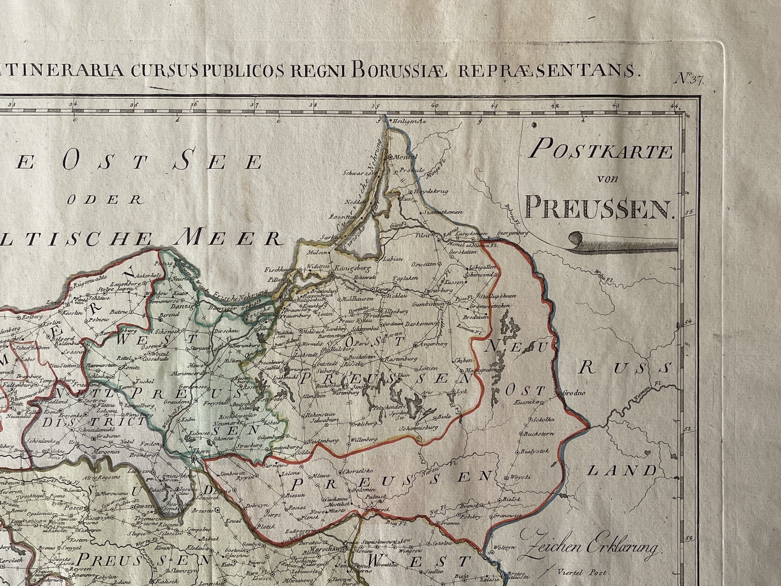
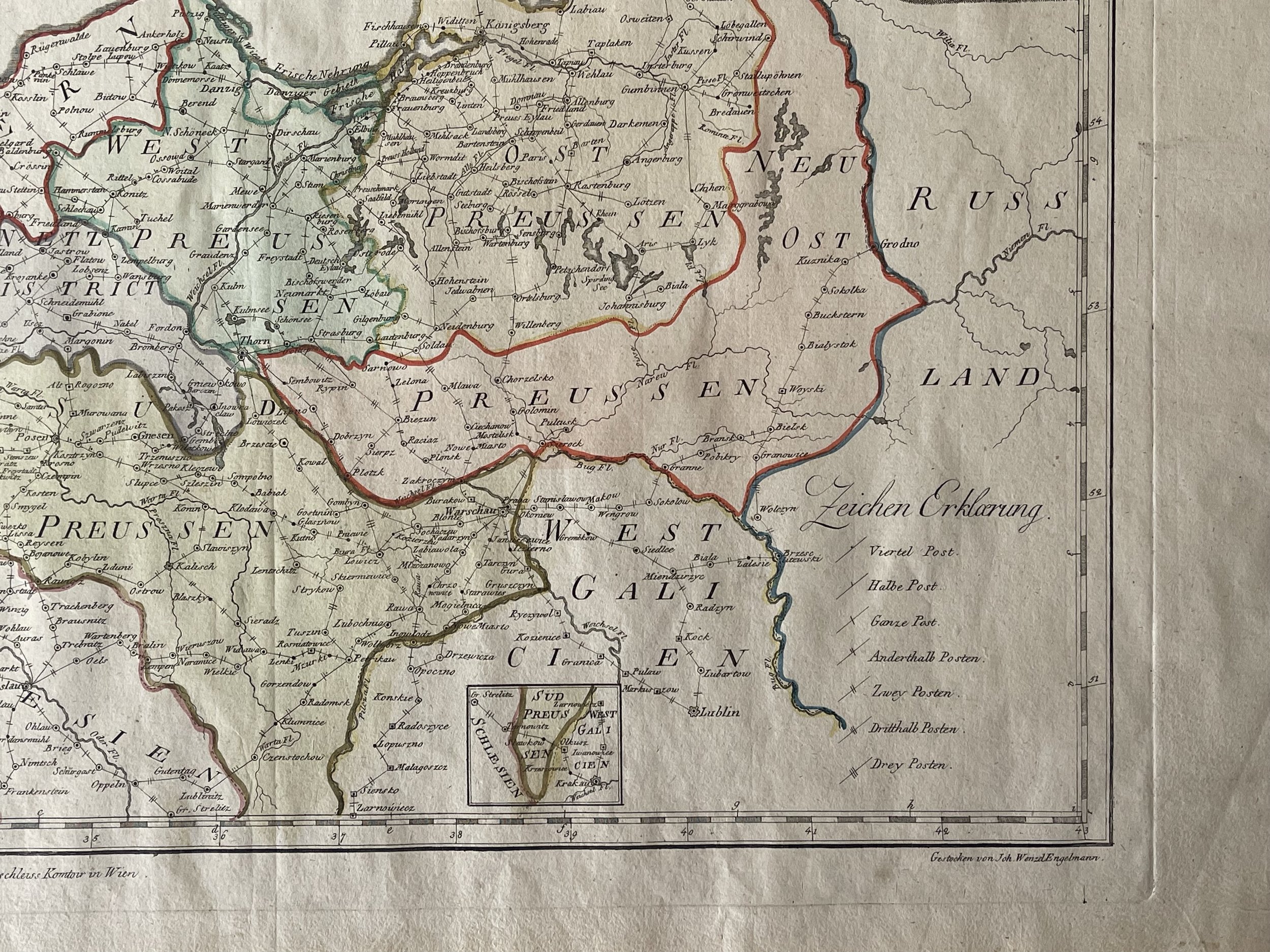
Code : A676
Cartographer : Cartographer / Engraver / Publisher: Johann Wenzel Engelmann
Date : Publication Place / Date - 1799
Size : Sheet size: 56.5 x 44 cm
Availability : Available
Type - Genuine - Antique
Grading A
Where Applicable - Folds as issued. Light box photo shows the folio leaf centre margin hinge ‘glue’, this is not visible otherwise.
Tracked postage, in casement. Please contact me for postal quotation outside of the UK.