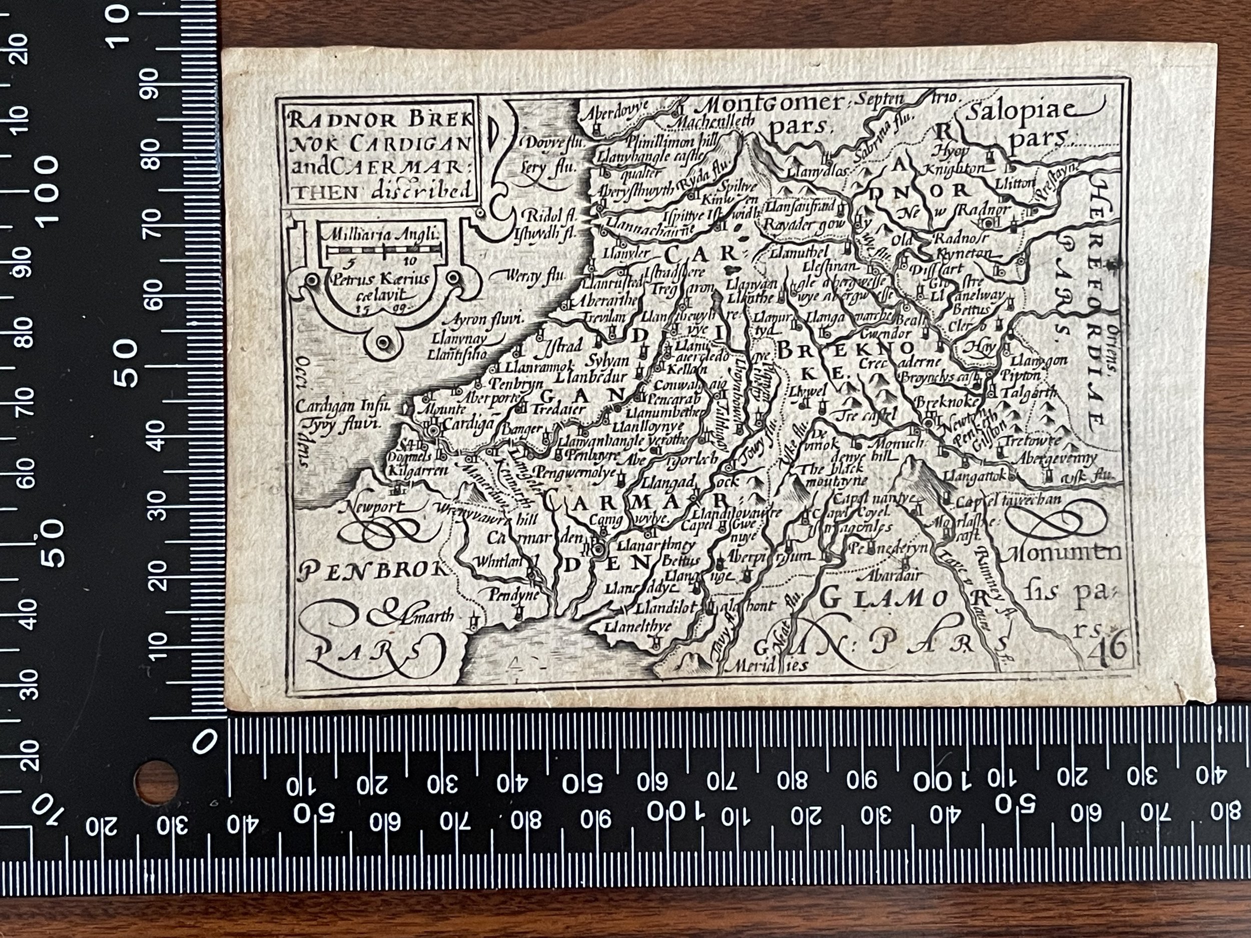
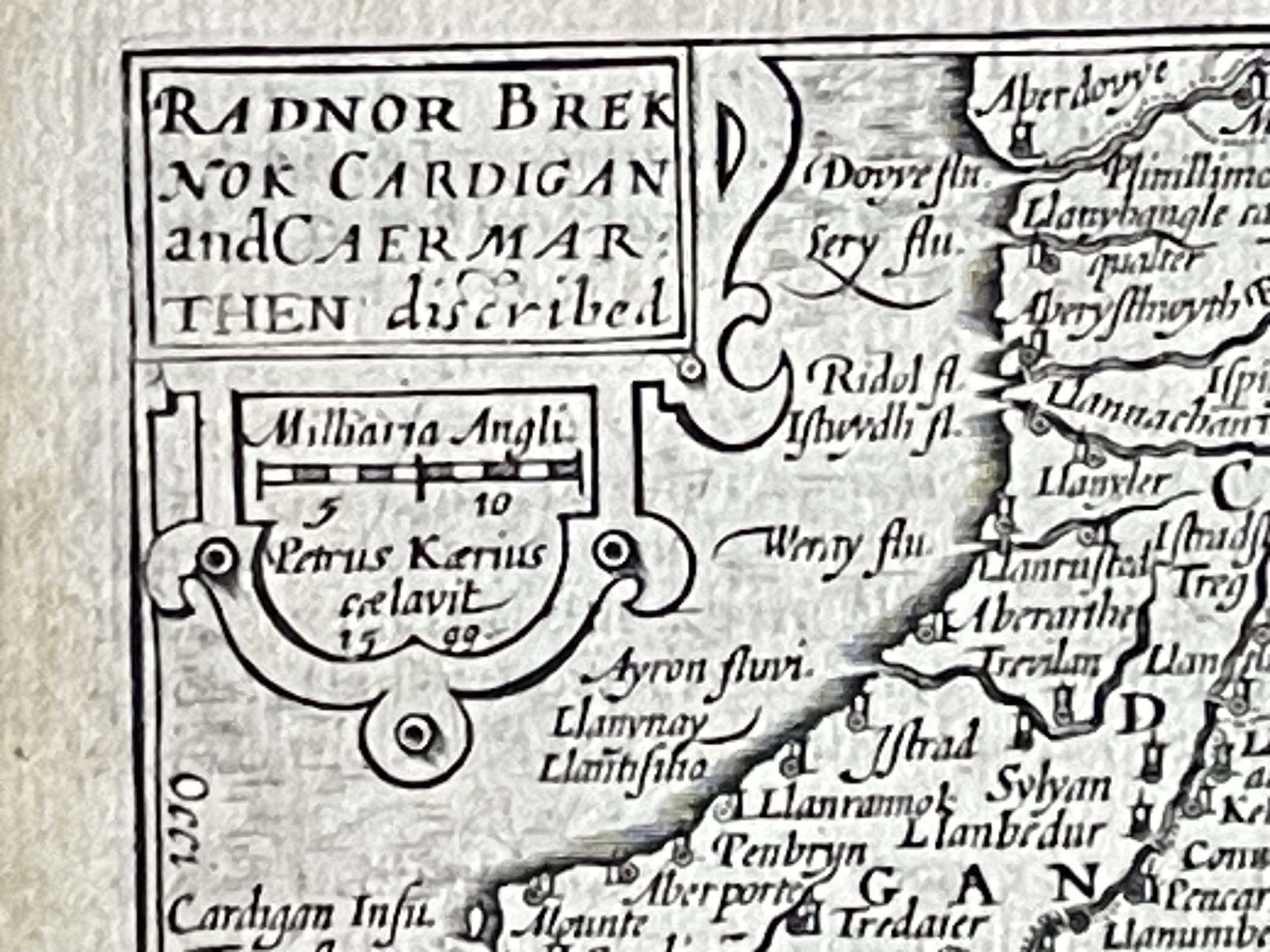
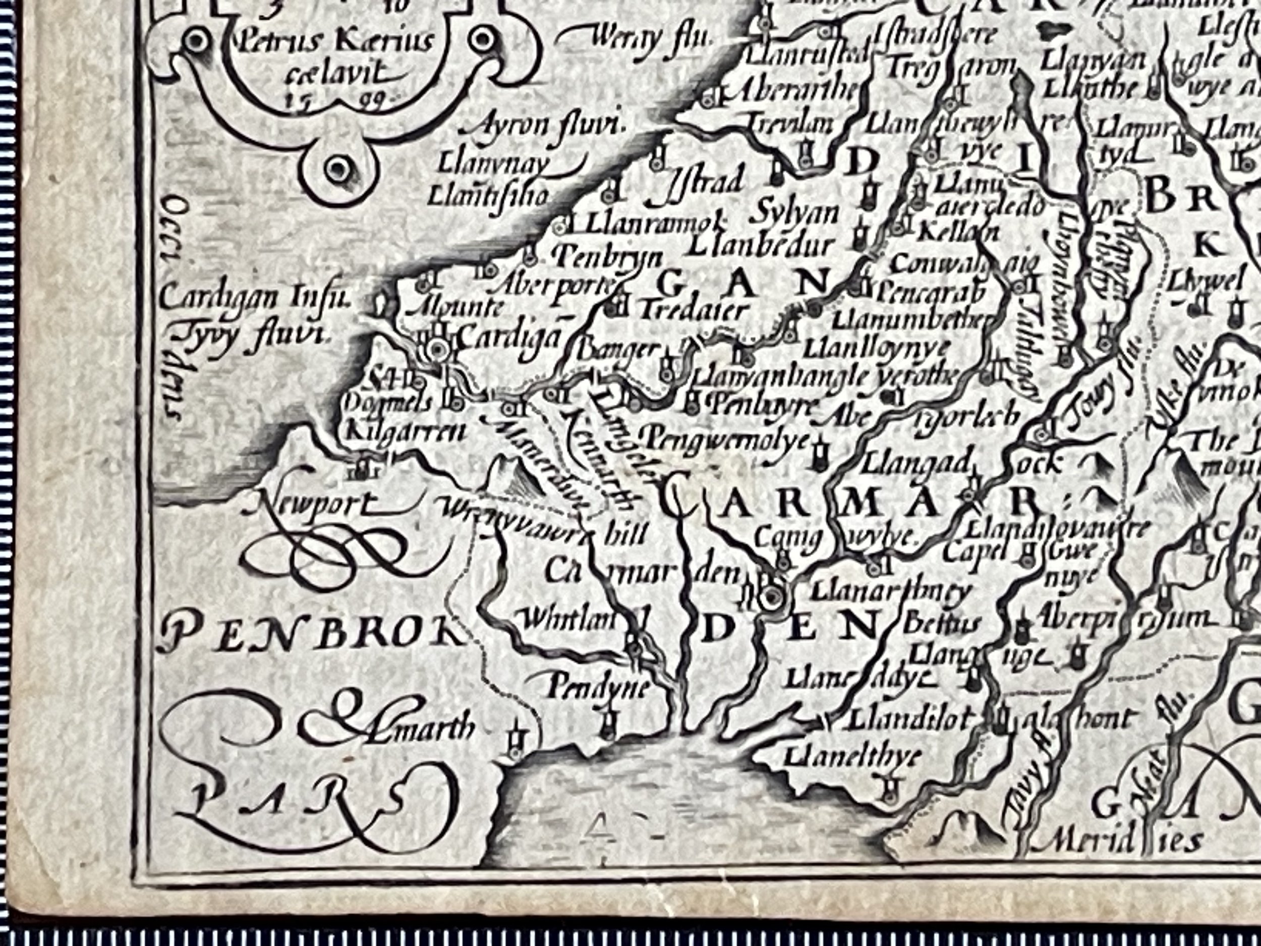
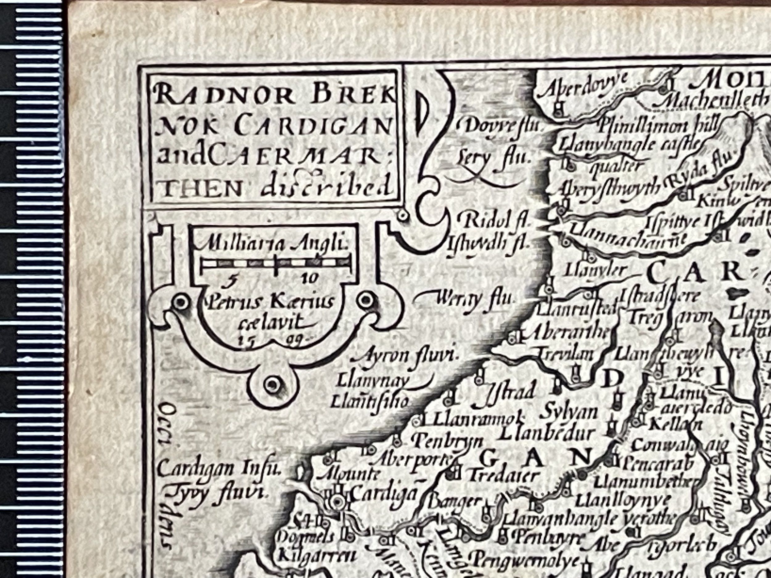
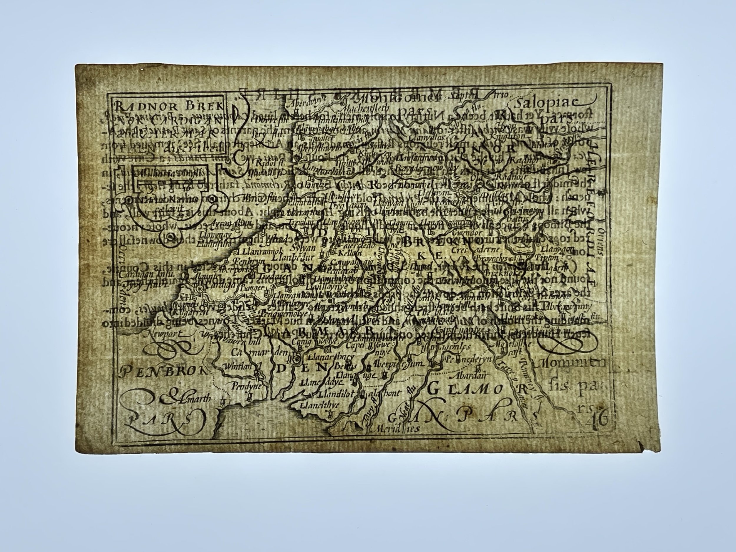
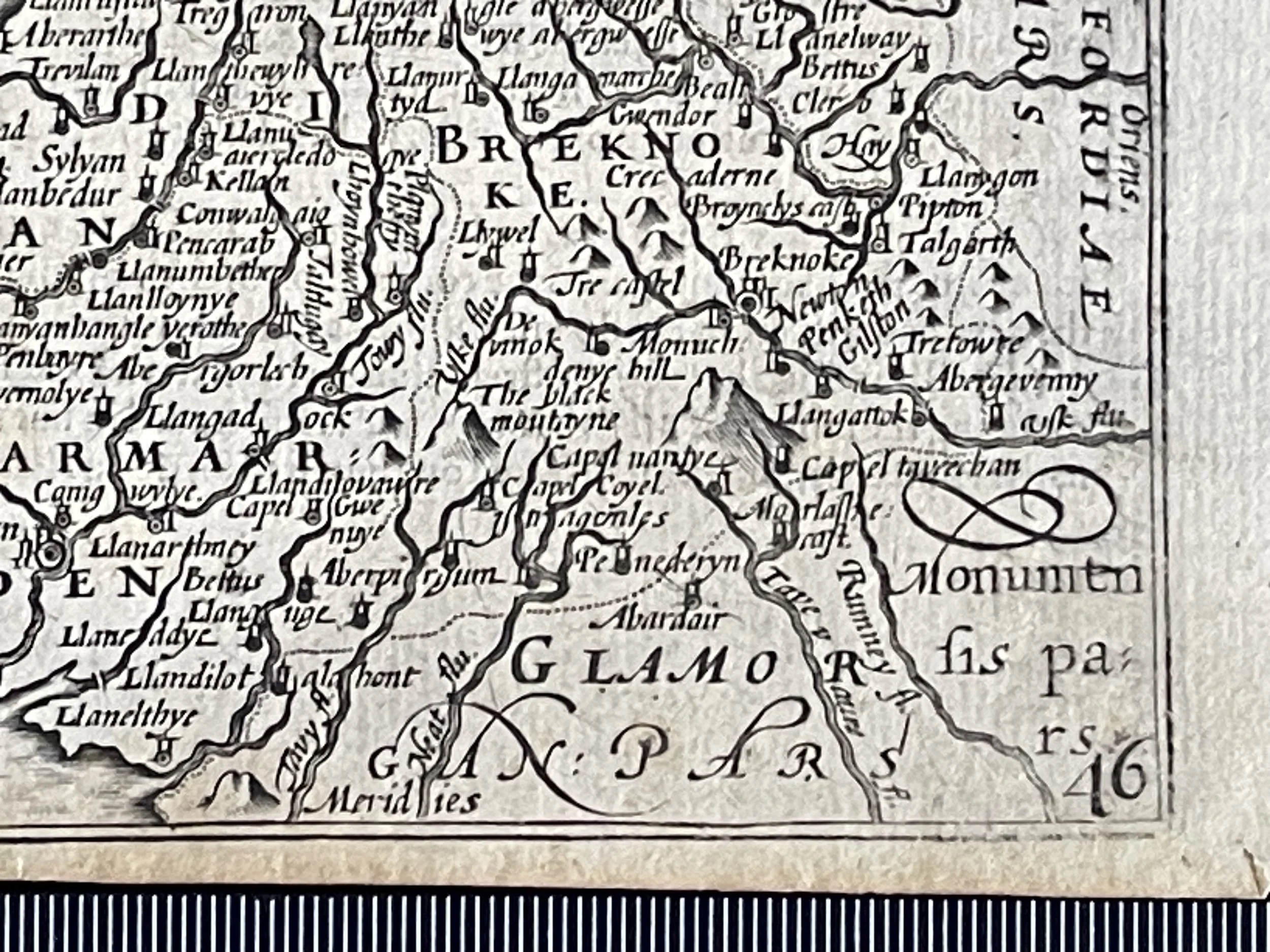
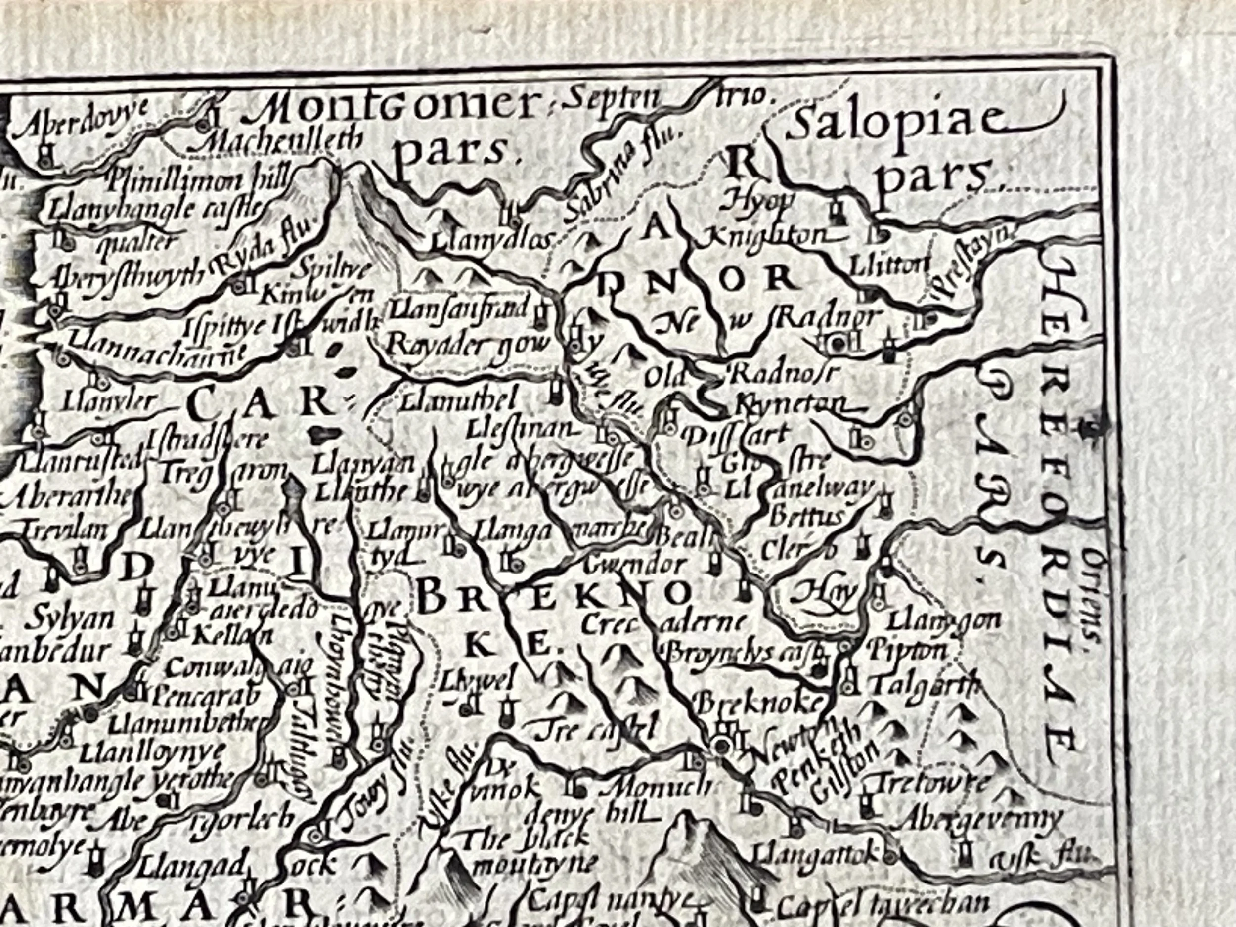
Radnor, Breknok, Cardigan, Caemarthen - Pieter Van Den Keere - 1605
An antique county map of "Radnor, Breknok, Cardigan and Carmarthen" by Pieter Van den Keere. The maps of England and Wales by Van den Keere were based on those of Christopher Saxton and in 1627 publisher George Humble "published a major edition of Speed's Atlas," who in turn "also issued" the van den Keere maps "as a pocket edition thereby van den Keere's works came to be known as "Miniature Speeds".
"Pieter van den Keere (Latin: Peter Kaerius 1571 – c. 1646) was a Flemish engraver, publisher and globe maker who worked for the most part of his career in England and the Dutch Republic. He was born in Ghent, son of engraver Hendrik van den Keere, and around 1583-4 moved with his family for religious reasons to London. His sister, Colette, who immigrated with van den Keere married Jodocus Hondius three years later. In London, van den Keere received training as an engraver from Jodocus Hondius, his brother-in-law. In 1593, both Keere and Hondius settled in Amsterdam. In Amsterdam he was betrothed on 7 September 1599 to Anna Burts or Beurt from Ghent, but he became betrothed again there on 10 March 1623 to a widow from Hoorn, Anna Winnens van Gent, possibly due to the death of his first wife. After 1630, there are few details of his life. The dating of some plates for John Speed's Prospect of the Most Famous Parts of the World of 1646 indicates that he was still alive then. From his time in England there is a map of Ireland from 1592, Hyberniae novissima descriptio. It was published by Hondius and served as a model for later editions of the Theatrum of Abraham Ortelius. Keere also contributed to John Norden's Speculum Britanniae of 1593.
For Willem Barents Keere engraved plates for Caertboeck Vande Middel-landsche Zee. He also worked with Petrus Bertius, Cornelis Claesz, Petrus Plancius, the House of Visscher, and Lucas Janszoon Waghenaer. In 1595, there appeared a large wall map of Europe in 10 sheets, Nova totius Europae descriptio.
From 1603, Keere began creating large urban panoramas, including Utrecht, Cologne, Amsterdam, and Paris. Around 1604, he was preparing the publication of the atlas Germania Inferior id est Provincuarum XVII. This first appeared in 1617, with a foreword by Petrus Montanus."
These maps were known as ‘Miniature John Speeds’
Now becoming rare and hard to locate, A series of 44 plates for the British Isles were constructed, from about 1599 and took a long time to publish. They were based on Christopher Saxton, Ortelius, and Giovanni Battista Boazio, respectively for England and Wales, Scotland, and Ireland. They appeared in 1617 in a Latin edition of the Britannia of William Camden, by Willem Blaeu. Later, these plates came to William Humble or George Humble (according to Royal Geographical Society fellow, Carl Moreland and David Bannister--map dealer--in "Antique Maps") who issued them (with some modification and expansion) in 1627 as a miniature version of the atlas of John Speed. Thereby van den Keere's works came by the name "Miniature Speeds".
Code : A181
Cartographer : Cartographer / Engraver / Publisher: Pieter Van Den Keere
Date : Publication Place / Date - 1605 approx
Size : Sheet size: Image Size: 12.5 by 9 cms.
Availability : Available
Type - Genuine - Antique
Grading A+
Where Applicable - Folds as issued. Light box photo shows the folio leaf centre margin hinge ‘glue’, this is not visible otherwise.
Tracked postage, in casement. Please contact me for postal quotation outside of the UK.