
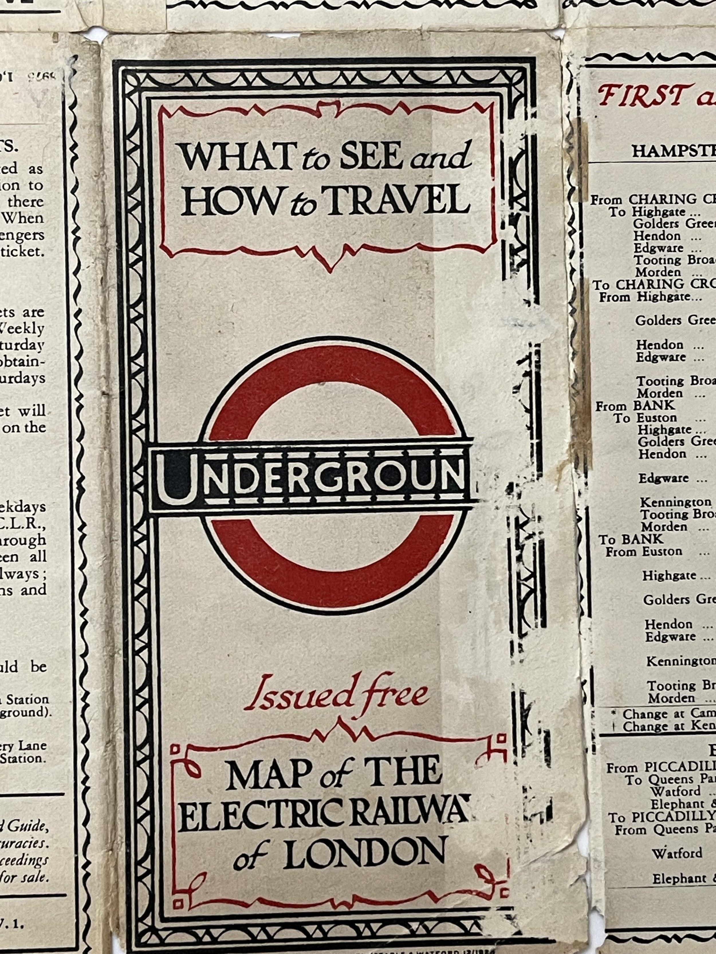
Railways of London - Edgar George Perman - 1928 RARE
One of the most charming and decorative maps of the London Underground. Designed by E.G. Perman in the style of Macdonald Gill
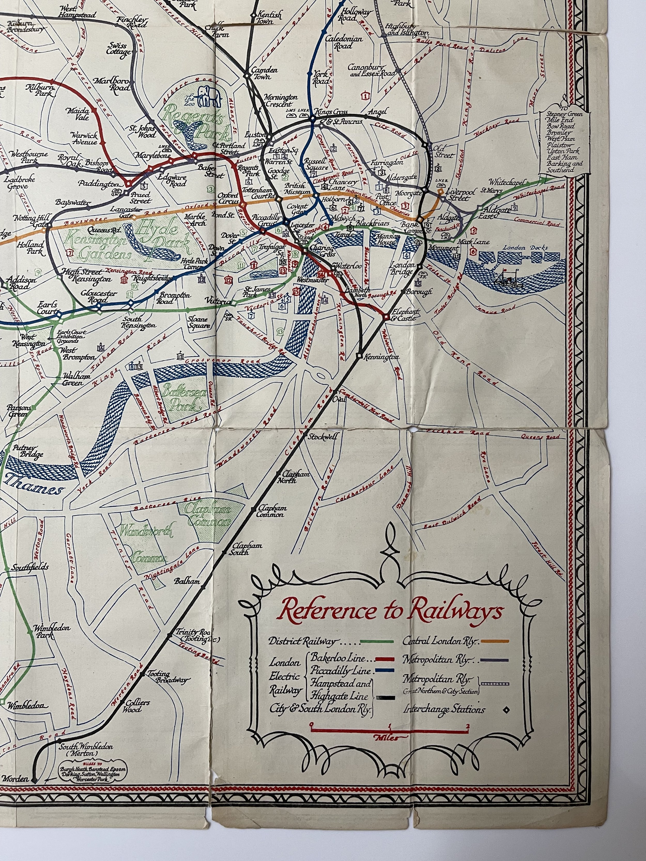
This map, titled "1928 Railways of London Tourist Map," was produced by Waterlow & Sons.
The Artist E G Perman designed some route maps for Shell in a style like eighteenth century maps. He also designed maps for the Underground Group, 1928.
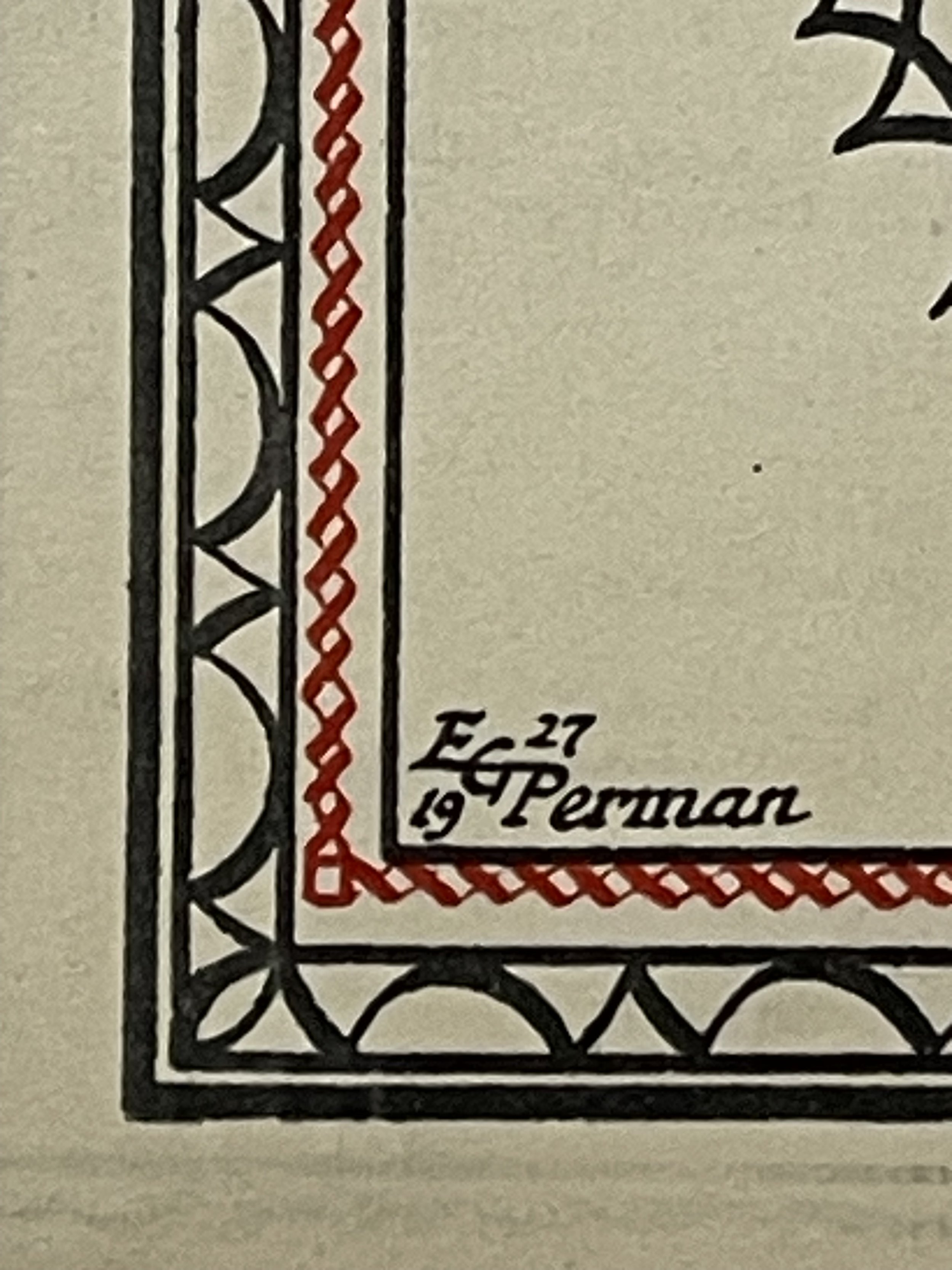
Edgar George Perman (1875-1955) designed a single, delightful, portrait format passenger map of the Underground, which was issued 1928-29. The style of the lines, stations and interchanges follows the series of maps created by Fred Stingemore, while the calligraphy is influenced by MacDonald Gill.
According to Artist Biographies, this talented artist was born and raised in Ealing, studied at the prestigious Westminster School of Art in the 1890s, and spent his professional life as a commercial artist in the 1920s. However, despite his skills, his body of work does not seem to be extensive. What unfolded after 1929? EG Perman and Co, a London-based company, was highly involved in promoting the 'Flying Flea' - a lightweight aircraft aimed to revolutionize air travel, similar to the Model T Ford. It would be intriguing to discover if our EG Perman, who himself designed the Perman Parasol, abandoned the world of fine art in his fifties to focus on promoting air travel for all. This could potentially explain the lack of maps created by him in later years.
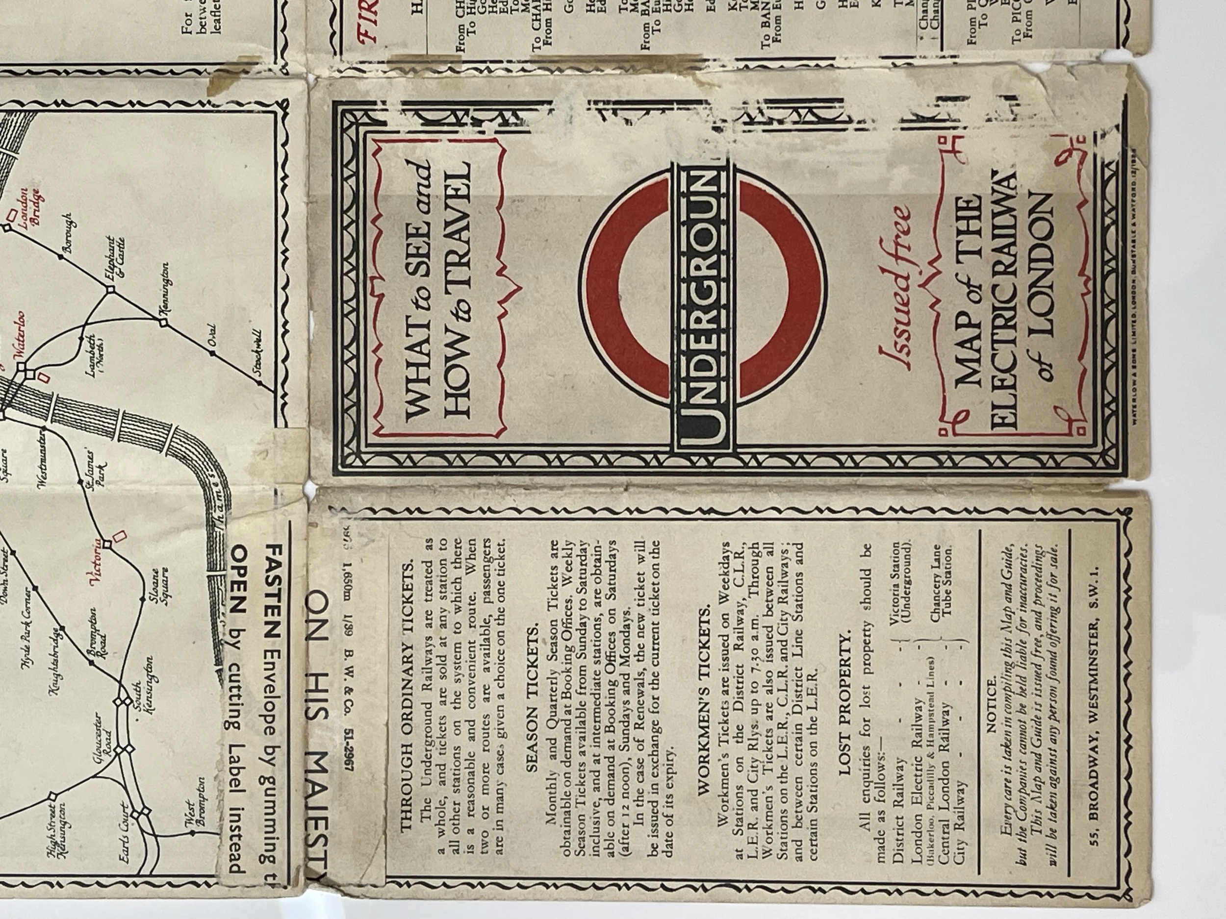
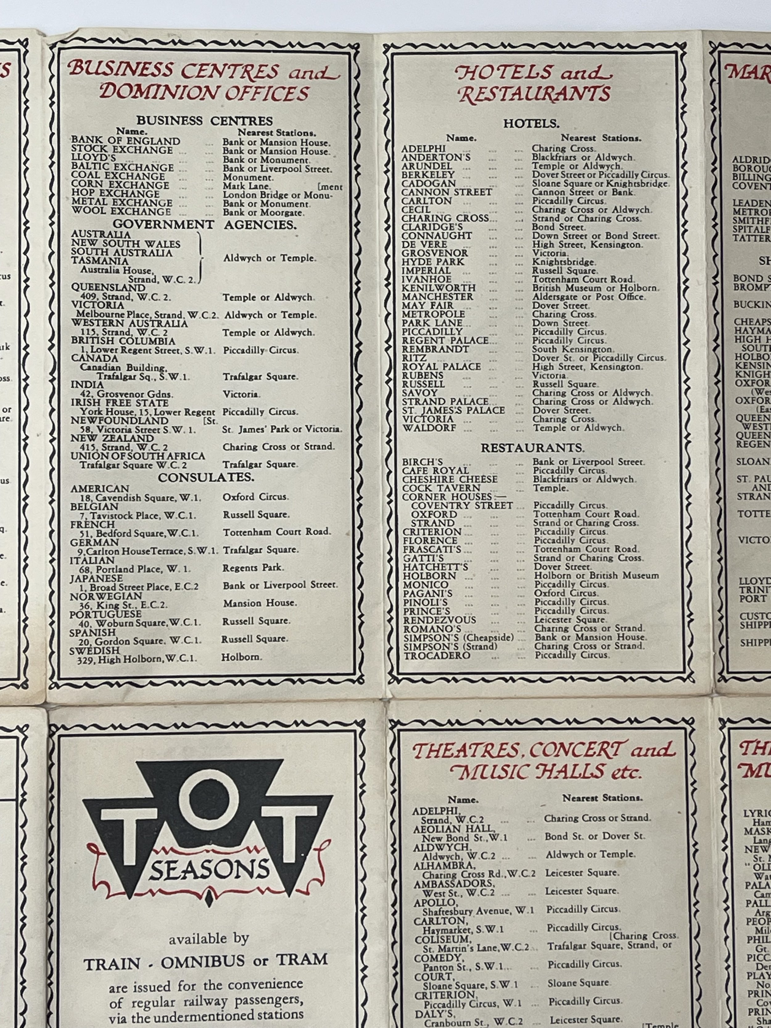
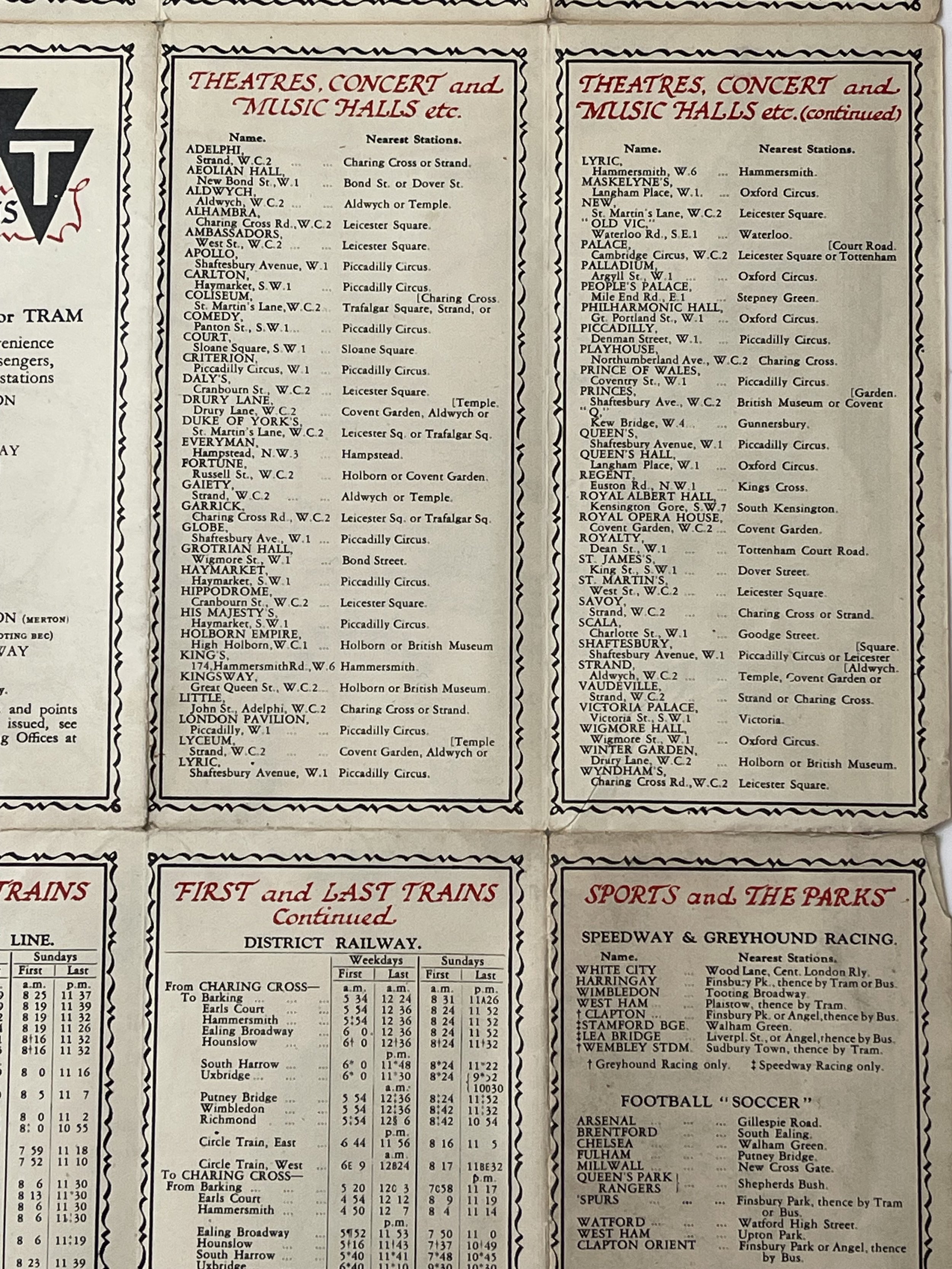
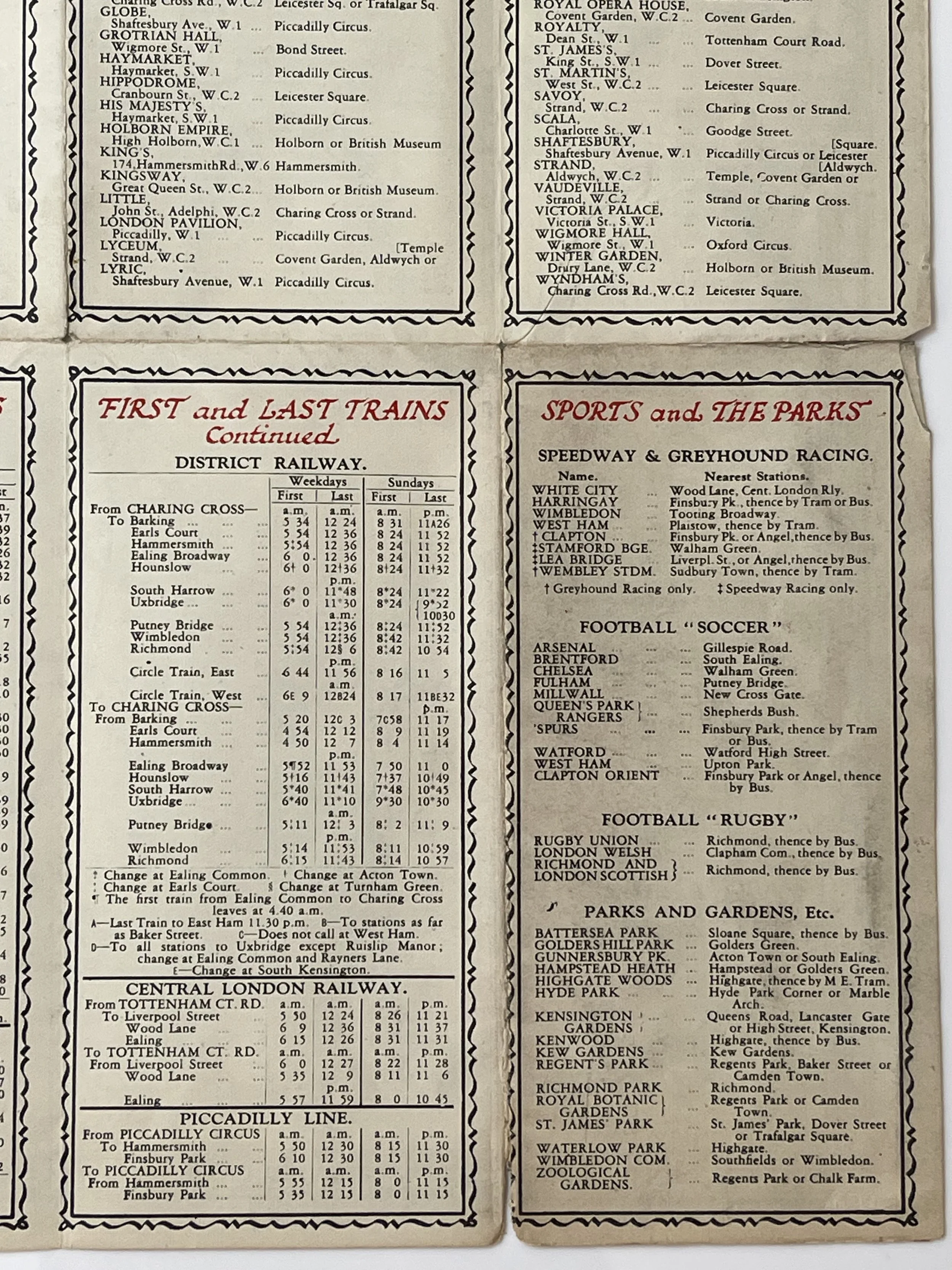
It is a compact map designed for tourists in the 1920s, indicating which attractions can be accessed via different railway lines. The map has been stored flat to prevent further damage to the seams. When viewed from the front, the map appears in excellent condition with only a few tiny holes at the fold intersections, which are not noticeable from a distance. However, upon closer inspection of the back, signs of wear and 1920s tape marks from previous repairs can be seen. Nevertheless, this map is a rare and well-preserved artefact from the 1920s and would make a stunning addition to any wall, if framed.
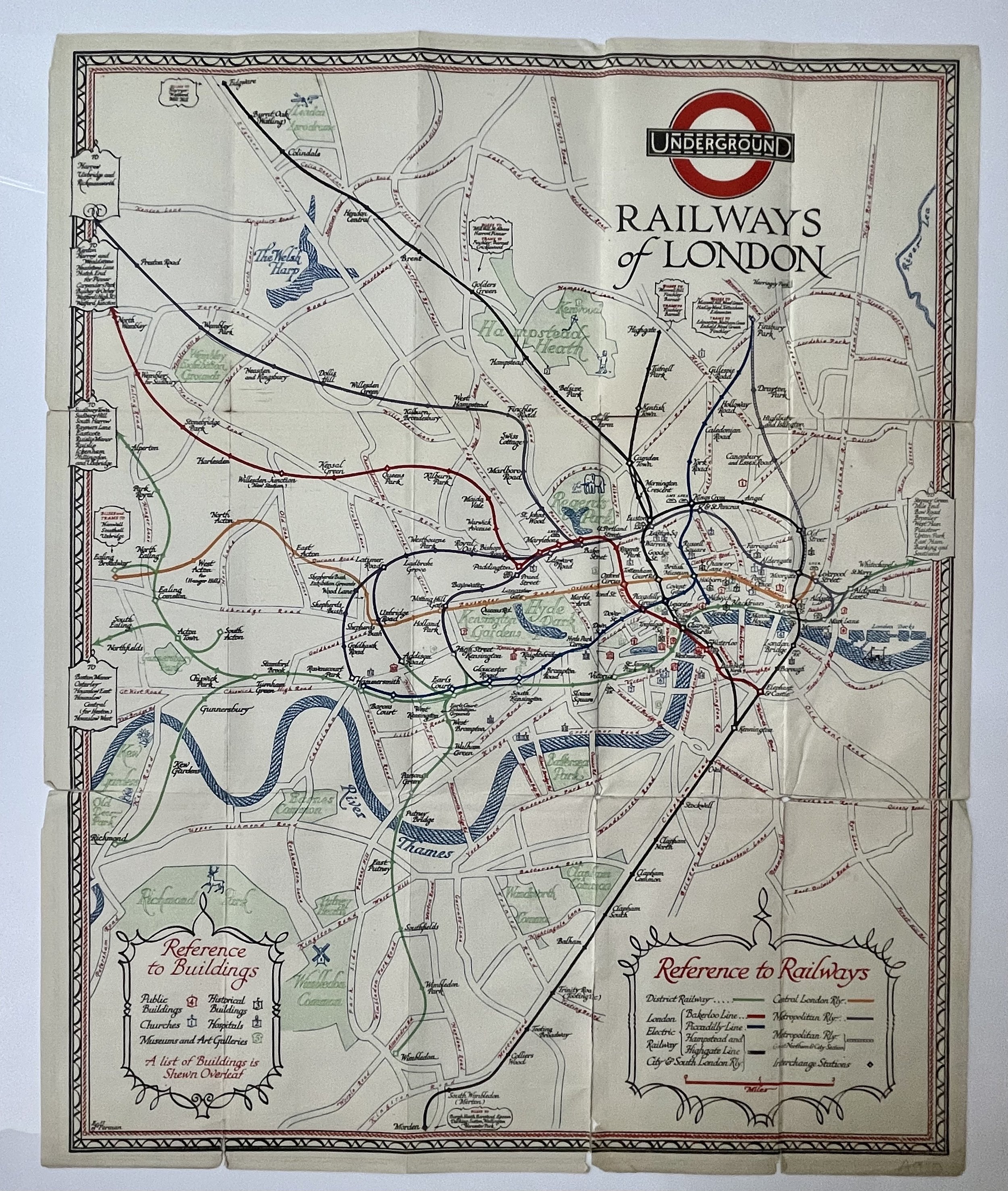
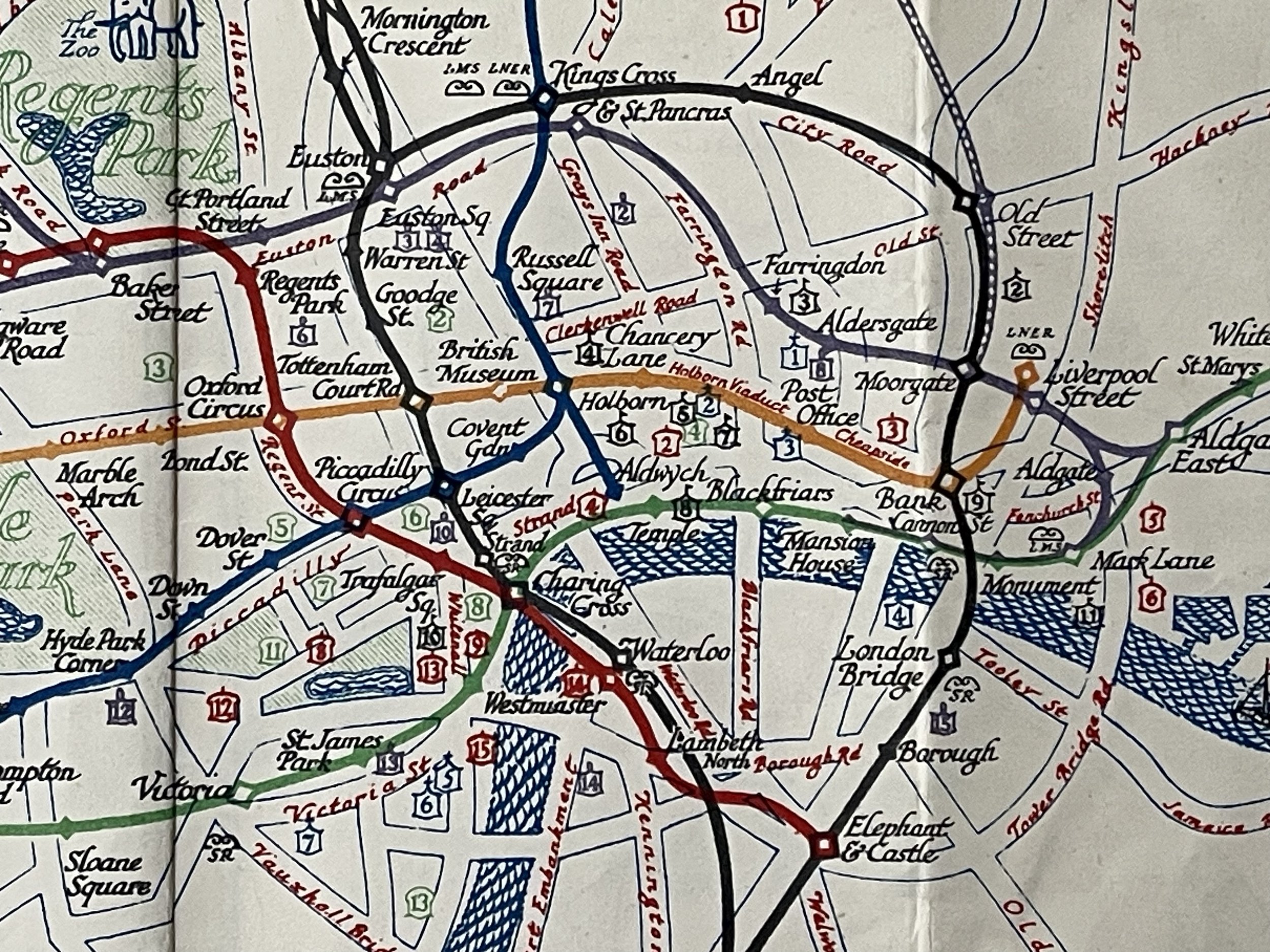
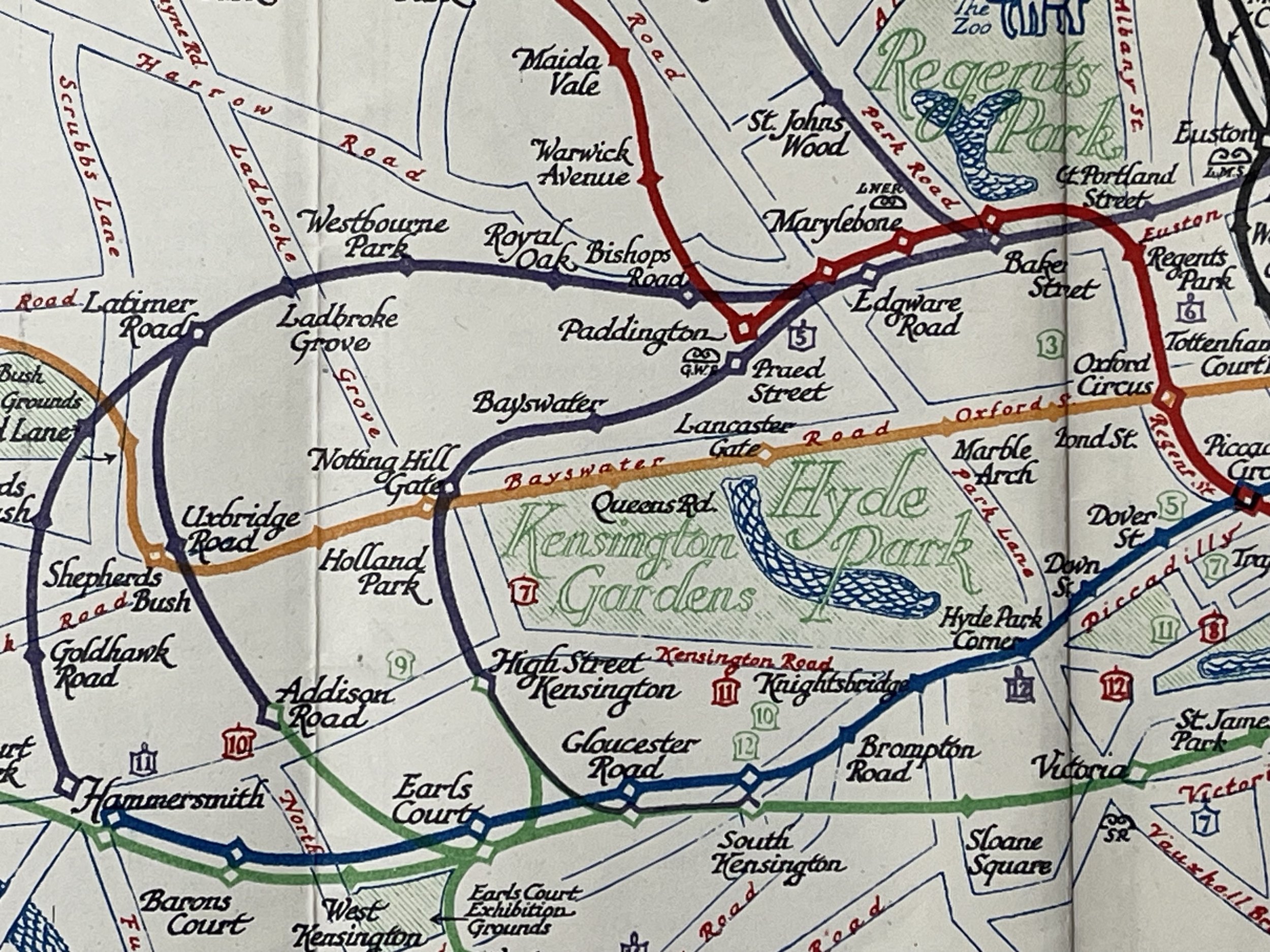
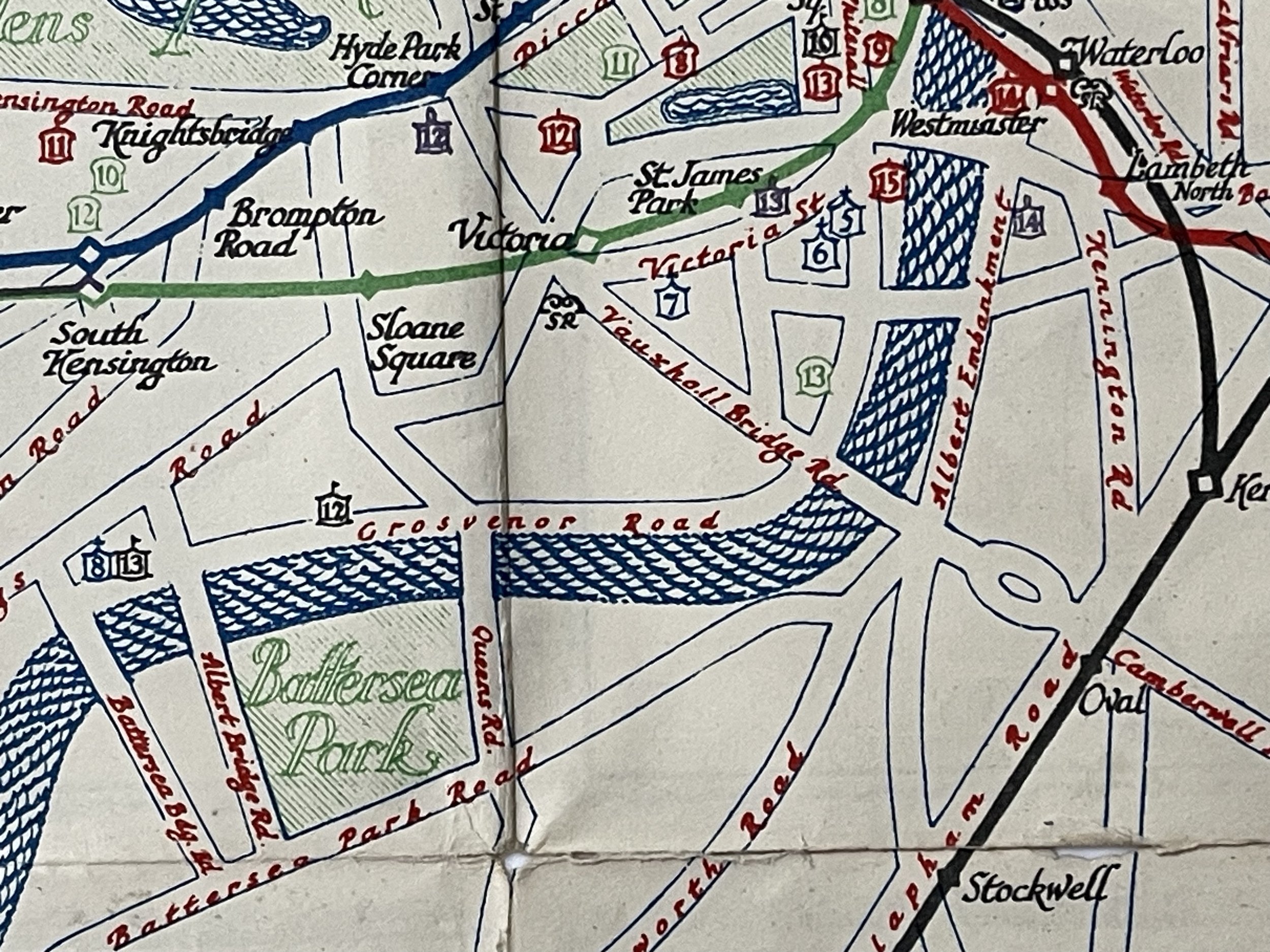
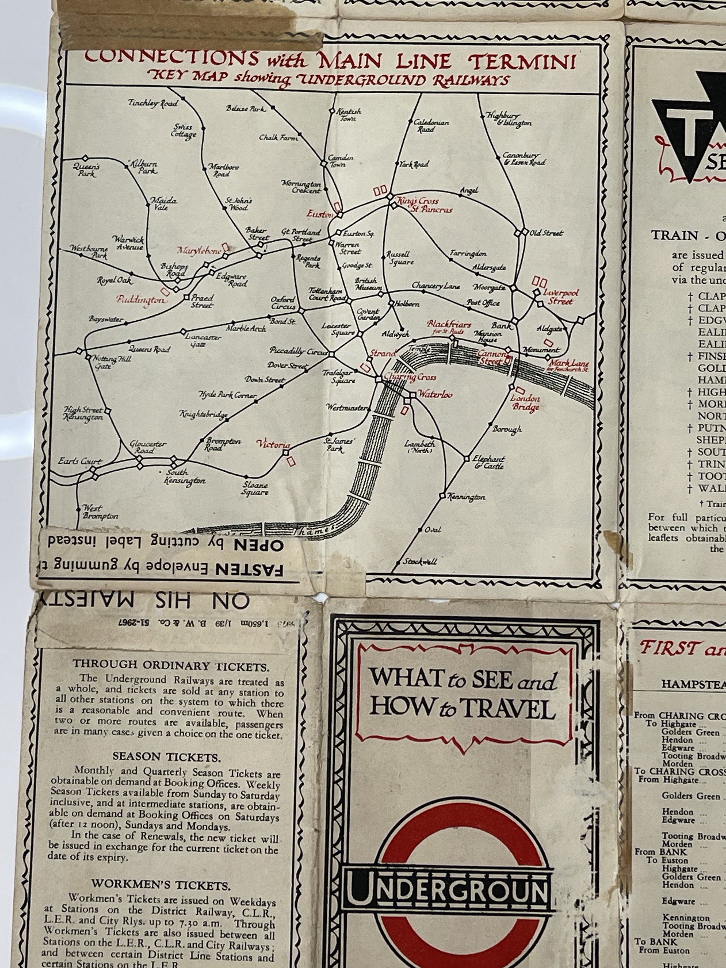
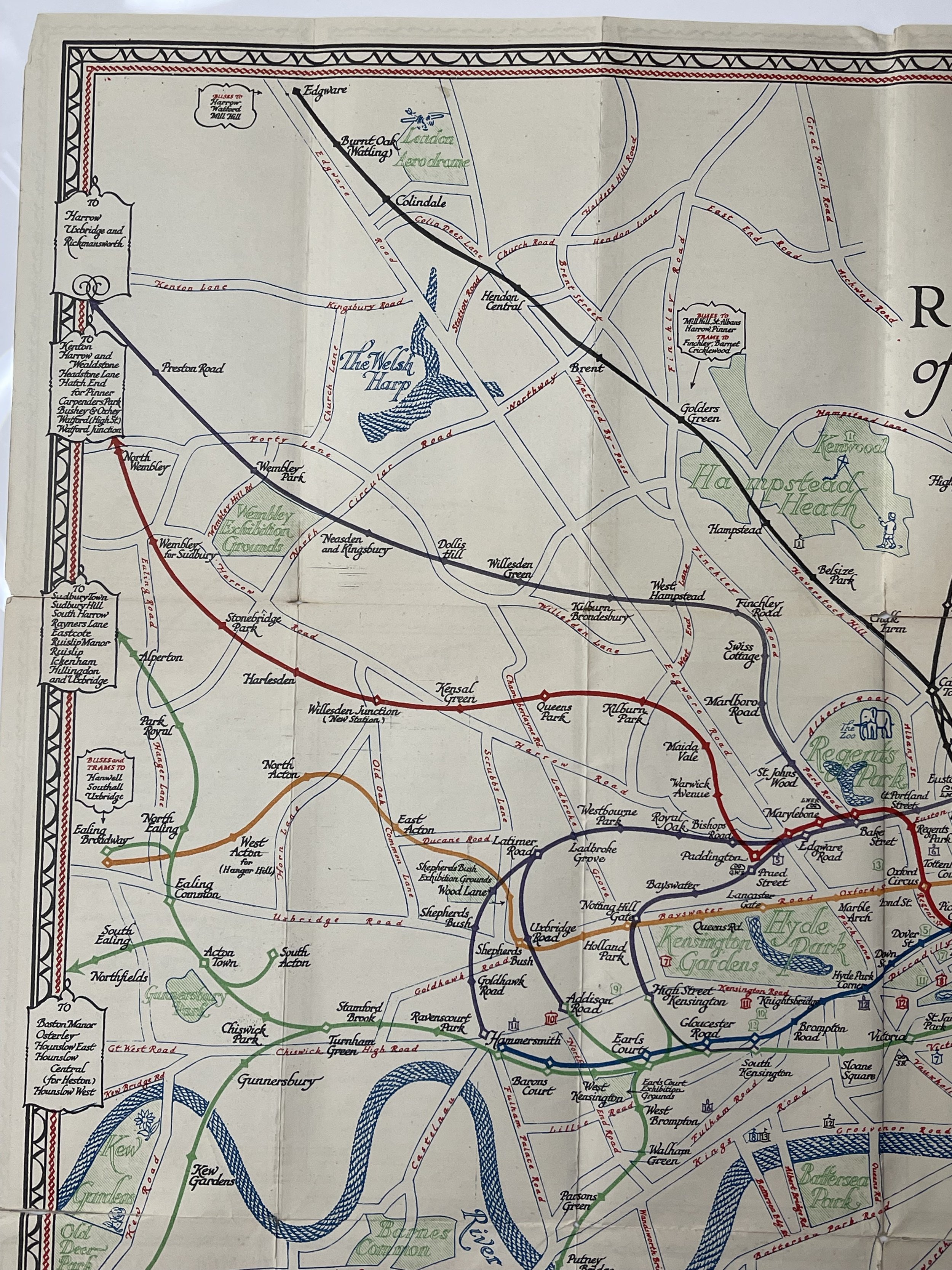
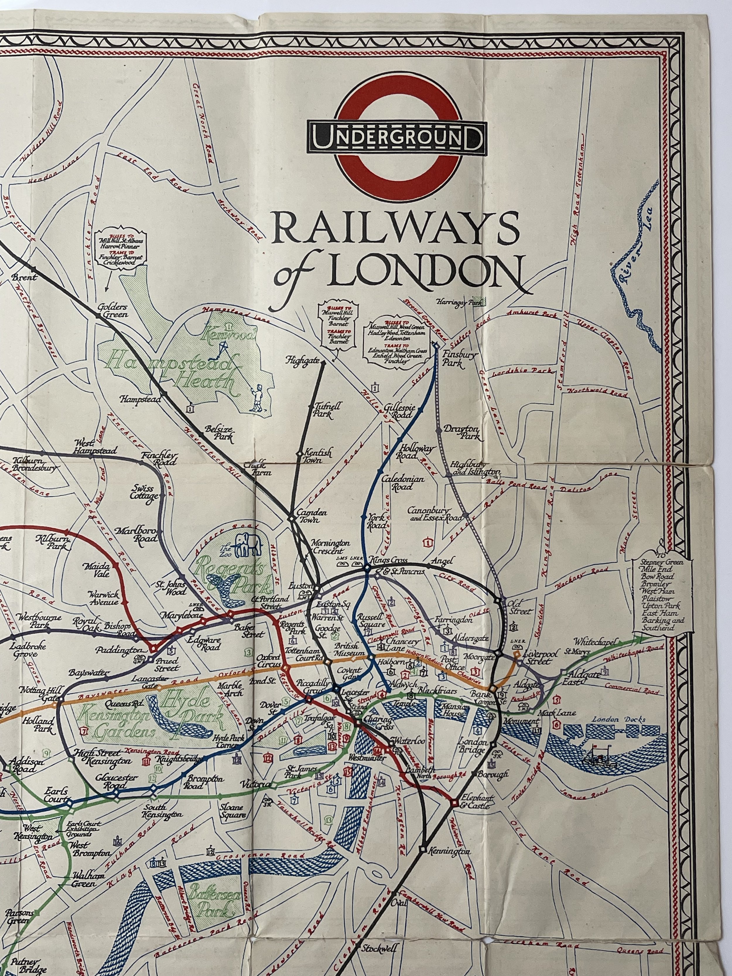
This map, created by E.G. Perman and accessible in the David Rumsey Map Collection, was one of the final depictions of London's underground network before the Beck "revolution" of the 1930s. Originating in 1927 and published the following year, it simplifies the network by representing the lines between stations with smooth, gradual curves rather than the true twists and turns. Regular stations are represented by small, solid diamonds while larger stations are shown as larger, hollow diamonds. When these symbols are overlaid, the varying line colours give some indication of connections between different lines. Notably, the intricate interchange of the Northern Line just south of Camden Town is accurately depicted on this map. The map also features symbols for connections with mainline rail services, marked by small wavy lines adjacent to the relevant station and accompanied by the operator's name in smaller font below.
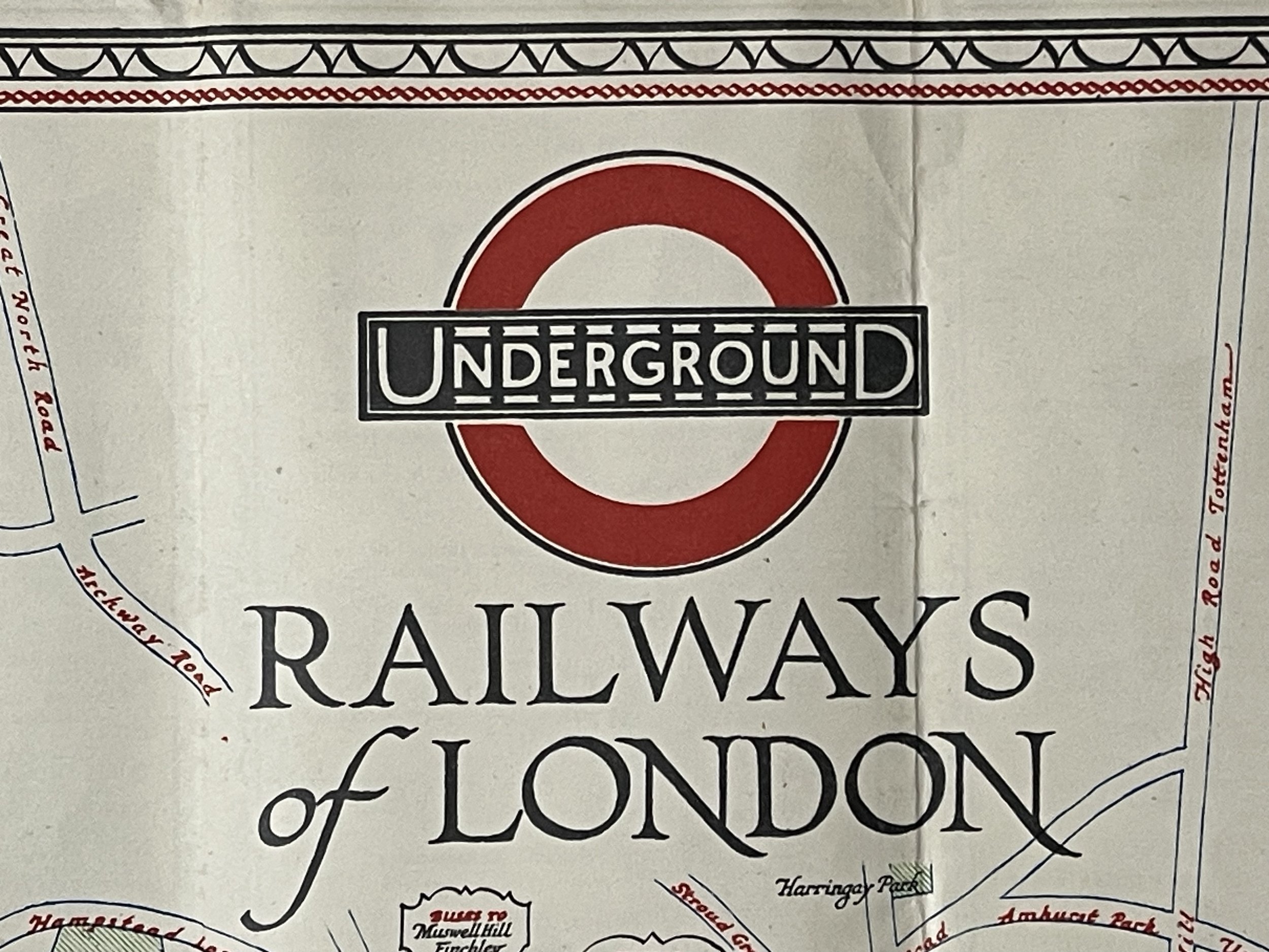
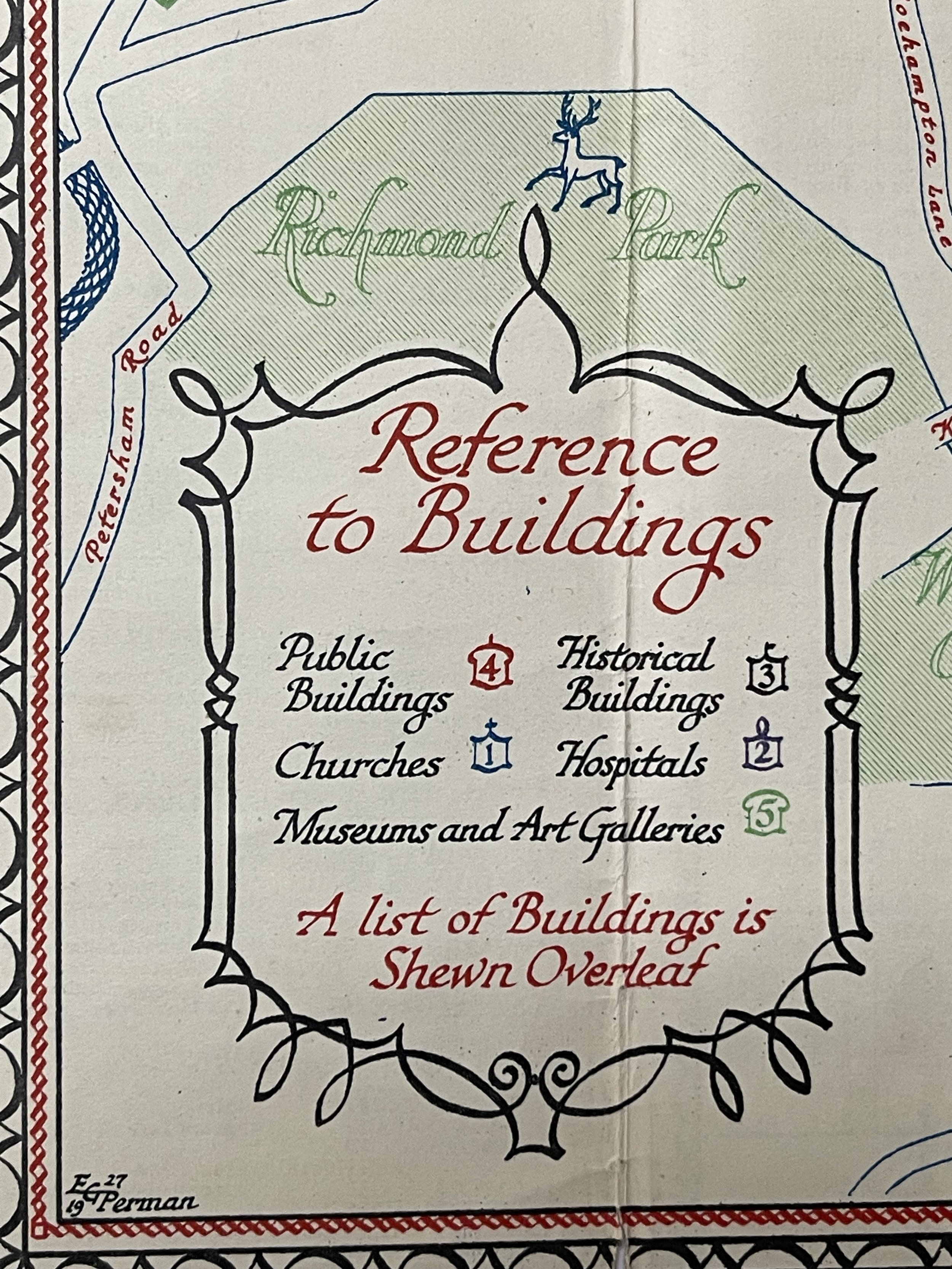
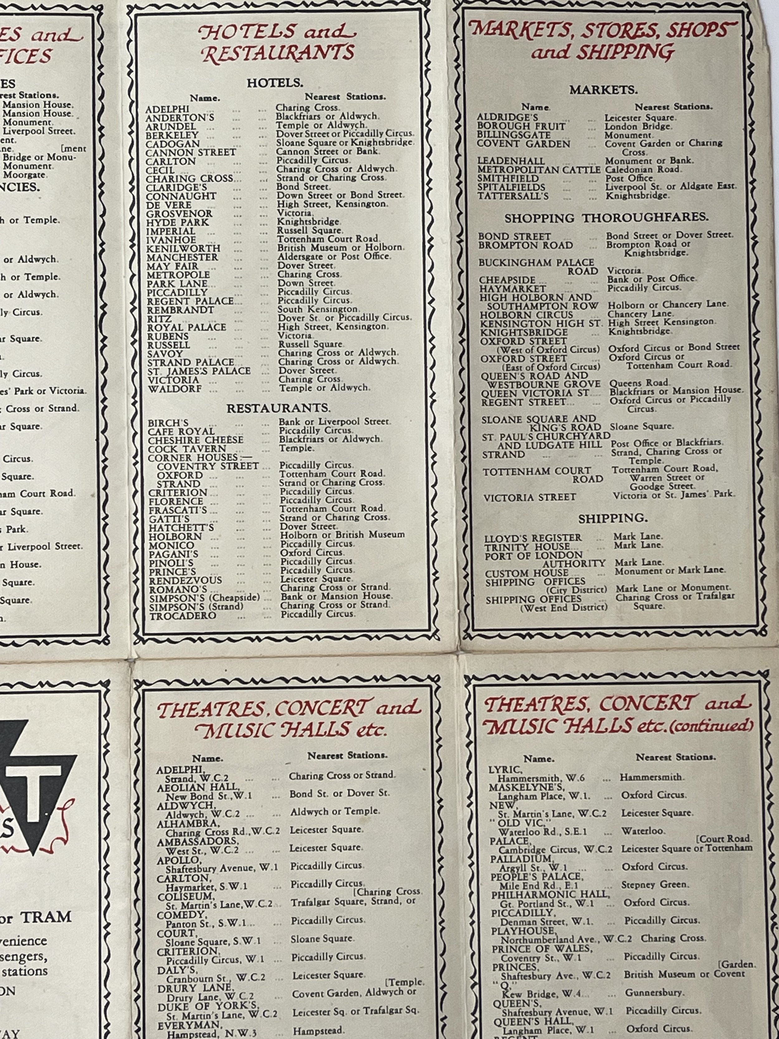
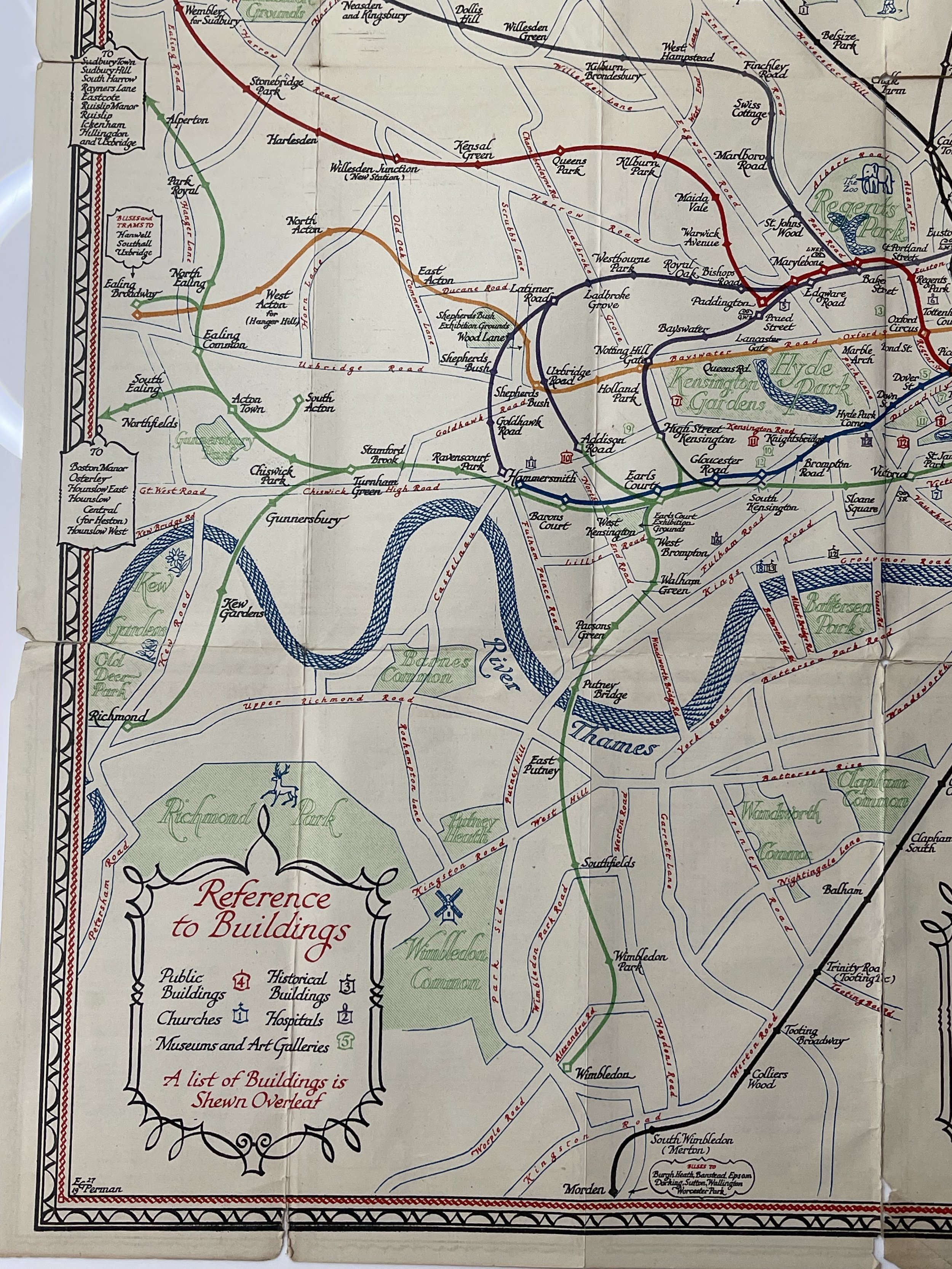
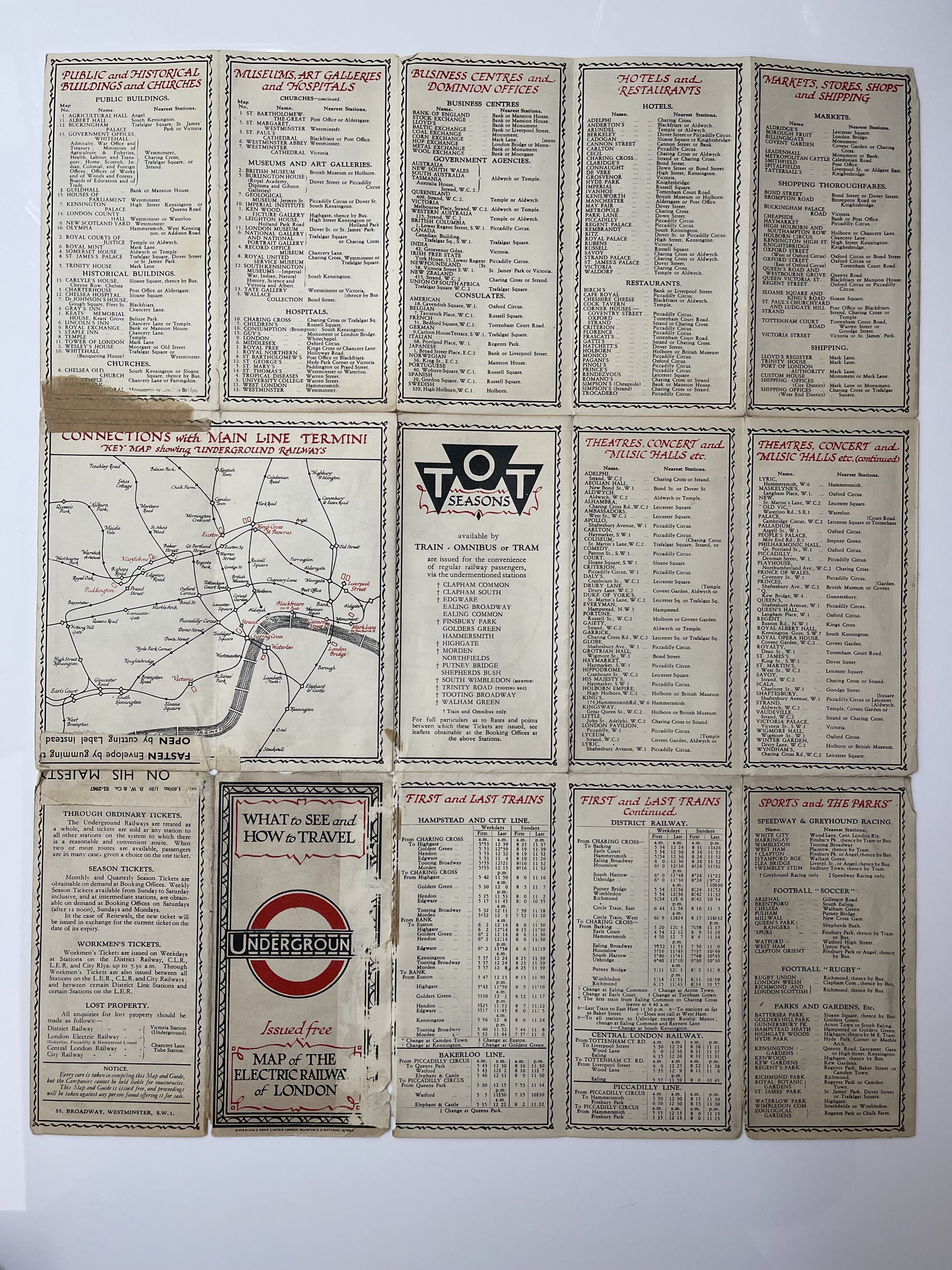
The map, originating from the 1920s, features the classic design elements of the time, such as intricate serifs on the font, graceful waves on water features, and a detailed border. Its most remarkable aspect is its geographical display of the tube network alongside major streets, the Thames, parks, and tourist attractions, all without overcrowding the map. Notably, there is even room for illustrations, such as an elephant at the Zoo, a windmill at Wimbledon Common, a stag at Richmond Park, and a boat on the Thames. Bus routes are marked at the ends of some lines, while longer ones are truncated with a list of outlying stations. Additionally, tourist attractions are easily identified through colour-coded and numbered symbols (with further details available on the back of the map).
The current tube maps are not comparable to the older versions - a straightforward map based solely on geographical locations is no longer user-friendly. However, I believe that if a modern tube map was designed in this traditional style, it could still effectively serve as a functional and informative map, while also being aesthetically pleasing and representative. It is regrettable that many Londoners and tourists heavily rely on the modern tube map as their primary reference for navigating the city, as this 90-year-old map effectively shows the interconnectedness of above-ground locations.
Interestingly, one of the seam repairs on the rear is with a 1920s piece of envelope tape with the script ‘ B.W & Co 51-2967, ON HIS MAJESTY, Fasten Envelope by gumming, OPEN by cutting label’. The tape is clearly from the same period as the map because His Majesty was King George V, who was on the throne in 1928 and reigned from 1910 - 1936.
A rare survivor and very collectable London Railway pocket Map. Pricing and grading commensurate.
One of the most charming and decorative maps of the London Underground. Designed by E.G. Perman in the style of Macdonald Gill
This map, titled "1928 Railways of London Tourist Map," was produced by Waterlow & Sons.
The Artist E G Perman designed some route maps for Shell in a style like eighteenth century maps. He also designed maps for the Underground Group, 1928.
Edgar George Perman (1875-1955) designed a single, delightful, portrait format passenger map of the Underground, which was issued 1928-29. The style of the lines, stations and interchanges follows the series of maps created by Fred Stingemore, while the calligraphy is influenced by MacDonald Gill.
According to Artist Biographies, this talented artist was born and raised in Ealing, studied at the prestigious Westminster School of Art in the 1890s, and spent his professional life as a commercial artist in the 1920s. However, despite his skills, his body of work does not seem to be extensive. What unfolded after 1929? EG Perman and Co, a London-based company, was highly involved in promoting the 'Flying Flea' - a lightweight aircraft aimed to revolutionize air travel, similar to the Model T Ford. It would be intriguing to discover if our EG Perman, who himself designed the Perman Parasol, abandoned the world of fine art in his fifties to focus on promoting air travel for all. This could potentially explain the lack of maps created by him in later years.
It is a compact map designed for tourists in the 1920s, indicating which attractions can be accessed via different railway lines. The map has been stored flat to prevent further damage to the seams. When viewed from the front, the map appears in excellent condition with only a few tiny holes at the fold intersections, which are not noticeable from a distance. However, upon closer inspection of the back, signs of wear and 1920s tape marks from previous repairs can be seen. Nevertheless, this map is a rare and well-preserved artefact from the 1920s and would make a stunning addition to any wall, if framed.
This map, created by E.G. Perman and accessible in the David Rumsey Map Collection, was one of the final depictions of London's underground network before the Beck "revolution" of the 1930s. Originating in 1927 and published the following year, it simplifies the network by representing the lines between stations with smooth, gradual curves rather than the true twists and turns. Regular stations are represented by small, solid diamonds while larger stations are shown as larger, hollow diamonds. When these symbols are overlaid, the varying line colours give some indication of connections between different lines. Notably, the intricate interchange of the Northern Line just south of Camden Town is accurately depicted on this map. The map also features symbols for connections with mainline rail services, marked by small wavy lines adjacent to the relevant station and accompanied by the operator's name in smaller font below.
The map, originating from the 1920s, features the classic design elements of the time, such as intricate serifs on the font, graceful waves on water features, and a detailed border. Its most remarkable aspect is its geographical display of the tube network alongside major streets, the Thames, parks, and tourist attractions, all without overcrowding the map. Notably, there is even room for illustrations, such as an elephant at the Zoo, a windmill at Wimbledon Common, a stag at Richmond Park, and a boat on the Thames. Bus routes are marked at the ends of some lines, while longer ones are truncated with a list of outlying stations. Additionally, tourist attractions are easily identified through colour-coded and numbered symbols (with further details available on the back of the map).
The current tube maps are not comparable to the older versions - a straightforward map based solely on geographical locations is no longer user-friendly. However, I believe that if a modern tube map was designed in this traditional style, it could still effectively serve as a functional and informative map, while also being aesthetically pleasing and representative. It is regrettable that many Londoners and tourists heavily rely on the modern tube map as their primary reference for navigating the city, as this 90-year-old map effectively shows the interconnectedness of above-ground locations.
Interestingly, one of the seam repairs on the rear is with a 1920s piece of envelope tape with the script ‘ B.W & Co 51-2967, ON HIS MAJESTY, Fasten Envelope by gumming, OPEN by cutting label’. The tape is clearly from the same period as the map because His Majesty was King George V, who was on the throne in 1928 and reigned from 1910 - 1936.
A rare survivor and very collectable London Railway pocket Map. Pricing and grading commensurate.
Code : A910
Cartographer : Cartographer / Engraver / Publisher: Edgar George Perman
Date : Publication Place / Date - 1928
Size : Sheet size: 45 x 36 Cm
Availability : Available
Type - Genuine - Almost Antique
Grading A-
Where Applicable - Folds as issued. Light box photo shows the folio leaf centre margin hinge ‘glue’, this is not visible otherwise.
Tracked postage, in casement. Please contact me for postal quotation outside of the UK.