
RCH Official Railway Map of London - Railway Clearing House J&W Emslie - 1913
J&W Emslie / Published by the Railway Clearing House
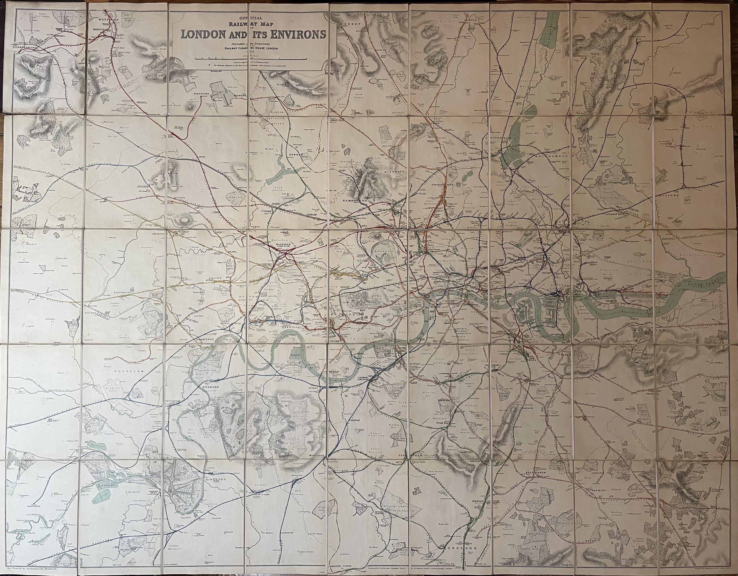
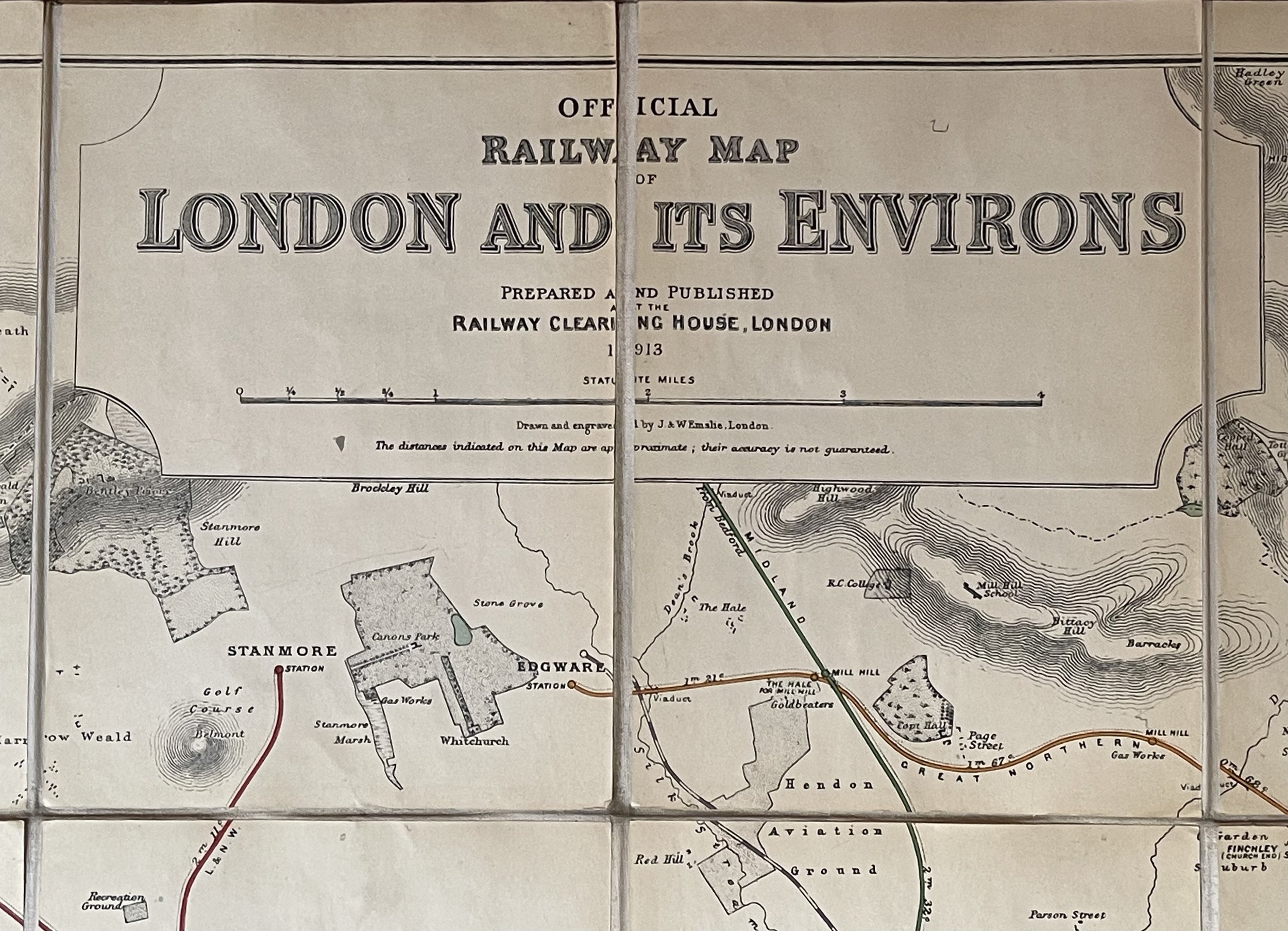
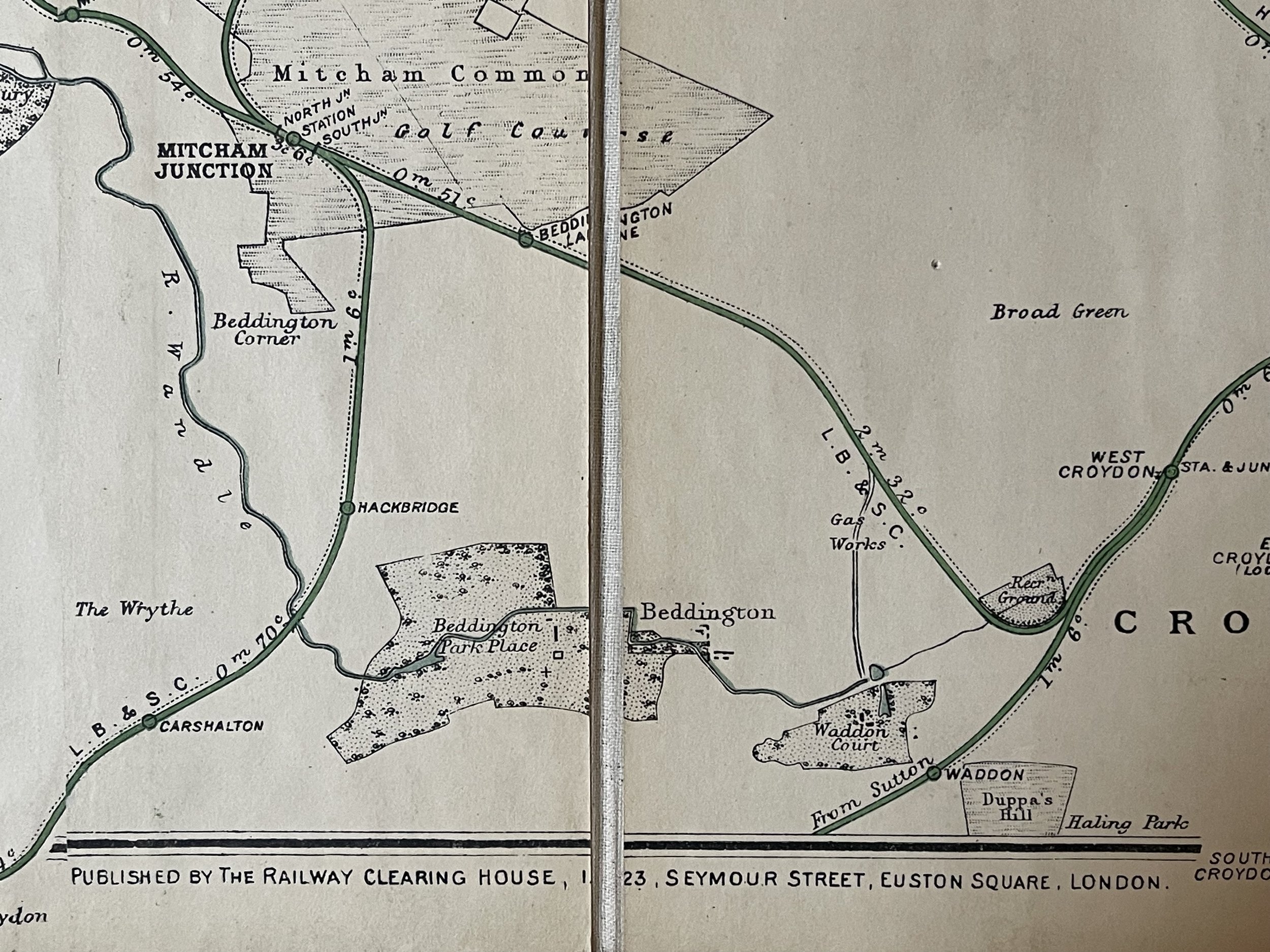
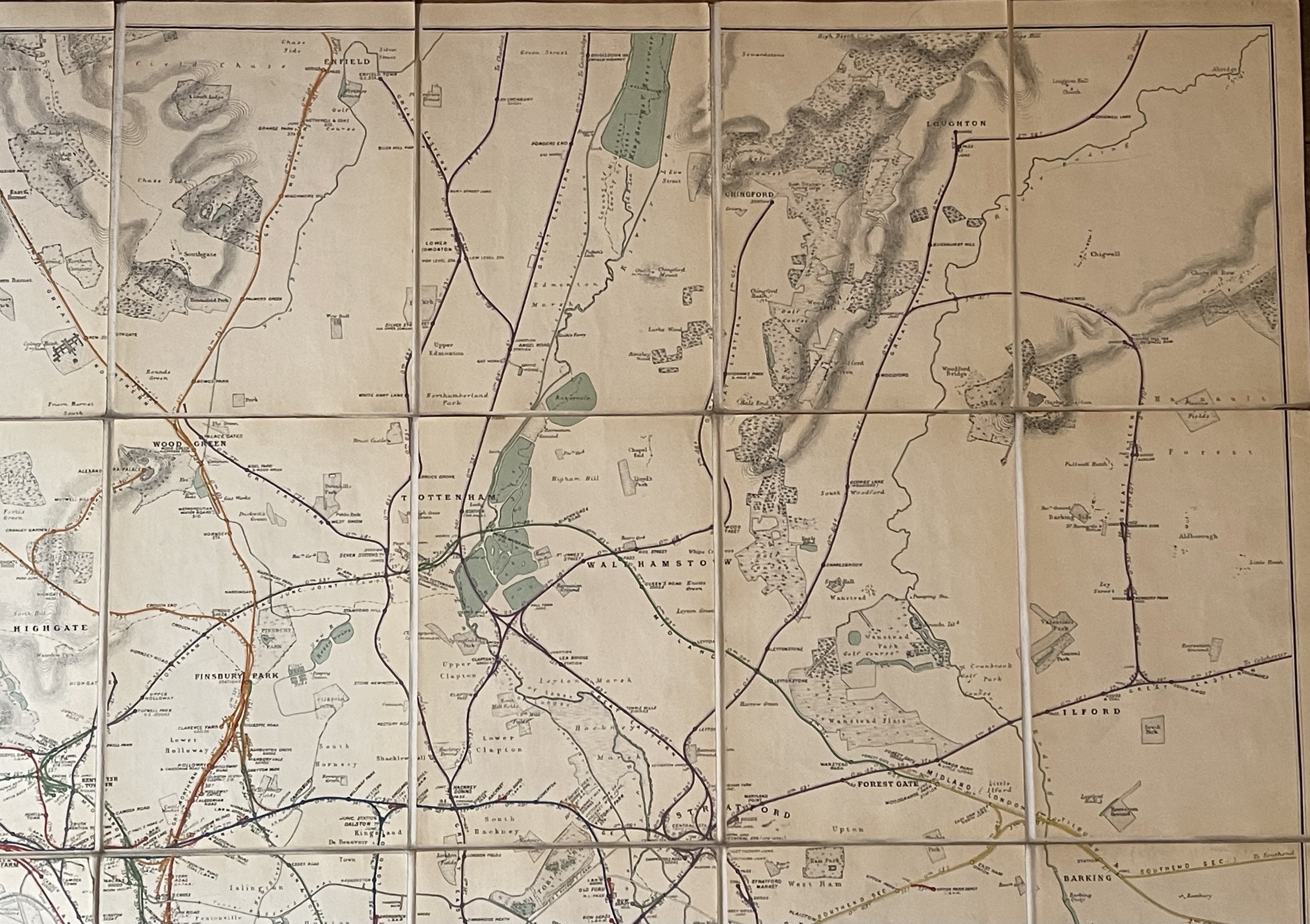
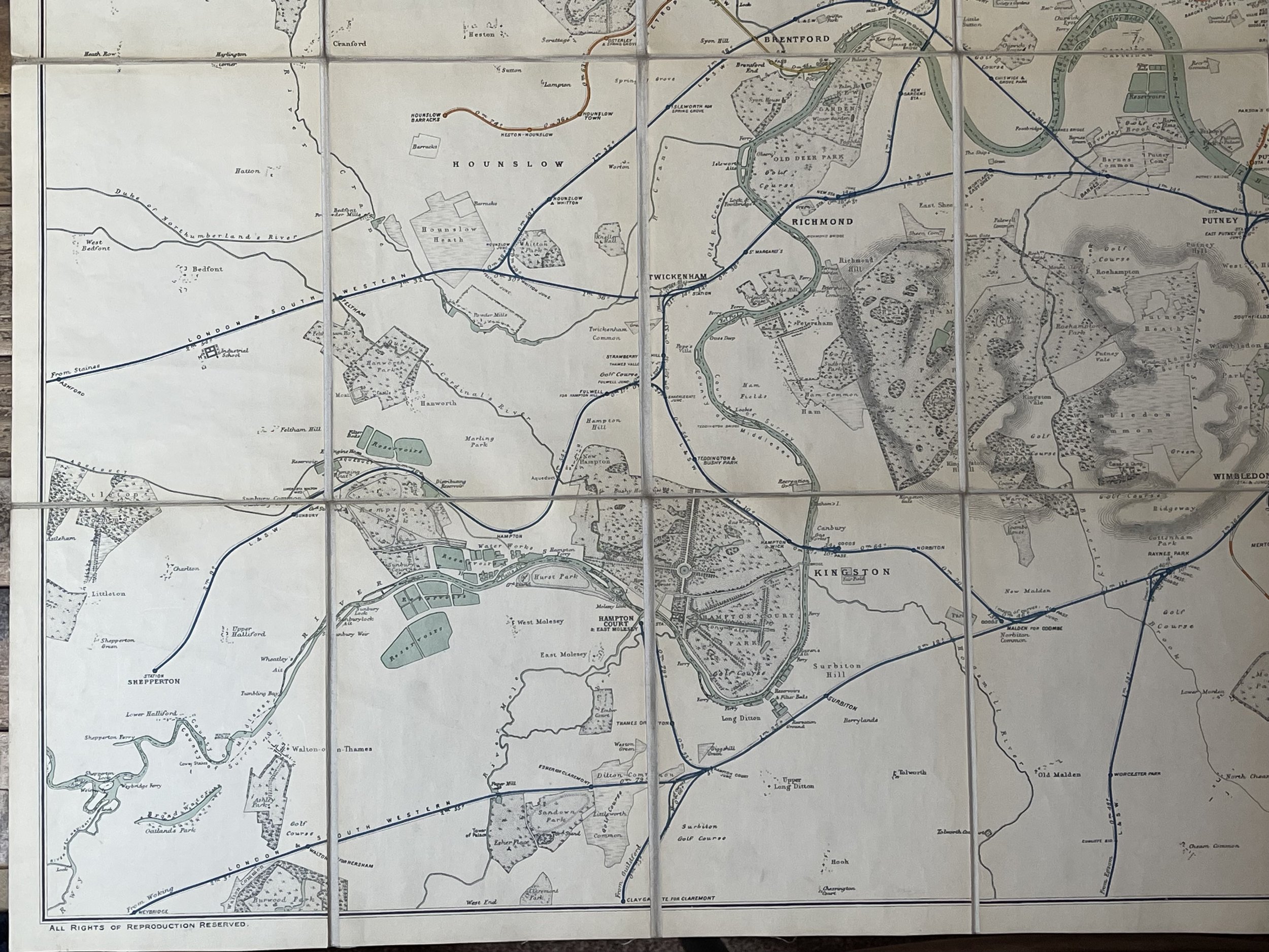
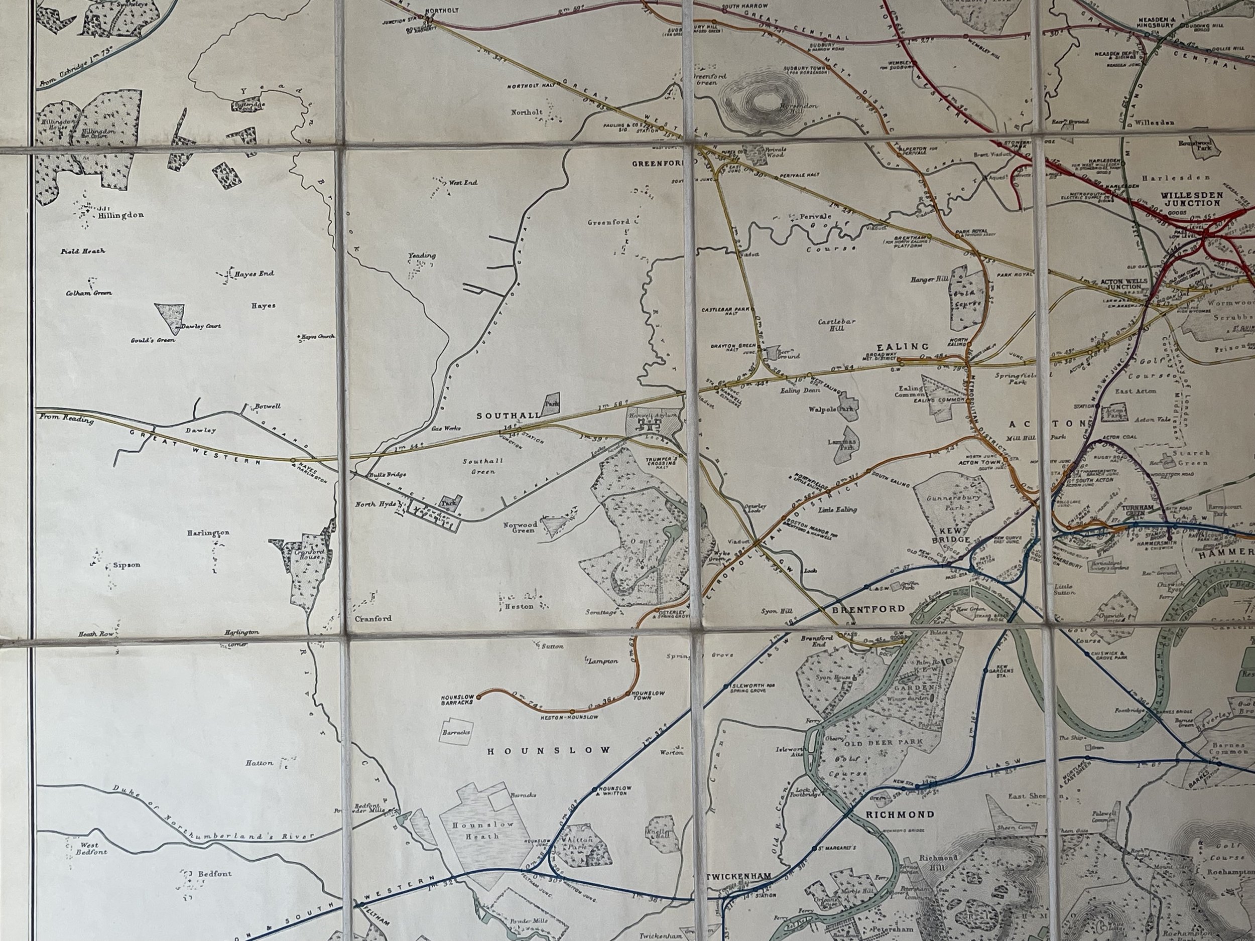
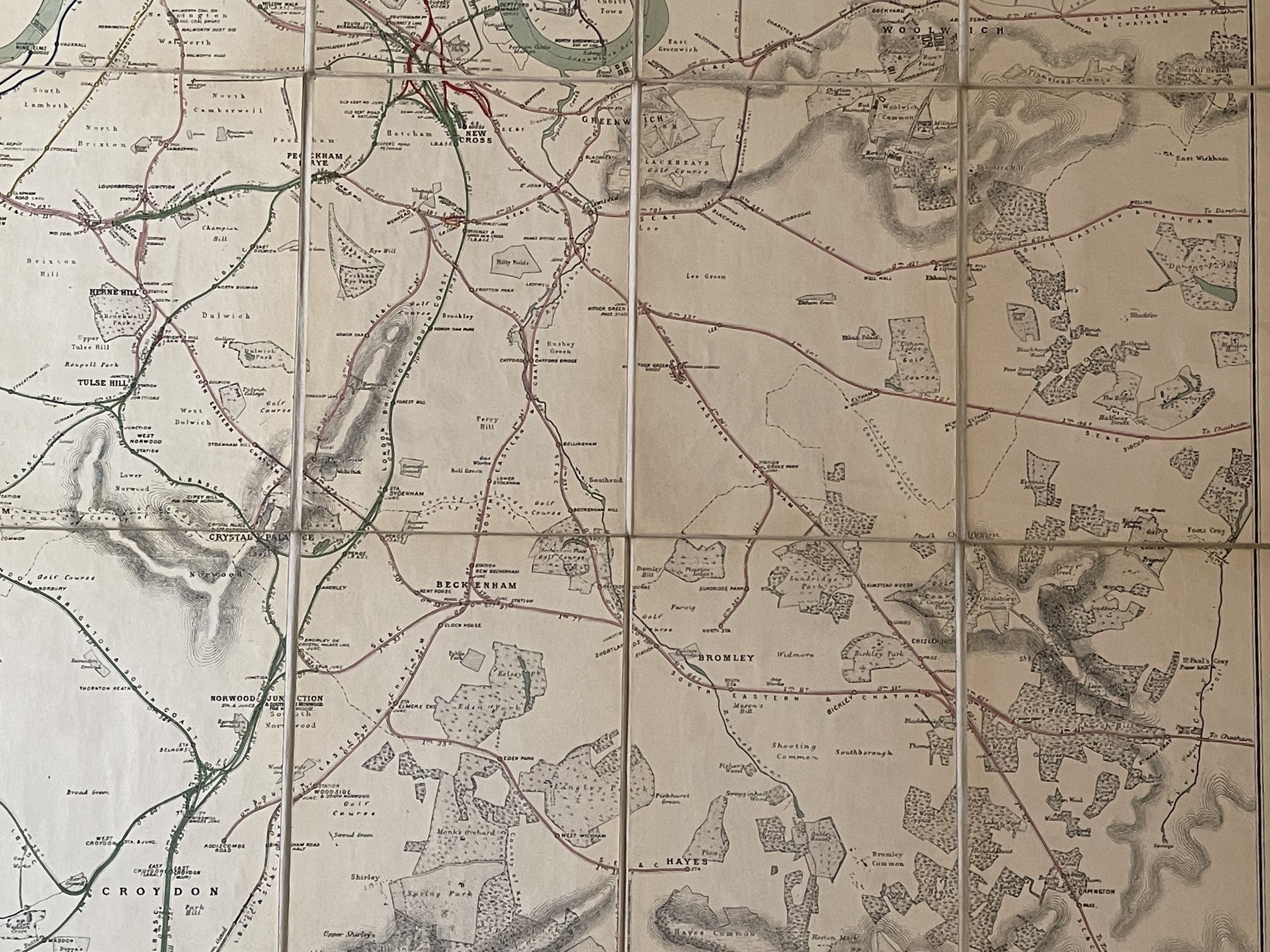
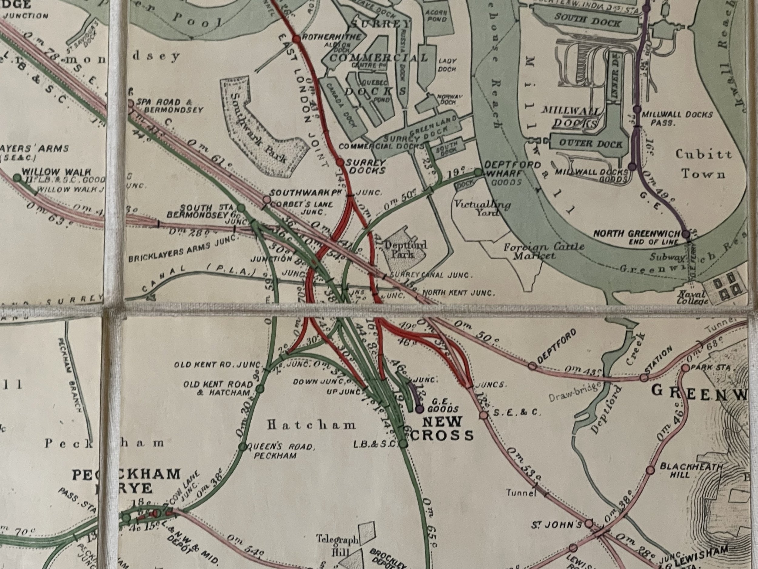
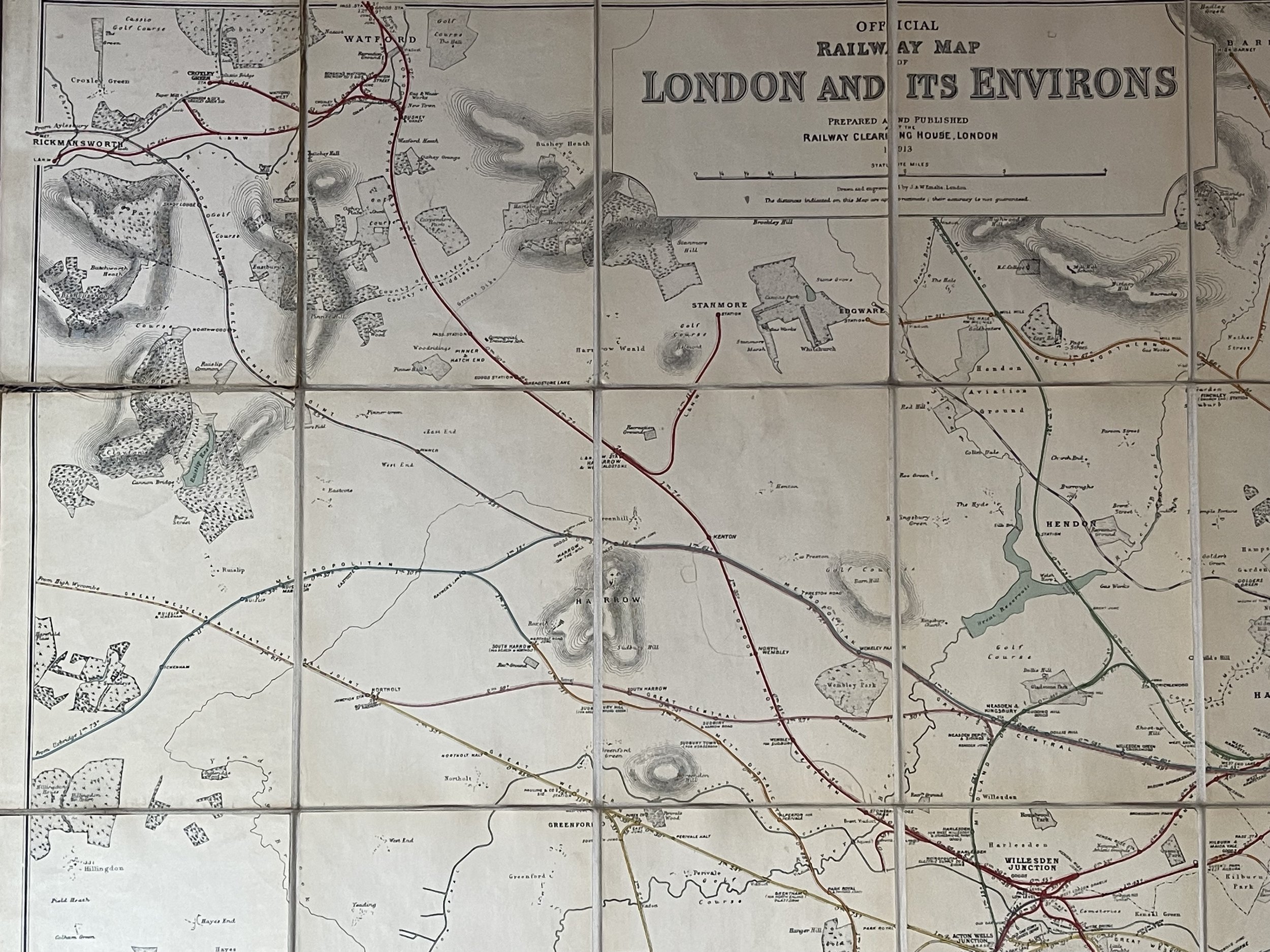
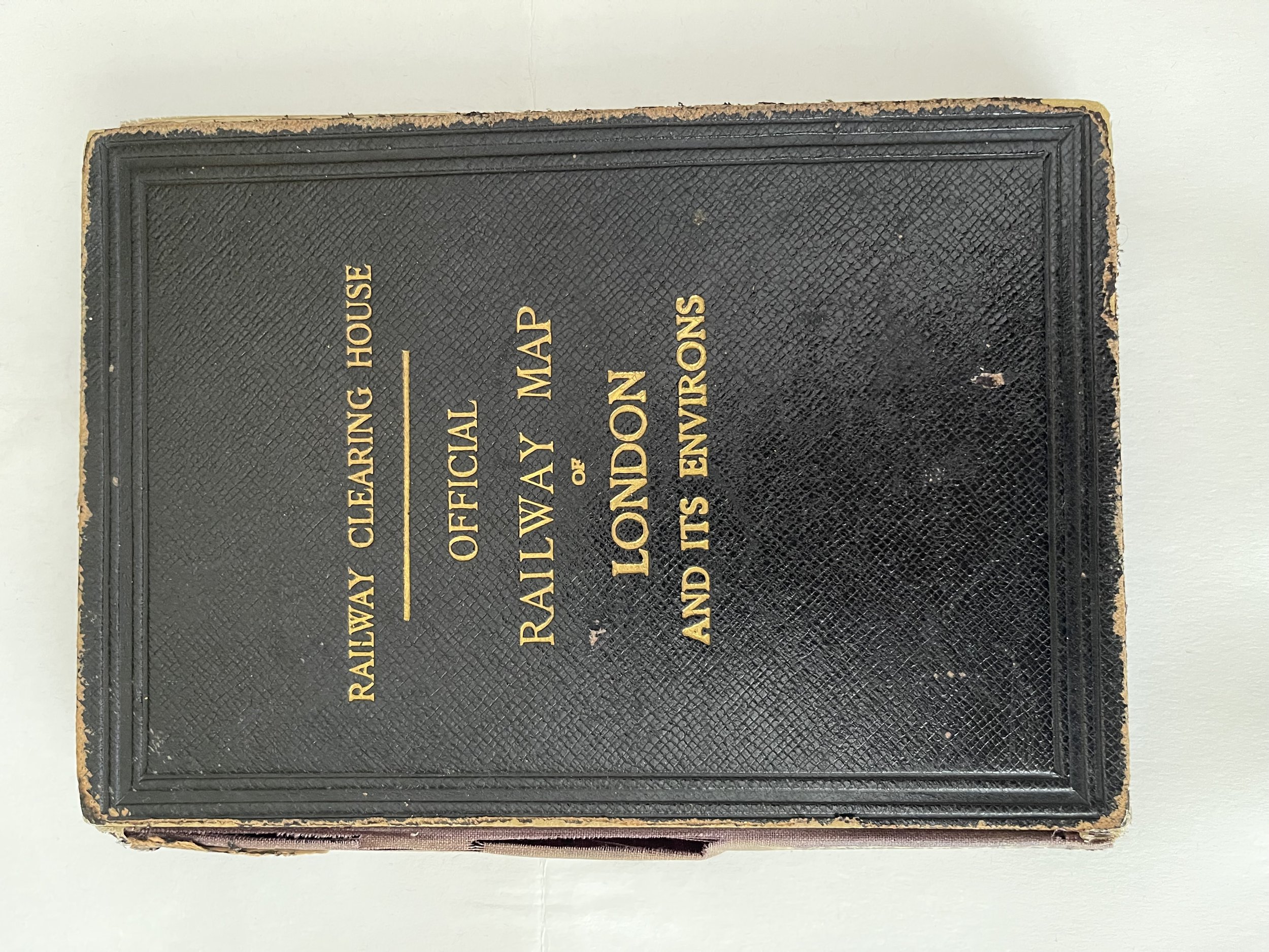
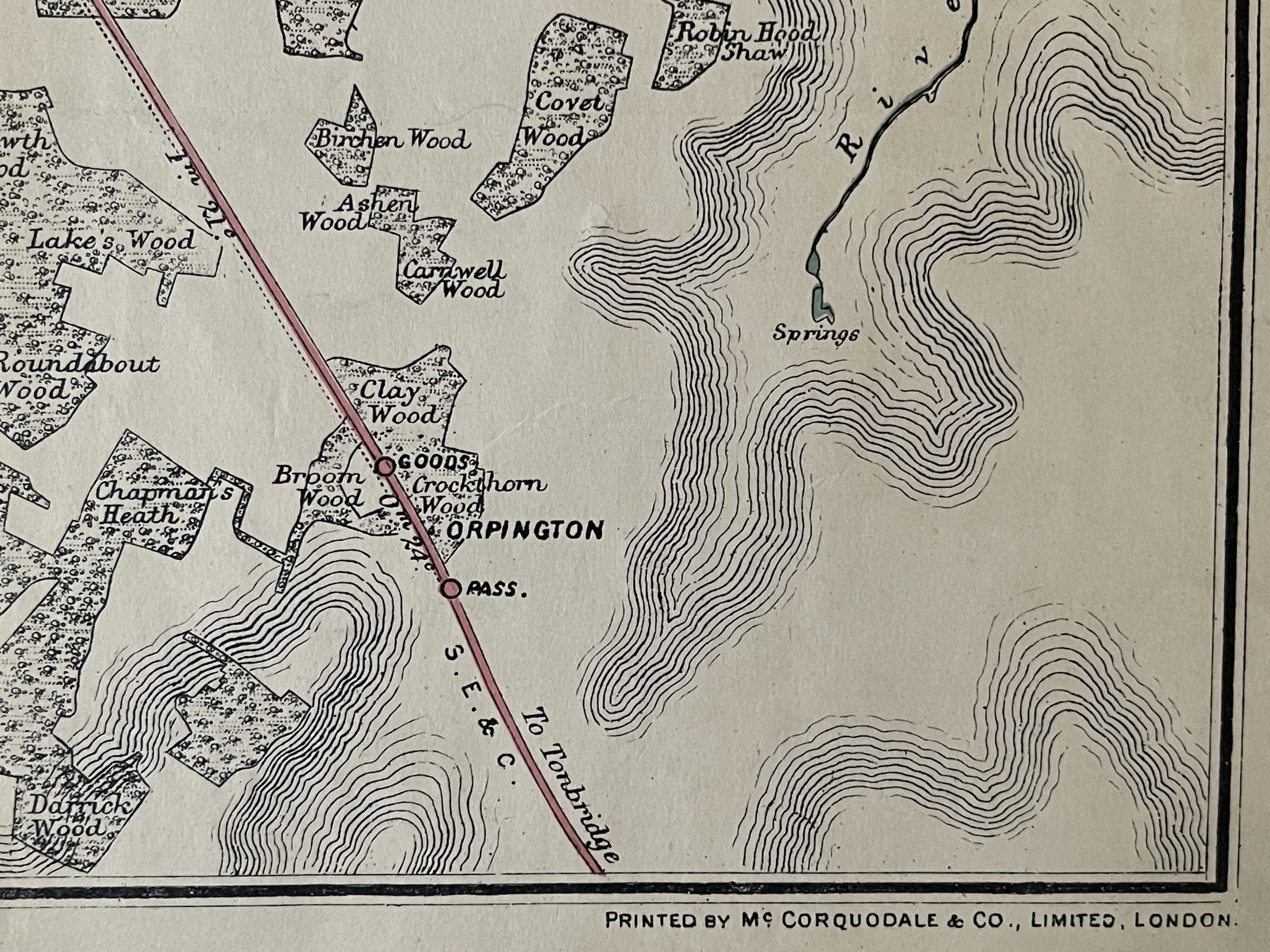
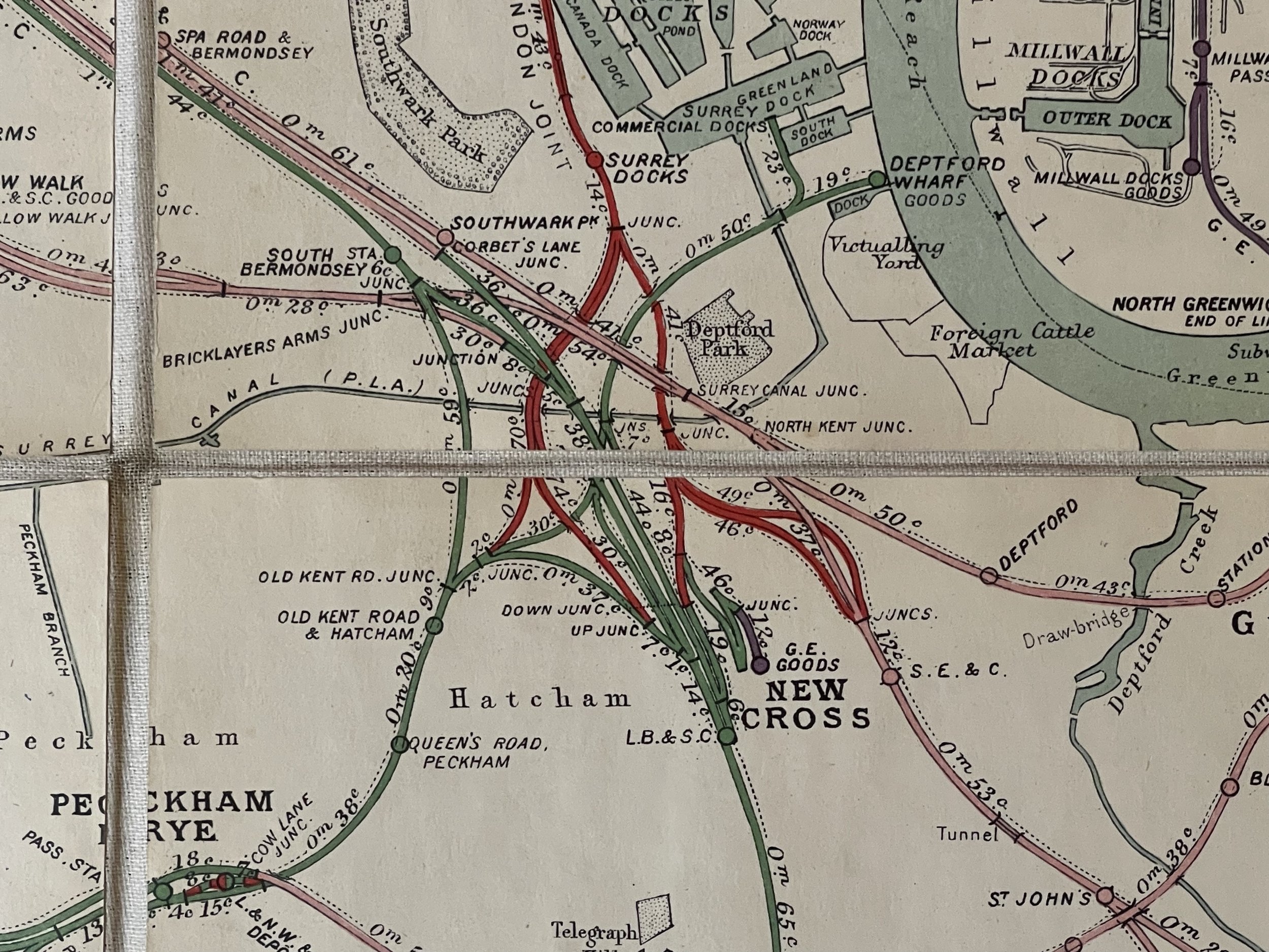
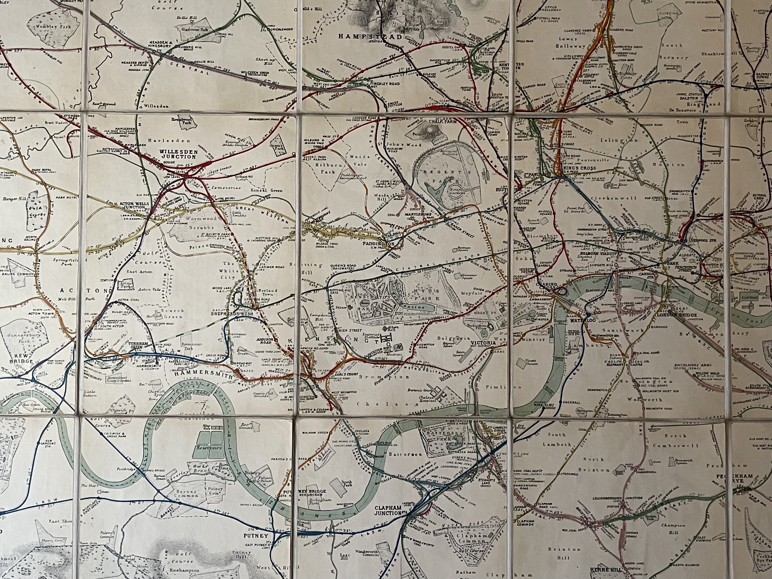
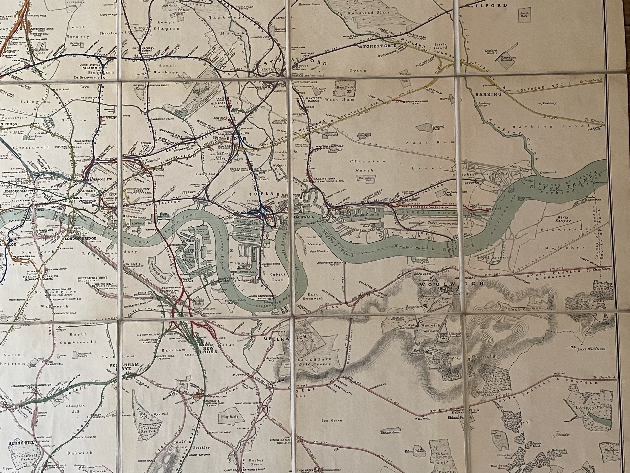
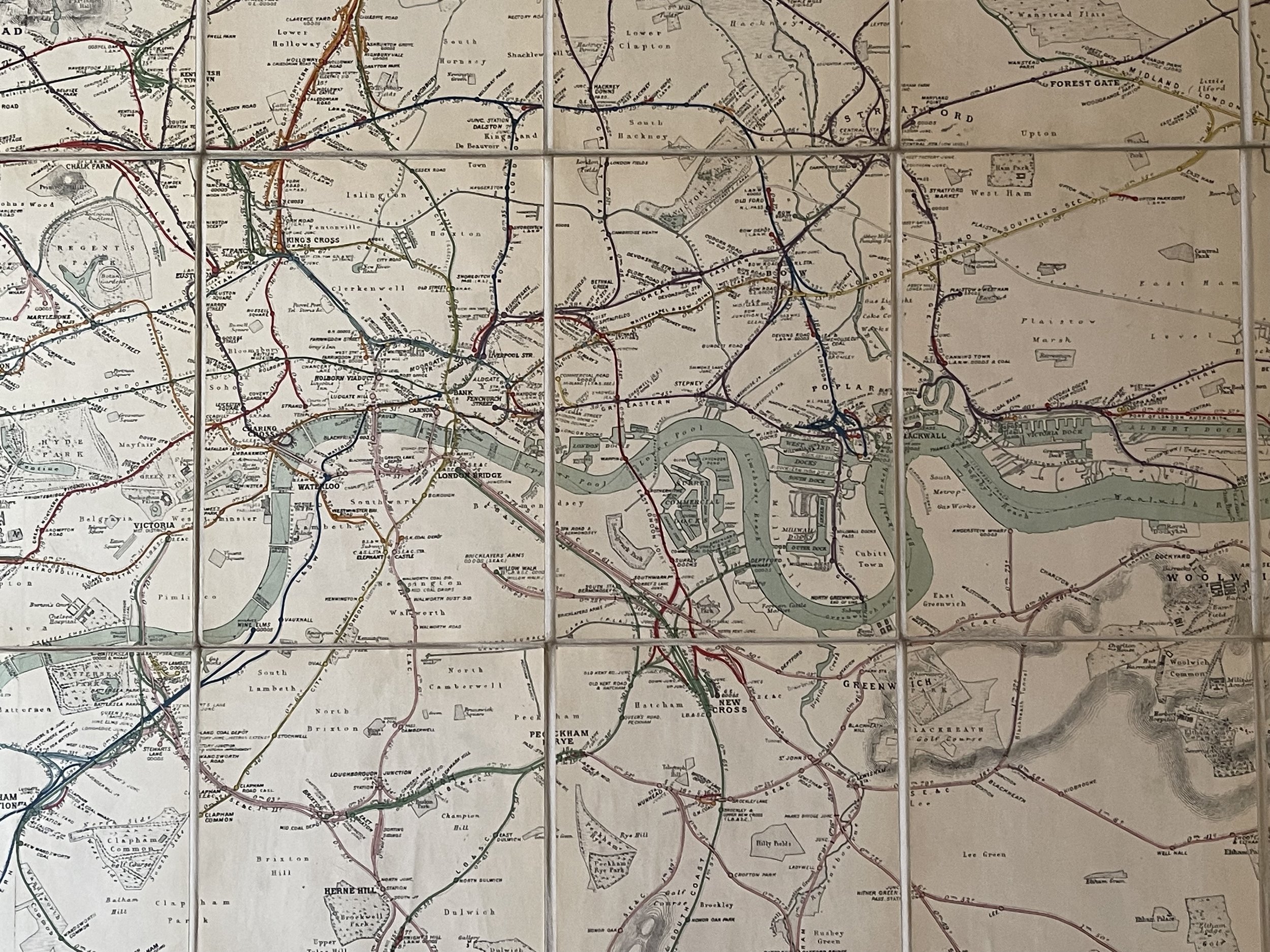
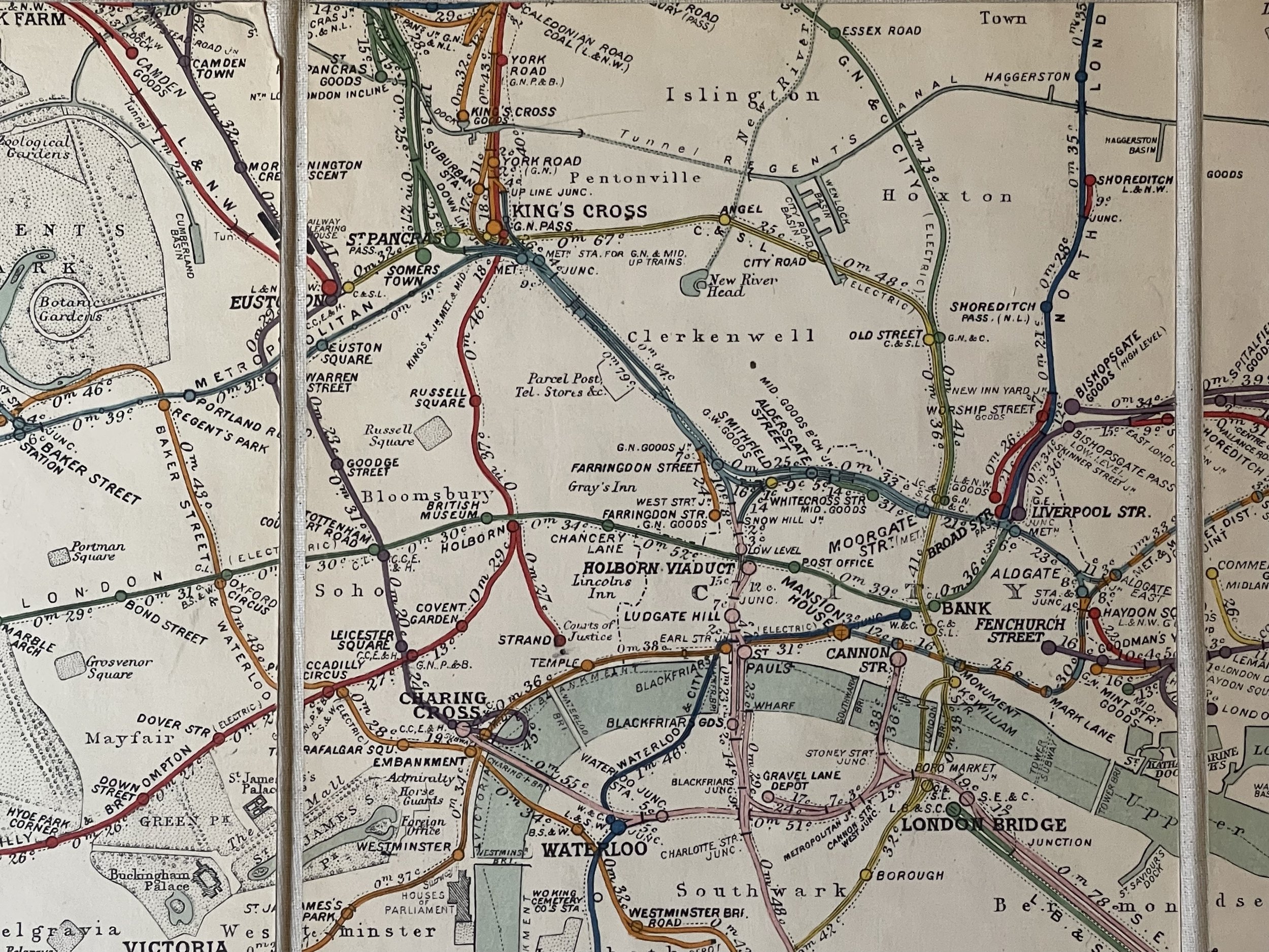
Large Official Railway Map of London and its Environs ", in 45 panels and dated 1913 .
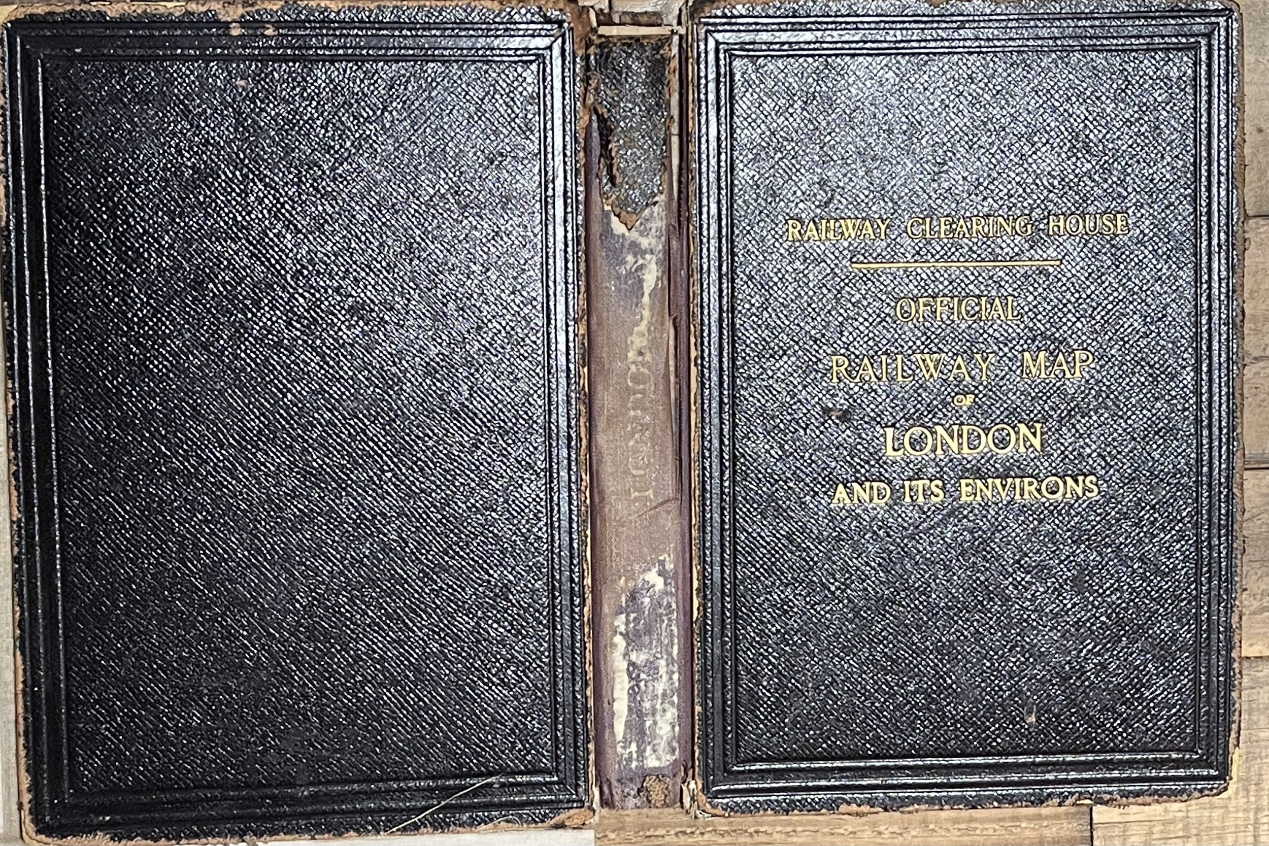
A large folding map laid on linen. The first issue of the map was 1902 and this is the second edition.
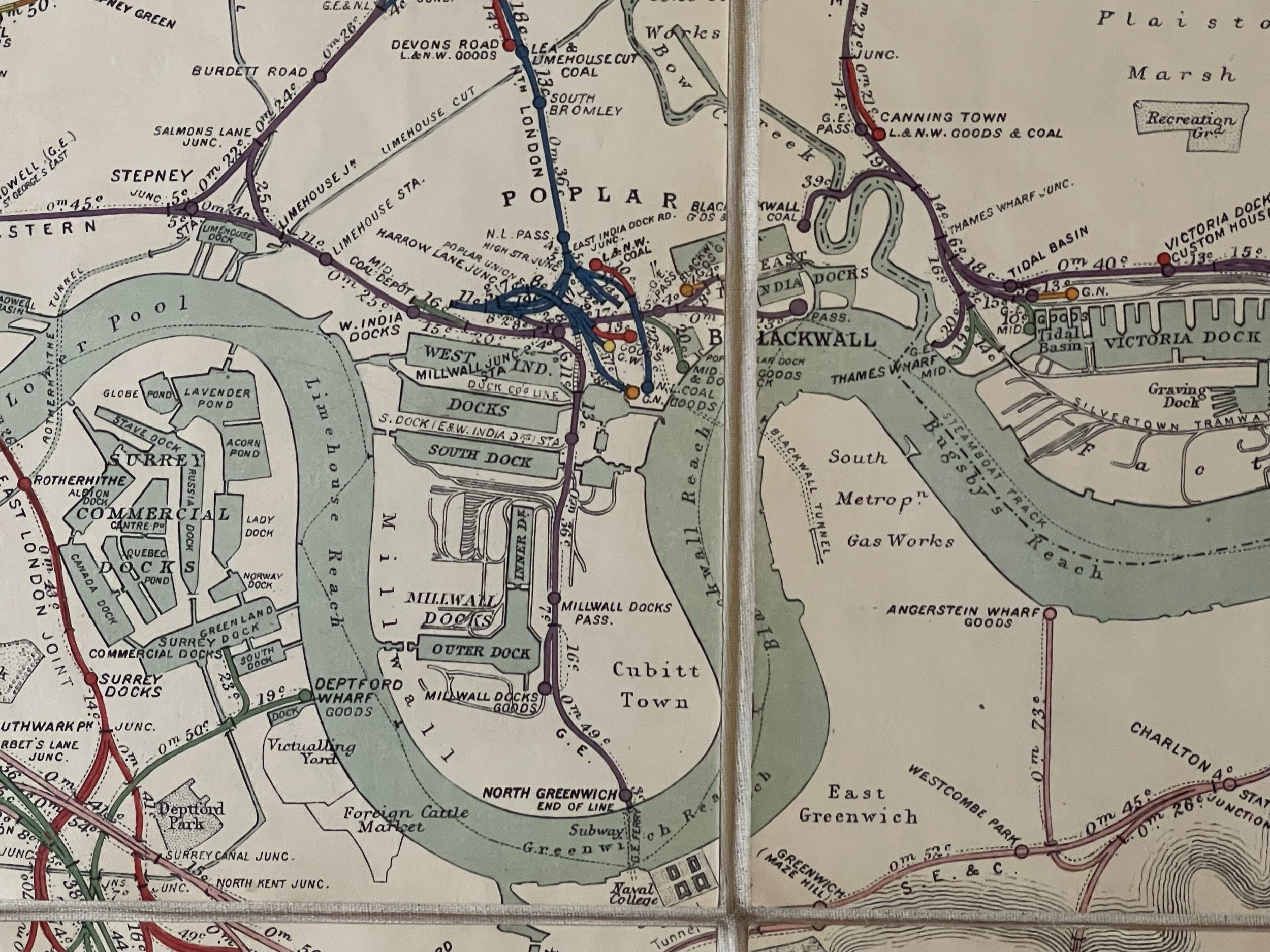
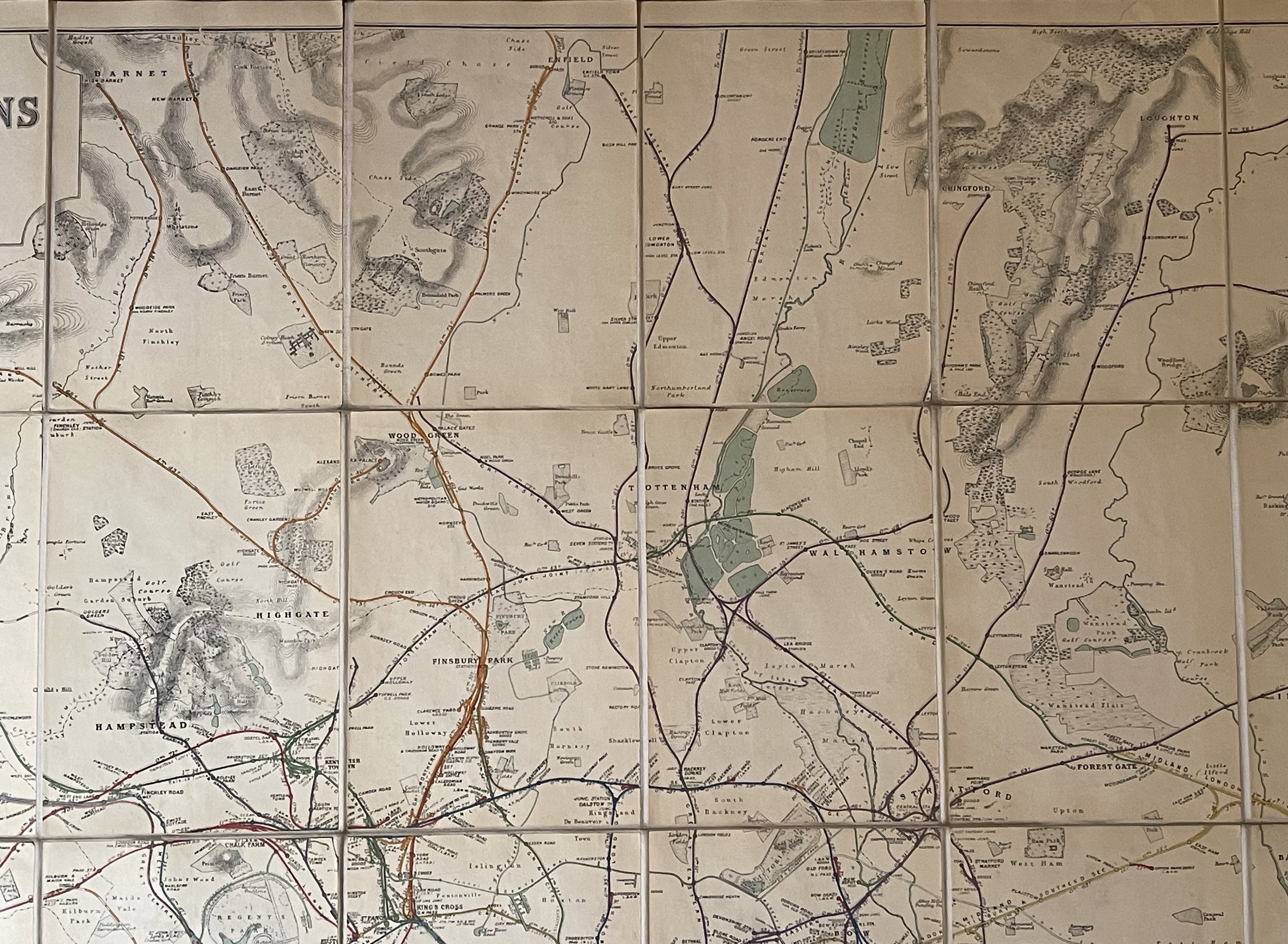
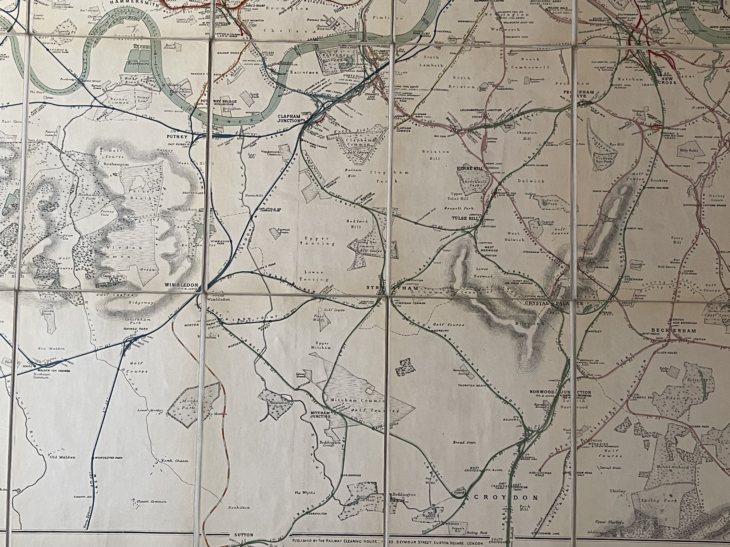
The Franco-British Exhibition site is included on what became White City and covered 140 acres. The tube lines are updated and include approved, and those under construction. A beautifully coloured map in green, red and blue. The tube lines are inserted onto a geographical map. It covers a wide area of London and the Home Counties. Unfaded colour and in good condition with one small area of dame (see photos). Folds and joins good except for the frontispiece board which is almost detached.
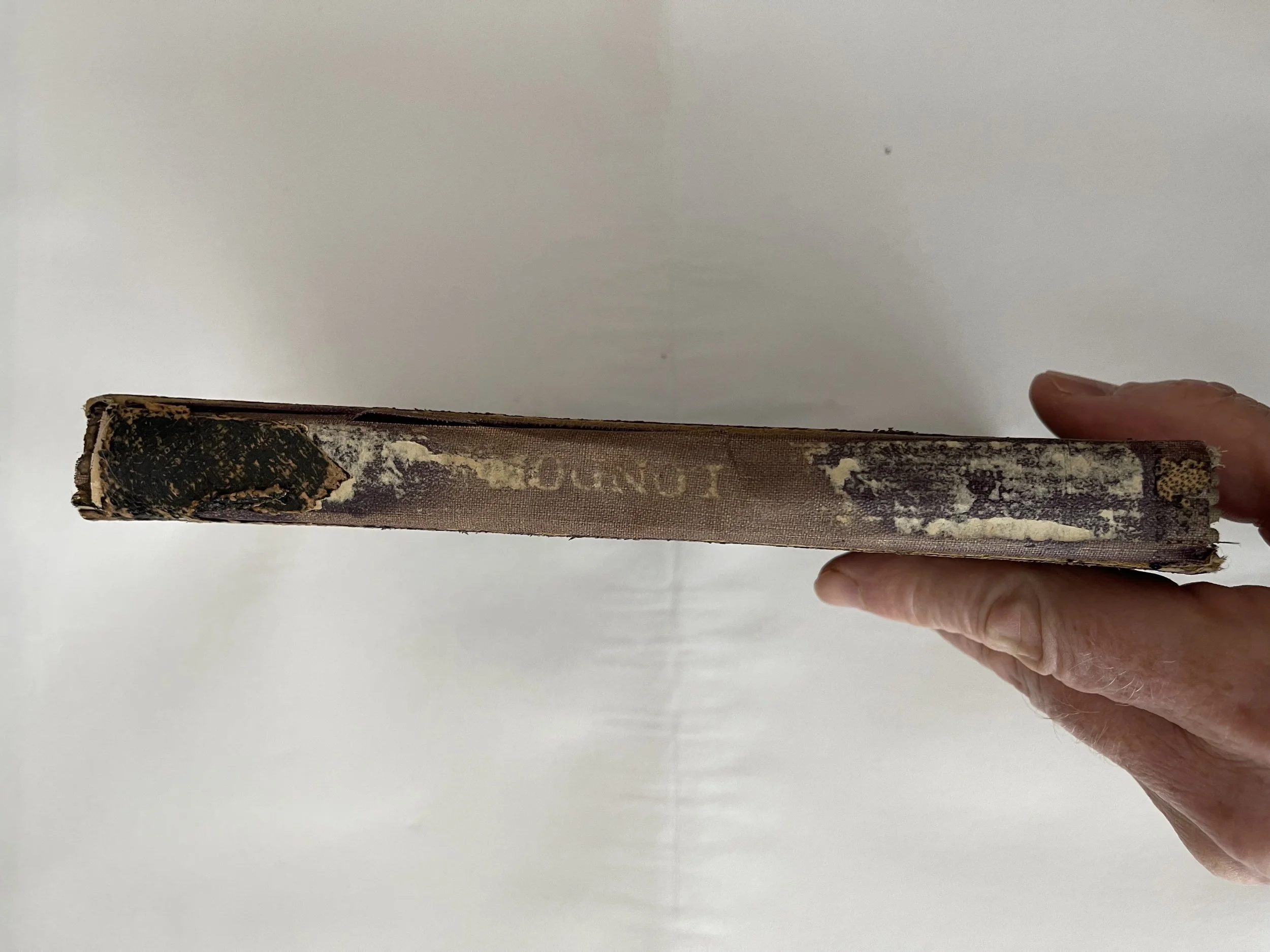
Covers are dirty and worn at extremities, the board spine has damage and wear with map in very good condition. Frontispiece and rear boards intact with wear and tear commensurate of age and use.
The RCH was responsible for the distribution of railway receipts, common standards for railways. The RCH was finally disbanded on 31 March 1963. The RCH was given legal status by a private Act of Parliament, the Railway Clearing Act 1850. Starting in 1859 it also issued what has been described as the "most superb series of railway maps ever produced in the United Kingdom.
J. & W. Emslie - Drawer, Engraver
Drawer and engraver of maps including geology, transport, geography, astronomy and natural philosophy maps including many for the railway. Partnership of J & W Emslie. Some work has been credited to John Emslie alone. The Railway Clearing House (RCH) was an organisation set up to manage the allocation of revenue collected by pre-grouping railway companies for the conveyance of passengers and goods over the lines (or using the rolling stock) of other companies. It went on to become the major regulatory body overseeing the day-to-day running of railways in Great Britain and setting common standards for railway companies, which ensured their safety and interoperability. The RCH also produced fare structures governing many aspects of rail transport at a national level and set limits on price increases for passenger travel.
J&W Emslie / Published by the Railway Clearing House
Large Official Railway Map of London and its Environs ", in 45 panels and dated 1913 .
A large folding map laid on linen. The first issue of the map was 1902 and this is the second edition.
The Franco-British Exhibition site is included on what became White City and covered 140 acres. The tube lines are updated and include approved, and those under construction. A beautifully coloured map in green, red and blue. The tube lines are inserted onto a geographical map. It covers a wide area of London and the Home Counties. Unfaded colour and in good condition with one small area of dame (see photos). Folds and joins good except for the frontispiece board which is almost detached.
Covers are dirty and worn at extremities, the board spine has damage and wear with map in very good condition. Frontispiece and rear boards intact with wear and tear commensurate of age and use.
The RCH was responsible for the distribution of railway receipts, common standards for railways. The RCH was finally disbanded on 31 March 1963. The RCH was given legal status by a private Act of Parliament, the Railway Clearing Act 1850. Starting in 1859 it also issued what has been described as the "most superb series of railway maps ever produced in the United Kingdom.
J. & W. Emslie - Drawer, Engraver
Drawer and engraver of maps including geology, transport, geography, astronomy and natural philosophy maps including many for the railway. Partnership of J & W Emslie. Some work has been credited to John Emslie alone. The Railway Clearing House (RCH) was an organisation set up to manage the allocation of revenue collected by pre-grouping railway companies for the conveyance of passengers and goods over the lines (or using the rolling stock) of other companies. It went on to become the major regulatory body overseeing the day-to-day running of railways in Great Britain and setting common standards for railway companies, which ensured their safety and interoperability. The RCH also produced fare structures governing many aspects of rail transport at a national level and set limits on price increases for passenger travel.
Code : A853
Cartographer : Cartographer / Engraver / Publisher: RCH
Date : Publication Place / Date - 1913
Size : Sheet size: Image Size: 54 x 40 cm
Availability : Available
Type - Genuine - Antique
Grading A-
Where Applicable - Folds as issued. Light box photo shows the folio leaf centre margin hinge ‘glue’, this is not visible otherwise.
Tracked postage, in casement. Please contact me for postal quotation outside of the UK.