Sarmatia modern Ukraine and Russia - R W Seale / Cellarius - 1740-1762
Sarmatia modern Ukraine and Russia 18th century 1740
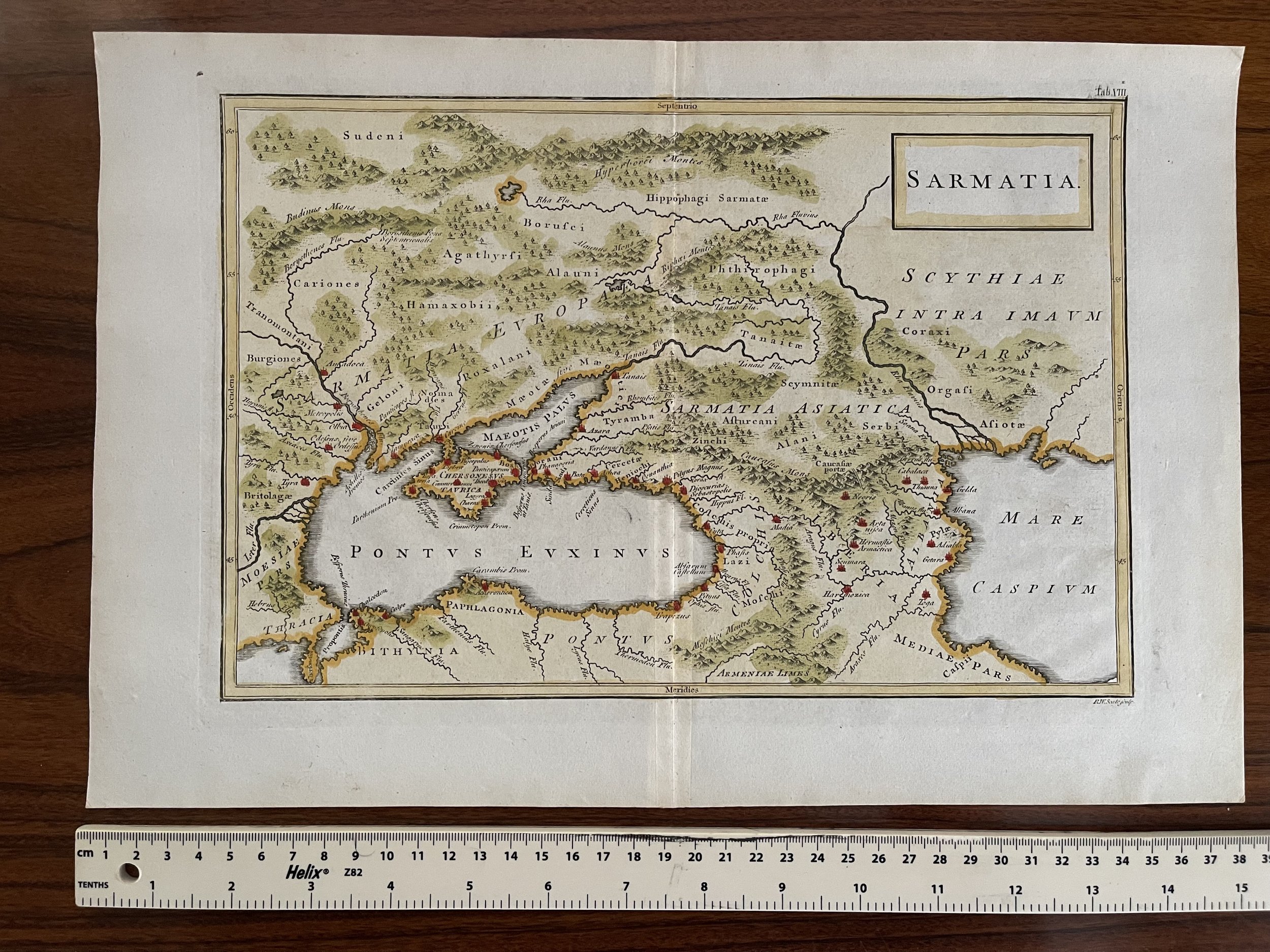
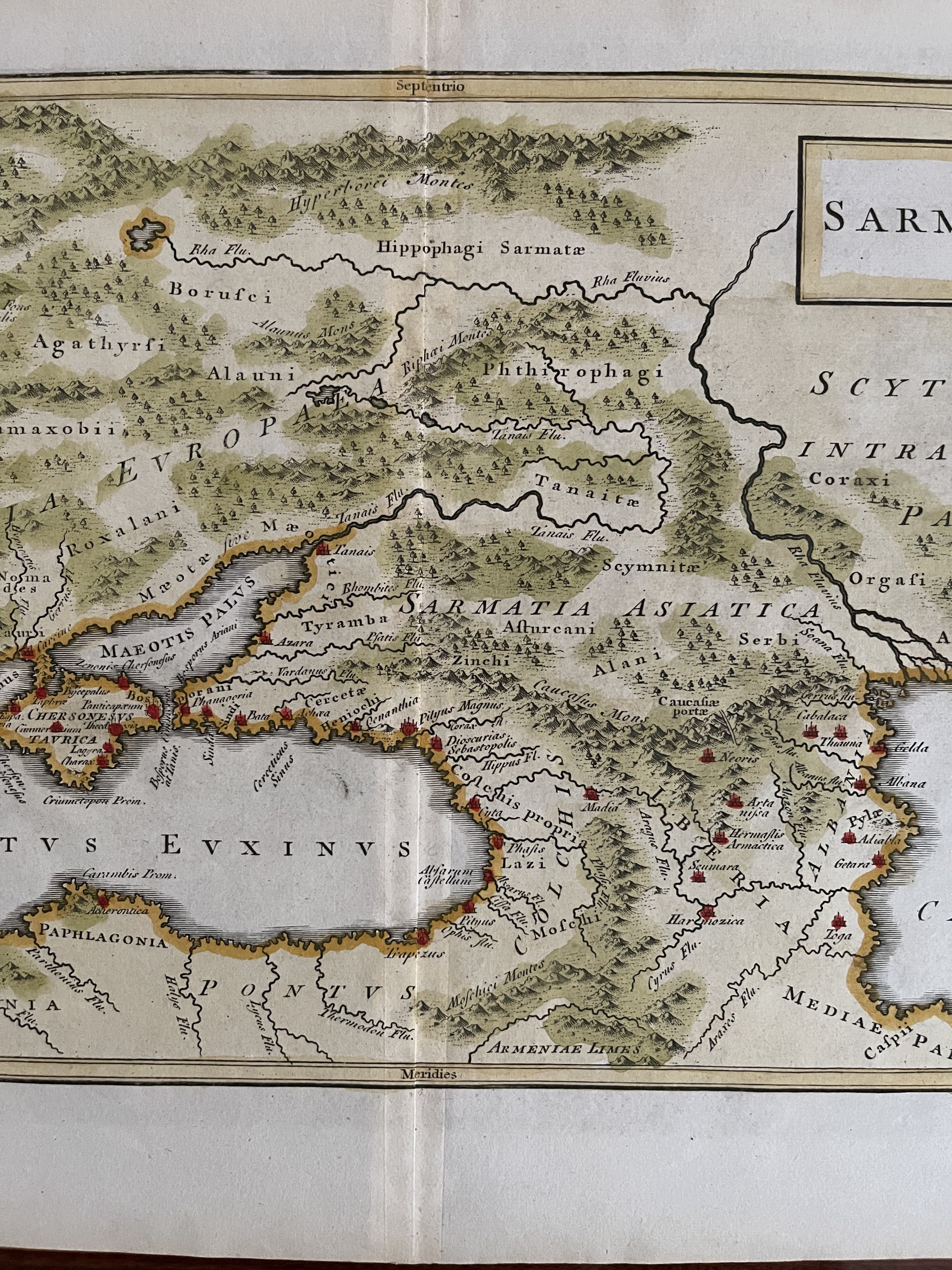
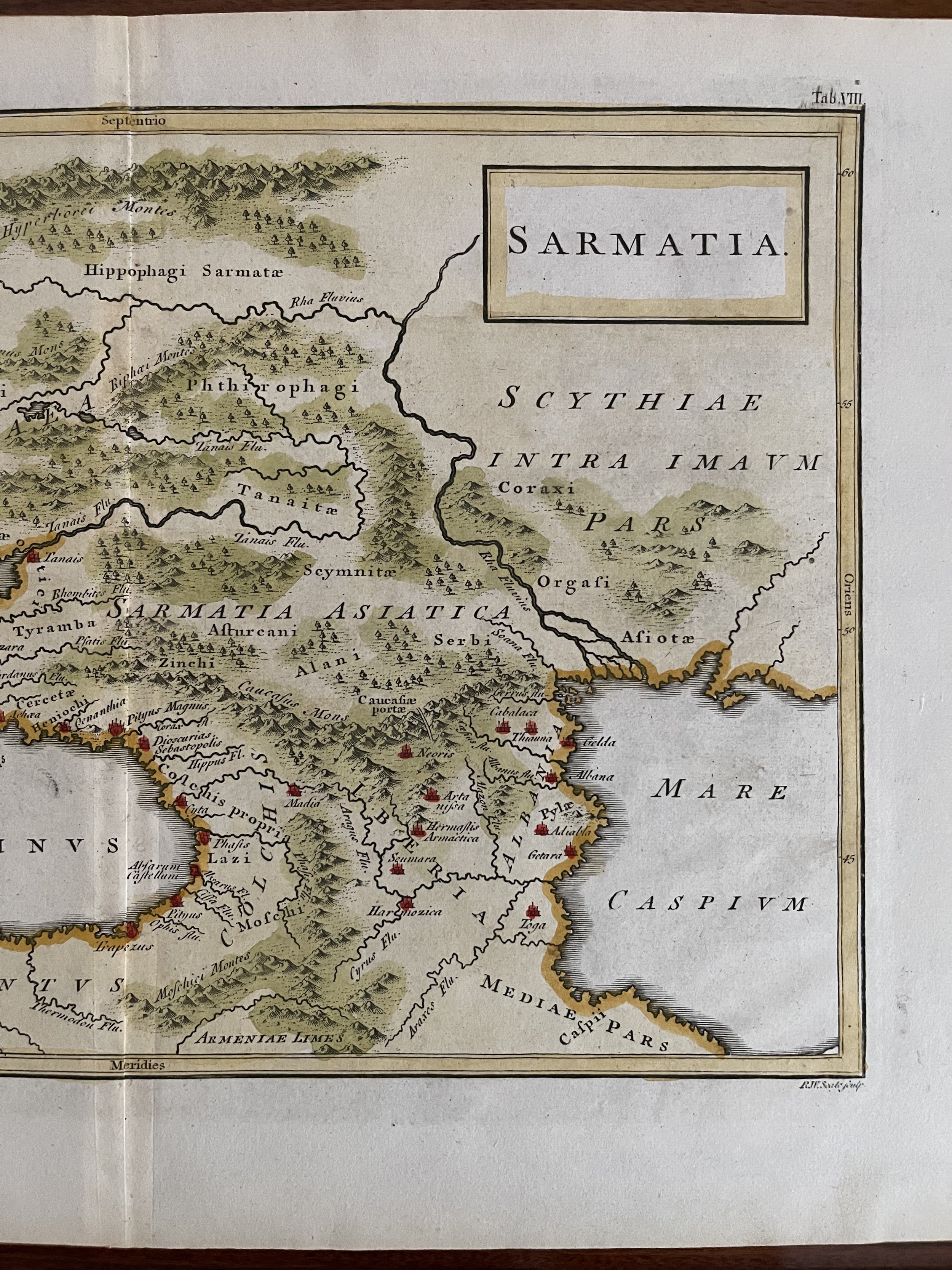
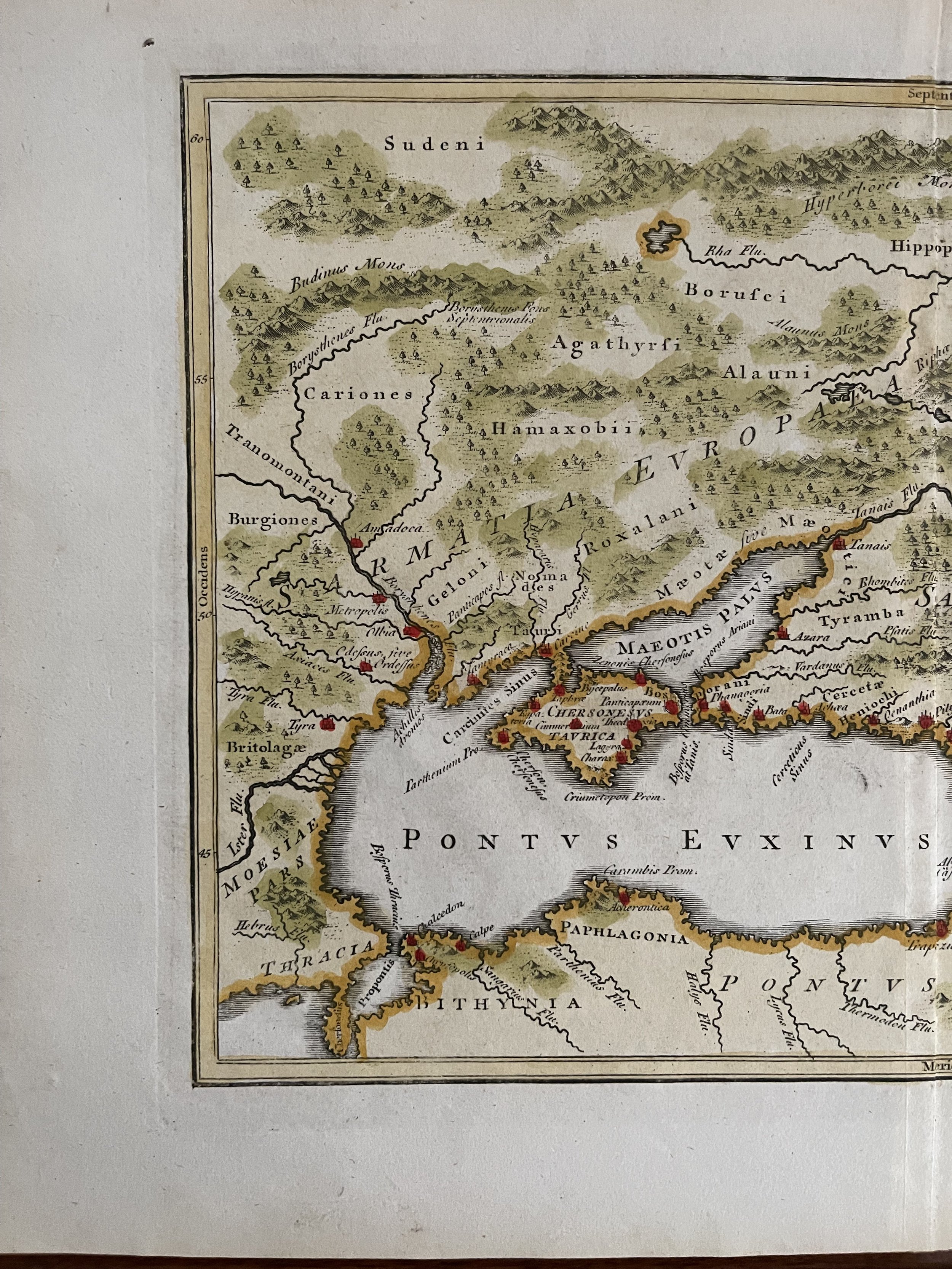
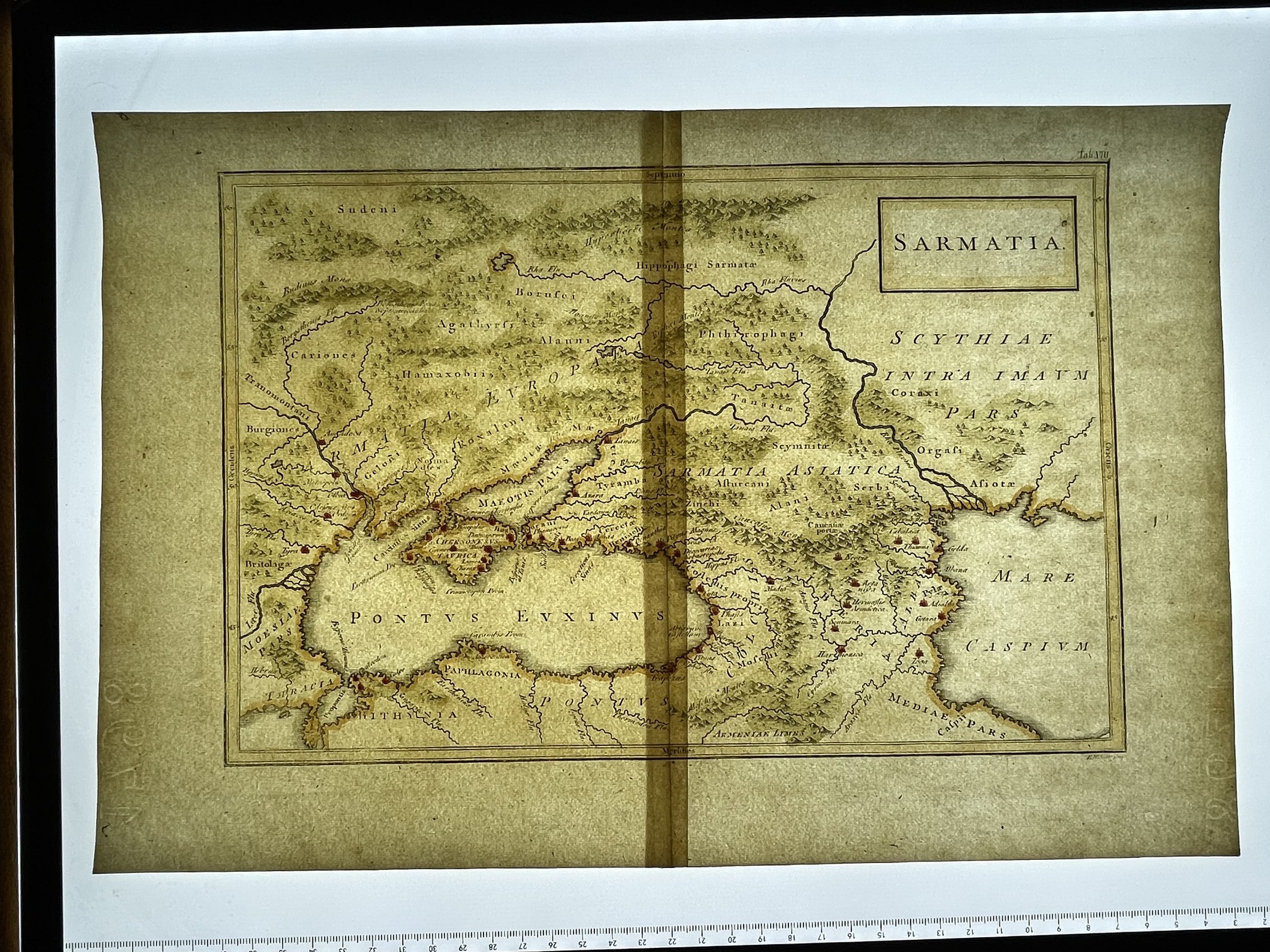
Description: Antique map titled 'Sarmatia'. Old map of the Caucasus with the Caspian and Black Sea. Originates from 'Geographia AntiquaThis is a map of Sarmatia, an area connected with the Sarmatian peoples who flourished between the 5th century BC and the 4th century AD. As such, this antique map relates to Classical times of the old Roman Empire, and it features the Latin language. The indentations made by the copperplate engraving process can be seen on this print, which dates from around 1740. A finely engraved map of Samartia from an atlas based on the work of Christoph Cellarius. Cellarius (1638-1707) was a classical scholar important for his breaking history into the ancient, medieval and modern periods in his influential Universal History. This map is from a late eighteenth century version of Geographia Antiqua, which provided cartographic depictions of various regions in Europe, Asia and Africa as they were situated in ancient times. The intended use of the maps was explained on the title page of the atlas: “Designed for the Use of Schools, and of Gentlemen who make the Antient [sic] Writers their Delight or Study.” These were among the most commonly studied maps of the ancient world and so had a large impact on the understanding of the period held by “modern” scholars and students.
Seale, Richard William (December 1703 - May 25, 1762)
Richard William Seale (December 1703 - May 25, 1762) was an English a mapmaker and engraver active in London during the middle part of the 18th century. Seale was the son of Richard and Elizabeth Seale. Richard, his father, was a member of the Stationers Company, suggesting that printing and engraving must have been a family trade. Nonetheless, he did not learn the trade from his father, but rather from Samuel Parker of Clerkenwell, to whom he was apprenticed in 1719. Seale was extremely active as an engraver and publisher from about 1740 until his death in 1762. His cartographic corpus is vast; including pieces engraved for most other notable English cartographers of his period: Willdey, Baron, Toms, Rocque, Basire, Bowles, Benning, among others. In addition to cartographic work, Seale also produce numerous architectural engravings.
Sarmatia modern Ukraine and Russia 18th century 1740
Description: Antique map titled 'Sarmatia'. Old map of the Caucasus with the Caspian and Black Sea. Originates from 'Geographia AntiquaThis is a map of Sarmatia, an area connected with the Sarmatian peoples who flourished between the 5th century BC and the 4th century AD. As such, this antique map relates to Classical times of the old Roman Empire, and it features the Latin language. The indentations made by the copperplate engraving process can be seen on this print, which dates from around 1740. A finely engraved map of Samartia from an atlas based on the work of Christoph Cellarius. Cellarius (1638-1707) was a classical scholar important for his breaking history into the ancient, medieval and modern periods in his influential Universal History. This map is from a late eighteenth century version of Geographia Antiqua, which provided cartographic depictions of various regions in Europe, Asia and Africa as they were situated in ancient times. The intended use of the maps was explained on the title page of the atlas: “Designed for the Use of Schools, and of Gentlemen who make the Antient [sic] Writers their Delight or Study.” These were among the most commonly studied maps of the ancient world and so had a large impact on the understanding of the period held by “modern” scholars and students.
Seale, Richard William (December 1703 - May 25, 1762)
Richard William Seale (December 1703 - May 25, 1762) was an English a mapmaker and engraver active in London during the middle part of the 18th century. Seale was the son of Richard and Elizabeth Seale. Richard, his father, was a member of the Stationers Company, suggesting that printing and engraving must have been a family trade. Nonetheless, he did not learn the trade from his father, but rather from Samuel Parker of Clerkenwell, to whom he was apprenticed in 1719. Seale was extremely active as an engraver and publisher from about 1740 until his death in 1762. His cartographic corpus is vast; including pieces engraved for most other notable English cartographers of his period: Willdey, Baron, Toms, Rocque, Basire, Bowles, Benning, among others. In addition to cartographic work, Seale also produce numerous architectural engravings.
Code : A176
Cartographer : Cartographer / Engraver / Publisher: R W Seale
Date : Publication Place / Date - Belgium 1740
Size : Sheet size: Image Size: 25.5 cm x 38.5 cm
Availability : Available
Type - Genuine - Antique
Grading A
Where Applicable - Folds as issued. Light box photo shows the folio leaf centre margin hinge ‘glue’, this is not visible otherwise.
Tracked postage, in casement. Please contact me for postal quotation outside of the UK.