Highly detailed large format map of the Southern Hemisphere, showing the tracks of the major voyages of exploration in the Southern Hemisphere from 1595 to 1775.
The map was prepared to illustrate the French edition of Cook's report of his voyages in the region. The map includes the coastlines of Australia, New Zealand and part of SE Asia, Africa and South America. The primary feature of the map is the remarkably detailed depiction of the various voyages in the Southern Hemisphere, including the voyages of Mendana (1595), Quiros (1606), Le Maire and Schoeten (1616), Tasman (1642), Halley (1700), Roggewein (1722), Bouvet (1738-39), Carteret (1767), Wallis (1767), Byron (1768), Bouganville (1768) Cook (1770-75), and others.
In addition to the map is a detailed set of tables of Latitudes and Discoveries, covering approximately 60 islands, bays, and other locales. A highly collectable map.
Some minor red blemishes to the bottom very edge of the map perimeter well outside of the engraving, neatline and borders. Slight foxing stripe from north to south visible also.
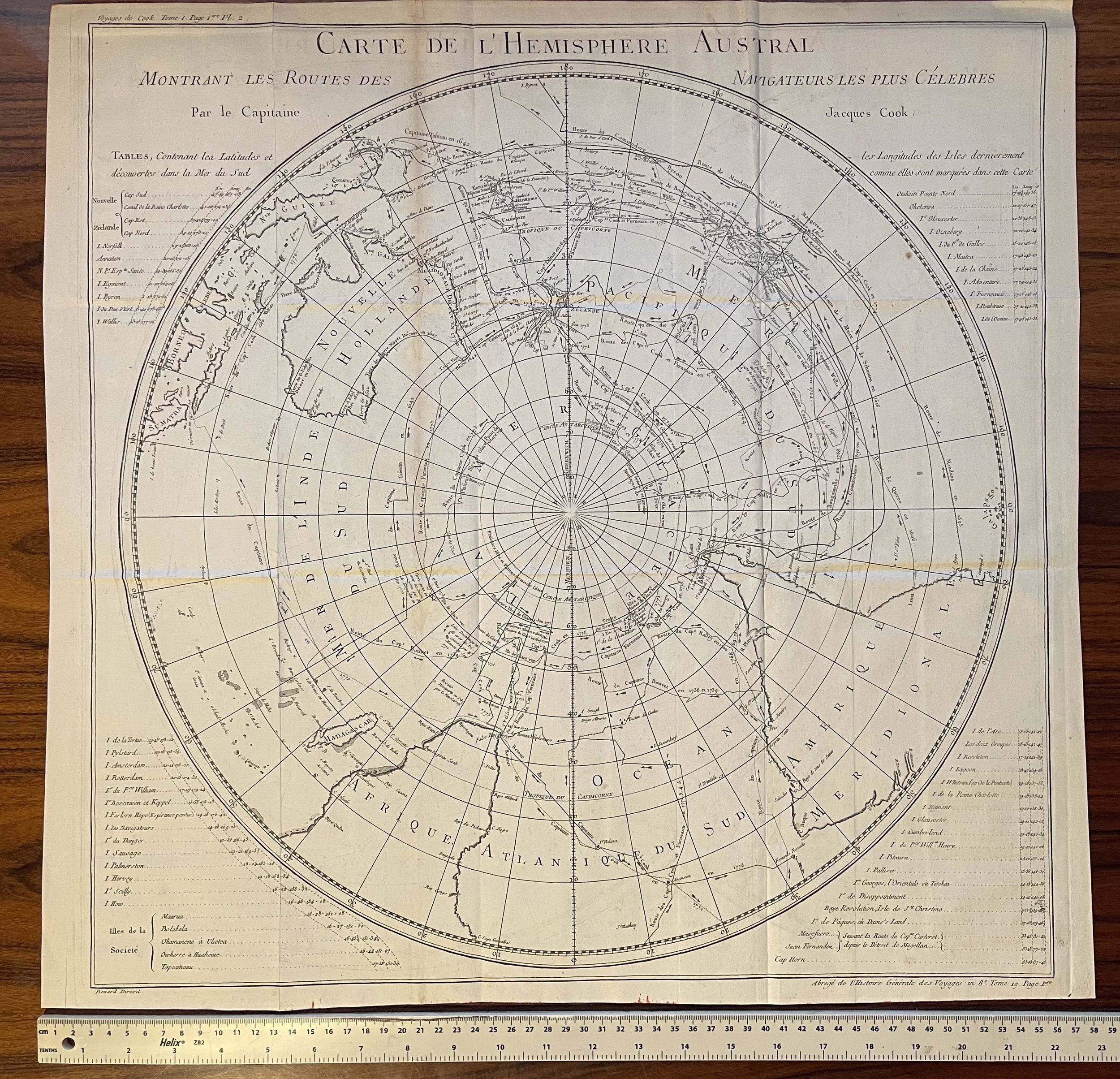 Image 1 of 10
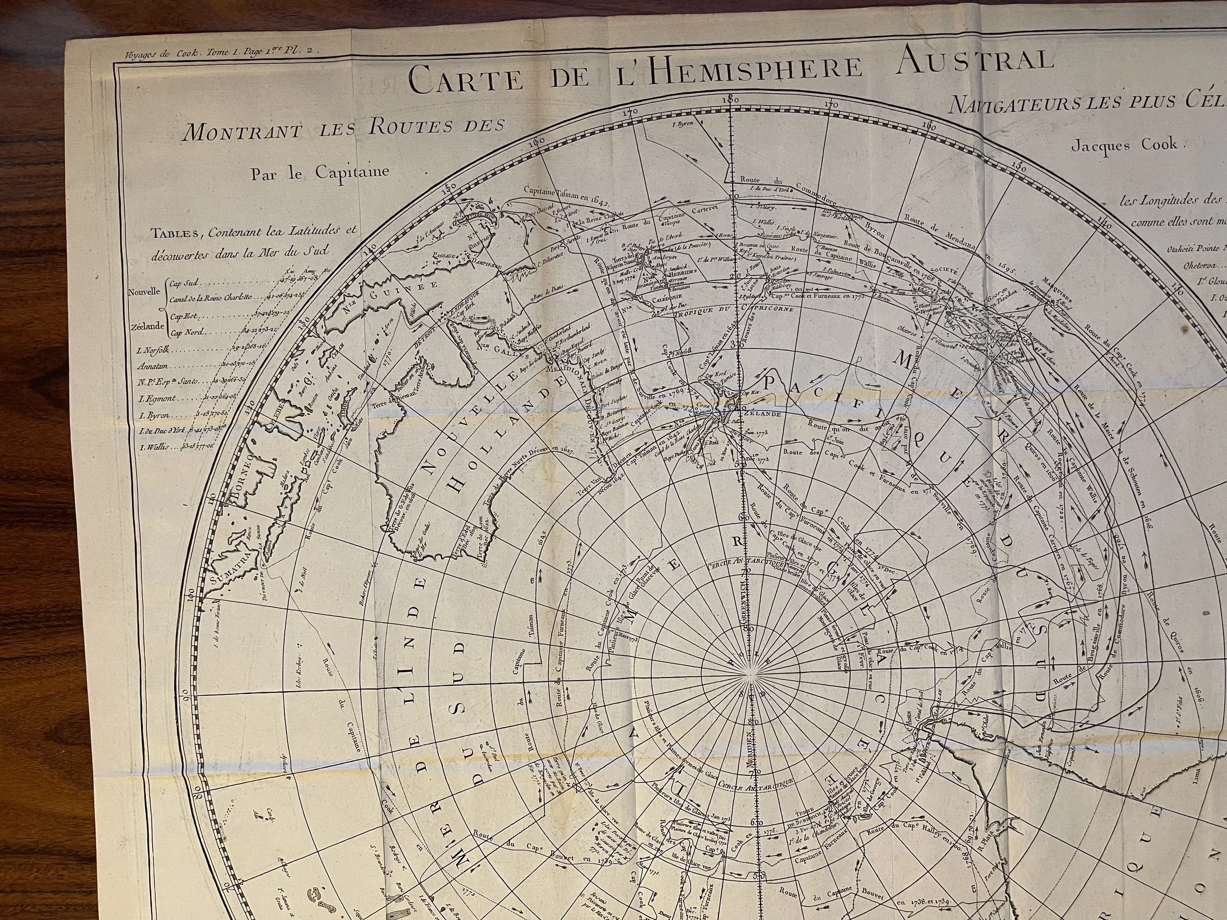 Image 2 of 10
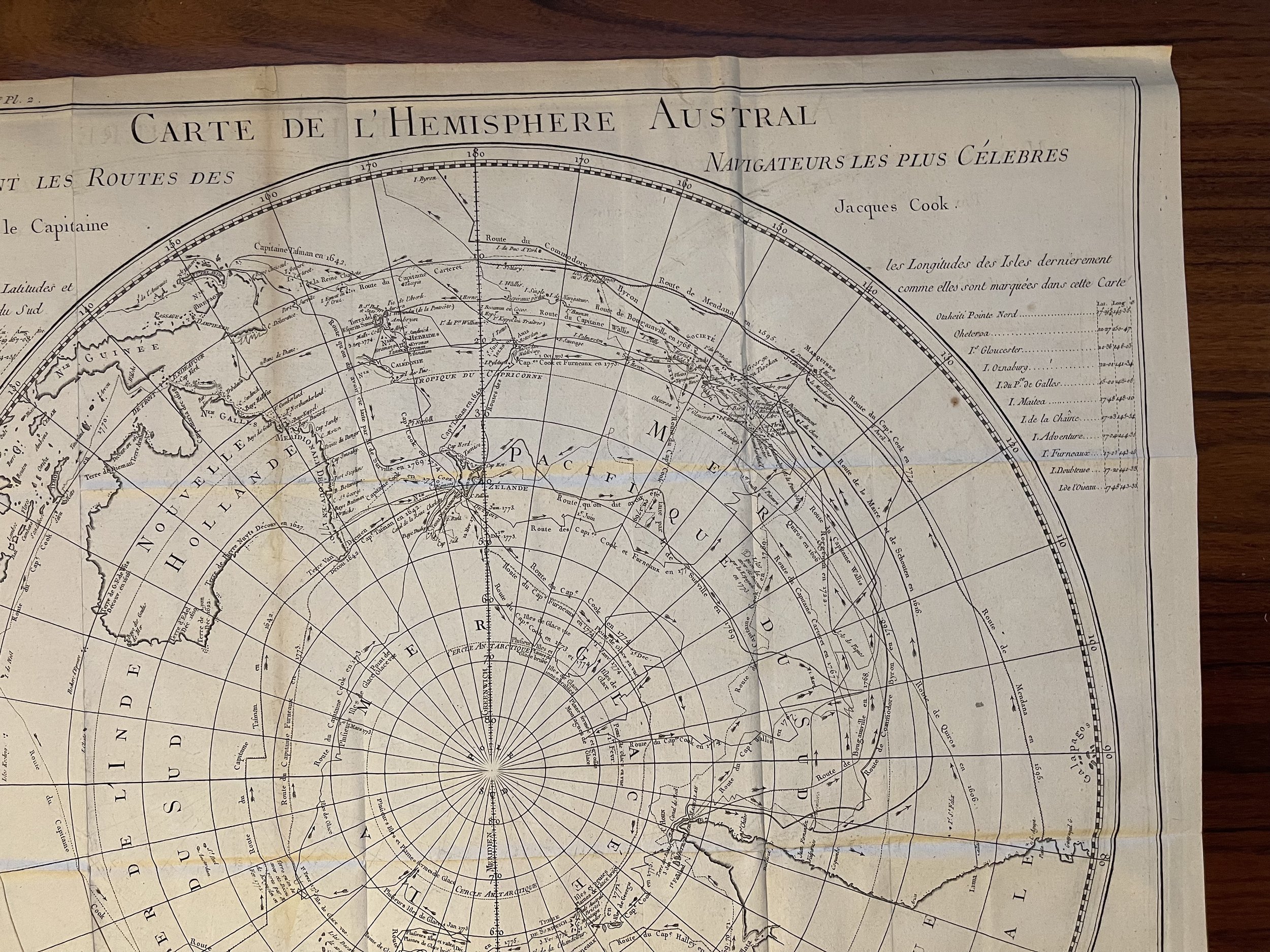 Image 3 of 10
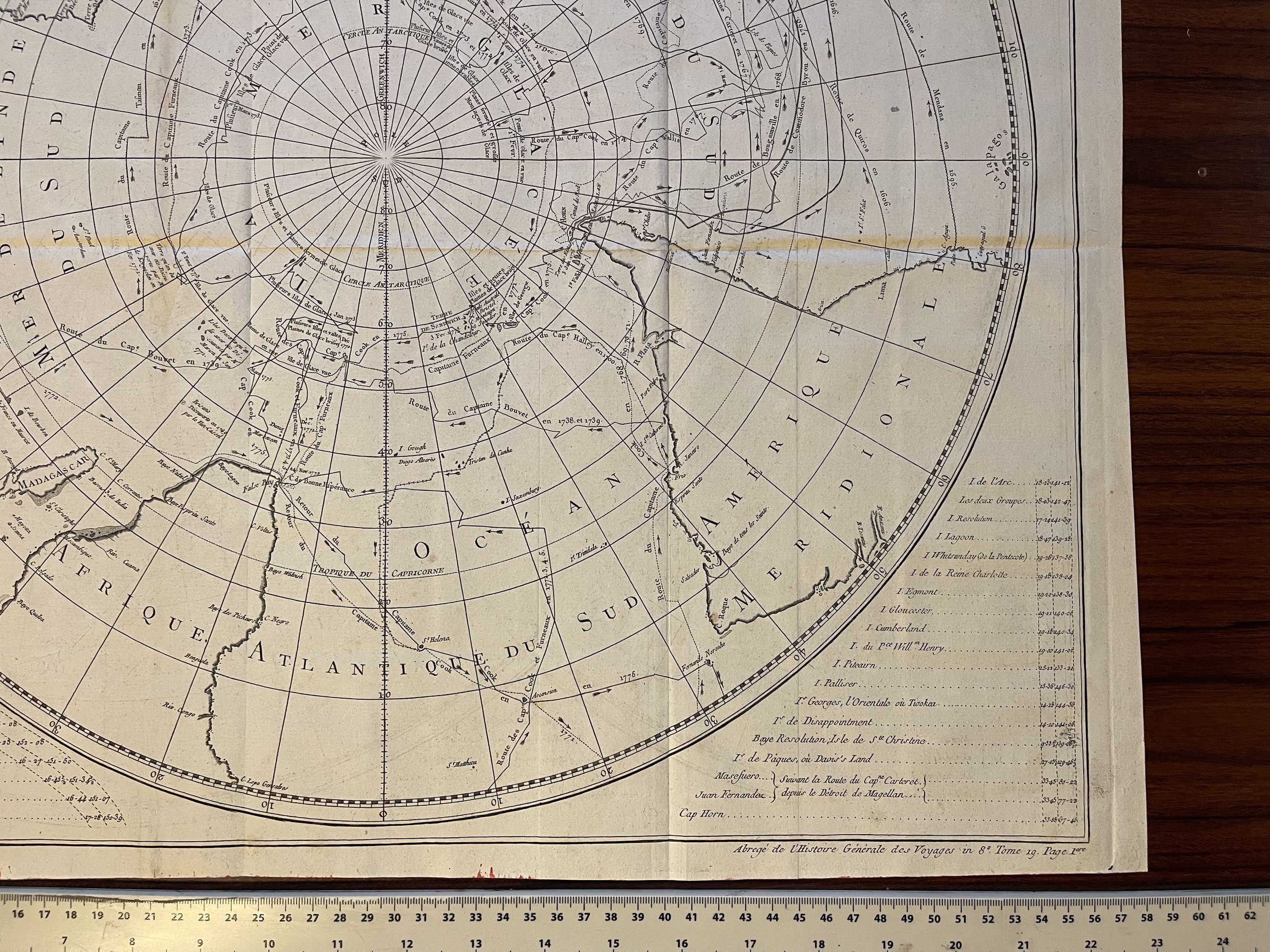 Image 4 of 10
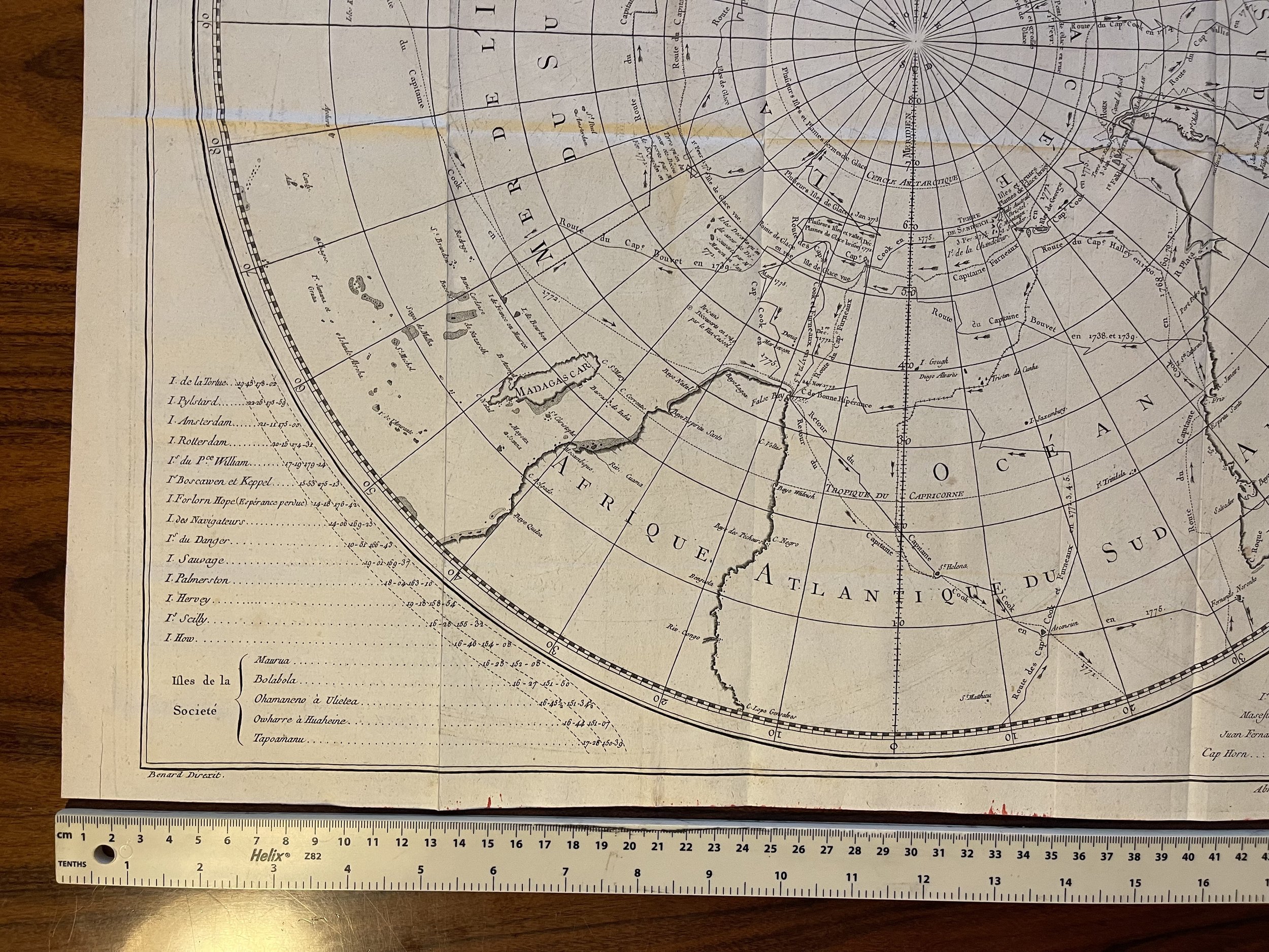 Image 5 of 10
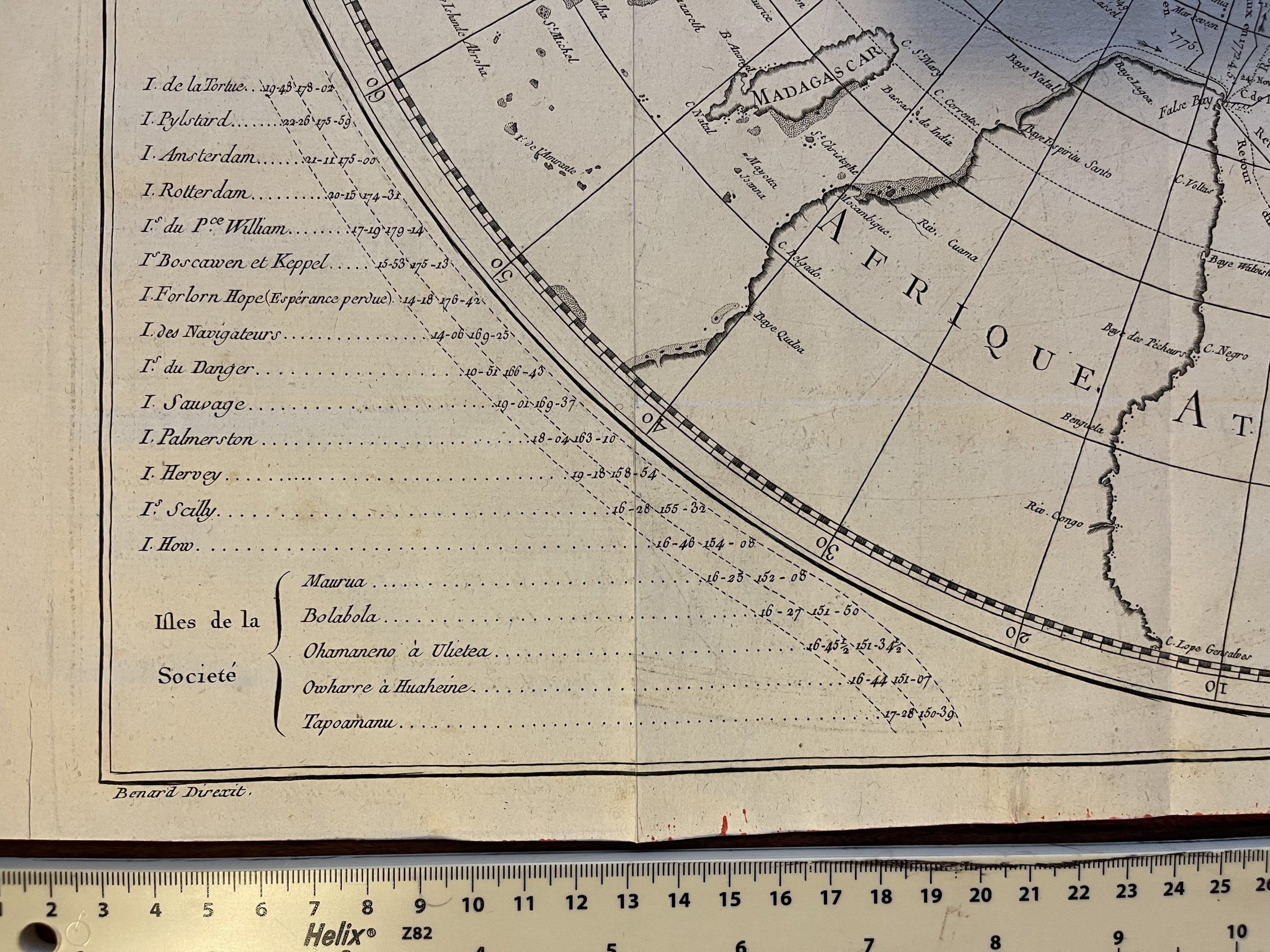 Image 6 of 10
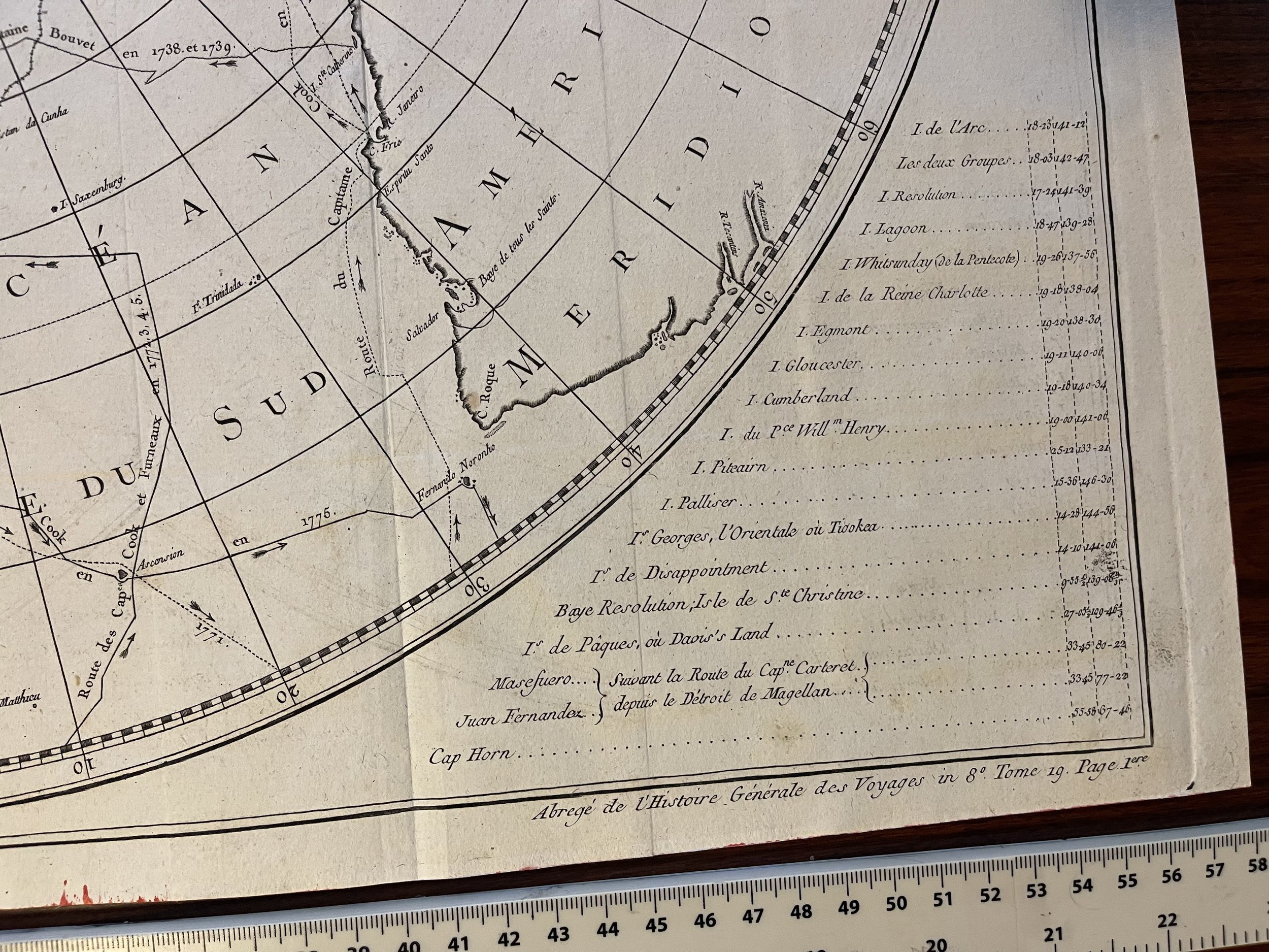 Image 7 of 10
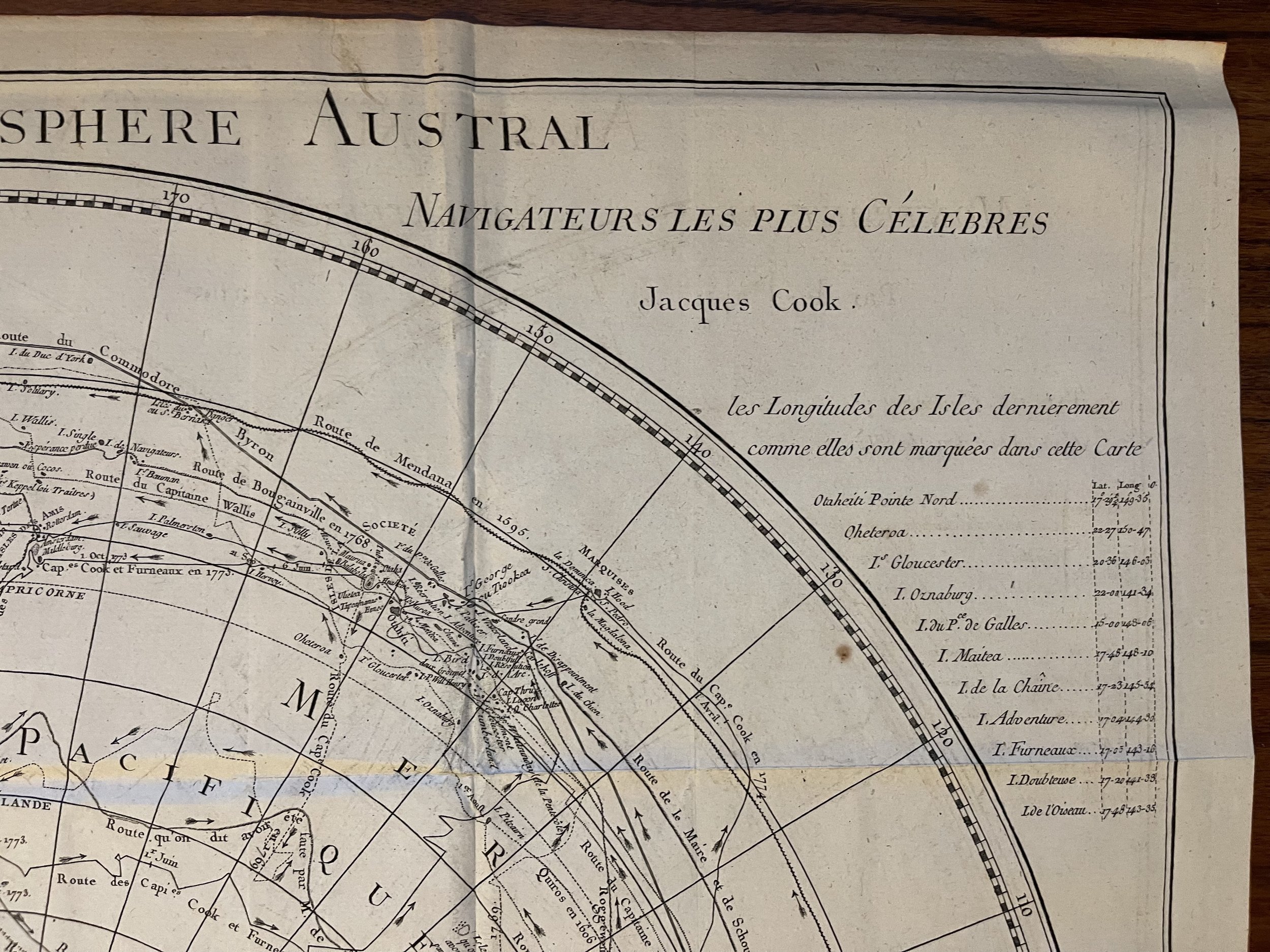 Image 8 of 10
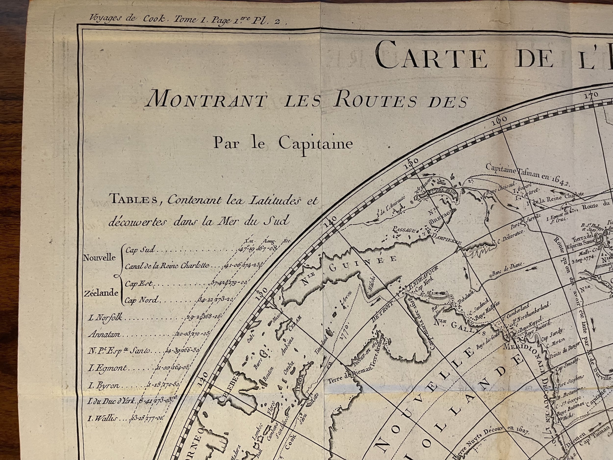 Image 9 of 10
 Image 10 of 10