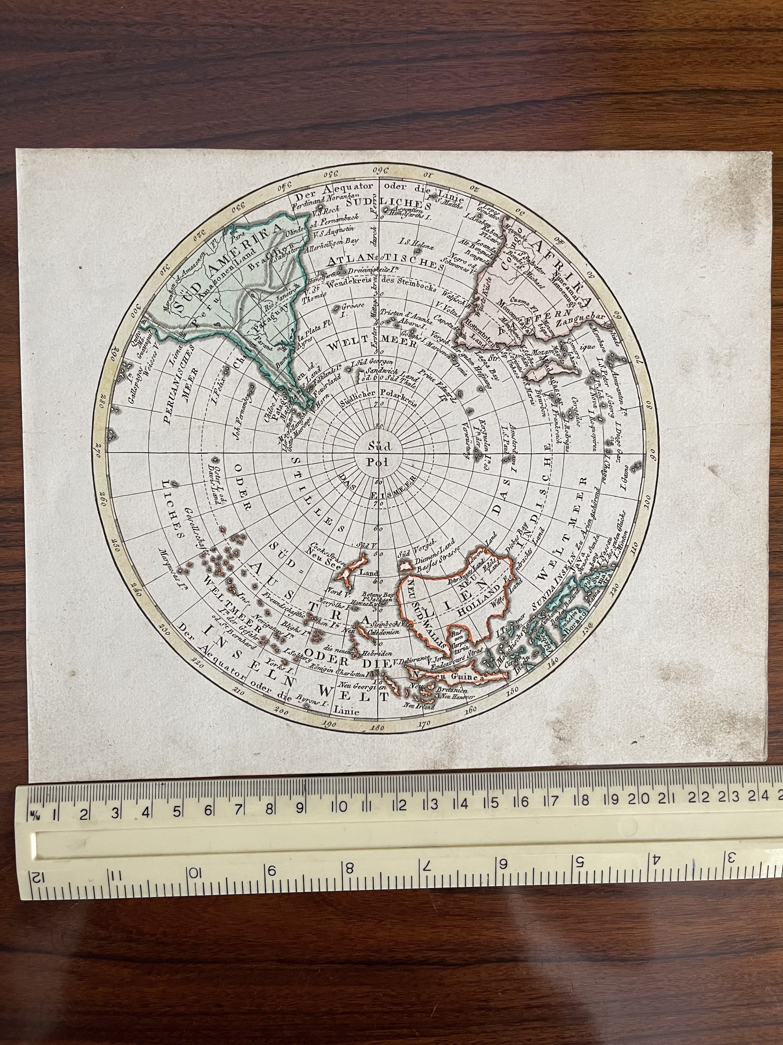
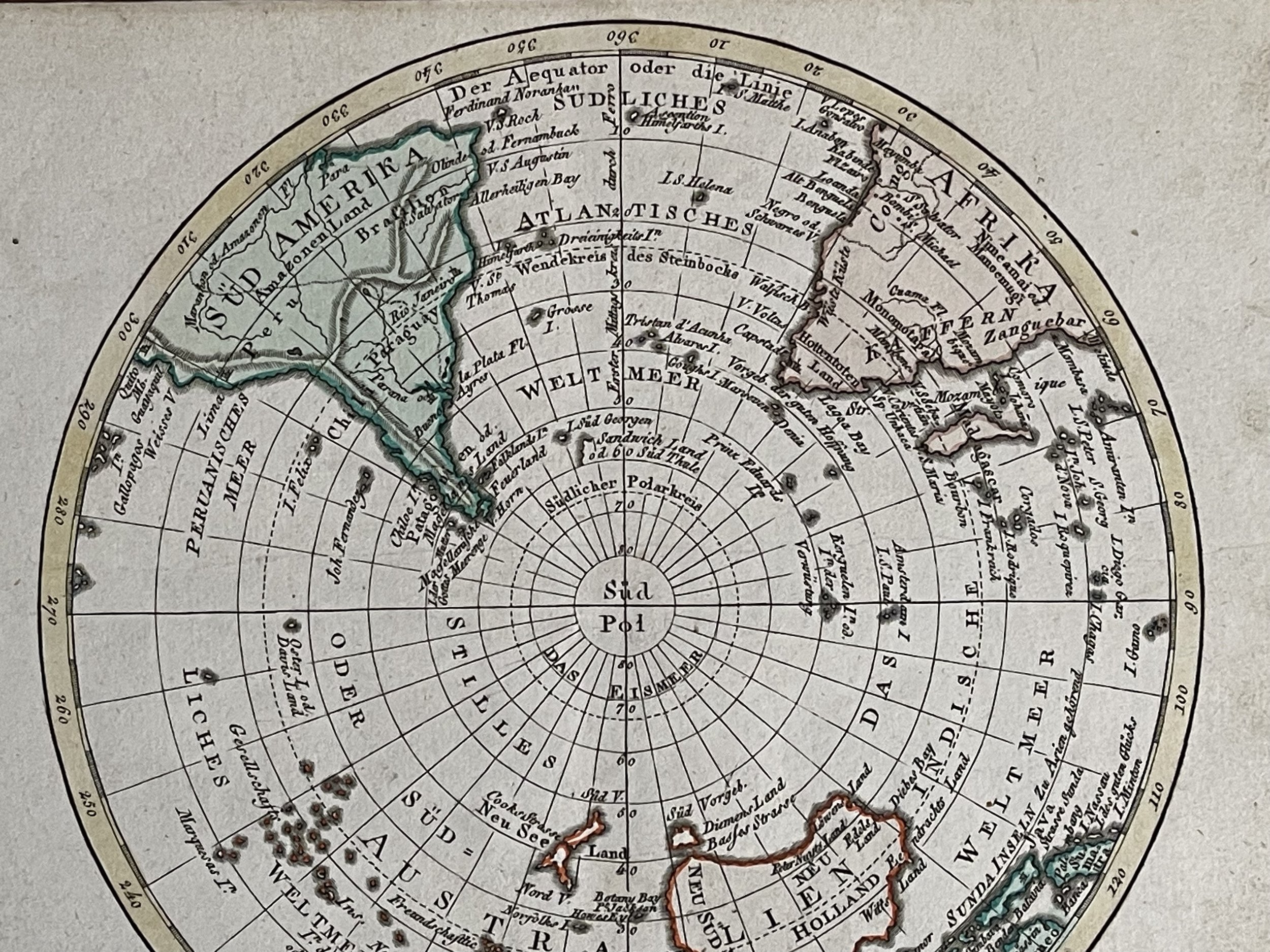
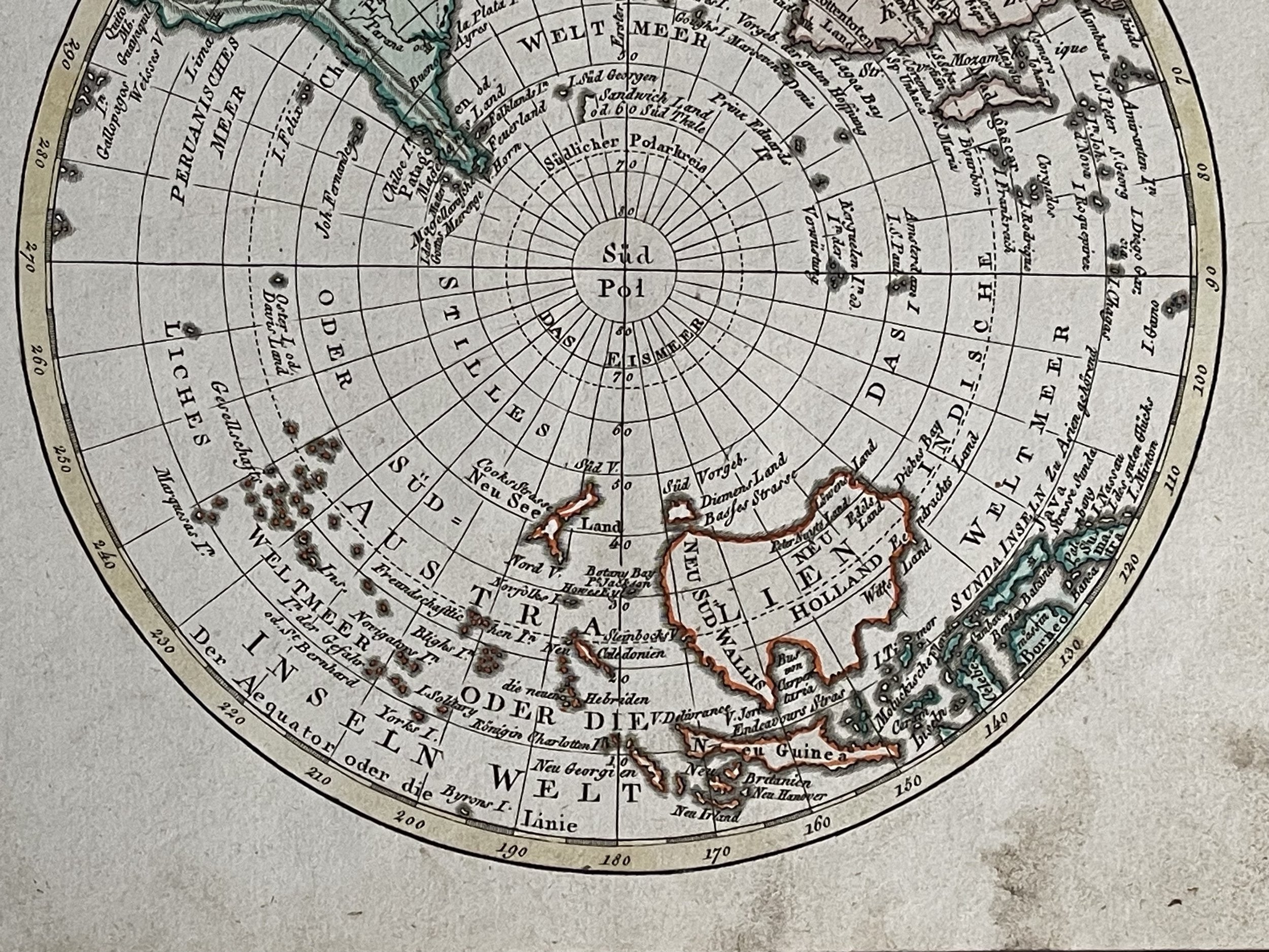
Southern Hemisphere Map - Johann Walch 1787
Interesting antique engraved polar view map of the Southern Hemisphere in original hand colour, showing nothing but open ocean in the region below 60 degrees south latitude. The map was published by Johann Walch, in his rare Allgemeiner Atlas Nach den bewährsten Hülfsmitteln , Augsburg, Germany, 1803. Land details include Van Dieman's Land (Tasmania), attached to Australia; Magellan's Land (Patagonia); Cook Strait in New Zealand; and Sandwich Land, discovered by Cook in 1775 and now the South Sandwich Islands. Other named places include the Amazon River, Congo, Madagascar, Paraguay, New Guinea, Java, and Borneo.The map is blank on the back, with no printing on the reverse side. Condition: It is in very good condition with a little thumbprint staining in the margins only.
Rare early map of the Northern Hemisphere, one of the earliest maps engraved by Walch, who would go on to have a successful career of more than 30 years as a mapmaker in Augsburg. Nice post-Cook detail, a very early use of information from Cook's Voyages in the South Pacific.
Johann, or Johannes, Walch (1757-1816) was a painter and engraver. He was well-known for painting miniature portraits, having trained in Geneva, Venice, and Rome. Walch published several atlases and sheet maps. As with his atlases, many of Walch’s maps were reprinted after his death.
Code : A415
Cartographer : Cartographer / Engraver / Publisher: Johann Walch
Date : Augsburg 1787 Approx
Size : Sheet size: 9 x 7.5 inches
Availability : Available
Type - Genuine Antique
Grading - B+
Tracked postage. in tubular casement. Please contact me for postal quotation outside of the UK.