The Earths Geography - Louis Brion de la Tour / Louis Charles Desnos - 1787
Map or Chart of the Earth's Geography - Louis Brion de la Tour / Louis Charles Desnos - 1787
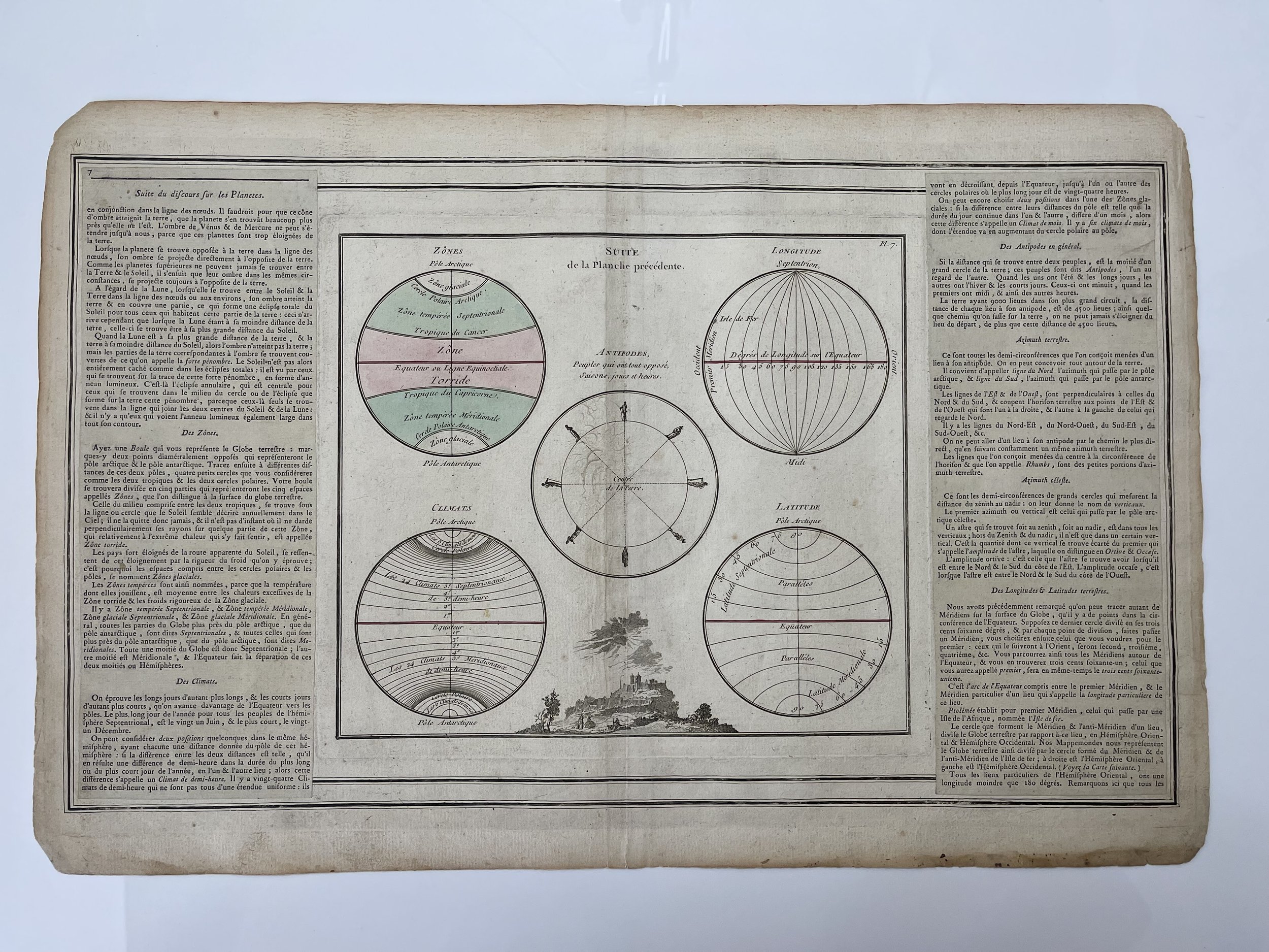
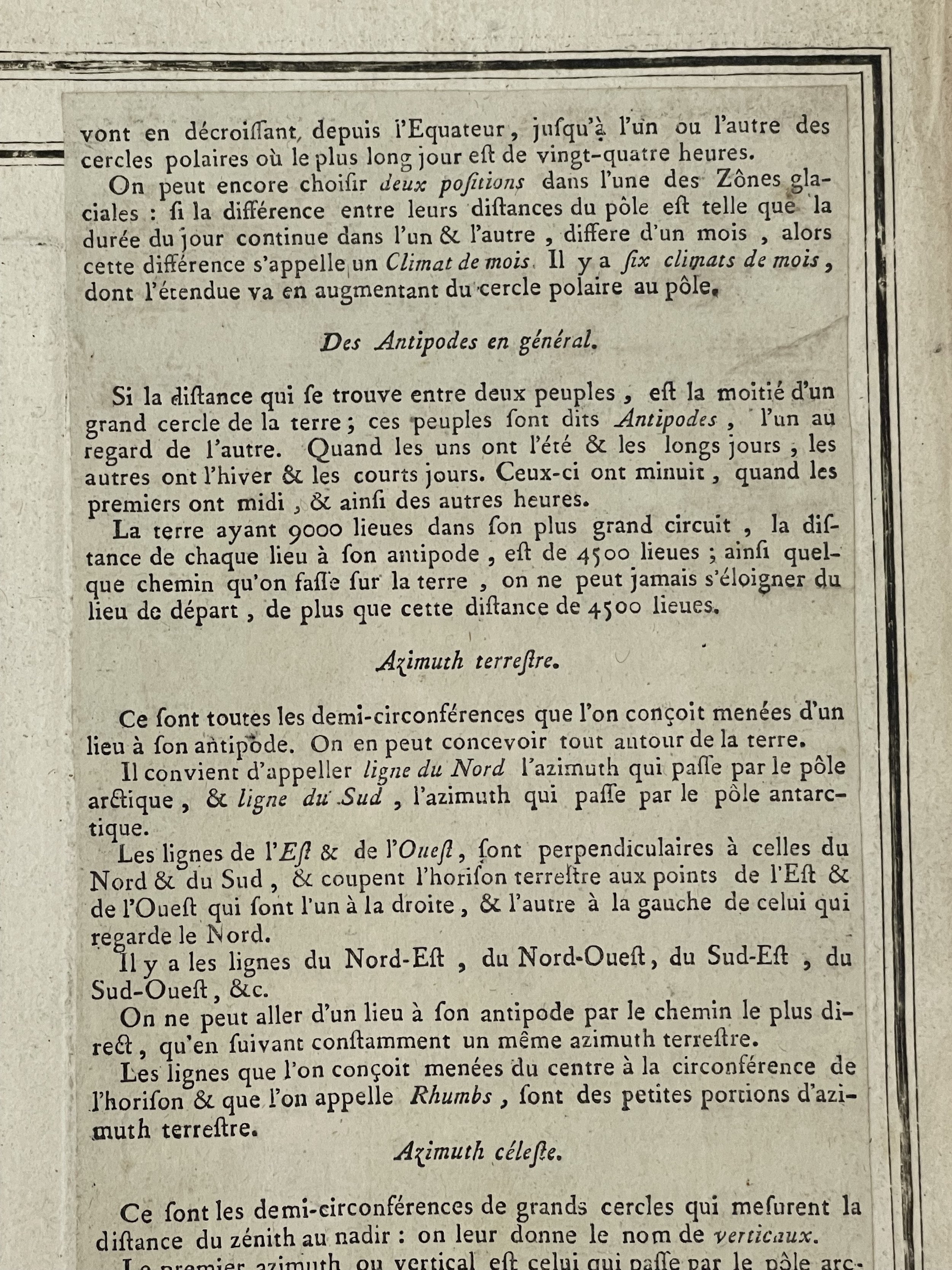
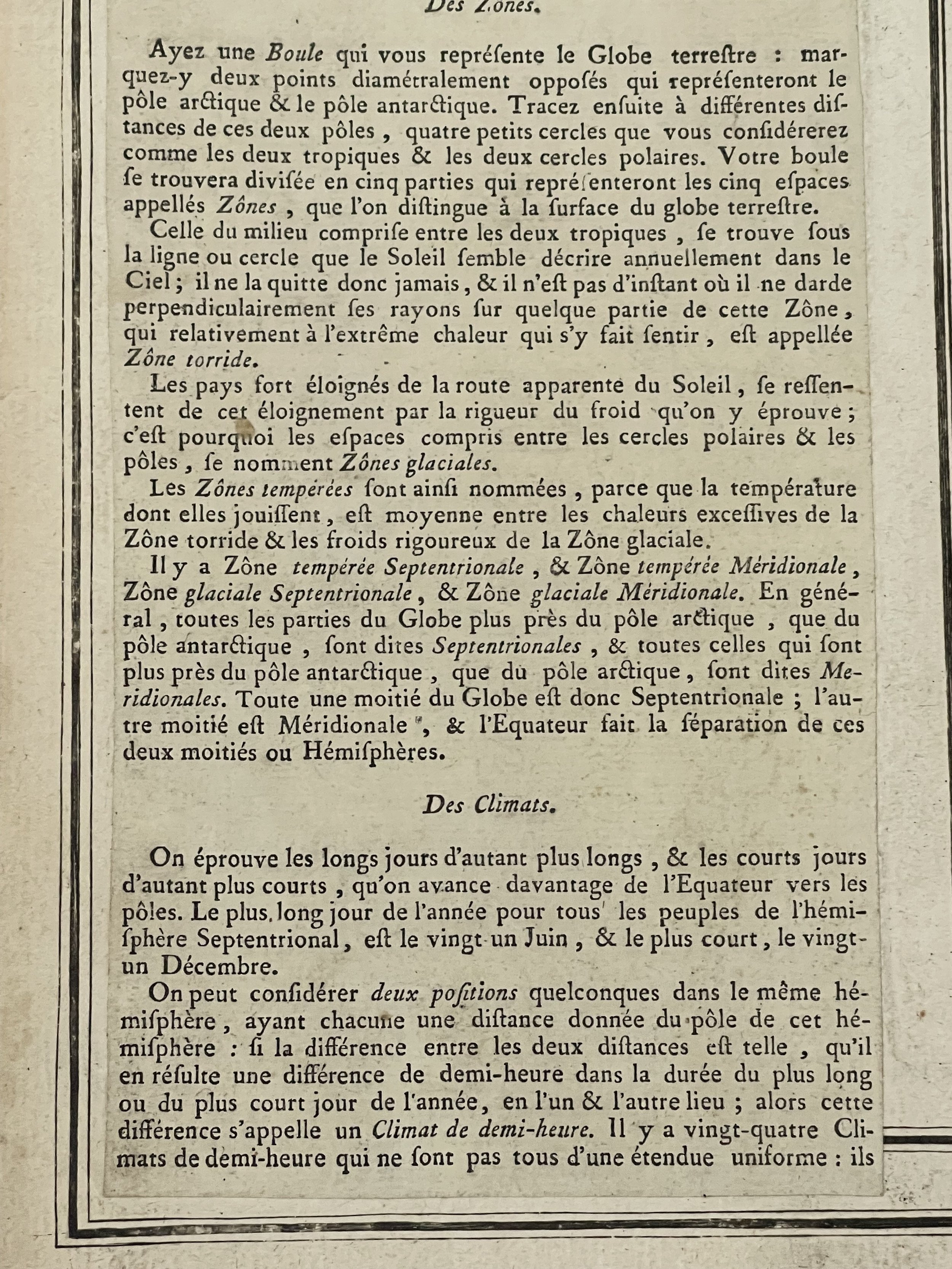
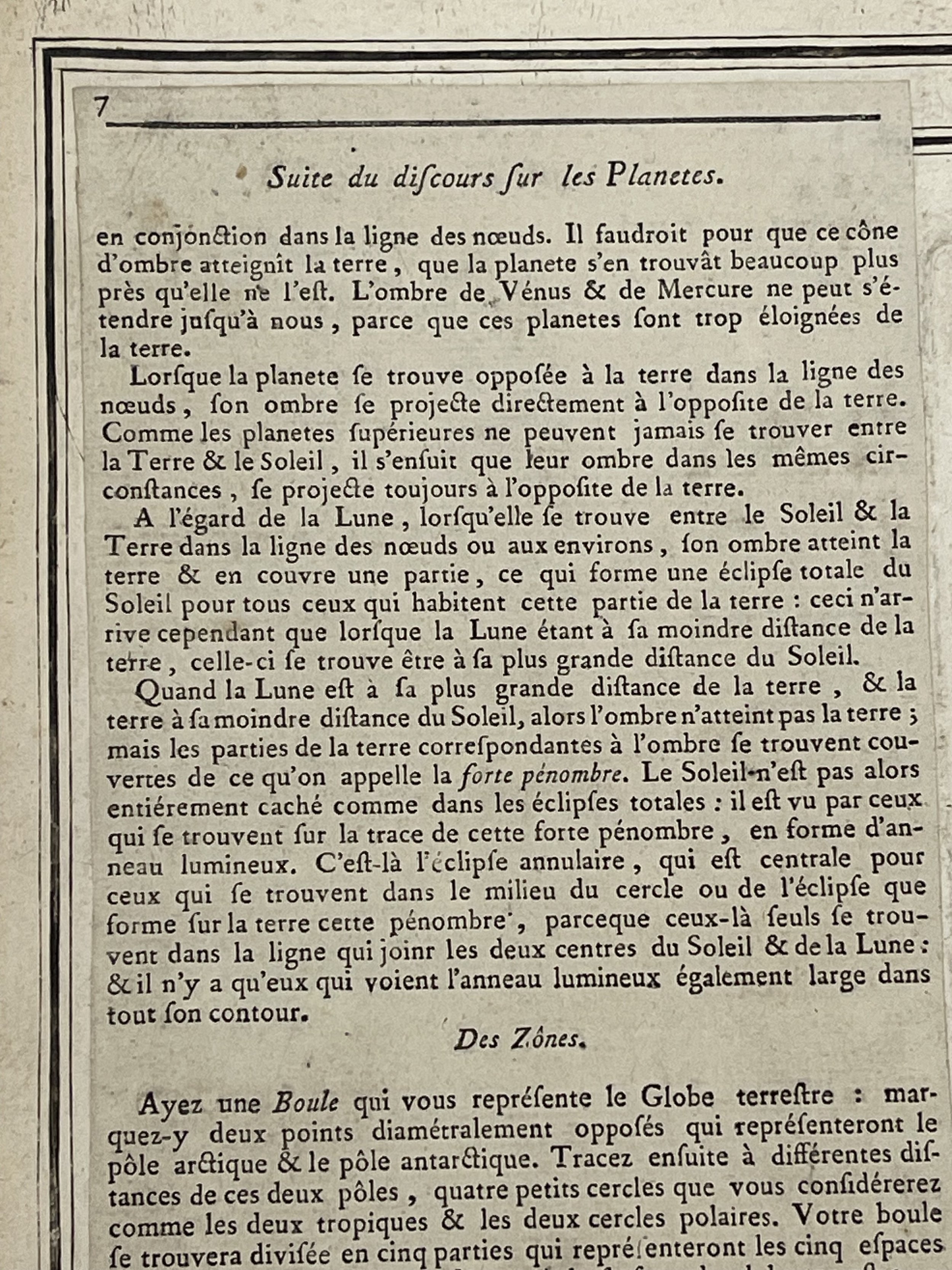
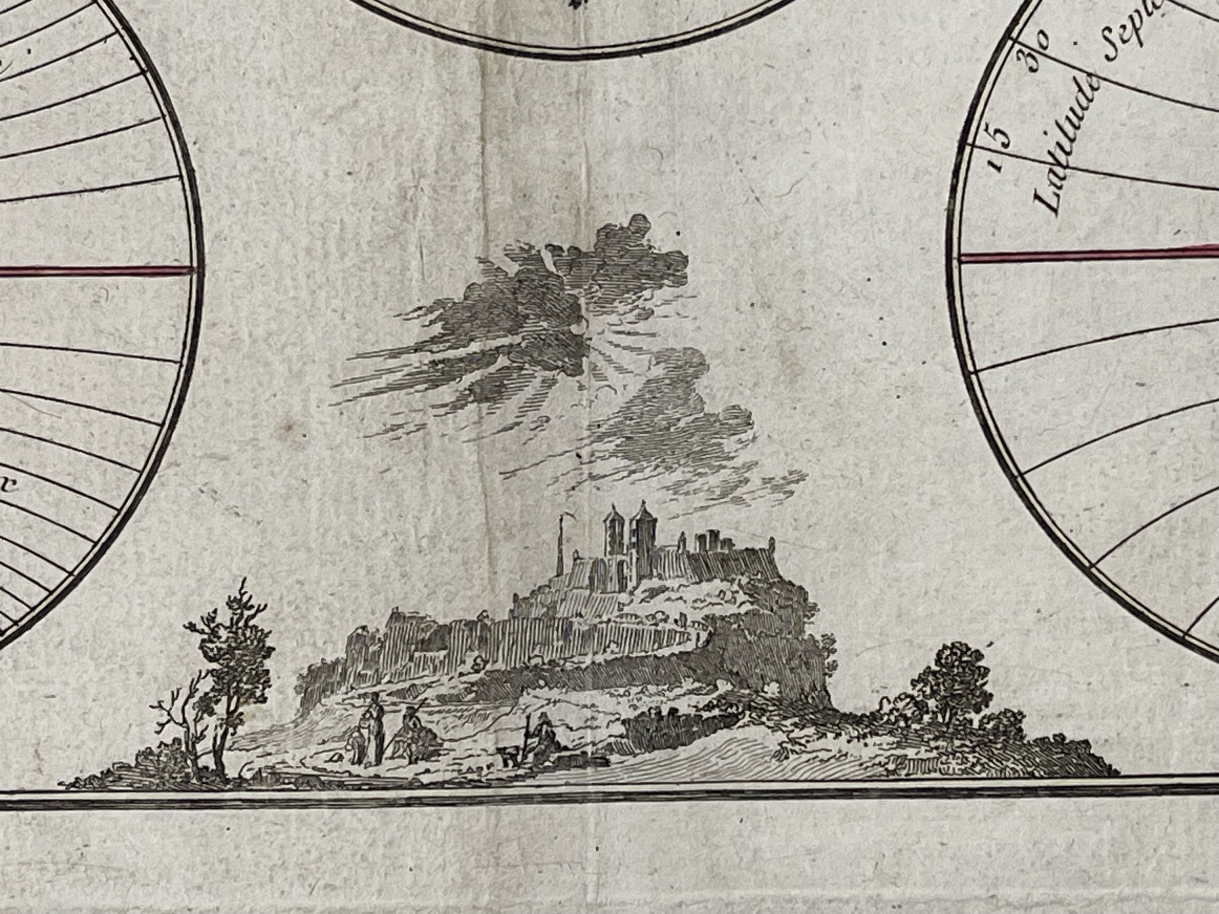
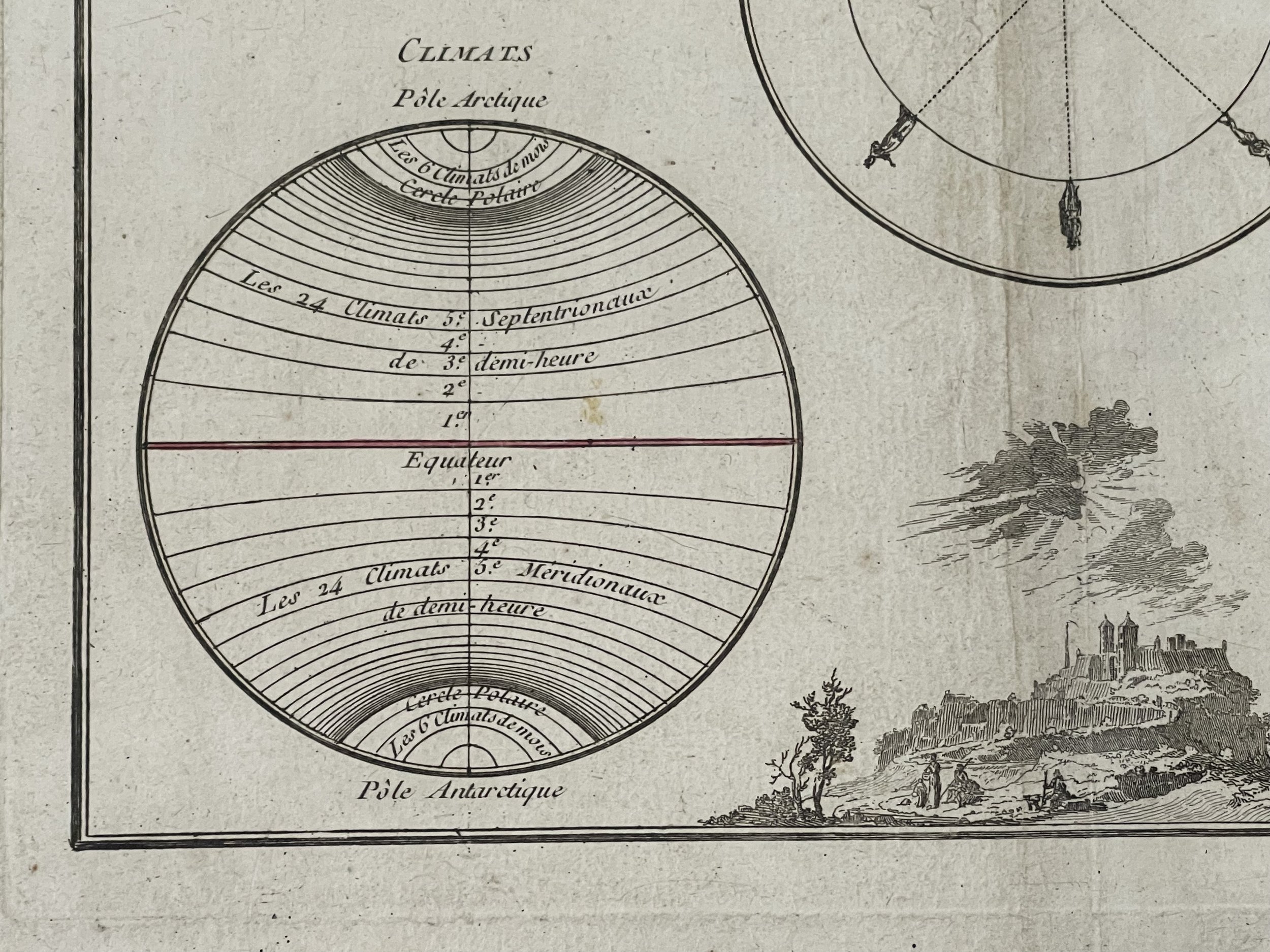
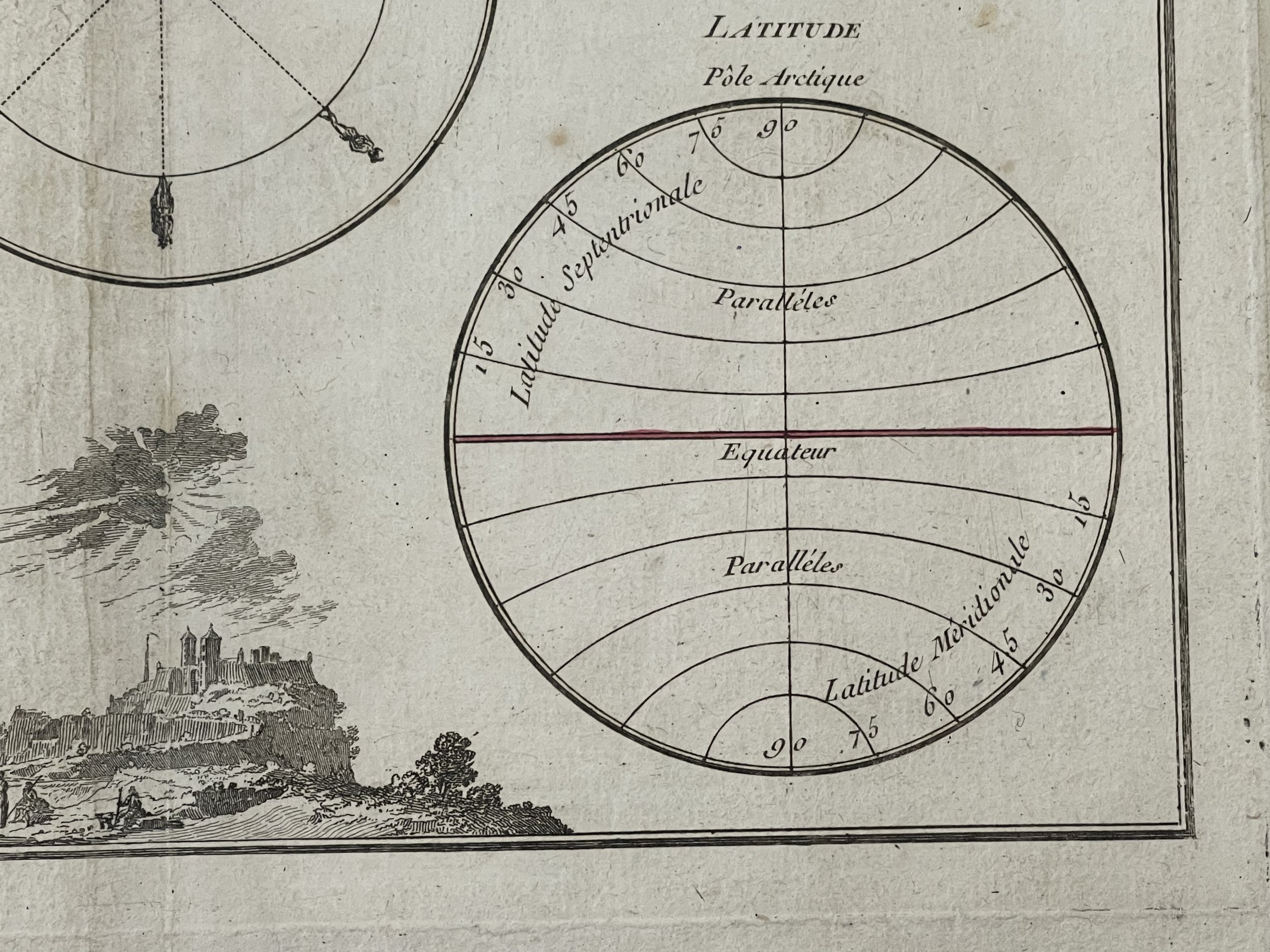
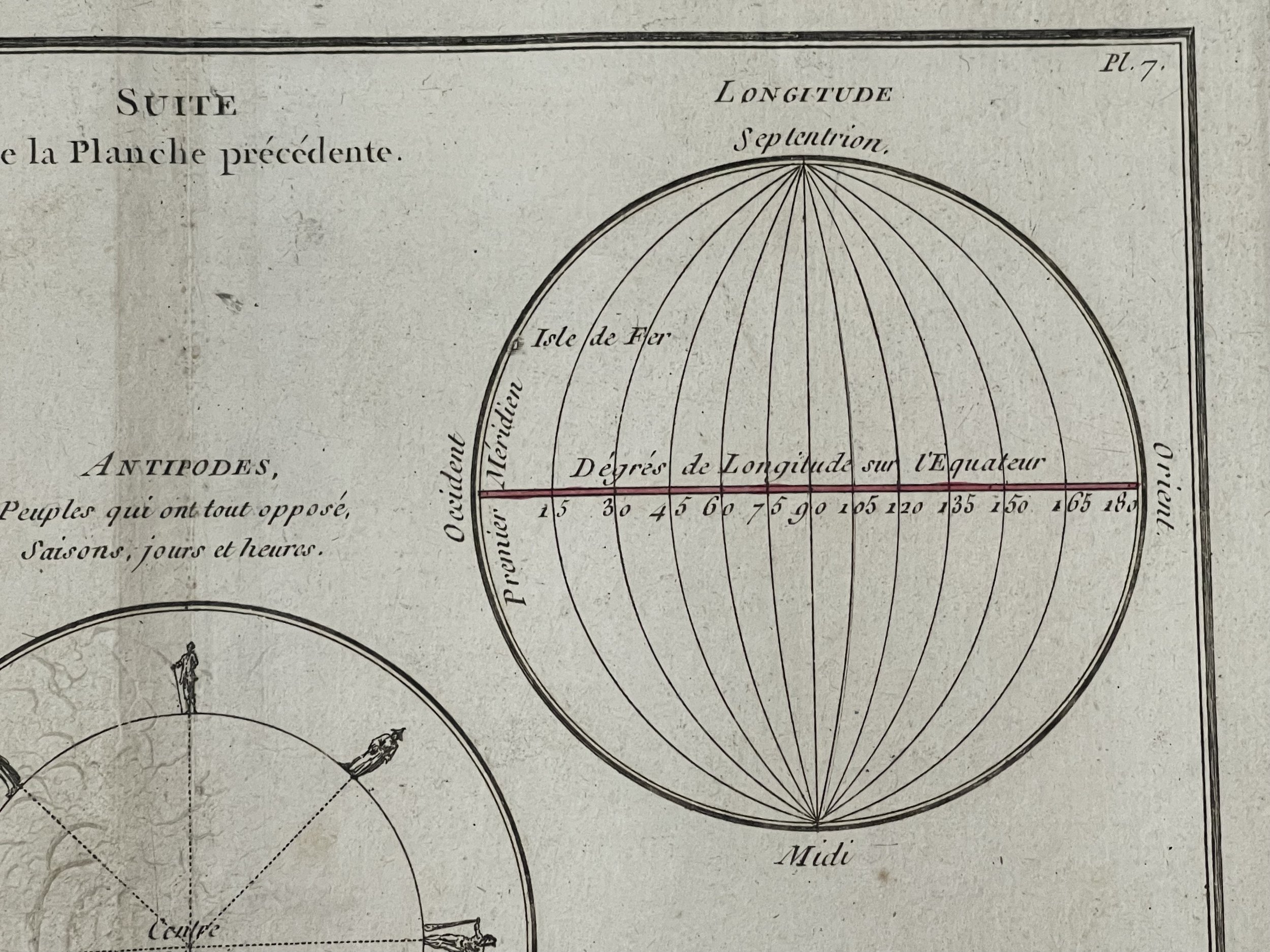
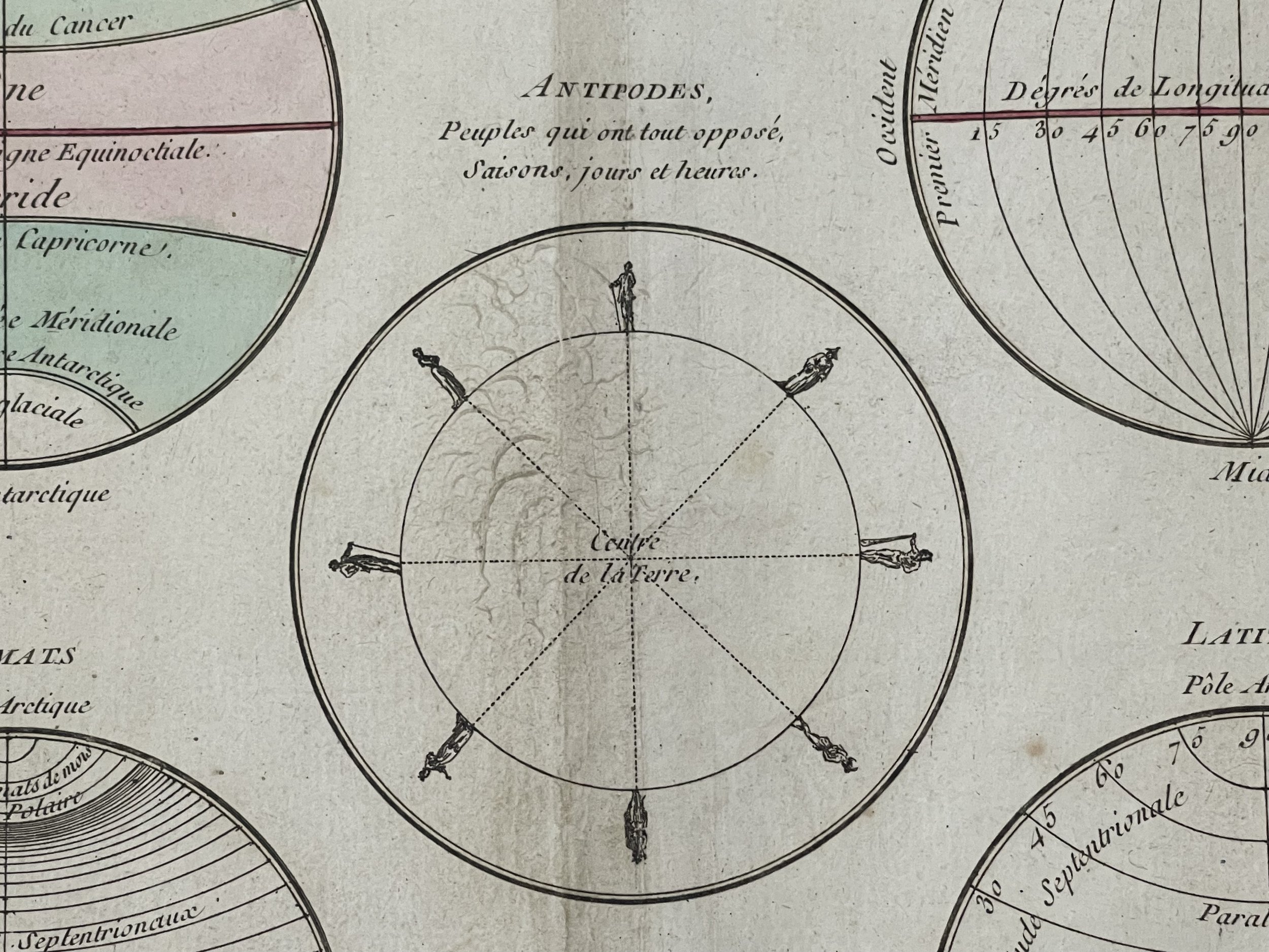
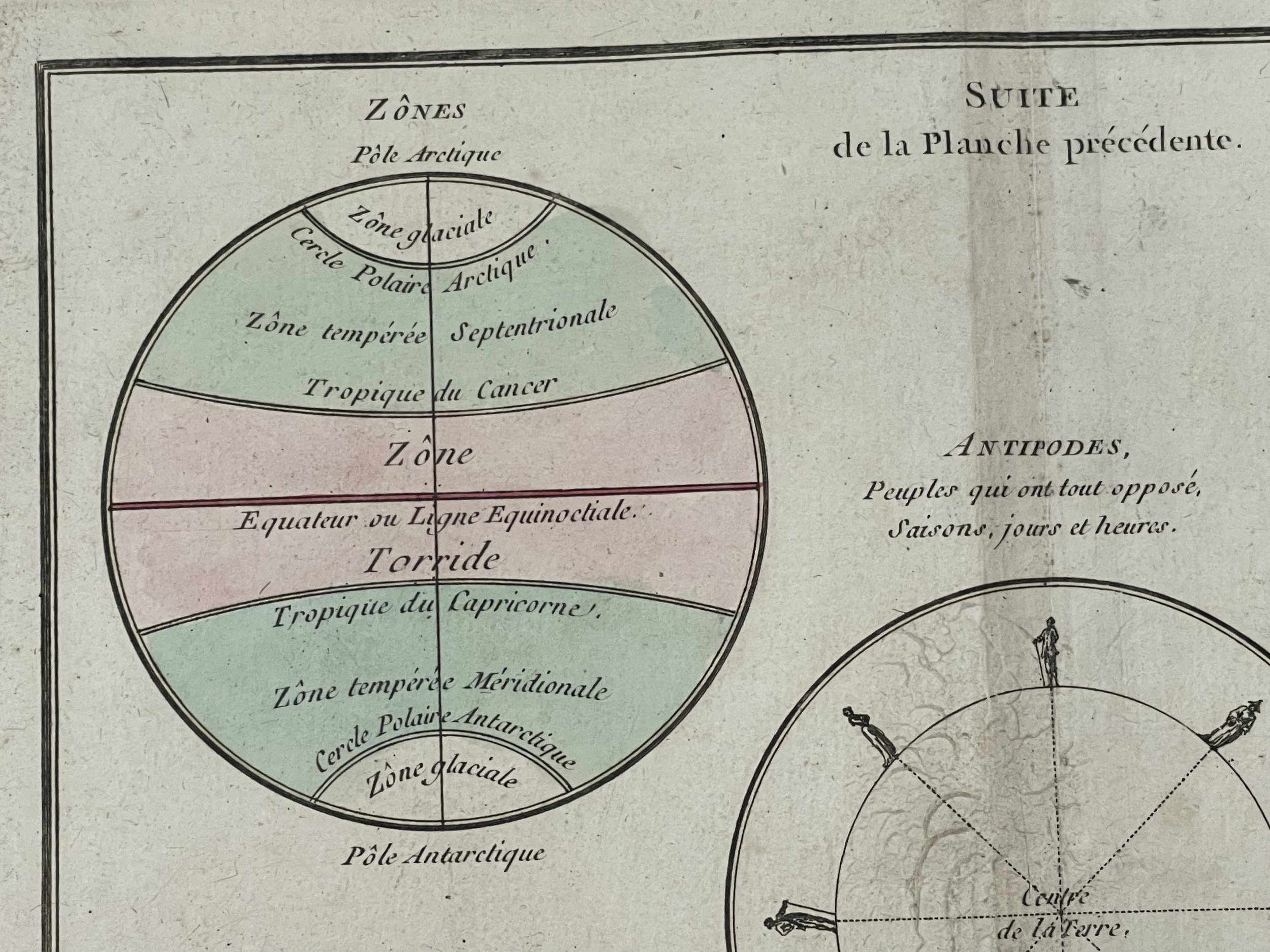
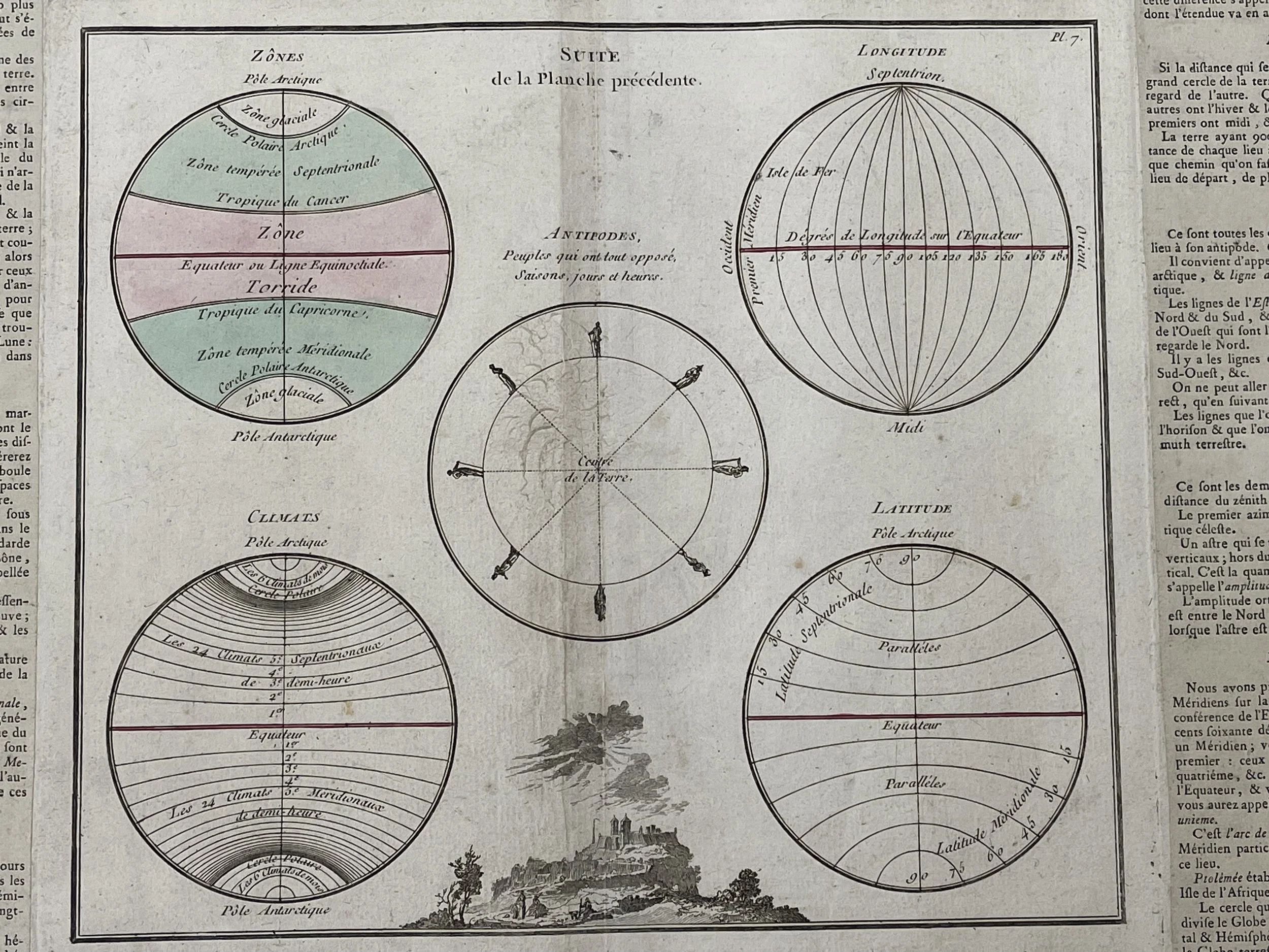
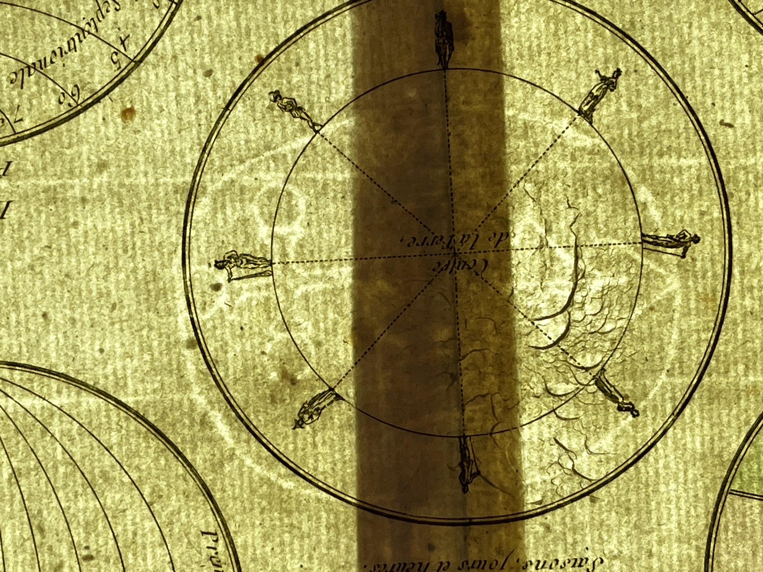
A chart by the French cartographer Louis Brion de la Tour. Includes five diagrams that depict the Longitude, Latitude, Climate, Zones, and the Antipodes of the Earth. A beautiful decorative vignette is included near the bottom border.
To the left and right of the map are paste downs of French text with remarks and description of the map. This map was issued as plate no. 7 in the most deluxe edition of Desnos' 1786 Atlas General Methodique et Elementaire, Pour l'Etude de la Geographie et de l'Histoire Moderne.
Louis Charles Desnos (1725 - April 18, 1805) was a highly regarded instrument maker, cartographer, and globe maker from France during the 18th century. He was born in Pont-Sainte-Maxence, Oise, France, to a family of cloth merchants. Desnos gained valuable experience at a metal foundry from April of 1745 through apprenticeships. He later married the widow of Nicolas Hardy, the son of renowned map, globe, and instrument seller, Jacques Hardy. As Royal Globemaker to King Christian VII of Denmark, Desnos was honoured with an annual stipend of 500 Livres. In exchange, he sent the king approximately 200 Livres worth of maps, books, and atlases each year. Collaborating with other notable figures such as Zannoni and Louis Brion de la Tour (1756-1823), Desnos was a prolific publisher, producing a significant body of work. However, his reputation was tarnished among serious cartographic experts, who regarded him as unscrupulous and indiscriminate in his publications. Desnos was frequently involved in legal disputes with other cartographers and publishers in Paris during his career. His offices were located on Rue St. Jacques in Paris.
Louis Brion de la Tour , (circa 1743 – 1803) was an 18th-century French geographer and demographer .
His family may have come from Bordeaux, having found asylum in Alsace when the Edict of Nantes was revoked by the Edict of Fontainebleau in 1685.
Generally, authors were careful to differentiate him from the engraver Antoine Brion from Reims , born in 1739. He was perhaps his son.
His official title was “Ingénieur Géographe du Roi” (“King’s Engineer Geographer”). Although he was a prolific geographer, very little is known of his life or his career. His life passed in scientific work. However what is known is that an important part of his work was done in collaboration with Louis Charles Desnos (circa 1750–1790), bookseller and geographical engineer for globes and spheres of His Danish Majesty. Between 1762 and 1785, he participated in the development of the Faithful indicator or traveler's guide, which teaches all the royal roads.
In 1795, he obtained a pension from the National Assembly. These cards cost 25 sols (1786). His son Louis Brion de la Tour (1763–1823), a student of Jean-Bernard Restout , was a map and Revolution documents engraver, and was also an occasional portraitist of oil paintings. It is often difficult to attribute what is the work of the father or the son. 29 pluviôse year II (27 February 1794), the Journal de la Montagne announced a picture engraved by Brion, representing the assassination of Marat. Brion de la Tour son was the author of portraits of Louis XVI and Marie-Antoinette and the series of the necklace.
Some water damage to the border periphery outside of the engraving. Creators Watermark present. Pricing & Grading commensurate.
Map or Chart of the Earth's Geography - Louis Brion de la Tour / Louis Charles Desnos - 1787
A chart by the French cartographer Louis Brion de la Tour. Includes five diagrams that depict the Longitude, Latitude, Climate, Zones, and the Antipodes of the Earth. A beautiful decorative vignette is included near the bottom border.
To the left and right of the map are paste downs of French text with remarks and description of the map. This map was issued as plate no. 7 in the most deluxe edition of Desnos' 1786 Atlas General Methodique et Elementaire, Pour l'Etude de la Geographie et de l'Histoire Moderne.
Louis Charles Desnos (1725 - April 18, 1805) was a highly regarded instrument maker, cartographer, and globe maker from France during the 18th century. He was born in Pont-Sainte-Maxence, Oise, France, to a family of cloth merchants. Desnos gained valuable experience at a metal foundry from April of 1745 through apprenticeships. He later married the widow of Nicolas Hardy, the son of renowned map, globe, and instrument seller, Jacques Hardy. As Royal Globemaker to King Christian VII of Denmark, Desnos was honoured with an annual stipend of 500 Livres. In exchange, he sent the king approximately 200 Livres worth of maps, books, and atlases each year. Collaborating with other notable figures such as Zannoni and Louis Brion de la Tour (1756-1823), Desnos was a prolific publisher, producing a significant body of work. However, his reputation was tarnished among serious cartographic experts, who regarded him as unscrupulous and indiscriminate in his publications. Desnos was frequently involved in legal disputes with other cartographers and publishers in Paris during his career. His offices were located on Rue St. Jacques in Paris.
Louis Brion de la Tour , (circa 1743 – 1803) was an 18th-century French geographer and demographer .
His family may have come from Bordeaux, having found asylum in Alsace when the Edict of Nantes was revoked by the Edict of Fontainebleau in 1685.
Generally, authors were careful to differentiate him from the engraver Antoine Brion from Reims , born in 1739. He was perhaps his son.
His official title was “Ingénieur Géographe du Roi” (“King’s Engineer Geographer”). Although he was a prolific geographer, very little is known of his life or his career. His life passed in scientific work. However what is known is that an important part of his work was done in collaboration with Louis Charles Desnos (circa 1750–1790), bookseller and geographical engineer for globes and spheres of His Danish Majesty. Between 1762 and 1785, he participated in the development of the Faithful indicator or traveler's guide, which teaches all the royal roads.
In 1795, he obtained a pension from the National Assembly. These cards cost 25 sols (1786). His son Louis Brion de la Tour (1763–1823), a student of Jean-Bernard Restout , was a map and Revolution documents engraver, and was also an occasional portraitist of oil paintings. It is often difficult to attribute what is the work of the father or the son. 29 pluviôse year II (27 February 1794), the Journal de la Montagne announced a picture engraved by Brion, representing the assassination of Marat. Brion de la Tour son was the author of portraits of Louis XVI and Marie-Antoinette and the series of the necklace.
Some water damage to the border periphery outside of the engraving. Creators Watermark present. Pricing & Grading commensurate.
Code : A807
Cartographer : Cartographer / Engraver / Publisher: Louis Brion de la Tour / Louis Charles Desnos
Date : Publication Place / Date - Circa 1787
Size : Sheet size: approx 47 x 28 Cm
Availability : Available
Type - Genuine - Antique
Grading A-
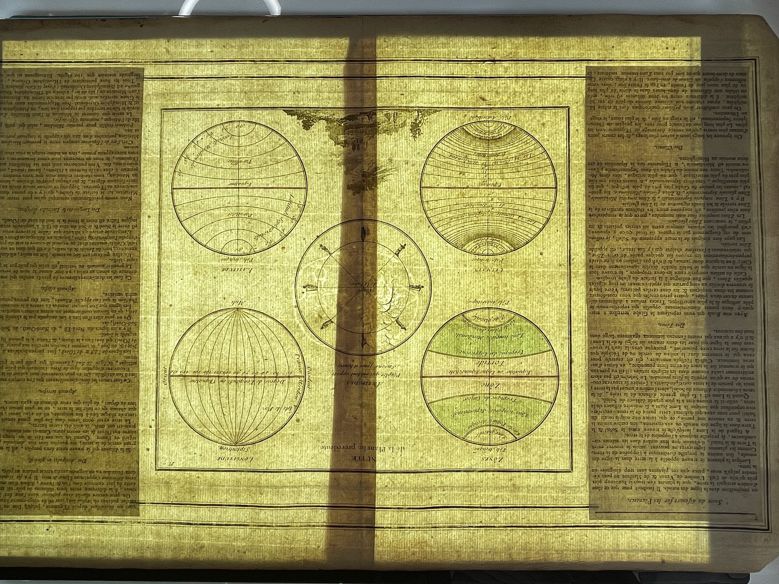
Where Applicable - Folds as issued. Light box photo shows the folio leaf centre margin hinge ‘glue’, this is not visible otherwise.
Tracked postage, in casement. Please contact me for postal quotation outside of the UK.