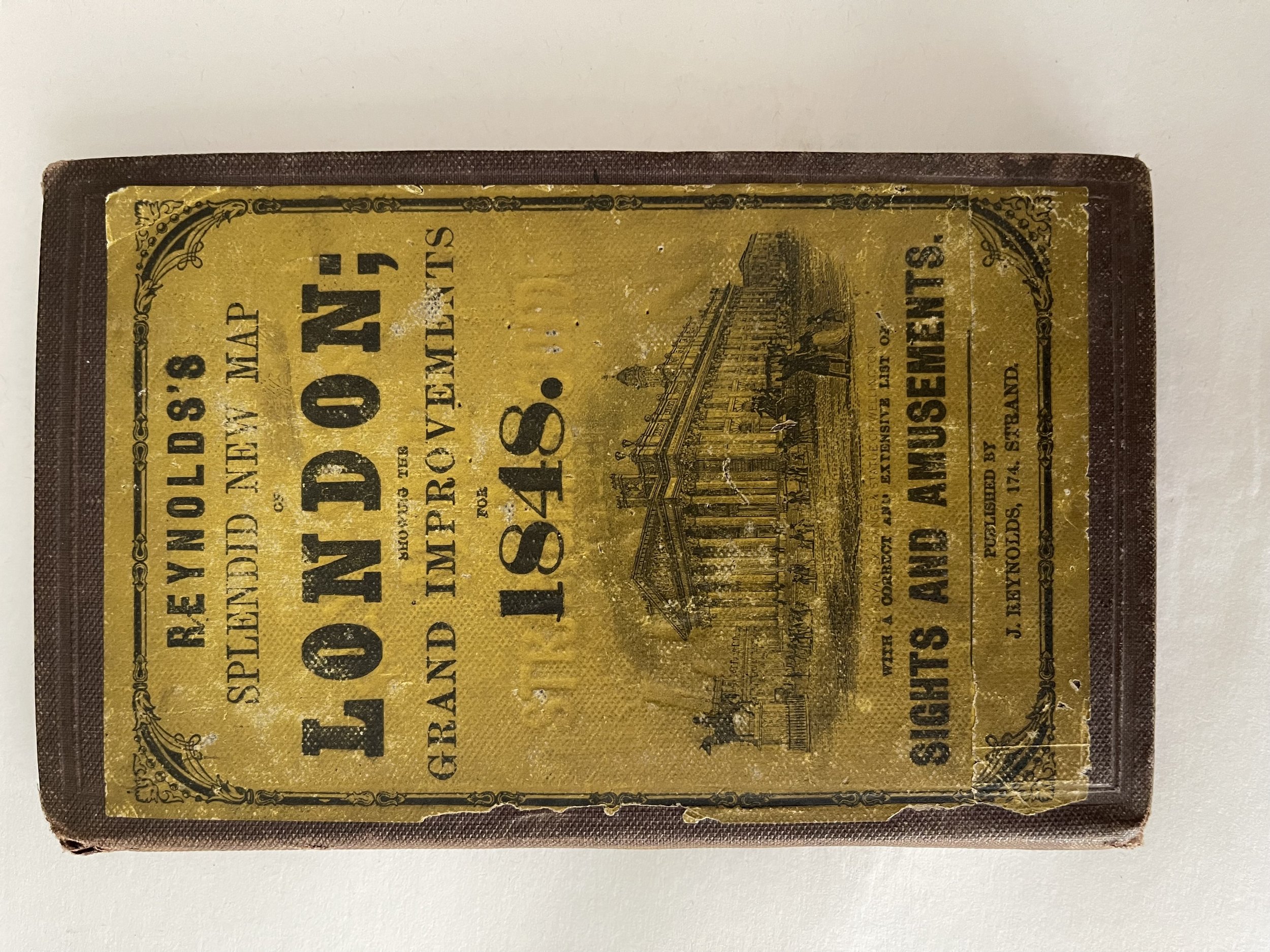

Splendid New Map of London Showing the Grand Improvements - James Reynolds - 1848 - Rare
Splendid New Map of London Showing the Grand Improvements - James Reynolds - 1848 - Rare
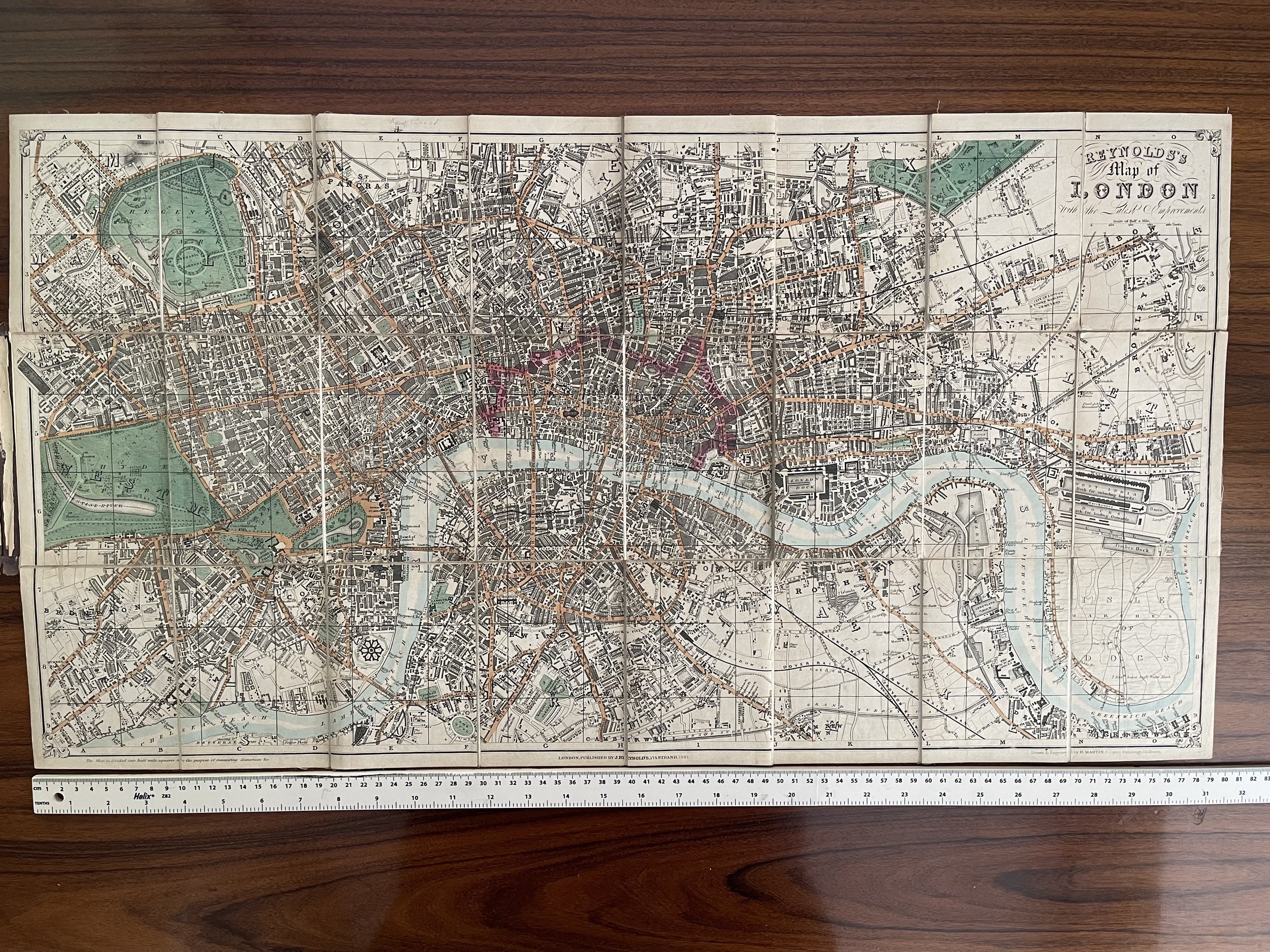
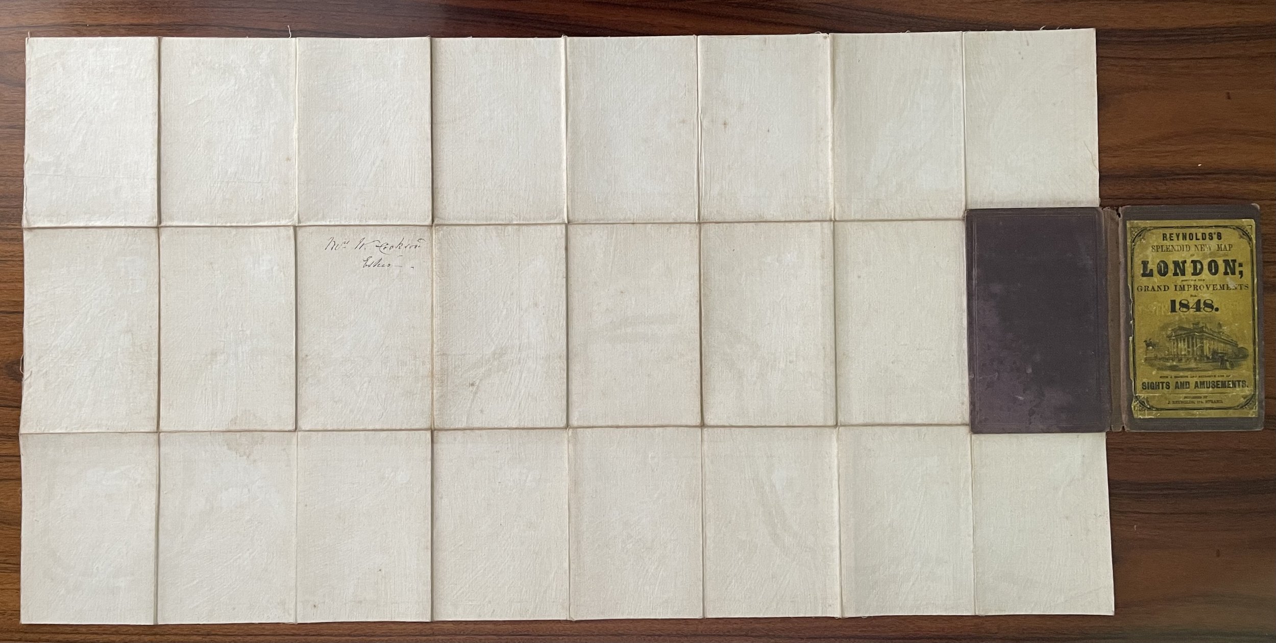
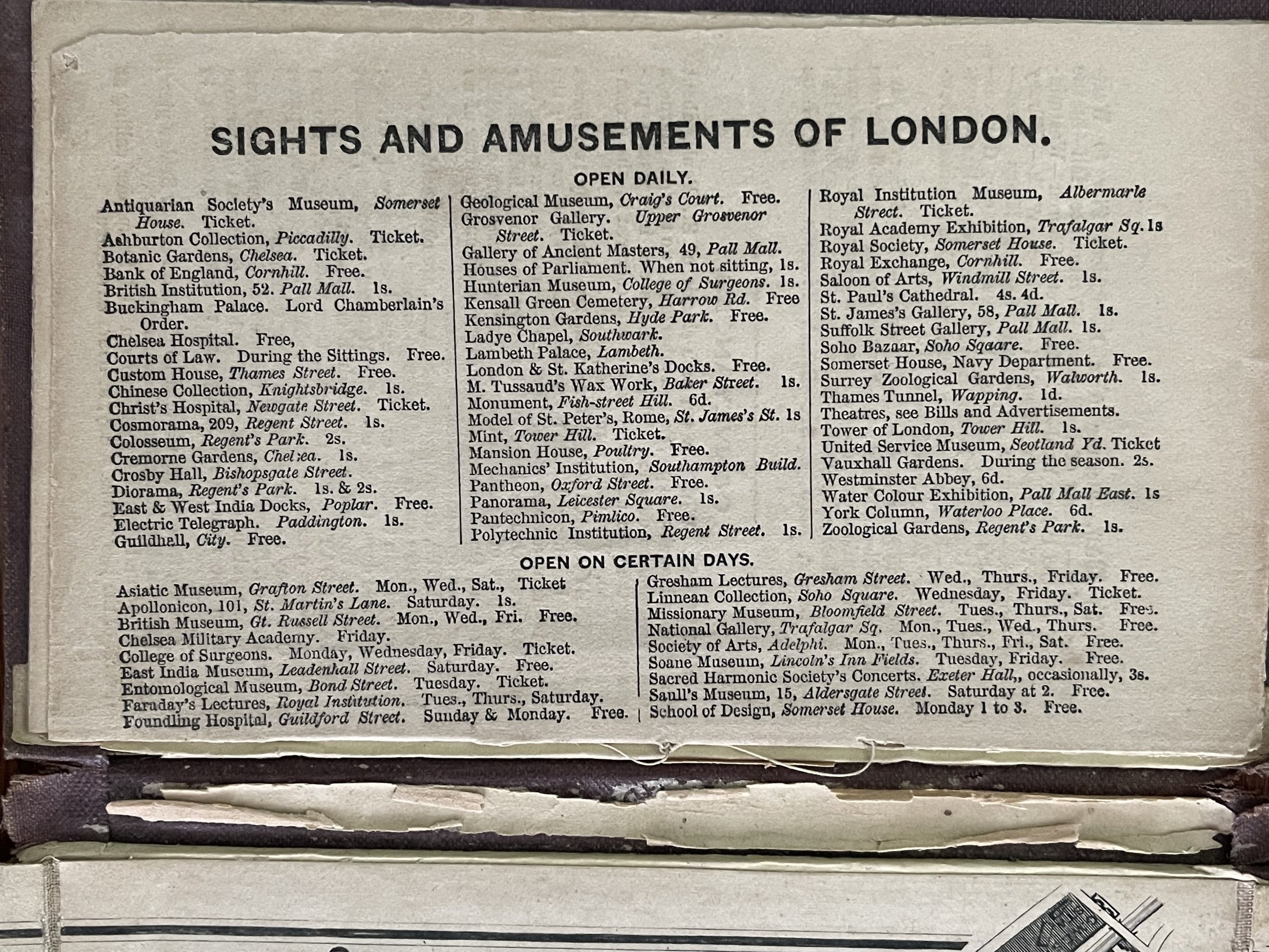
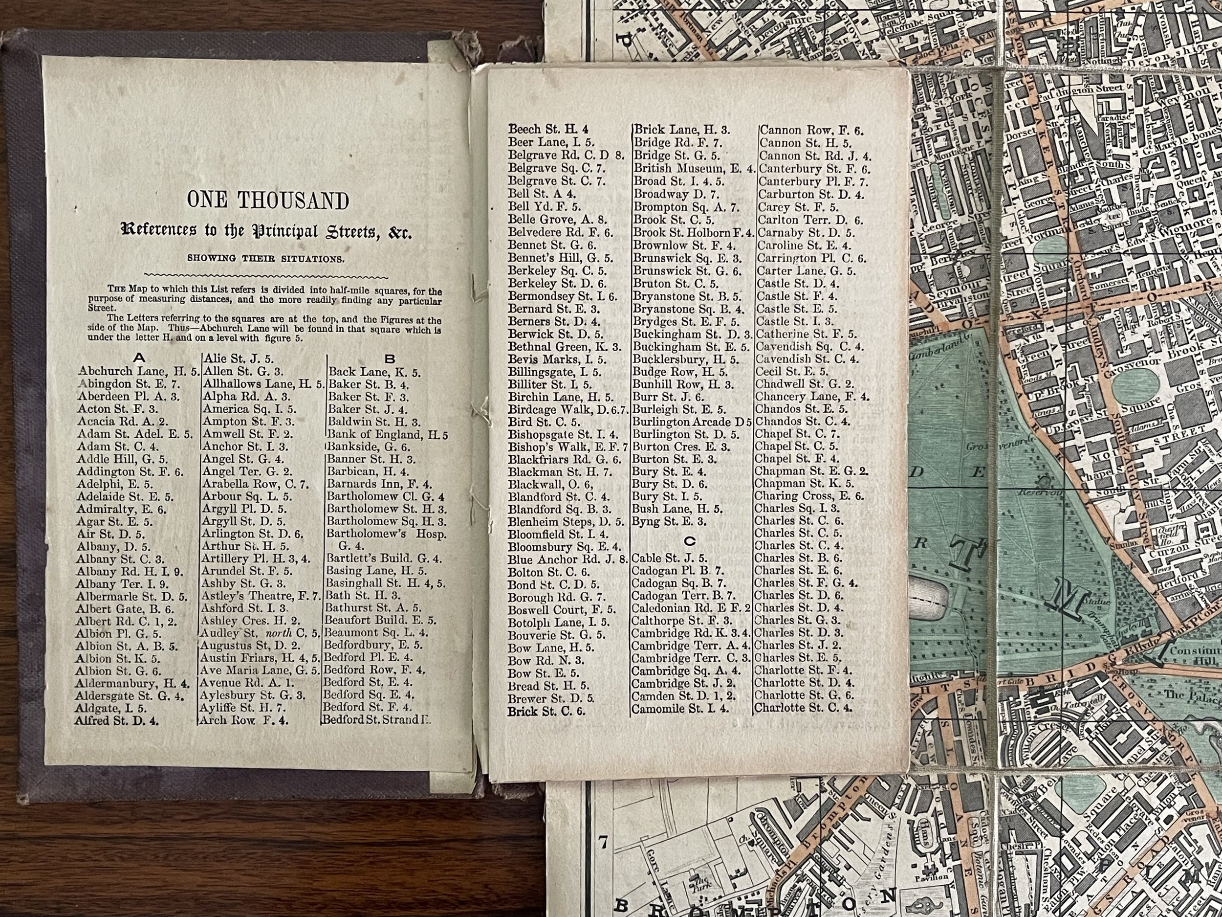
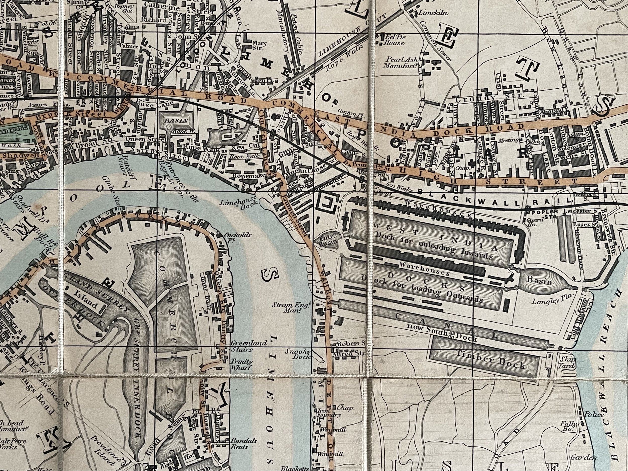
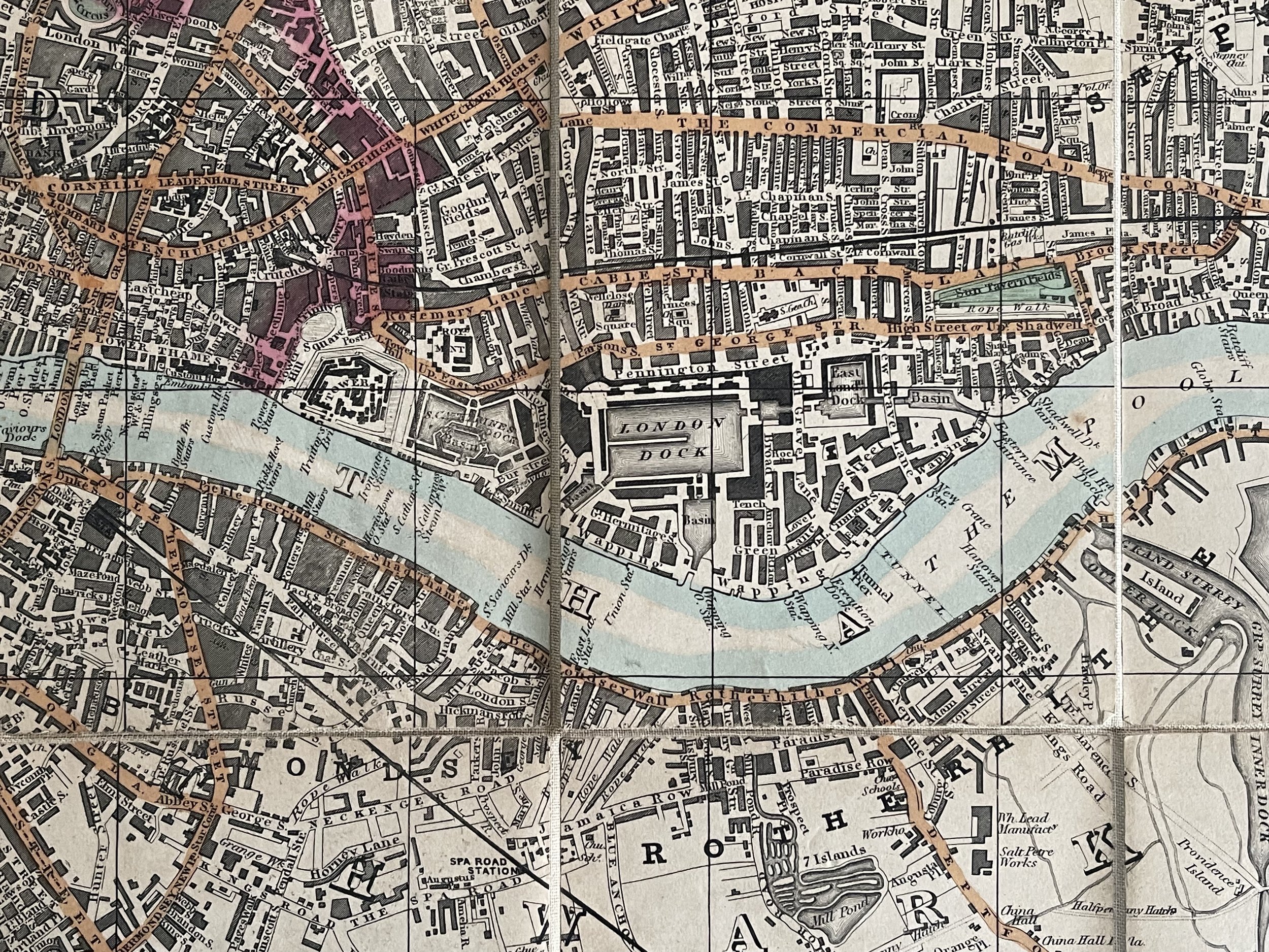
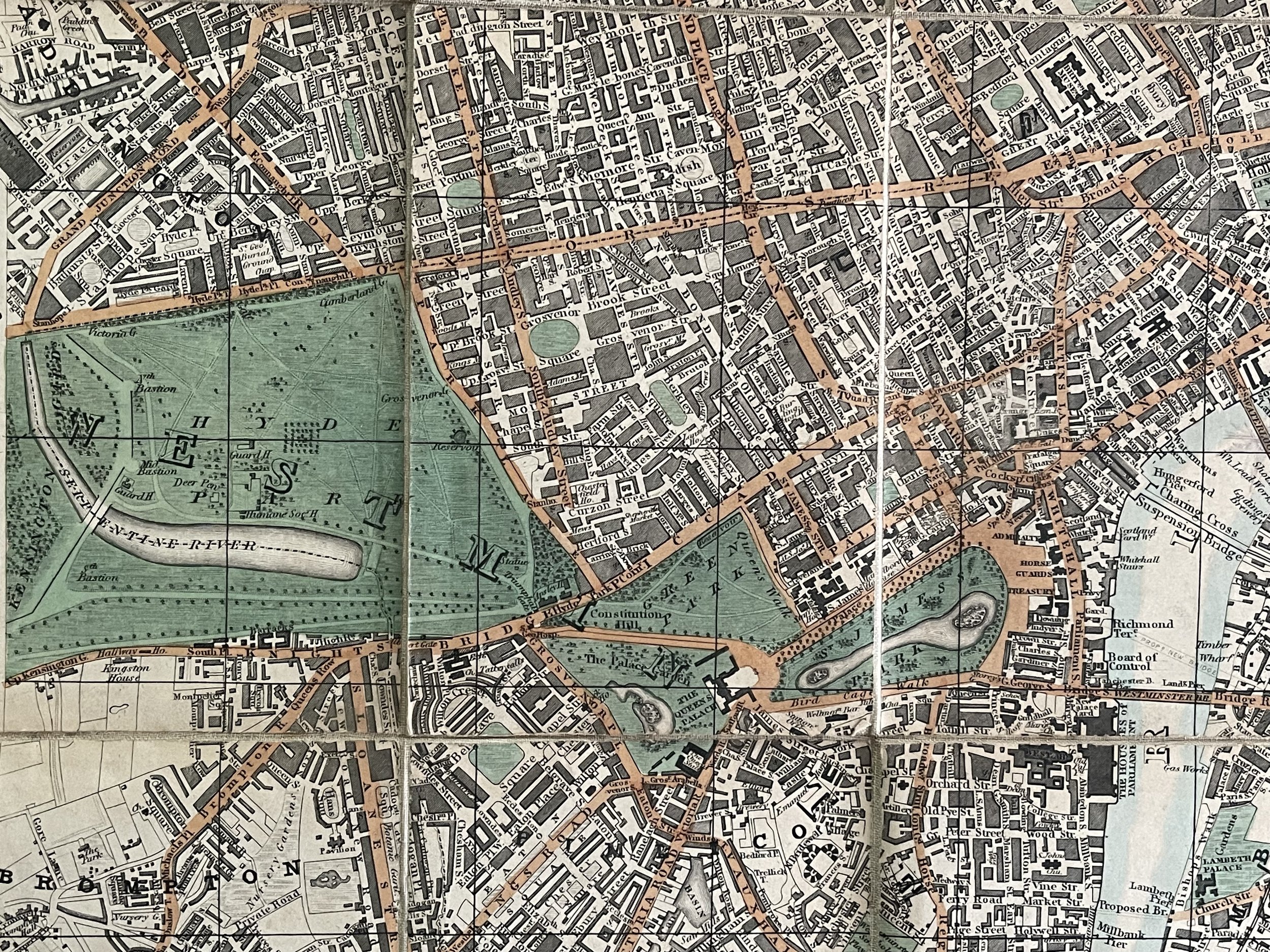
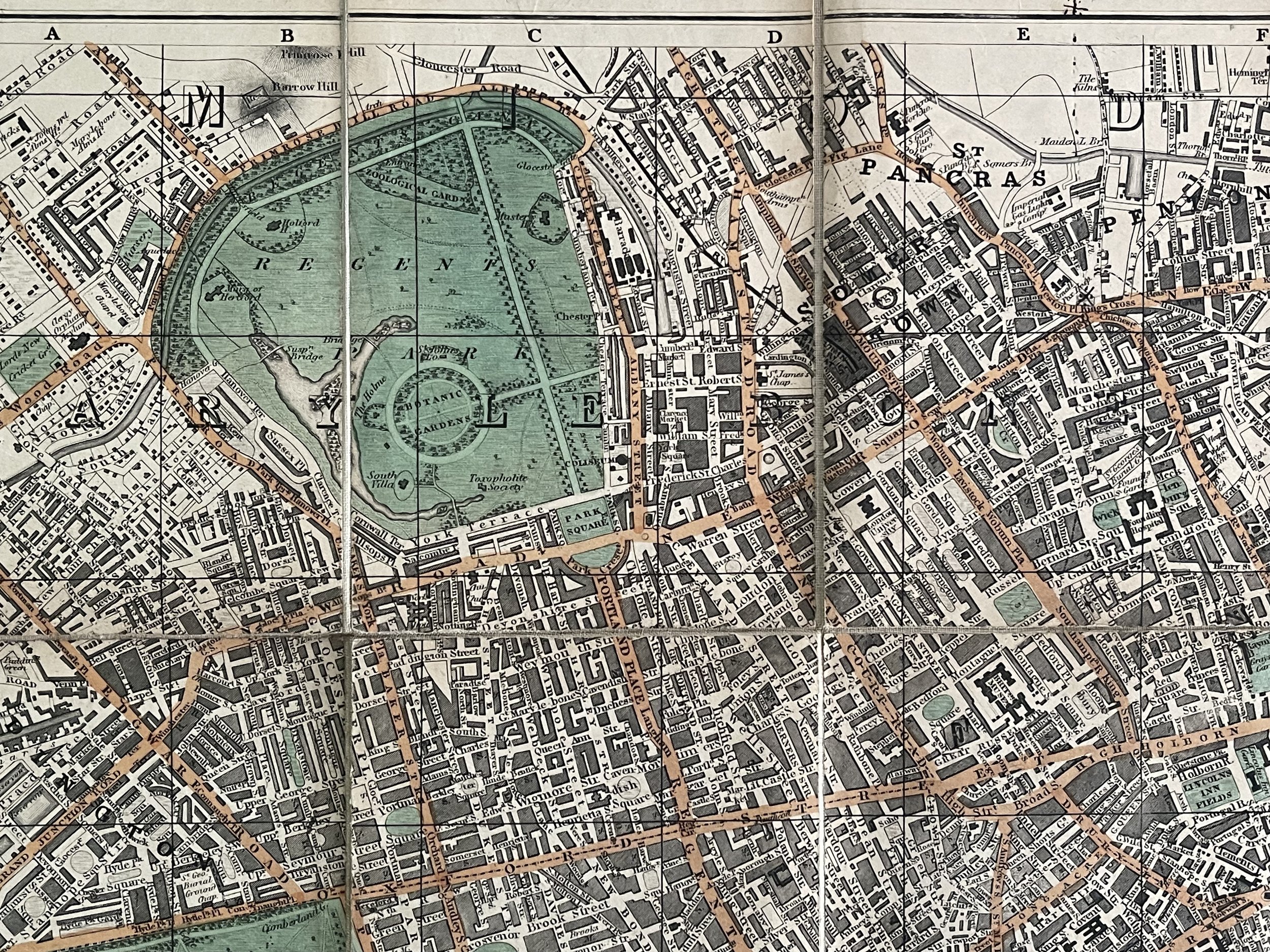
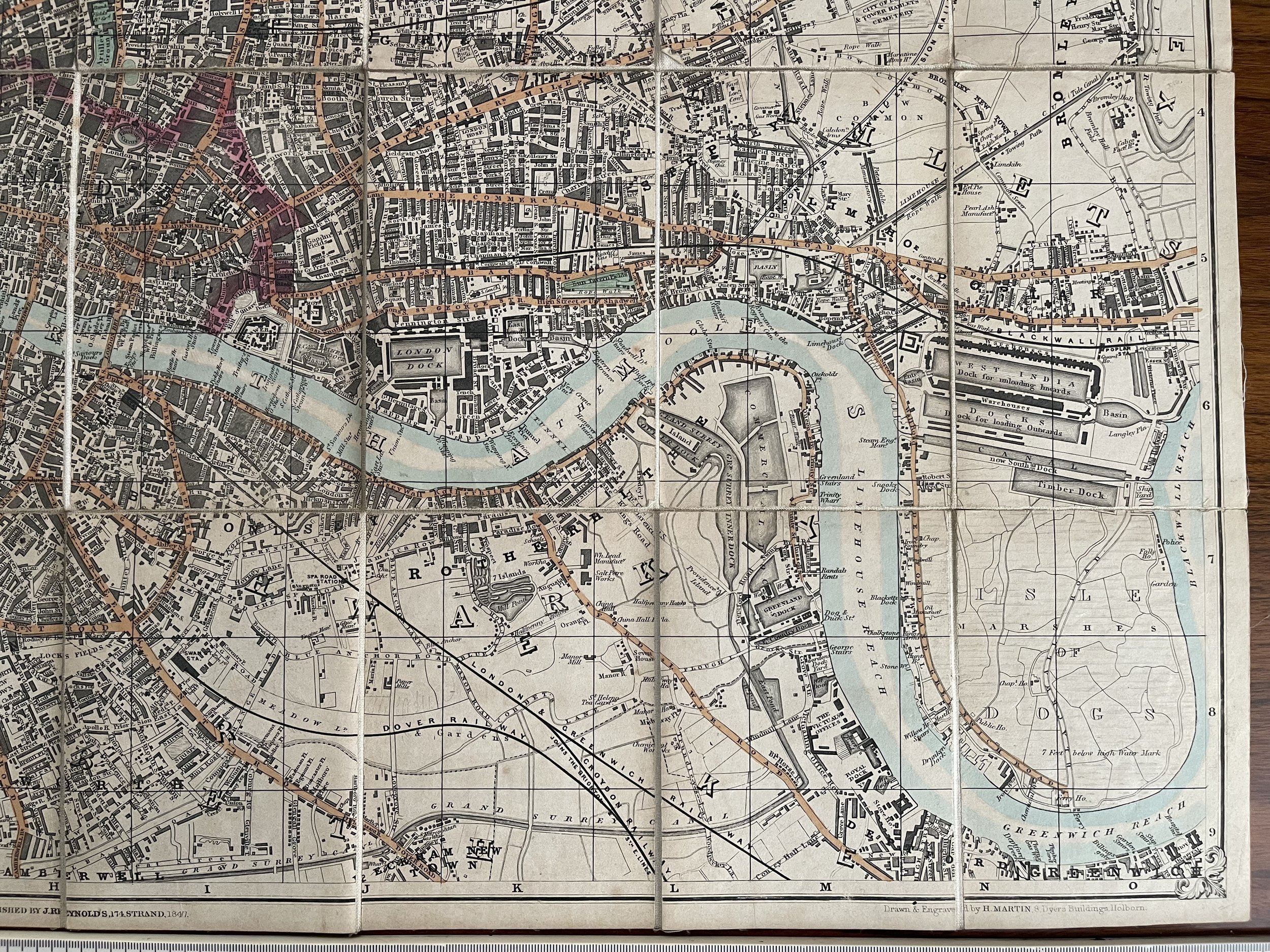
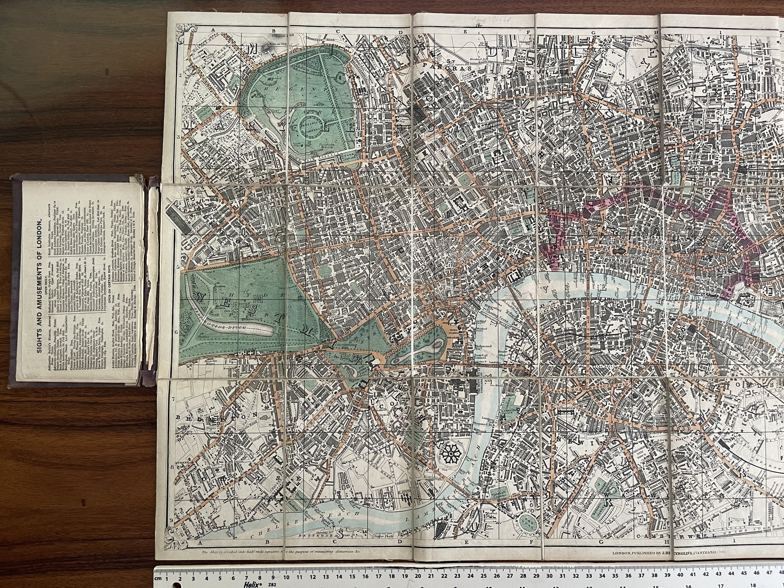
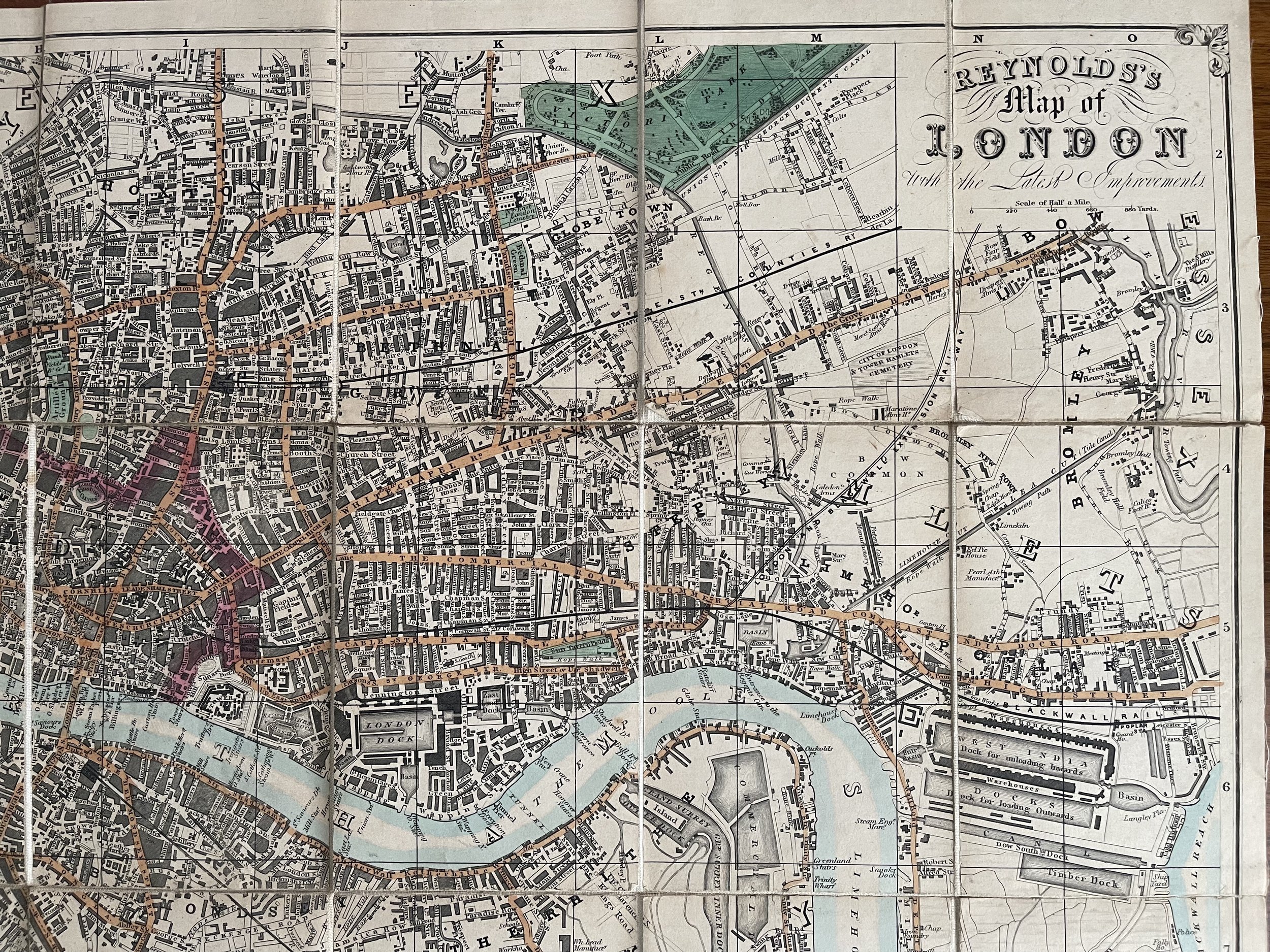
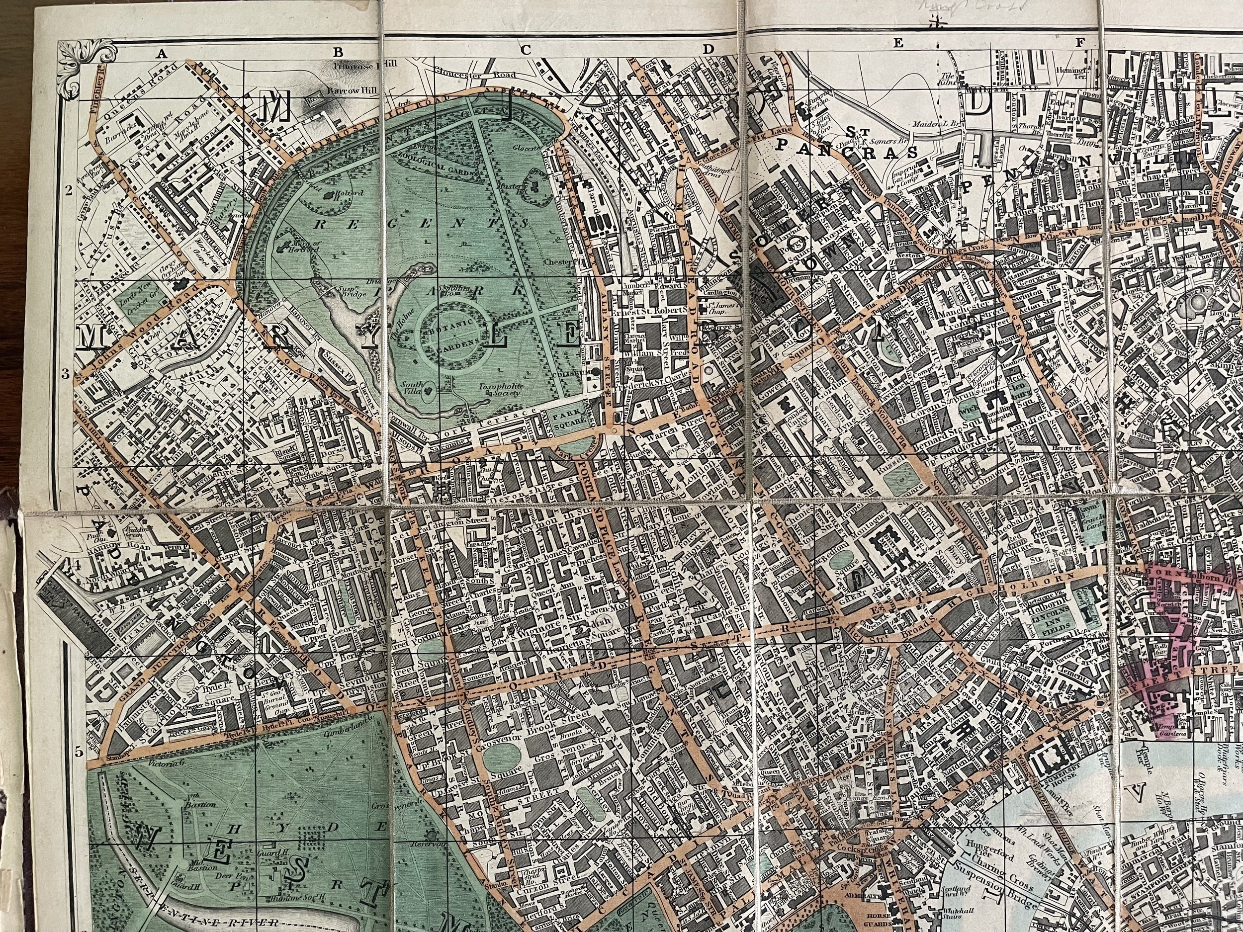
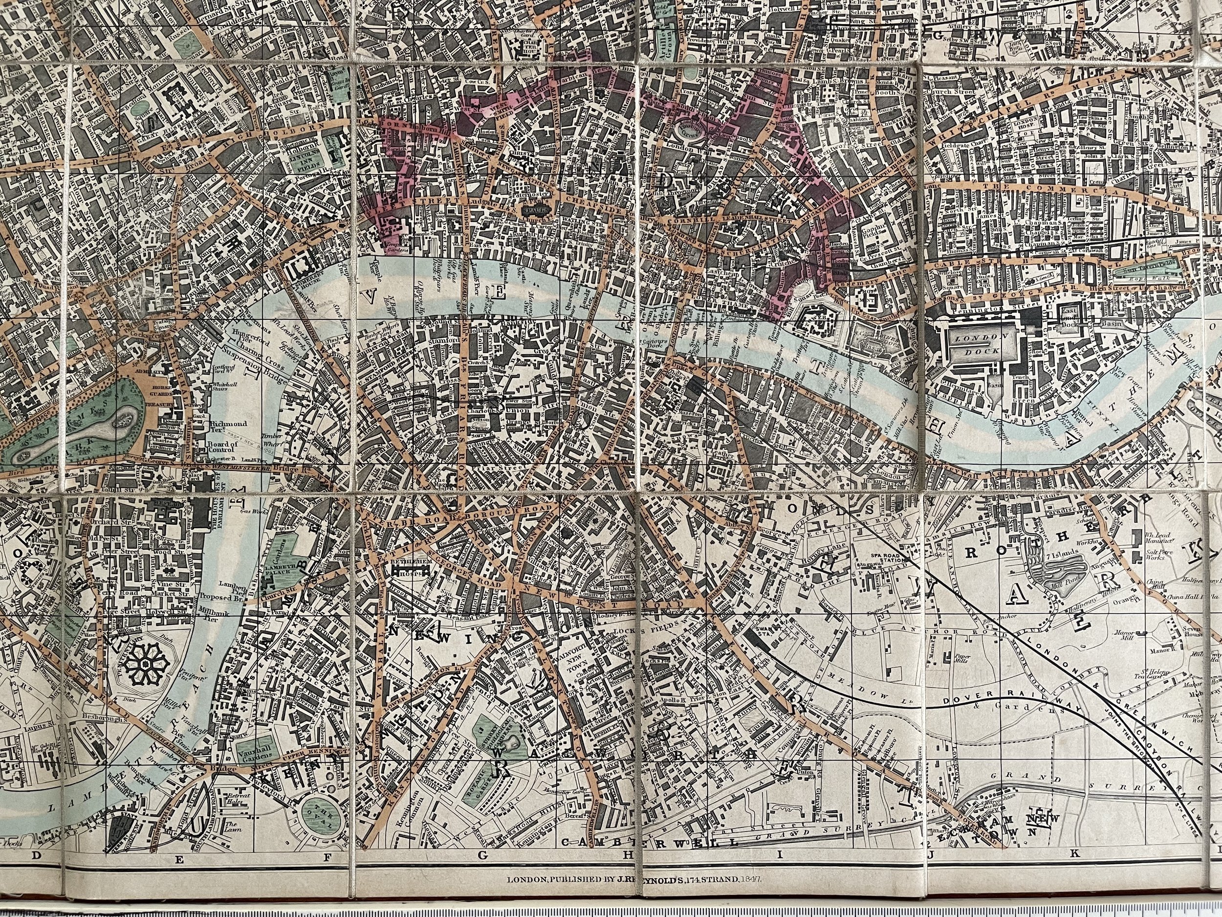
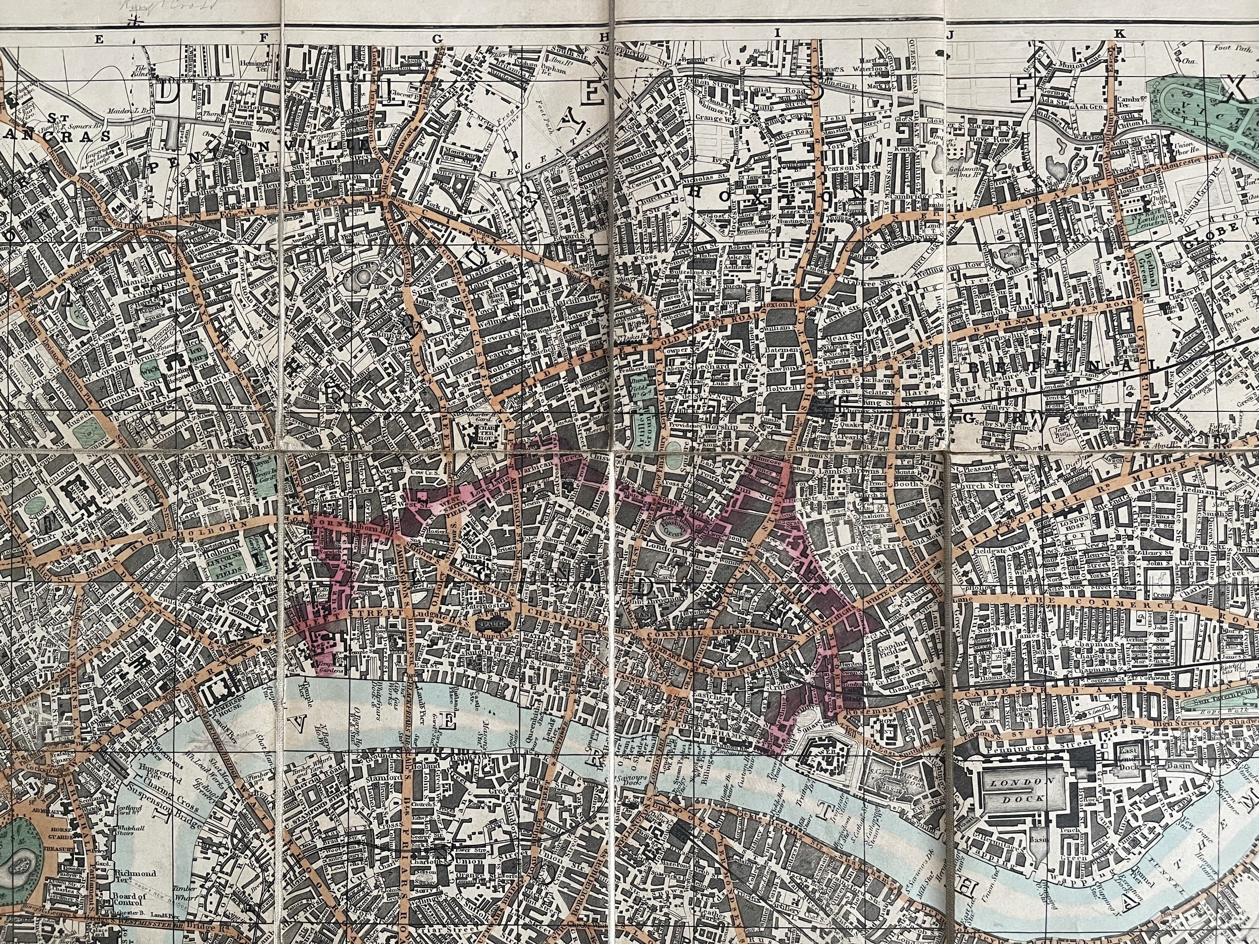
A nice clean second iteration copy of Reynolds's Splendid New Map of London 1848. Cloth backed folding map mounted in 24 sections on a scale of 4 inches to the mile. Inside the front board is a list of 1000 principal streets and a guide for viewing London in six days. The first edition of this map appeared in 1847.
James Reynolds (1817-1876)
Was a London based map and chart publisher active in the mid-19th century. Reynolds produced numerous maps and tourist guides of London and the surrounding areas as well as various astronomical and scientific charts. After Reynolds retired his sons, William Henry and Frederick, took over his business, updating and reprinting many of his maps and charts before selling the firm to Charles Smith in the late 19th century. Reynolds operated out of office at 174 Strand Street, London.
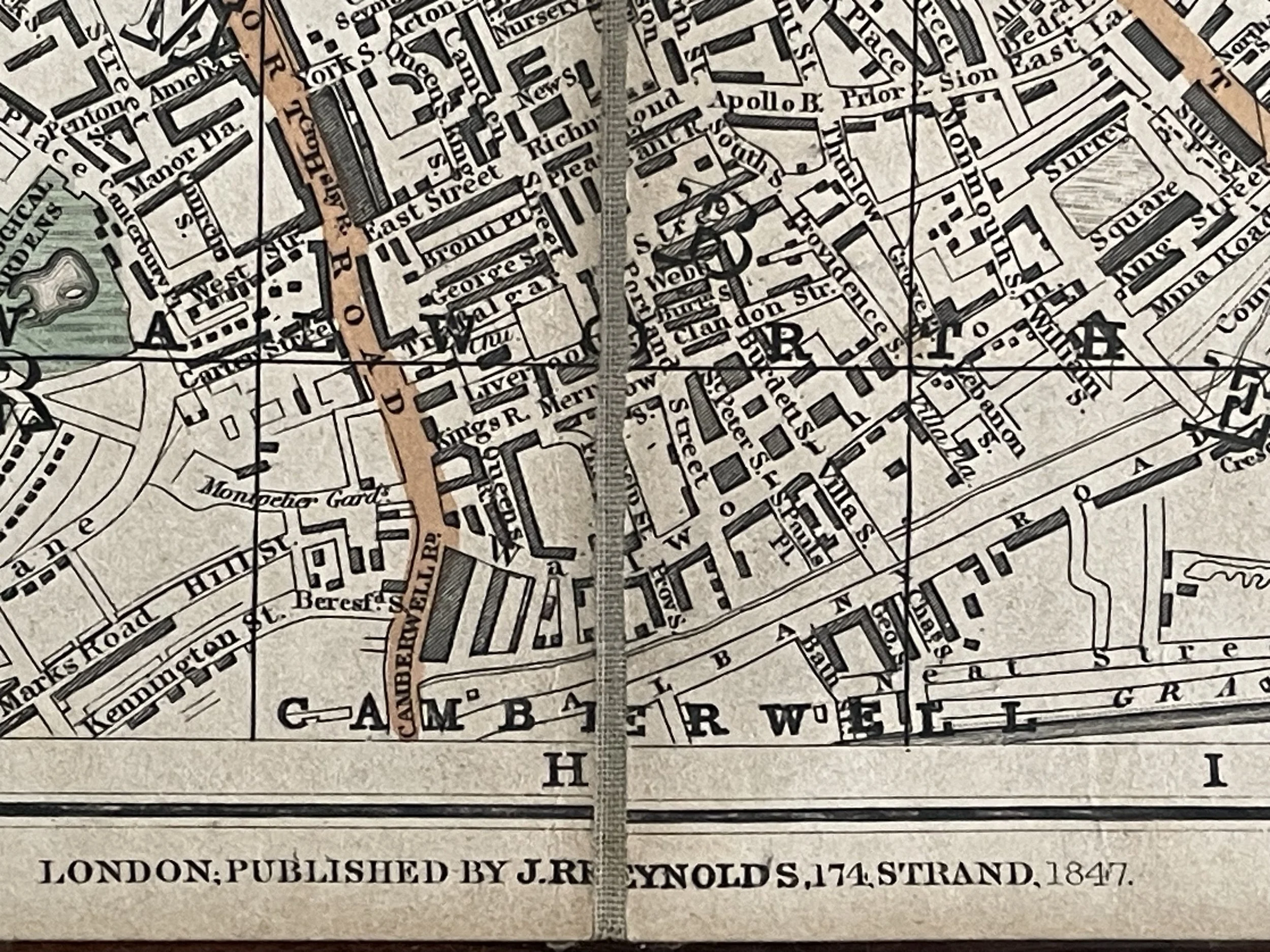
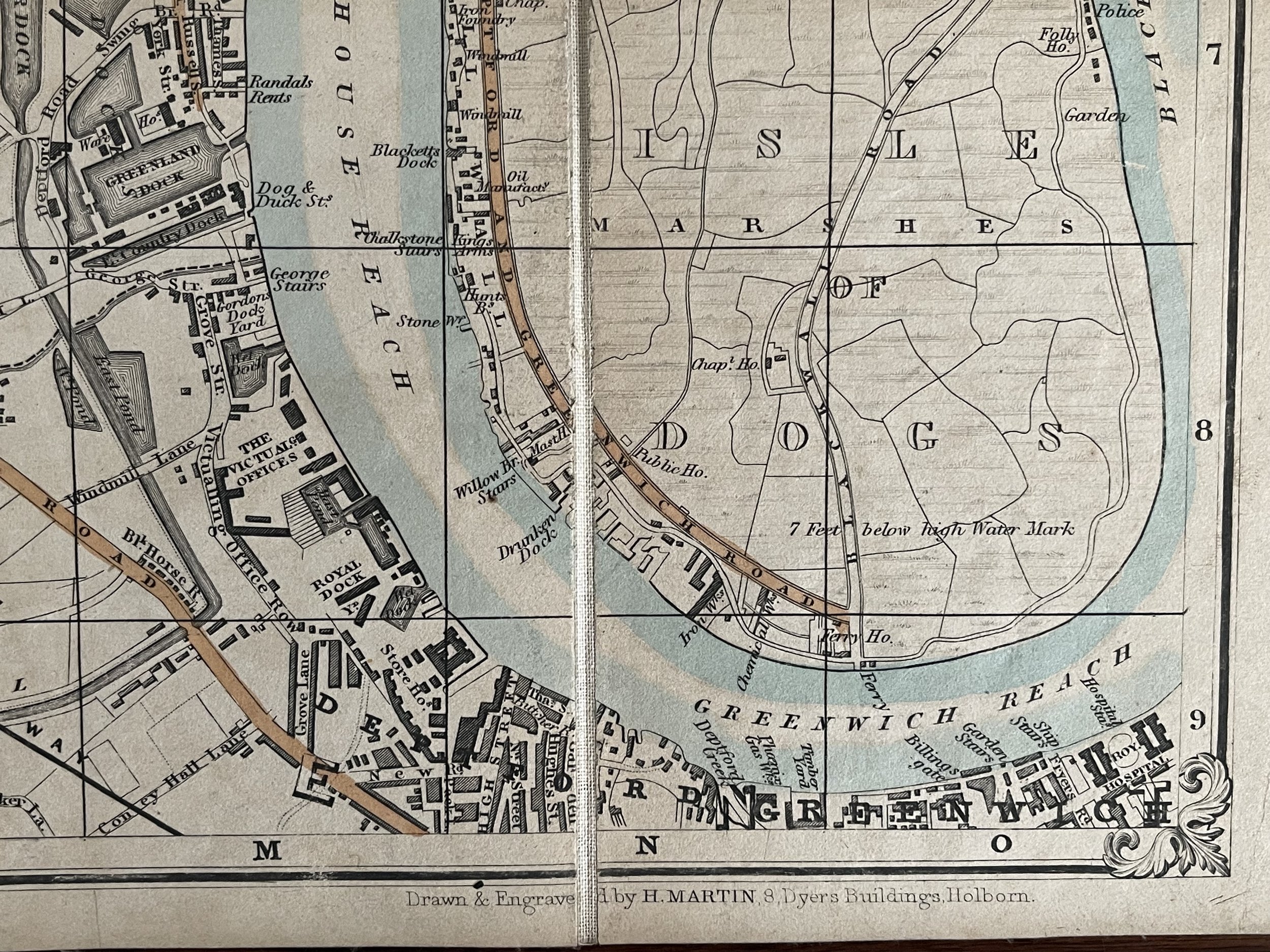
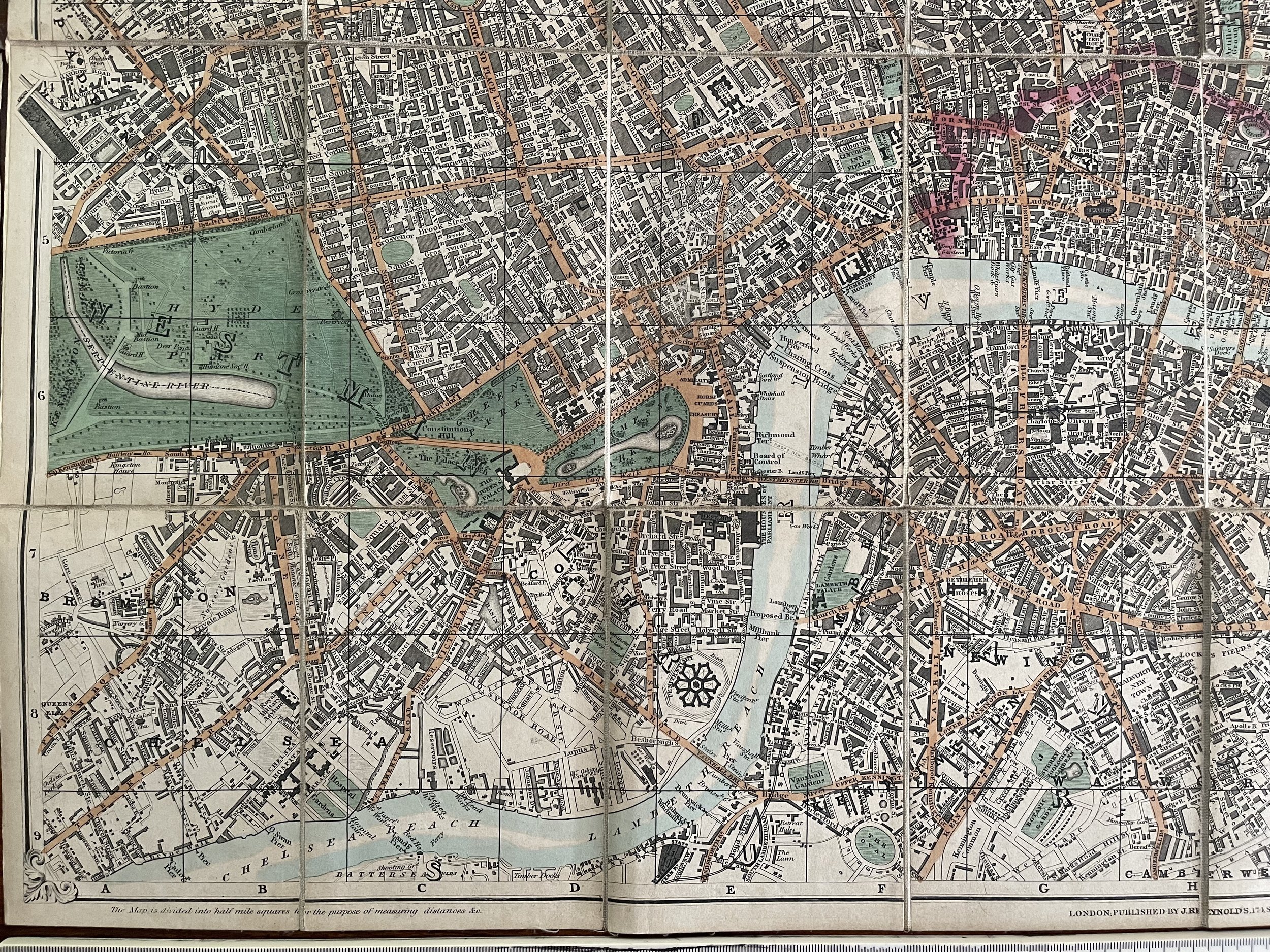
His shop was located at 174 Strand. The 1847 map was one of his first publications, and he would go on to produce regular updates to his London maps throughout the 19th century, also gradually incorporating colour into the maps. It is fascinating watch how London evolves with each new issue of Reynolds’s London map. The most distinctive feature is the hexagonal shape in the lower centre of the map. This was the Millbank Penitentiary or prison which occupied the site adjacent to the approach road to Vauxhall Bridge for much of the 19th century.
Although Vauxhall Bridge crosses the river, the rest of the river looks rather empty until Westminster Bridge, however, look midway between the two bridges and there is the location of a “Proposed Bridge”. This was the site of the future Lambeth Bridge which would open in 1862.
The area occupied by the prison can be easily located today, by referencing Vauxhall Bridge and Vauxhall Bridge Road, although the rest of the area has changed considerably. The following map extract shows the area today with the location of the prison now occupied by the housing to the north of Bessborough Gardens and up to Tate Britain. Map and OpenStreetMap contributors).
Splendid New Map of London Showing the Grand Improvements - James Reynolds - 1848 - Rare
A nice clean second iteration copy of Reynolds's Splendid New Map of London 1848. Cloth backed folding map mounted in 24 sections on a scale of 4 inches to the mile. Inside the front board is a list of 1000 principal streets and a guide for viewing London in six days. The first edition of this map appeared in 1847.
James Reynolds (1817-1876)
Was a London based map and chart publisher active in the mid-19th century. Reynolds produced numerous maps and tourist guides of London and the surrounding areas as well as various astronomical and scientific charts. After Reynolds retired his sons, William Henry and Frederick, took over his business, updating and reprinting many of his maps and charts before selling the firm to Charles Smith in the late 19th century. Reynolds operated out of office at 174 Strand Street, London.
His shop was located at 174 Strand. The 1847 map was one of his first publications, and he would go on to produce regular updates to his London maps throughout the 19th century, also gradually incorporating colour into the maps. It is fascinating watch how London evolves with each new issue of Reynolds’s London map. The most distinctive feature is the hexagonal shape in the lower centre of the map. This was the Millbank Penitentiary or prison which occupied the site adjacent to the approach road to Vauxhall Bridge for much of the 19th century.
Although Vauxhall Bridge crosses the river, the rest of the river looks rather empty until Westminster Bridge, however, look midway between the two bridges and there is the location of a “Proposed Bridge”. This was the site of the future Lambeth Bridge which would open in 1862.
The area occupied by the prison can be easily located today, by referencing Vauxhall Bridge and Vauxhall Bridge Road, although the rest of the area has changed considerably. The following map extract shows the area today with the location of the prison now occupied by the housing to the north of Bessborough Gardens and up to Tate Britain. Map and OpenStreetMap contributors).
Code : A1024
Cartographer : Cartographer / Engraver / Publisher: James Reynolds
Date : Publication Place / Date - 1848
Size : Sheet size: Image Size: 79.5 X 43 cm
Availability : Available
Type - Genuine - Antique
Grading A
Where Applicable - Folds as issued. Light box photo shows the folio leaf centre margin hinge ‘glue’, this is not visible otherwise.
Tracked postage, in casement. Please contact me for postal quotation outside of the UK.