Suffolke described and divided into Hundreds - 1610/11 - Unframed.
London: John Speed, c. 1611. A magnificent and early, ornate county map of Suffolk with coats of arms, Roman figures and an inset town plan of Ipswich.
Dated to 1610/11 - Provinence - Thomas Chubb The Printed Maps in the Atlases of Great Britain and Ireland 1579-1870 - Page 25, No 17 explains that this map shows the map is performed by John Speed (Speede), solde by George Hubble (Huble) 1610 (See photo). The scale is also correct at 10 miles = 3 1/4 Inches. A plan of Ipswiche is shown to the top centre as is the Royal Arms top left. All the coats of Arms for the Earls and Dukes of the time are also correct. The map shows ornate cherubs, a Ship at sea off of the port of Orford and has been coloured at a later date. Some staining outside of the engraving neatline, around the periphery, where is has been in a frame for many years. Price and grading commensurate. The map shows signs of discolouration due to bleaching which is not uncommon considering its 415+ year age.
Suffolk is one of Speed's more interesting county maps historically speaking. The geography was based on that of Saxton, as was often the case in East Anglia. The county was always wealthy due to its success as an agricultural centre as well as having several important towns. Its coastline on the North Sea ensured a thriving fishing industry and its proximity to the mainland of Europe provided many of the coastal towns with other avenues for trade.
The most prominent feature on the map is the large city plan of Ipswich given pride of place on the upper centre. It is larger than most of Speed town plans and it is also another of the plans known to have been provided by Speed himself. The detail and elaboration indicate its importance. It was both one of the oldest settlements in the country, established in Roman times as well as being an important port. This depiction is also believed to be the first printed image of the town.
The map is particularly ornate, even by Speed's standards. Two figures flank the town of Ipswich: one is that of "Boadicia" or Boadicea, an ancient British queen from the Romano British period, who rose against the Romans and briefly threatened to end Roman rule in the country and who has since become a figure of legend. The other figure is a far more obscure Romano British ruler, Pet.Cerfalis.
The two side panels are dedicated to the coats of arms of the Earls of Suffolk on the right, a title in the British peerage going back to Norman times and held by the Howard family for centuries and on the left, an even more illustrious set of armorial shields, this time dedicated to the Earls and Dukes of Clare, named after another major town in the county. This is a slightly more peculiar title in that it was created during the Norman period in the 11th century and held by the powerful de Clare family.
However, it appears to have been self-styled and was not officially created until 1624. Despite this, Speed seems to have no hesitation in styling the de Clare family as Earls of Clare; the earldom was later combined with the Dukedom of Clarence, another medieval title which is now more often associated with the members of the British royal family.
John Speed (1551 or 1552 – 28 July 1629) was an English cartographer, chronologer and historian of Cheshire origins. The son of a citizen and Merchant Taylor in London, he rose from his family occupation to accept the task of drawing together and revising the histories, topographies and maps of the Kingdoms of Great Britain as an exposition of the union of their monarchies in the person of King James I and VI. He accomplished this with remarkable success, with the support and assistance of the leading antiquarian scholars of his generation. He drew upon and improved the shire maps of Christopher Saxton, John Norden and others, being the first to incorporate the hundred-boundaries into them, and he was the surveyor and originator of many of the town or city plans inset within them. His work helped to define early modern concepts of British national identity. His Biblical genealogies were also formally associated with the first edition of the King James Bible. He is among the most famous of English mapmakers.
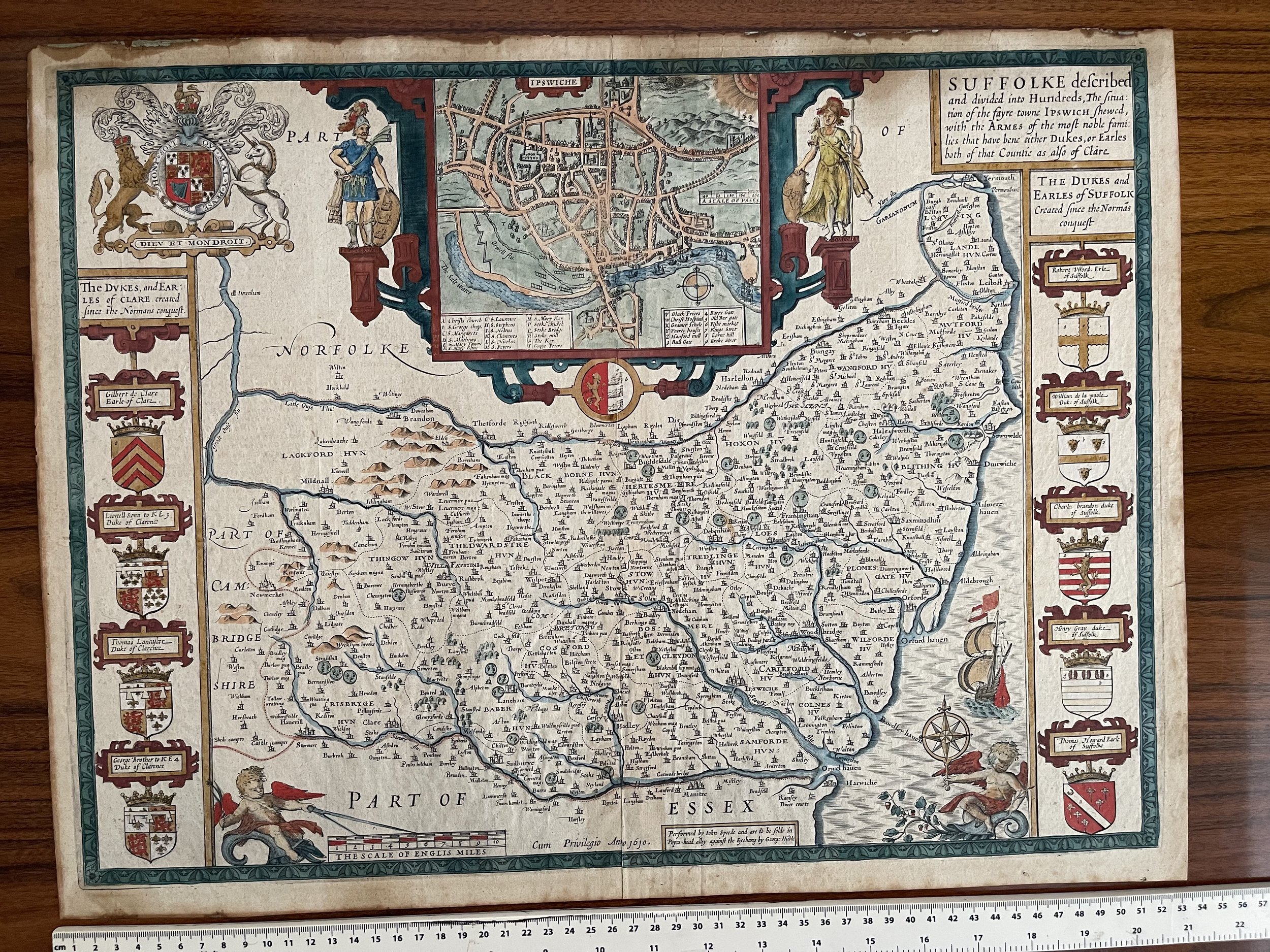 Image 1 of 16
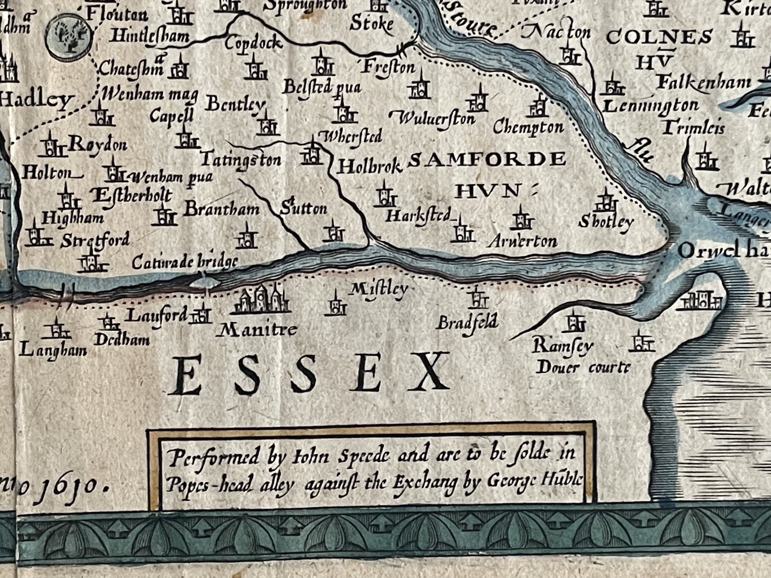 Image 2 of 16
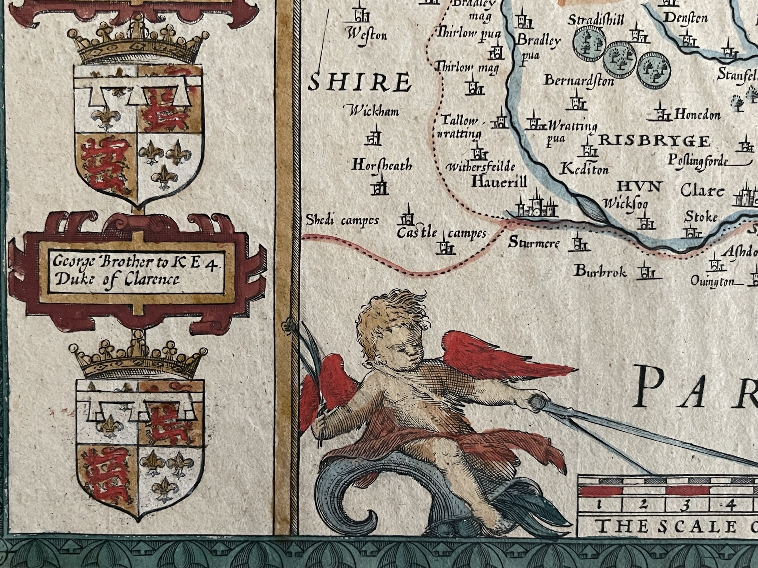 Image 3 of 16
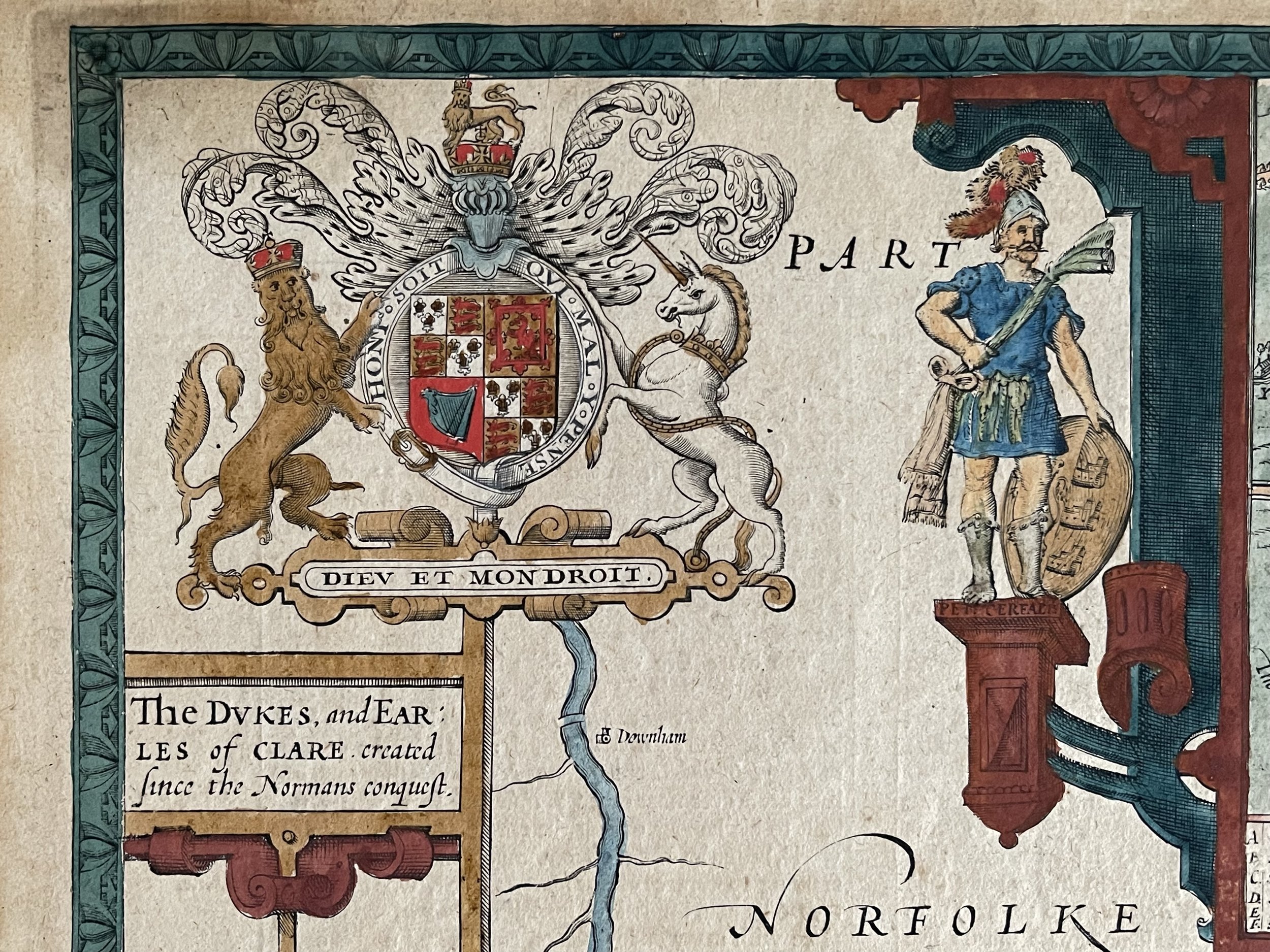 Image 4 of 16
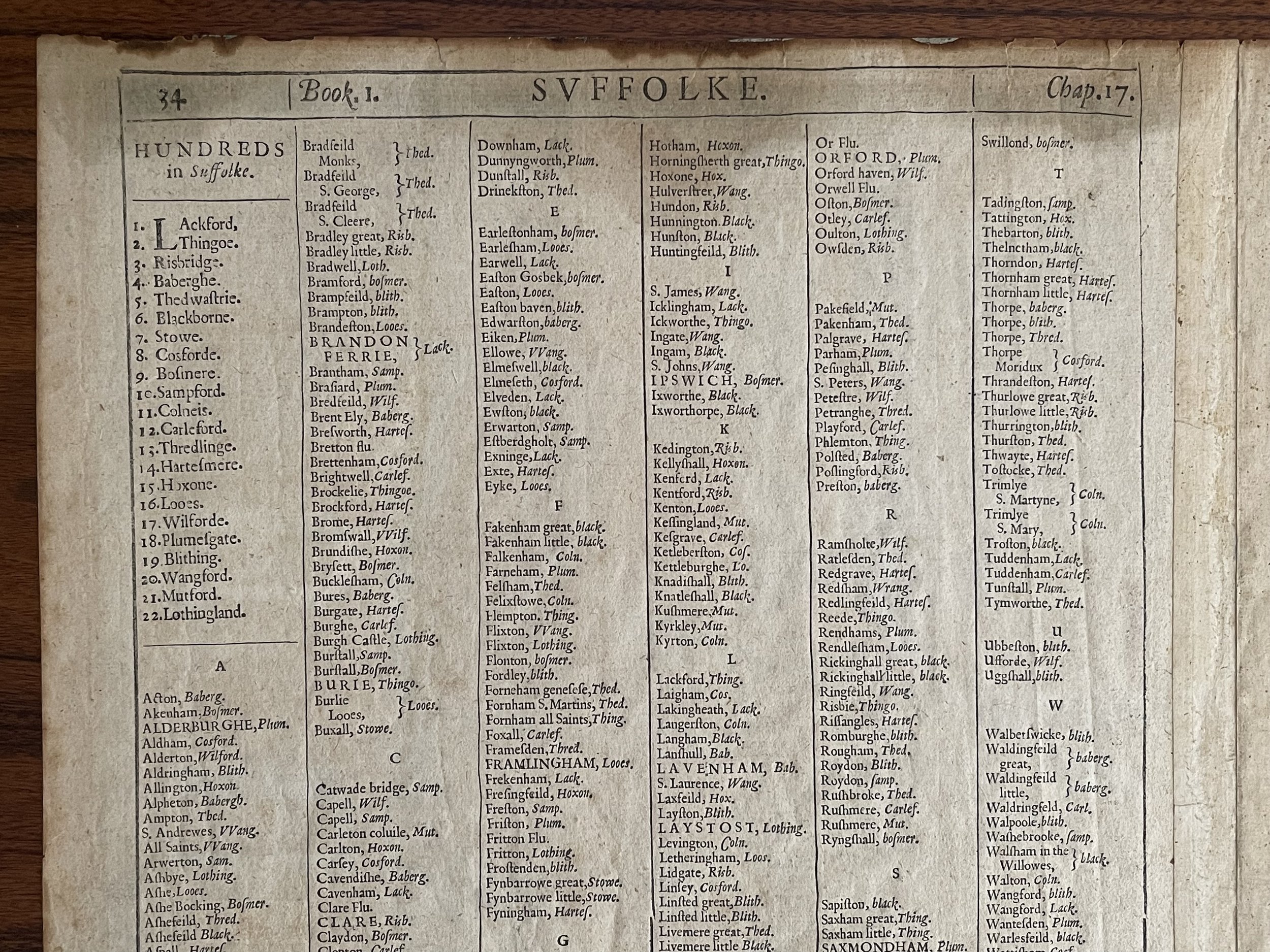 Image 5 of 16
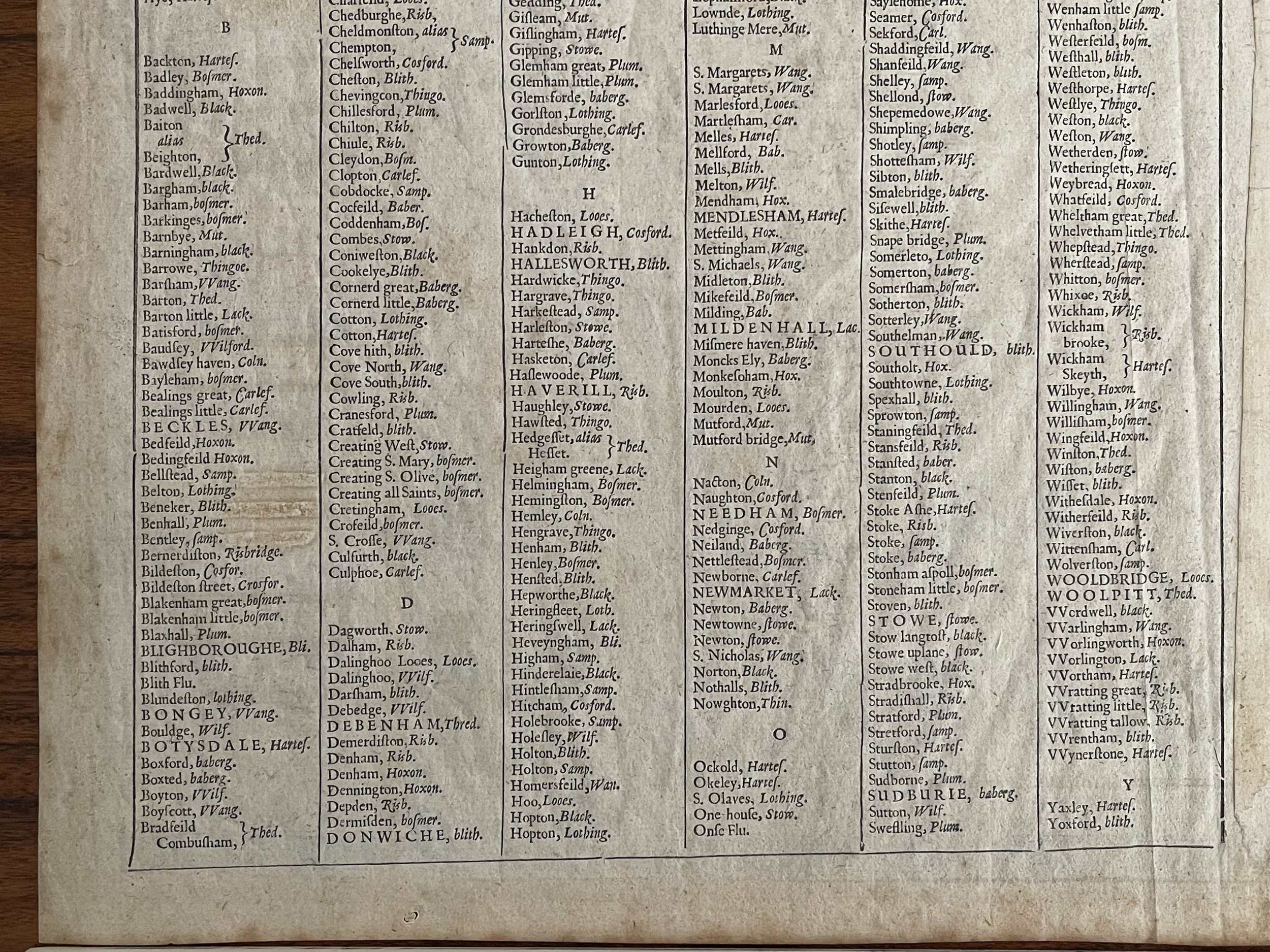 Image 6 of 16
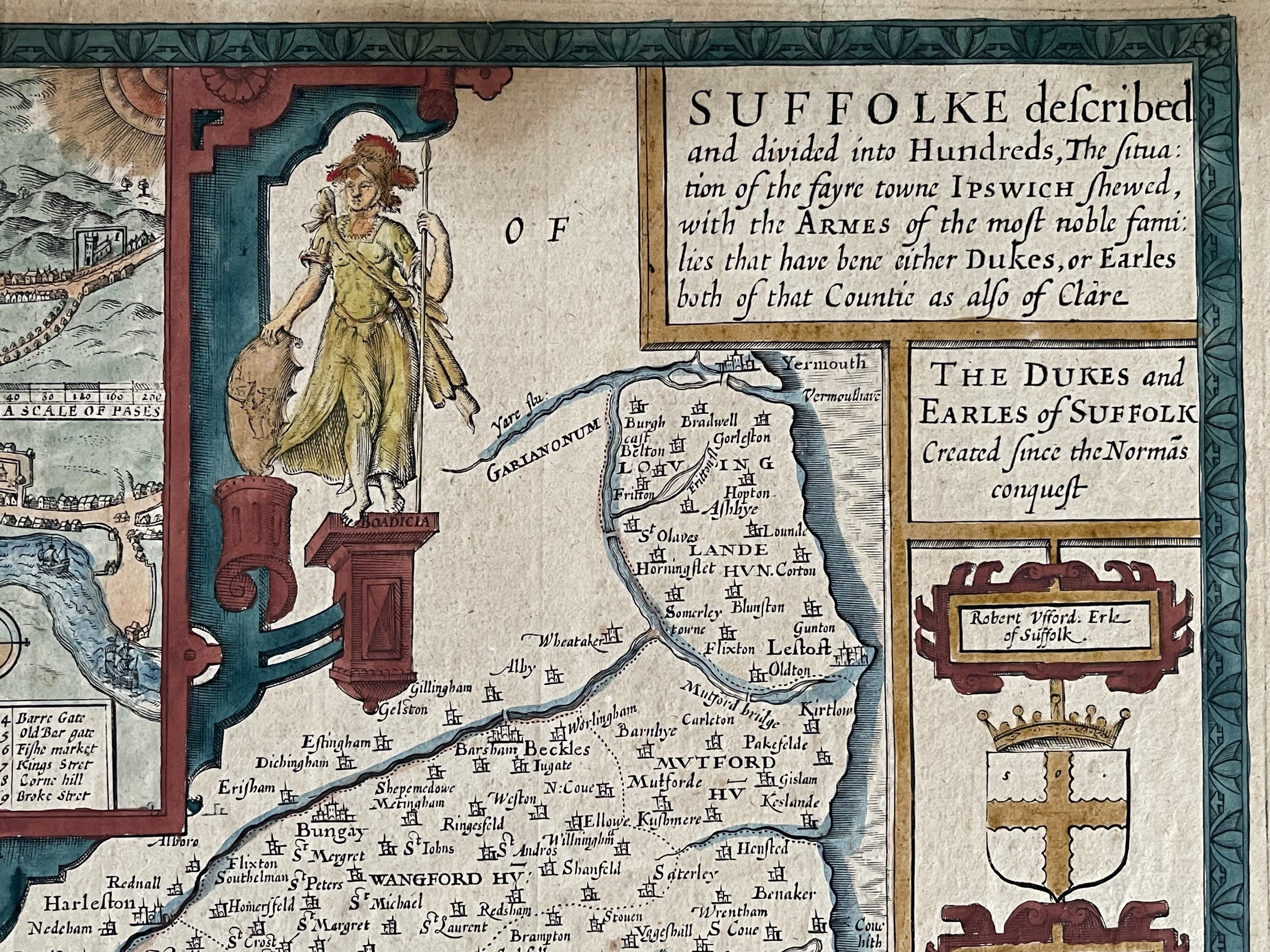 Image 7 of 16
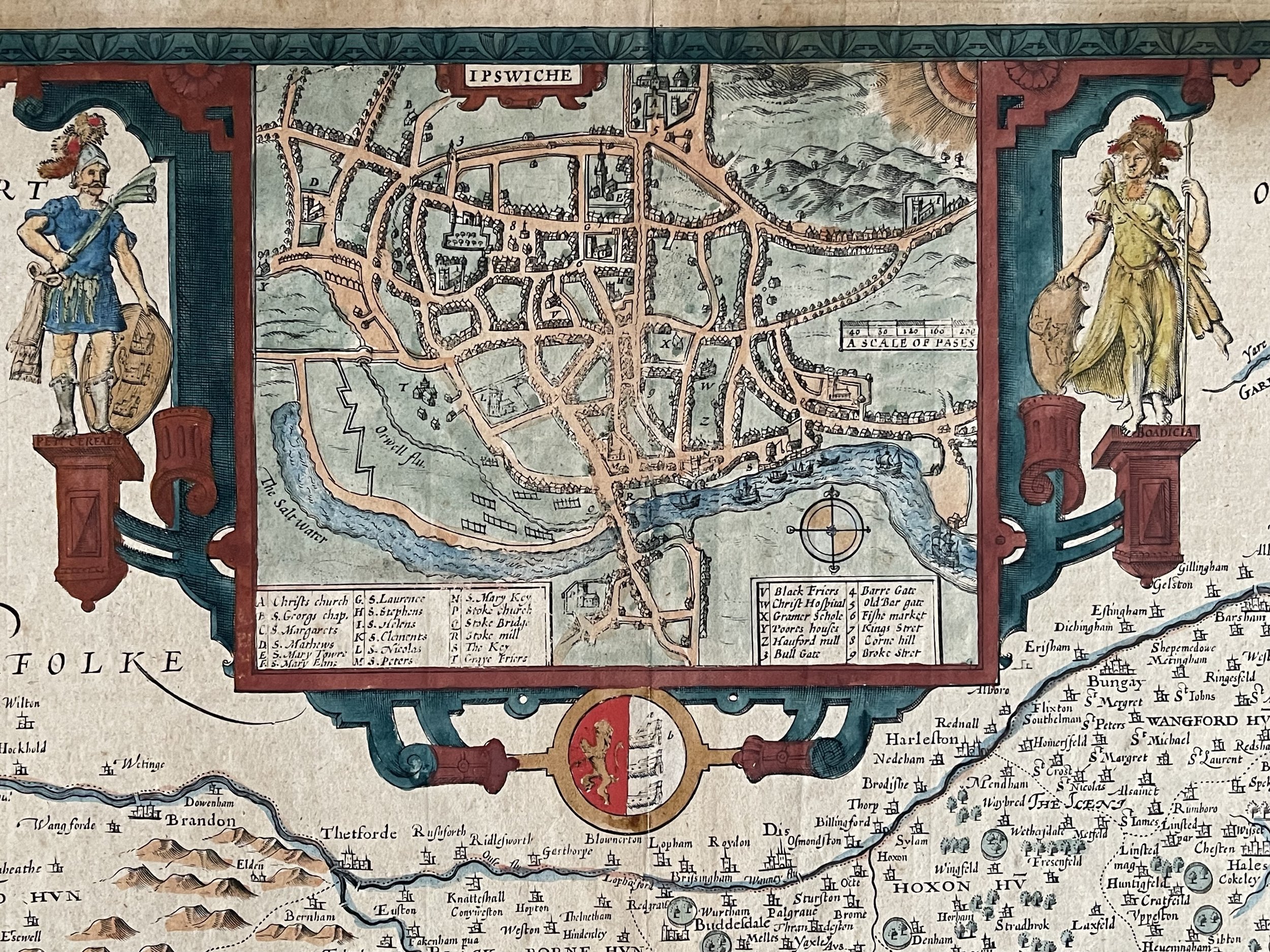 Image 8 of 16
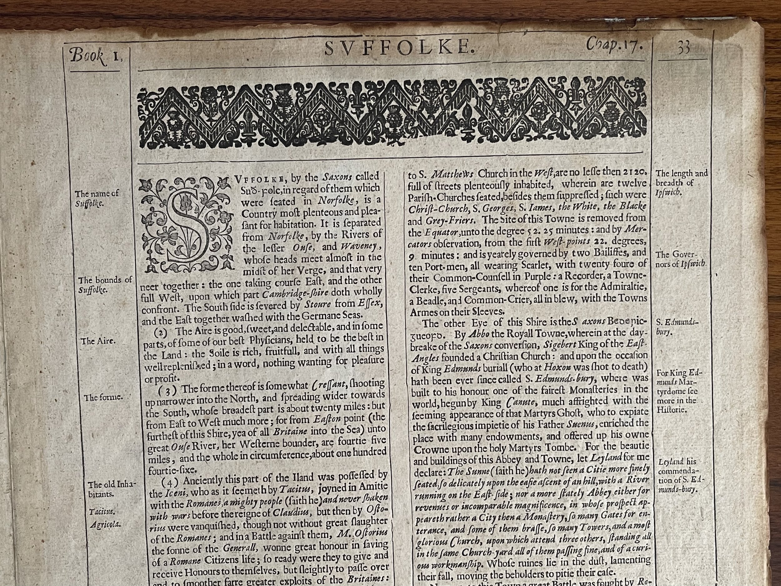 Image 9 of 16
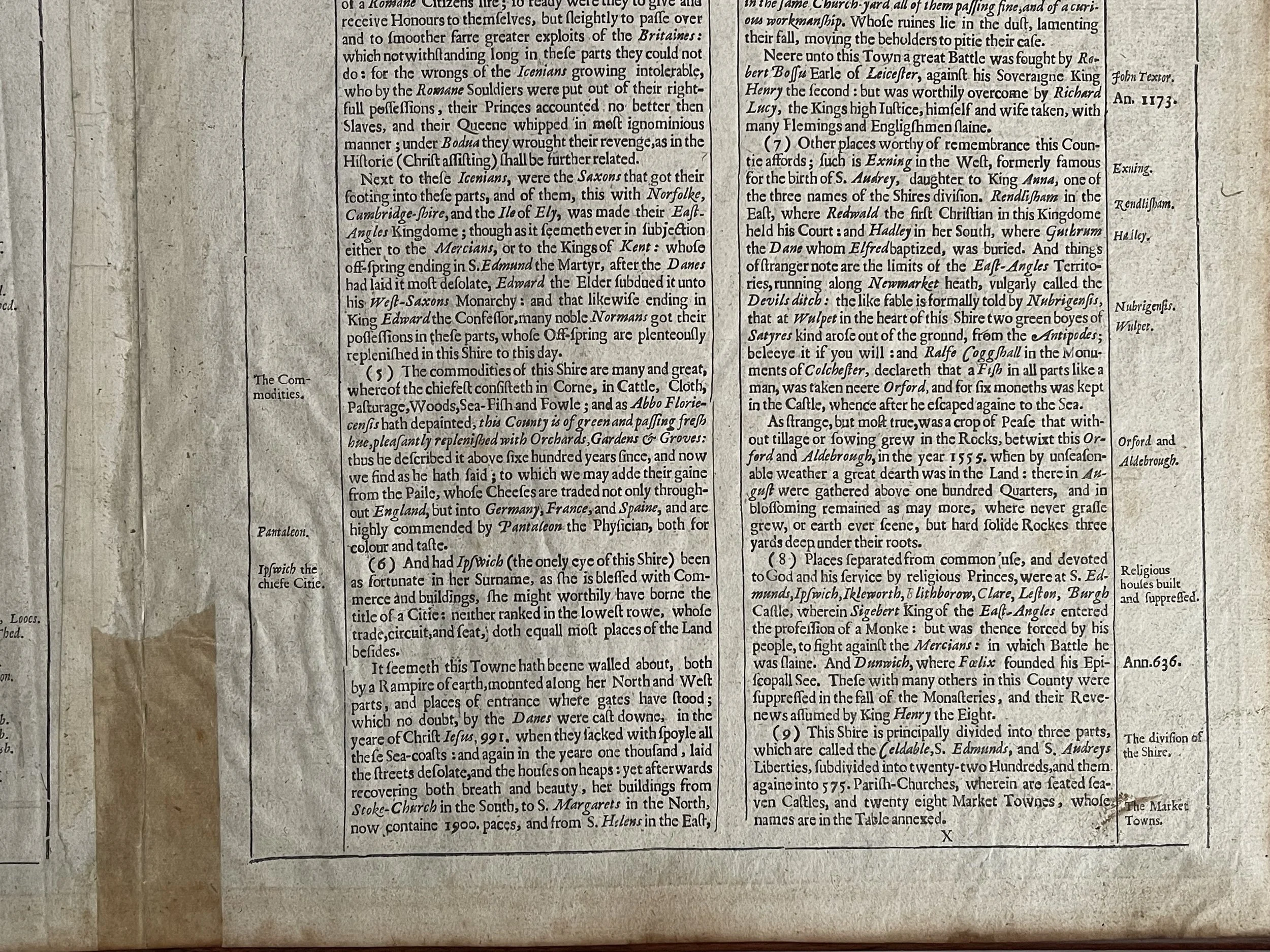 Image 10 of 16
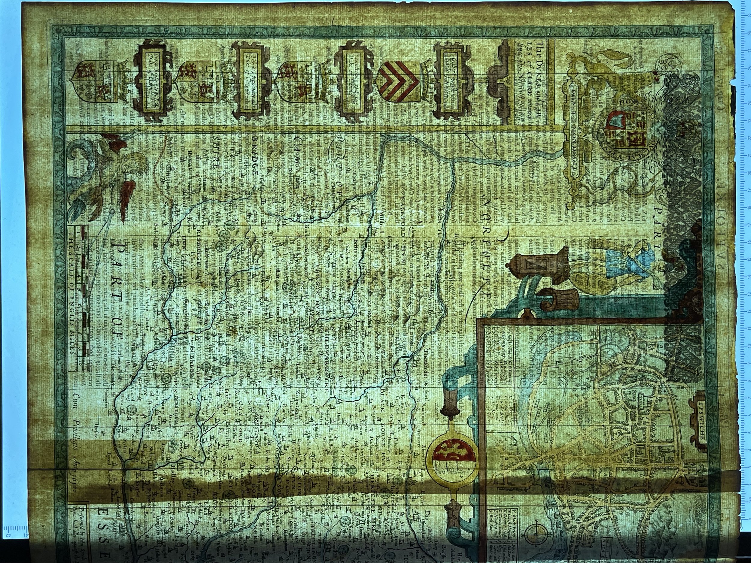 Image 11 of 16
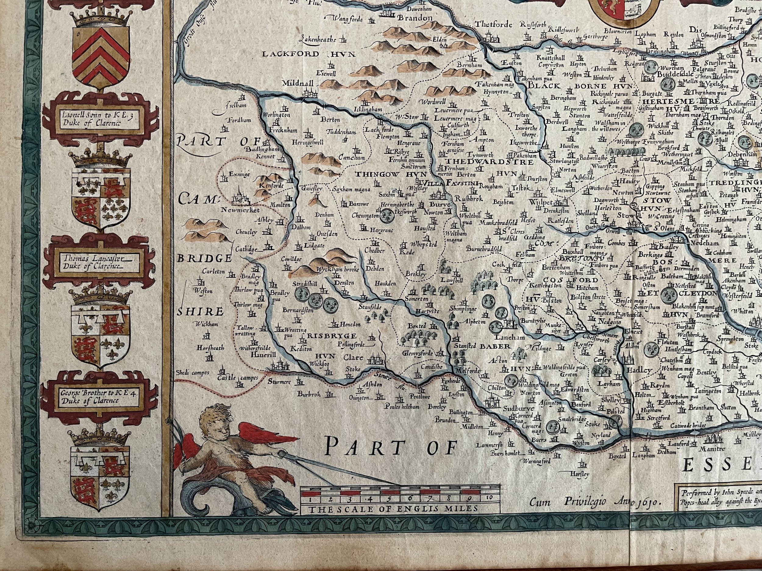 Image 12 of 16
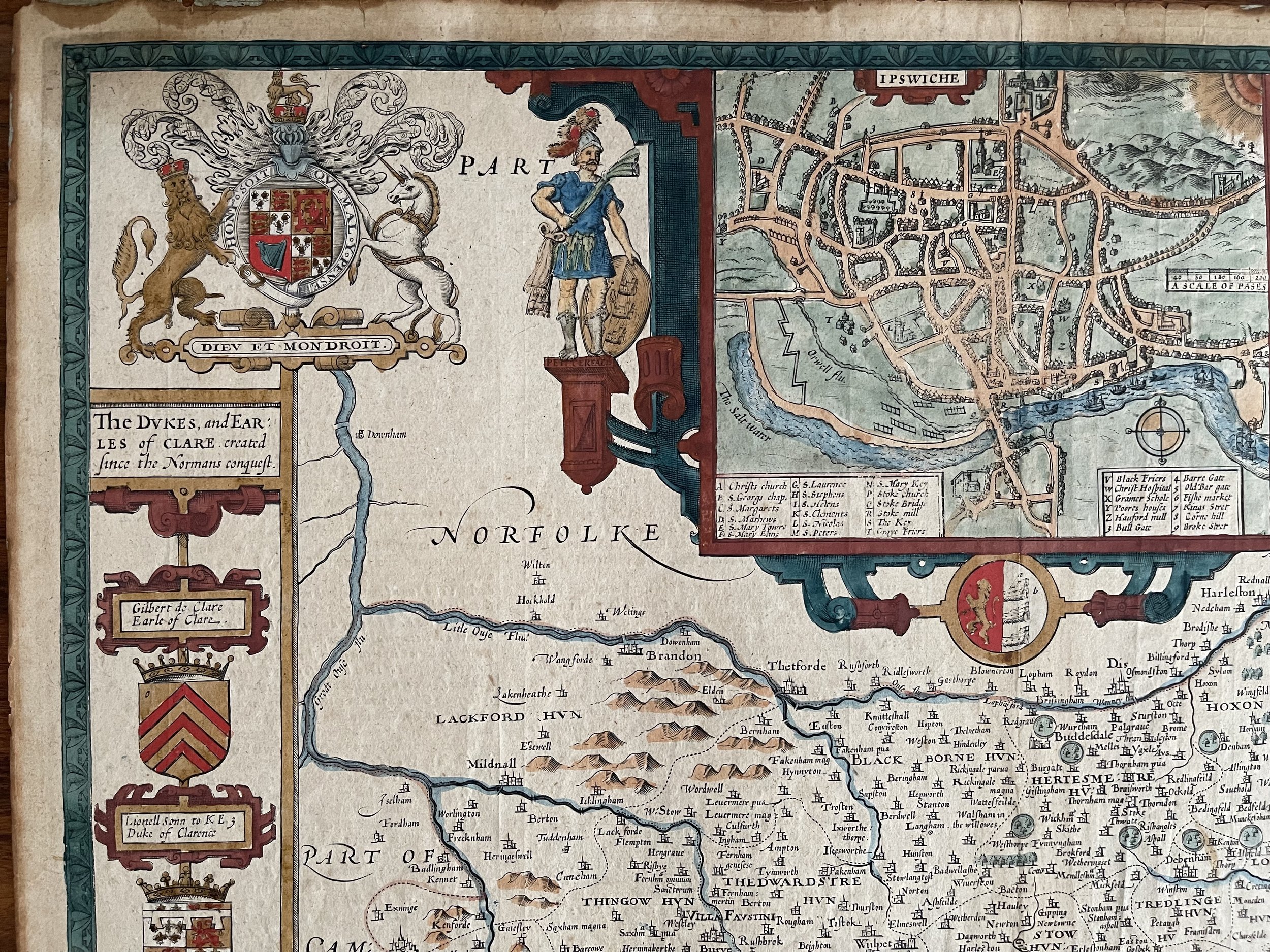 Image 13 of 16
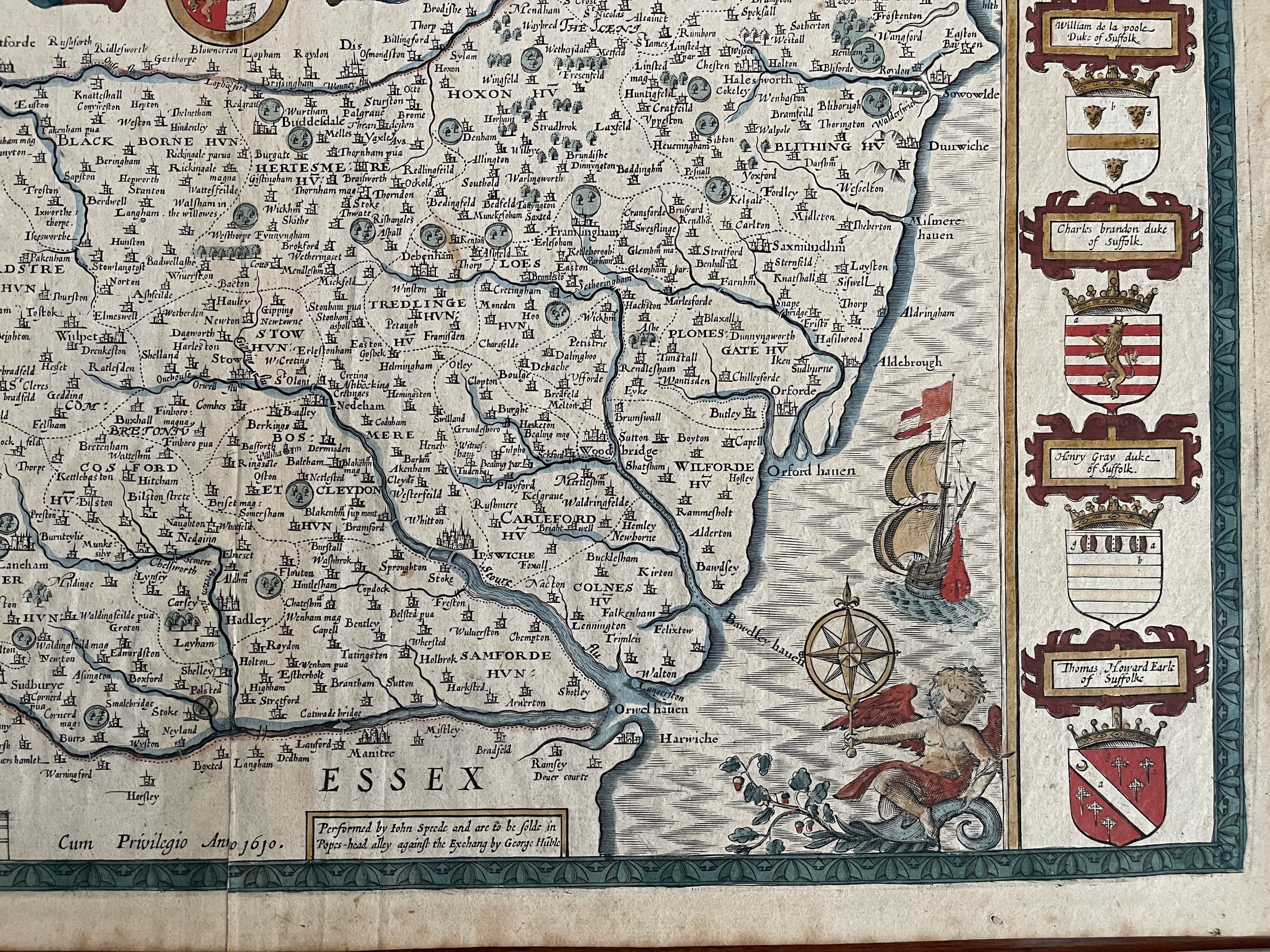 Image 14 of 16
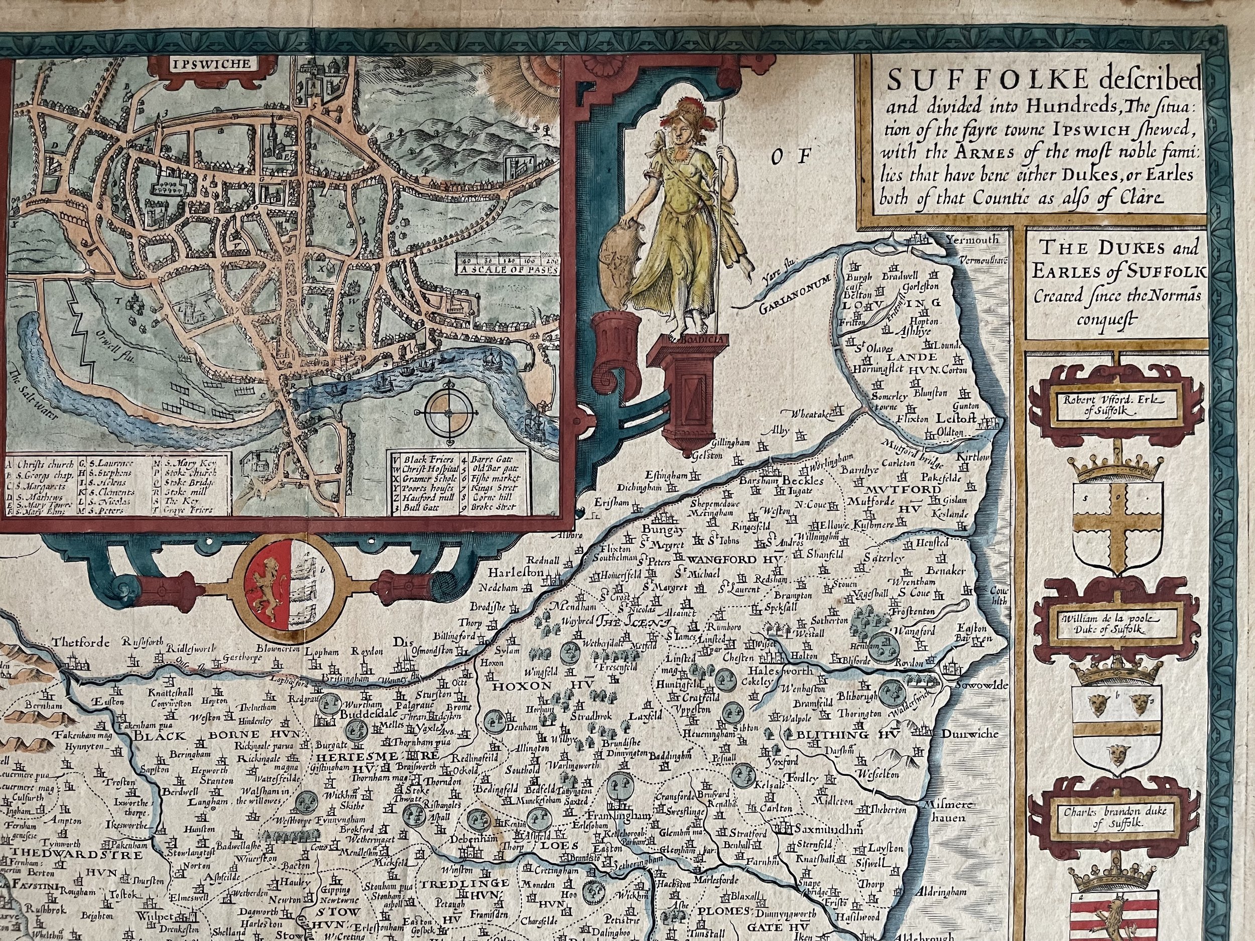 Image 15 of 16
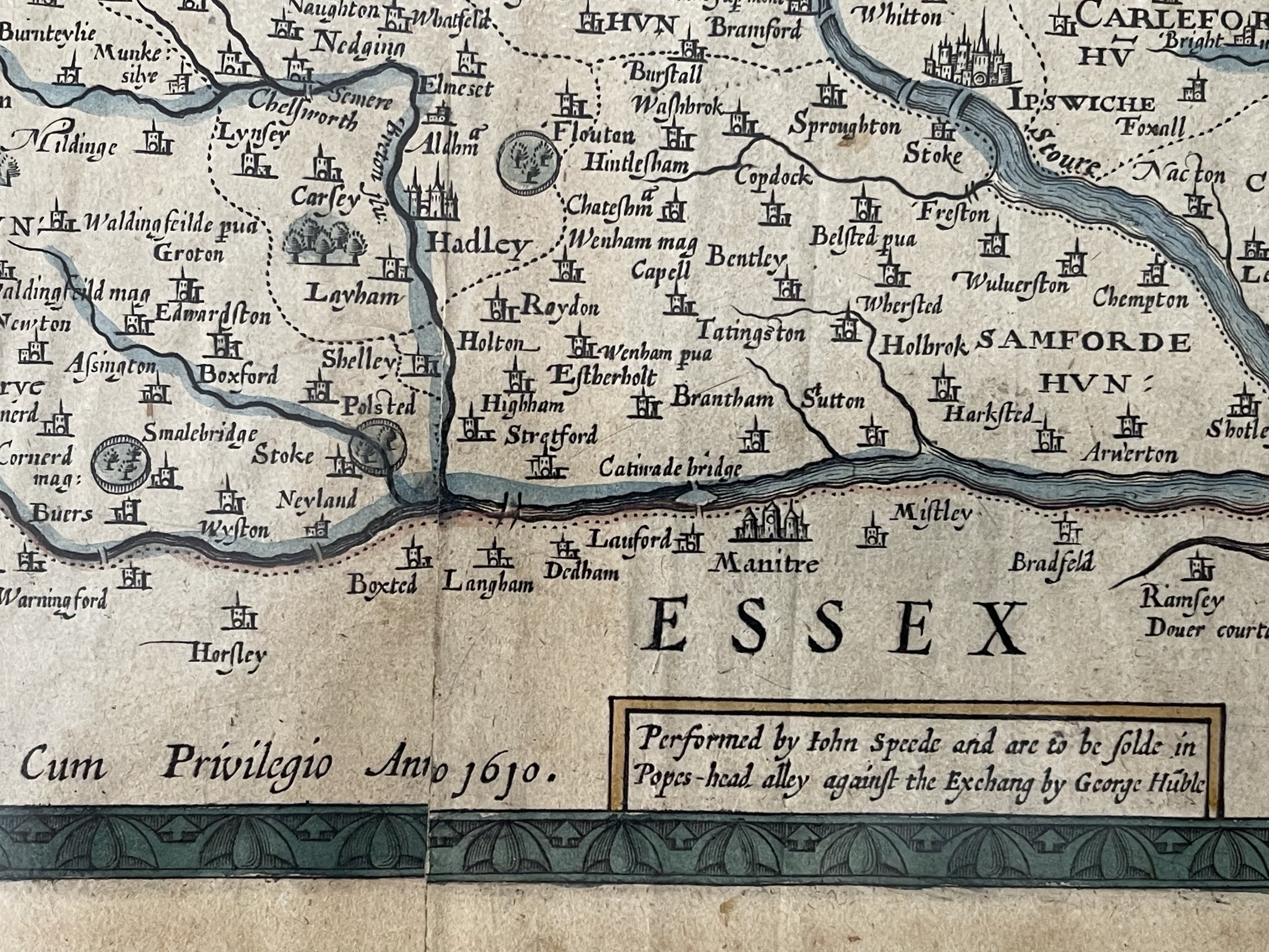 Image 16 of 16