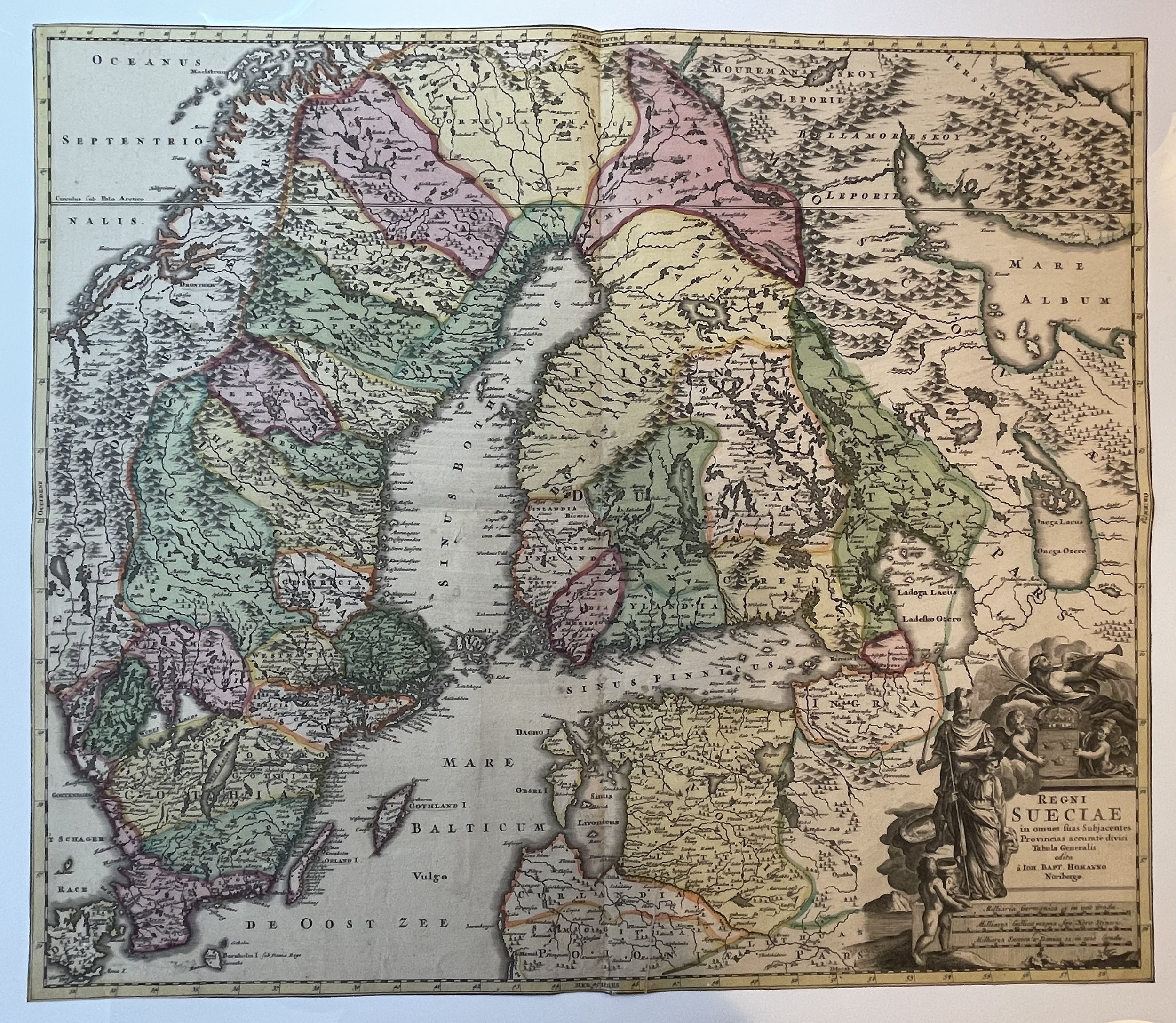
Sweden and Finland - Johann Baptiste Homann - 1720
Sweden and Finland Map
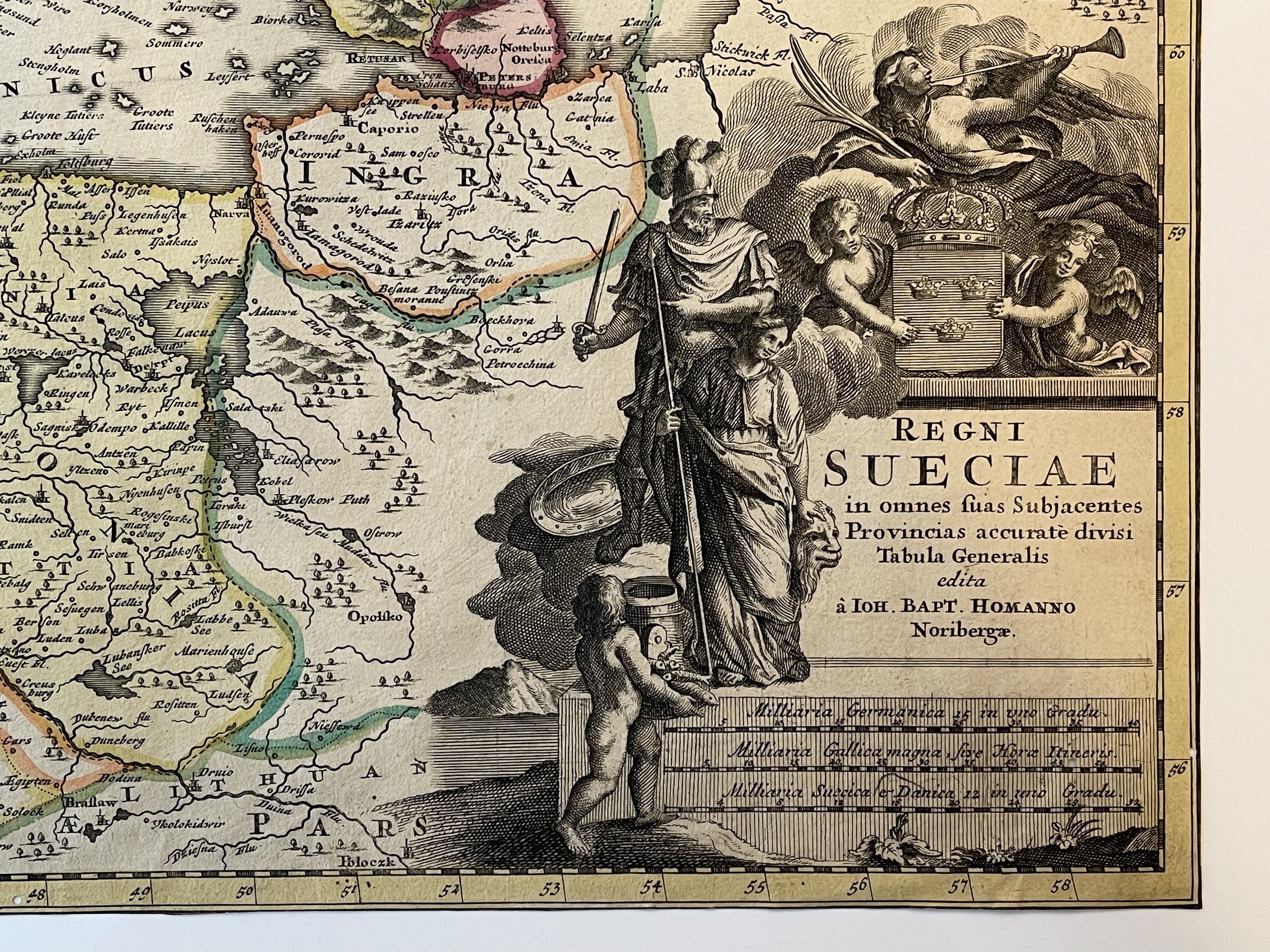
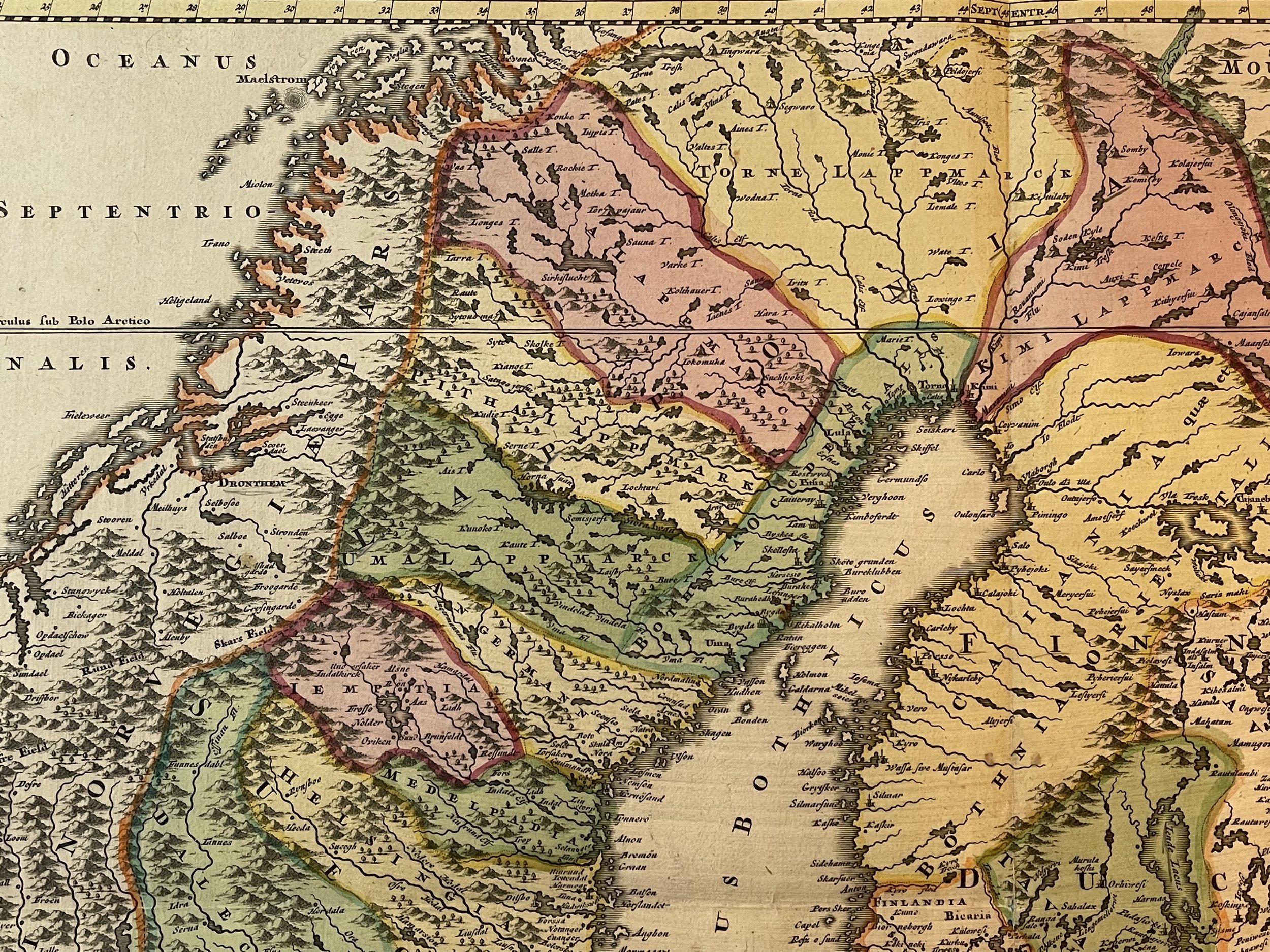
Regni Sueciae in omnes suas Subjacentes Provincias accurate divisi Tabula Generalis edita à Ioh. Bapt. Homanno Noribergae.
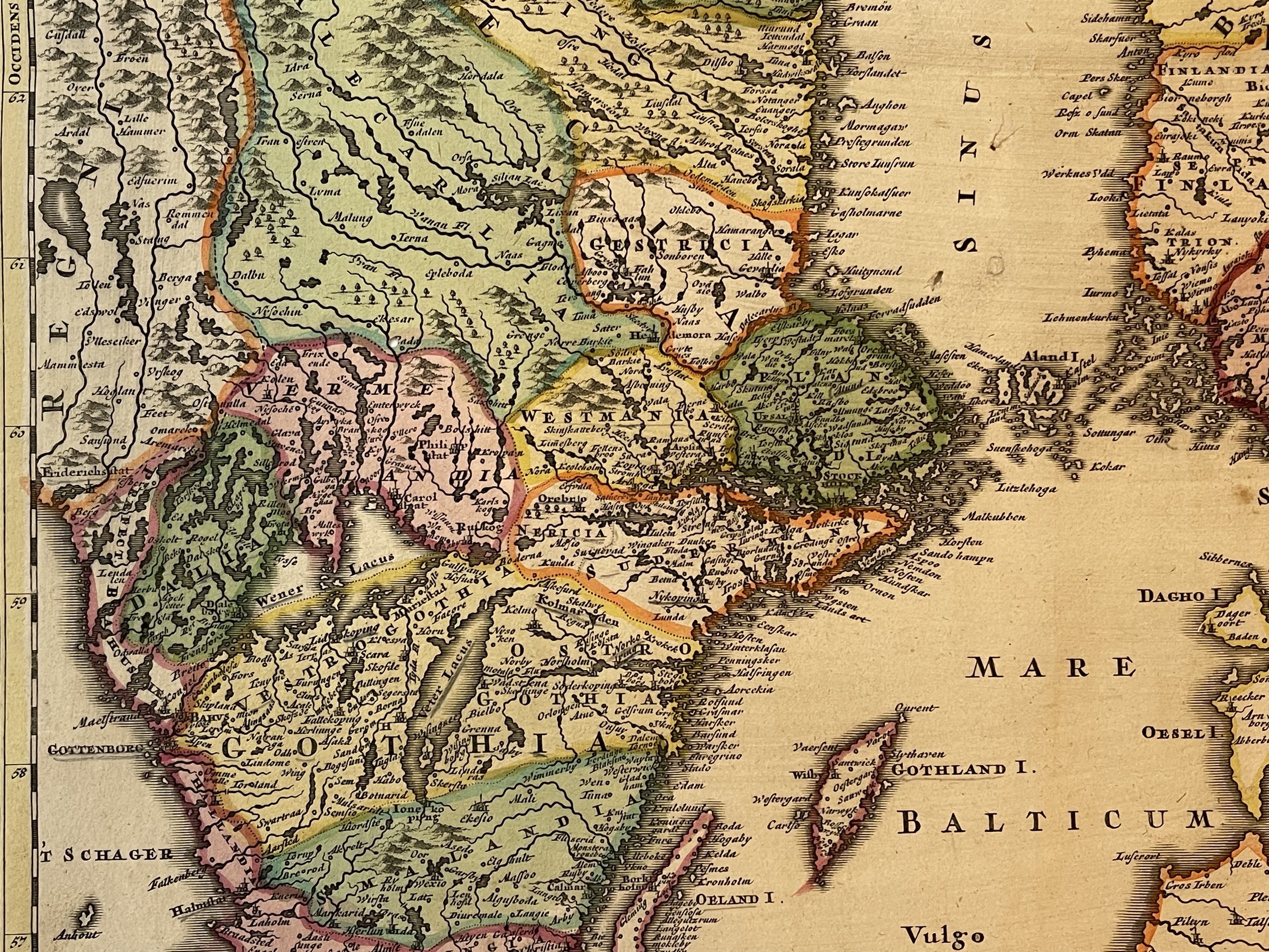
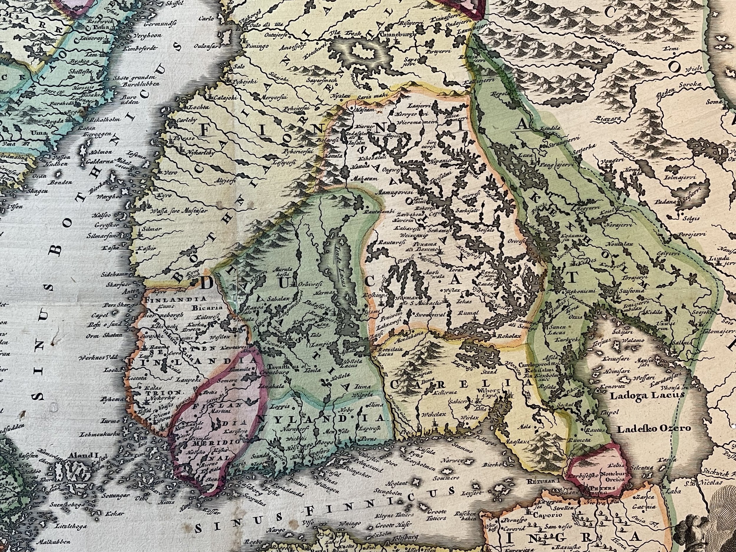
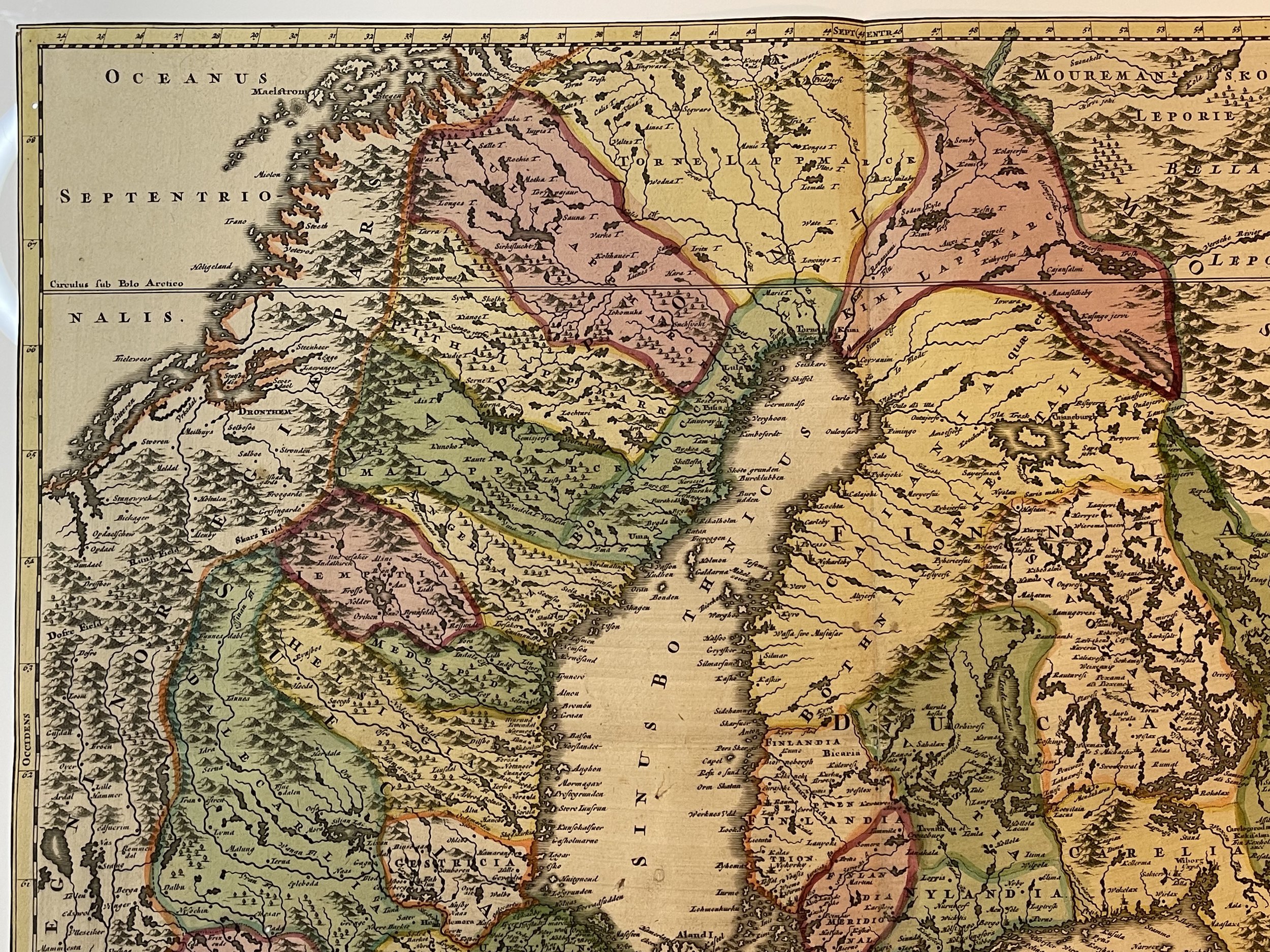
Beautifully coloured example of Johan Baptist Homann's c. 1716 map of the Kingdom of Sweden, which brought what was the dominant mapping of Sweden and its neighbours in line with the events of the Great Northern War.
The Great Northern War
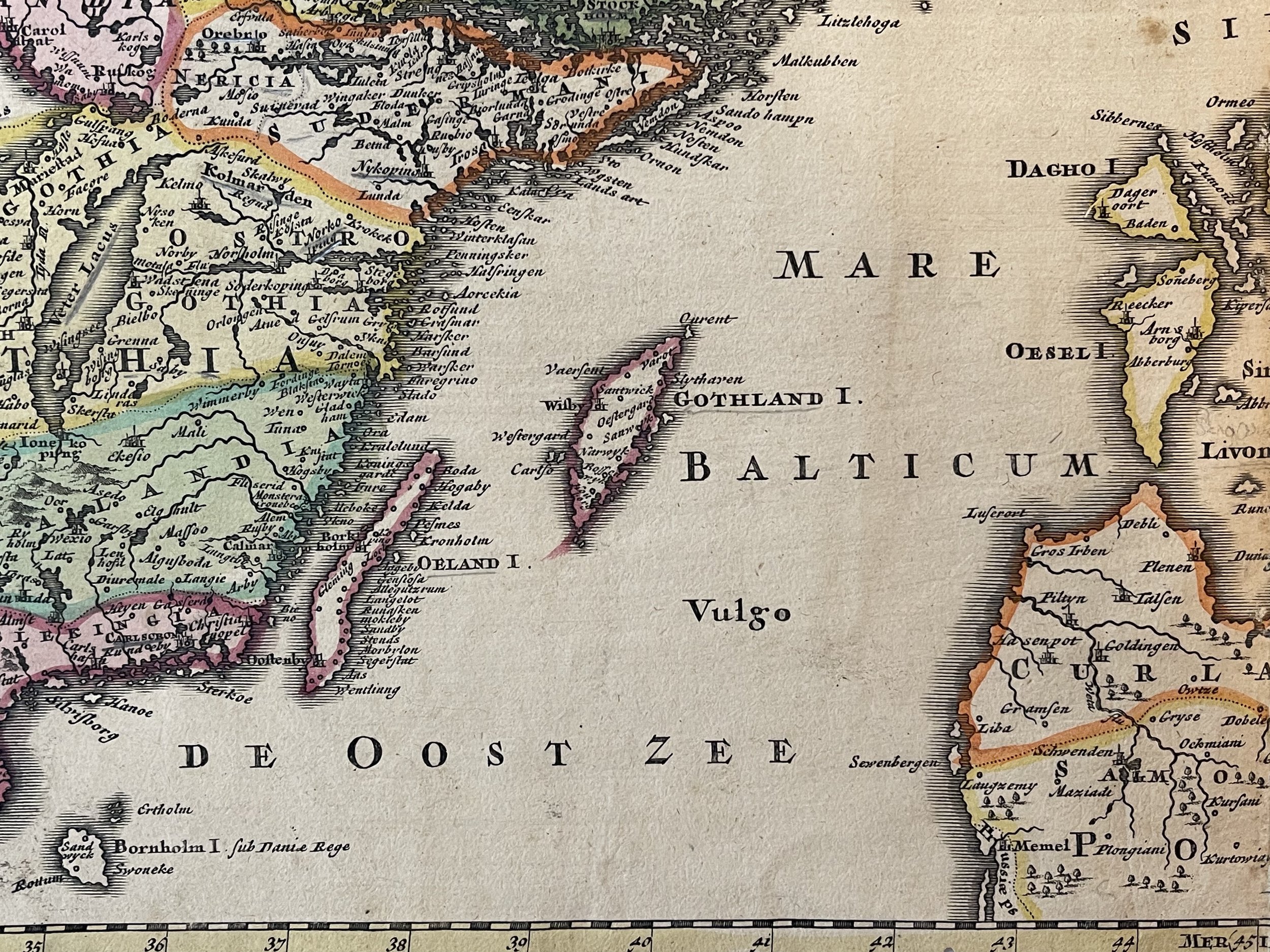
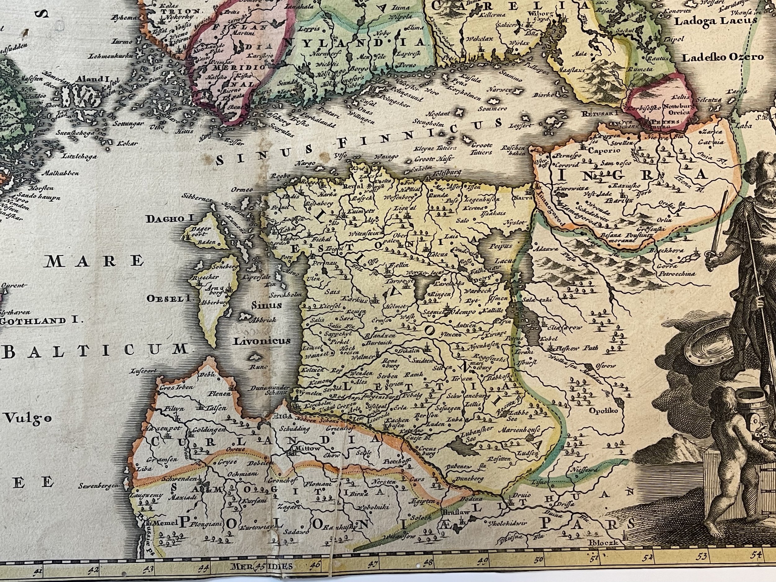
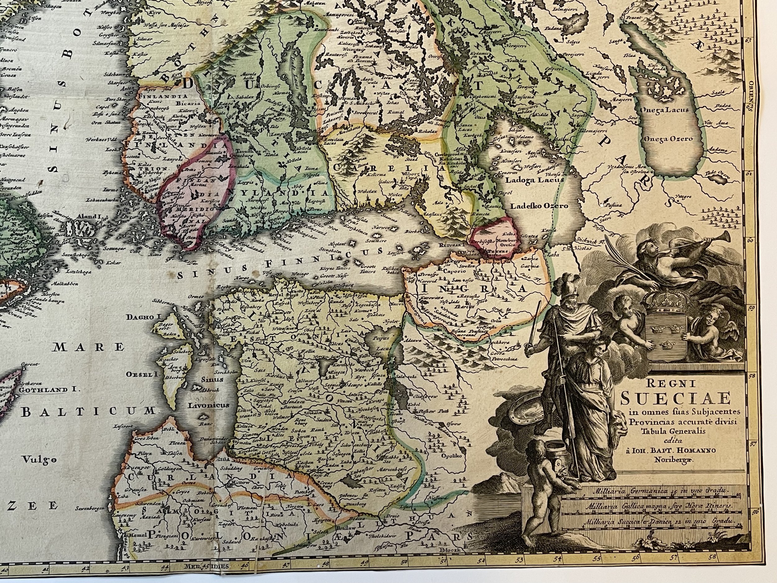
This map was produced during the 1700-1721 Great Northern War between Sweden and Russia and captures a period in which Sweden was losing ground in the conflict - particularly in the region of the Gulf of Finland, and the city of St. Petersburg. The dotted, engraved border between Russian and Swedish territory is preserved here from (most likely) De Wit's 1680 Regni Sueciae Tabula Generalis, which showed the extent of Sweden's acquisitions as of 1654 or thereabouts.
In the lower right is an attractive cartouche. Two putti display the Swedish three-crowned arms, and a winged victory, or fame, blows her horn overhead. Ares and Minerva look on from the side, having not yet entirely forsaken Sweden.
The Great Northern War (1700–1721) was a conflict in which a coalition led by the Tsardom of Russia successfully contested the supremacy of the Swedish Empire in Northern, Central and Eastern Europe. The initial leaders of the anti-Swedish alliance were Peter I of Russia, Frederick IV of Denmark–Norway and Augustus II the Strong of Saxony–Poland–Lithuania. Frederick IV and Augustus II were defeated by Sweden, under Charles XII, and forced out of the alliance in 1700 and 1706 respectively but rejoined it in 1709 after the defeat of Charles XII at the Battle of Poltava. George I of Great Britain and the Electorate of Hanover joined the coalition in 1714 for Hanover and in 1717 for Britain, and Frederick William I of Brandenburg-Prussia joined it in 1715.
Homann started - almost certainly - with Frederic de Wit's 1680 Regni Sueciae but added detail and place names that did not exist prior to the 1700-1721 Great Northern War between Sweden and Russia, and particularly before the 1703 capture of the island of Kotlin by Russia from Sweden, the 1703 Russian capture of Nyenskans, and the foundation of the city of St. Petersburg. The city of Oresca, also known as Oreshek, was captured by Russia in 1702 and renamed Schlüsselburg by Peter the Great during his administrative reforms. Here it retained its earlier name.
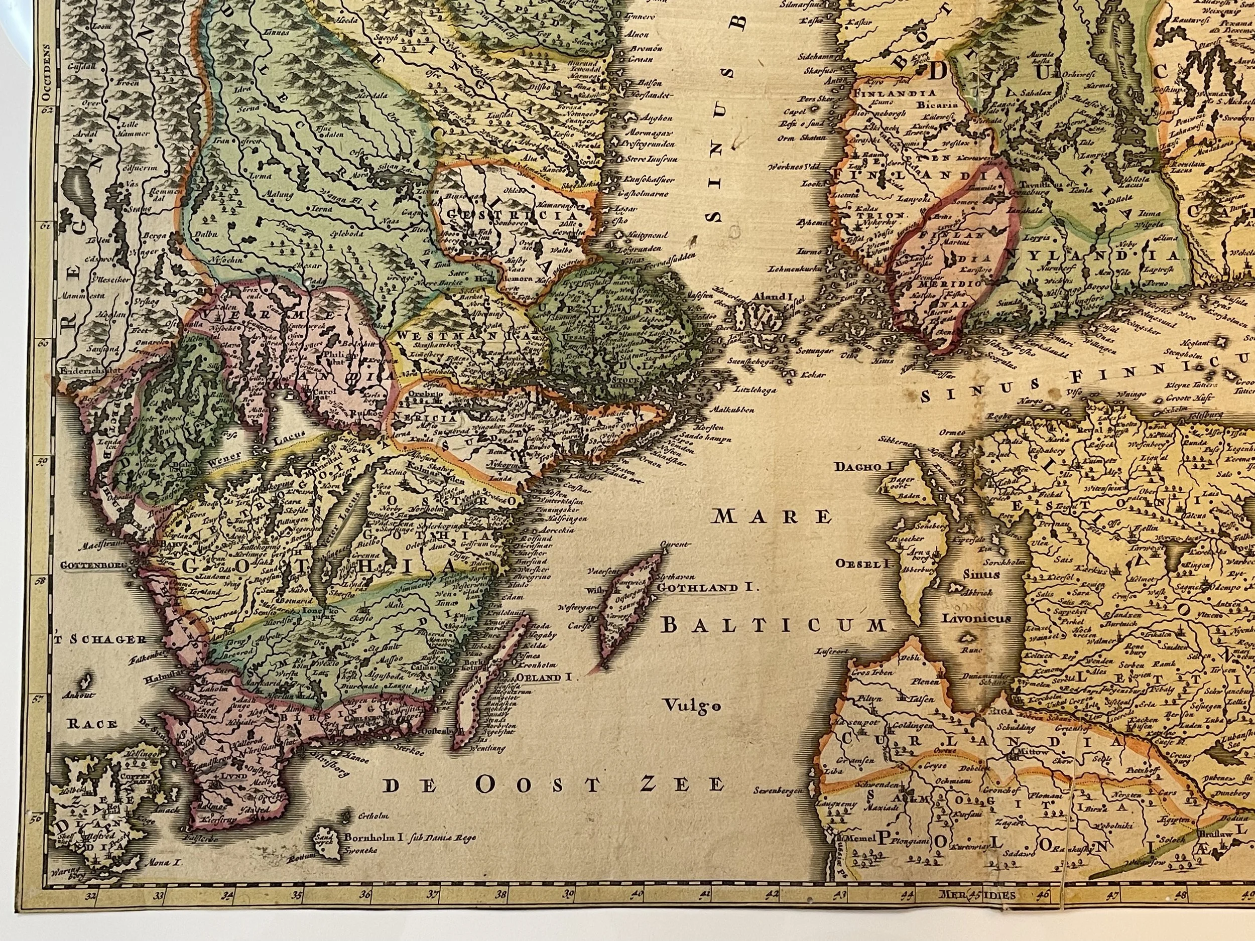
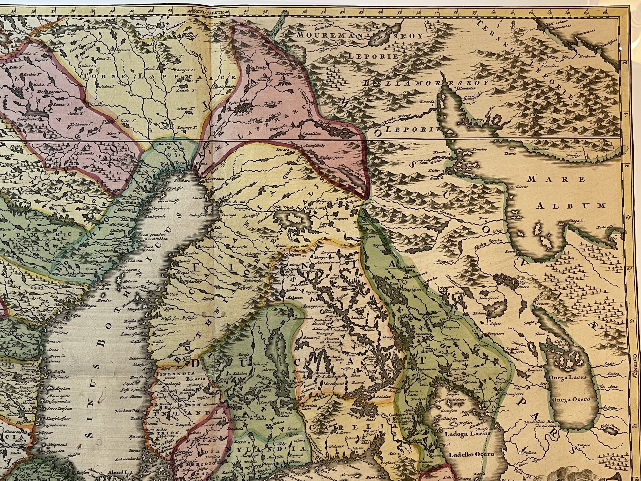
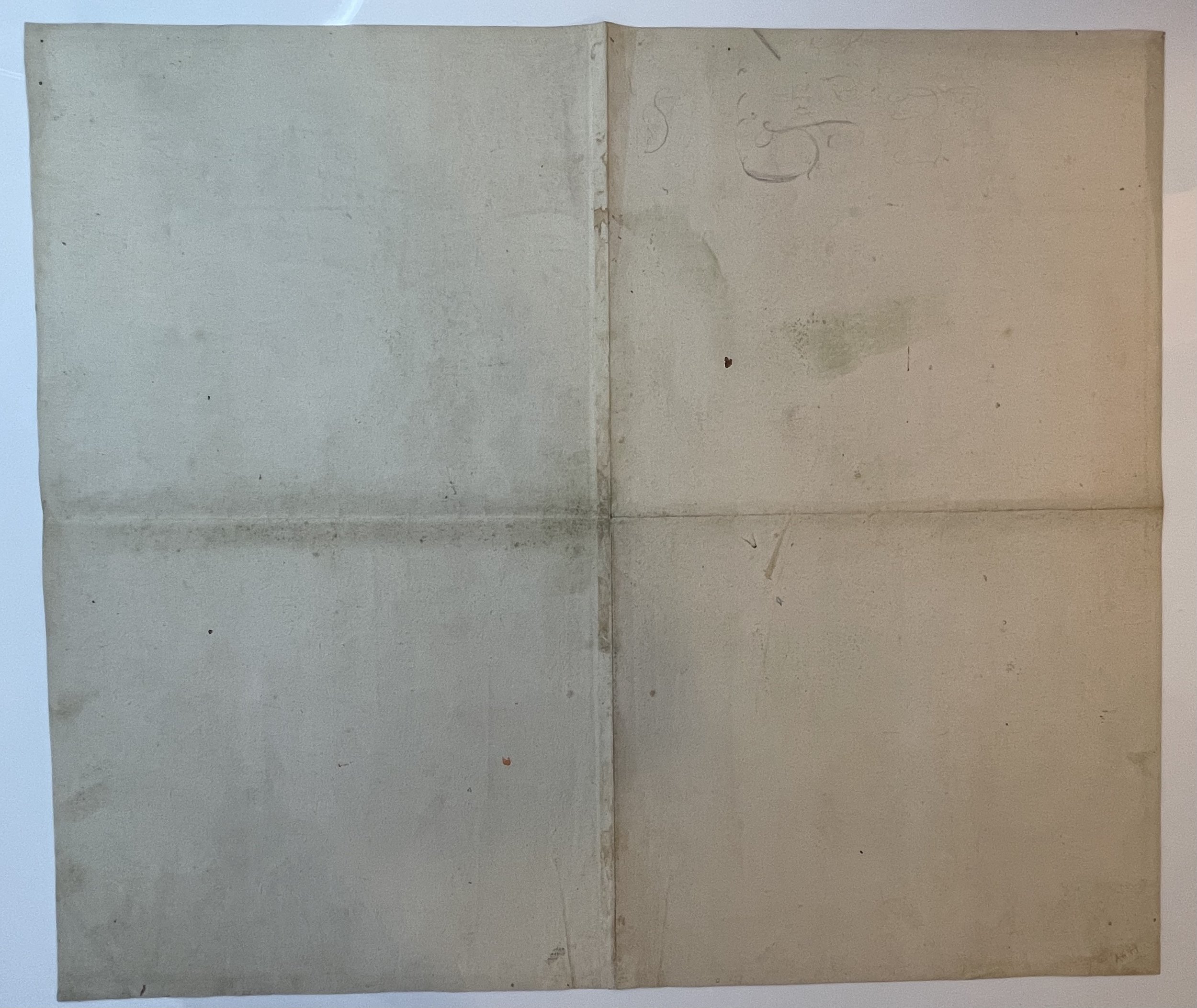
Good engraving and nice colour. Cut along outer borderline - no margins. With slight damage to central fold. Several small worming holes - hardly visible when laid down. Highly detailed map of Sweden and Finland, including parts of Norway, Russia, Latvia, and Estonia. Decorative colouring and with a large title cartouche. Pricing and grading commensurate.
Johann Baptist Homann (1663-1724) was a mapmaker who founded the famous Homann Heirs publishing company. He lived his entire life in Bavaria, particularly in Nuremberg. Initially, Johann trained to become a priest before converting to Protestantism and working as a notary.
In 1702, Johann founded a publishing house that specialized in engravings. The firm flourished, becoming the leading map publisher in Germany and an important entity in the European map market. In 1715, Johann was named Imperial Geographer to the Holy Roman Empire by Charles VI and made a member of the Prussian Academy of Sciences. Most importantly for his business, his reputation and contacts gained him imperial printing privileges which protected his publications and recommended him to customers. Johann is best known for this Grosser Atlas ueber die ganze Welt, or the Grand Atlas of the World, published in 1716.
After Johann died in 1724, the business passed to his son, Christoph (1703-1730). Upon Christoph’s early death, the company passed to subsequent heirs, with the name of the company changing to Homann Erben, or Homann Heirs. The firm continued in business until 1848.
Sweden and Finland Map
Regni Sueciae in omnes suas Subjacentes Provincias accurate divisi Tabula Generalis edita à Ioh. Bapt. Homanno Noribergae.
Beautifully coloured example of Johan Baptist Homann's c. 1716 map of the Kingdom of Sweden, which brought what was the dominant mapping of Sweden and its neighbours in line with the events of the Great Northern War.
The Great Northern War
This map was produced during the 1700-1721 Great Northern War between Sweden and Russia and captures a period in which Sweden was losing ground in the conflict - particularly in the region of the Gulf of Finland, and the city of St. Petersburg. The dotted, engraved border between Russian and Swedish territory is preserved here from (most likely) De Wit's 1680 Regni Sueciae Tabula Generalis, which showed the extent of Sweden's acquisitions as of 1654 or thereabouts.
In the lower right is an attractive cartouche. Two putti display the Swedish three-crowned arms, and a winged victory, or fame, blows her horn overhead. Ares and Minerva look on from the side, having not yet entirely forsaken Sweden.
The Great Northern War (1700–1721) was a conflict in which a coalition led by the Tsardom of Russia successfully contested the supremacy of the Swedish Empire in Northern, Central and Eastern Europe. The initial leaders of the anti-Swedish alliance were Peter I of Russia, Frederick IV of Denmark–Norway and Augustus II the Strong of Saxony–Poland–Lithuania. Frederick IV and Augustus II were defeated by Sweden, under Charles XII, and forced out of the alliance in 1700 and 1706 respectively but rejoined it in 1709 after the defeat of Charles XII at the Battle of Poltava. George I of Great Britain and the Electorate of Hanover joined the coalition in 1714 for Hanover and in 1717 for Britain, and Frederick William I of Brandenburg-Prussia joined it in 1715.
Homann started - almost certainly - with Frederic de Wit's 1680 Regni Sueciae but added detail and place names that did not exist prior to the 1700-1721 Great Northern War between Sweden and Russia, and particularly before the 1703 capture of the island of Kotlin by Russia from Sweden, the 1703 Russian capture of Nyenskans, and the foundation of the city of St. Petersburg. The city of Oresca, also known as Oreshek, was captured by Russia in 1702 and renamed Schlüsselburg by Peter the Great during his administrative reforms. Here it retained its earlier name.
Good engraving and nice colour. Cut along outer borderline - no margins. With slight damage to central fold. Several small worming holes - hardly visible when laid down. Highly detailed map of Sweden and Finland, including parts of Norway, Russia, Latvia, and Estonia. Decorative colouring and with a large title cartouche. Pricing and grading commensurate.
Johann Baptist Homann (1663-1724) was a mapmaker who founded the famous Homann Heirs publishing company. He lived his entire life in Bavaria, particularly in Nuremberg. Initially, Johann trained to become a priest before converting to Protestantism and working as a notary.
In 1702, Johann founded a publishing house that specialized in engravings. The firm flourished, becoming the leading map publisher in Germany and an important entity in the European map market. In 1715, Johann was named Imperial Geographer to the Holy Roman Empire by Charles VI and made a member of the Prussian Academy of Sciences. Most importantly for his business, his reputation and contacts gained him imperial printing privileges which protected his publications and recommended him to customers. Johann is best known for this Grosser Atlas ueber die ganze Welt, or the Grand Atlas of the World, published in 1716.
After Johann died in 1724, the business passed to his son, Christoph (1703-1730). Upon Christoph’s early death, the company passed to subsequent heirs, with the name of the company changing to Homann Erben, or Homann Heirs. The firm continued in business until 1848.
Code : A677
Cartographer : Cartographer / Engraver / Publisher: Johann Baptiste Homann
Date : Publication Place / Date - 1720
Size : Sheet size: 57 x 49 cm
Availability : Available
Type - Genuine - Antique
Grading A
Where Applicable - Folds as issued. Light box photo shows the folio leaf centre margin hinge ‘glue’, this is not visible otherwise.
Tracked postage, in casement. Please contact me for postal quotation outside of the UK.