The Black Sea Crimea Ukraine - Jean Covens & Corneille Mortier / Guillaume de L'Isle - 1772
Jean Covens & Corneille Mortier / L'Isle, Guillaume de, 1675-1726
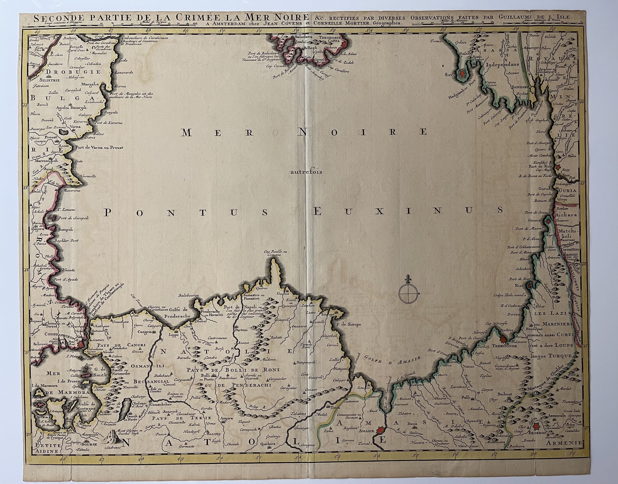
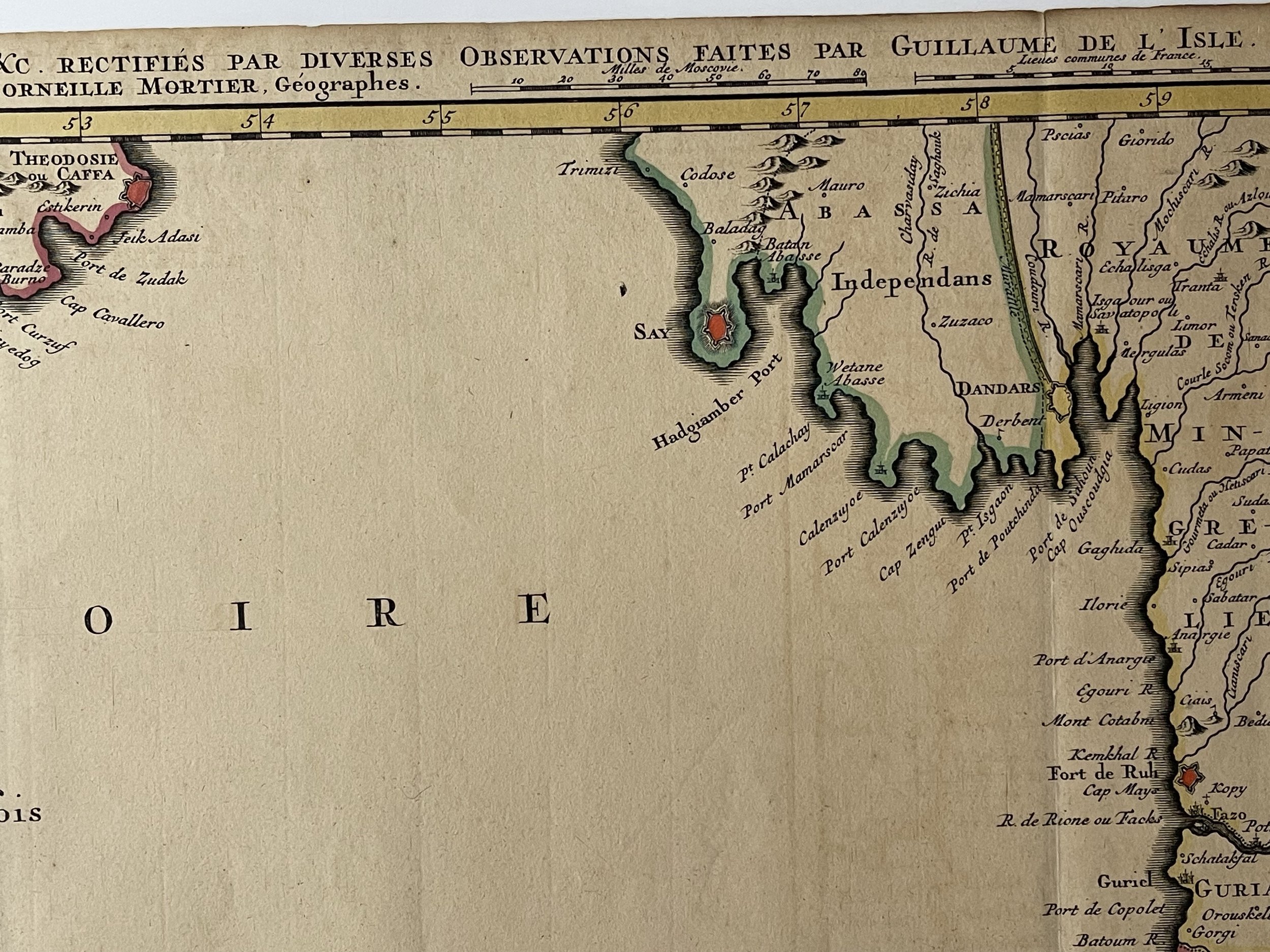
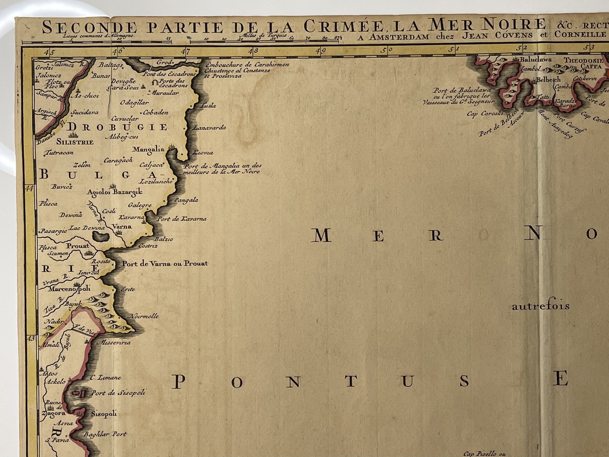
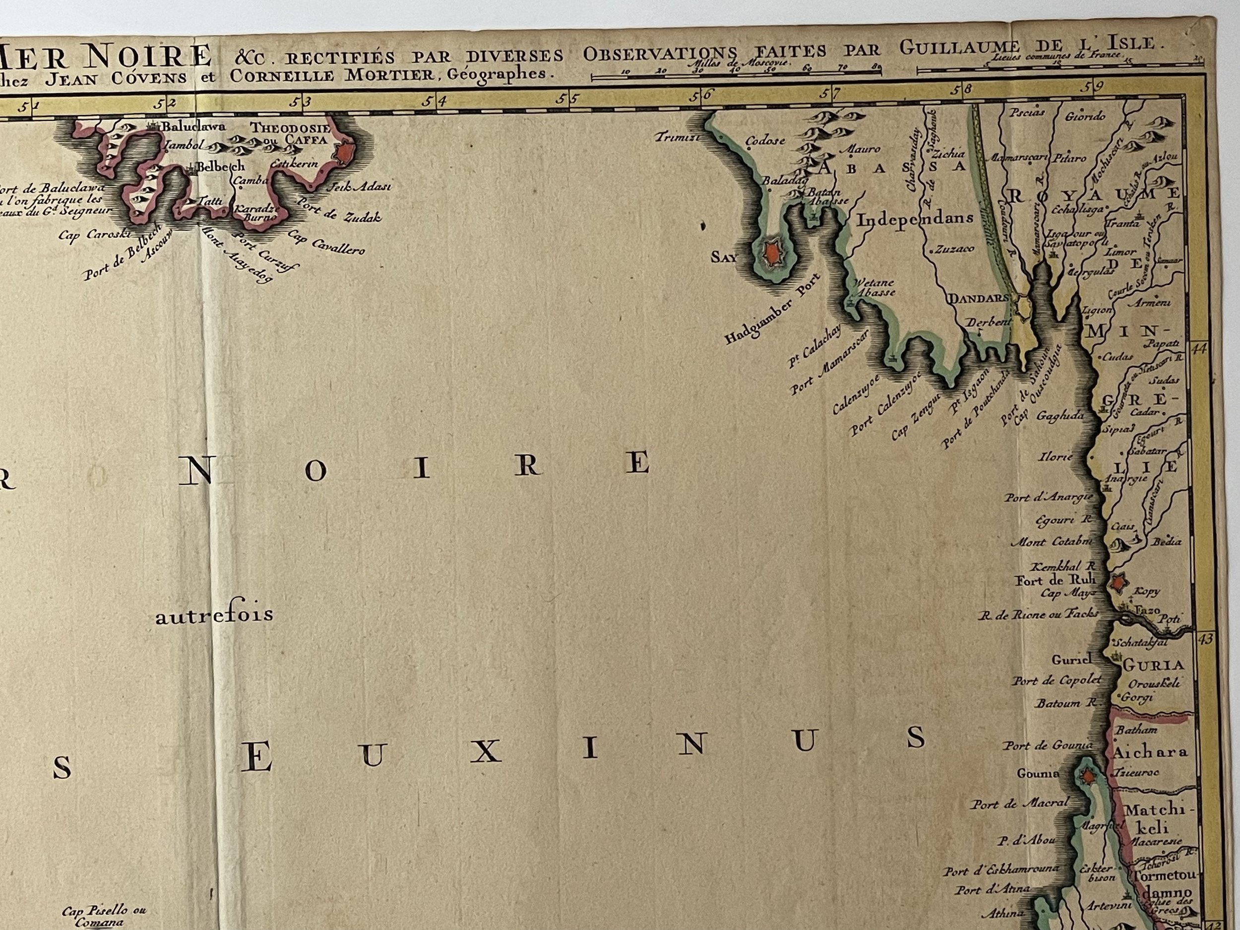
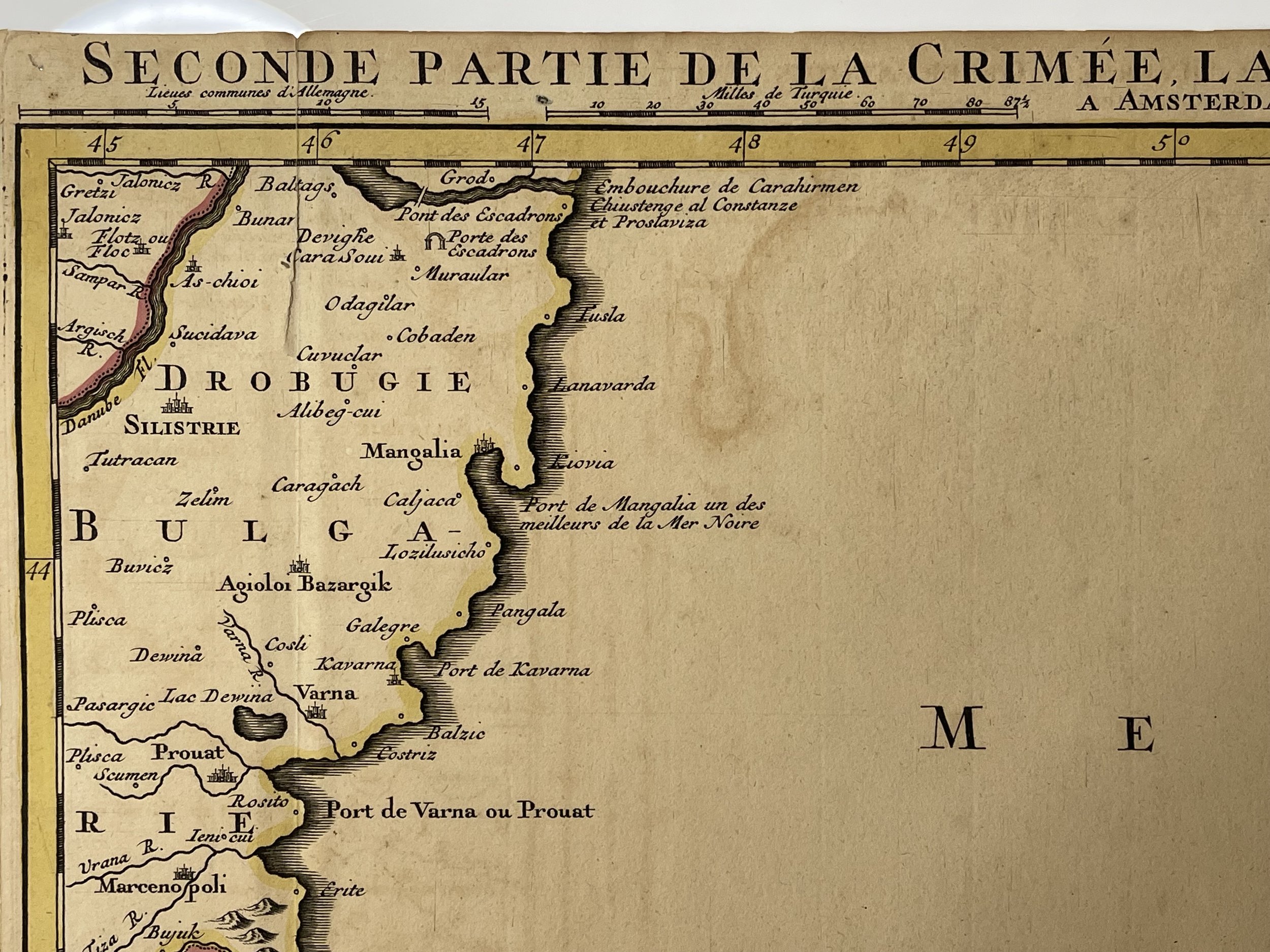
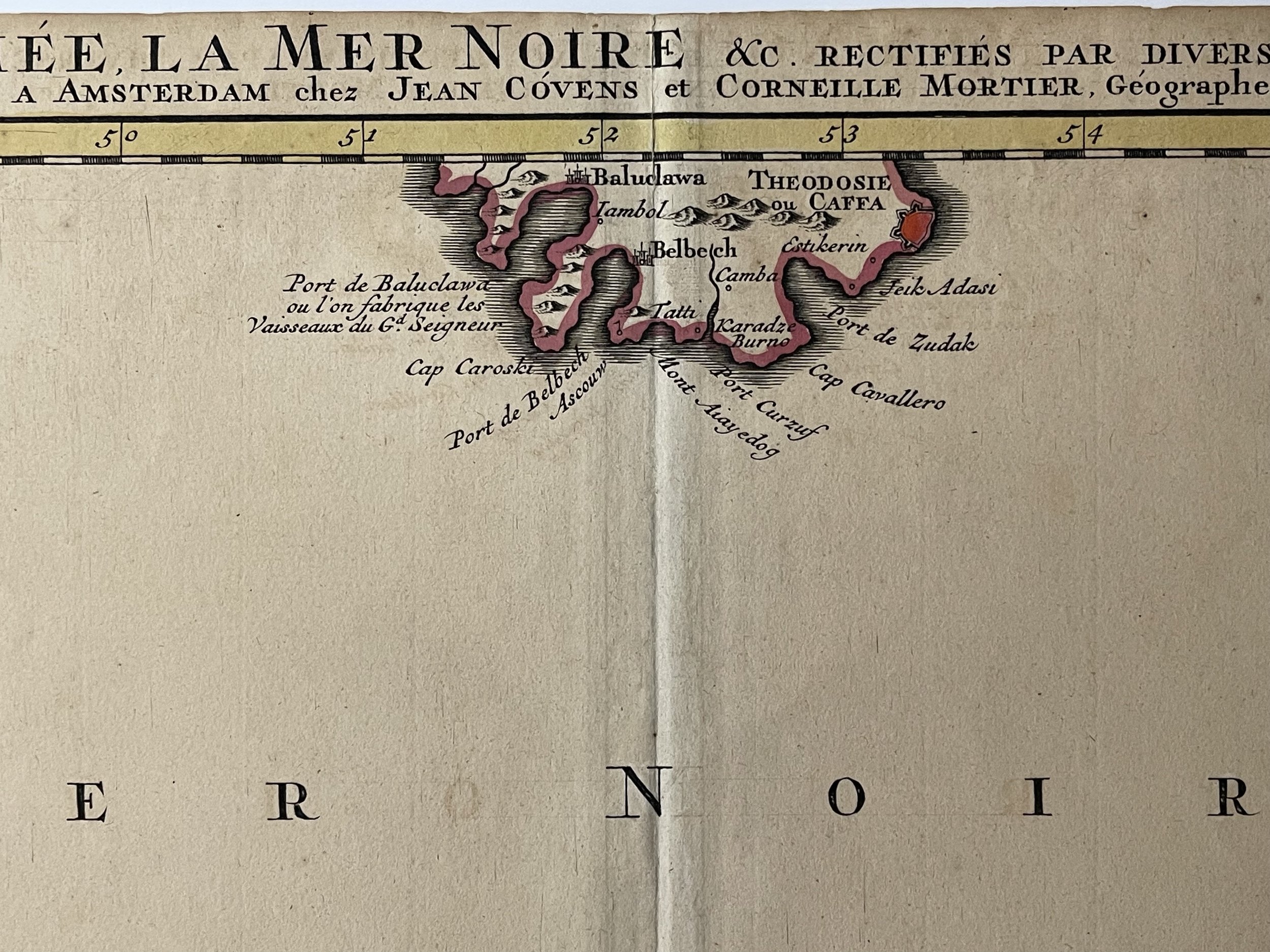
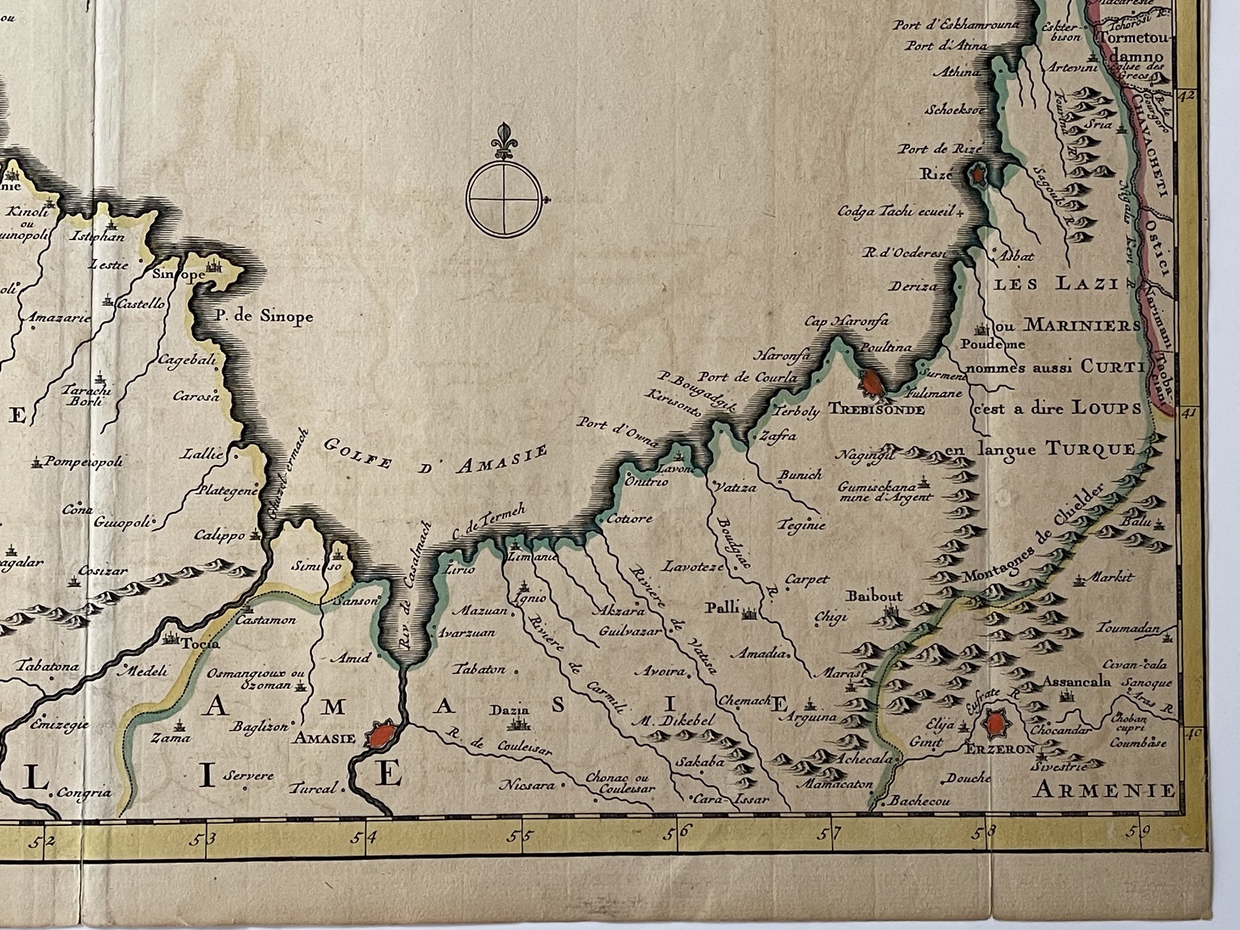
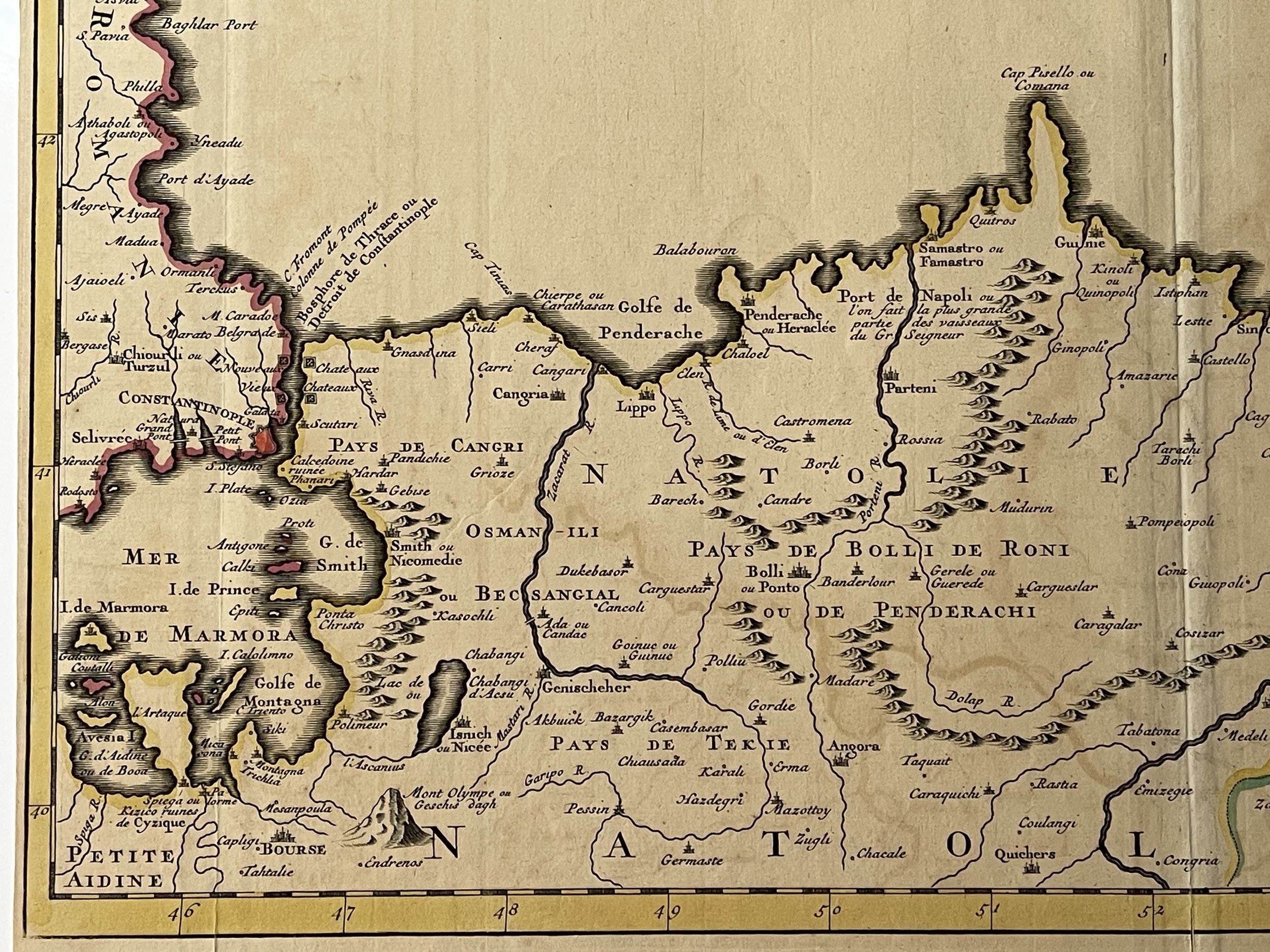
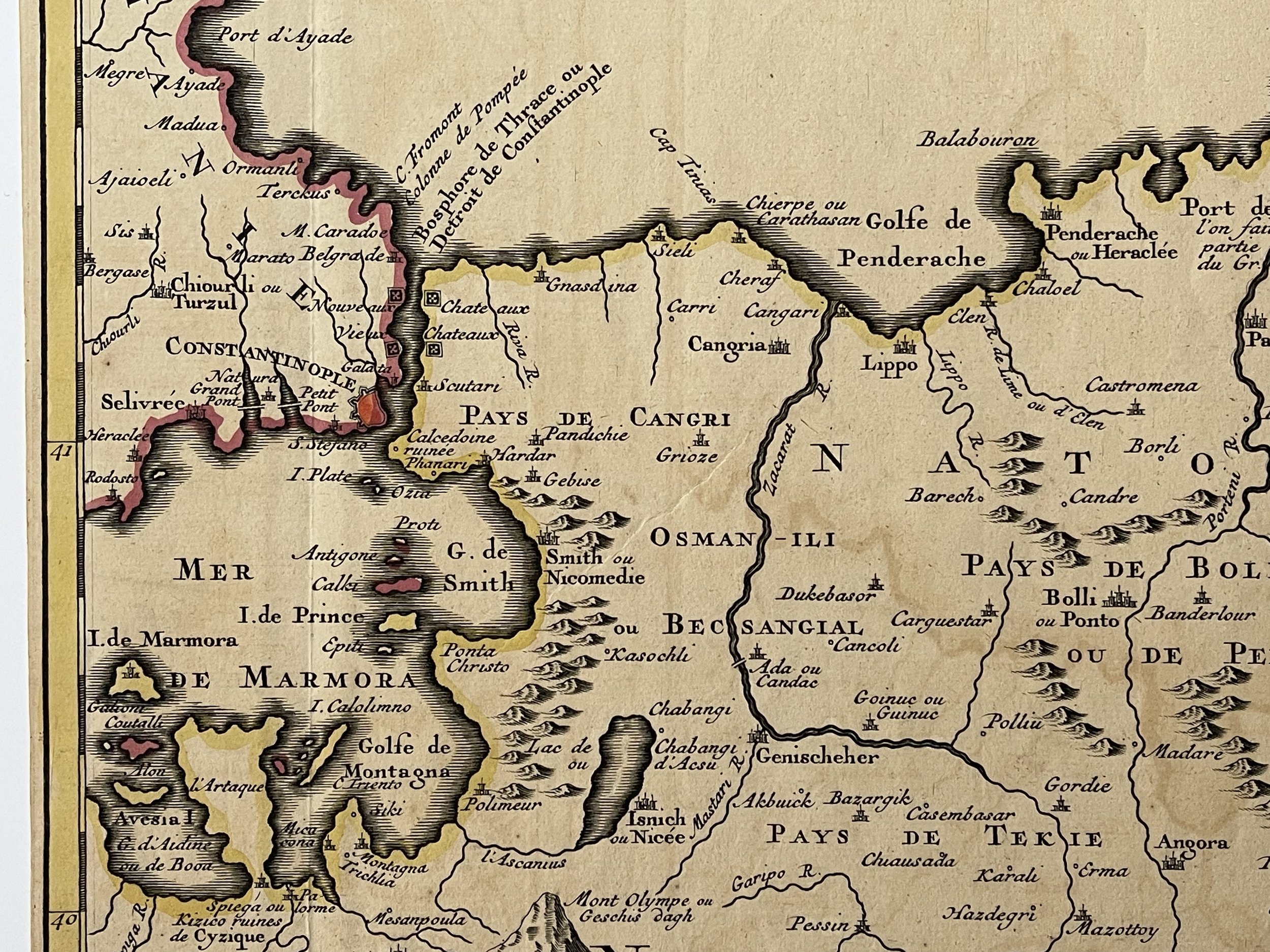
The lower part of a set of two maps from the observations of Guillaume De L’isle focusing on the Black Sea with wonderful detail of the surrounding regions. Includes Constantinople and the Sea of Marmara.
Shows watershed, villages and cities, mountains. Locates the confluence of the Danube, the walled cities of Tekin (Bender), Ouzi Oczakow (Dziarcrimenda), Taman, Magazin, and numerous forts and villages.
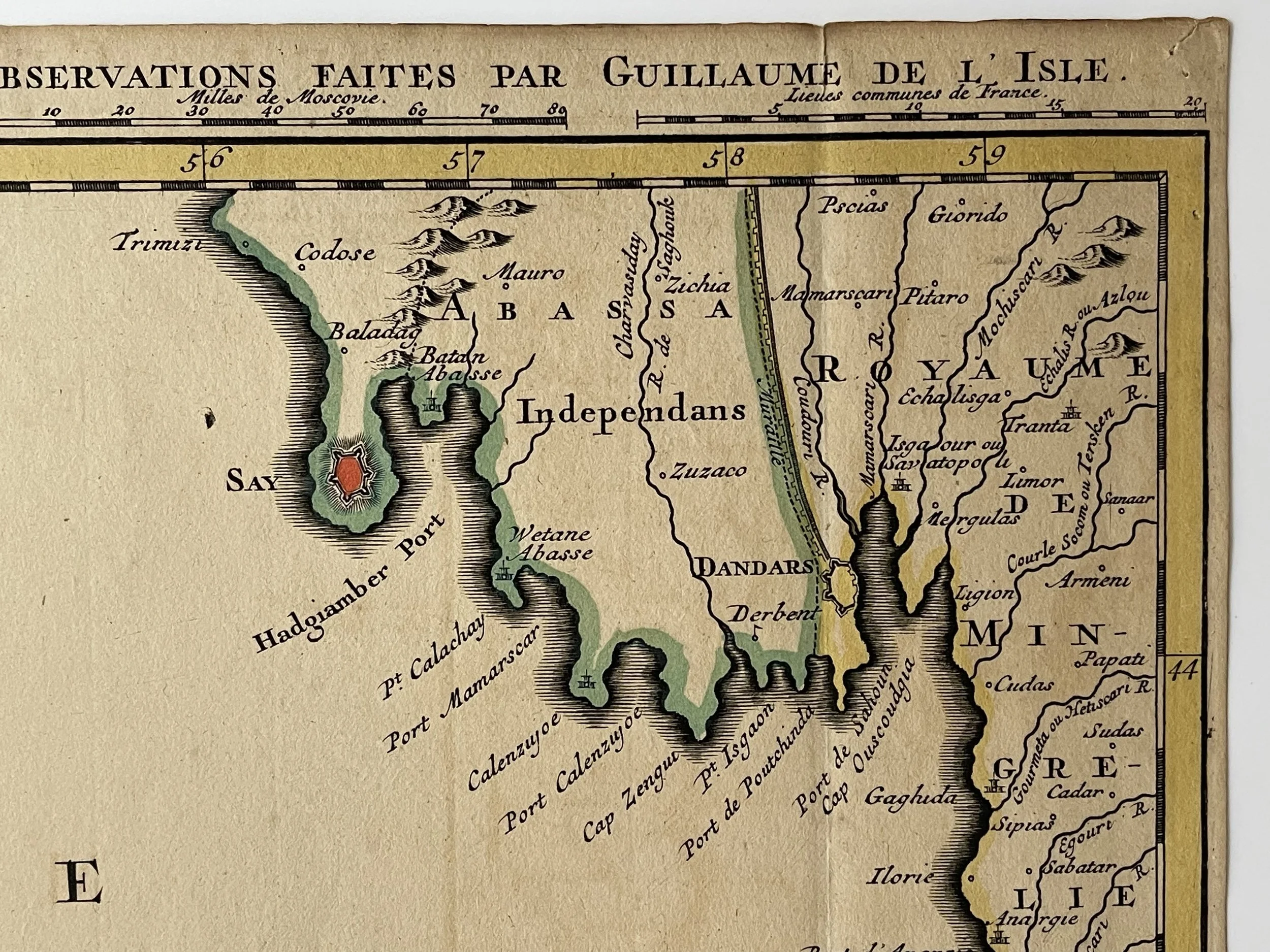
The map is from a Dutch edition of De L'Isle's work entitled, Atlas Nouveau, Contenant Toutes Les Parties Du Monde, Ou sont exactement Remarquées les Empires, Monarchies, Royaumes, Etats, Republiques &c. Par Guillaume de l'Isle. Premier Géographe de sa Majesté.
It was published by Covens and Mortier, brothers-in-law who continued the firm established by Pierre Mortier.
Pieter und David Mortier were booksellers in Paris and have published a wide range of geographical works. After Pieter's death, his widow continued the business until their son Cornelius took over. Cornelius started a partnership with his brother-in-law Johannes Covens and established the famous publishing house Covens and Mortier in Amsterdam. They have re-issued Atlases of Sanson, de l'Isle, Visscher and de Wit.
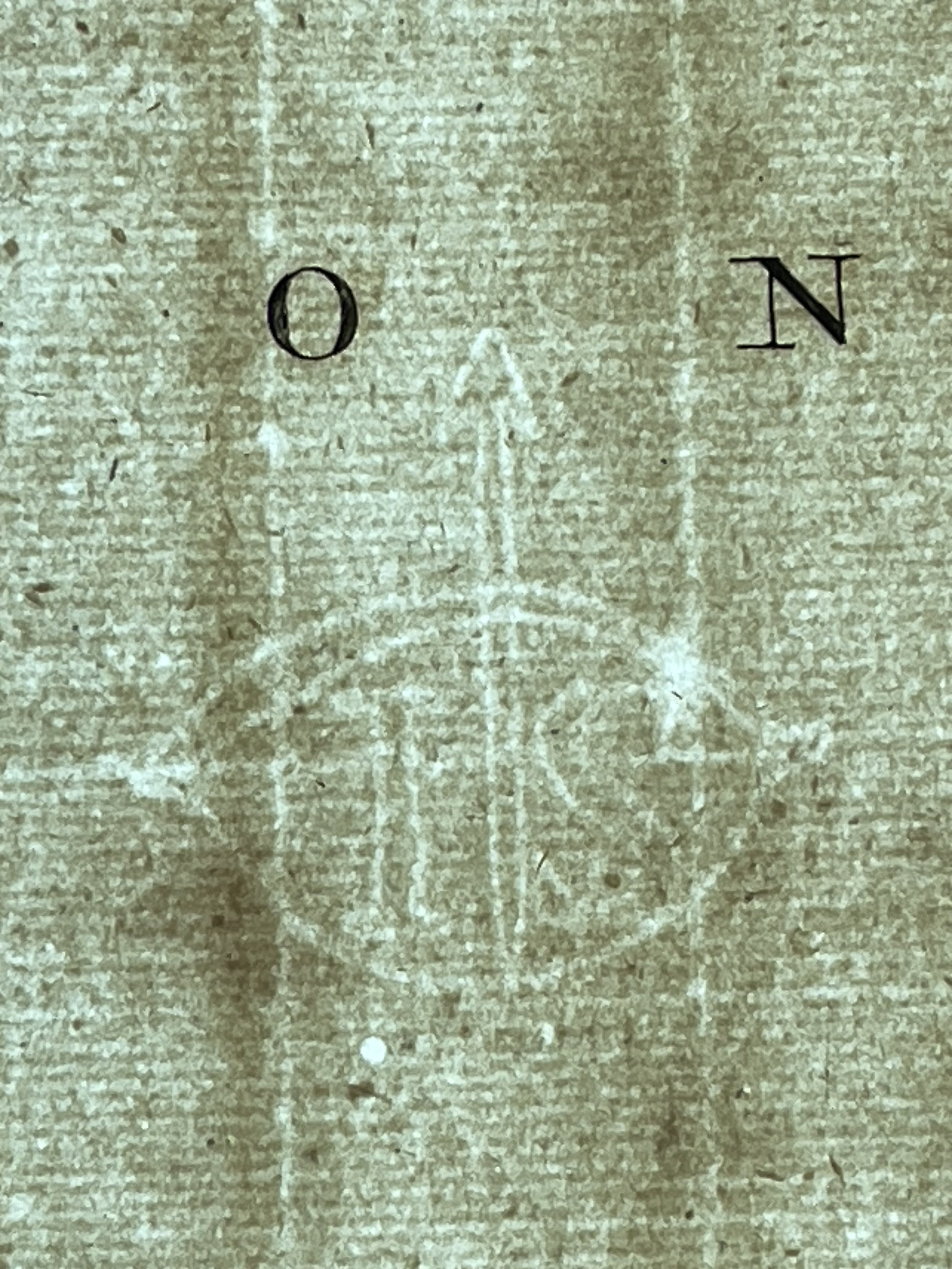
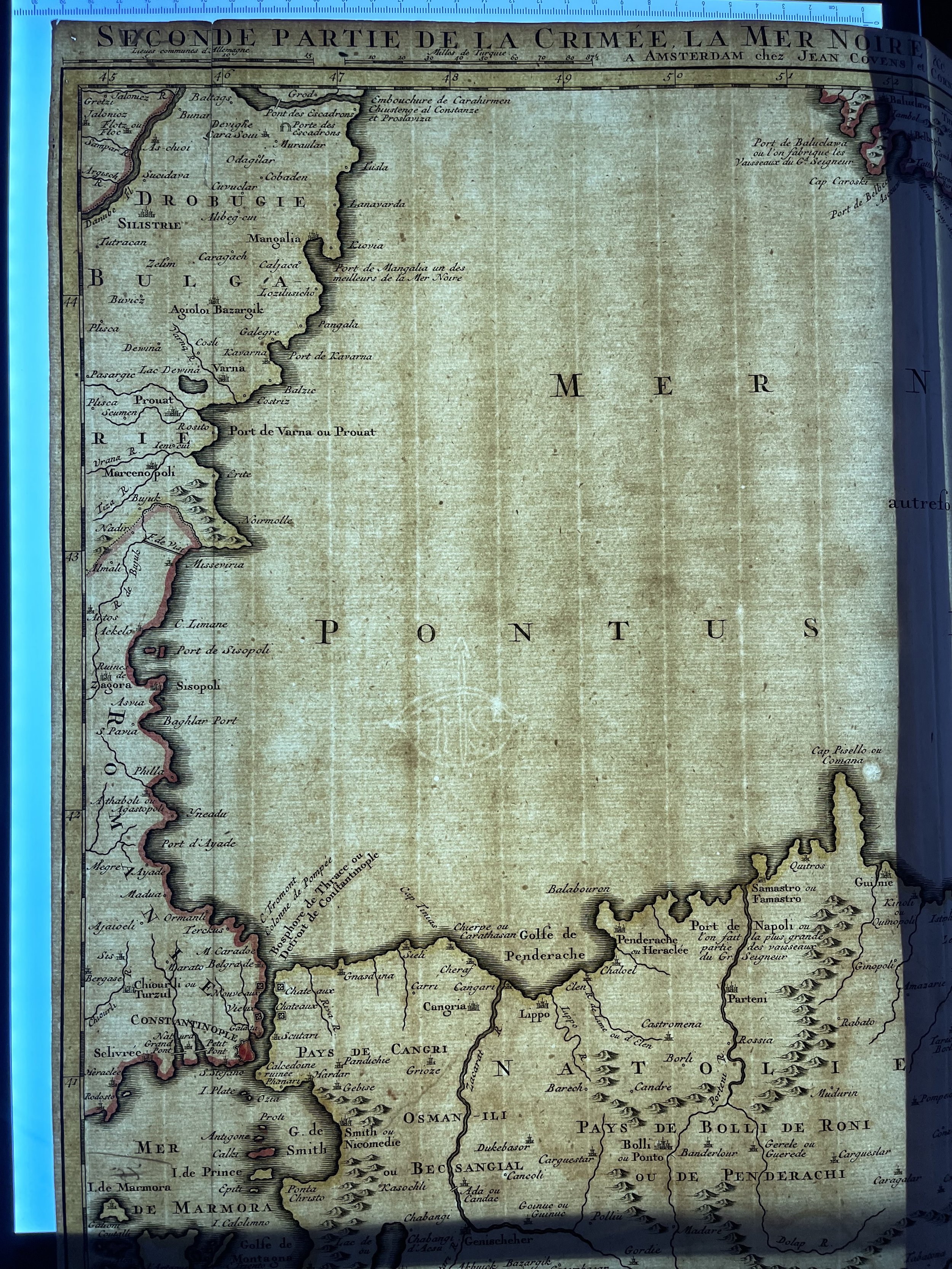
Large and Beautiful map in excellent condition albeit from a little ink oxidisation staining that is normal for this period of engraving / ink used. The laid paper has a watermark (see Lightbox photo). Pricing and grading commensurate.
Jean Covens & Corneille Mortier / L'Isle, Guillaume de, 1675-1726
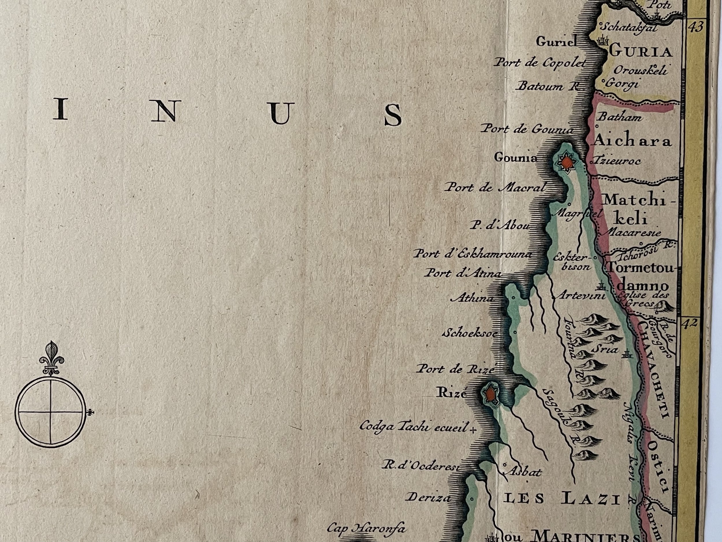
The lower part of a set of two maps from the observations of Guillaume De L’isle focusing on the Black Sea with wonderful detail of the surrounding regions. Includes Constantinople and the Sea of Marmara.
Shows watershed, villages and cities, mountains. Locates the confluence of the Danube, the walled cities of Tekin (Bender), Ouzi Oczakow (Dziarcrimenda), Taman, Magazin, and numerous forts and villages.
The map is from a Dutch edition of De L'Isle's work entitled, Atlas Nouveau, Contenant Toutes Les Parties Du Monde, Ou sont exactement Remarquées les Empires, Monarchies, Royaumes, Etats, Republiques &c. Par Guillaume de l'Isle. Premier Géographe de sa Majesté.
It was published by Covens and Mortier, brothers-in-law who continued the firm established by Pierre Mortier.
Pieter und David Mortier were booksellers in Paris and have published a wide range of geographical works. After Pieter's death, his widow continued the business until their son Cornelius took over. Cornelius started a partnership with his brother-in-law Johannes Covens and established the famous publishing house Covens and Mortier in Amsterdam. They have re-issued Atlases of Sanson, de l'Isle, Visscher and de Wit.
Large and Beautiful map in excellent condition albeit from a little ink oxidisation staining that is normal for this period of engraving / ink used. The laid paper has a watermark (see Lightbox photo). Pricing and grading commensurate.
Jean Covens & Corneille Mortier / L'Isle, Guillaume de, 1675-1726
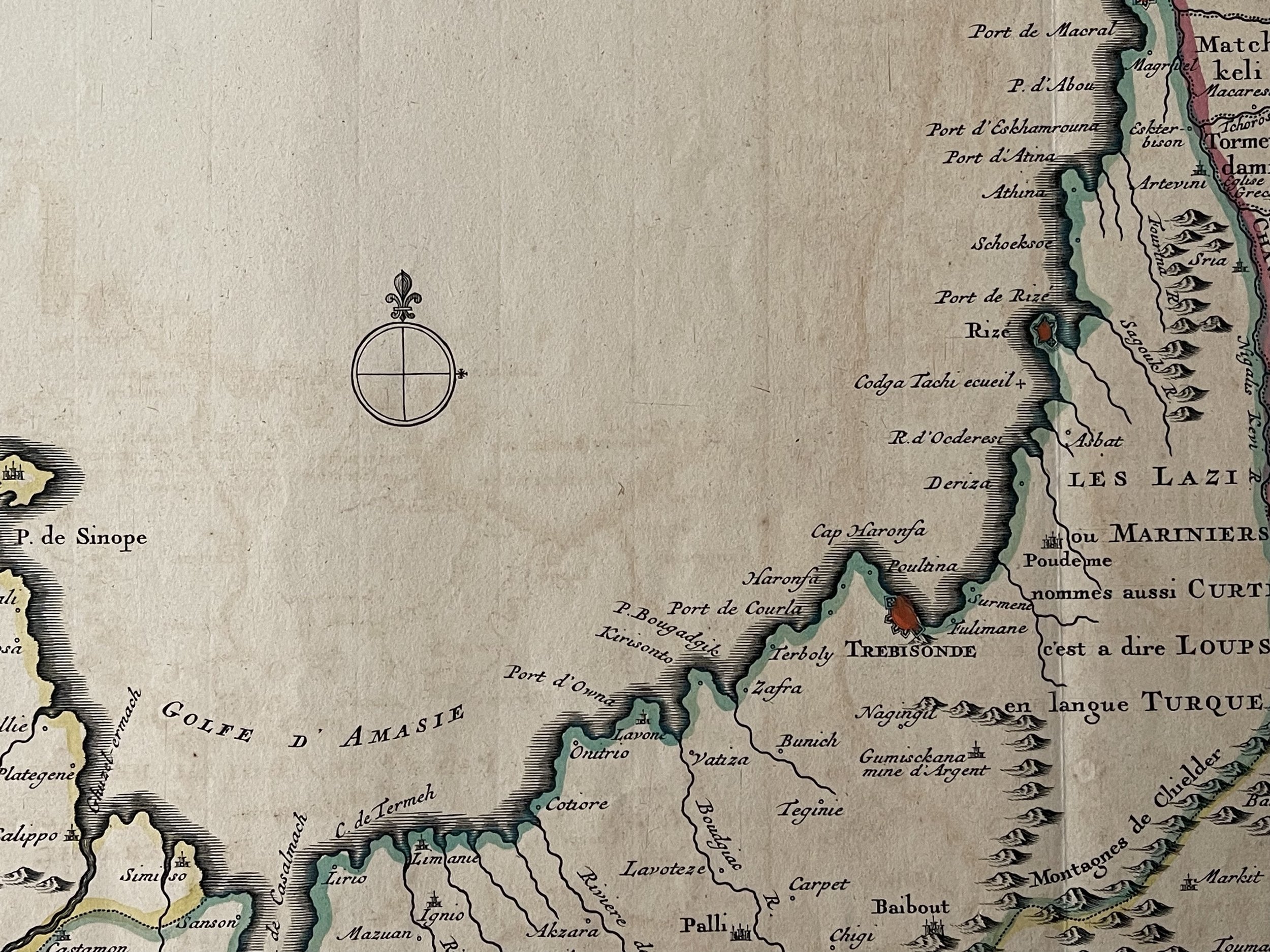
The lower part of a set of two maps from the observations of Guillaume De L’isle focusing on the Black Sea with wonderful detail of the surrounding regions. Includes Constantinople and the Sea of Marmara.
Shows watershed, villages and cities, mountains. Locates the confluence of the Danube, the walled cities of Tekin (Bender), Ouzi Oczakow (Dziarcrimenda), Taman, Magazin, and numerous forts and villages.
The map is from a Dutch edition of De L'Isle's work entitled, Atlas Nouveau, Contenant Toutes Les Parties Du Monde, Ou sont exactement Remarquées les Empires, Monarchies, Royaumes, Etats, Republiques &c. Par Guillaume de l'Isle. Premier Géographe de sa Majesté.
It was published by Covens and Mortier, brothers-in-law who continued the firm established by Pierre Mortier.
Pieter und David Mortier were booksellers in Paris and have published a wide range of geographical works. After Pieter's death, his widow continued the business until their son Cornelius took over. Cornelius started a partnership with his brother-in-law Johannes Covens and established the famous publishing house Covens and Mortier in Amsterdam. They have re-issued Atlases of Sanson, de l'Isle, Visscher and de Wit.
Large and Beautiful map in excellent condition albeit from a little ink oxidisation staining that is normal for this period of engraving / ink used. The laid paper has a watermark (see Lightbox photo). Pricing and grading commensurate.
Code : A58
Cartographer : Cartographer / Engraver / Publisher: Jean Covens & Corneille Mortier / Guillaume de L'Isle
Date : Publication Place / Date - Circa 1772
Size : Sheet size: 62 x 51 Inches
Availability : Available
Type - Genuine - Antique
Grading A
Where Applicable - Folds as issued. Light box photo shows the folio leaf centre margin hinge ‘glue’, this is not visible otherwise.
Tracked postage, in casement. Please contact me for postal quotation outside of the UK.