The Country Twenty Miles Round London - William Faden - 1790 (1st Edition)
This is a First Edition Folding map by William Faden.
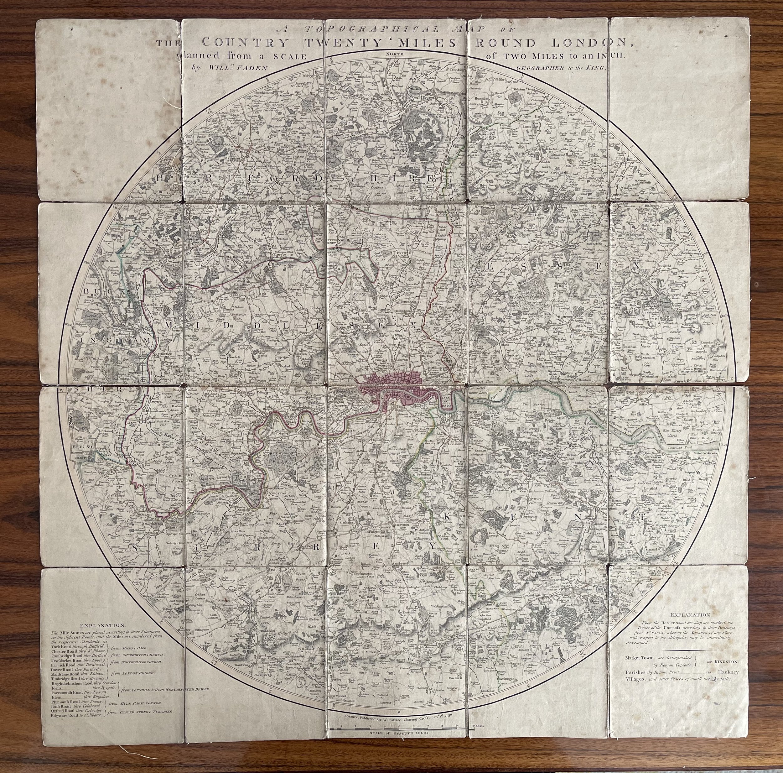
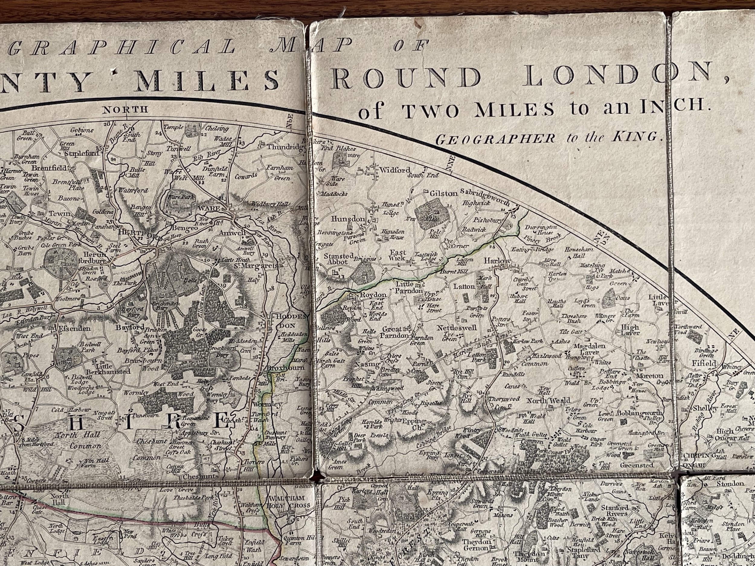
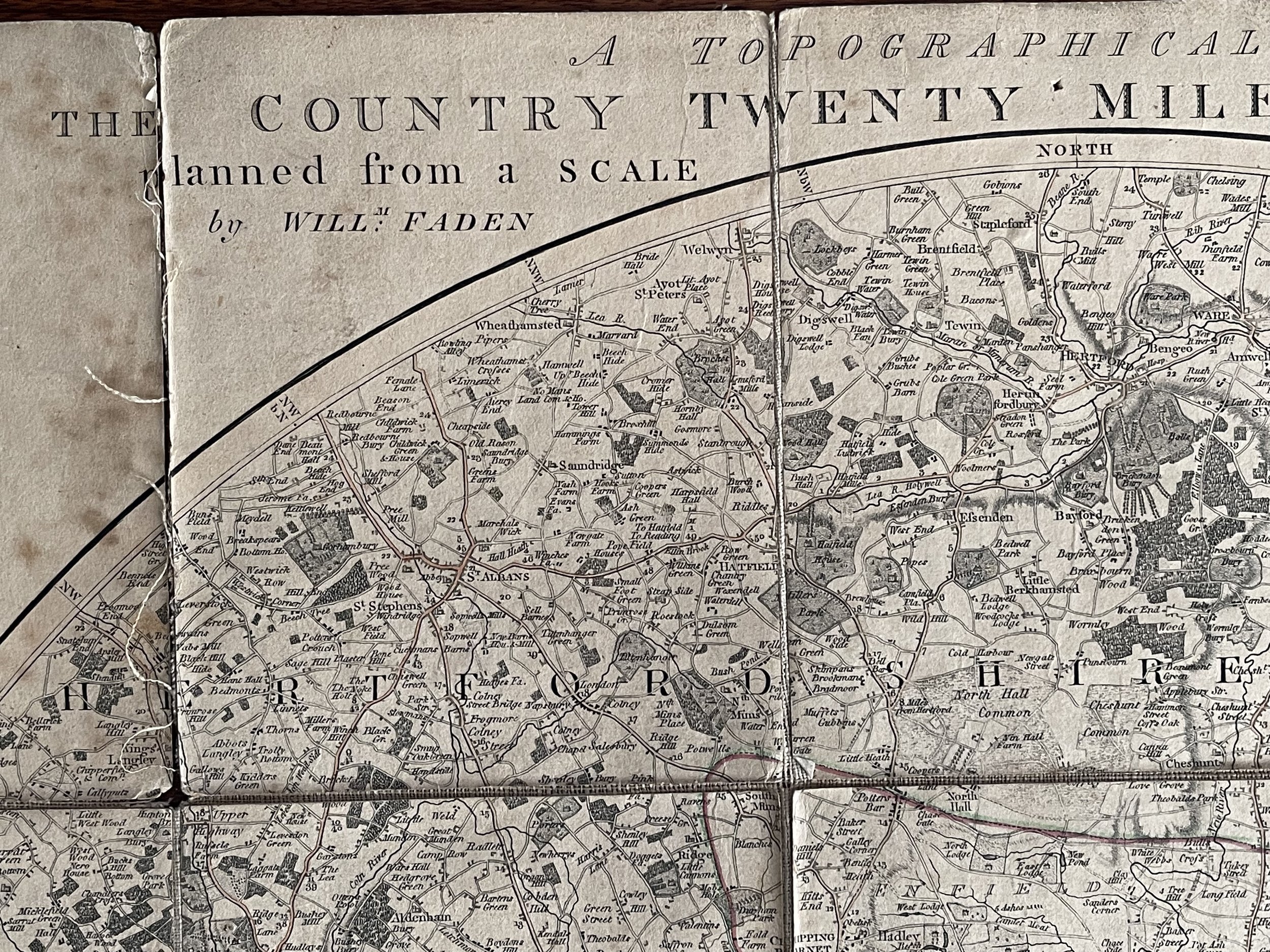
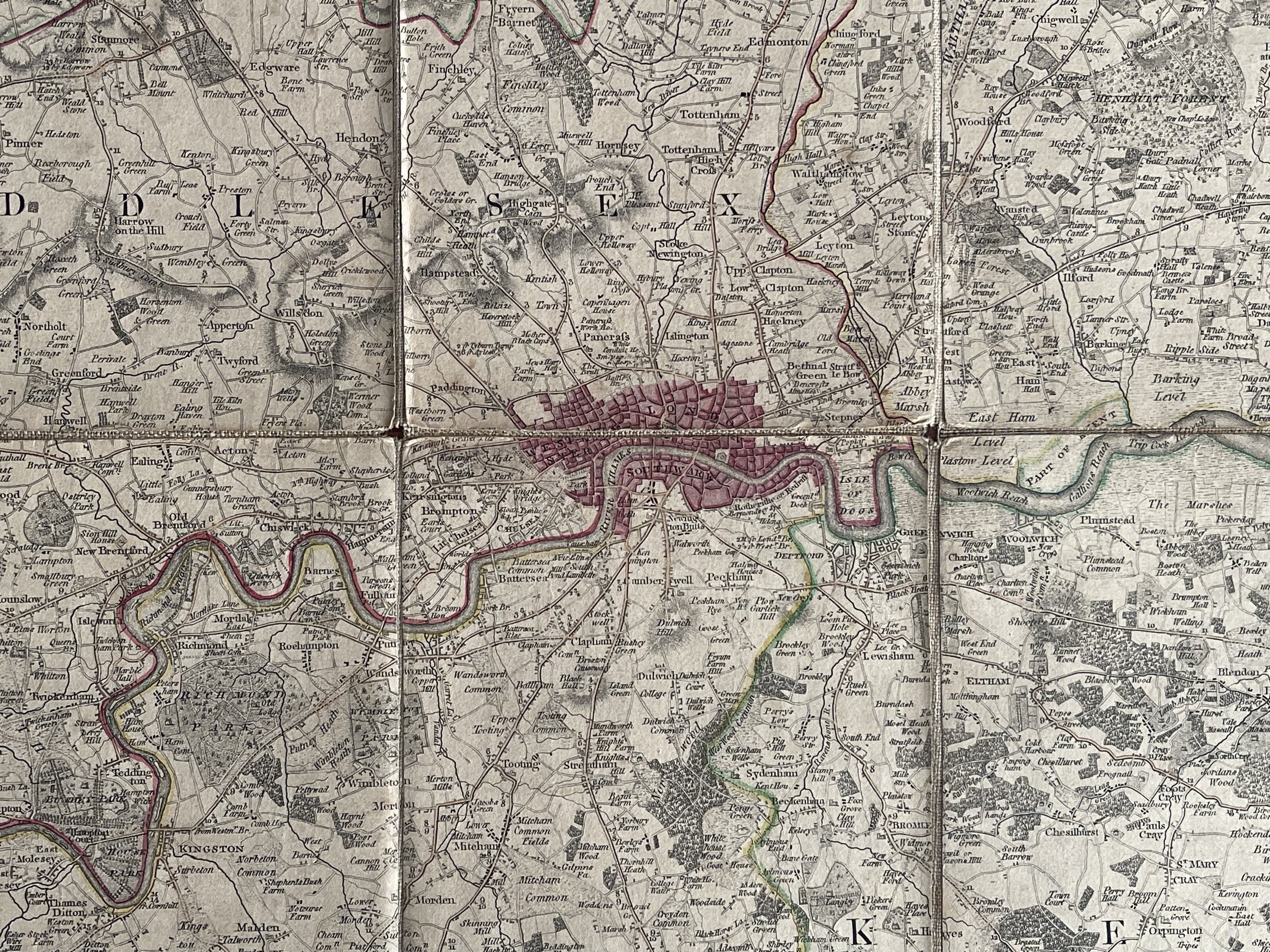
A Topigrahical Map of The Country Twenty Miles Round London - William Faden - 1790 (1st Edition)
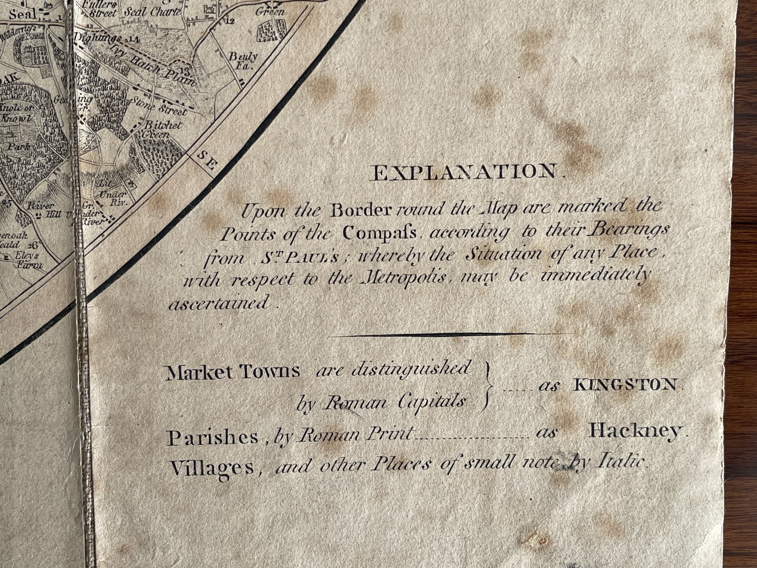
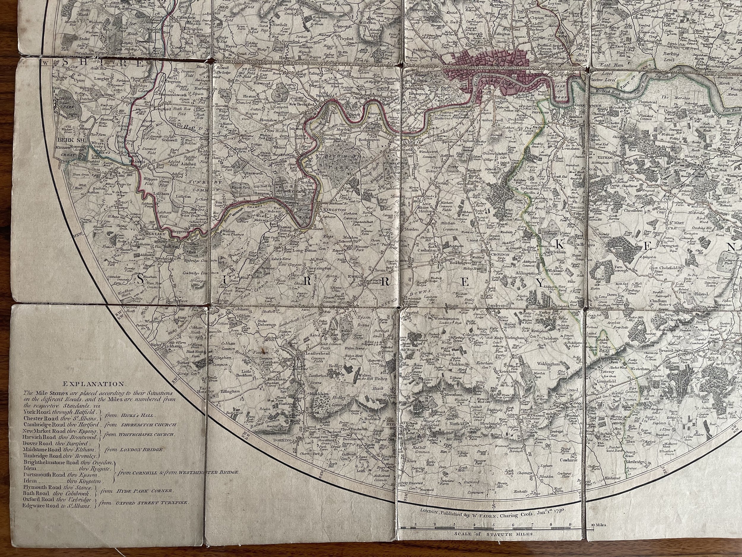
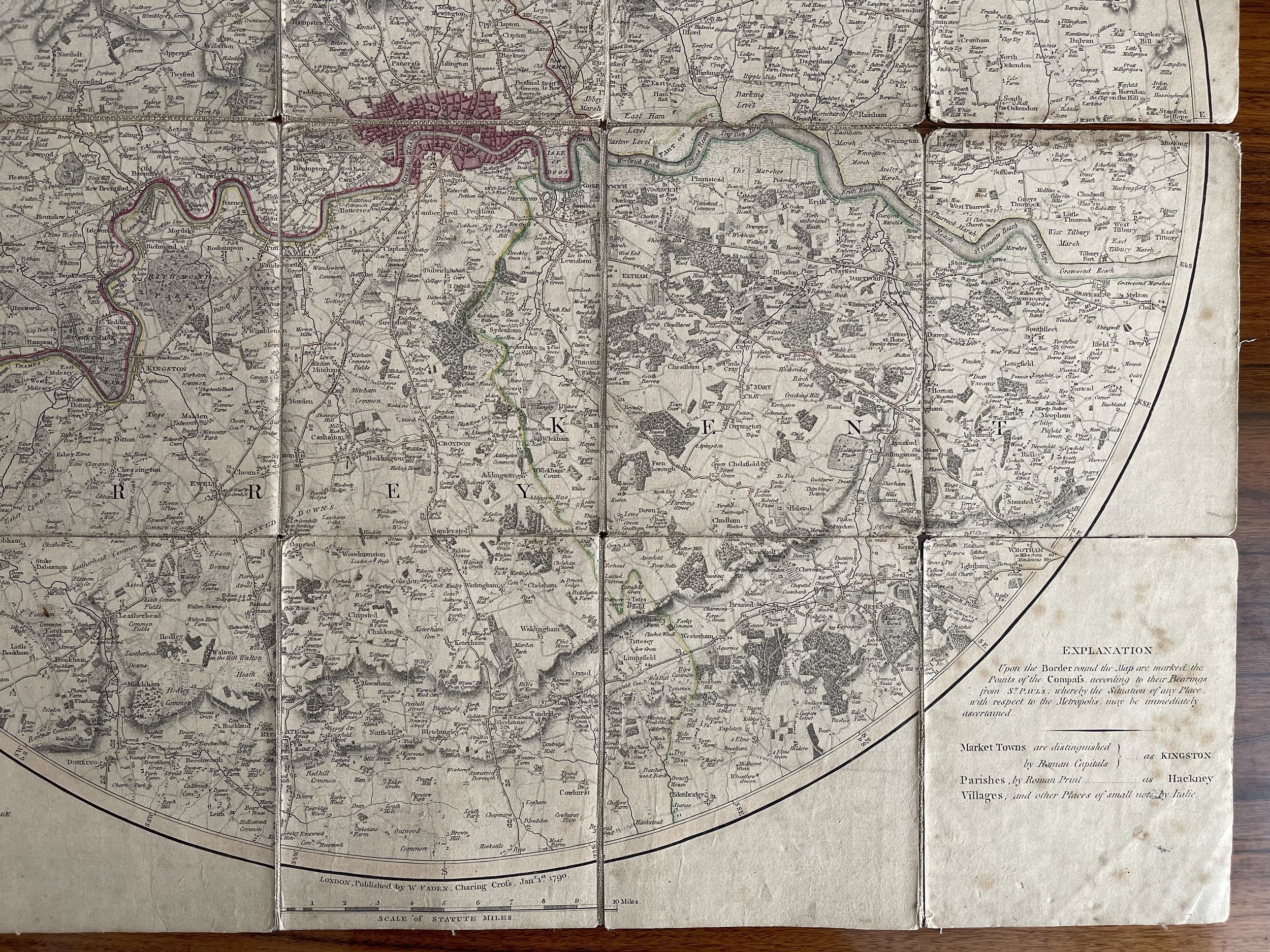
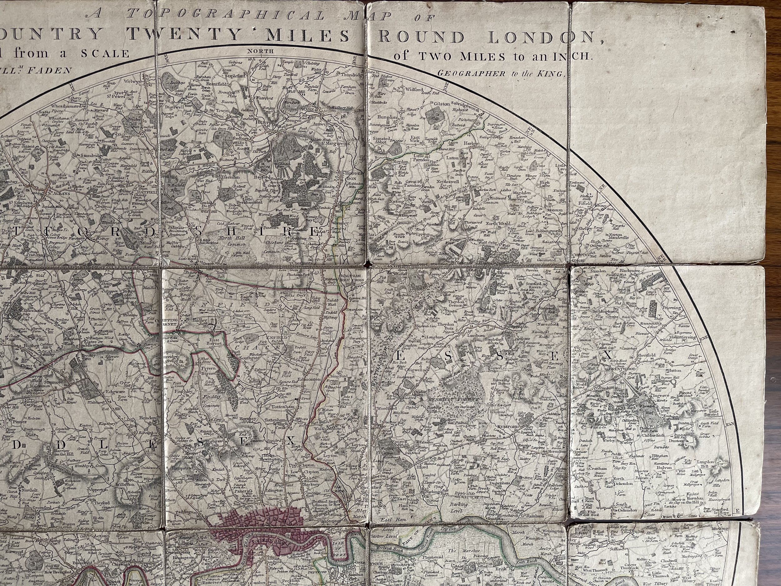
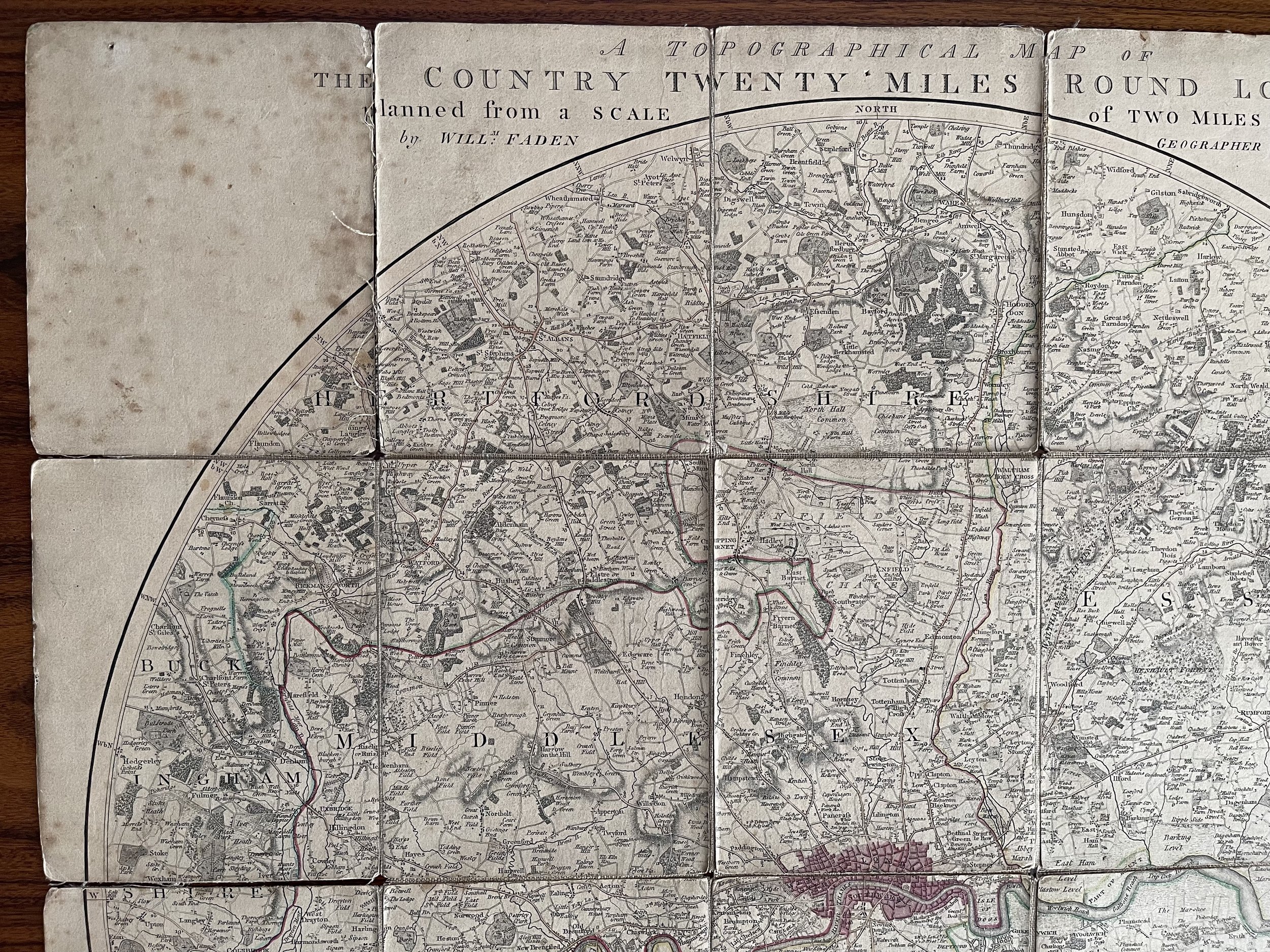
Hand coloured in outline, with parks coloured. Explanation bottom left and bottom right outside map. Imprint and scale below.
This extreemly rare first edition of this map was published by Faden in 1790. The date imprint of this edition is January 1st 1790".
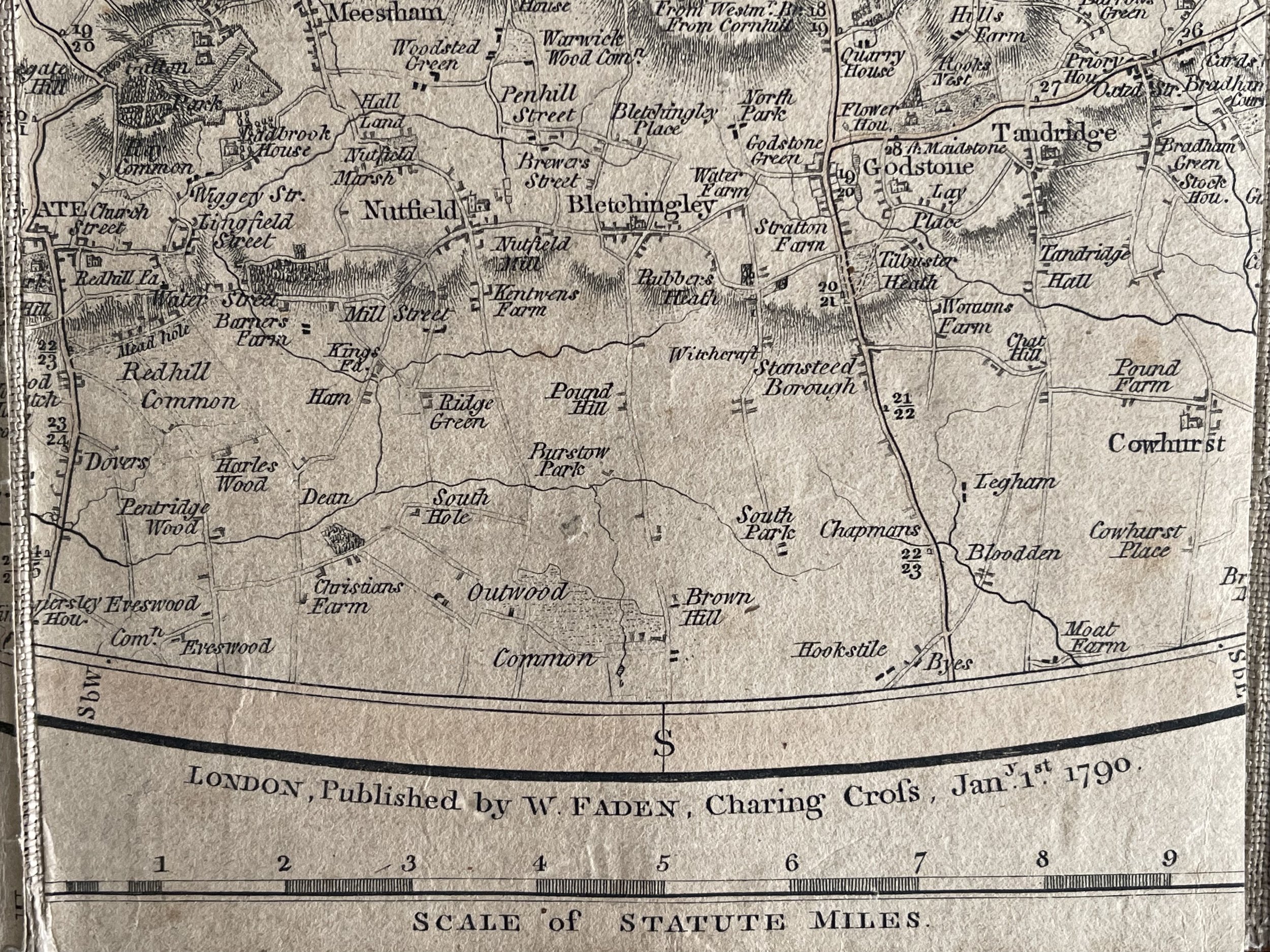
Toning of this map is quite pronounced due to UV exposure however it is intact and clear on the eye showing detail for its 234-year age. This folding map was a traveling map, and as such, is a well-used. It is quite stained in places, but overall is in good condition considering the amount of use it has seen over the centuries.
Unfortunately, the slipcase for this map is not present.
William Faden (1749–1836) was an English cartographer and a publisher of maps. He was the royal geographer to King George III. He replaced Thomas Jeffery’s in that role.
The title of "geographer to the king" was given to various people in the 18th century, including John Senex, Herman Moll, Emanuel Bowen and Thomas Jeffreys. All of these men, including William Faden, were engravers and publishers, not scholars or academics. Their part was to publish and supply maps to the crown and parliament.
William Faden was born as the son of the printer Willam Faden senior (1711-1783).
He self-printed the North American Atlas in 1777, and "...it became the most important atlas chronicling the Revolution's battles." There were 29 maps in the atlas, and they included detailed battle maps drawn by eyewitnesses.
William Faden was also the publisher of the periodical "the Public Ledger" or "The Daily Register" in London.
A list of the English county maps printed by William Faden is also given in one of his biographies.
In the second half of the 18th century, the introduction of turnpike roads and the increased coach-traffic in and out of London contributed to the popularity of the maps of the countryside around the capital.
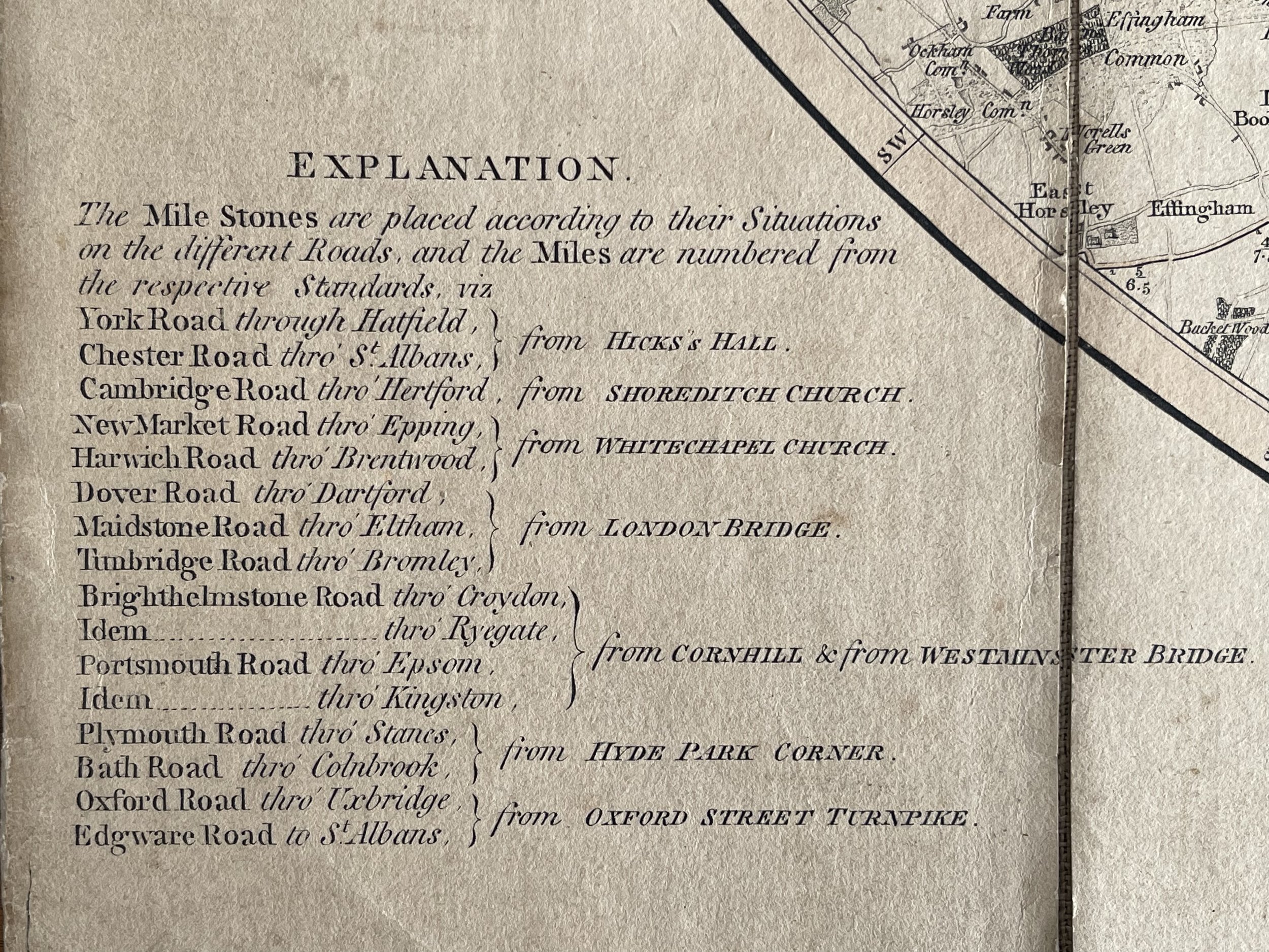
The title of this circular map runs along the top, with points on the compass marked on the border. A list of main roads to and from London is provided at bottom left, with a key at bottom right and scale bar below the plan.
The map is made up of 20 panels, is a rare first edition survivor of the period.
Some foxing to top left and bottom right borders outside of the map. Some panels detached from the linen folded joins. The map plates are intact. Pricing and grading commensurate.
This is a First Edition Folding map by William Faden.
A Topigrahical Map of The Country Twenty Miles Round London - William Faden - 1790 (1st Edition)
Hand coloured in outline, with parks coloured. Explanation bottom left and bottom right outside map. Imprint and scale below.
This extreemly rare first edition of this map was published by Faden in 1790. The date imprint of this edition is January 1st 1790".
Toning of this map is quite pronounced due to UV exposure however it is intact and clear on the eye showing detail for its 234-year age. This folding map was a traveling map, and as such, is a well-used. It is quite stained in places, but overall is in good condition considering the amount of use it has seen over the centuries.
Unfortunately, the slipcase for this map is not present.
William Faden (1749–1836) was an English cartographer and a publisher of maps. He was the royal geographer to King George III. He replaced Thomas Jeffery’s in that role.
The title of "geographer to the king" was given to various people in the 18th century, including John Senex, Herman Moll, Emanuel Bowen and Thomas Jeffreys. All of these men, including William Faden, were engravers and publishers, not scholars or academics. Their part was to publish and supply maps to the crown and parliament.
William Faden was born as the son of the printer Willam Faden senior (1711-1783).
He self-printed the North American Atlas in 1777, and "...it became the most important atlas chronicling the Revolution's battles." There were 29 maps in the atlas, and they included detailed battle maps drawn by eyewitnesses.
William Faden was also the publisher of the periodical "the Public Ledger" or "The Daily Register" in London.
A list of the English county maps printed by William Faden is also given in one of his biographies.
In the second half of the 18th century, the introduction of turnpike roads and the increased coach-traffic in and out of London contributed to the popularity of the maps of the countryside around the capital.
The title of this circular map runs along the top, with points on the compass marked on the border. A list of main roads to and from London is provided at bottom left, with a key at bottom right and scale bar below the plan.
The map is made up of 20 panels, is a rare first edition survivor of the period.
Some foxing to top left and bottom right borders outside of the map. Some panels detached from the linen folded joins. The map plates are intact. Pricing and grading commensurate.
Code : A796
Cartographer : Cartographer / Engraver / Publisher: William Faden
Date : Publication Place / Date - 1790 1st Edition
Size : Sheet size: Image Size: 60.5 x 61.5 cm
Availability : Available
Type - Genuine - Antique
Grading A-
Where Applicable - Folds as issued. Light box photo shows the folio leaf centre margin hinge ‘glue’, this is not visible otherwise.
Tracked postage, in casement. Please contact me for postal quotation outside of the UK.