Although it’s use as a reference for day-to-day transportation around the city is suspect, this Benjamin Davies map of London provides a detailed view of the London area near the end of the 19th century. The impressive size of the sheet and fine steel engraving method allows for the individual labelling of roads, buildings, and other points of interest, plus topographical hatching, wooded areas and bodies of water. Splashes of colour add organisational context between the boroughs, while natural elements such as water and grass are coloured in addition to the major rail lines serving the city.
The map was compiled by Benjamin Rees Davies, an early adopter of the steel plate method of engraving who did much of his own surveying. The delicate lines and attention to detail made him a popular cartographer in London and led to regular publishing partnerships with Edward Stanford. Today the Stanford firm still publishes maps and remains one of the most important and prolific cartographic publishers in the world.
Benjamin Rees Davies (1789 - December 16, 1872)
Was an engraver, cartographer, painter, and map publisher active in the early to mid-19th century. Davies was born in Holborn, England, apprenticed as under John Lodge in 1803. He began publishing around 1811 and is known to have compiled many of own maps from original survey work. From approximately 1848 onward Davies published in conjunction with the Stanford Firm. He is also known to have engraved several maps for the Dispatch Atlas and the S.D.U.K. Davies was an early adopter of steel plate engraving and used the exceptional hardness of steel to create some of the most delicately engraved and beautifully produced maps of his era. He was quite famous in England for his detailed street plans of London, which he began publishing in
1848. Davies is known to have worked with numerous other cartographers of his period including French, Mexican, and American map makers. Many of his maps and plans continued to be published and updated posthumously well into the 1880s.
The map is in excellent condition - backed on linen, it folds into 36 segments with the original case and seller's label.
 Image 1 of 19
 Image 2 of 19
 Image 3 of 19
 Image 4 of 19
 Image 5 of 19
 Image 6 of 19
 Image 7 of 19
 Image 8 of 19
 Image 9 of 19
 Image 10 of 19
 Image 11 of 19
 Image 12 of 19
 Image 13 of 19
 Image 14 of 19
 Image 15 of 19
 Image 16 of 19
 Image 17 of 19
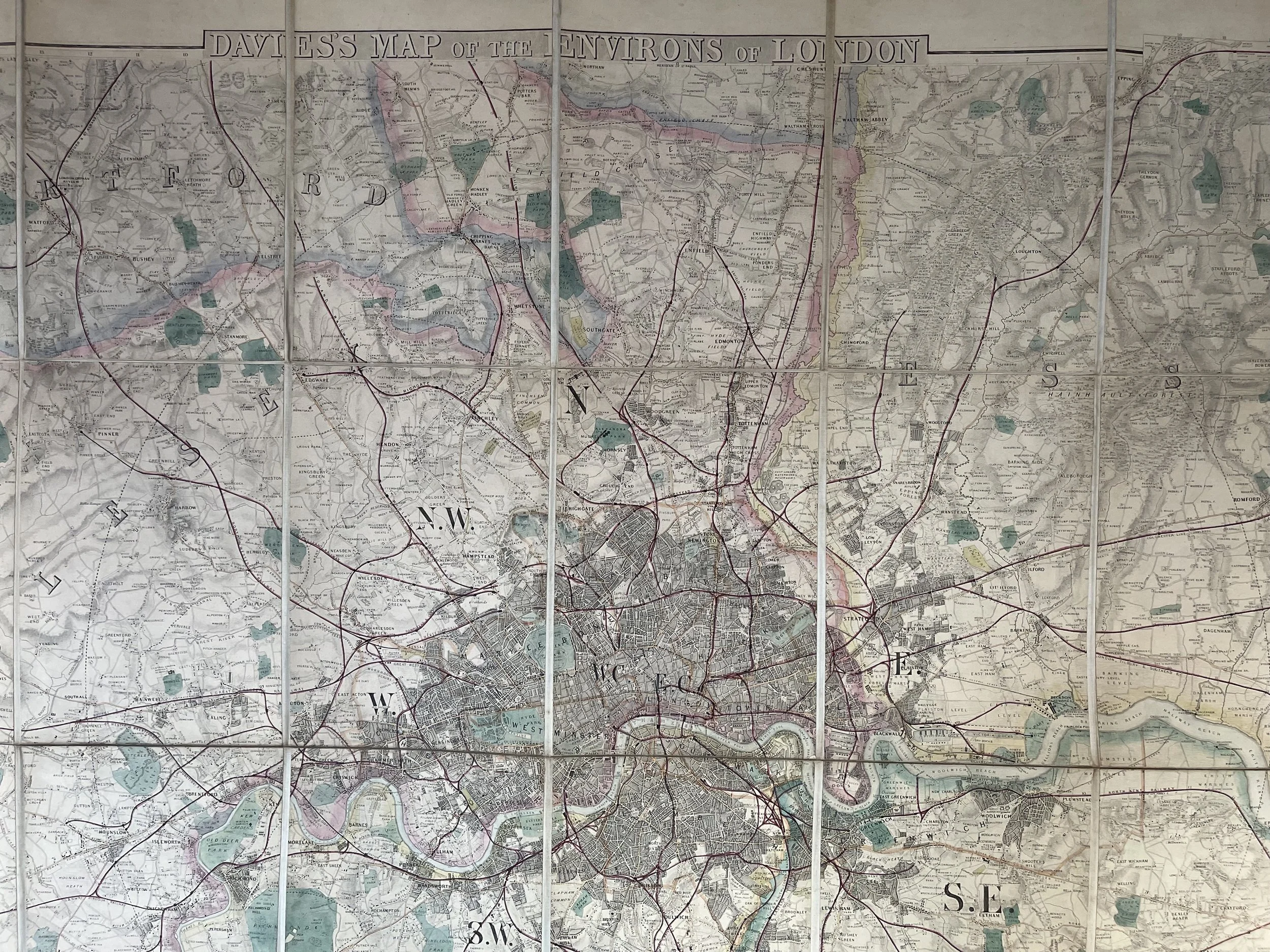 Image 18 of 19
 Image 19 of 19