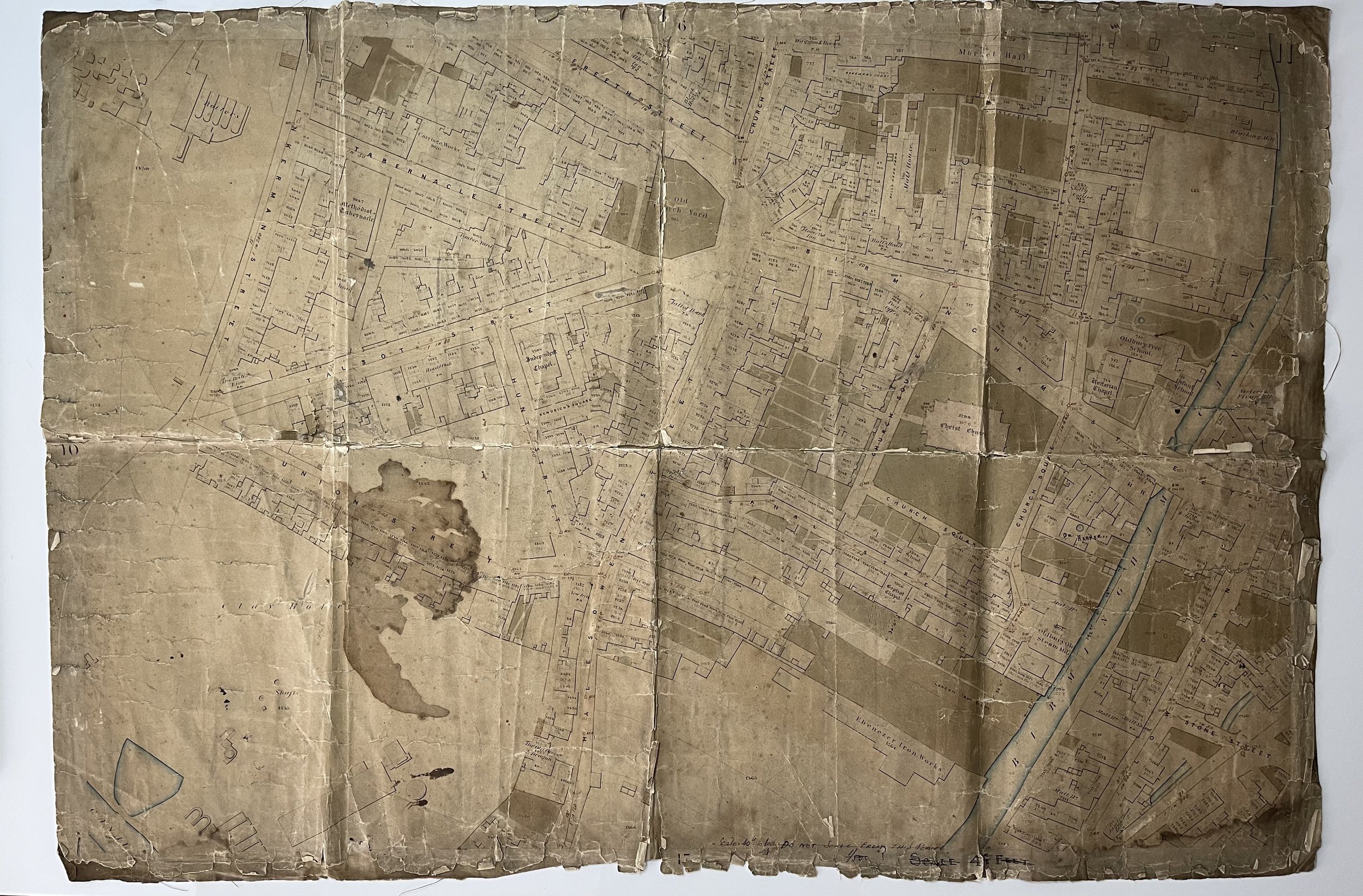
Topographical Survey of 'Oldbury', Sandwell District, England - 1860s
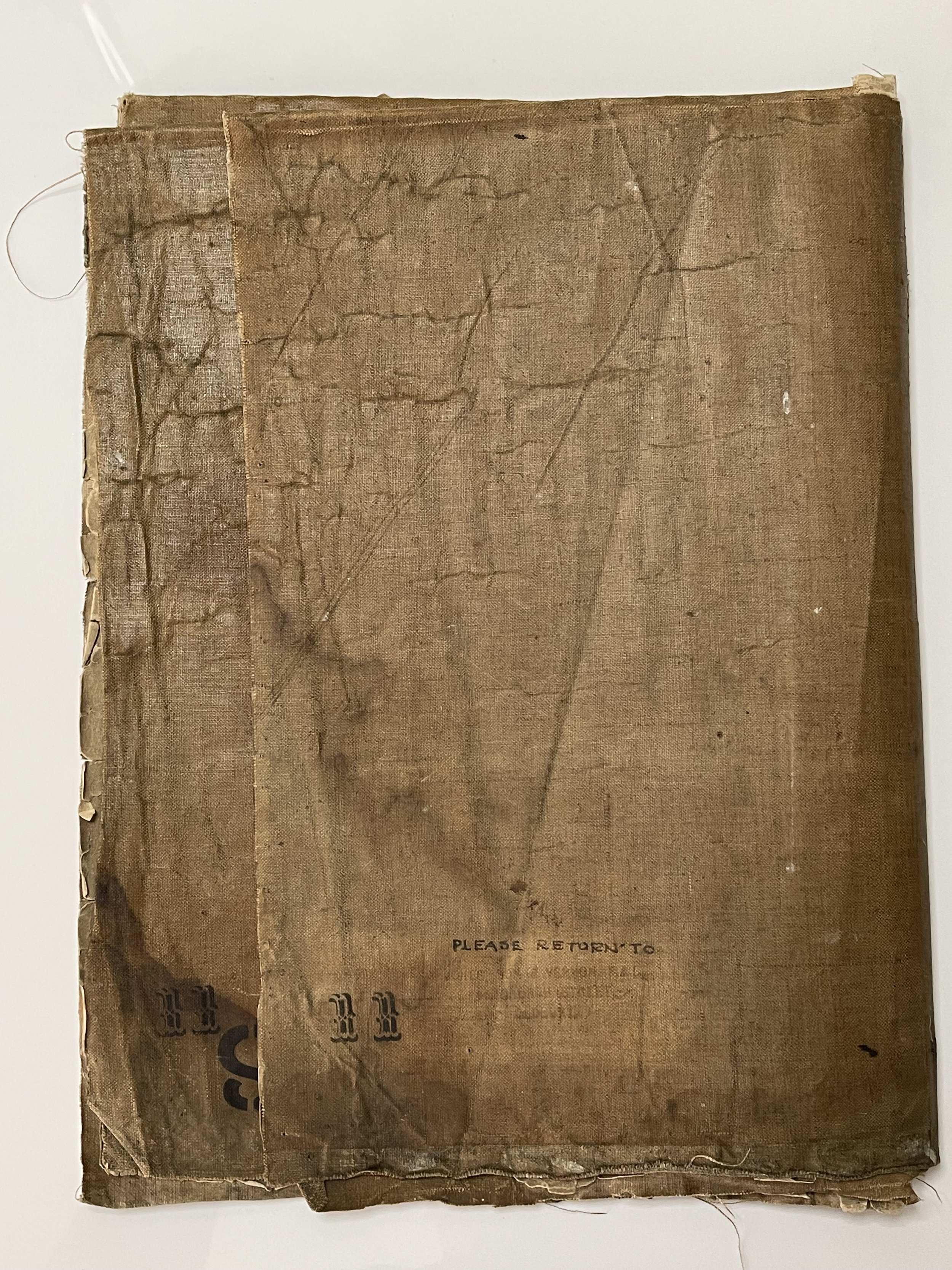
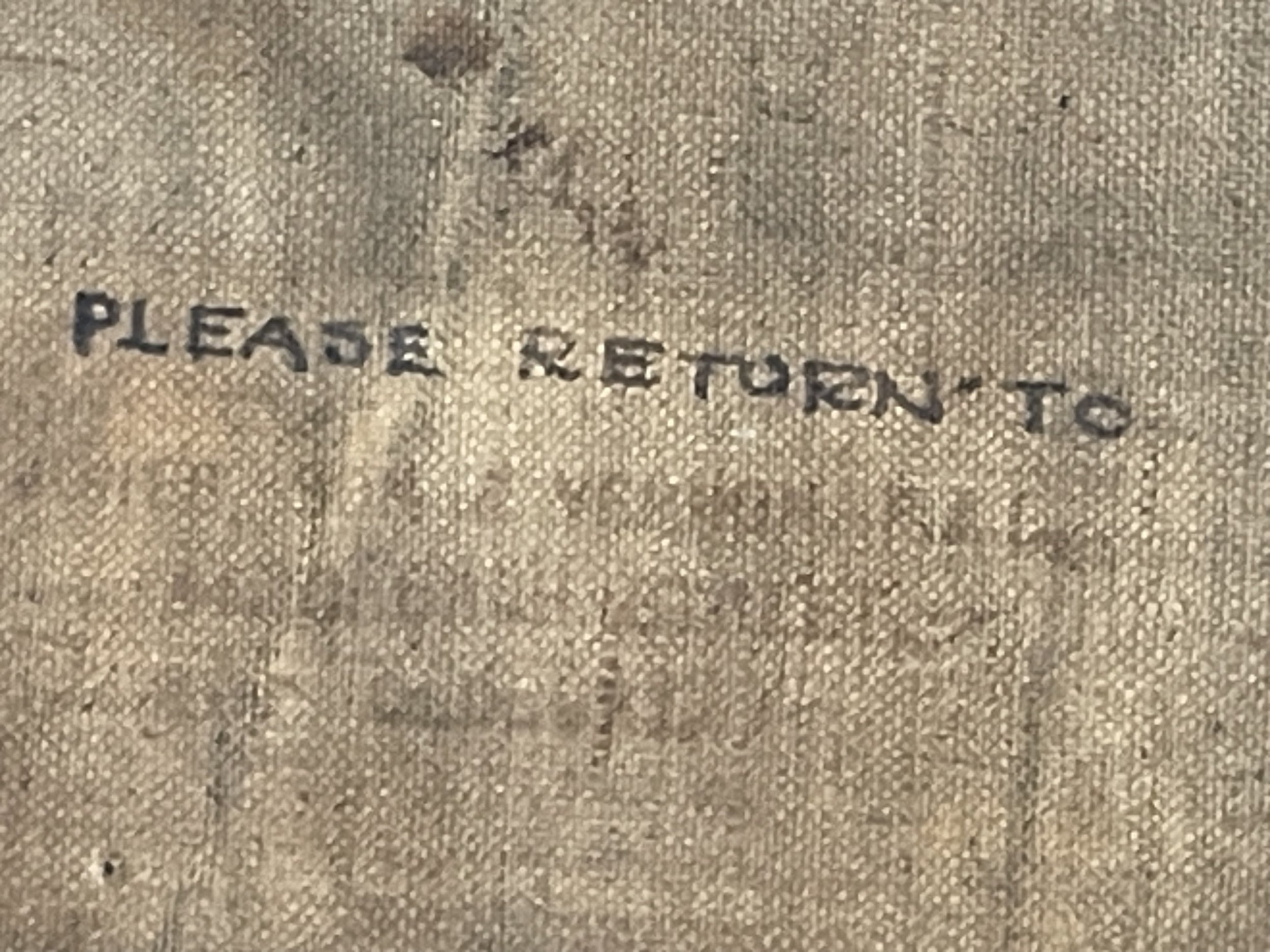
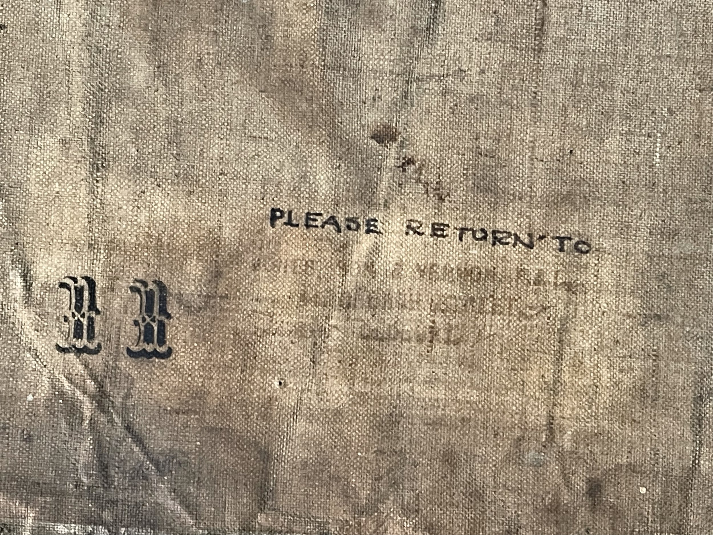
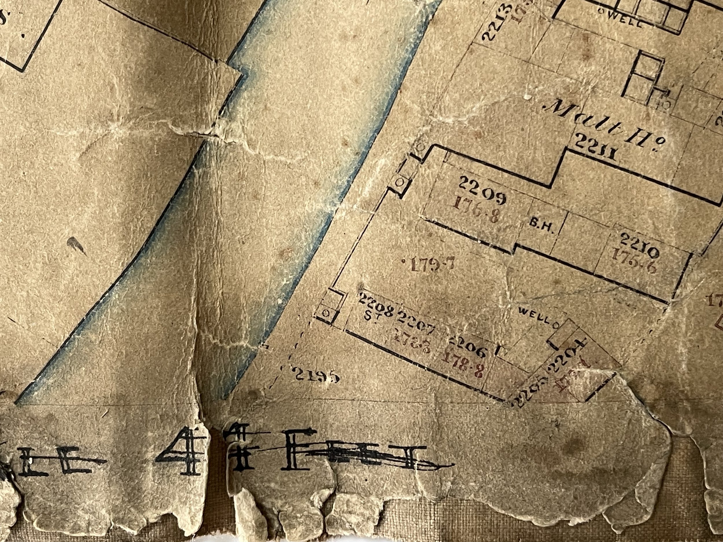
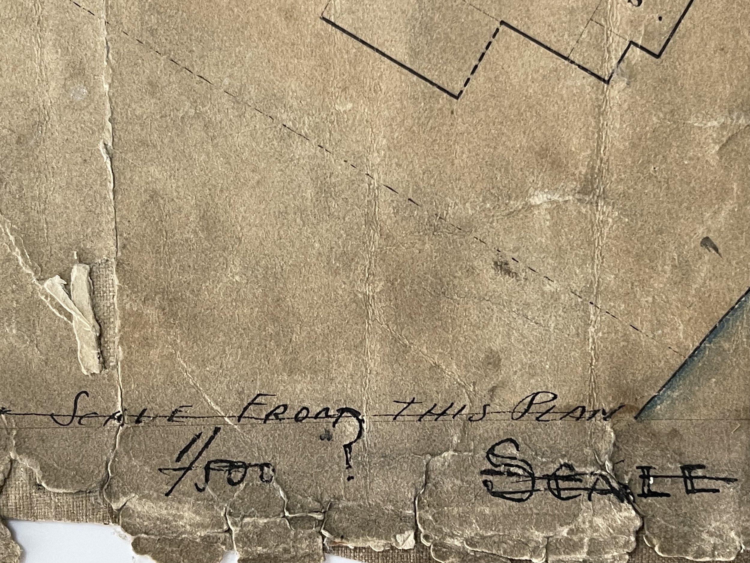
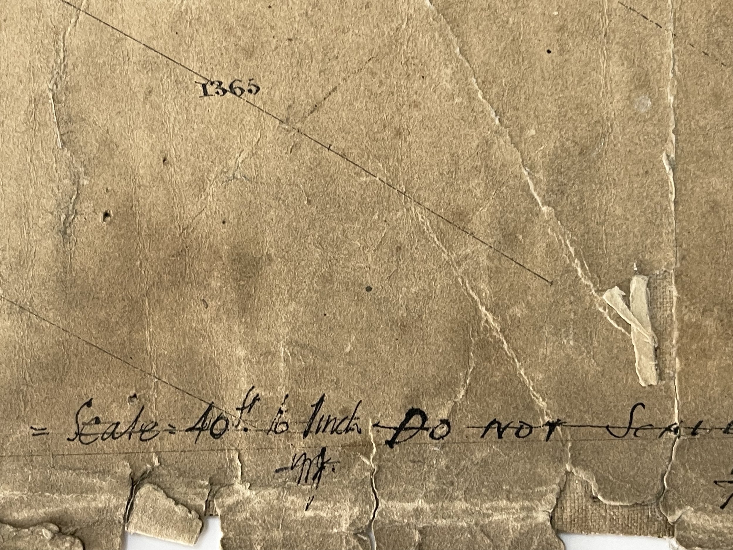
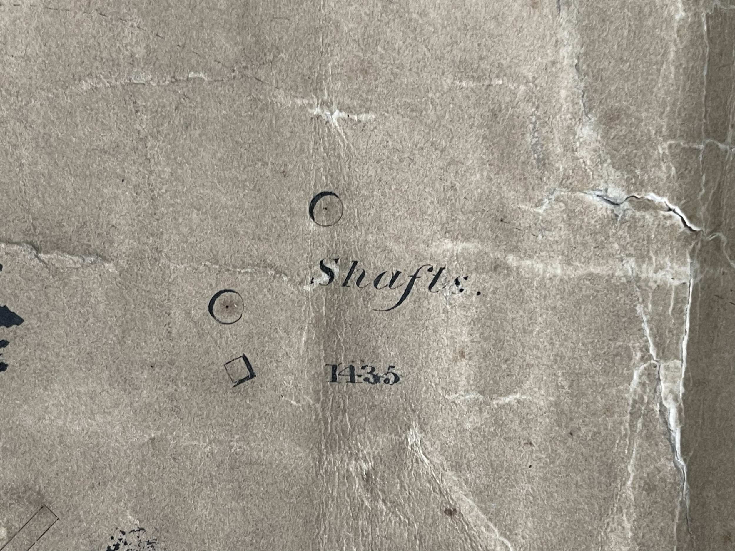
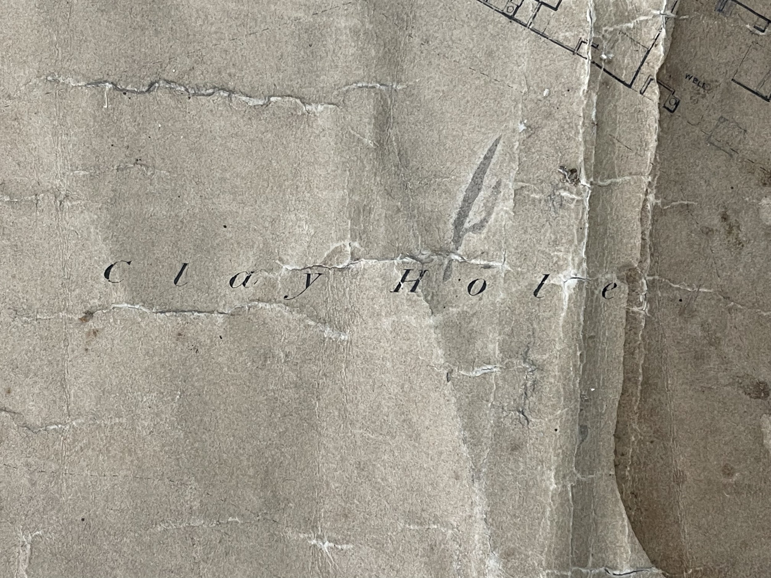
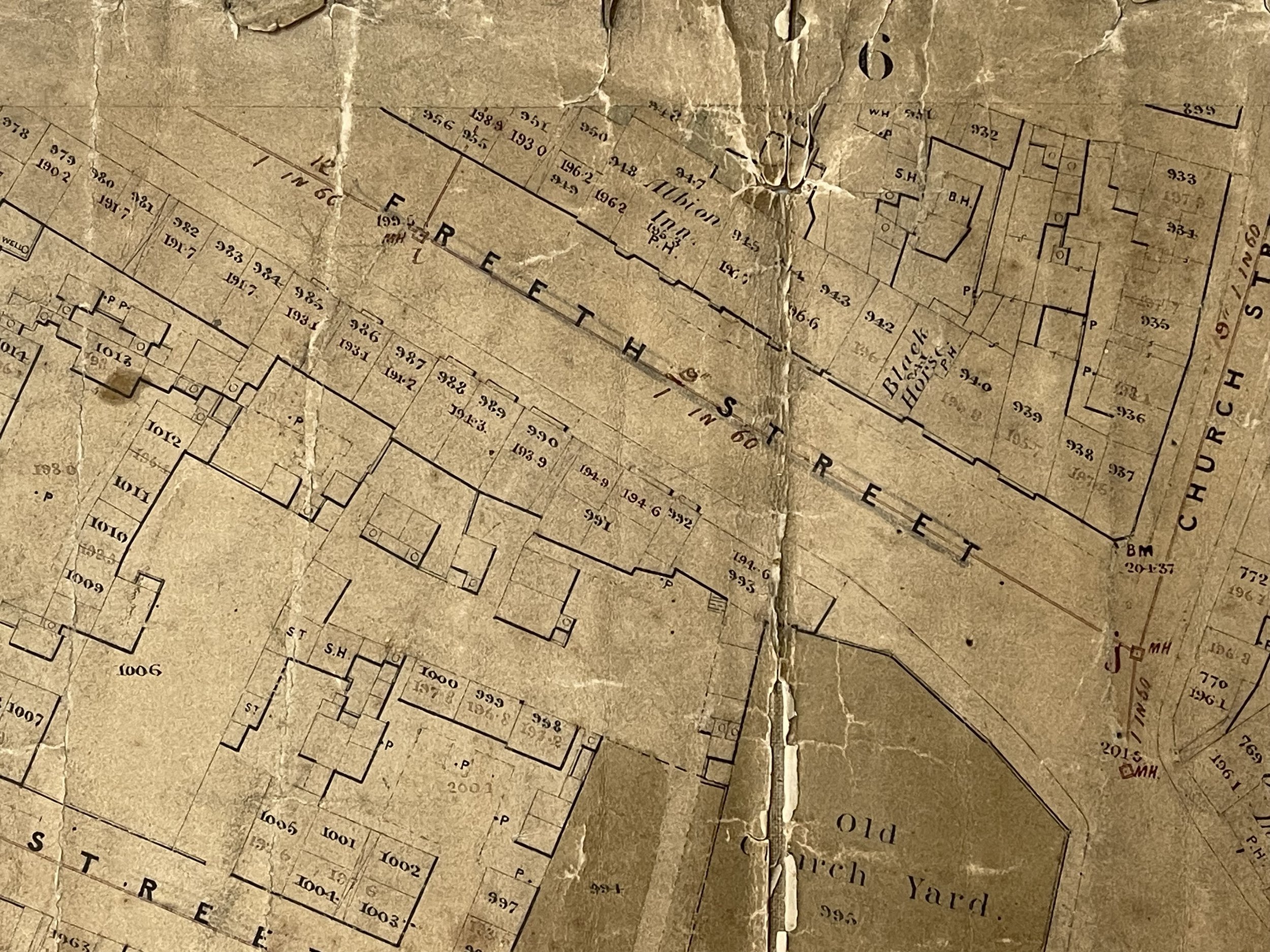
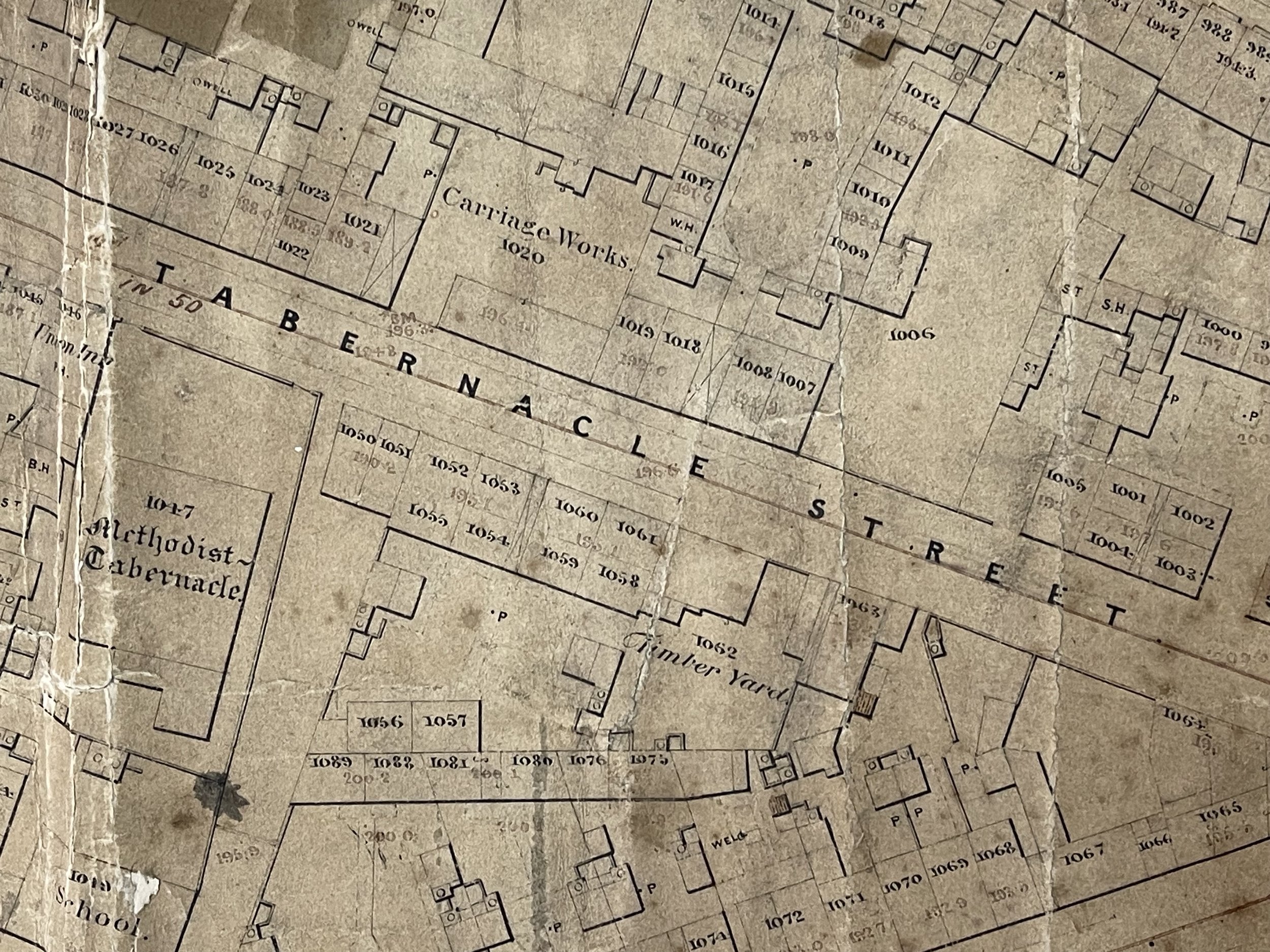
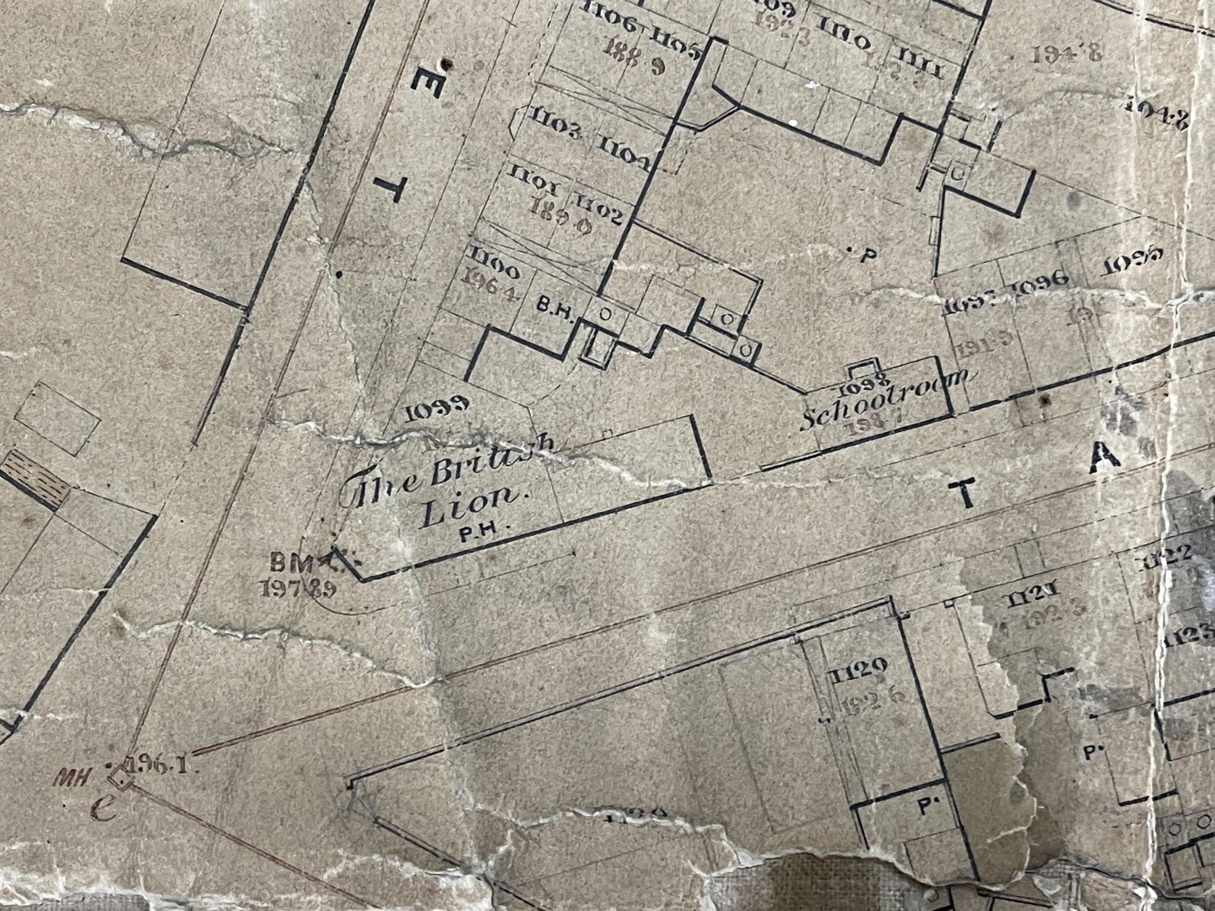
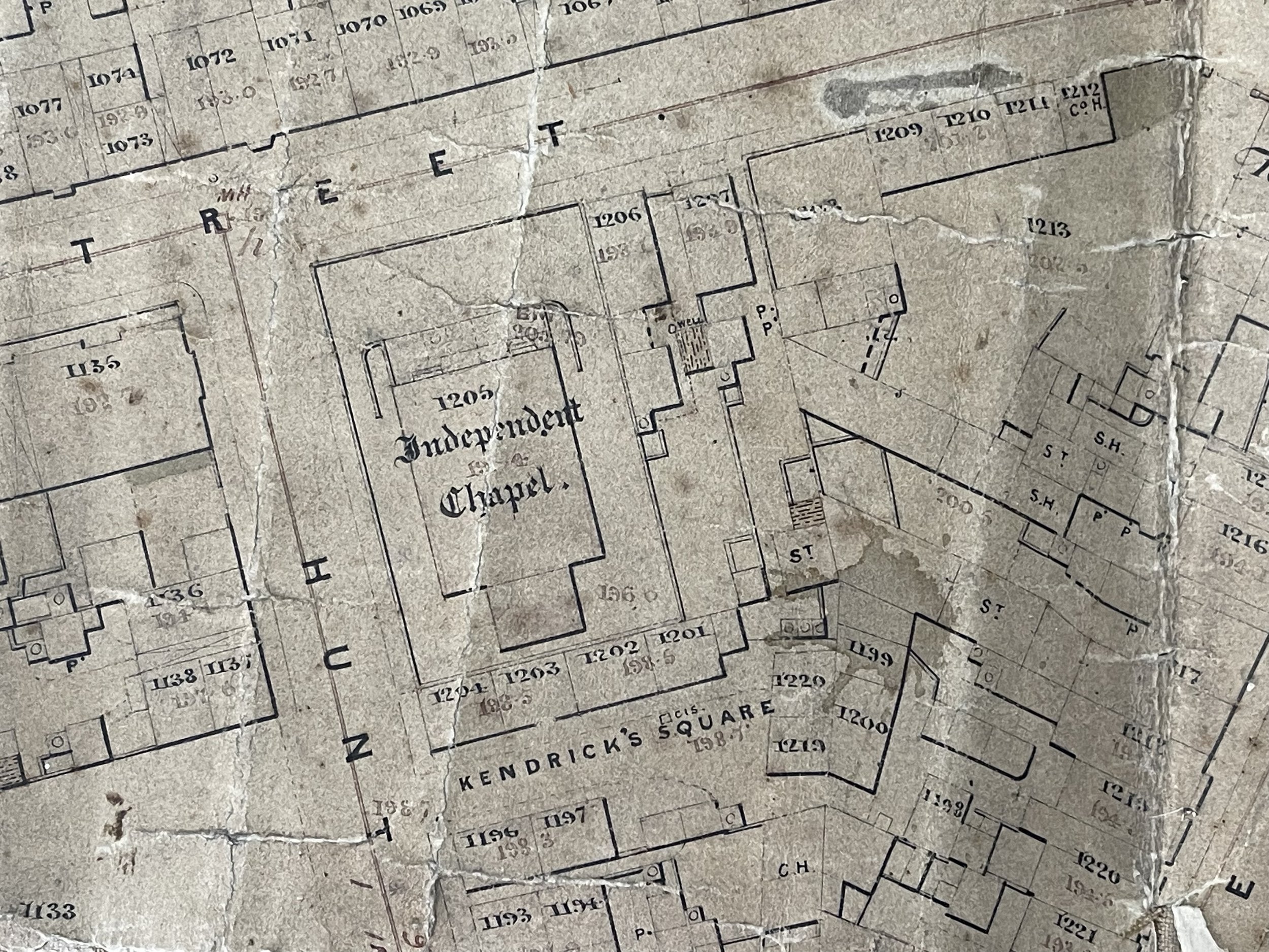
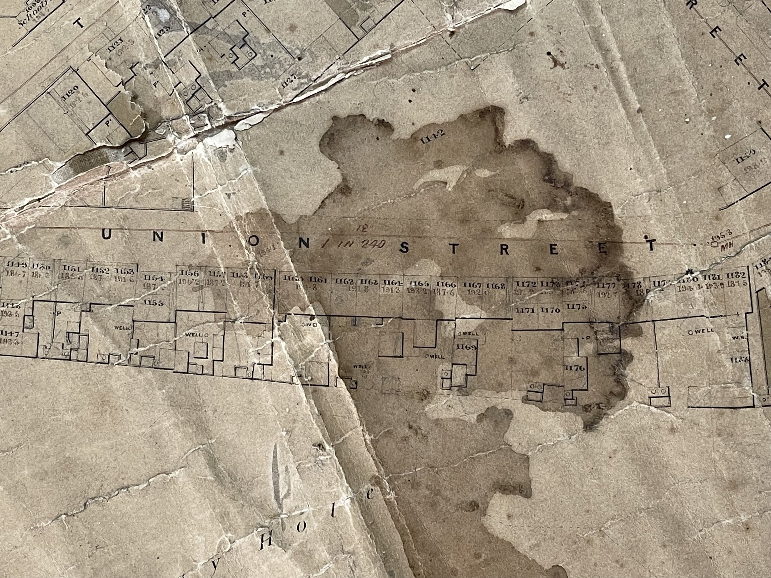
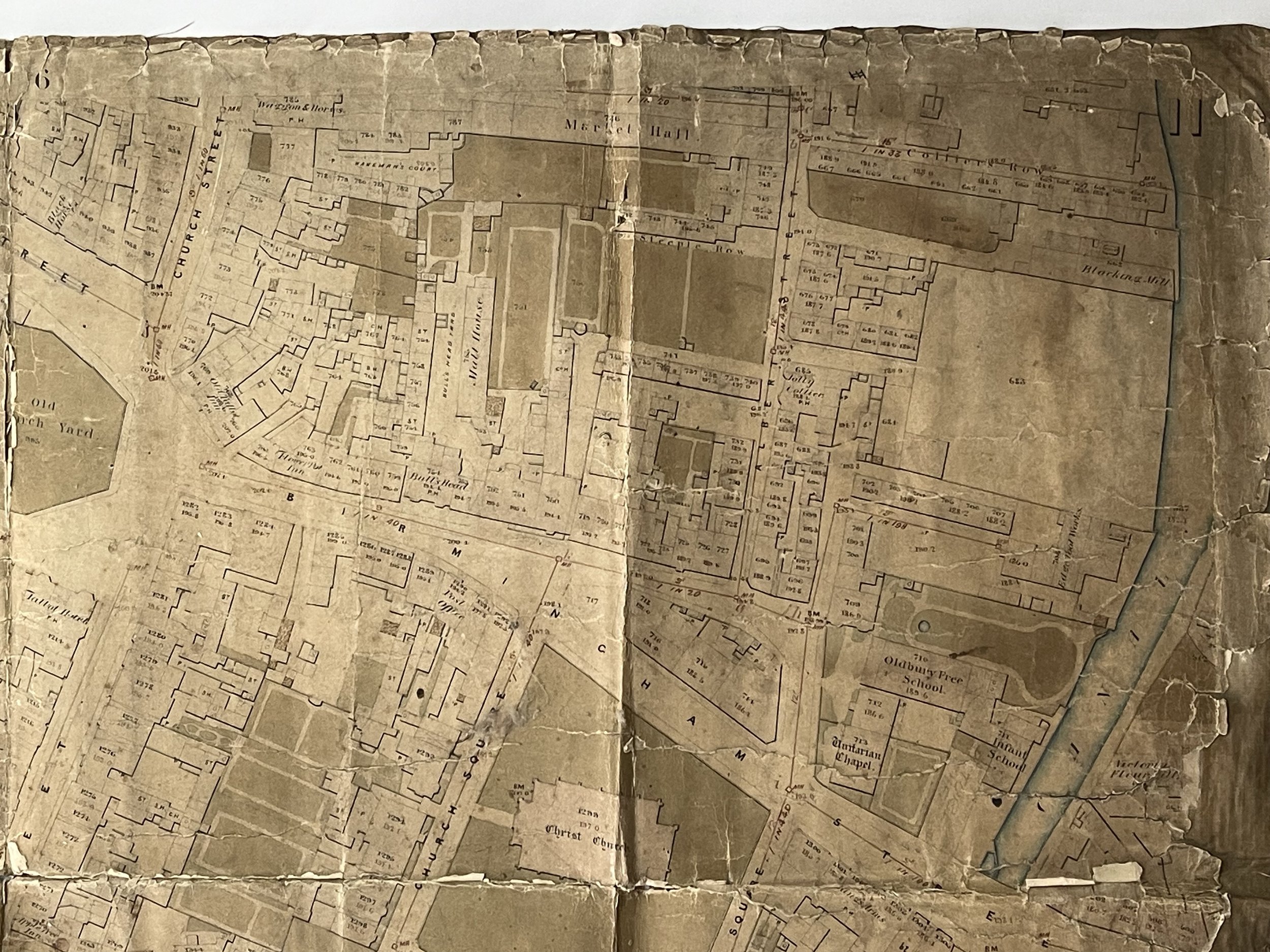
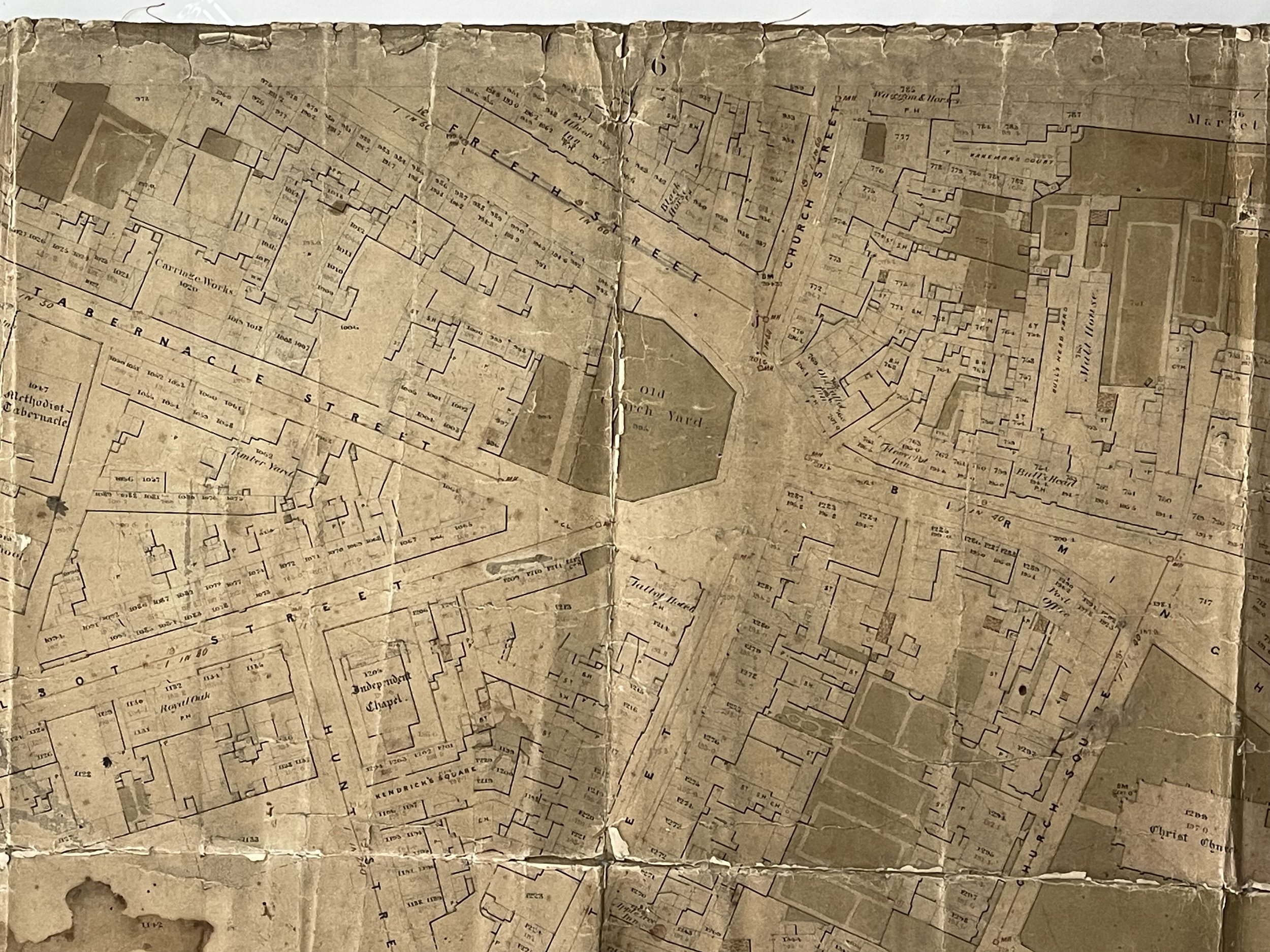
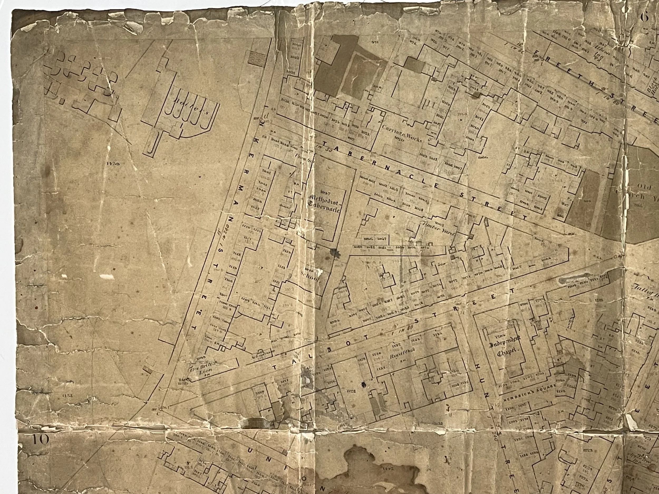
Intricately detailed waxed and hessian topographical plan of Oldbury near Birmingham. It shows current land plots and other vacant plots, some earmarked for construction. There is a stamp to the rear that is faded and hard to make out but I believe it says: ‘Please return to Jones & Son, R Vernon R&L m***burgh street Oldbury’. Im unable to locate the source of this information however.
Oldbury is a market town in the Metropolitan Borough of Sandwell, West Midlands, England. It is the administrative centre of the borough. Oldbury is rich in deposits of clay, shales, ironstones and other minerals ripe for exploration at the time of the industrial revolution. The area was built on the four pillars of industrial strength - Coal, iron, bricks and chemicals. Canals and mining foundries and forges and workers homes were crowded side by side.
Mentioned in the Doomsday book, the place name Oldbury comes from the Old English 'Ealdenbyrig', – signifying that Oldbury was old even in early English times over 1,000 years ago. Eald being Old English for 'old', Byrig is the plural of 'burh' in Old English – a burh being a fortification or fortified town.
Oldbury was part of the ancient parish of Halesowen, a detached part of Shropshire surrounded by Worcestershire and Staffordshire. After the dissolution of the monasteries, Henry VIII gave Hales Owen manor including Oldbury to Sir John Dudley. In 1555, Sir John's son Robert sold most of Hales Owen manor but retained Oldbury and Langley which became a separate manor. Thus, Sir Robert Dudley became the first Lord of the Manor of Oldbury. Oldbury manor was held by several families thereafter with the land gradually being sold off and the manorial functions dispersed. The last Lord of Oldbury Manor was Patrick Allan Fraser.
Pigot and Co.'s National Commercial Directory for 1828-9 describes Oldbury as a village in Shropshire with close trade and manufacturing links to Dudley and Stourbridge. It notes the importance of the iron trade with its "considerable blast furnaces, for making pig iron" and states "there are also steel works; and coal and ironstone abound in the vicinity". Mention is made of a debtors' prison, and a courthouse which held a fortnightly Court of Requests for recovery of debts not exceeding five pounds.
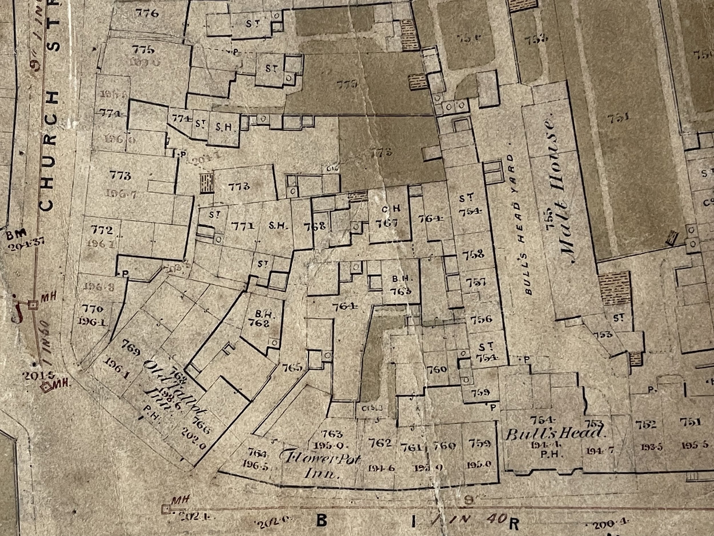
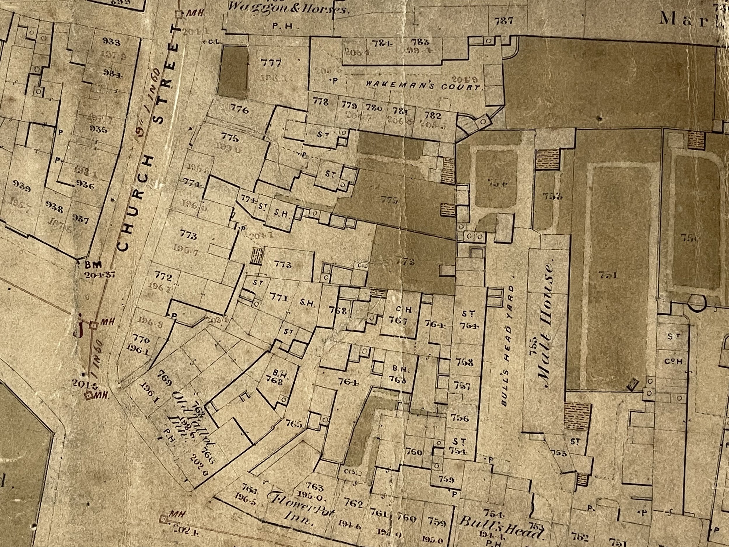
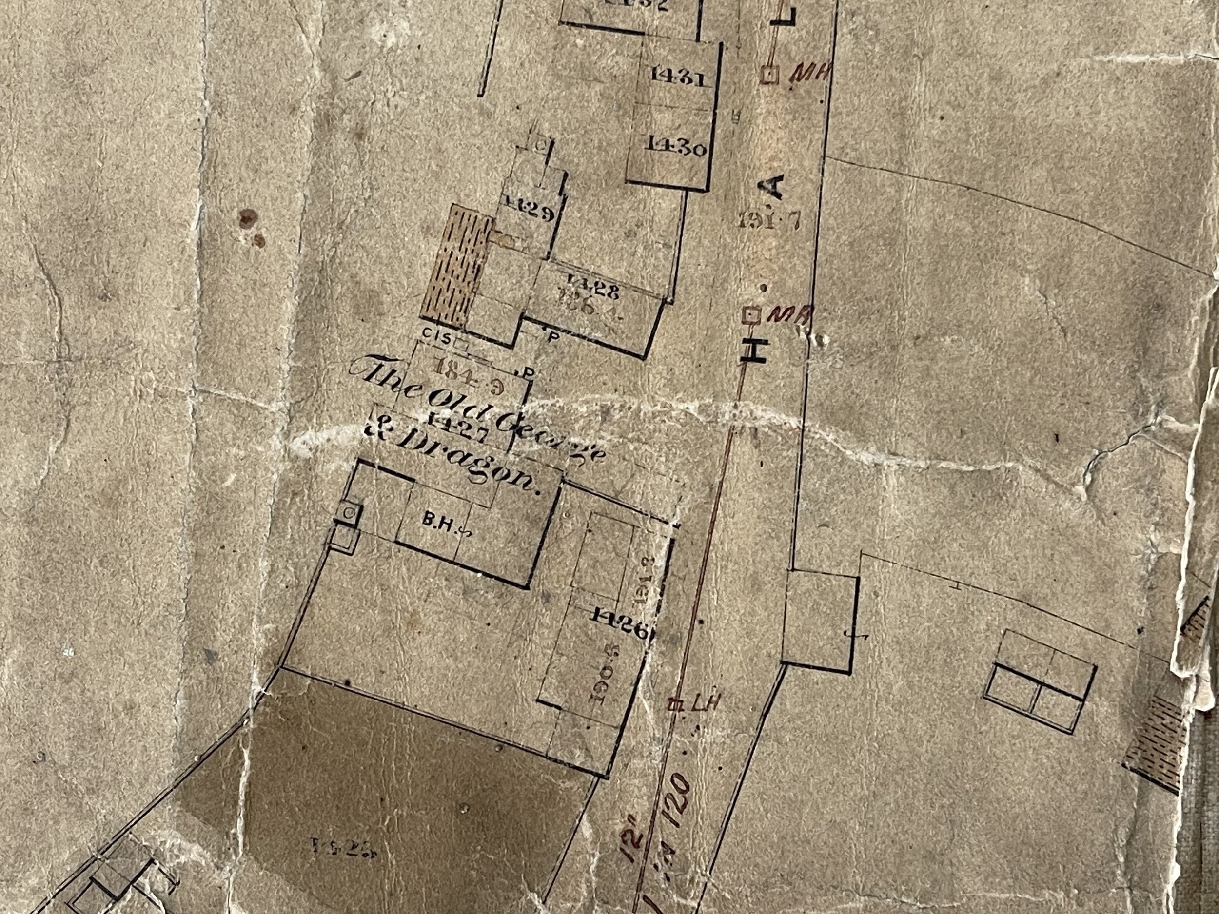
Significant point of note on the map – The Old Talbot Inn was one of the coaching inns, and the road was later turnpiked with a toll gate at the junction of Birmingham Road and Rood End Road.
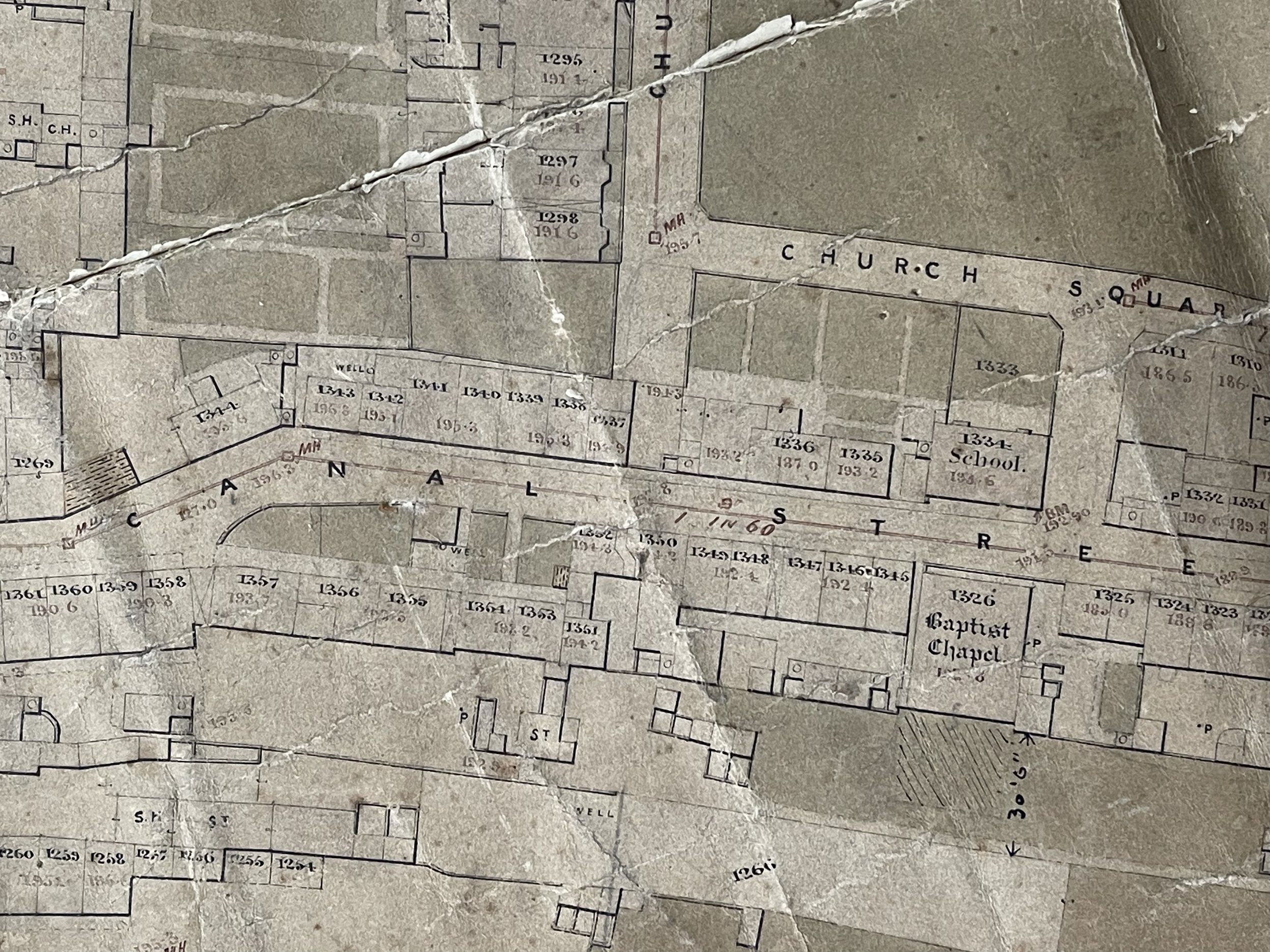
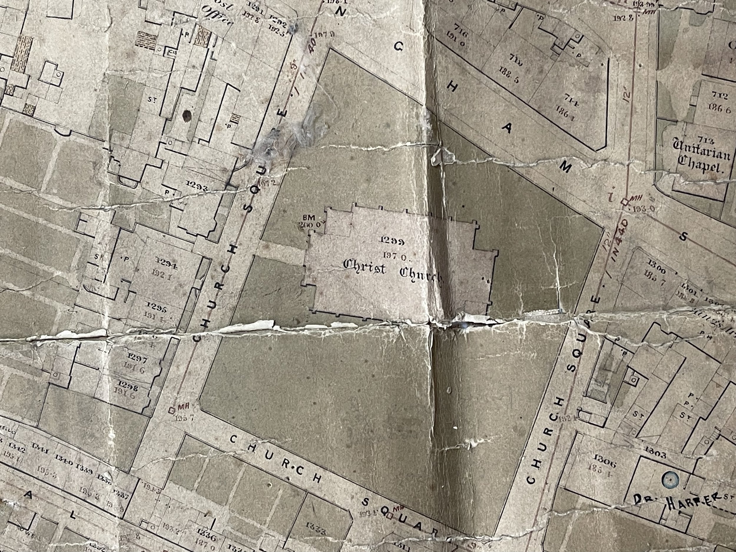
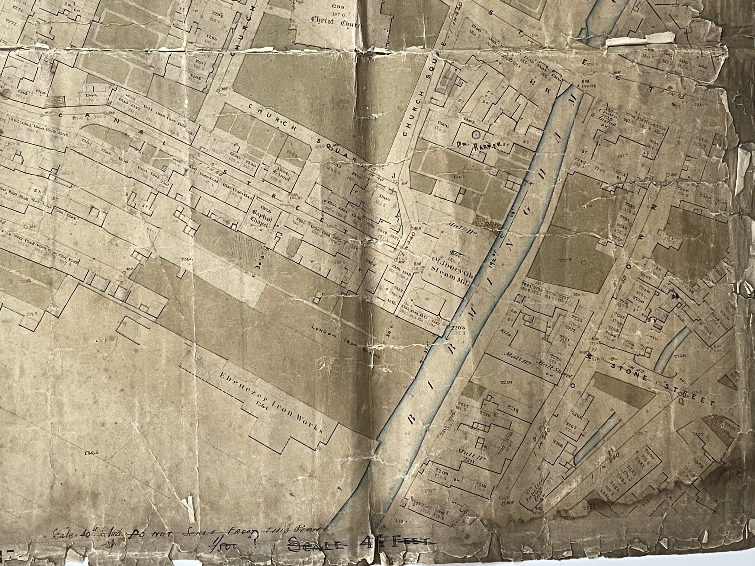
Christ Church, Oldbury’s Parish Church (Shown on the map)
In 1837 Oldbury Chapel (St Nicholas) was in a very dilapidated condition and it was also deemed to be too small, containing seating for only 234. By 1831, the population of Oldbury was around 6,000 and rising, owing to industrialisation. The foundation stone for a new church was laid in 1840, on a piece of land known as the ‘Close Orchard’, and
the building of Christ Church was consecrated in July the following year.
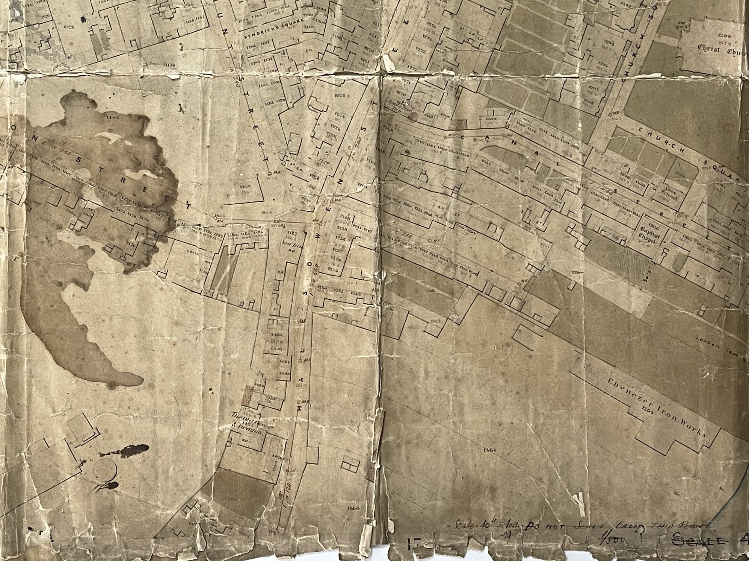
The Tabernacle Methodist Church, Oldbury - William Booth (1855) is shown on the map off Tabernacle Street and was built in 1838. The church no longer exists. The Tabernacle School which is also shown opened in 1885. William Booth (10 April 1829 – 20 August 1912) was an English Methodist preacher who, along with his wife, Catherine, founded the Salvation Army and became its first General (1878–1912).
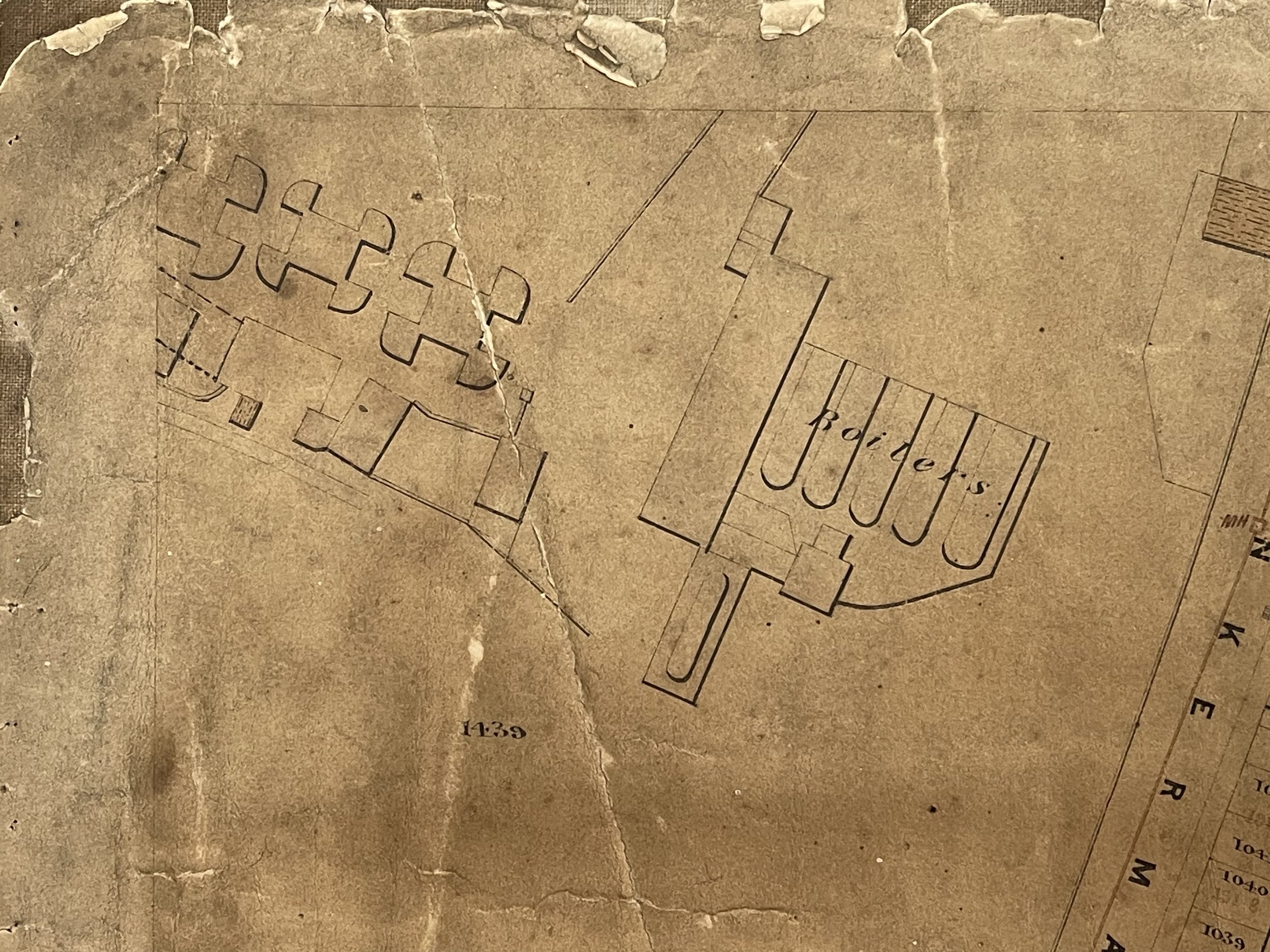
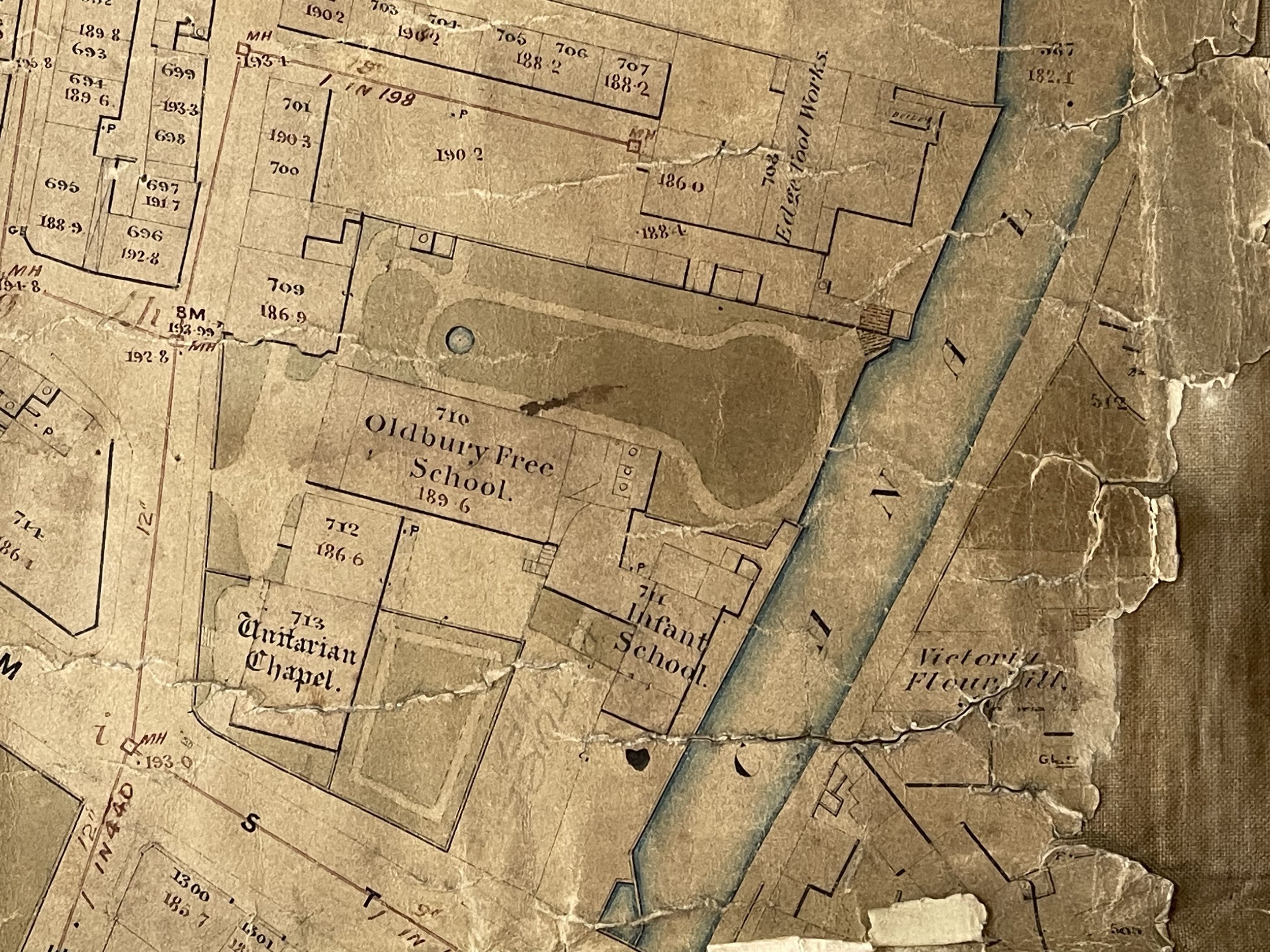
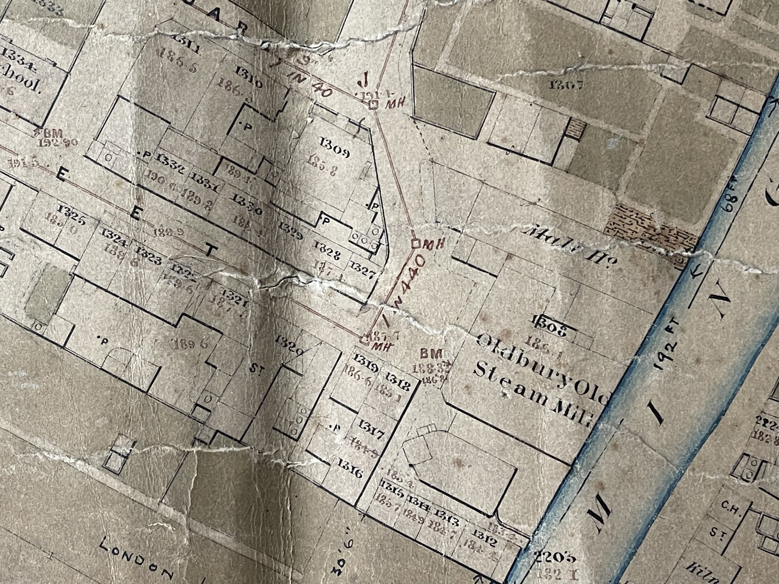
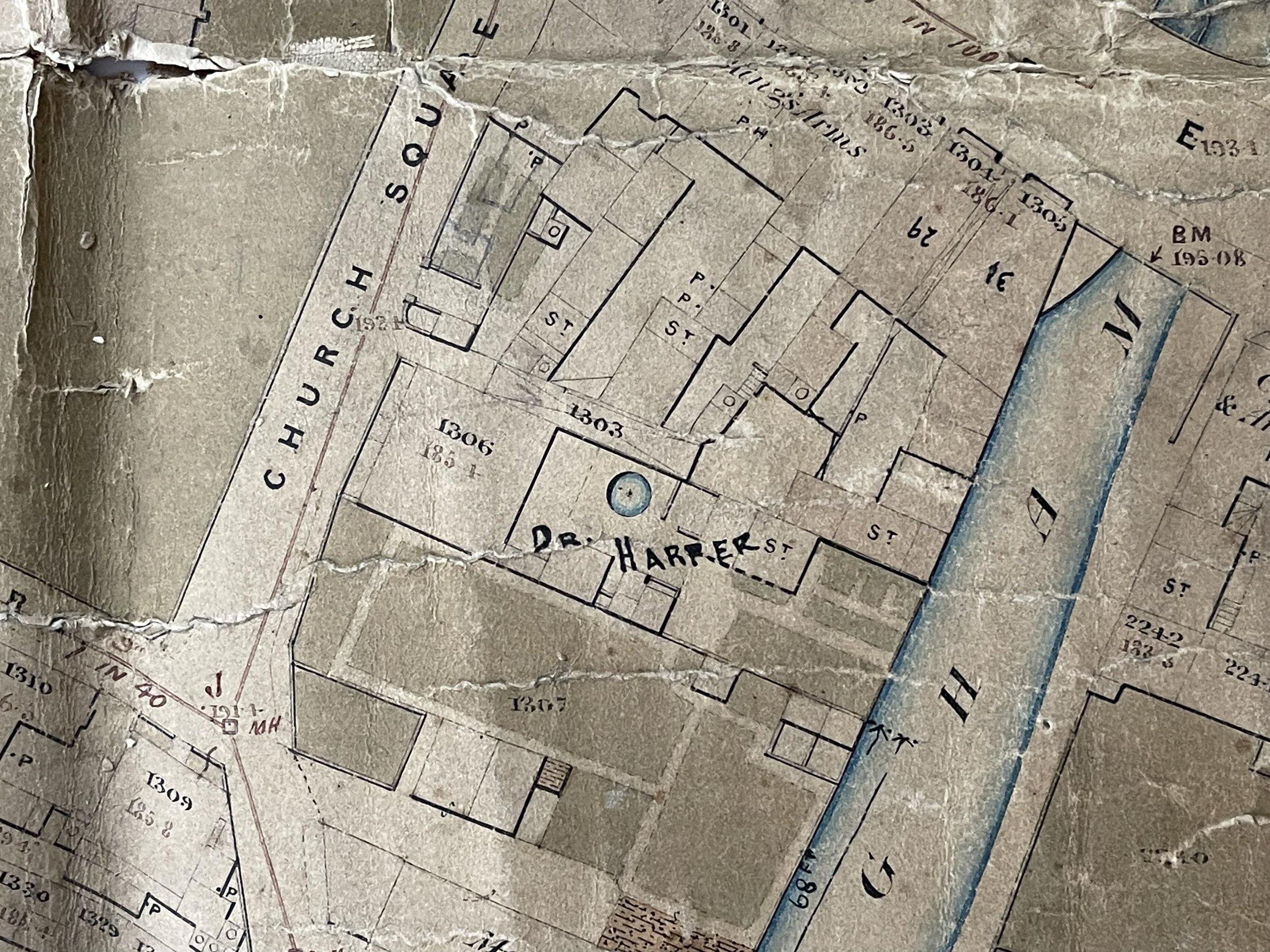
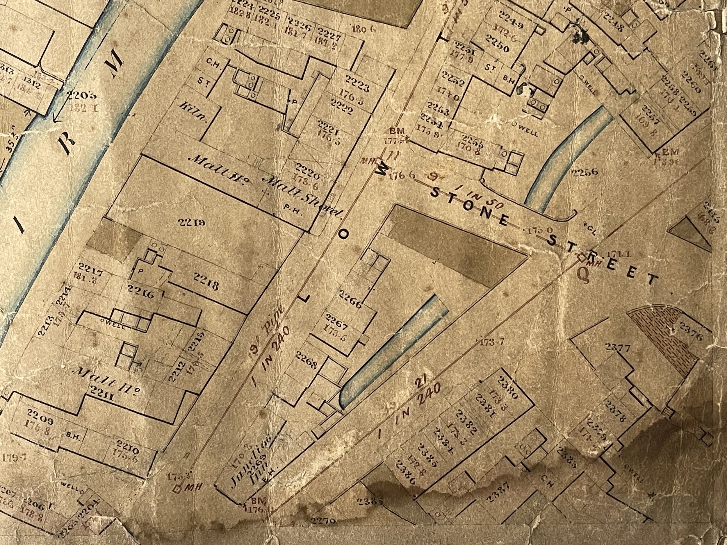
The Free School (Unitarian) opened in 1780, and this is shown. William Hunt starts an edge-tool factory at 'The Brades' and this is shown. Ebeneezer Iron Works established in Halesowen Street in 1821, is shown (later London Iron Works – name not updated but the land that was reserved for this site is shown). Independent Chapel opened in Talbot Street is shown and this opened in 1843. Oldbury Carriage Works established in 1854, and this is shown off Tabernacle Street. Crosswells Brewery was founded in 1857, this isn’t labelled but there is a Malt House shown adjacent to Bulls Head Yard off Birmingham Street. Part of the Edwin Danks Boiler Works shown in top left corner of the map, setup in 1868. In the 1860s, his firm made boiler tanks for the local brickworks. By 1876 they were making shell boilers and began supplying larger firms such as B.S.A.
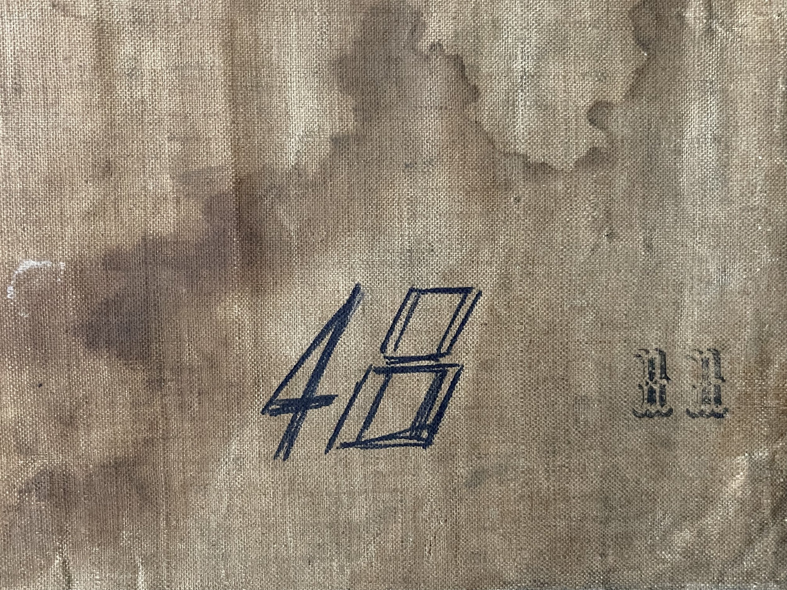
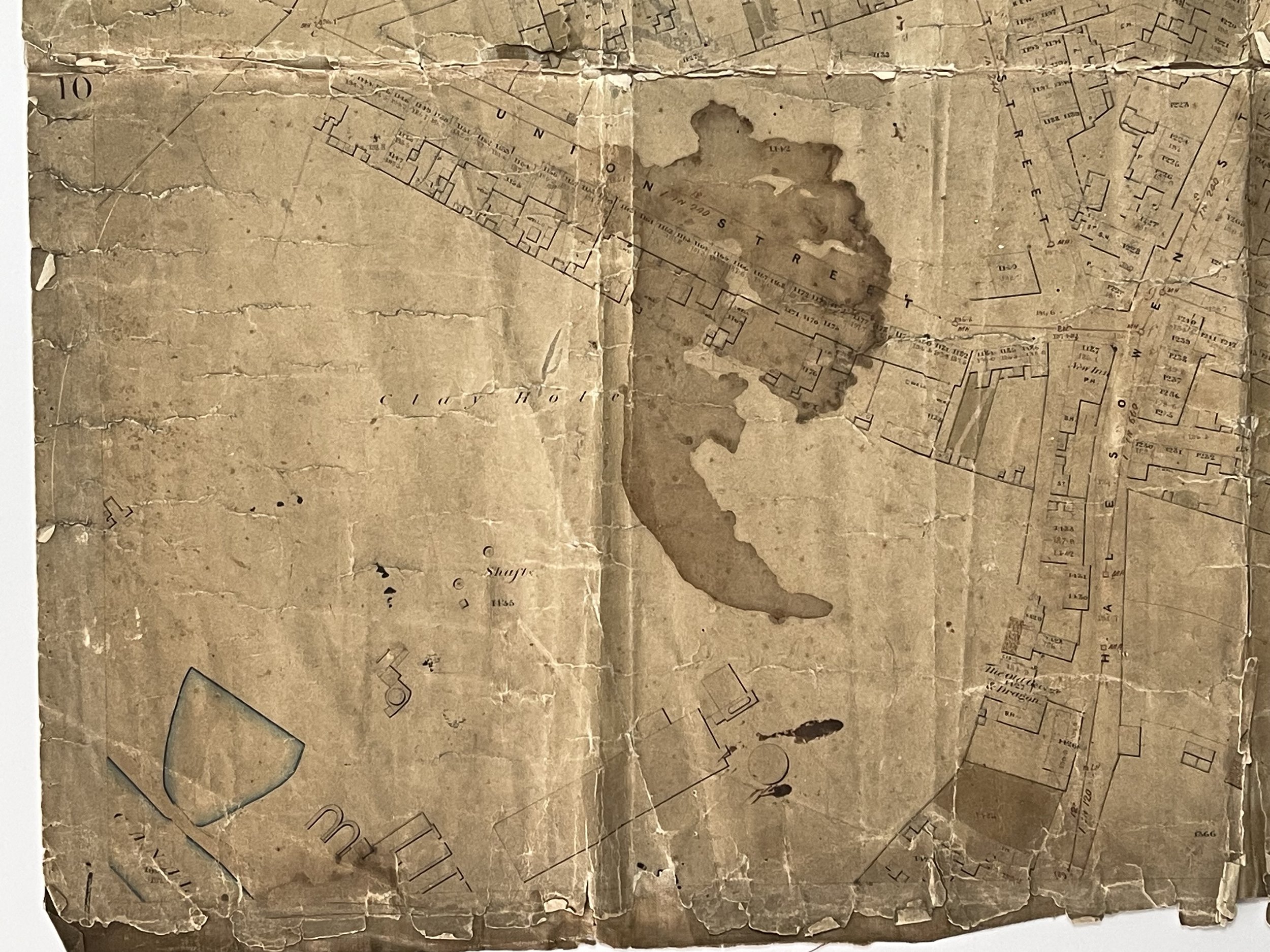
Although very detailed and vibrant in most areas, this plan is well thumbed and folded and shows heavy signs of use and some staining. Loose portions of the map surface will be carefully reaffixed to the hessian back using museum grade products. Pricing and grading commensurate.
Intricately detailed waxed and hessian topographical plan of Oldbury near Birmingham. It shows current land plots and other vacant plots, some earmarked for construction. There is a stamp to the rear that is faded and hard to make out but I believe it says: ‘Please return to Jones & Son, R Vernon R&L m***burgh street Oldbury’. Im unable to locate the source of this information however.
Oldbury is a market town in the Metropolitan Borough of Sandwell, West Midlands, England. It is the administrative centre of the borough. Oldbury is rich in deposits of clay, shales, ironstones and other minerals ripe for exploration at the time of the industrial revolution. The area was built on the four pillars of industrial strength - Coal, iron, bricks and chemicals. Canals and mining foundries and forges and workers homes were crowded side by side.
Mentioned in the Doomsday book, the place name Oldbury comes from the Old English 'Ealdenbyrig', – signifying that Oldbury was old even in early English times over 1,000 years ago. Eald being Old English for 'old', Byrig is the plural of 'burh' in Old English – a burh being a fortification or fortified town.
Oldbury was part of the ancient parish of Halesowen, a detached part of Shropshire surrounded by Worcestershire and Staffordshire. After the dissolution of the monasteries, Henry VIII gave Hales Owen manor including Oldbury to Sir John Dudley. In 1555, Sir John's son Robert sold most of Hales Owen manor but retained Oldbury and Langley which became a separate manor. Thus, Sir Robert Dudley became the first Lord of the Manor of Oldbury. Oldbury manor was held by several families thereafter with the land gradually being sold off and the manorial functions dispersed. The last Lord of Oldbury Manor was Patrick Allan Fraser.
Pigot and Co.'s National Commercial Directory for 1828-9 describes Oldbury as a village in Shropshire with close trade and manufacturing links to Dudley and Stourbridge. It notes the importance of the iron trade with its "considerable blast furnaces, for making pig iron" and states "there are also steel works; and coal and ironstone abound in the vicinity". Mention is made of a debtors' prison, and a courthouse which held a fortnightly Court of Requests for recovery of debts not exceeding five pounds.
Significant point of note on the map – The Old Talbot Inn was one of the coaching inns, and the road was later turnpiked with a toll gate at the junction of Birmingham Road and Rood End Road.
Christ Church, Oldbury’s Parish Church (Shown on the map)
In 1837 Oldbury Chapel (St Nicholas) was in a very dilapidated condition and it was also deemed to be too small, containing seating for only 234. By 1831, the population of Oldbury was around 6,000 and rising, owing to industrialisation. The foundation stone for a new church was laid in 1840, on a piece of land known as the ‘Close Orchard’, and
the building of Christ Church was consecrated in July the following year.
The Tabernacle Methodist Church, Oldbury - William Booth (1855) is shown on the map off Tabernacle Street and was built in 1838. The church no longer exists. The Tabernacle School which is also shown opened in 1885. William Booth (10 April 1829 – 20 August 1912) was an English Methodist preacher who, along with his wife, Catherine, founded the Salvation Army and became its first General (1878–1912).
The Free School (Unitarian) opened in 1780, and this is shown. William Hunt starts an edge-tool factory at 'The Brades' and this is shown. Ebeneezer Iron Works established in Halesowen Street in 1821, is shown (later London Iron Works – name not updated but the land that was reserved for this site is shown). Independent Chapel opened in Talbot Street is shown and this opened in 1843. Oldbury Carriage Works established in 1854, and this is shown off Tabernacle Street. Crosswells Brewery was founded in 1857, this isn’t labelled but there is a Malt House shown adjacent to Bulls Head Yard off Birmingham Street. Part of the Edwin Danks Boiler Works shown in top left corner of the map, setup in 1868. In the 1860s, his firm made boiler tanks for the local brickworks. By 1876 they were making shell boilers and began supplying larger firms such as B.S.A.
Although very detailed and vibrant in most areas, this plan is well thumbed and folded and shows heavy signs of use and some staining. Loose portions of the map surface will be carefully reaffixed to the hessian back using museum grade products. Pricing and grading commensurate.
Code : A1092
Cartographer : Cartographer / Engraver / Publisher: Jones & Son, R Vernon R&L
Date : Publication Place / Date - Circa 1860s
Size : Sheet size: approx 95 x 65 Cm
Availability : Available
Type - Genuine - Antique
Grading B-
Where Applicable - Folds as issued. Light box photo shows the folio leaf centre margin hinge ‘glue’, this is not visible otherwise.
Tracked postage, in casement. Please contact me for postal quotation outside of the UK.