Tower Liberty and Tower of London - Richard Blome / John Stow / John Strype - 1720
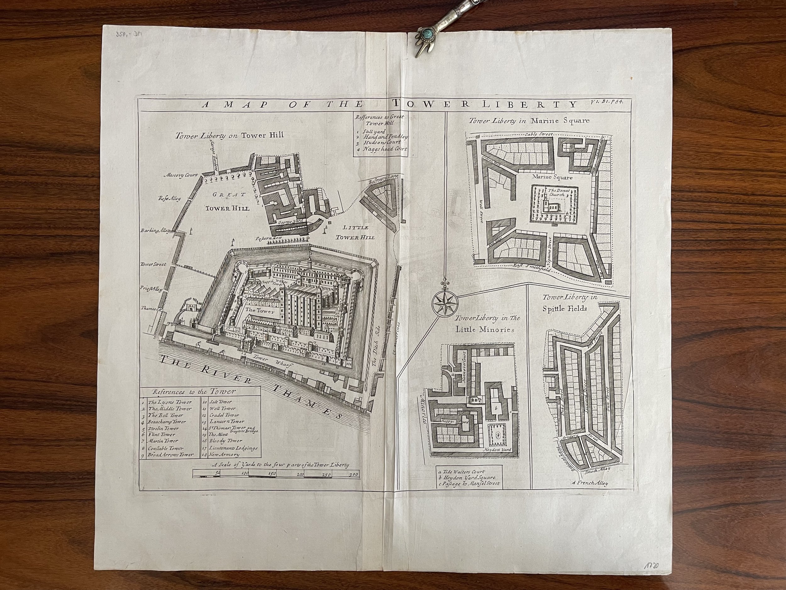
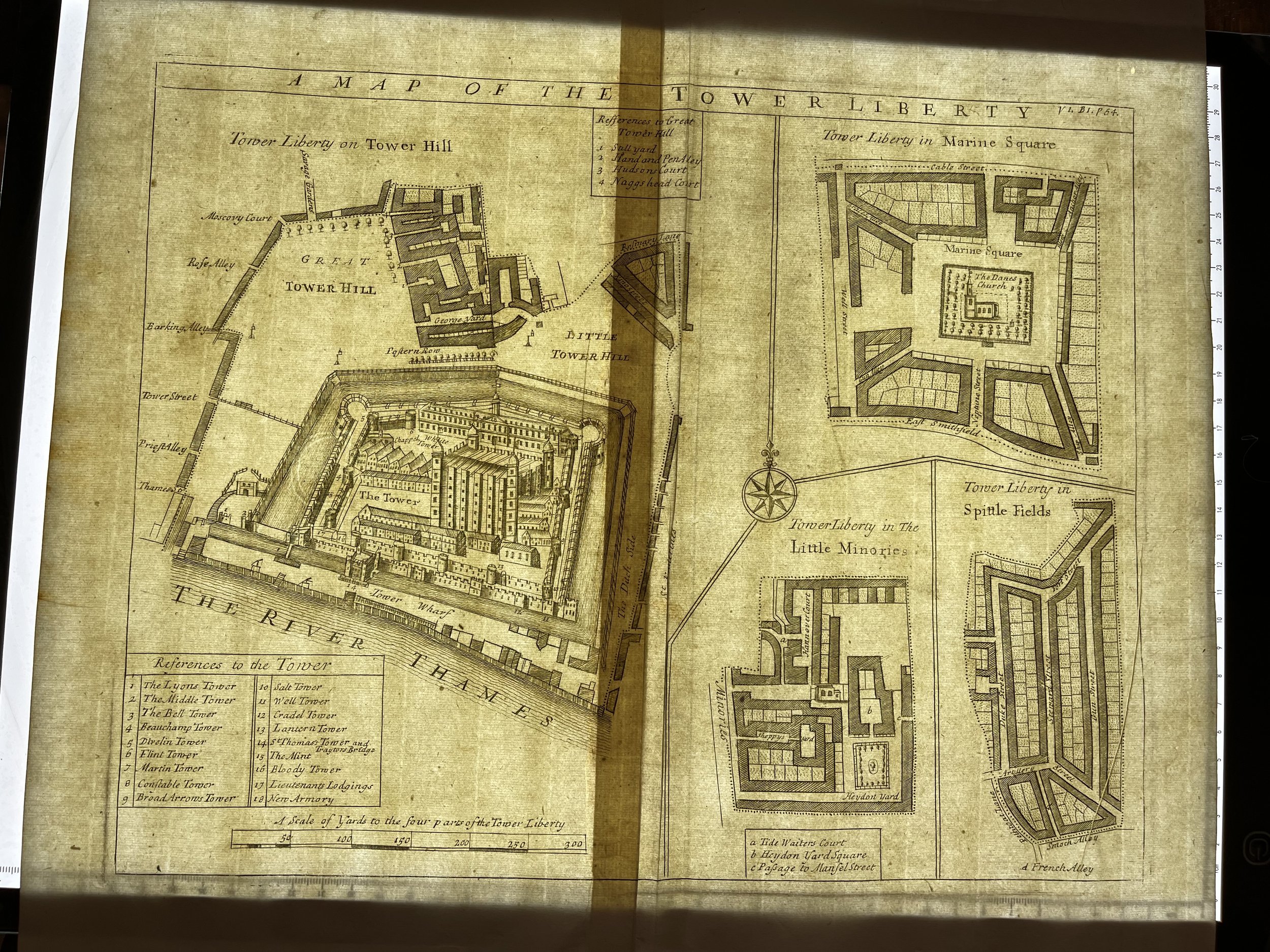
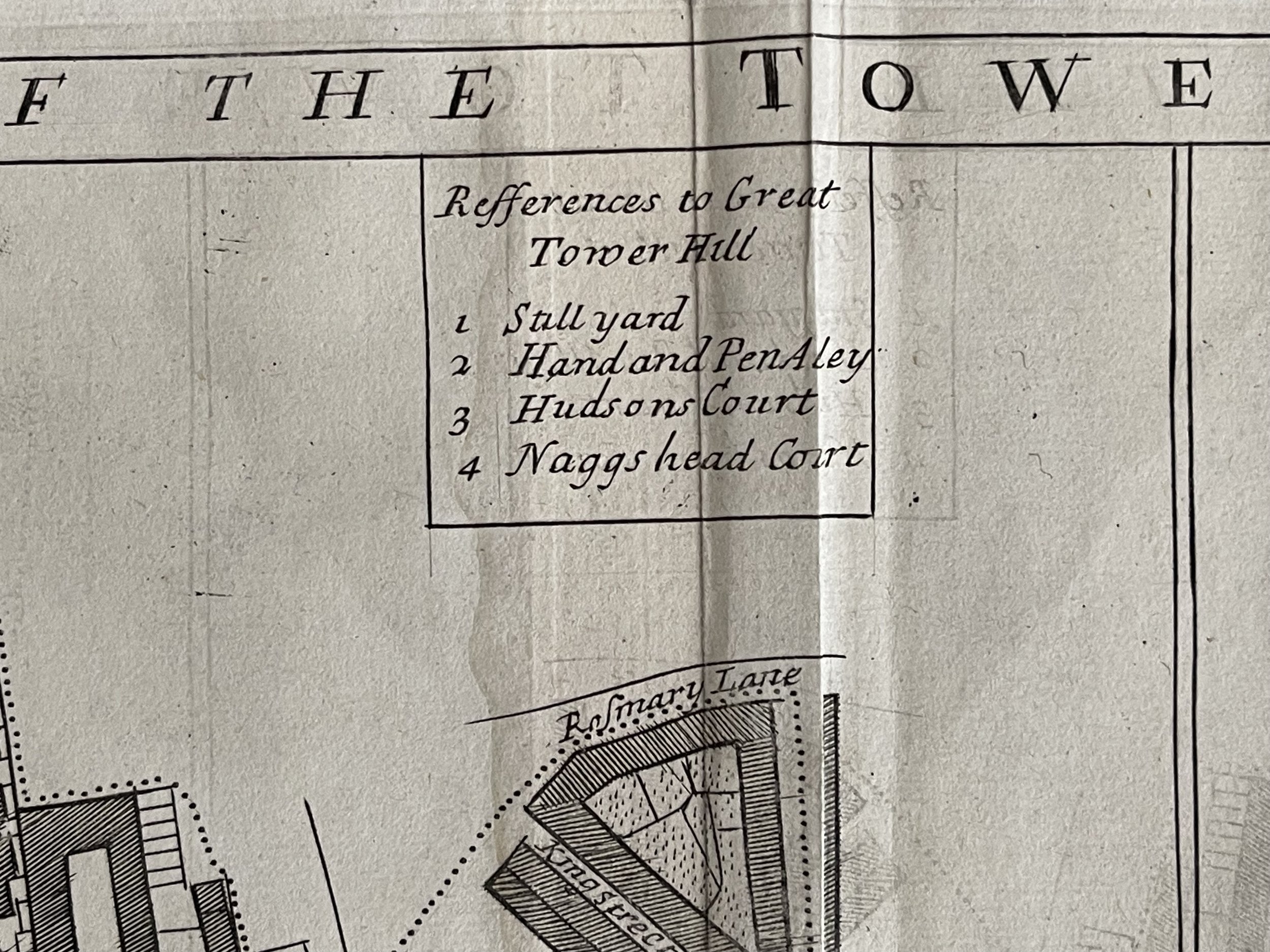
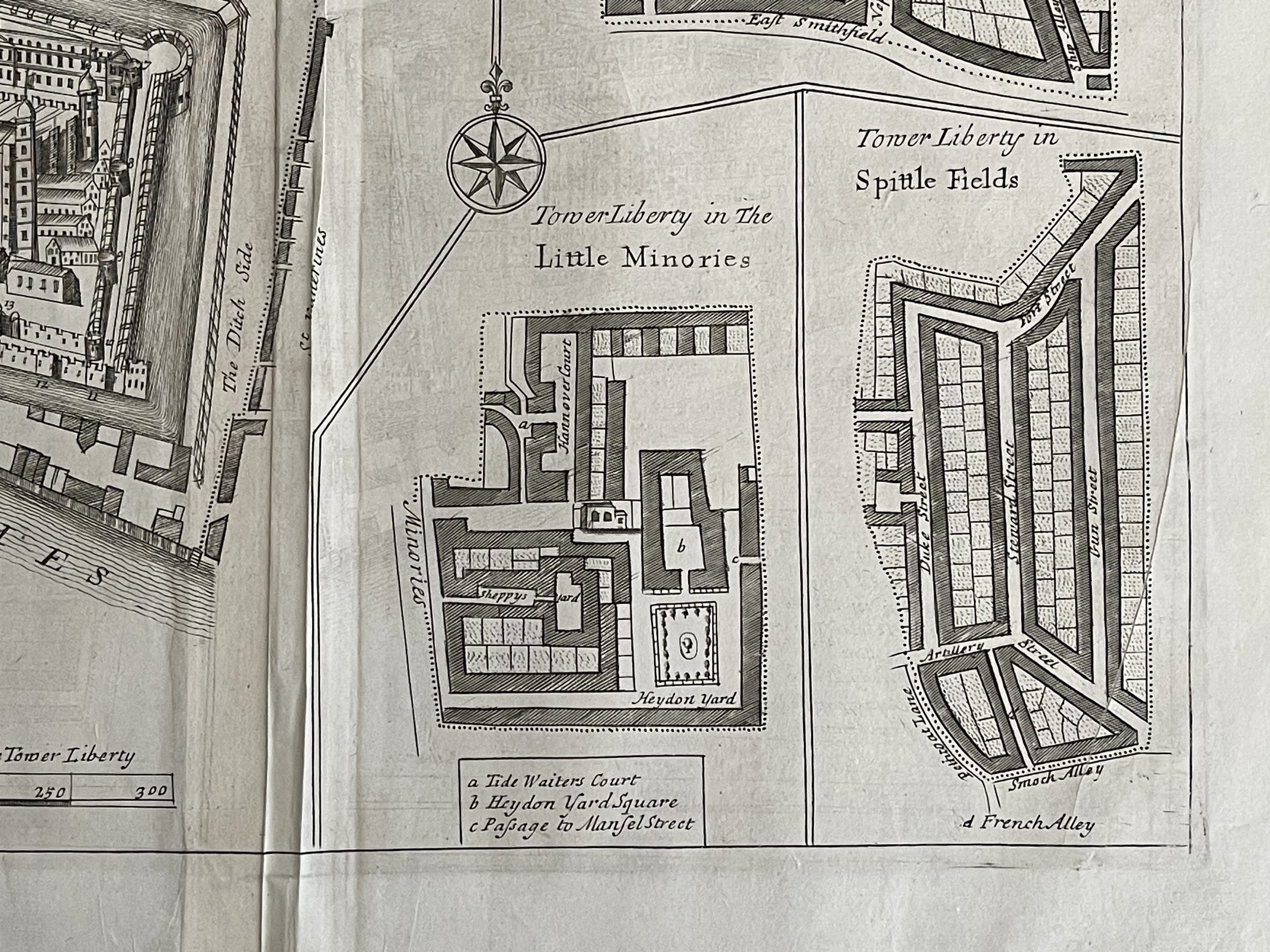
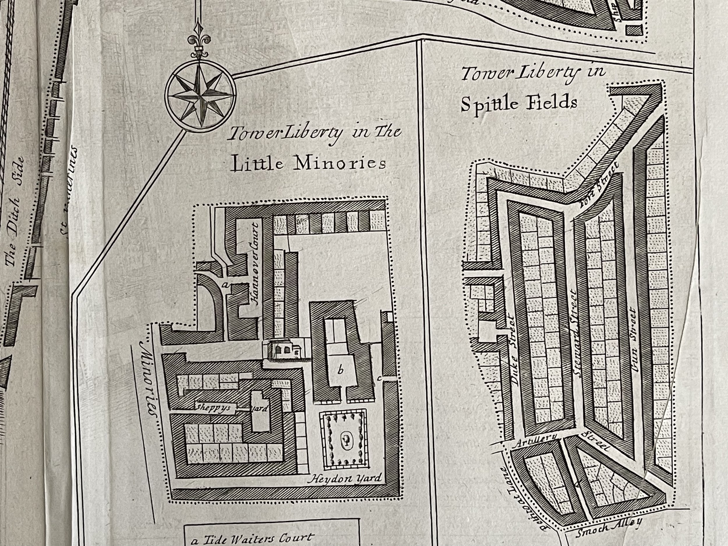
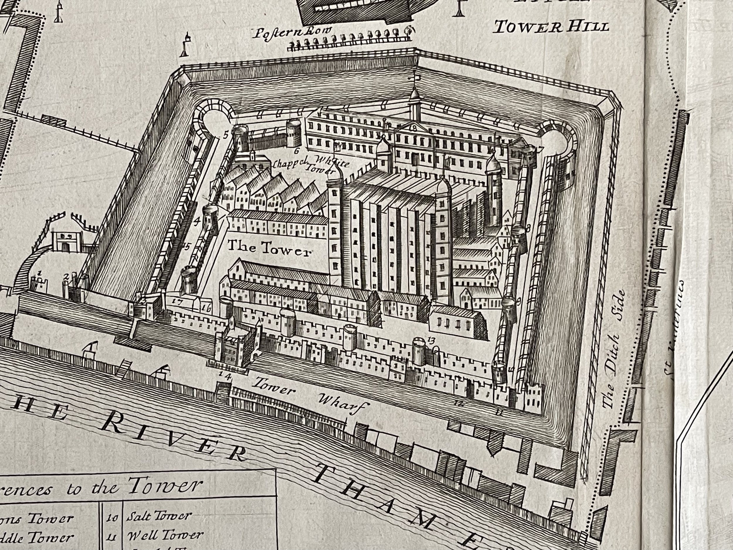
An original map "A Map of the Tower Liberty." Richard Blome 1720
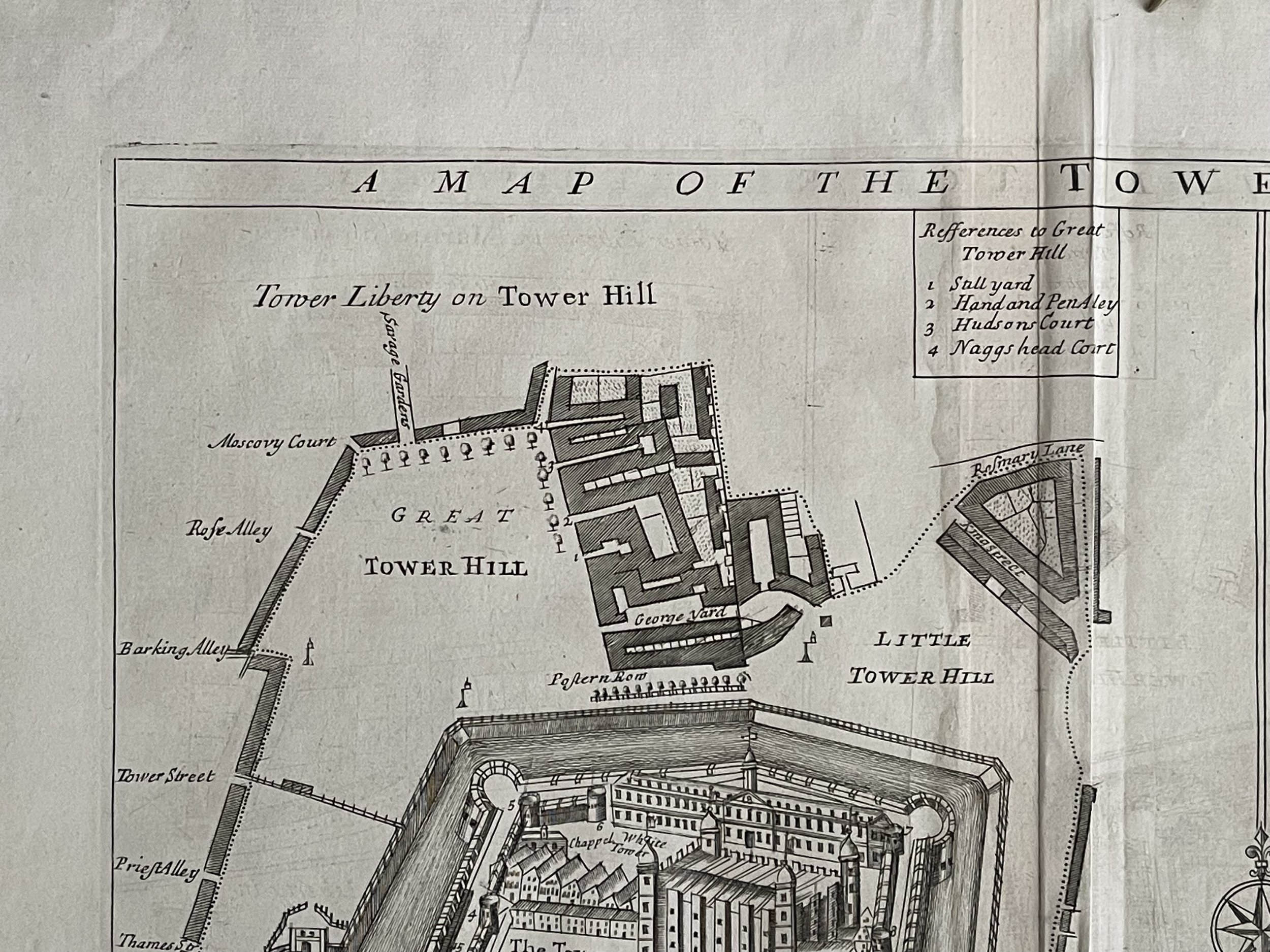
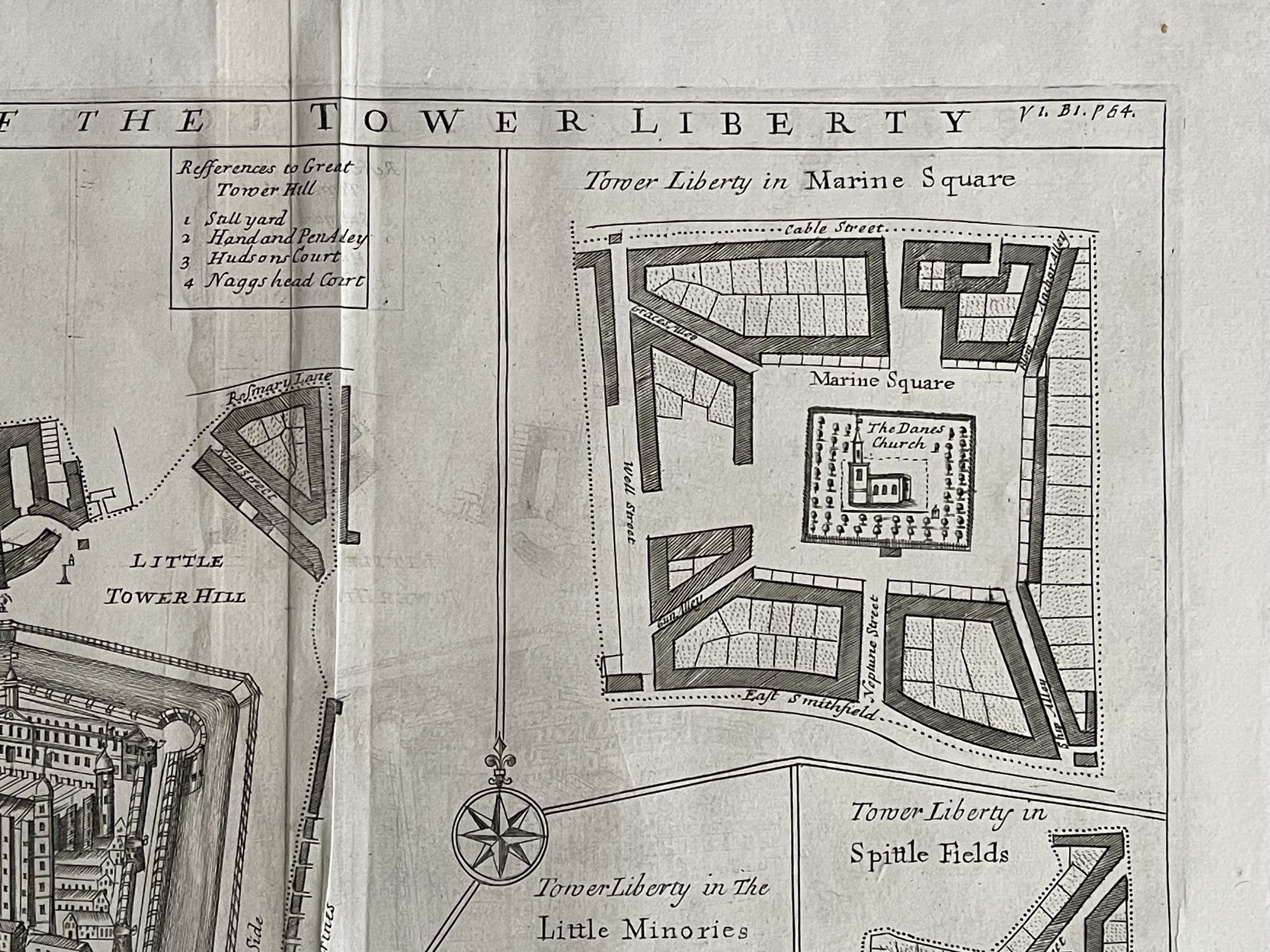
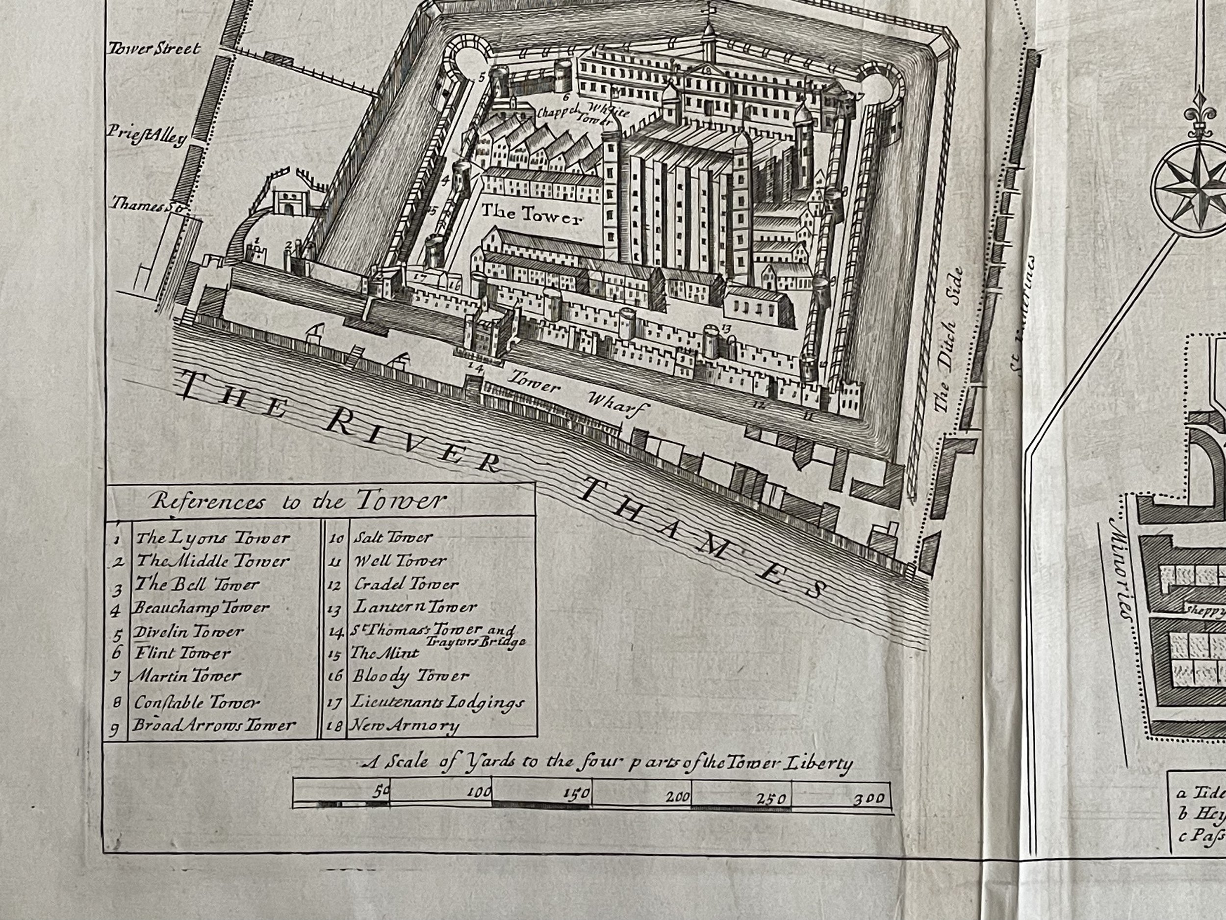
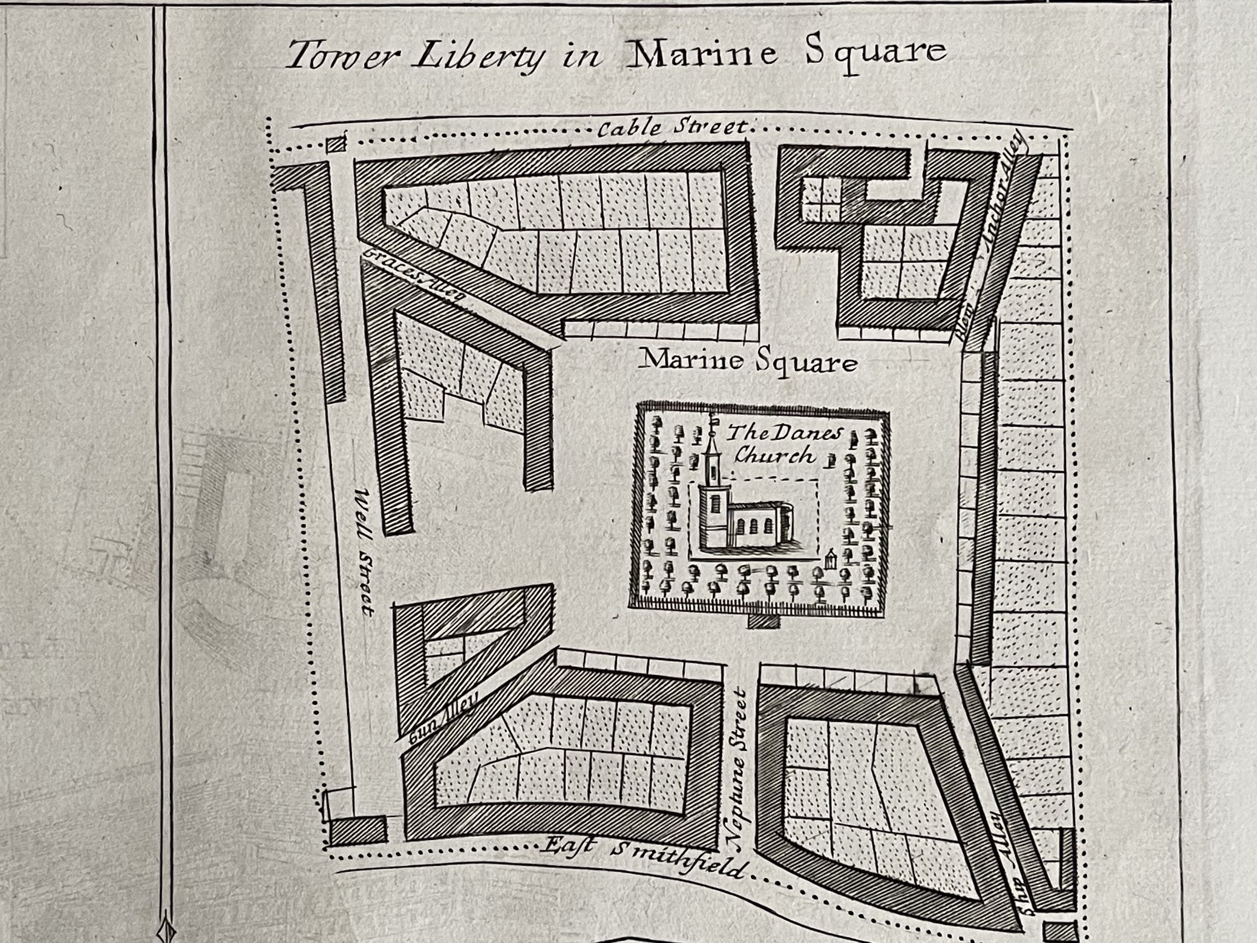
The map covers includes a map and view of the Tower Liberty on Tower Hill, the Tower Liberty in Marine Square, the Tower Liberty in the Little Minories and Tower Liberty in Spittle Fields. Includes the Old Artillery Ground (Spitalfields), Little Minories and the Liberty of Well close (Marine Square).
PROVENANCE: Published in 1720 in the John Strype edition of 'Stow’s Survey of London'. TYPE: Antique copper plate engraving printed on paper. VERSO: There is nothing printed on the reverse side, which is blank.
CONDITION: Very good. Suitable for framing. Please check the scan for any blemishes prior to making your purchase. Virtually all antiquarian maps and prints are subject to some normal aging due to use and time which is not significant unless otherwise stated.
Richard Blome (1635–1705) was an engraver, cartographer, and publisher in the Kingdom of England.
John Strype (1 November 1643 – 11 December 1737) was an English clergyman, historian and biographer from London. He became a merchant when settling in Petticoat Lane. In his twenties, he became perpetual curate of Theydon Bois, Essex and later became curate of Leyton; this allowed him direct correspondence with several highly notable ecclesiastical figures of his time. He wrote extensively in his later years.
John Stow (born 1525, London, England—died April 6, 1605, London) was one of the best-known Elizabethan antiquaries, author of the famous A Survey of London (1598; revised and enlarged, 1603). Stow was a prosperous tailor until about 1565–70, after which he devoted his time to collecting rare books and manuscripts, a hobby that left him impoverished. Self-educated, with a passion for learning, he became the friend of famous antiquaries and was employed by Matthew Parker, archbishop of Canterbury, to edit medieval chronicles. He had already published an edition of Chaucer (1561) and a Summarie of Englyshe Chronicles (1565; many abridged versions). His first original work was The Chronicles of England (1580), revised as Annales of England (1592).
One small tear in the top border that hasnt affected the engraving (see pointer). Pricing and grading commensurate.
An original map "A Map of the Tower Liberty." Richard Blome 1720
The map covers includes a map and view of the Tower Liberty on Tower Hill, the Tower Liberty in Marine Square, the Tower Liberty in the Little Minories and Tower Liberty in Spittle Fields. Includes the Old Artillery Ground (Spitalfields), Little Minories and the Liberty of Well close (Marine Square).
PROVENANCE: Published in 1720 in the John Strype edition of 'Stow’s Survey of London'. TYPE: Antique copper plate engraving printed on paper. VERSO: There is nothing printed on the reverse side, which is blank.
CONDITION: Very good. Suitable for framing. Please check the scan for any blemishes prior to making your purchase. Virtually all antiquarian maps and prints are subject to some normal aging due to use and time which is not significant unless otherwise stated.
Richard Blome (1635–1705) was an engraver, cartographer, and publisher in the Kingdom of England.
John Strype (1 November 1643 – 11 December 1737) was an English clergyman, historian and biographer from London. He became a merchant when settling in Petticoat Lane. In his twenties, he became perpetual curate of Theydon Bois, Essex and later became curate of Leyton; this allowed him direct correspondence with several highly notable ecclesiastical figures of his time. He wrote extensively in his later years.
John Stow (born 1525, London, England—died April 6, 1605, London) was one of the best-known Elizabethan antiquaries, author of the famous A Survey of London (1598; revised and enlarged, 1603). Stow was a prosperous tailor until about 1565–70, after which he devoted his time to collecting rare books and manuscripts, a hobby that left him impoverished. Self-educated, with a passion for learning, he became the friend of famous antiquaries and was employed by Matthew Parker, archbishop of Canterbury, to edit medieval chronicles. He had already published an edition of Chaucer (1561) and a Summarie of Englyshe Chronicles (1565; many abridged versions). His first original work was The Chronicles of England (1580), revised as Annales of England (1592).
One small tear in the top border that hasnt affected the engraving (see pointer). Pricing and grading commensurate.
Code : A238
Cartographer : Cartographer / Engraver / Publisher: Richard Blome
Date : Publication Place / Date - 1720
Size : Sheet size: Image Size: 41.5 x 39.5 cm
Availability : Available
Type - Genuine - Antique
Grading A
Where Applicable - Folds as issued. Light box photo shows the folio leaf centre margin hinge ‘glue’, this is not visible otherwise.
Tracked postage, in casement. Please contact me for postal quotation outside of the UK.