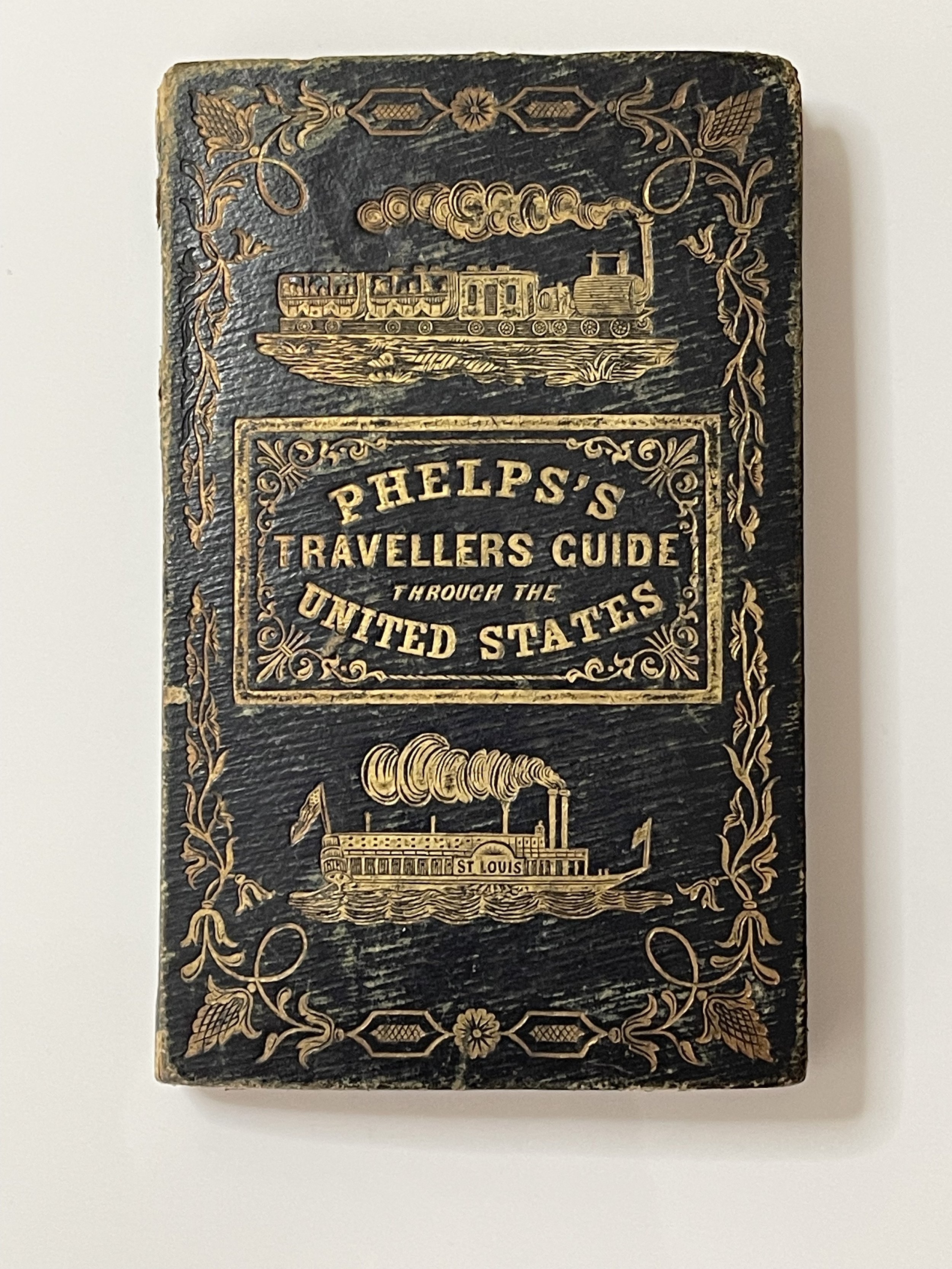


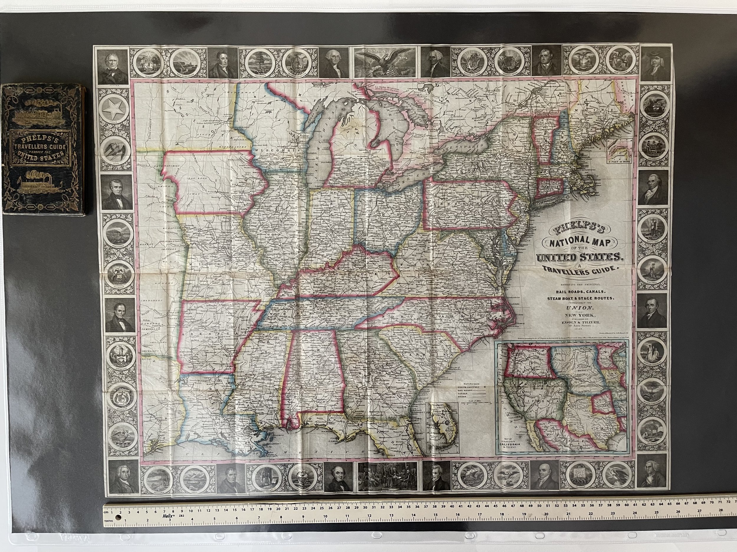
Traveller's Guide through the United States - Humphrey Phelps - Dated 1849 - RARE
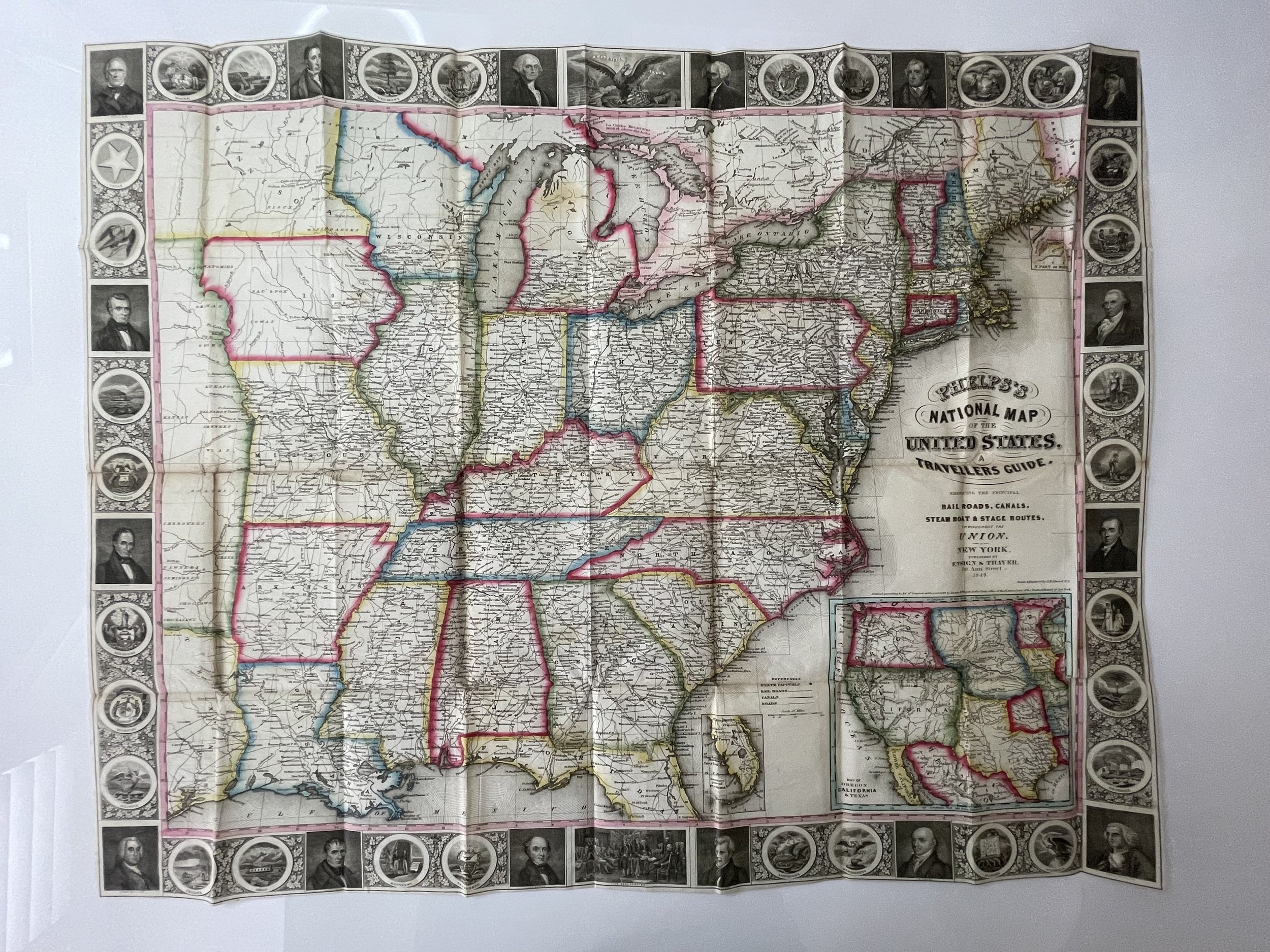
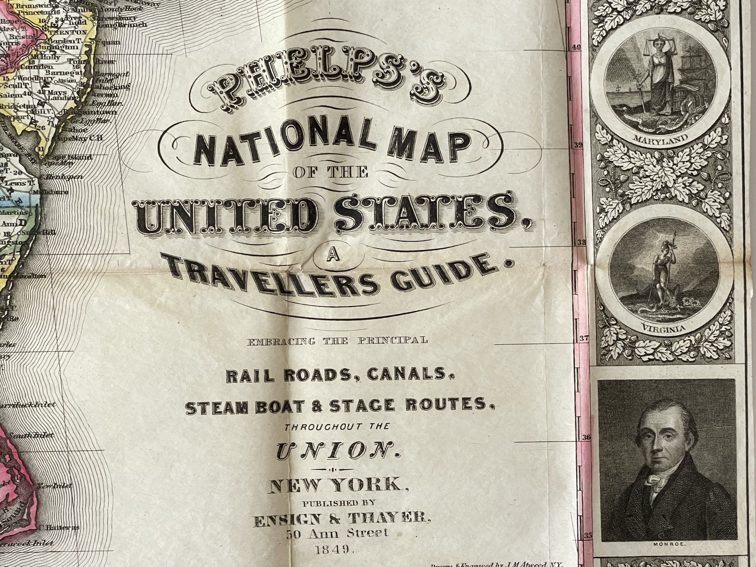
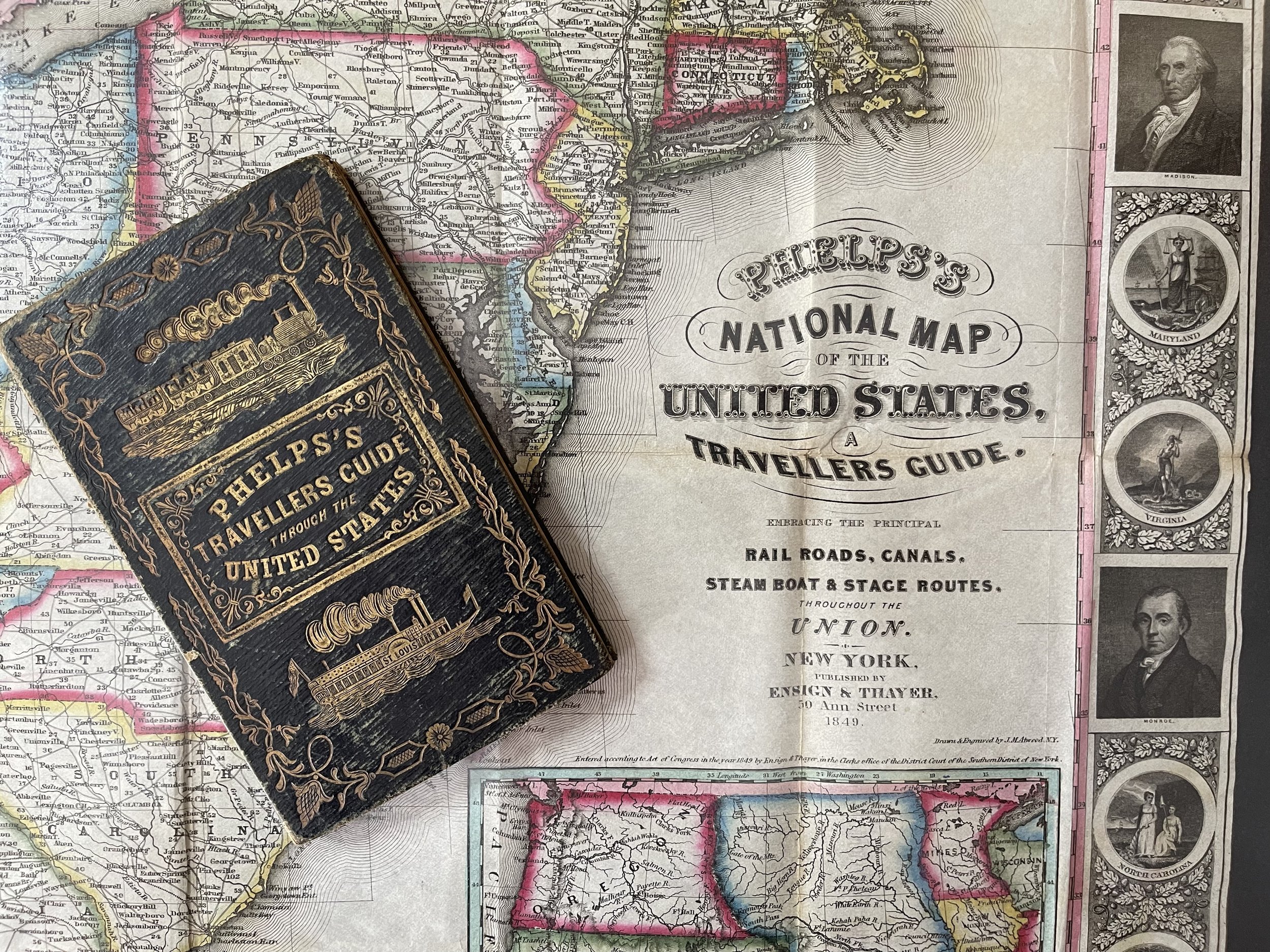
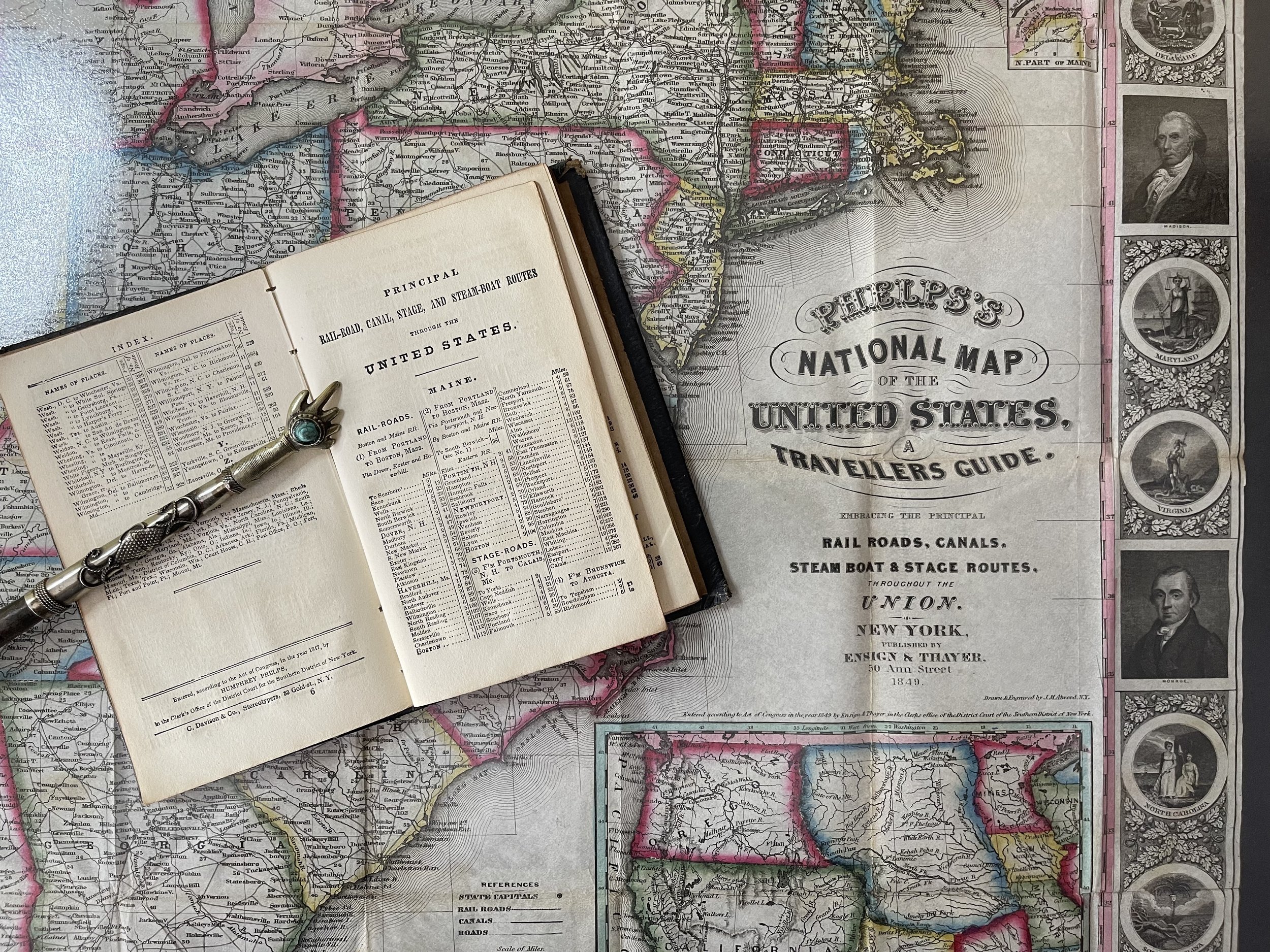
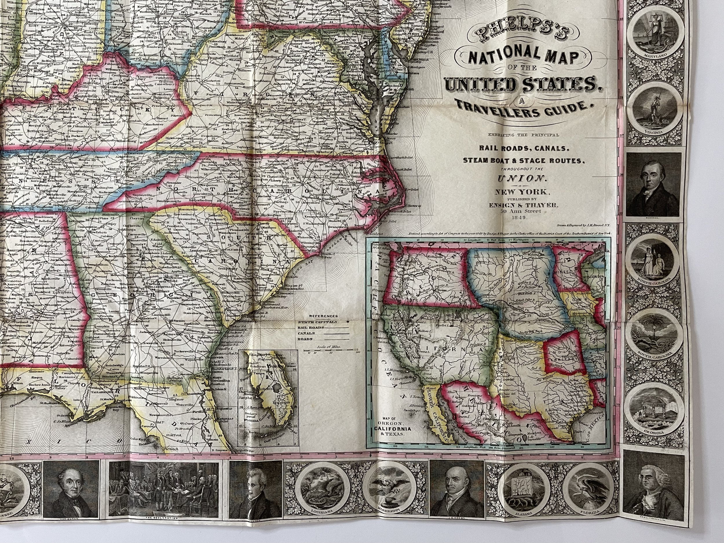
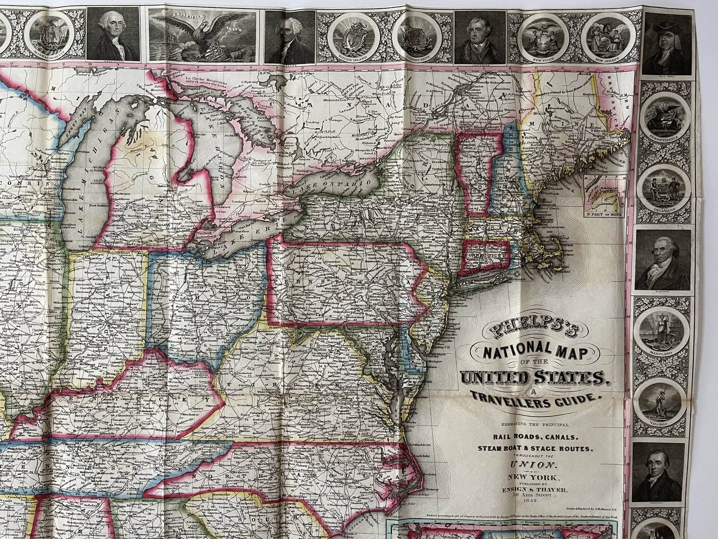
Phelps’s National Map of the United States, A Travellers Guide. Embracing the Principal Rail Roads, Canals, Steam Boat & Stage Routes throughout the Union.
Published by Horace Thayer & Co., 50 Ann St. 1852. Drawn & engraved by J. M. Atwood, N.Y. Entered according to Act of Congress in the year 1849 by Ensign & Thayer in the Clerk's Office of the District Court of the Southern District of New York.
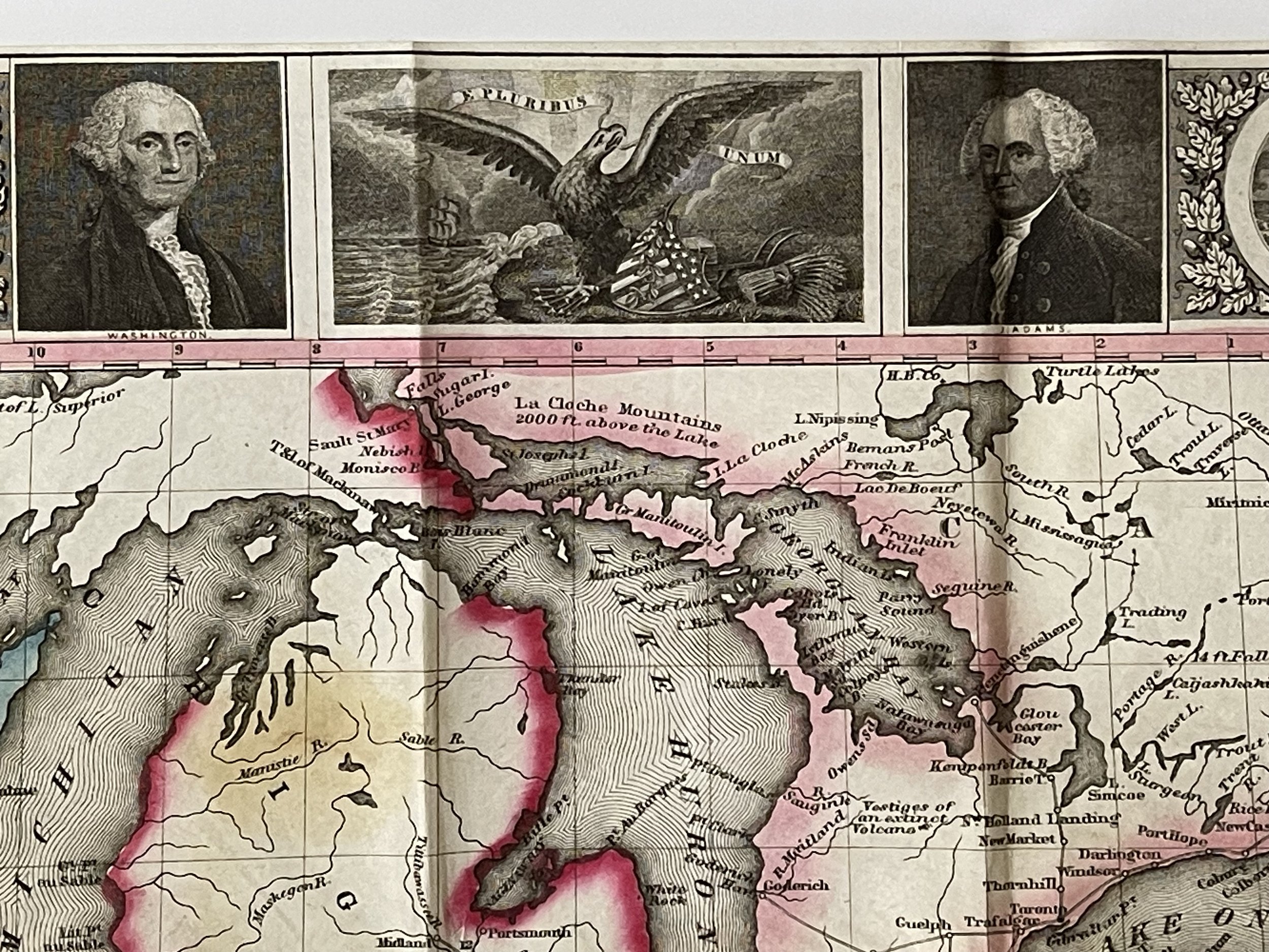
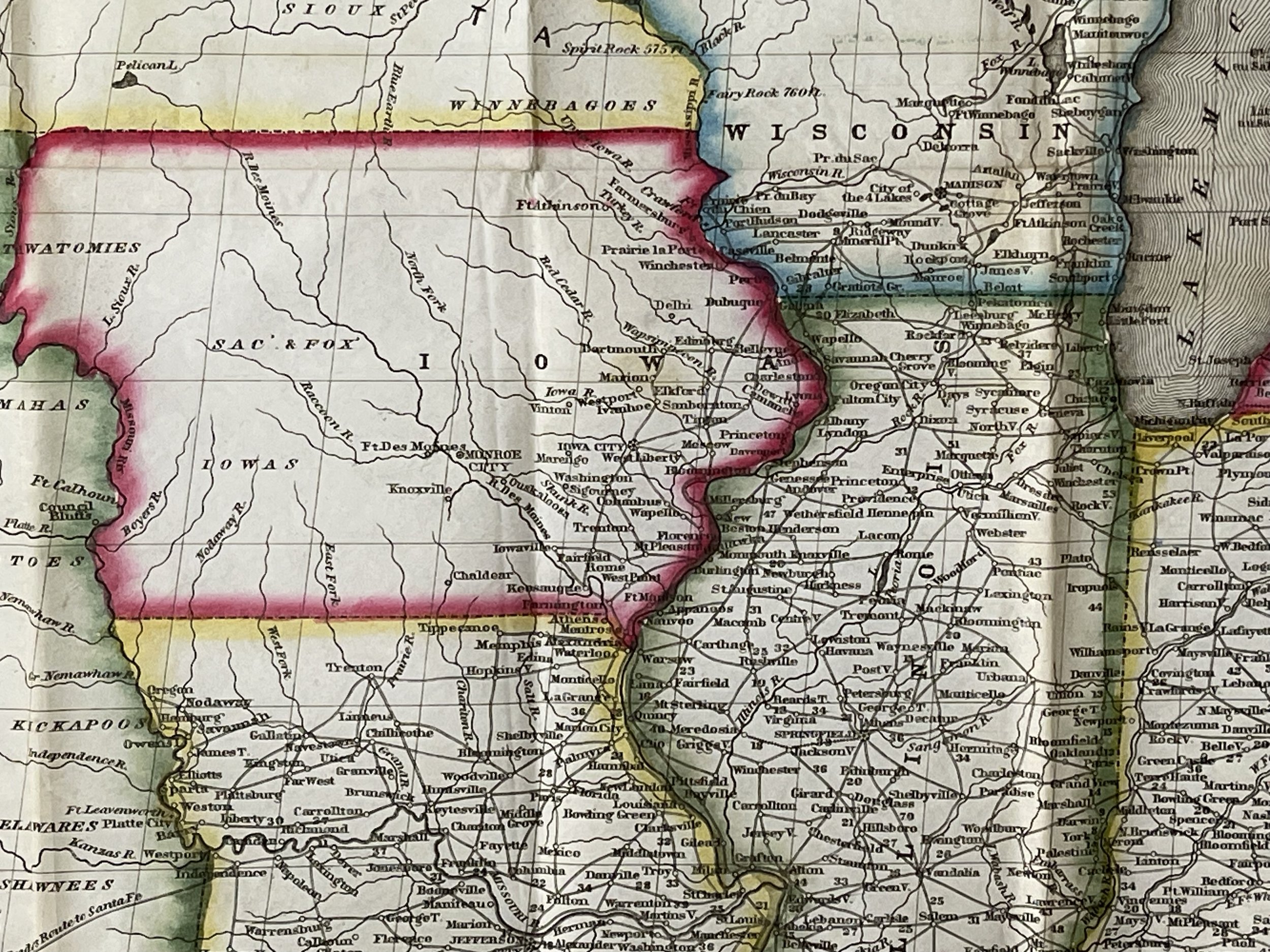
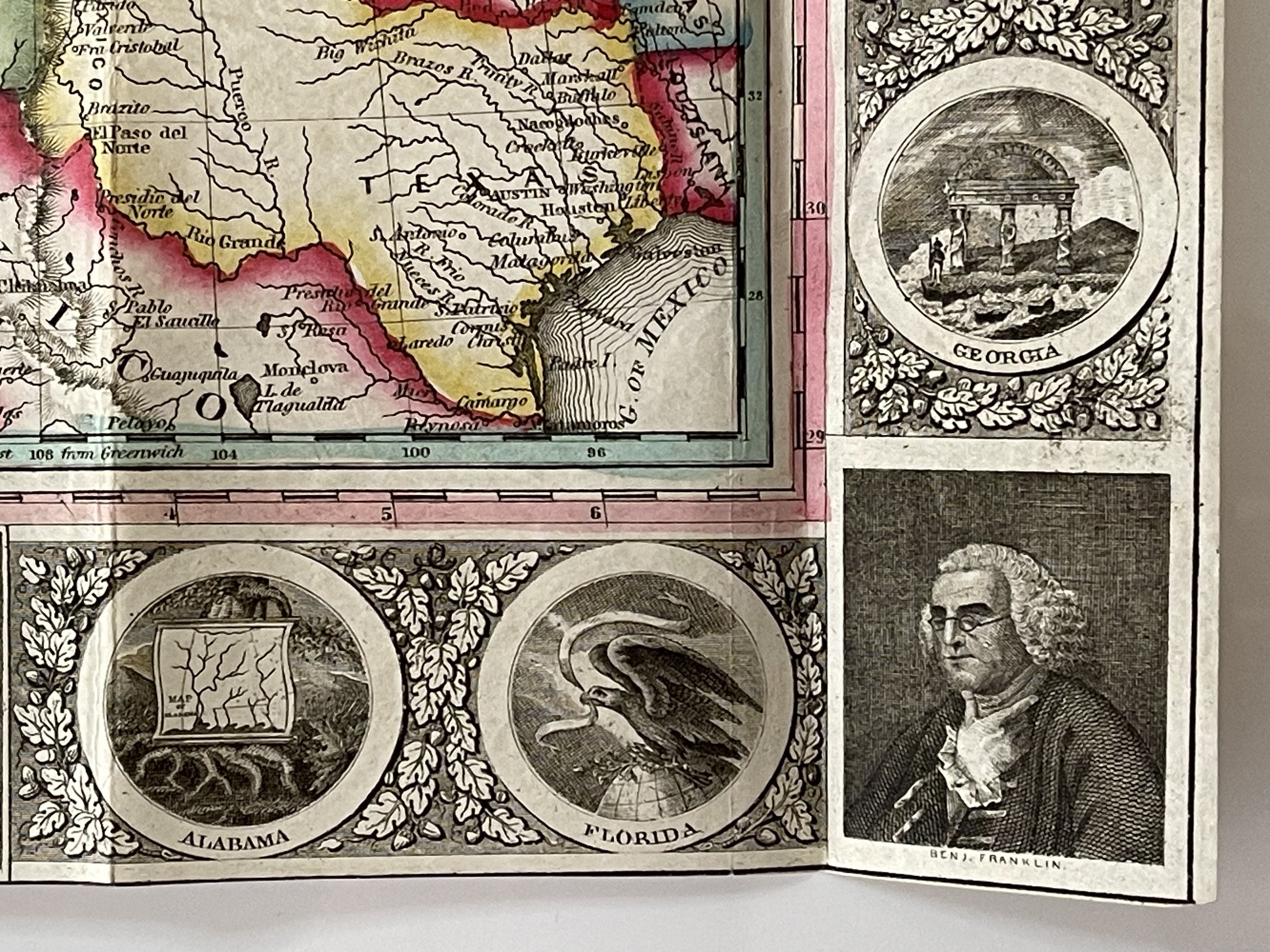
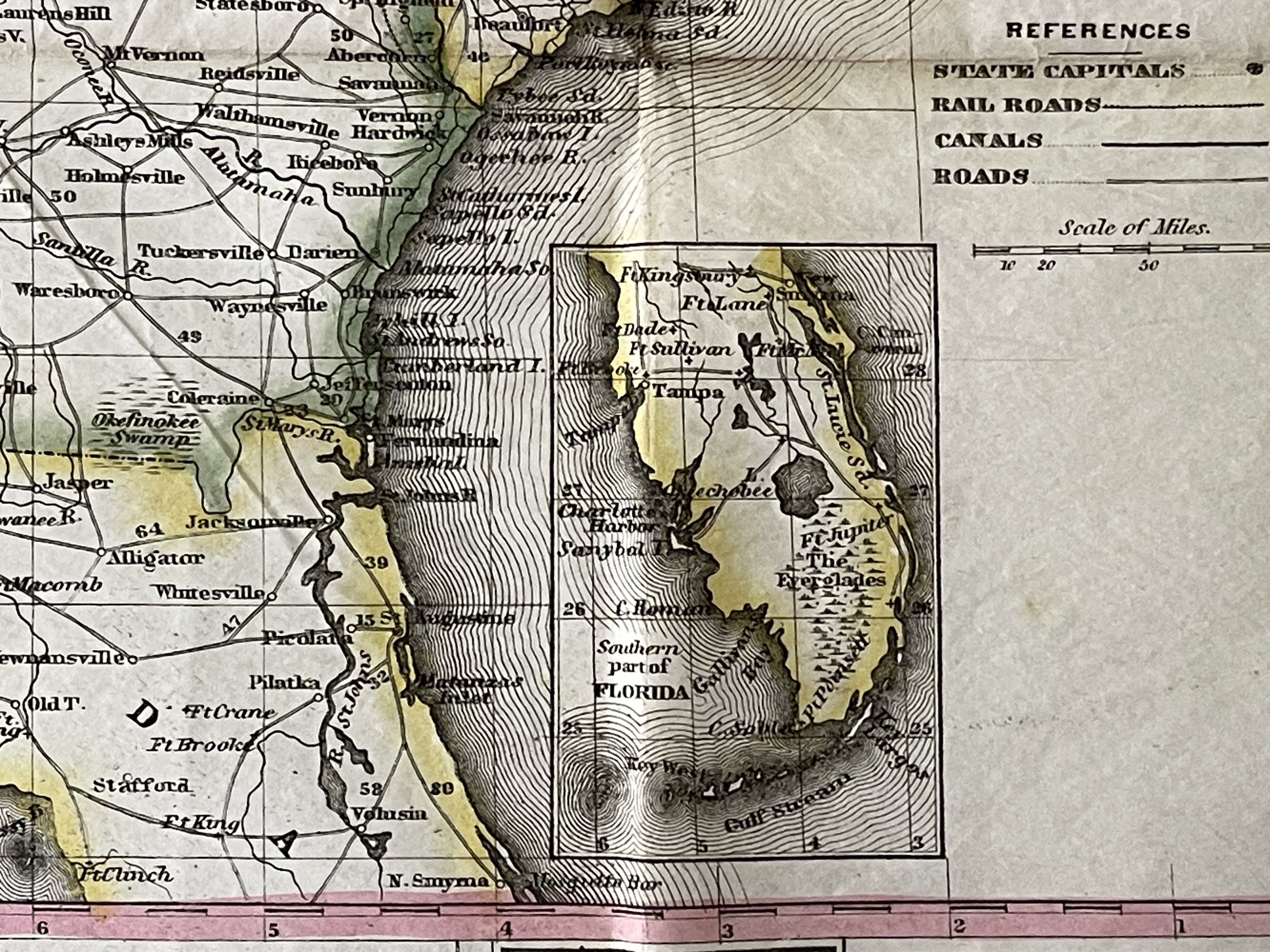
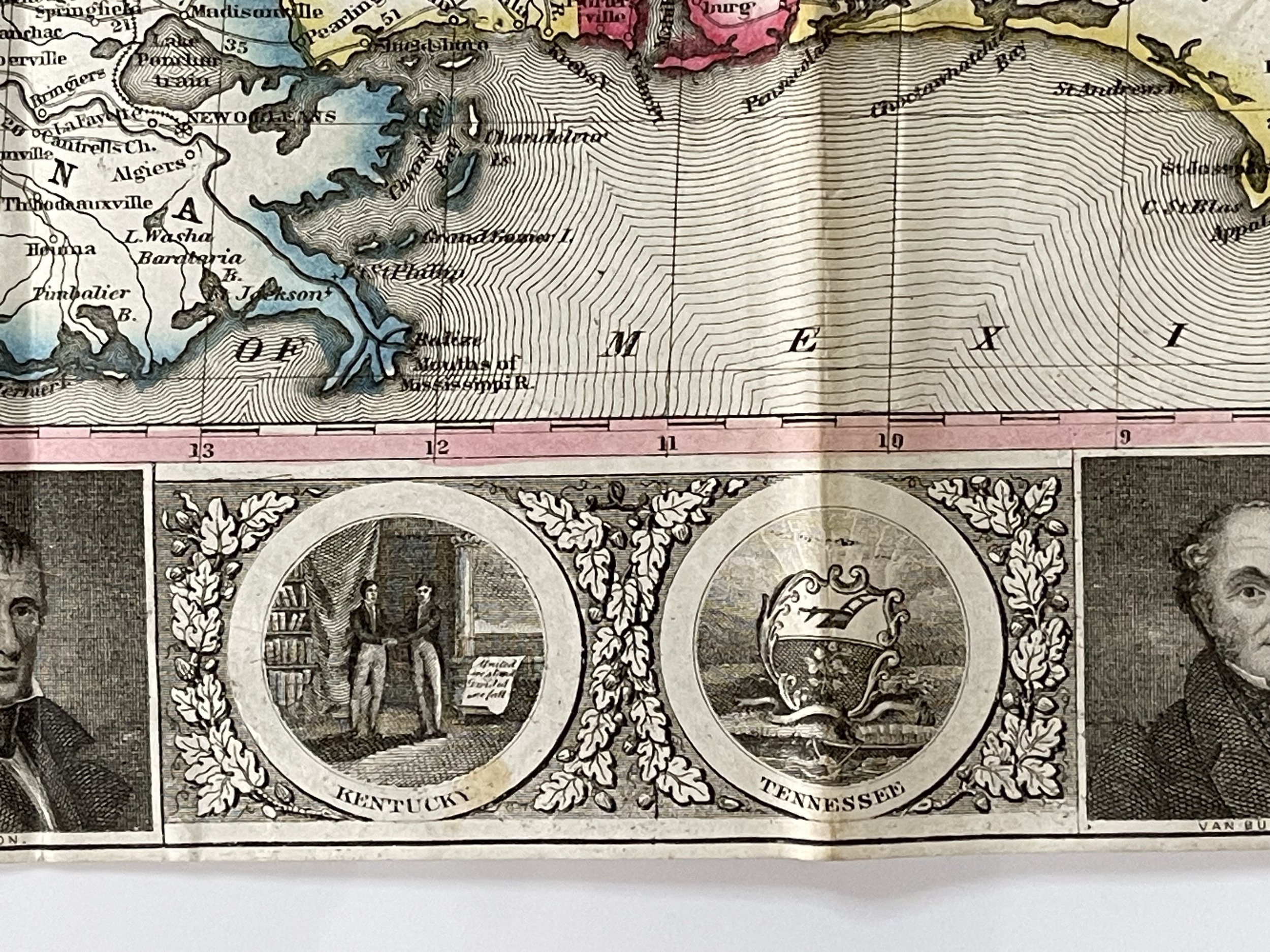
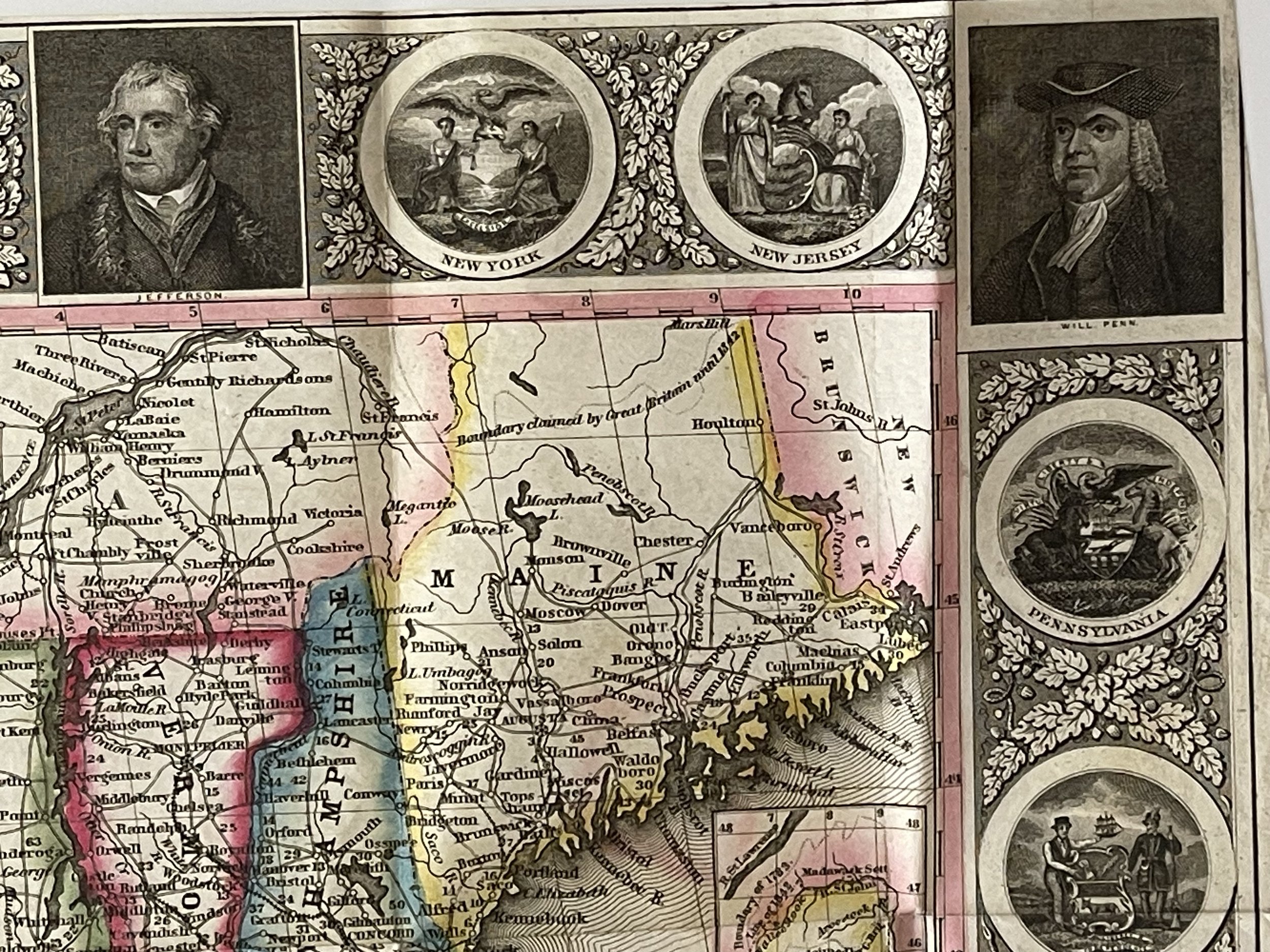
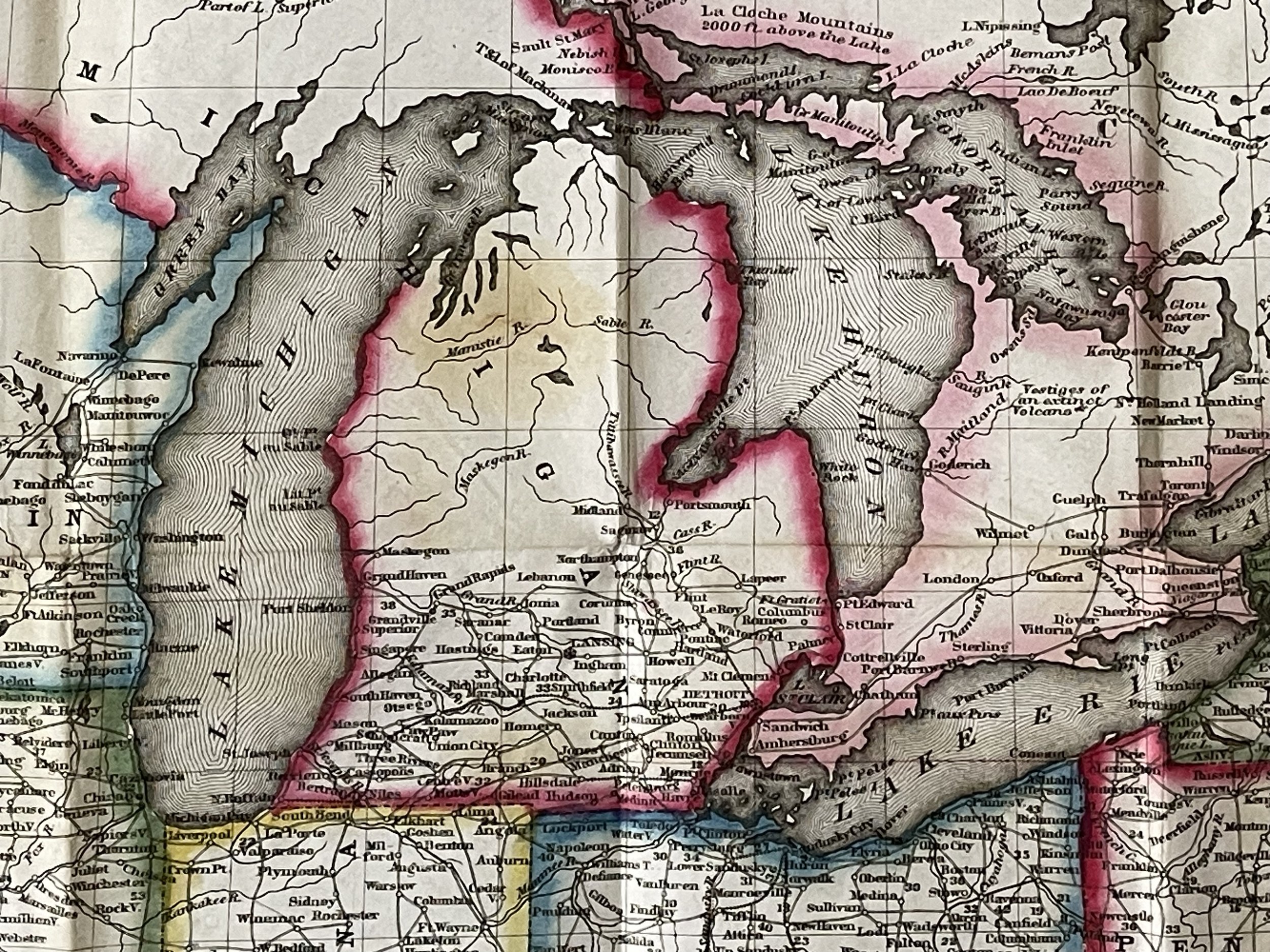
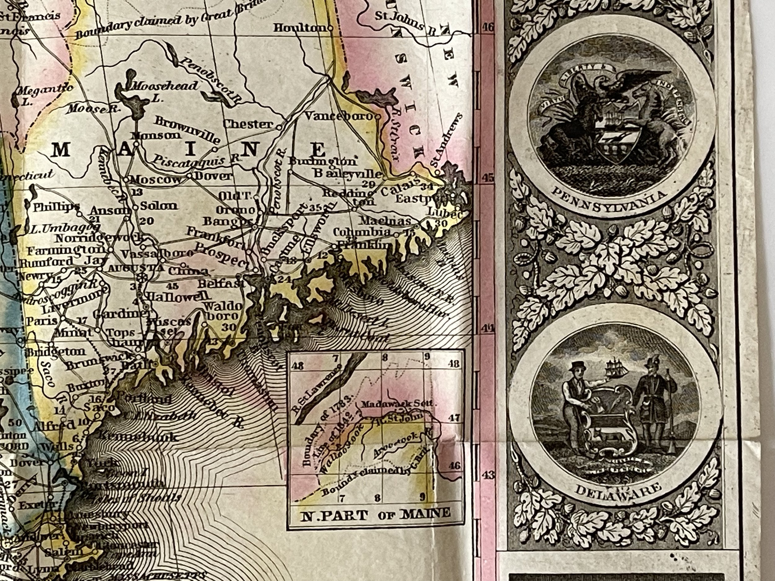
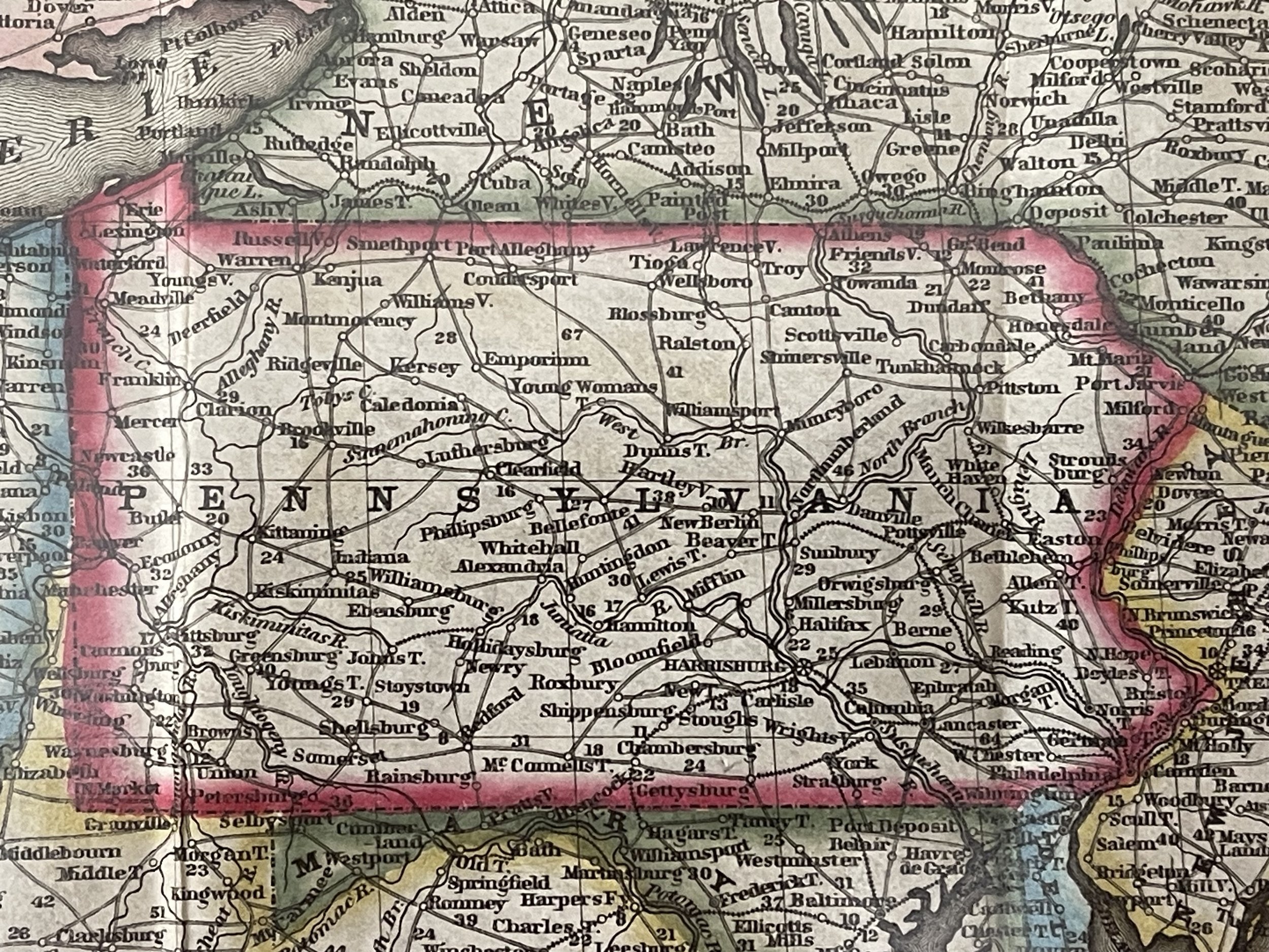
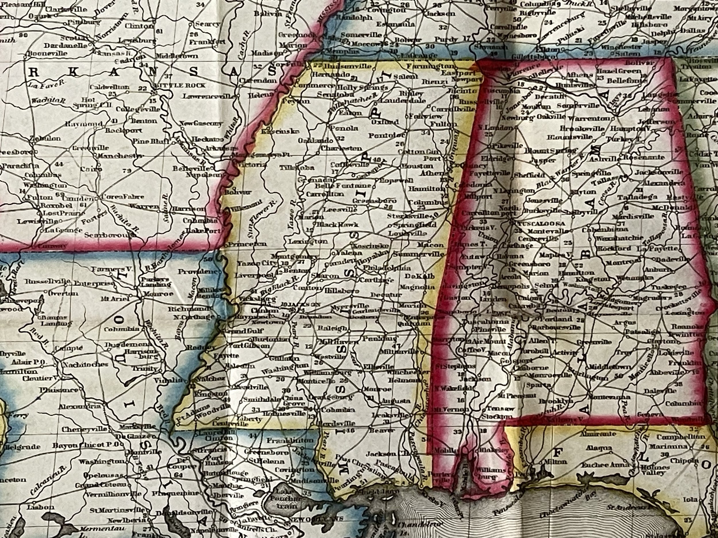
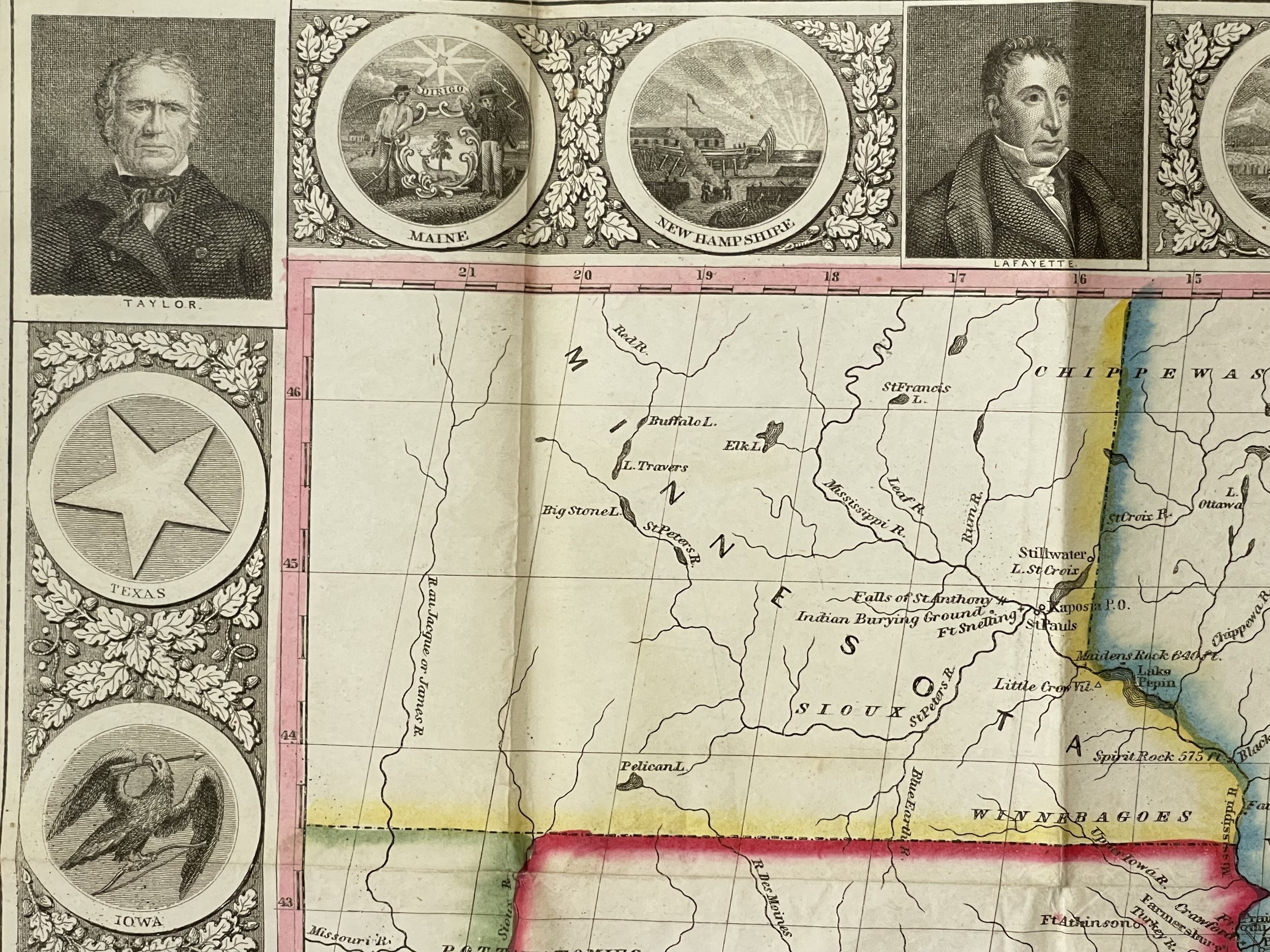
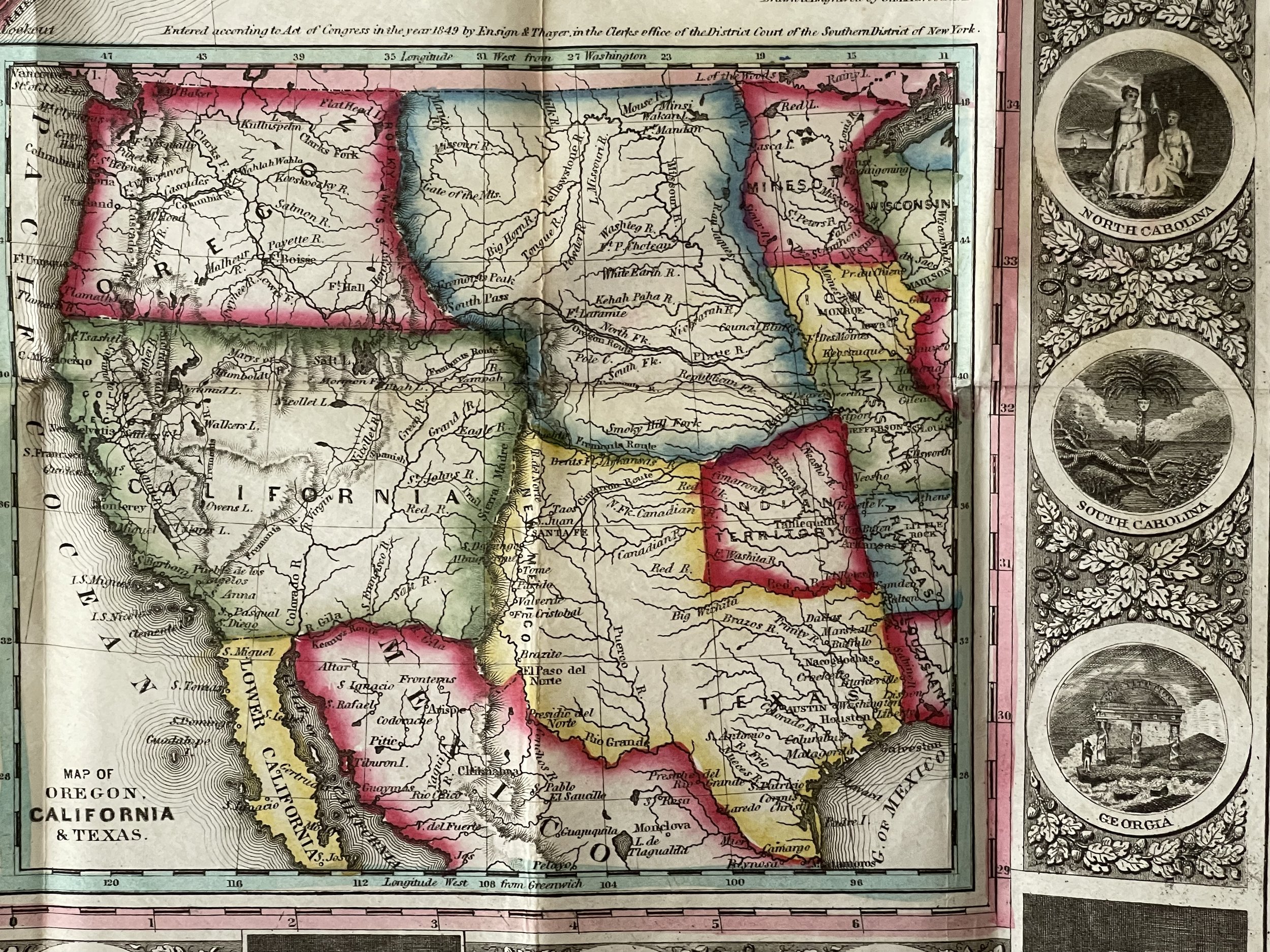
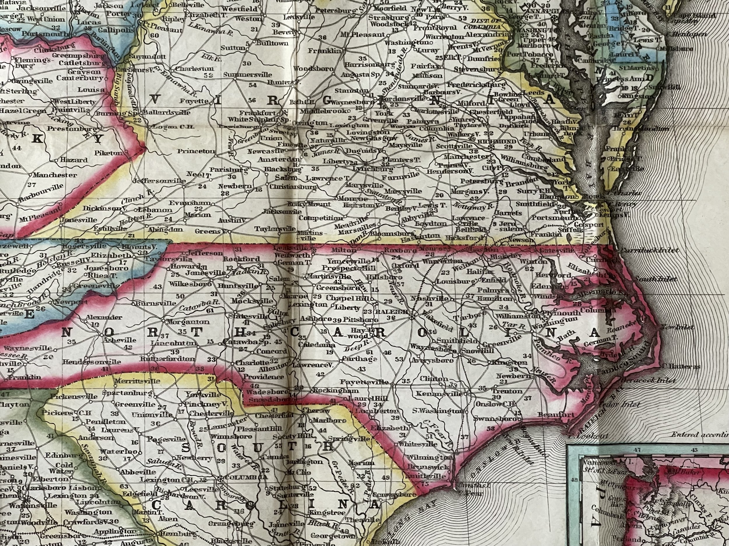
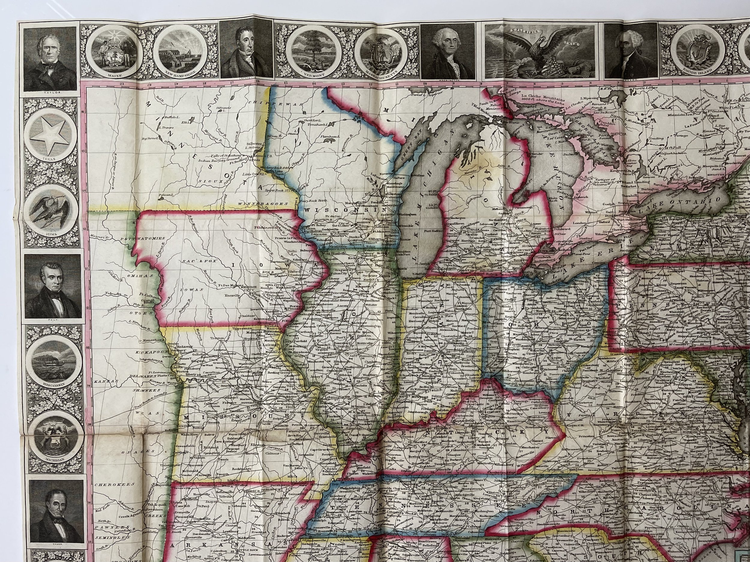
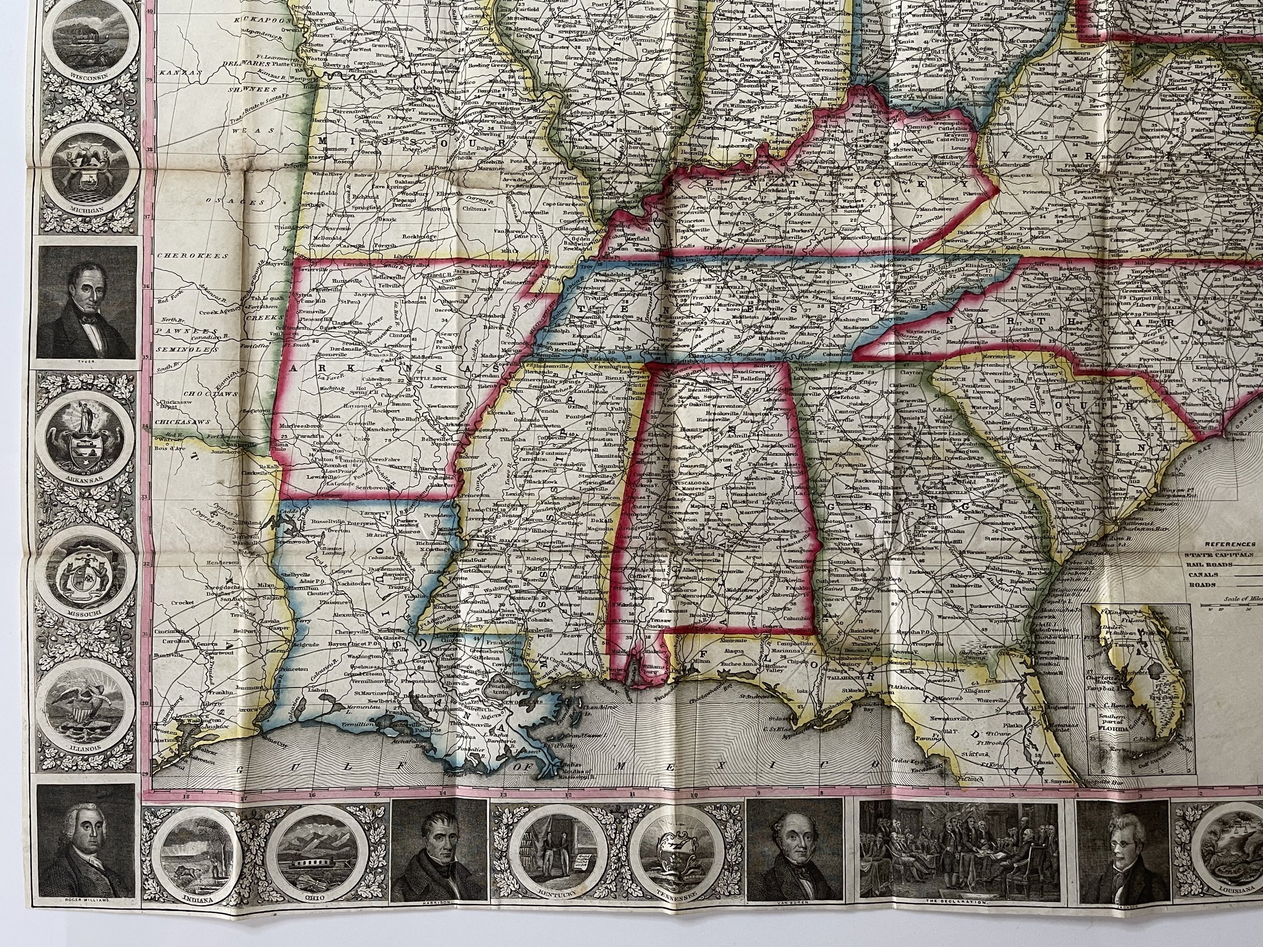
First issued in 1848, this 1849 rare map of the United States. It covers most of the eastern portion of the United States bounded on the west by Texas and two large unnamed territories to the north. Insets in the lower right quadrant illustrate seven important port cities: New York, Philadelphia, Baltimore, Boston, Birmingham, Cincinnati, St. Louis and Chicago. Two smaller map insets depict southern Florida and Northern Maine, the extremes of both of which are just off the map. The whole is surrounded by a fine decorative border depicting 30 alternating state seals and 16 important historical figures. The state seal of Texas appears in the upper left quadrant, but California's does not. Shows the 'Trader's Route to Santa Fe' as it passes through Missouri and the territory to the west. Liberally names numerous American Indian tribes as well as Indian Burial Grounds, and trading depots.
Later editions, published after 1849 replace all seven city plans with a mini-map of the western United States. There is also a German language edition issued in 1849.
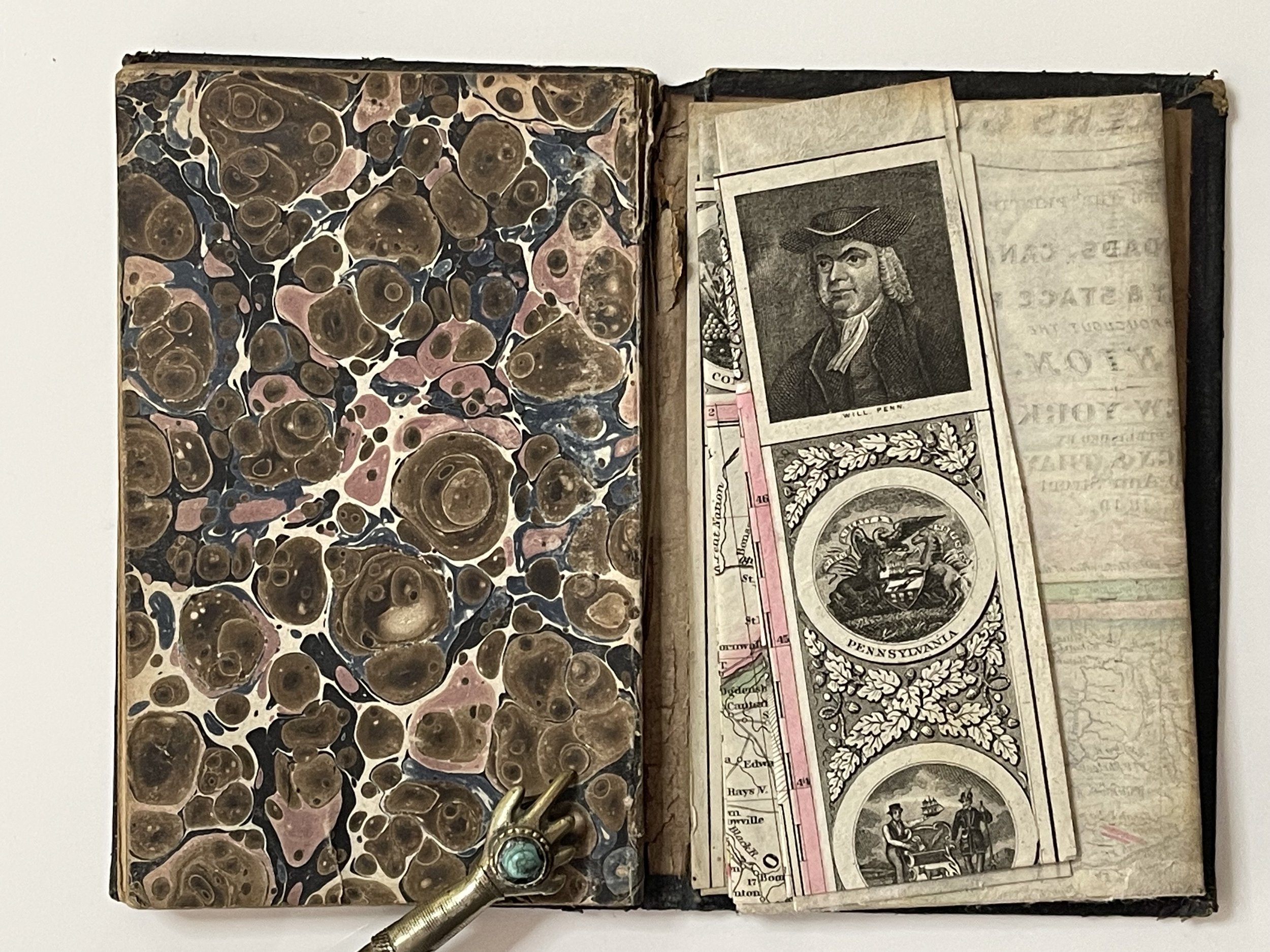
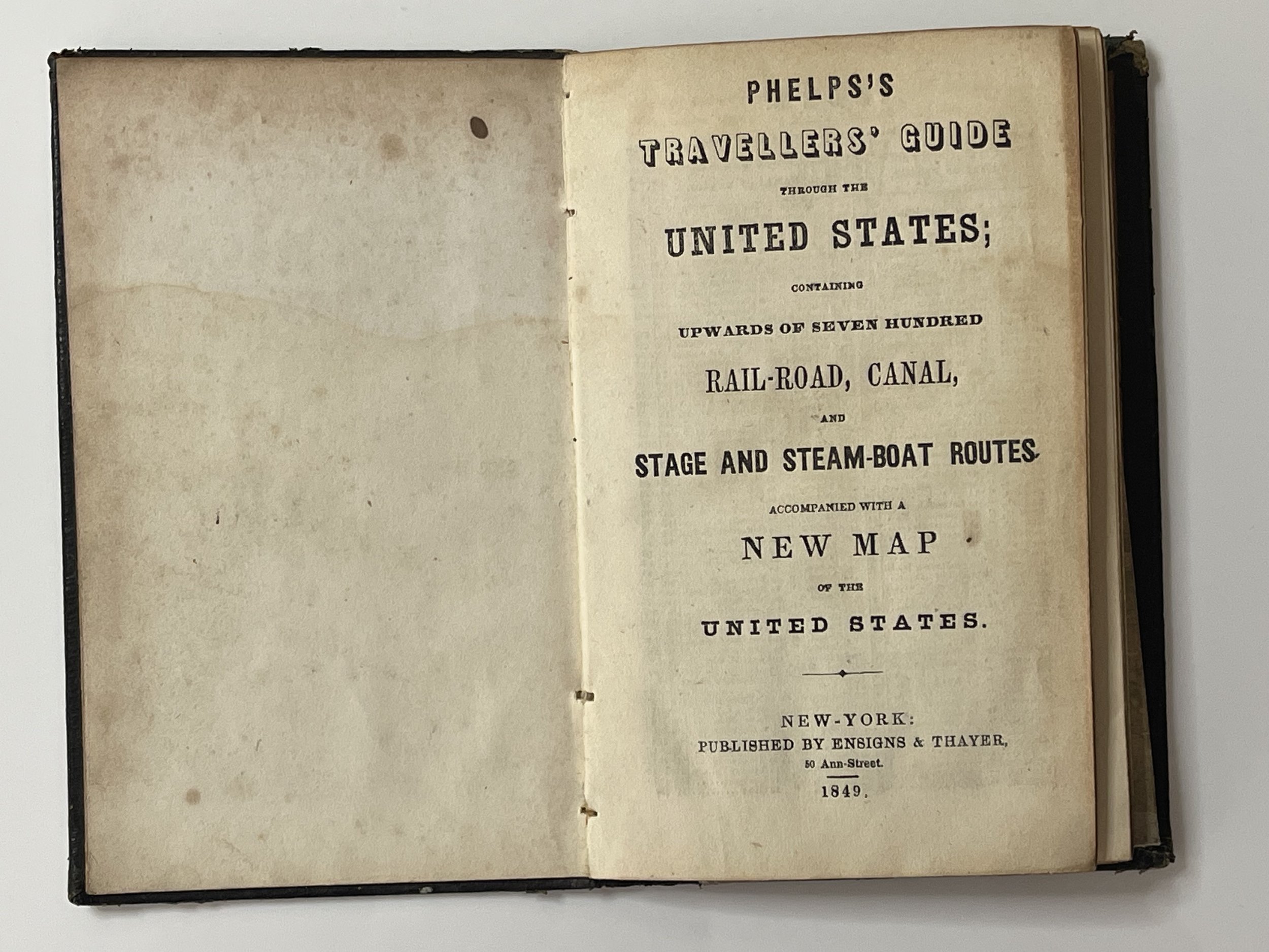
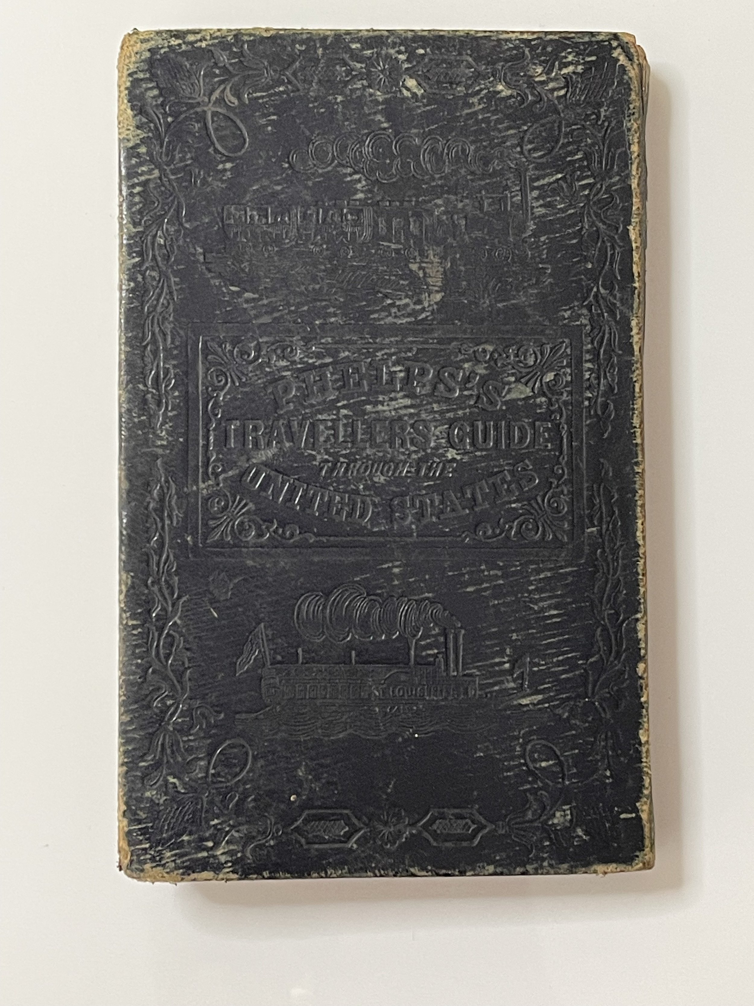
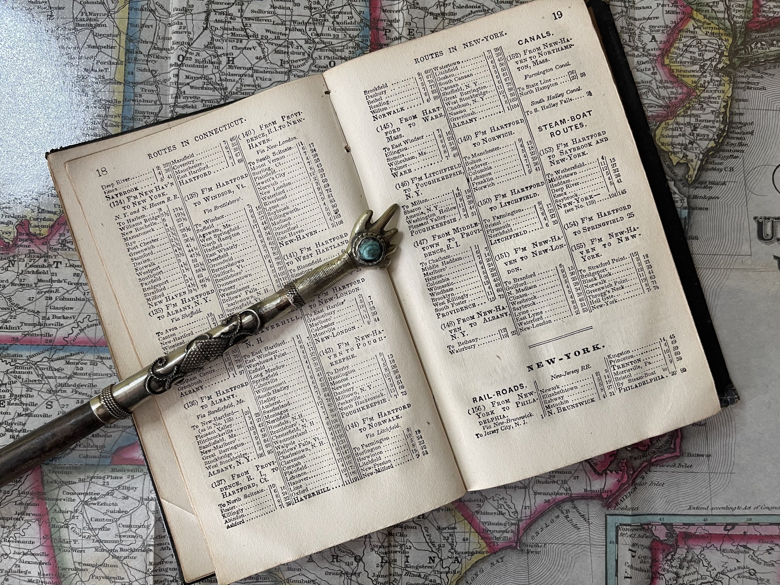
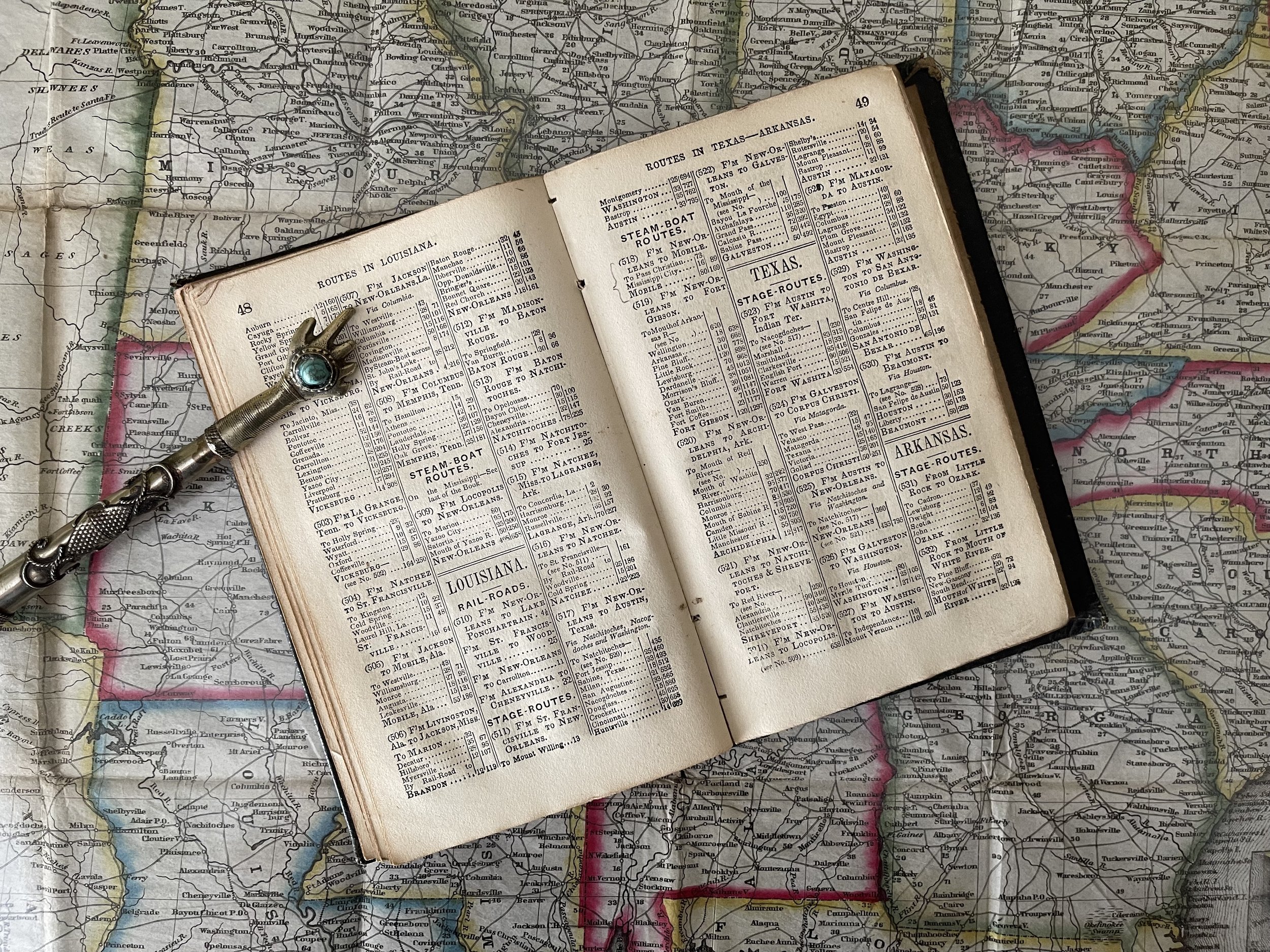
This map was issued as an accompaniment to Phelps's Travellers' Guide through the United States; containing Upwards of seven hundred Rail-road, Canal, and Stage and Steam-boat Routes, accompanied with a New Map of the United States. This 70 page booklet is bound in red leather with an elaborate cover design stamped in gold gilt. Book features an index of place names as well as mileage charts between important cities on rail and stage routes. This original booklet is included with this item.
Drawn and engraved by J. M Atwood of New York. Portraits and state seals engraved by William D. Smith. The copyright reads 'Entered according to Act of Congress in the year 1845 by H. Phelps in the Clerks office of the District Court of the Southern District of N. York.'
Humphrey Phelps (1799 - 1875) was an American map, broadside, and book publisher based in New York City. Phelps was born in 1799 in Hebron, Connecticut. Phelps' earliest work seems to be a plan of New York City for his Stranger's Guide, dating to about 1830. Between 183- and 1837 he published with Bela Scovil Squire (1786 - 1861) under the imprint of Phelps and Squire. The New York map publishing circle seems to have been quite close and Phelps commonly partnered with various other New York publishers and printers including Edward H. Ensign (1818 - 1871), Horace Thayer, Erastus Clark Bridgman (1817 - 1870), Thomas C. Fanning (1805 - 1873), Hooker, Peabody, Charles Magnus, Gaylord Watson, and George Walker, among others. The natural consequence of his rampant partnering is a vast and varied corpus of work including many scarce items with low print runs. Phelps is best known for his emigrant and tourist guides
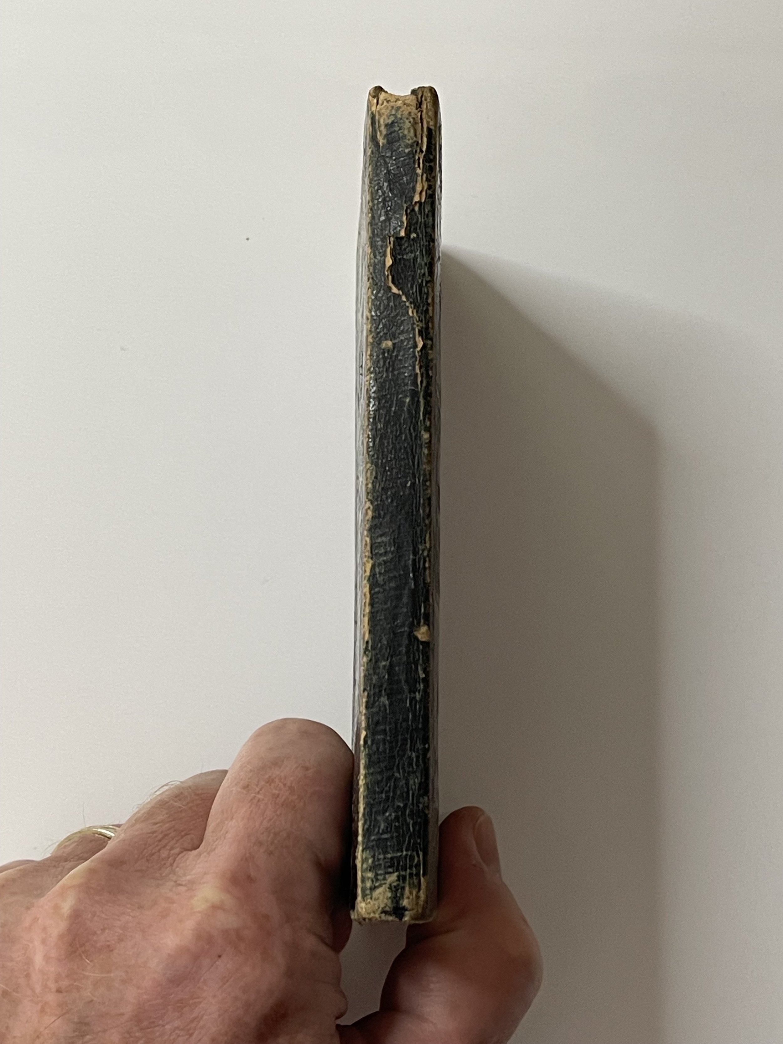
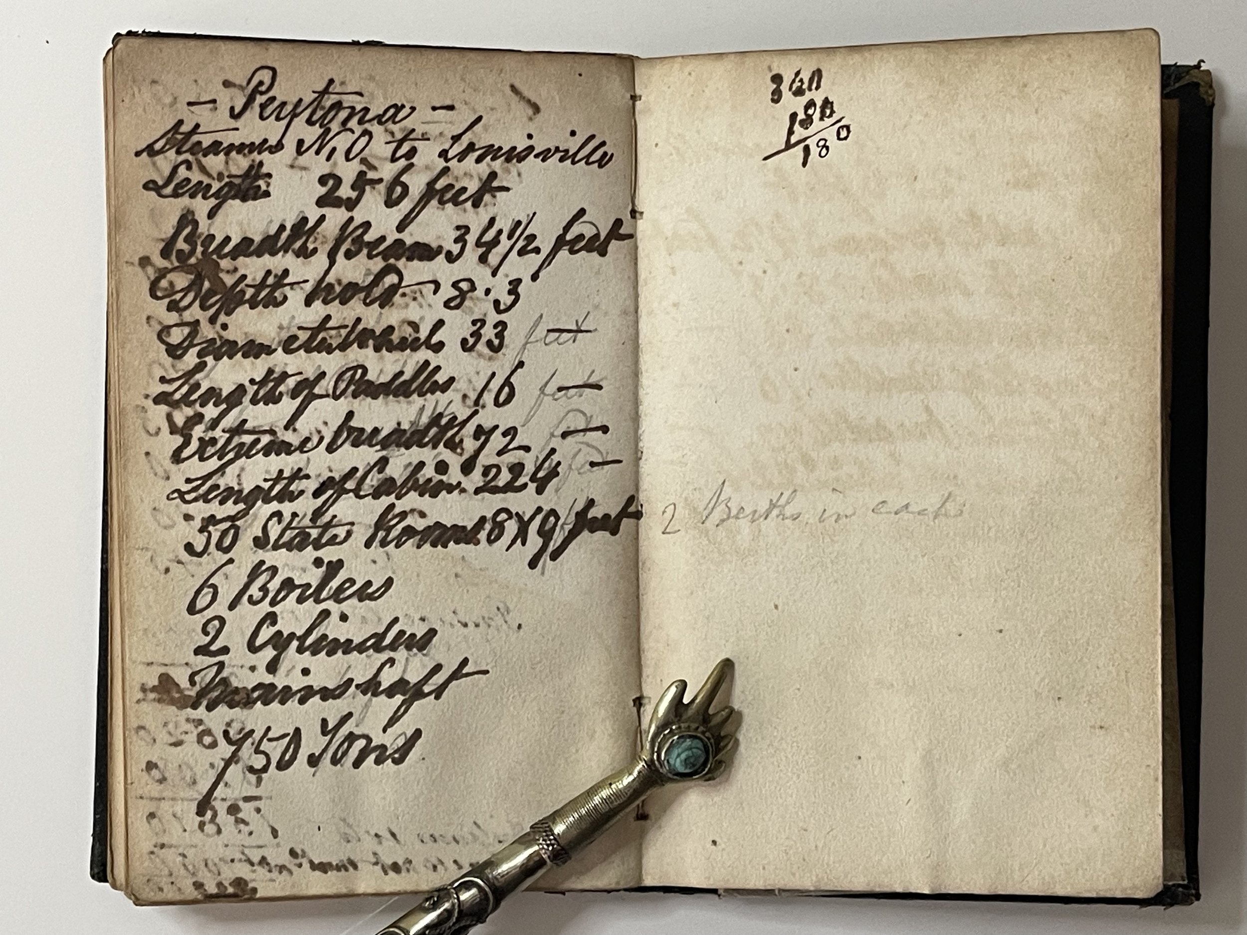
In amazing condition considering its tactile use. The pages have gold leaf around the edge of each page. To the rear there is some writing in ink on one of the blank pages that has transgressed into the opposing page. Im presuming the blank pages were reserved for scribbling ones notes. The front board has beautifully inlaid gold descriptives, ornate locomotive and St Louis steamboat. The rear backboard has an identical impression but the gold leaf has worn away. The spine is intact and operational but shows wear indicative of age and use. The map is disconnected from the book but is in incredible condition with no tears or blemishes to note. It has vibrant colours and incredible detail. A rare and very desirable acquisition for the collector. The map is stored separate and flat to protect the folds. Pricing and grading commensurate.
Phelps’s National Map of the United States, A Travellers Guide. Embracing the Principal Rail Roads, Canals, Steam Boat & Stage Routes throughout the Union.
Published by Horace Thayer & Co., 50 Ann St. 1852. Drawn & engraved by J. M. Atwood, N.Y. Entered according to Act of Congress in the year 1849 by Ensign & Thayer in the Clerk's Office of the District Court of the Southern District of New York.
First issued in 1848, this 1849 rare map of the United States. It covers most of the eastern portion of the United States bounded on the west by Texas and two large unnamed territories to the north. Insets in the lower right quadrant illustrate seven important port cities: New York, Philadelphia, Baltimore, Boston, Birmingham, Cincinnati, St. Louis and Chicago. Two smaller map insets depict southern Florida and Northern Maine, the extremes of both of which are just off the map. The whole is surrounded by a fine decorative border depicting 30 alternating state seals and 16 important historical figures. The state seal of Texas appears in the upper left quadrant, but California's does not. Shows the 'Trader's Route to Santa Fe' as it passes through Missouri and the territory to the west. Liberally names numerous American Indian tribes as well as Indian Burial Grounds, and trading depots.
Later editions, published after 1849 replace all seven city plans with a mini-map of the western United States. There is also a German language edition issued in 1849.
This map was issued as an accompaniment to Phelps's Travellers' Guide through the United States; containing Upwards of seven hundred Rail-road, Canal, and Stage and Steam-boat Routes, accompanied with a New Map of the United States. This 70 page booklet is bound in red leather with an elaborate cover design stamped in gold gilt. Book features an index of place names as well as mileage charts between important cities on rail and stage routes. This original booklet is included with this item.
Drawn and engraved by J. M Atwood of New York. Portraits and state seals engraved by William D. Smith. The copyright reads 'Entered according to Act of Congress in the year 1845 by H. Phelps in the Clerks office of the District Court of the Southern District of N. York.'
Humphrey Phelps (1799 - 1875) was an American map, broadside, and book publisher based in New York City. Phelps was born in 1799 in Hebron, Connecticut. Phelps' earliest work seems to be a plan of New York City for his Stranger's Guide, dating to about 1830. Between 183- and 1837 he published with Bela Scovil Squire (1786 - 1861) under the imprint of Phelps and Squire. The New York map publishing circle seems to have been quite close and Phelps commonly partnered with various other New York publishers and printers including Edward H. Ensign (1818 - 1871), Horace Thayer, Erastus Clark Bridgman (1817 - 1870), Thomas C. Fanning (1805 - 1873), Hooker, Peabody, Charles Magnus, Gaylord Watson, and George Walker, among others. The natural consequence of his rampant partnering is a vast and varied corpus of work including many scarce items with low print runs. Phelps is best known for his emigrant and tourist guides
In amazing condition considering its tactile use. The pages have gold leaf around the edge of each page. To the rear there is some writing in ink on one of the blank pages that has transgressed into the opposing page. Im presuming the blank pages were reserved for scribbling ones notes. The front board has beautifully inlaid gold descriptives, ornate locomotive and St Louis steamboat. The rear backboard has an identical impression but the gold leaf has worn away. The spine is intact and operational but shows wear indicative of age and use. The map is disconnected from the book but is in incredible condition with no tears or blemishes to note. It has vibrant colours and incredible detail. A rare and very desirable acquisition for the collector. The map is stored separate and flat to protect the folds. Pricing and grading commensurate.
Code : A974
Cartographer : Cartographer / Engraver / Publisher: Humphrey Phelps
Date : Publication Place / Date - Circa 1849
Size : Sheet size: 65 x 51 Inches
Availability : Available
Type - Genuine - Antique
Grading A+
Where Applicable - Folds as issued. Light box photo shows the folio leaf centre margin hinge ‘glue’, this is not visible otherwise.
Tracked postage, in casement. Please contact me for postal quotation outside of the UK.