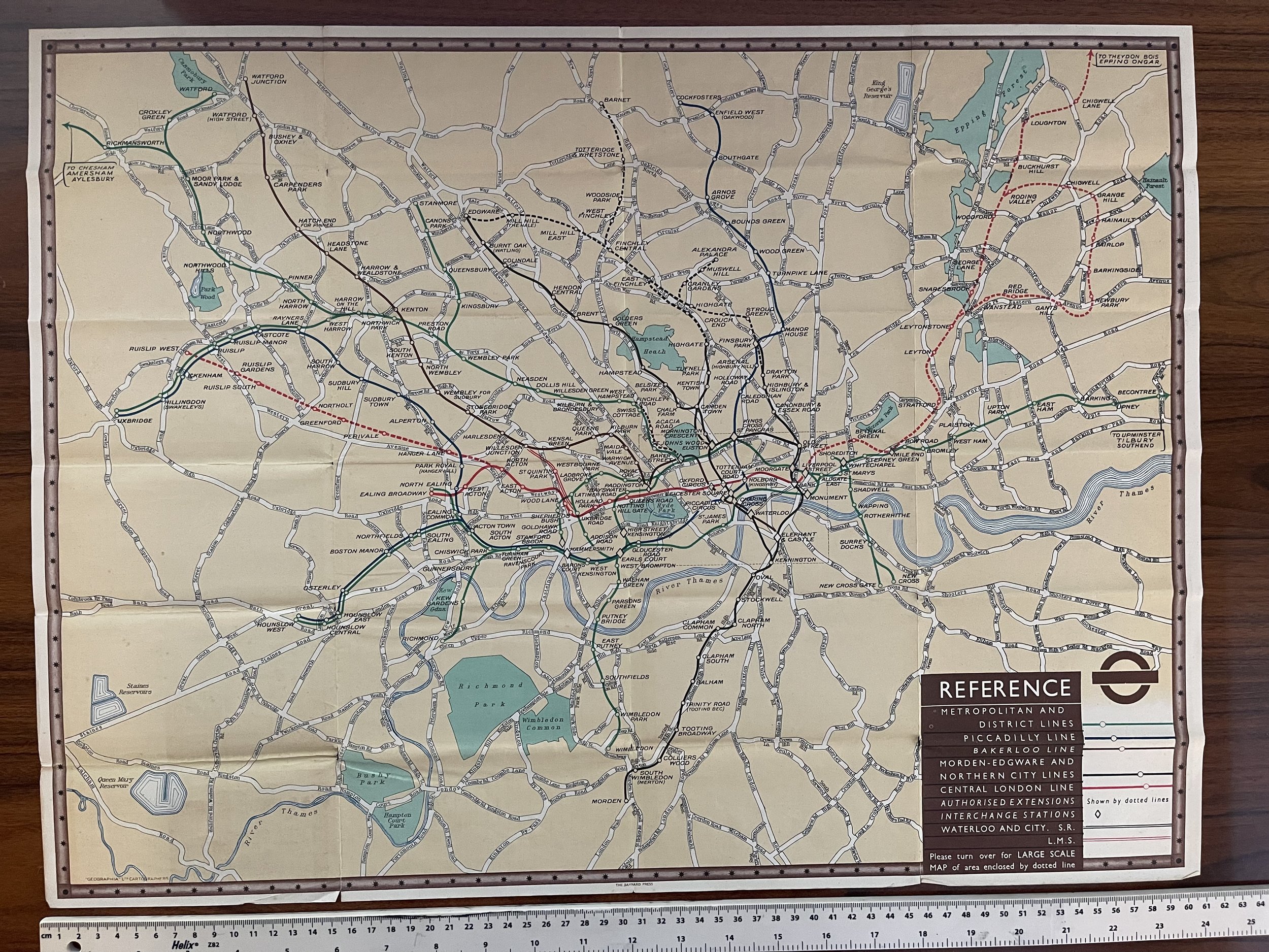


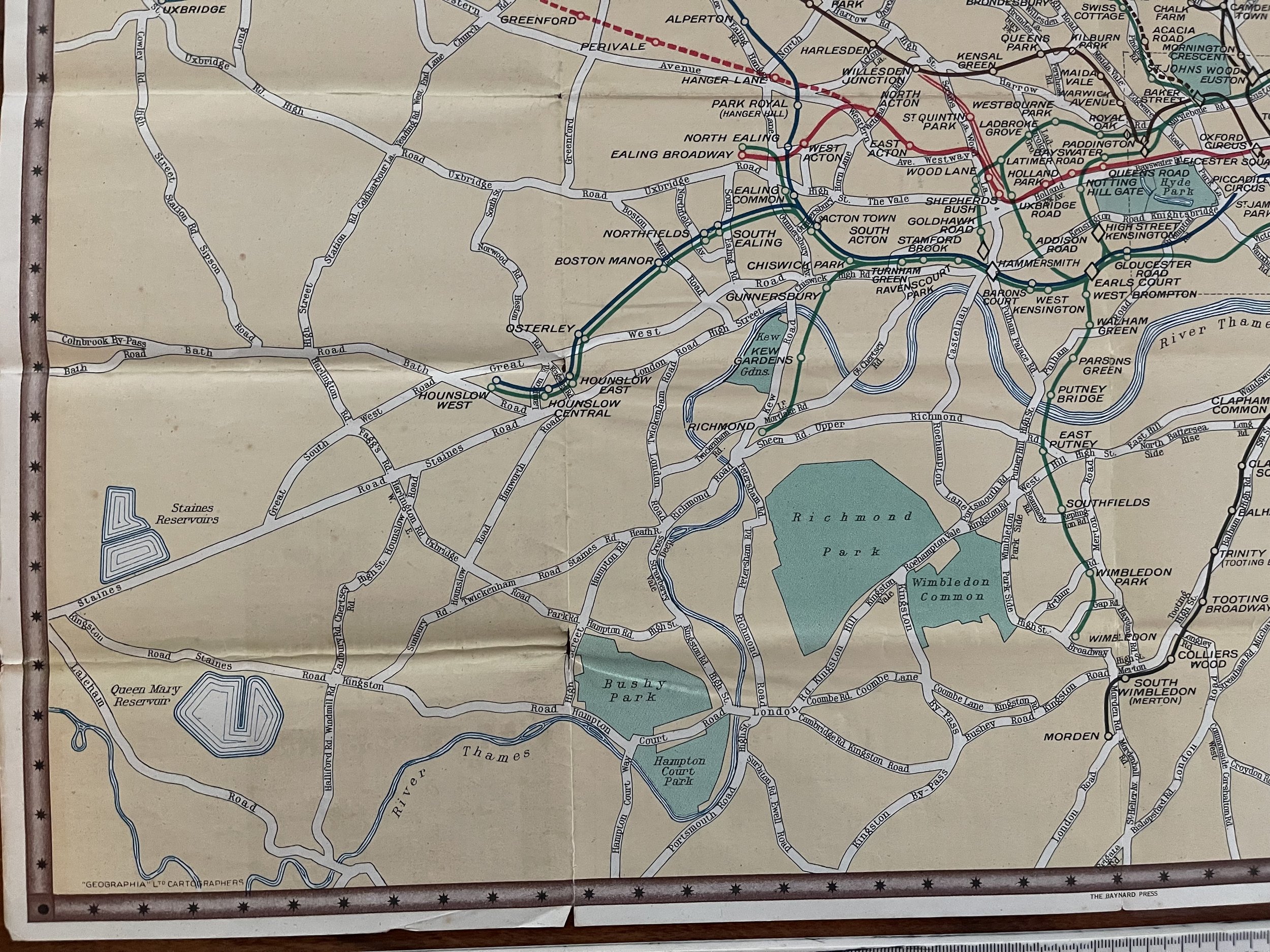
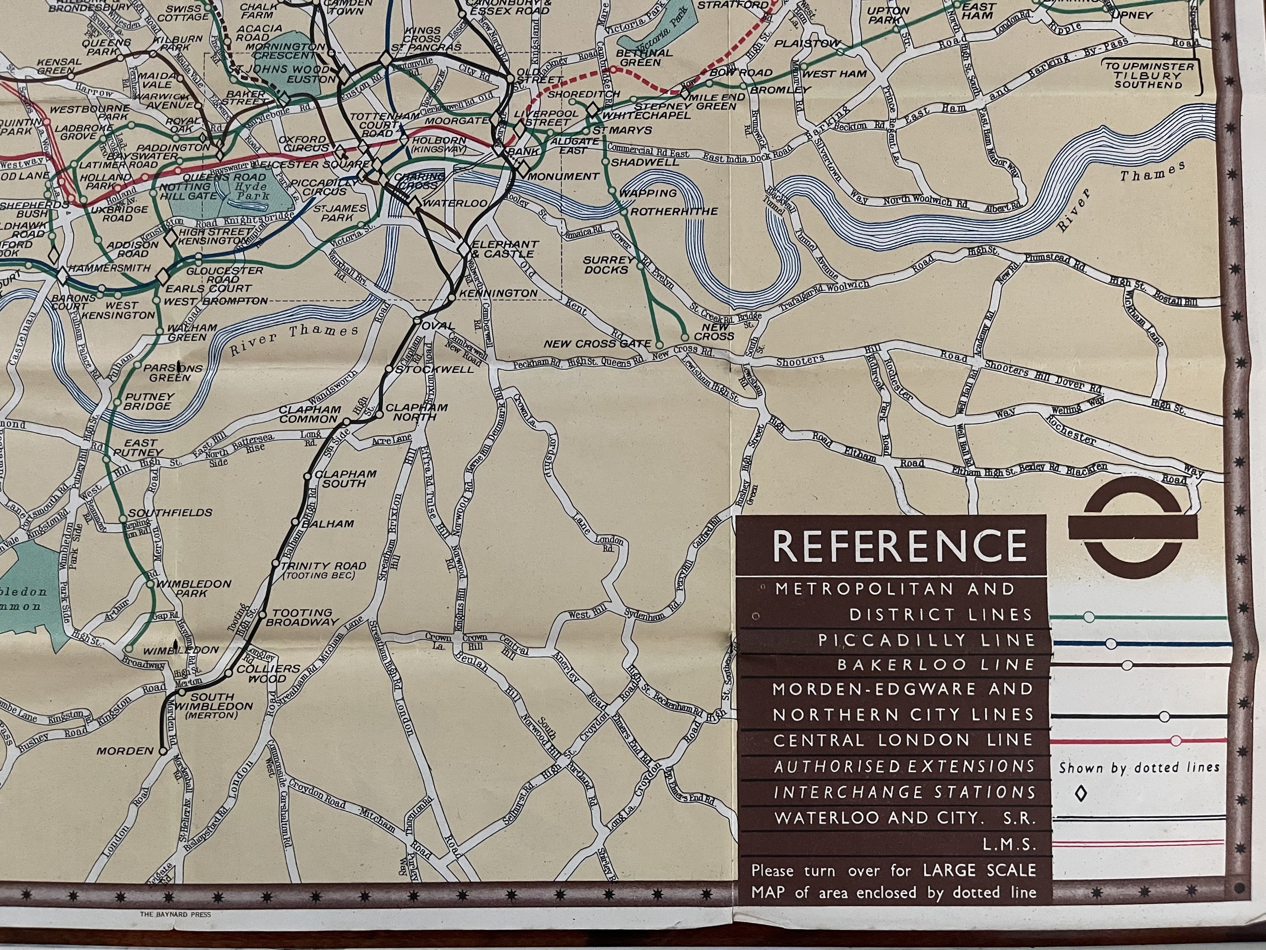
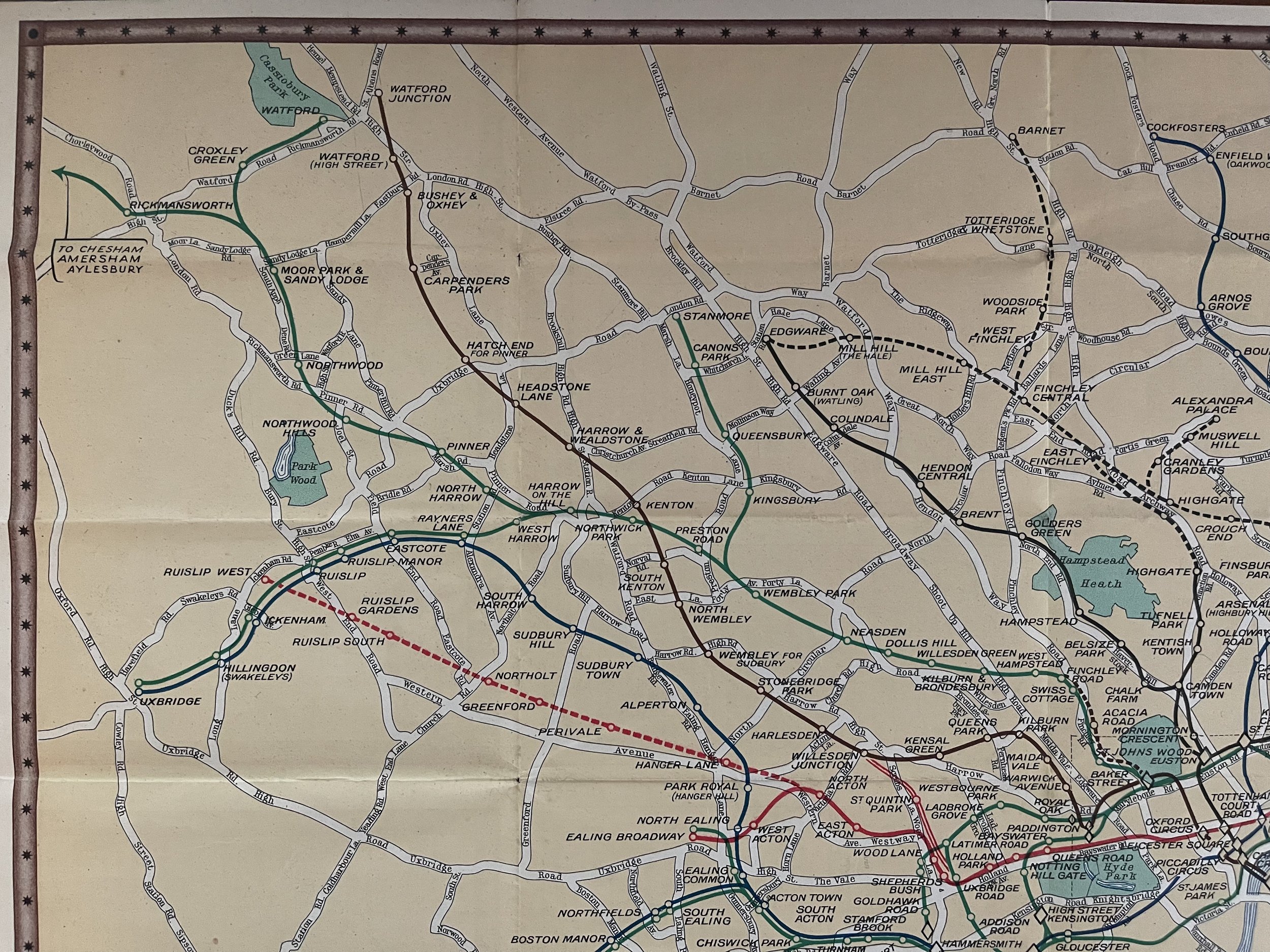
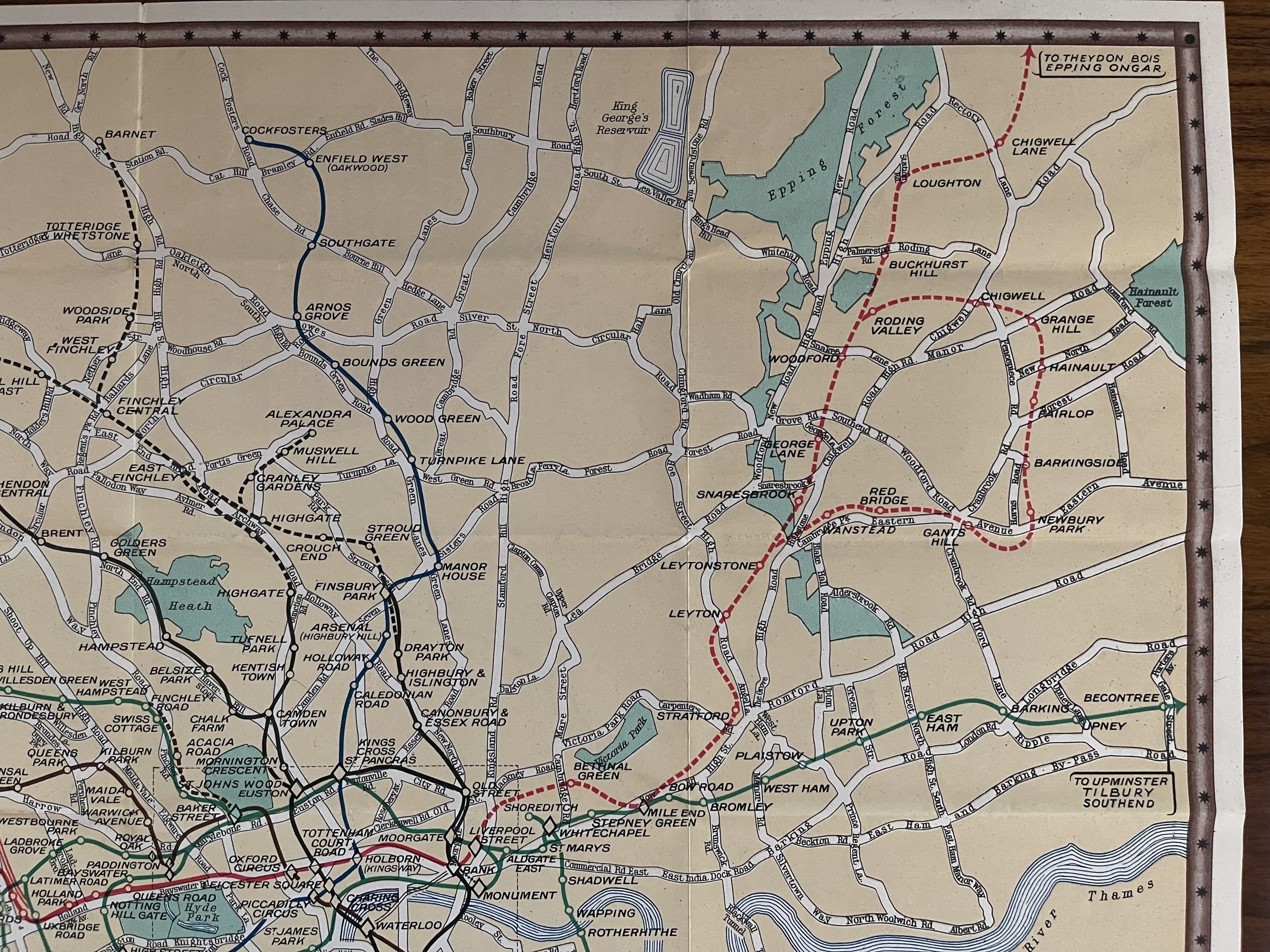
Underground Railway Map - London Transport - Publication Date: 1937
London: London Transport, 1937. Scarce folding colour original London Underground map, which includes 2 other maps of important London sites.
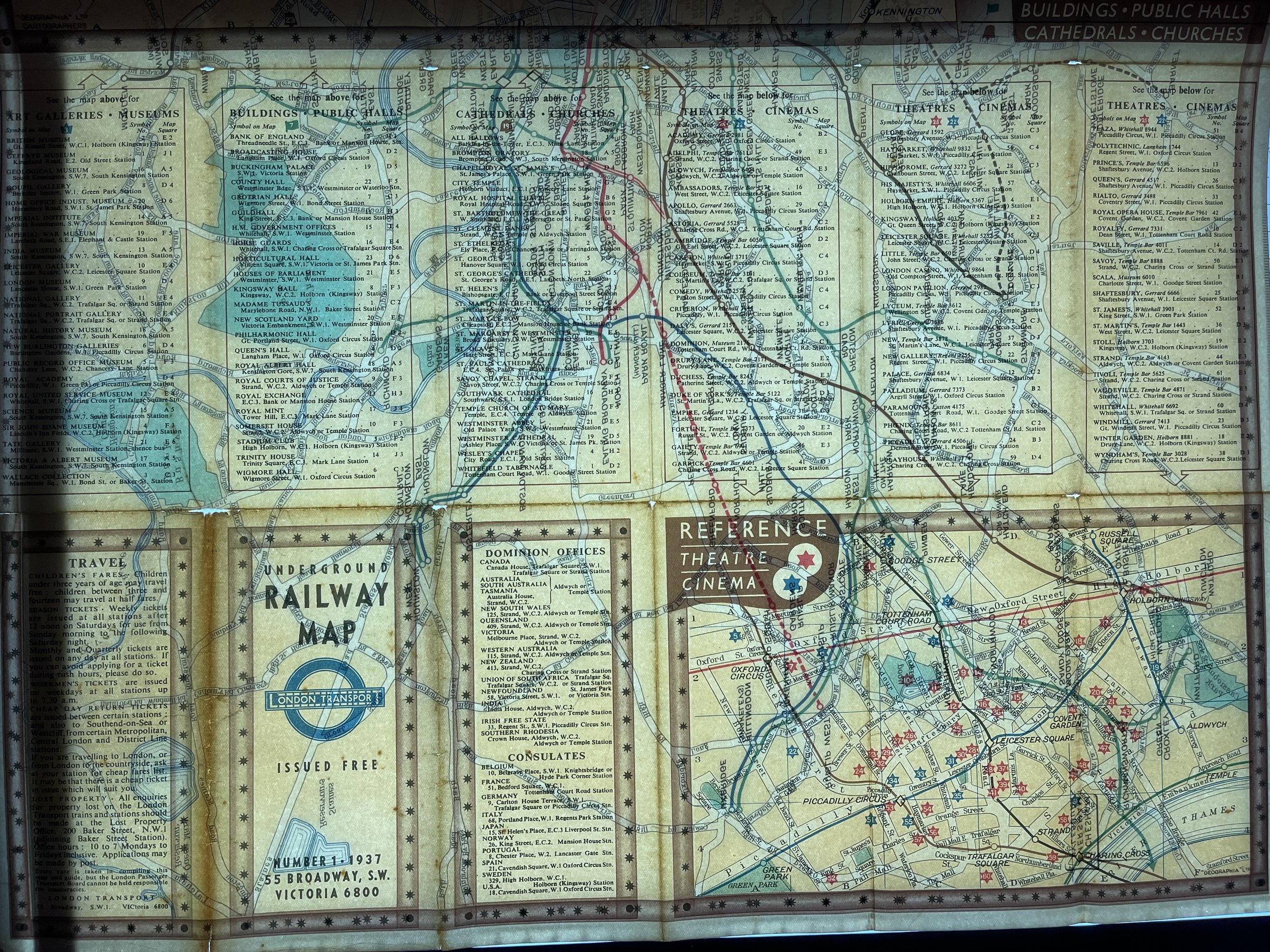
London Underground Railway Map. London Transport tube plan. Number 1 - 1937. Coloured vintage map; London Transport / Geographia (1937). This is a folding map so there are a few tears and nicks along folding lines that do not significantly impact on the map itself. Condition: Very Good. Wear and discolouration at junctions of some folds commensurate with age.
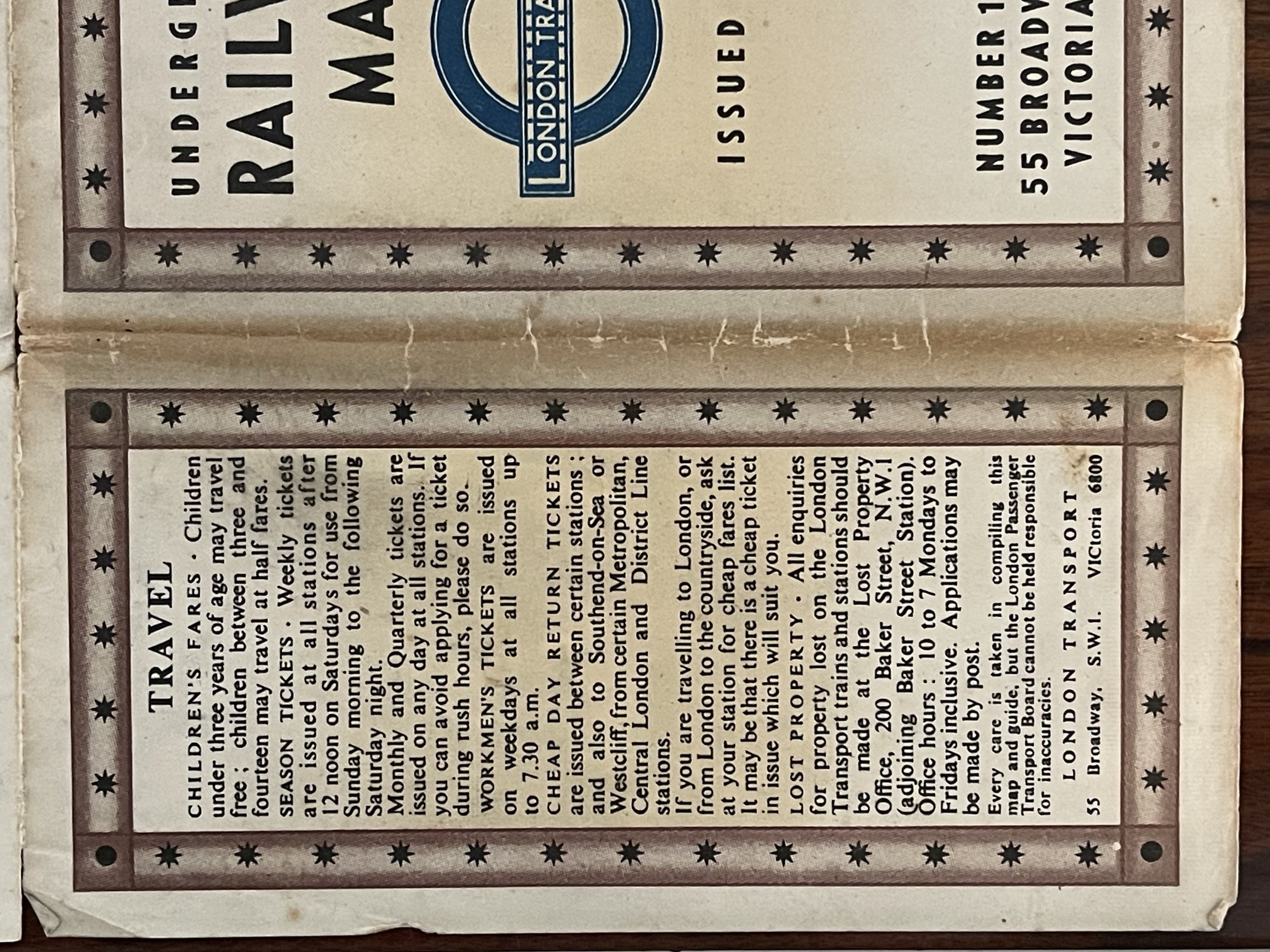
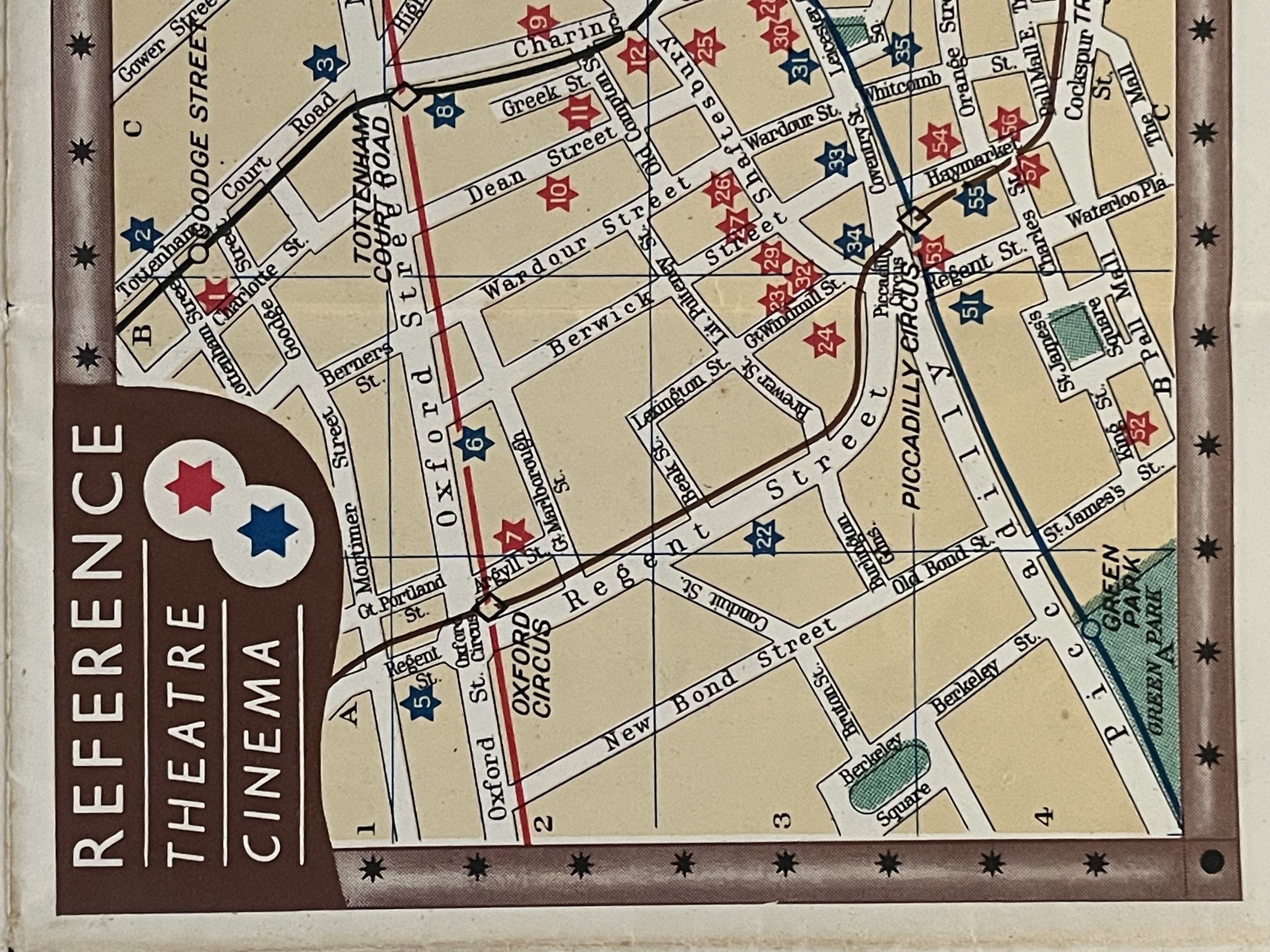
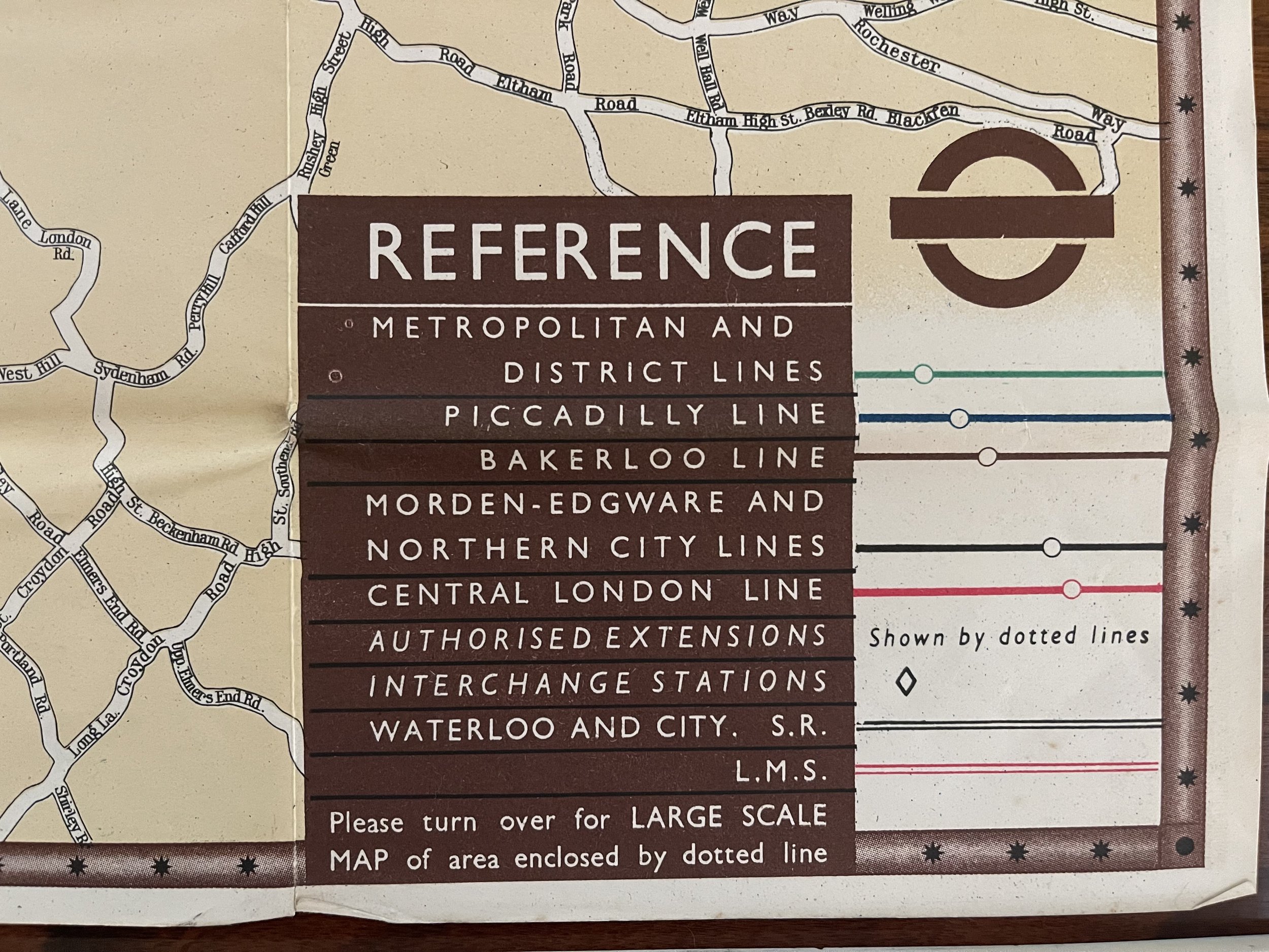
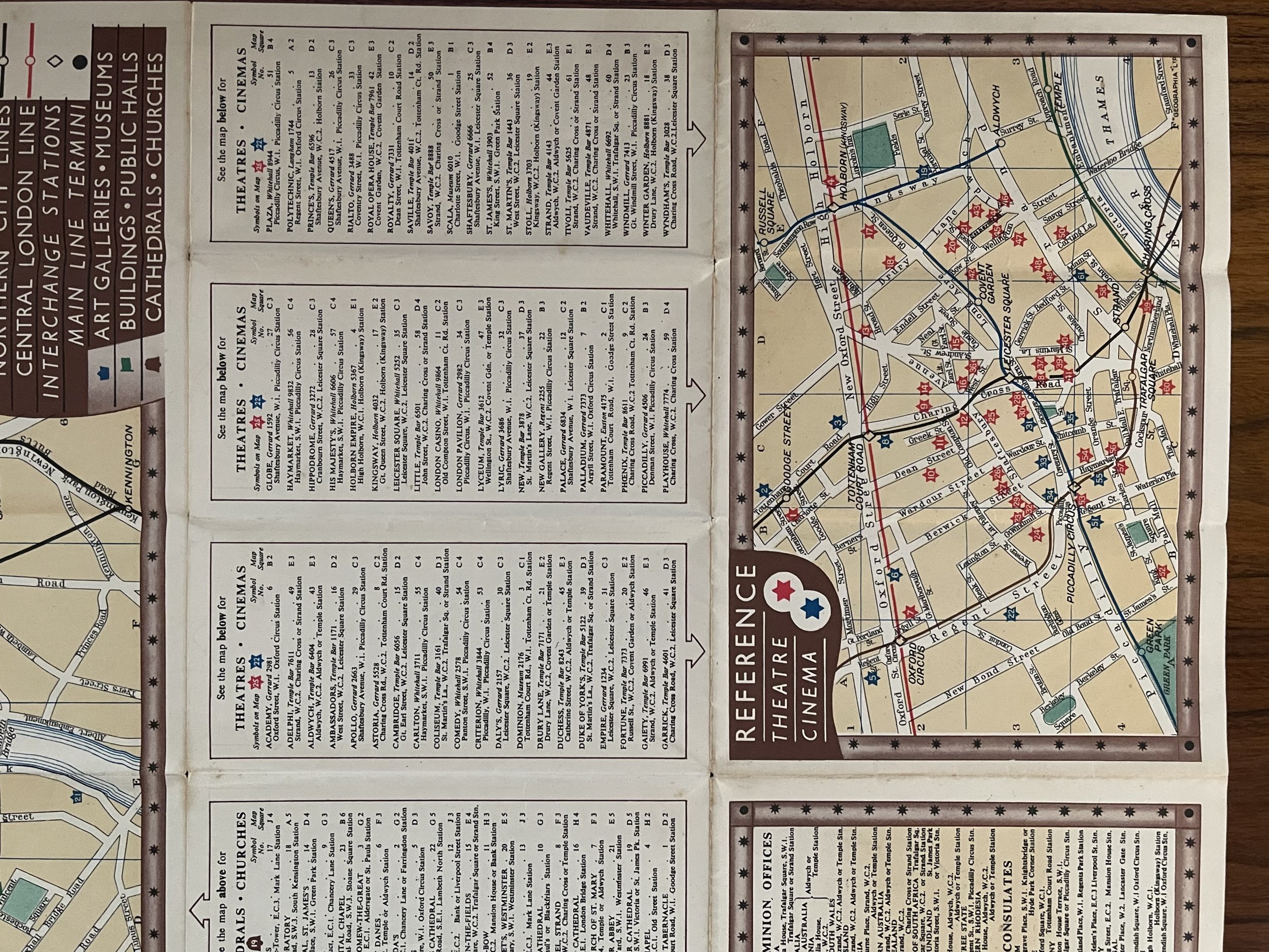
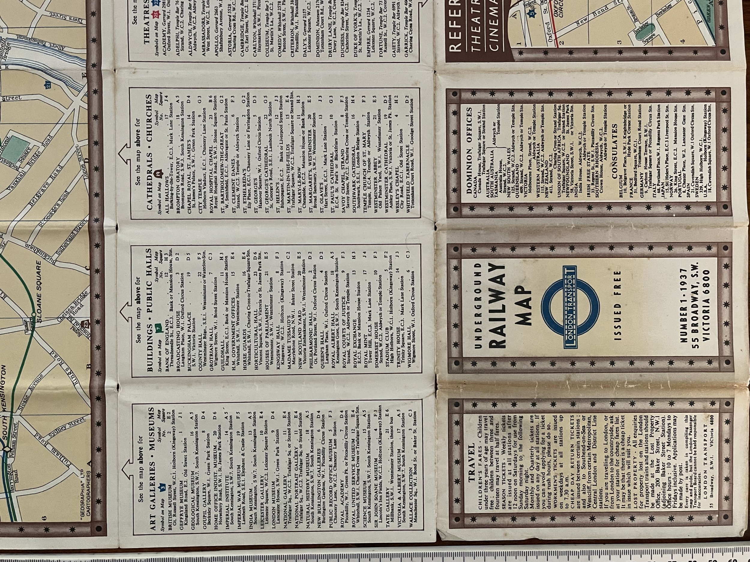
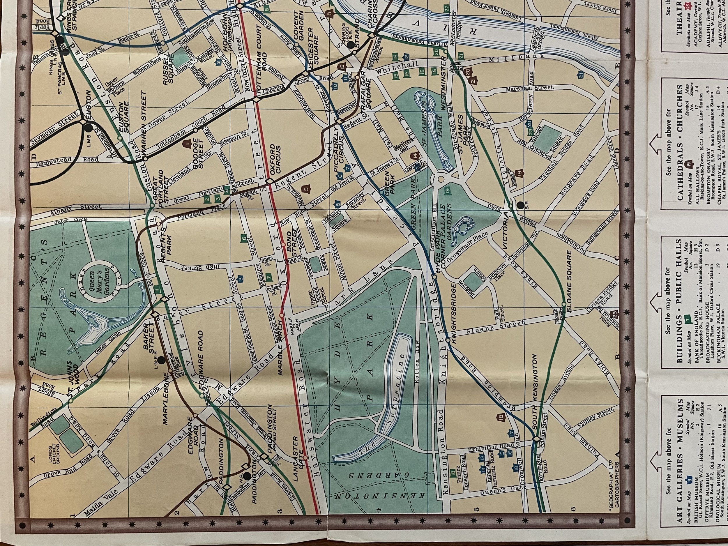
There is another map of the central area, and related tourist information on the reverse side. With the three cover panels offering information on fares, and listing dominion offices and consulates, with the flip side with a map showing theatres and cinemas in relation to the underground lines, in red and blue stars, and lists of art galleries, museums, public halls, and churches and cathedrals.
The Baynard Press 1894 – 1960 - Poster printer, Printer
Stockwell, London, Greater London, England, United Kingdom
1894: established by F Sanders Phillips; used colour lithography; 1960: took over Vincent Brooks, Day & Son Ltd; Sanders Phillips & Co, The Baynard Press, Chryssell Road, London, SW9.
It employed highly skilled craftsmen such as Thomas Griffits and did much to advance the use of colour lithography. It printed many of London Transport’s pictorial posters, often using it’s own artists such as Shep. The Baynard Press was amongst the largest and most technically accomplished printing firms in Britain. They had machinery and plant resources that allowed them to produce large-scale poster images for the advertising of London Transport and various other organisations. The Baynard Press also maintained a level of technical excellence through the employment of Thomas Griffits and other master craftsmen. This allowed the firm to produce work of the highest standard. At the outbreak of WW2, the entire resources of the firm were made available to support the war effort.
London: London Transport, 1937. Scarce folding colour original London Underground map, which includes 2 other maps of important London sites.
London Underground Railway Map. London Transport tube plan. Number 1 - 1937. Coloured vintage map; London Transport / Geographia (1937). This is a folding map so there are a few tears and nicks along folding lines that do not significantly impact on the map itself. Condition: Very Good. Wear and discolouration at junctions of some folds commensurate with age.
There is another map of the central area, and related tourist information on the reverse side. With the three cover panels offering information on fares, and listing dominion offices and consulates, with the flip side with a map showing theatres and cinemas in relation to the underground lines, in red and blue stars, and lists of art galleries, museums, public halls, and churches and cathedrals.
The Baynard Press 1894 – 1960 - Poster printer, Printer
Stockwell, London, Greater London, England, United Kingdom
1894: established by F Sanders Phillips; used colour lithography; 1960: took over Vincent Brooks, Day & Son Ltd; Sanders Phillips & Co, The Baynard Press, Chryssell Road, London, SW9.
It employed highly skilled craftsmen such as Thomas Griffits and did much to advance the use of colour lithography. It printed many of London Transport’s pictorial posters, often using it’s own artists such as Shep. The Baynard Press was amongst the largest and most technically accomplished printing firms in Britain. They had machinery and plant resources that allowed them to produce large-scale poster images for the advertising of London Transport and various other organisations. The Baynard Press also maintained a level of technical excellence through the employment of Thomas Griffits and other master craftsmen. This allowed the firm to produce work of the highest standard. At the outbreak of WW2, the entire resources of the firm were made available to support the war effort.
Code : A35
Cartographer : Cartographer / Engraver / Publisher: Geographia
Date : Publication Place / Date - 1937
Size : Sheet size: Image Size: 44.5 x 59.0cm
Availability : Available
Type - Genuine - Antique
Grading A-
Where Applicable - Folds as issued. Light box photo shows the folio leaf centre margin hinge ‘glue’, this is not visible otherwise.
Tracked postage, in casement. Please contact me for postal quotation outside of the UK.