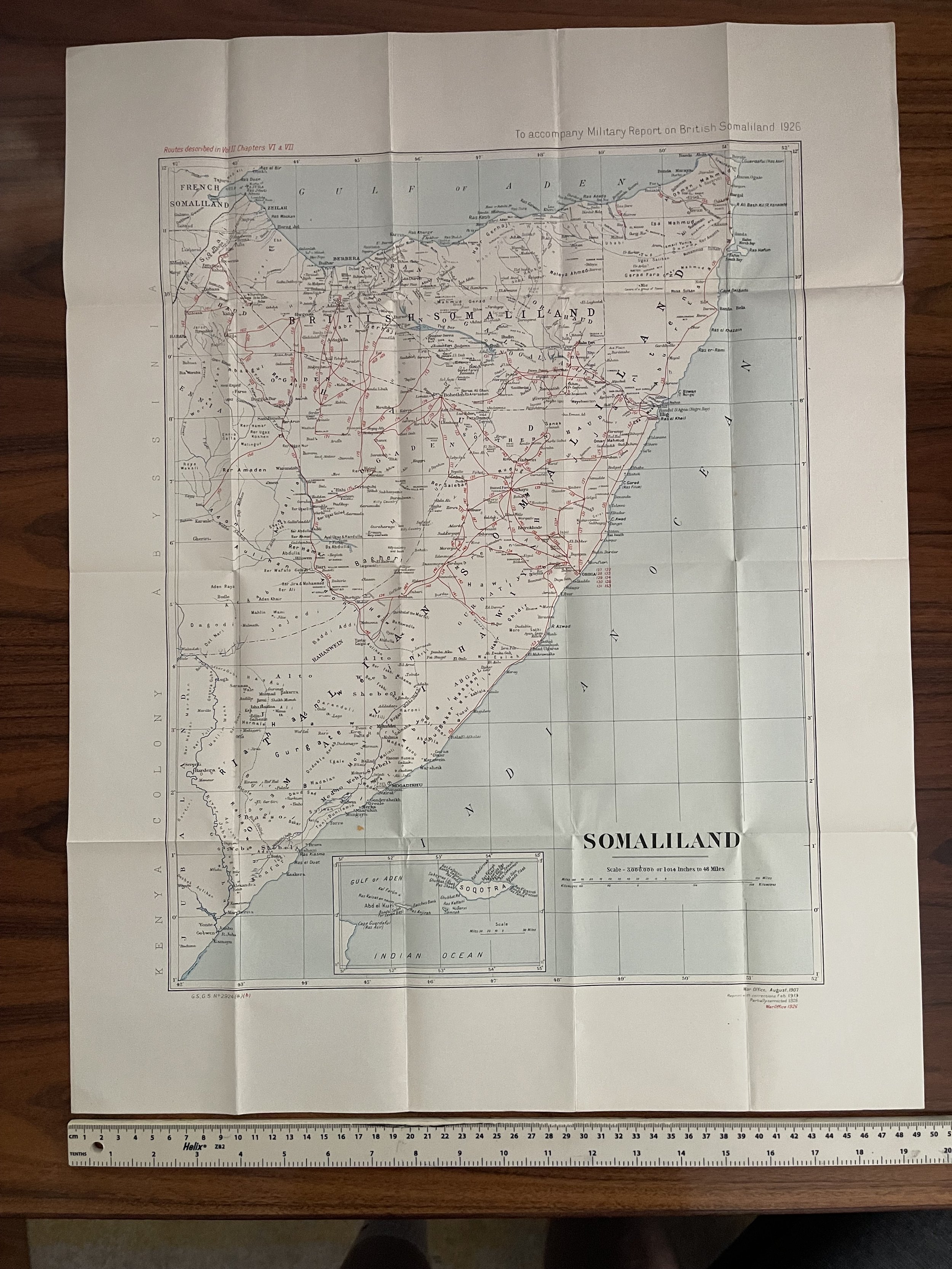
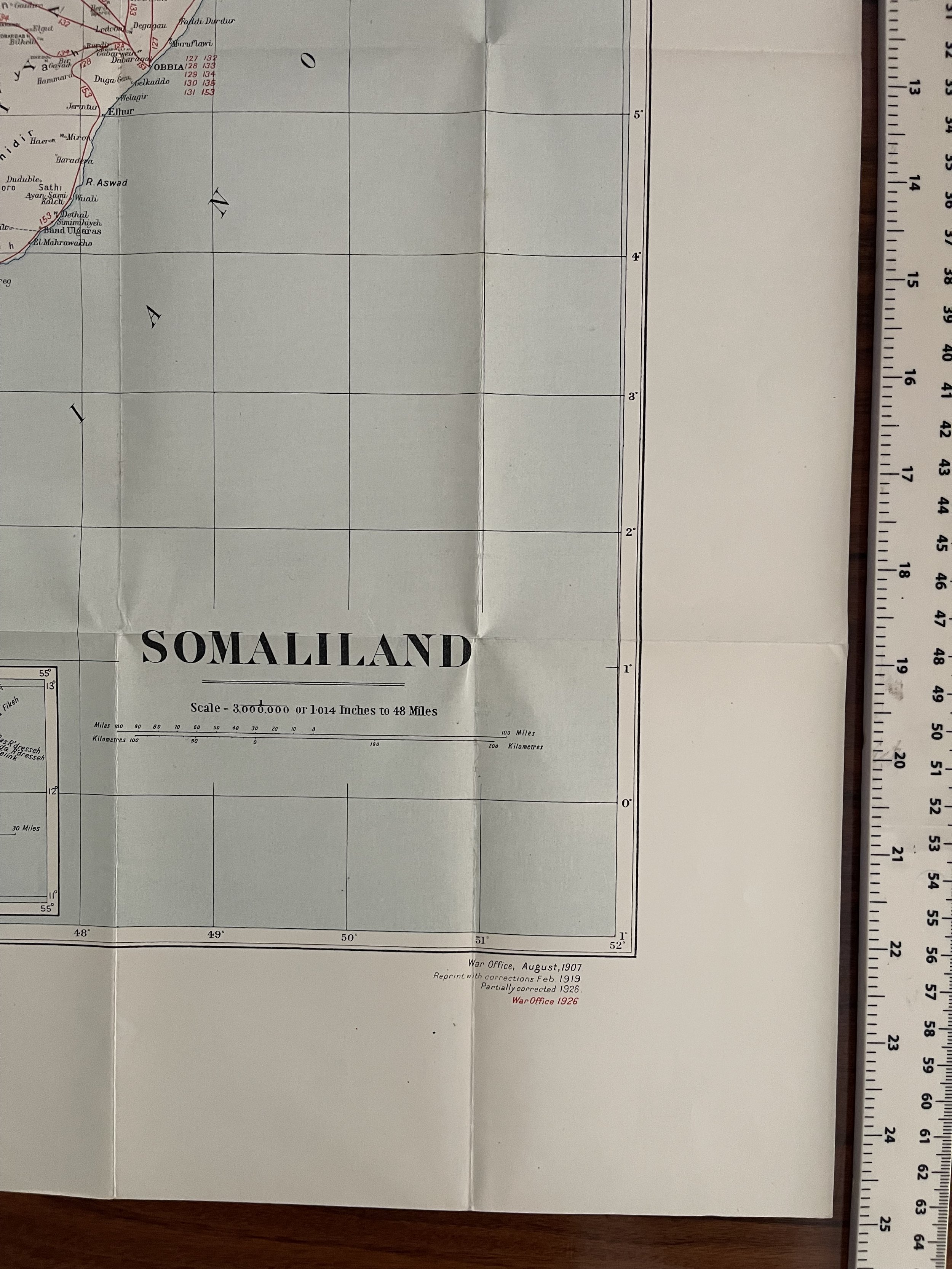
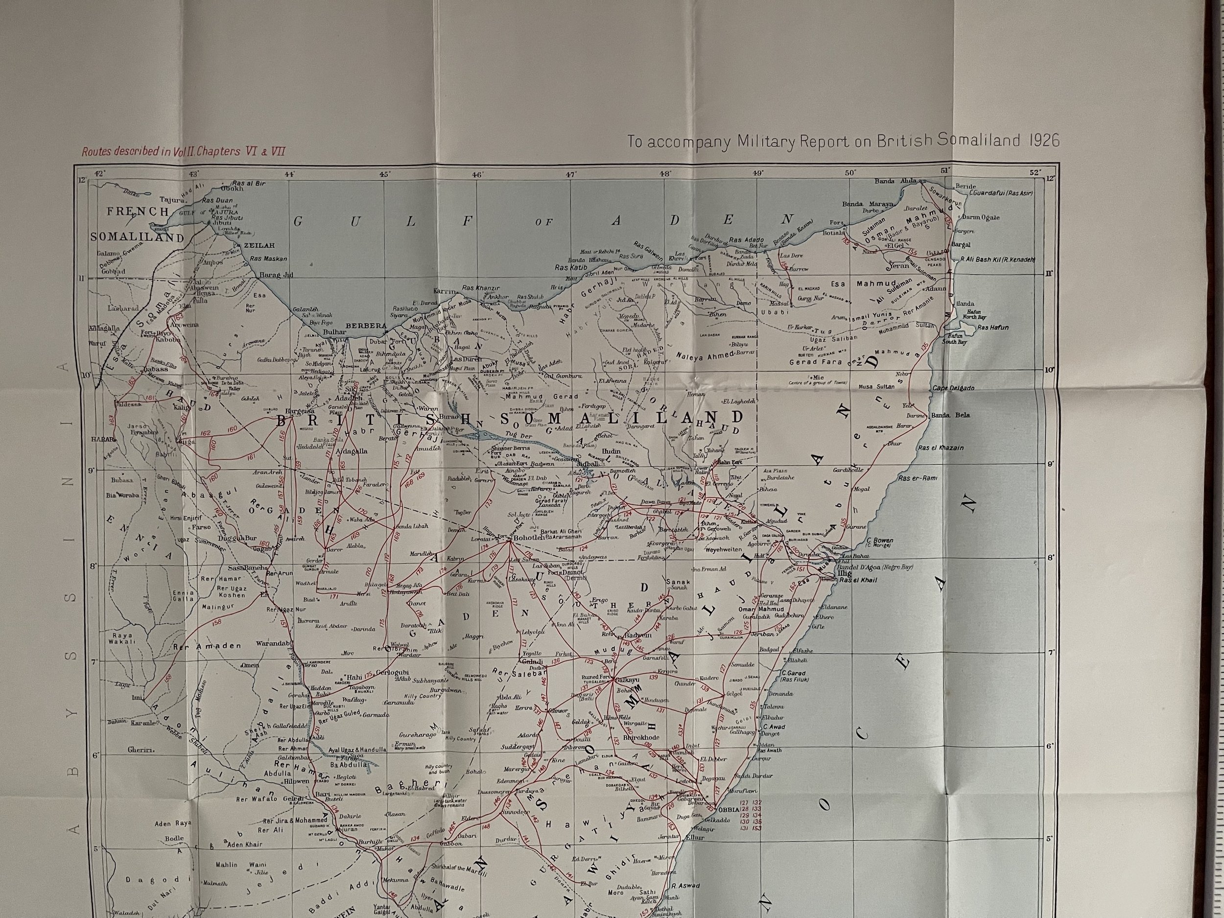
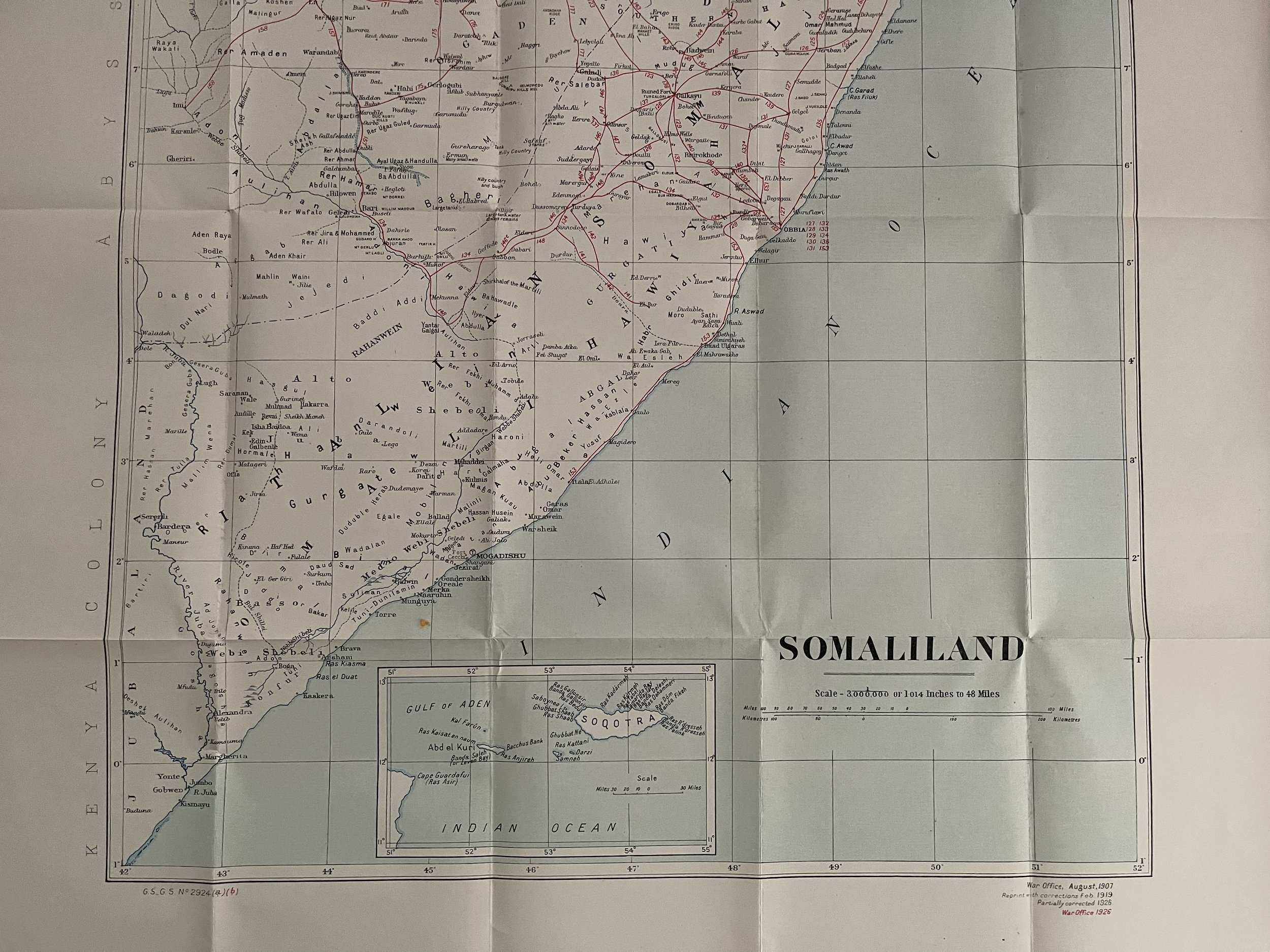
War Office Map of British Somaliland and Sokatra - Creator: Great Britain. Foreign Office.- Historical Section. 1926
Nice clean map in excellent condition for its age. Created by the Great Britain. Foreign Office. Historical Section.
This map marks out the boundaries with Italian Somalia, and has strategic importance. In 1924 the British ceded northern Jubaland to the Italians in return for their support during the Great War, and it was duly incorporated into Italian Somaliland in 1926. In the same year, Britain attempted to force Abyssinia to accept construction of a major water project intended to irrigate the Anglo-Egyptian Sudan, while the Italians attempted to exploit local railway links for commercial gain. In response to Ras Tafari's appeal to the League of Nations, the British scheme was dropped.
Code : A794
Cartographer : Cartographer / Engraver / Publisher: Creator: Great Britain. Foreign Office. Historical Section.
Date : Publication Place / Date - London 1926
Size : Sheet size: 49.5 x 63 cm
Availability : Available
Type - 98 years old - Vintage - Almost Genuine Antique
Grading - A+
Tracked postage, in tubular casement. Please contact me for postal quotation outside of the UK.