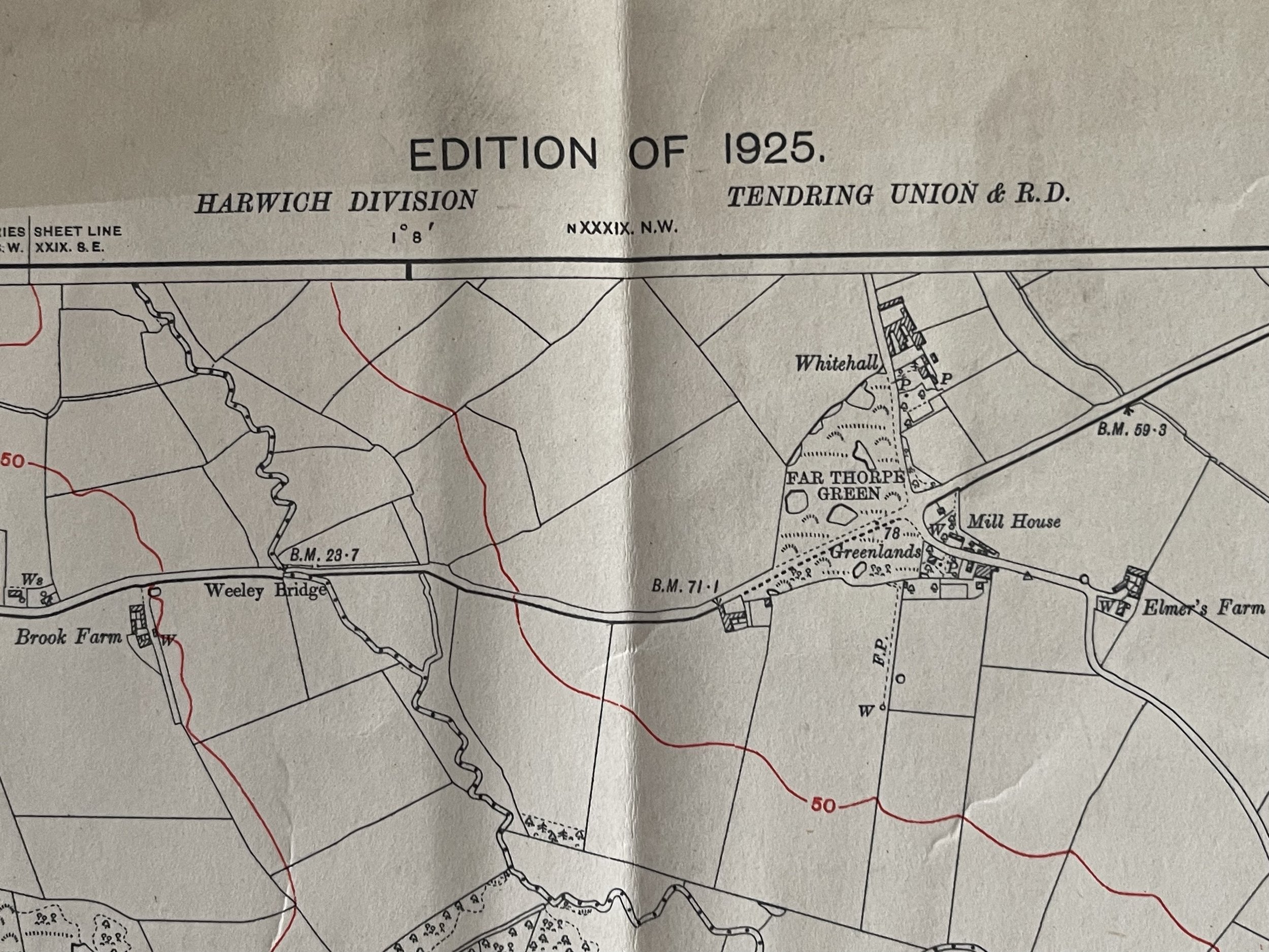
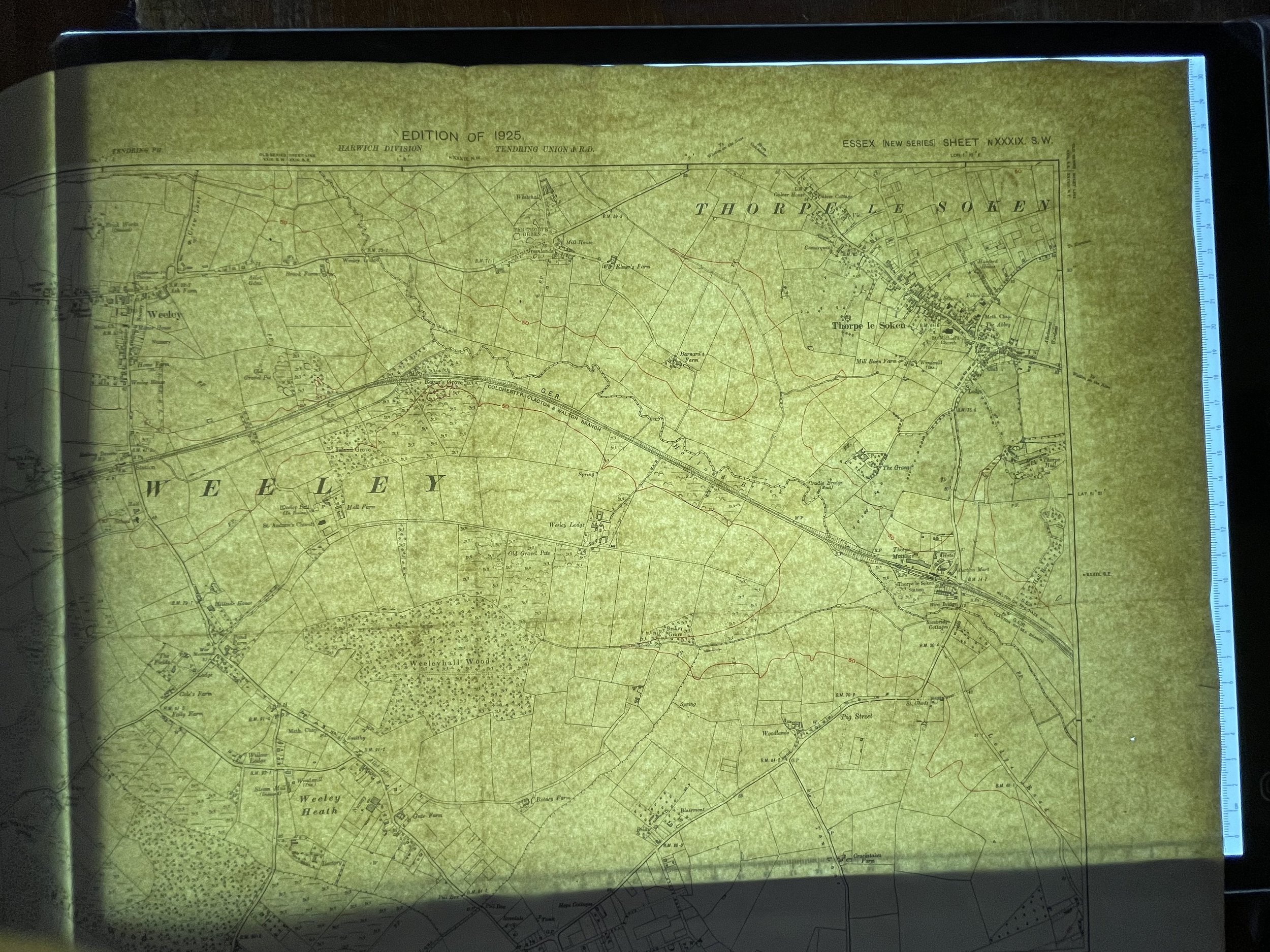
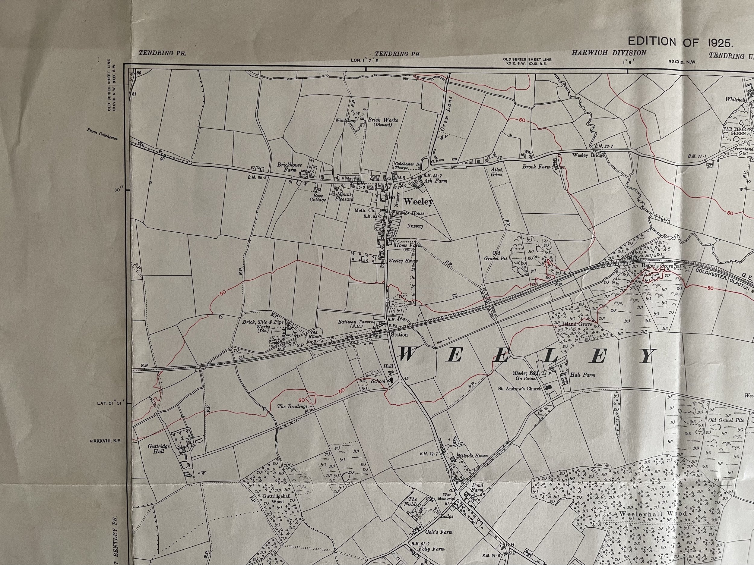
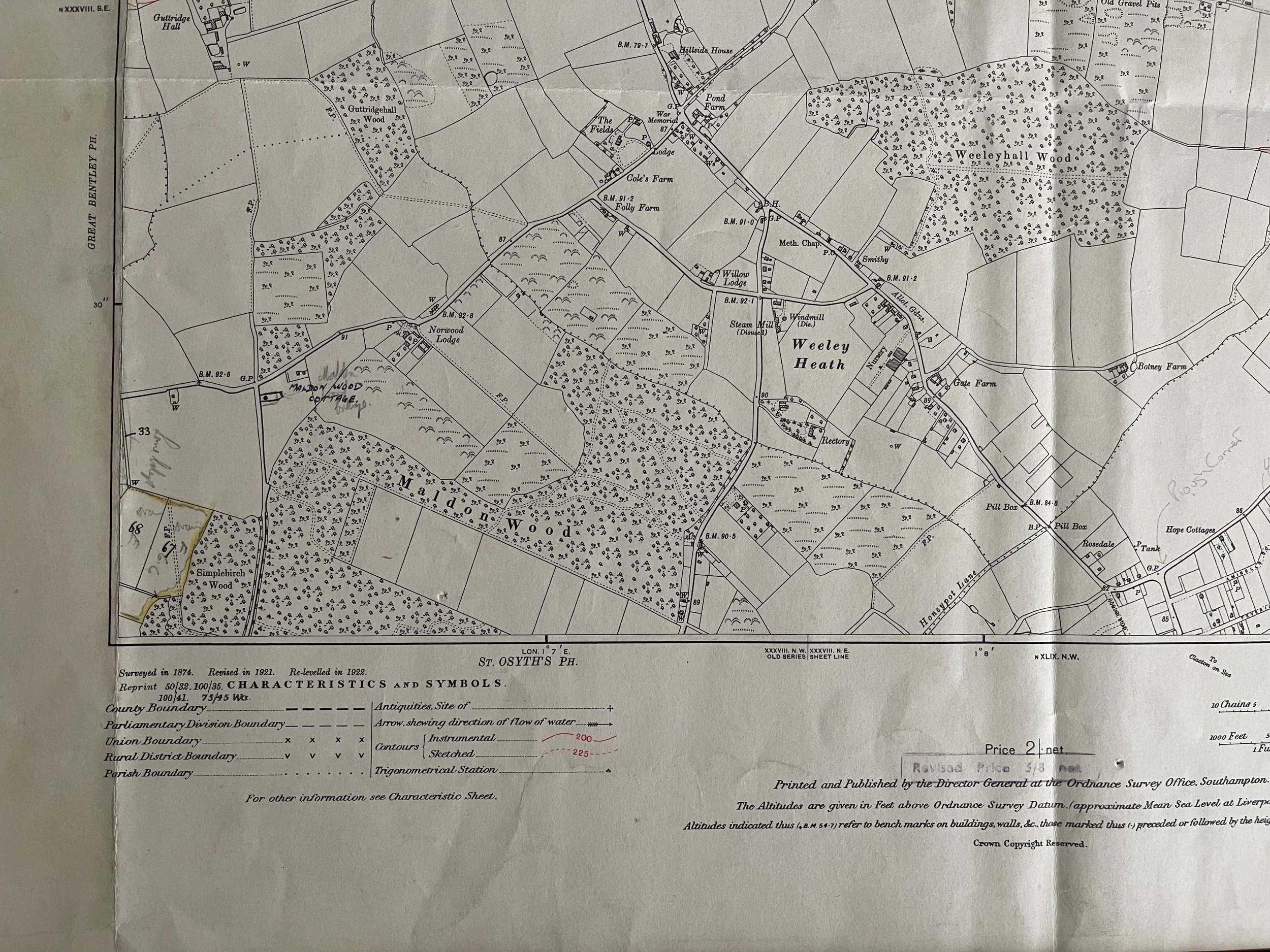
Weeley Little Clacton & Thorpe Le Soken - Ordnance Survey - 1925
Parish map - Essex new series - Ordnance Survey - 1925
Pre WW2 - A highly detailed map showing all, or parts of Weeley Little Clacton & Thorpe Le Soken
A highly detailed map showing most roads, streets and lanes are named.If present, may also show: schools, workhouses, archaeological finds, mines, quarries, factories, breweries, churches, wells, footpaths, woods, rivers, signposts, letterboxes, electricity pylons etc.
Very detailed map on thick parchment, grading and pricing commensurate.
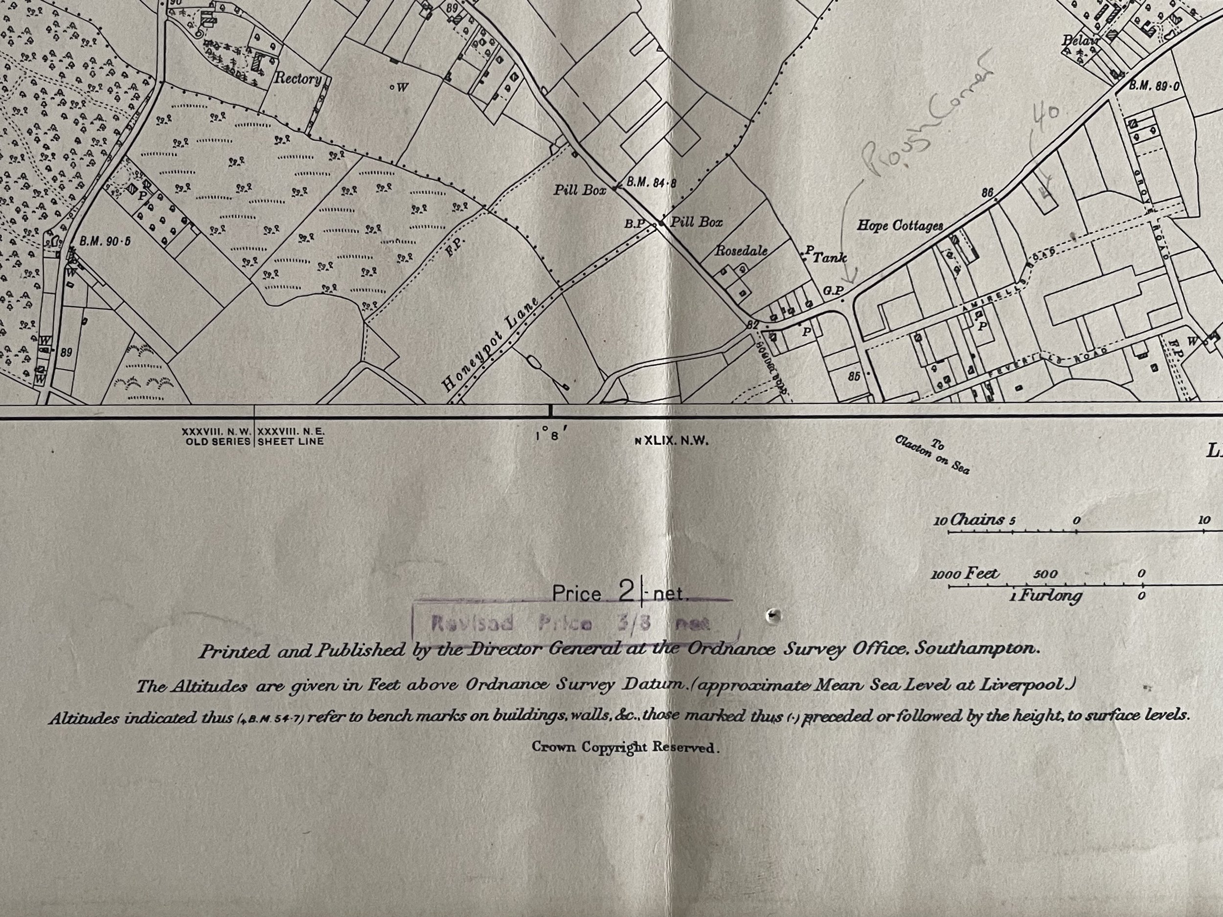
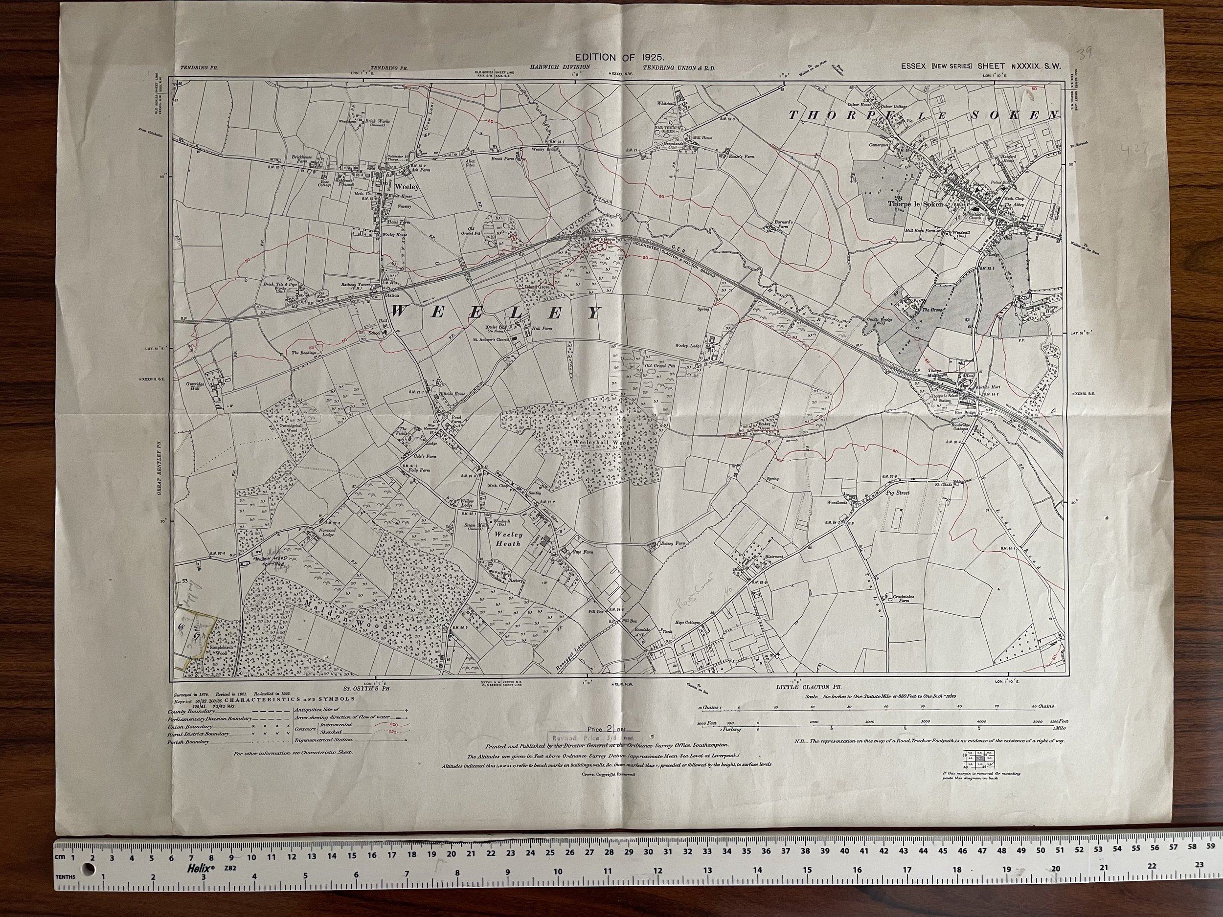
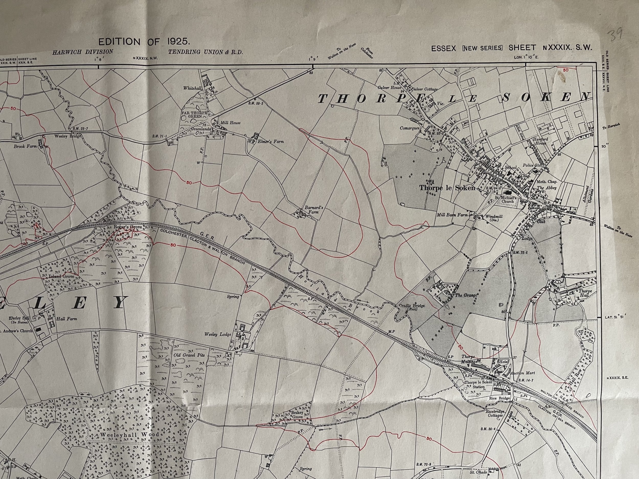
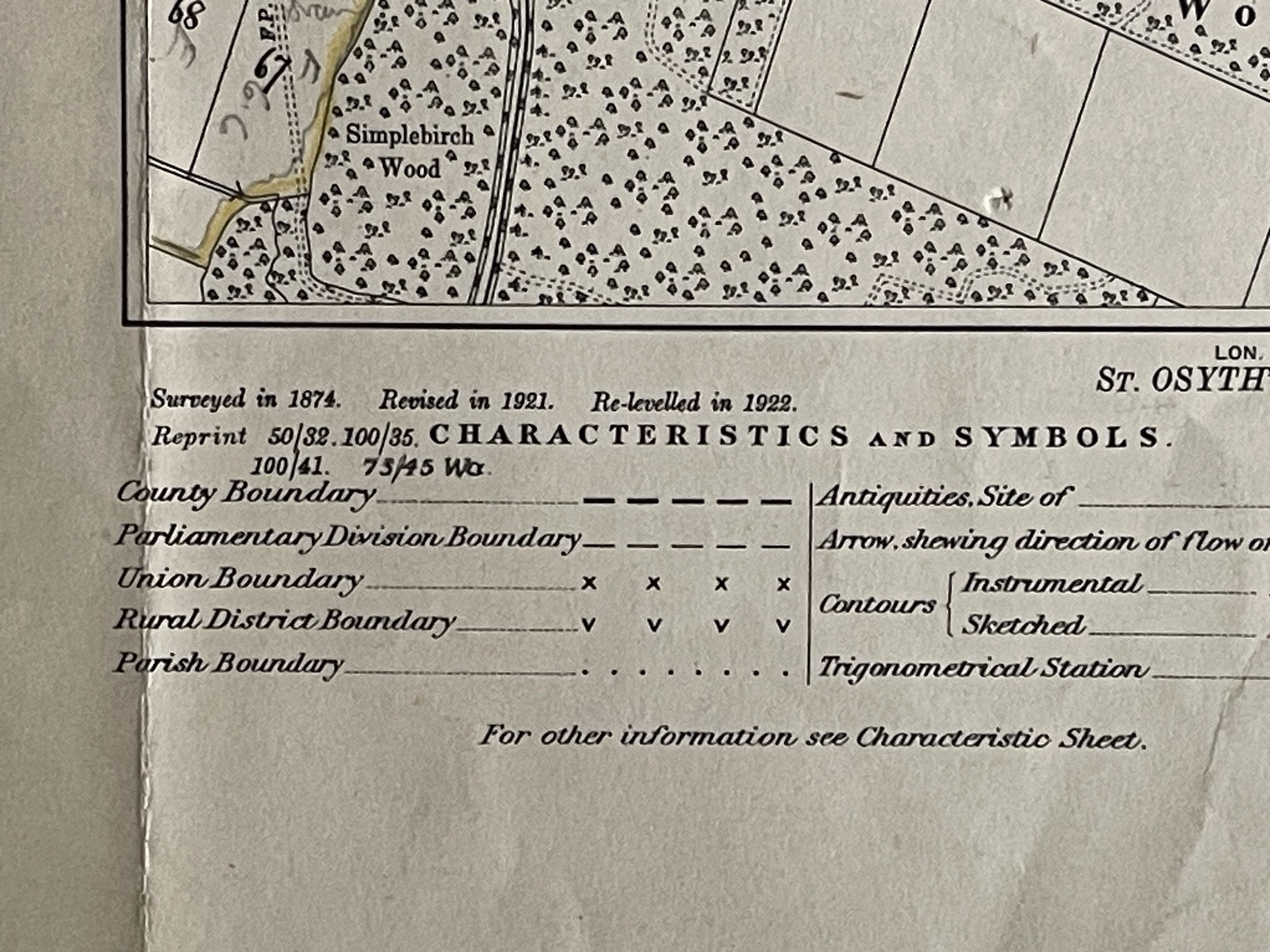
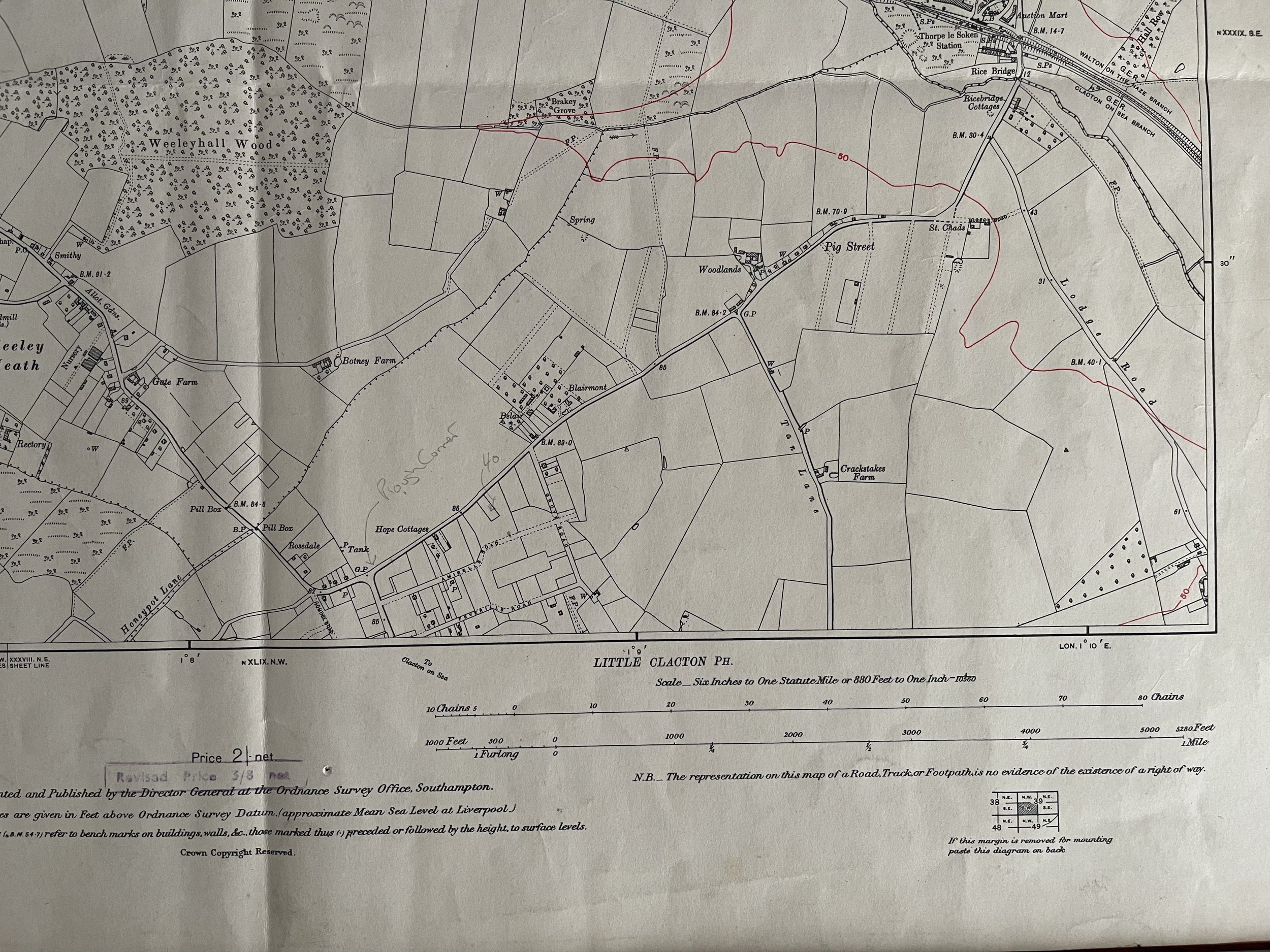
Code : A412
Cartographer : Cartographer / Engraver / Publisher: Ordnance Survey
Date : Publication Place / Date - 1925
Size : Sheet size: Image Size: 57 X 42.5 cm
Availability : Available
Type - Genuine - Antique
Grading A-
Where Applicable - Folds as issued. Light box photo shows the folio leaf centre margin hinge ‘glue’, this is not visible otherwise.
Tracked postage, in casement. Please contact me for postal quotation outside of the UK.