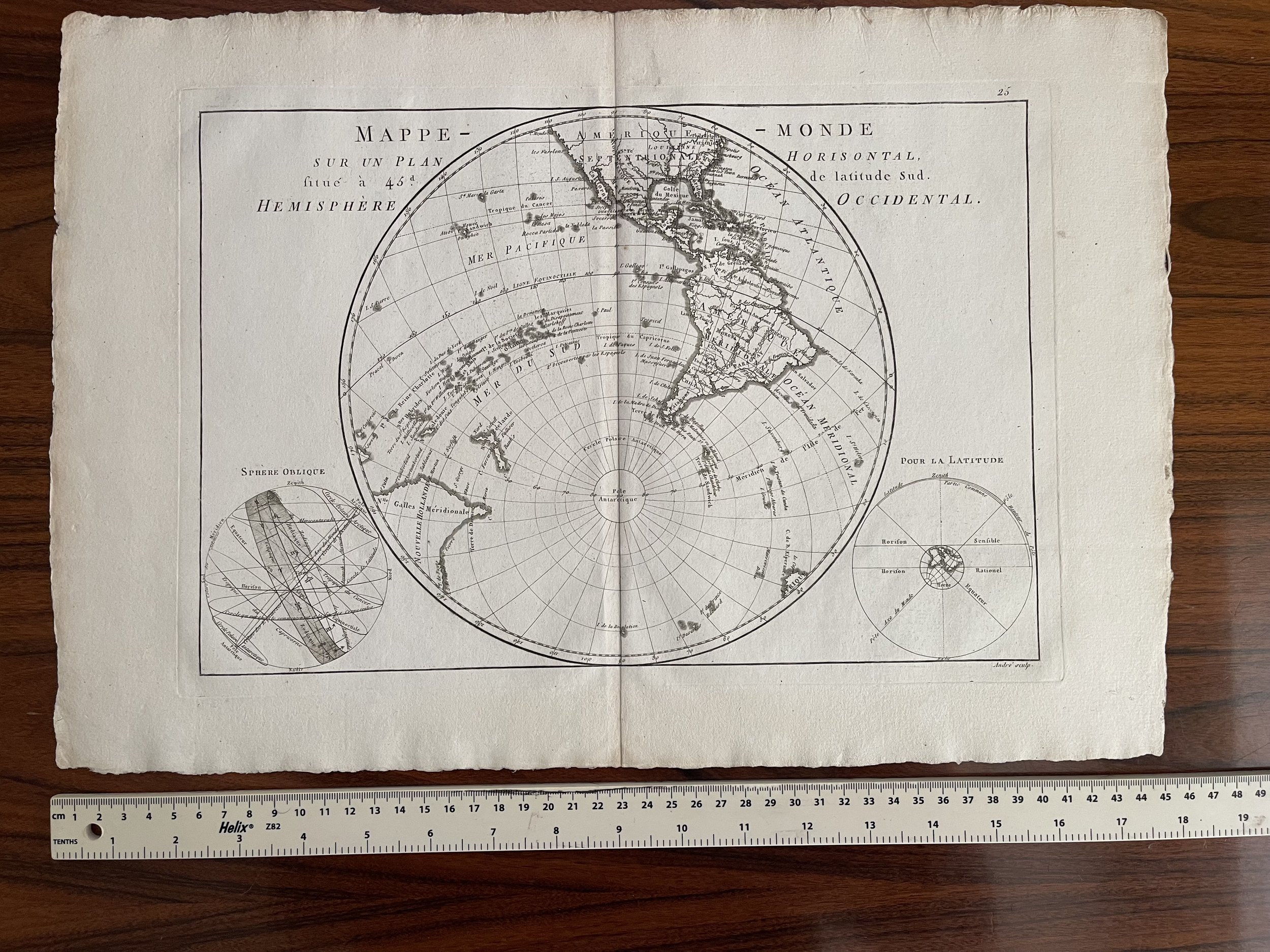

Western Hemisphere Mappe Monde sur un Plan Horisontal, Situe a 45d. de Latitude Sud. Hemisphere Occidental - Rigobert Bonne - 1770
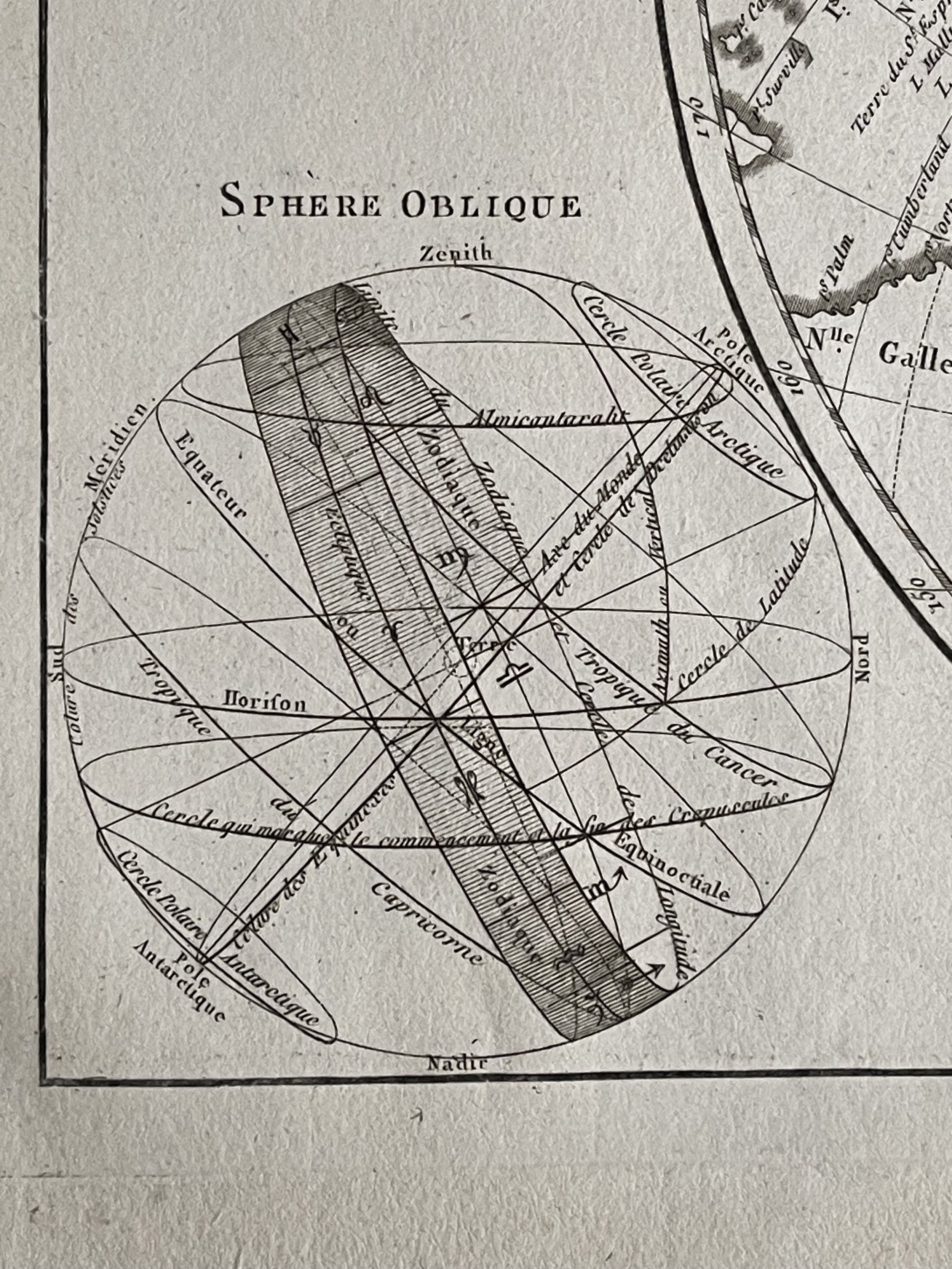
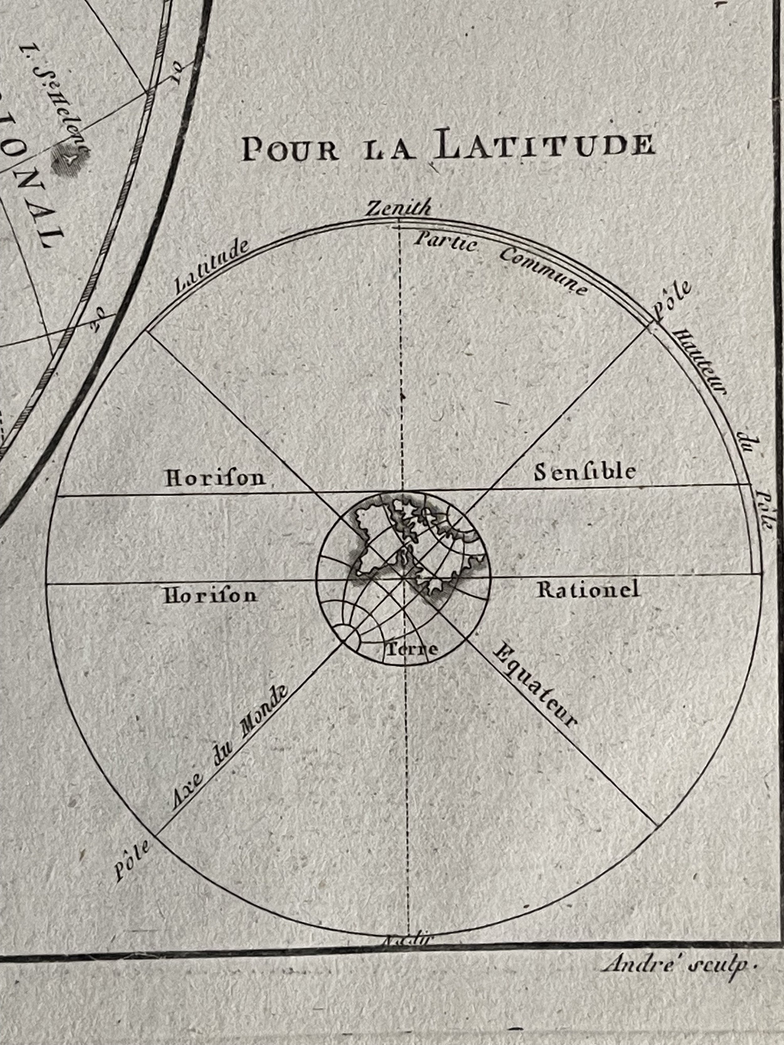
Detailed map showing the Southwestern Hemisphere, including most of America, Hawaii, New Zealand, Australia and the South Pole. Includes decorative celestial models in the corners.
Rigobert Bonne (1727-1794) was an influential French cartographer of the late-eighteenth century. Born in the Lorraine region of France, Bonne came to Paris to study and practice cartography. He was a skilled cartographer and hydrographer and succeeded Jacques Nicolas Bellin as Royal Hydrographer at the Depot de la Marine in 1773. He published many charts for the Depot, including some of those for the Atlas Maritime of 1762. In addition to his work at the Depot, he is best known for his work on the maps of the Atlas Encyclopedique (1788) which he did with Nicholas Desmarest. He also made the maps for the Abbe Raynals’ famous Atlas de Toutes Les Parties Connues du Globe Terrestre (1780).
More than his individual works, Bonne is also important for the history of cartography because of the larger trends exemplified by his work. In Bonne’s maps, it is possible to see the decisive shift from the elaborate decorations of the seventeenth century and the less ornate, yet still prominent embellishments of the early to mid-eighteenth century. By contrast, Bonne’s work was simple, unadorned, and practical. This aesthetic shift, and the detail and precision of his geography, make Bonne an important figure in mapping history.
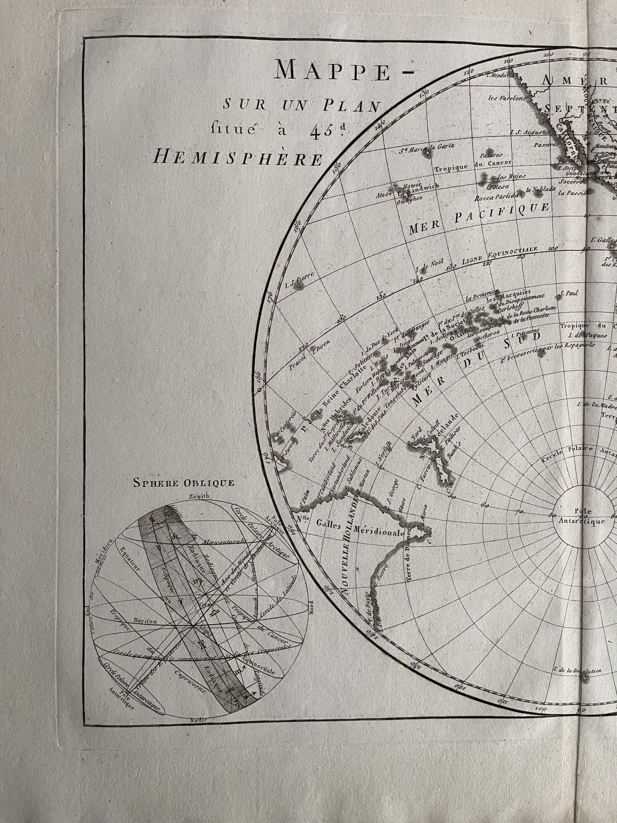
Code : A413
Cartographer : Cartographer / Engraver / Publisher: Rigobert Bonne
Date : Publication Place / Date - Paris 1770 Approx
Size : Sheet size: 13.5 x 9.5 inches
Availability : Available
Type - Genuine Antique
Grading - A
Tracked postage. in tubular casement. Please contact me for postal quotation outside of the UK.