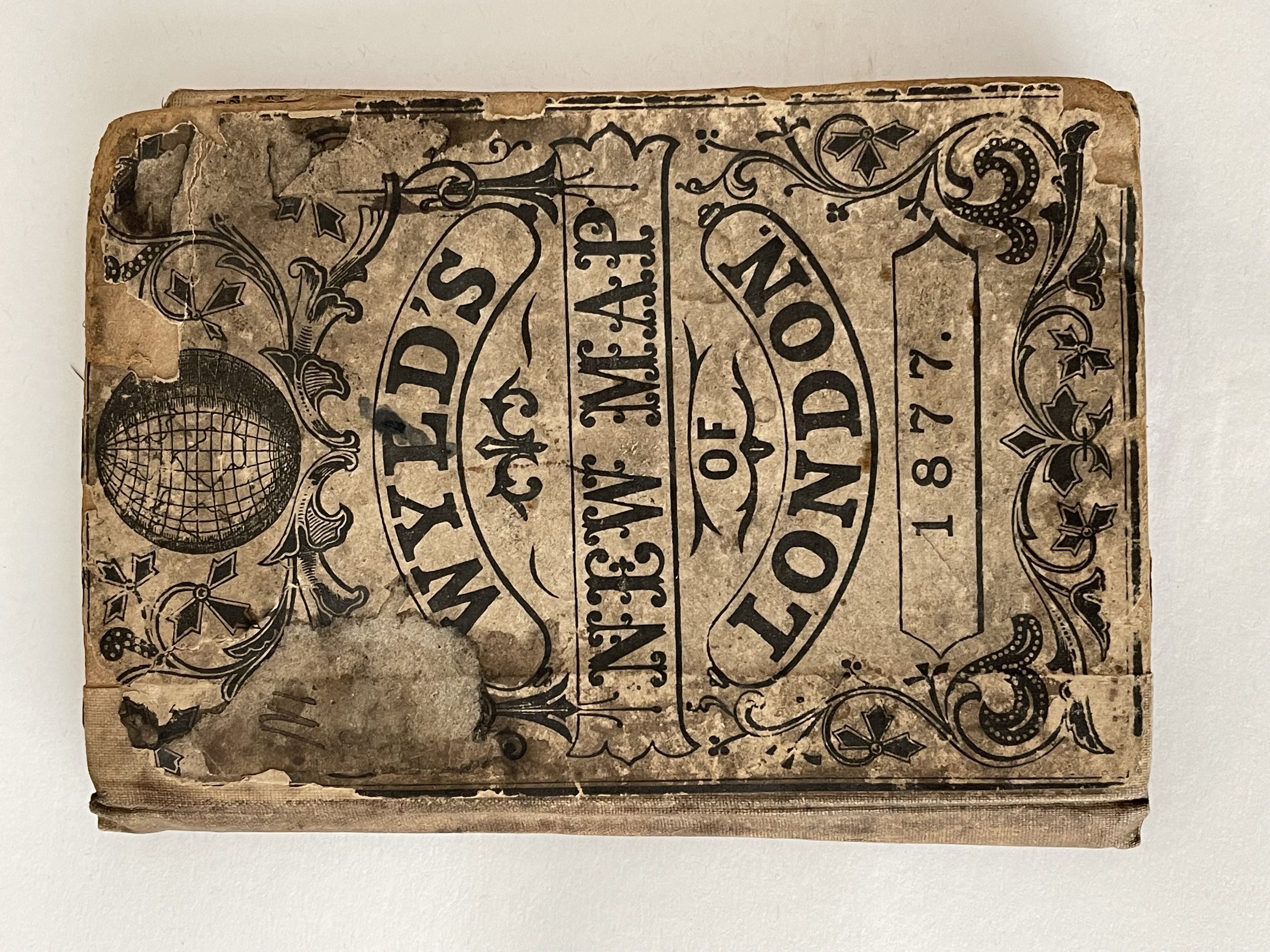
Wyld's New Map of London - James Wyld - 1877 - Scarce
Incredibly detailed, rare and collectable map of London from 1877. A scarce survivor from the era.
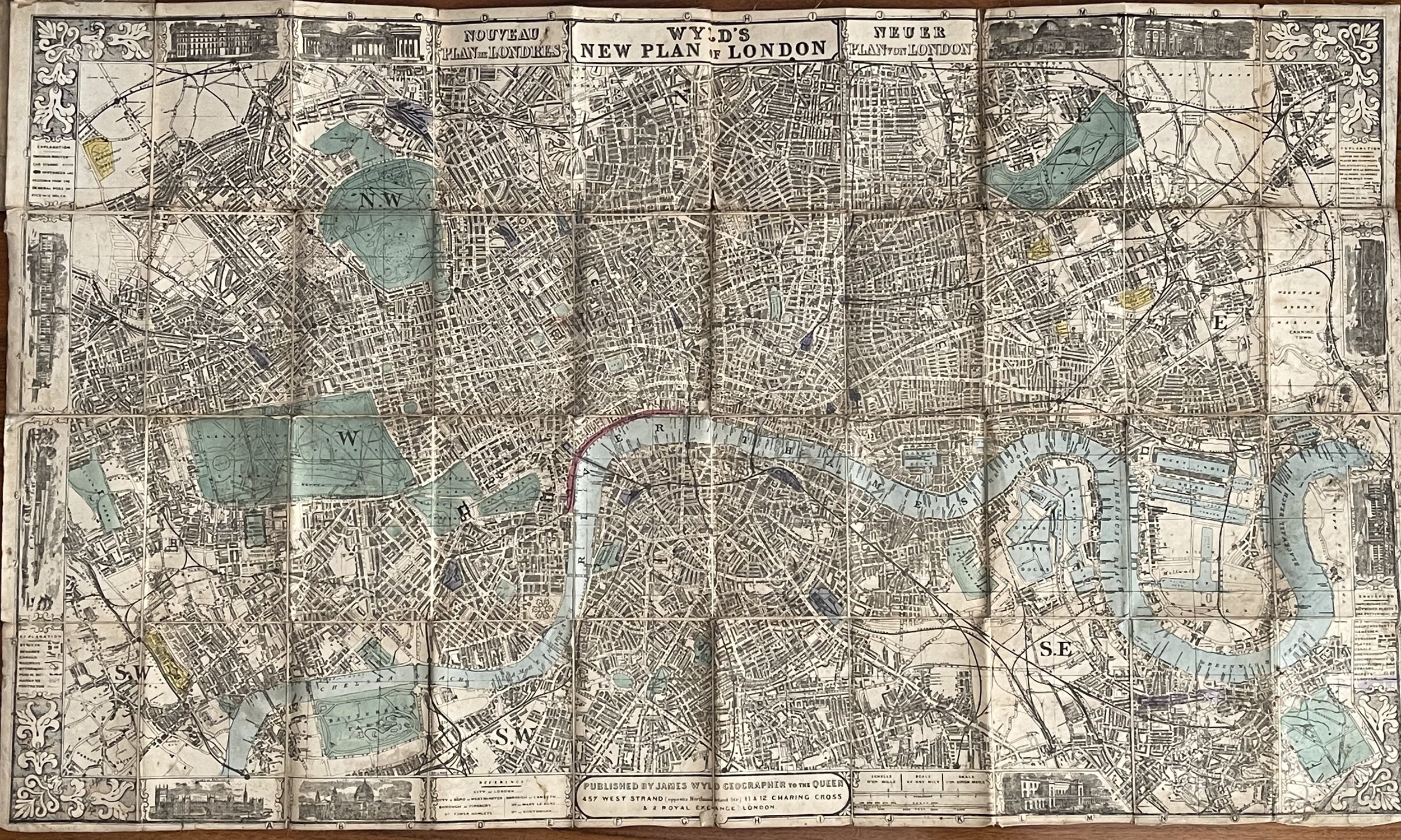
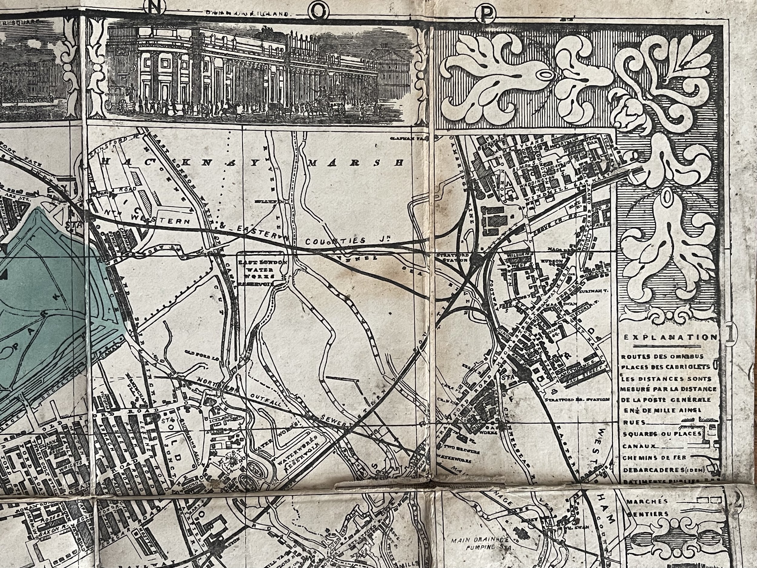
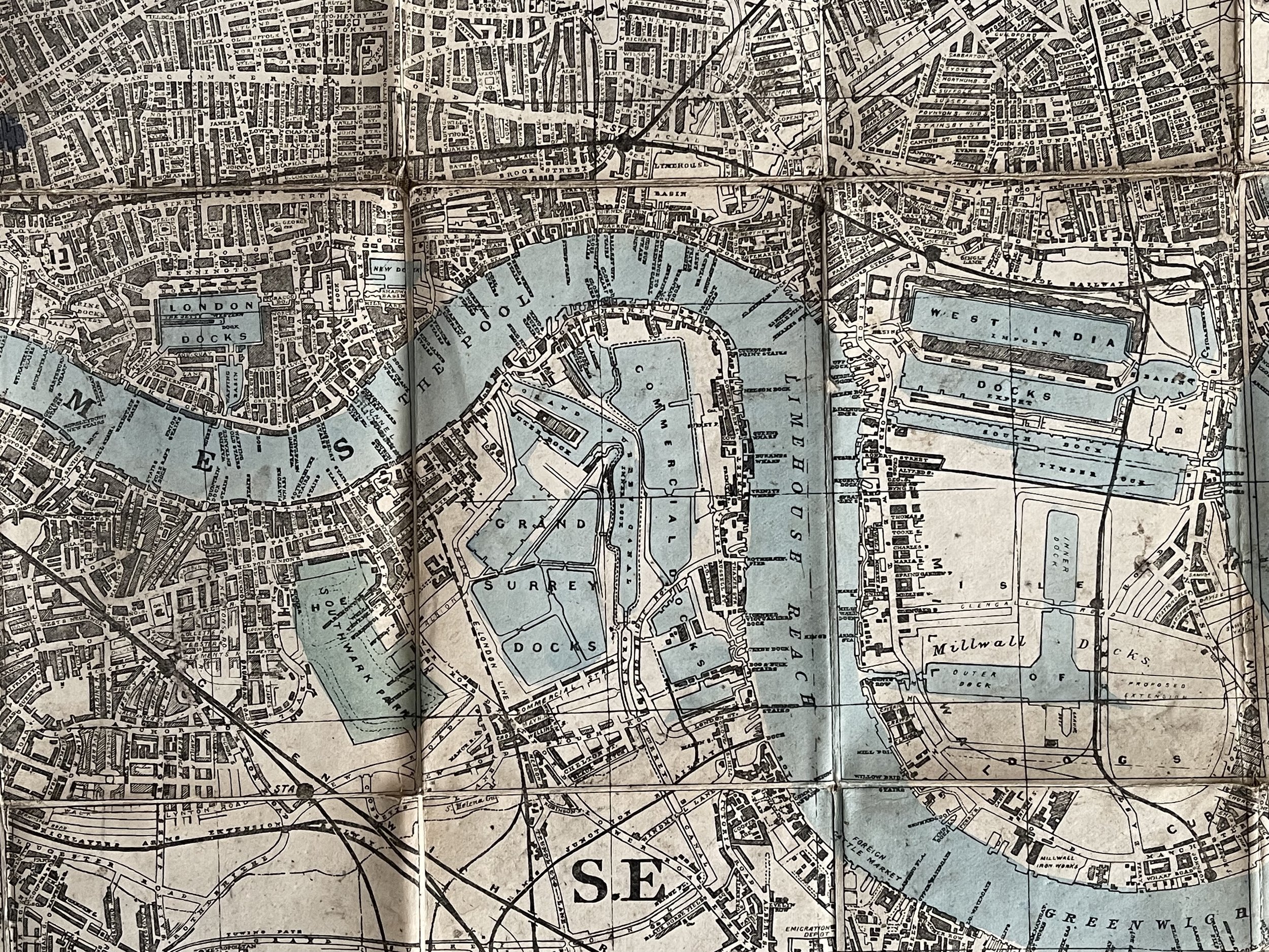
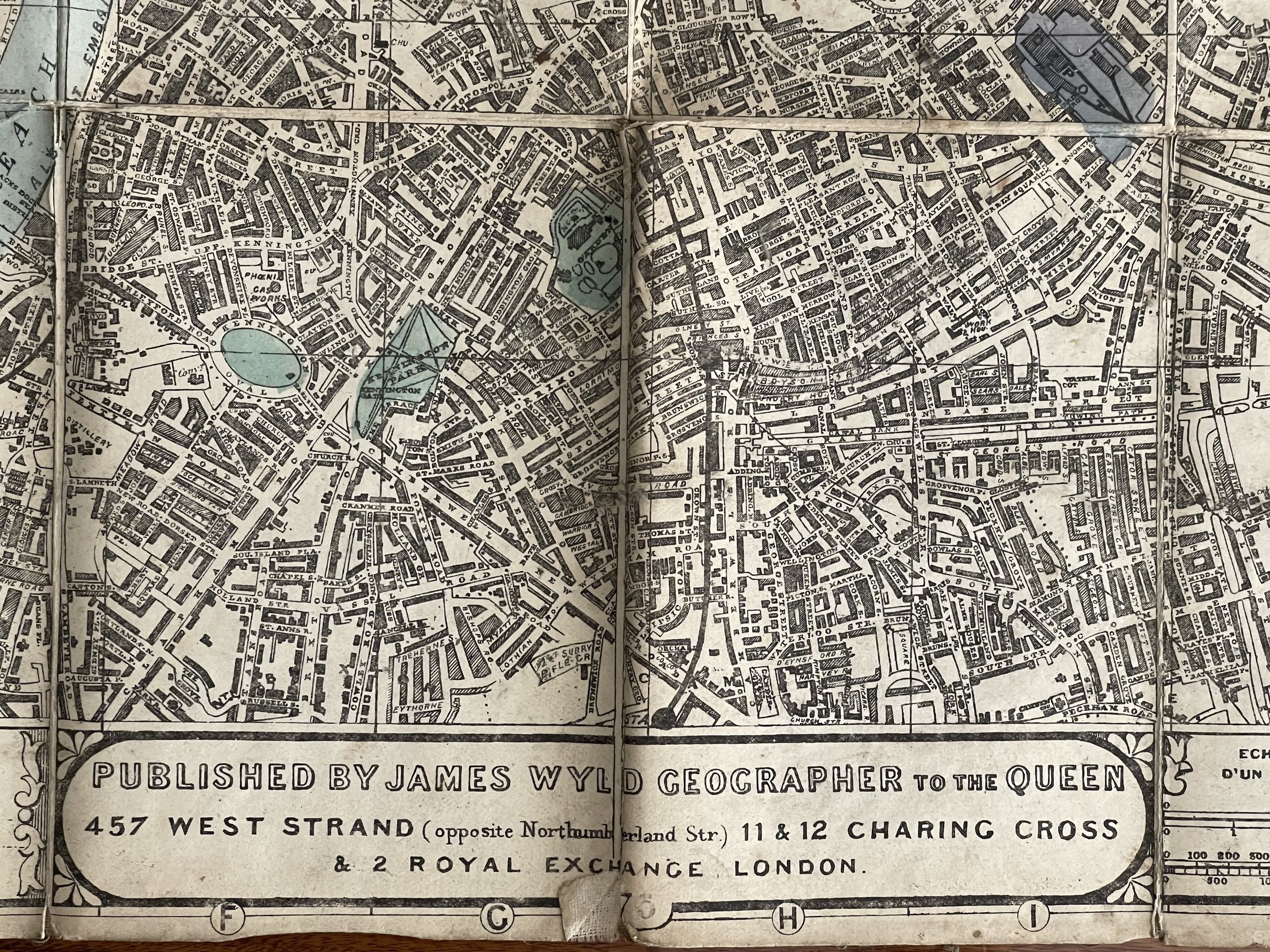
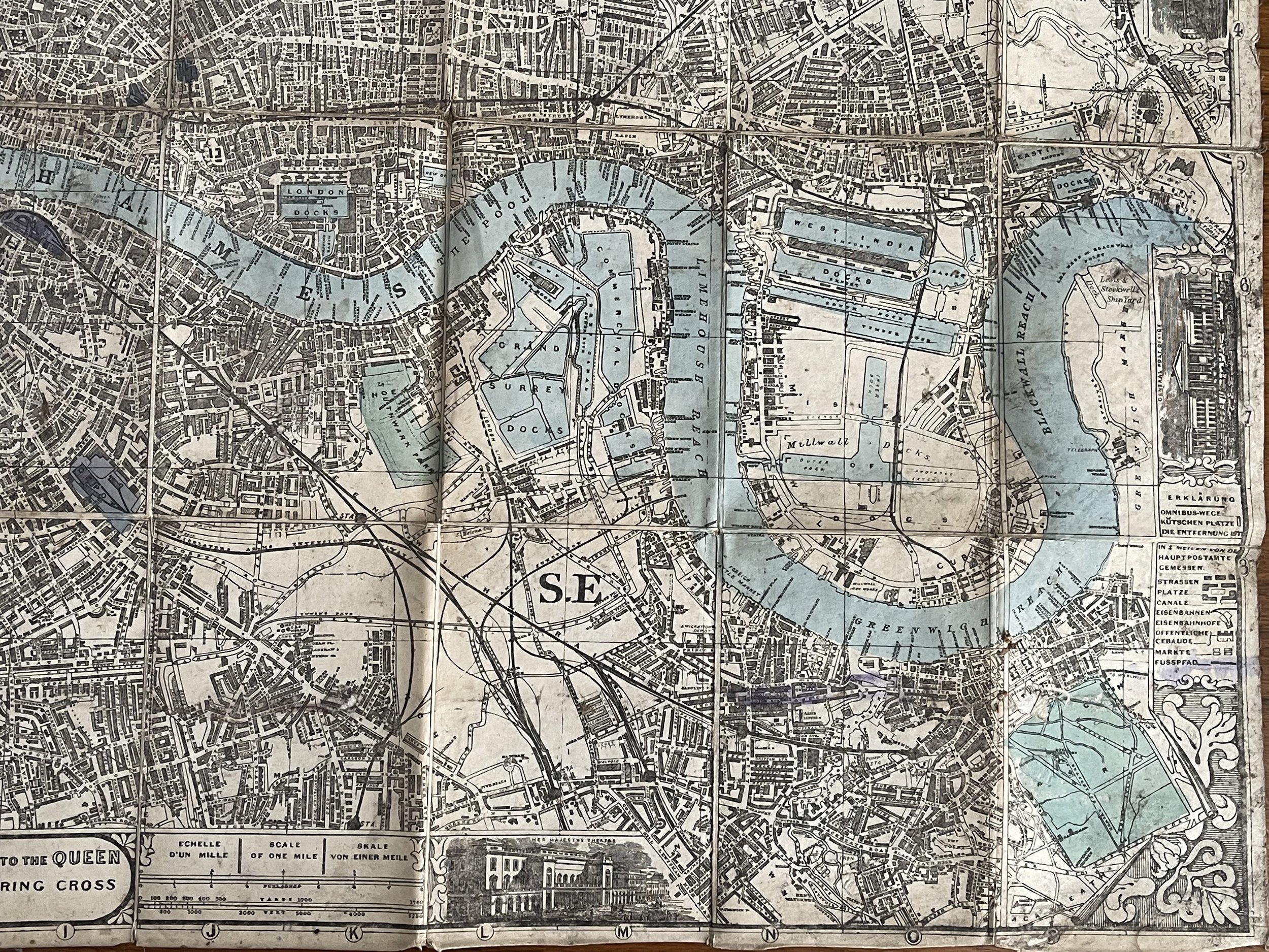
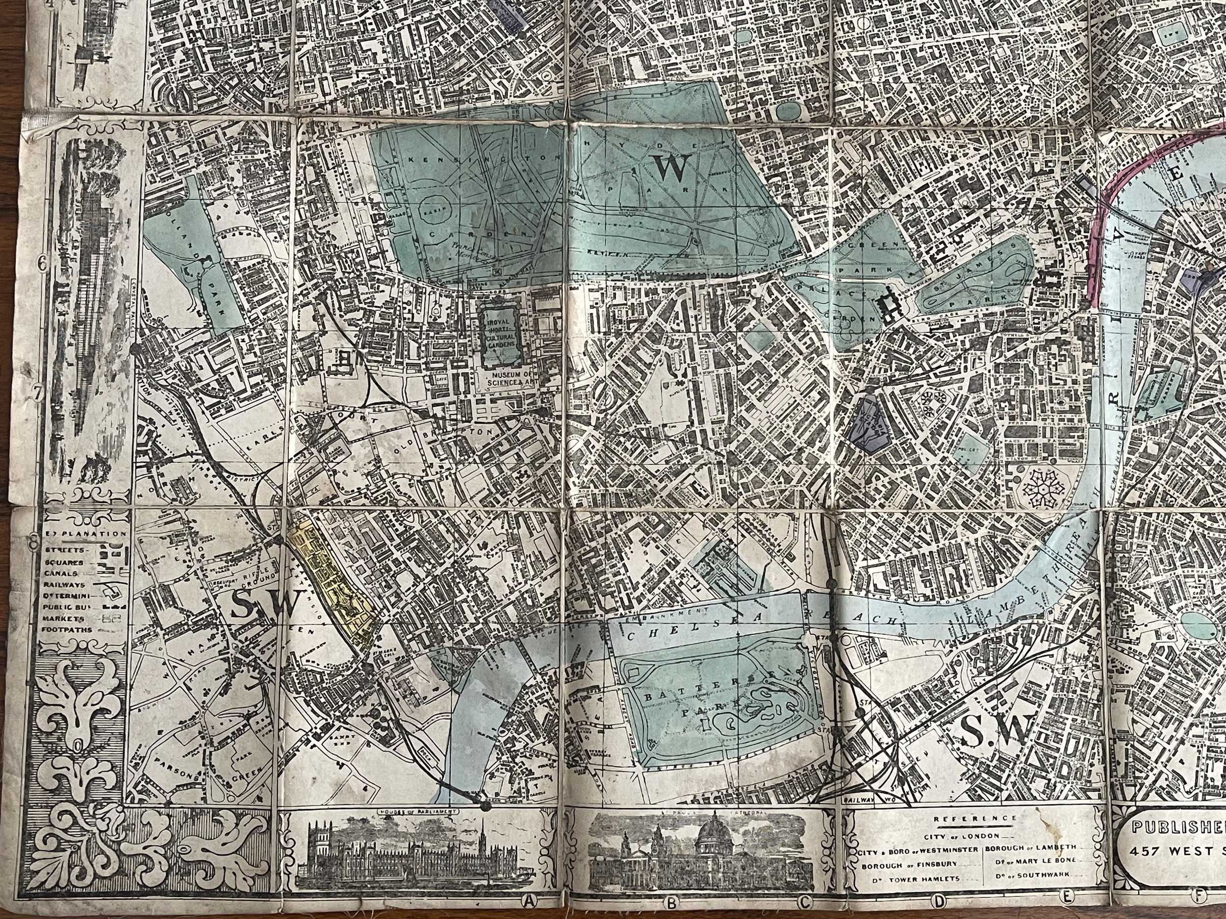
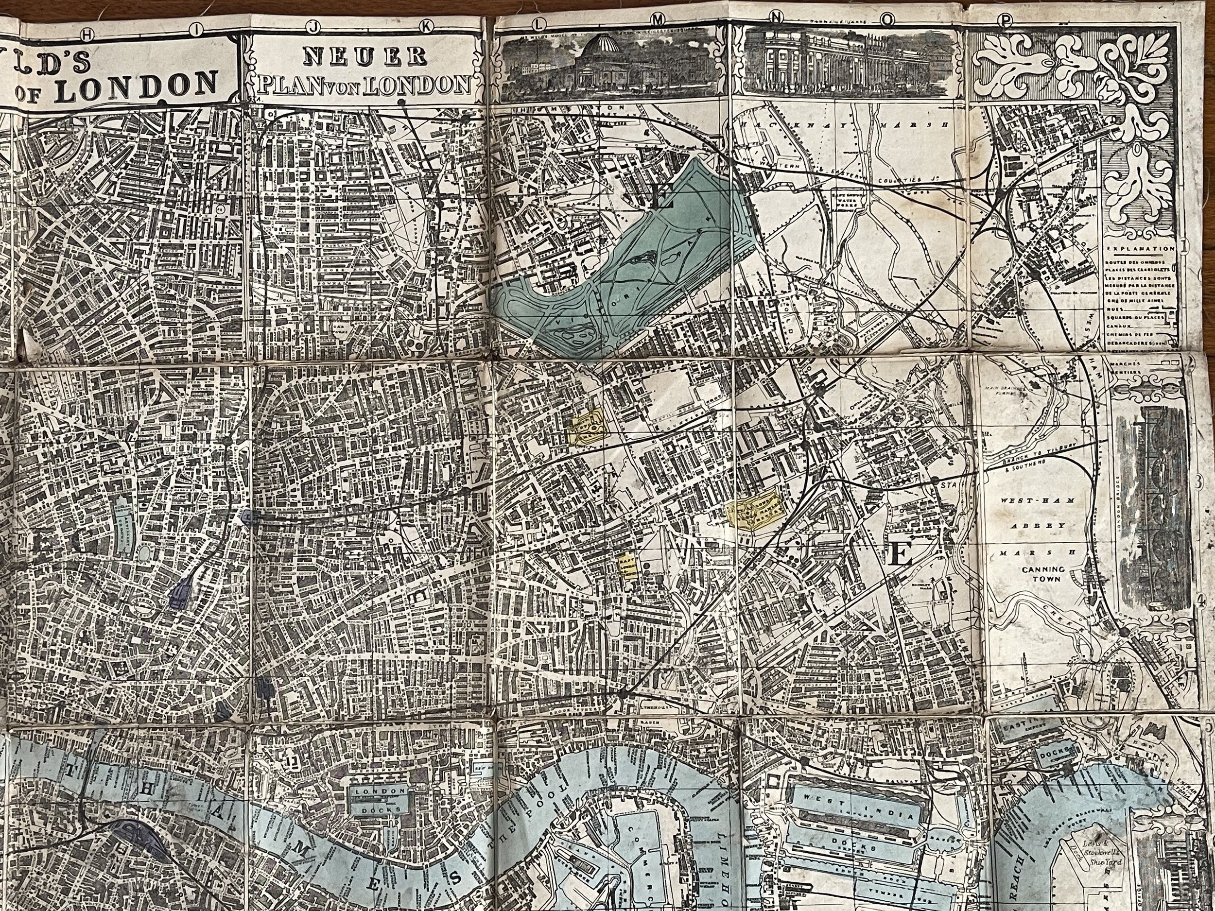
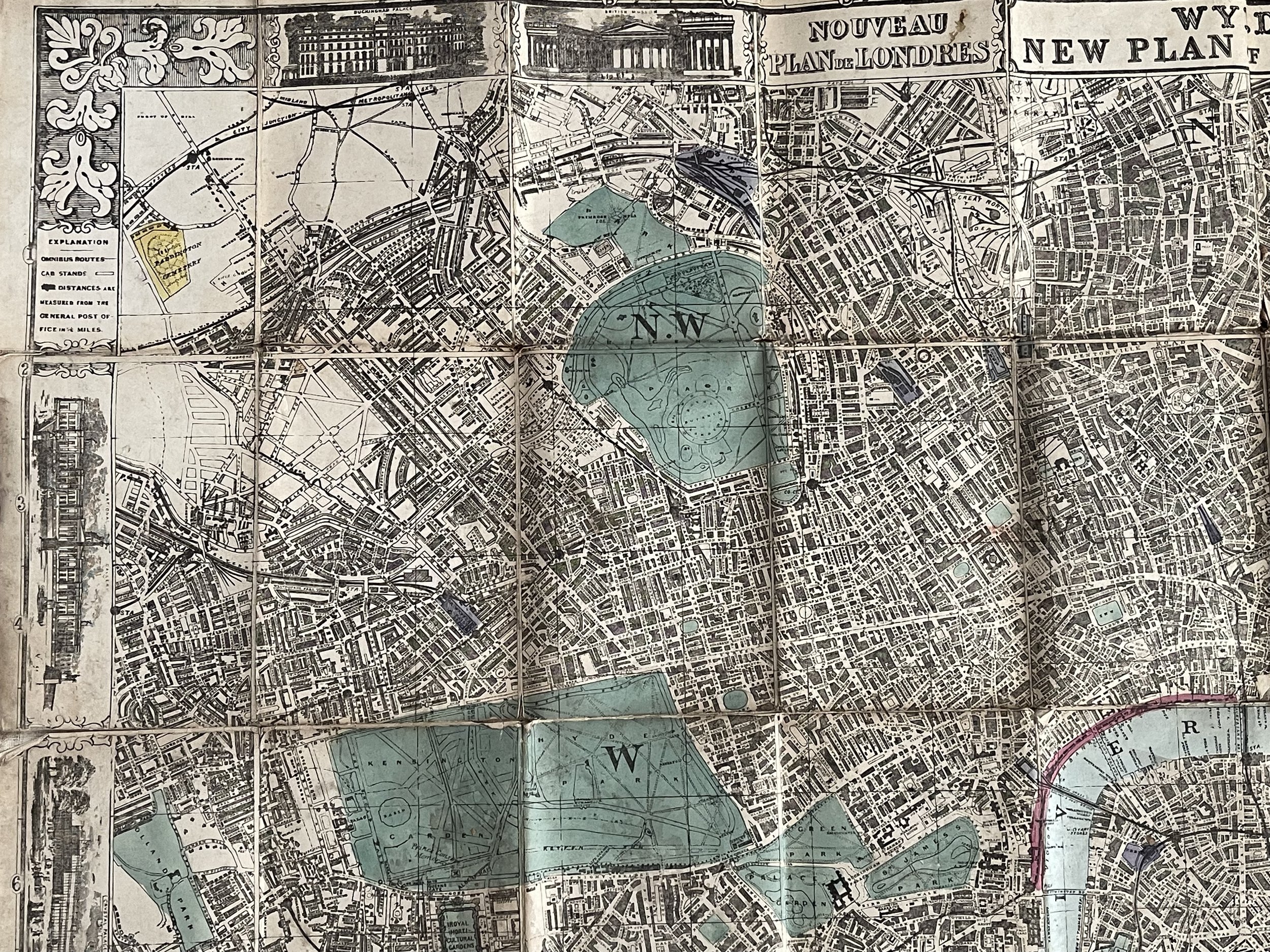
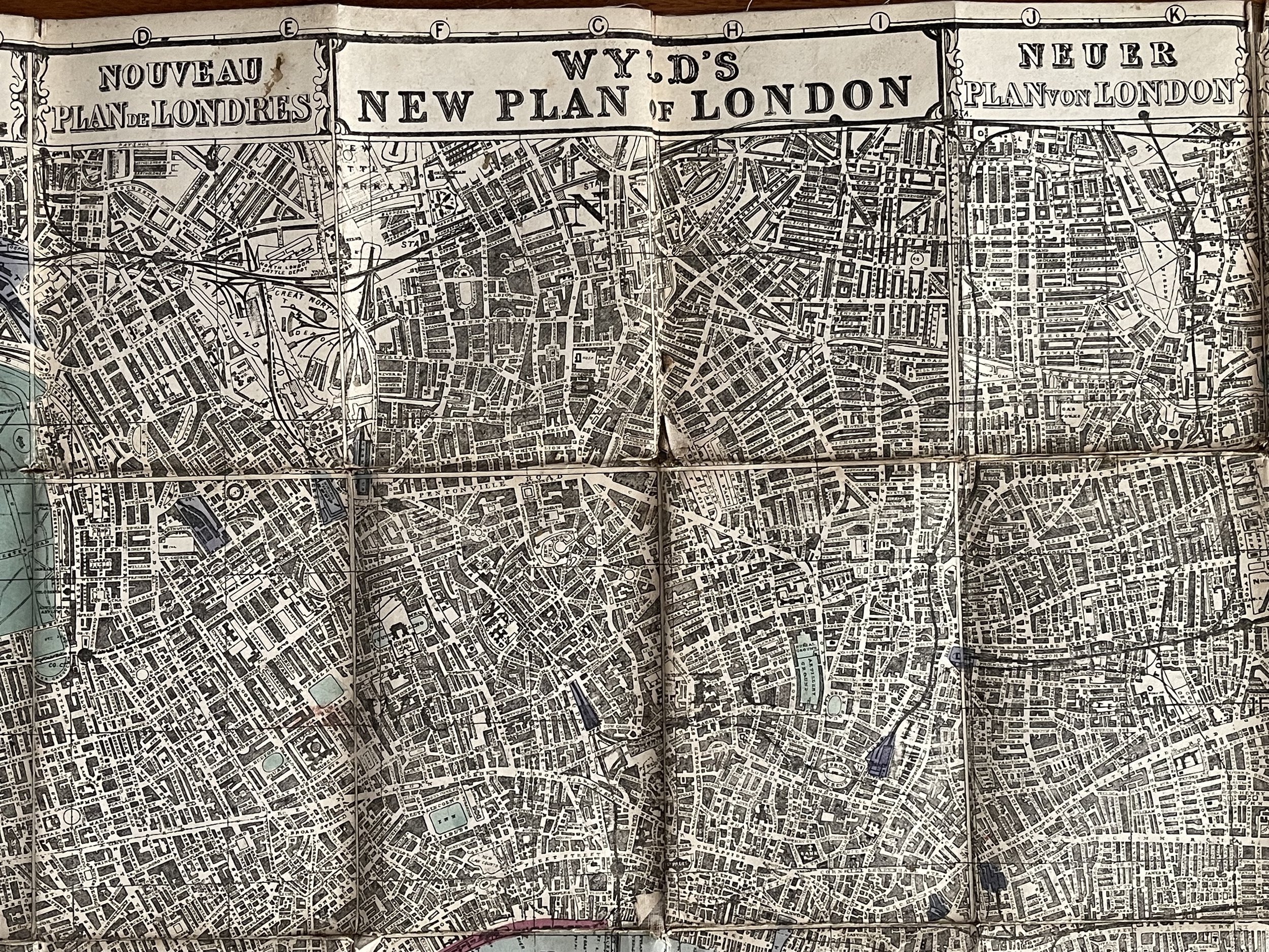
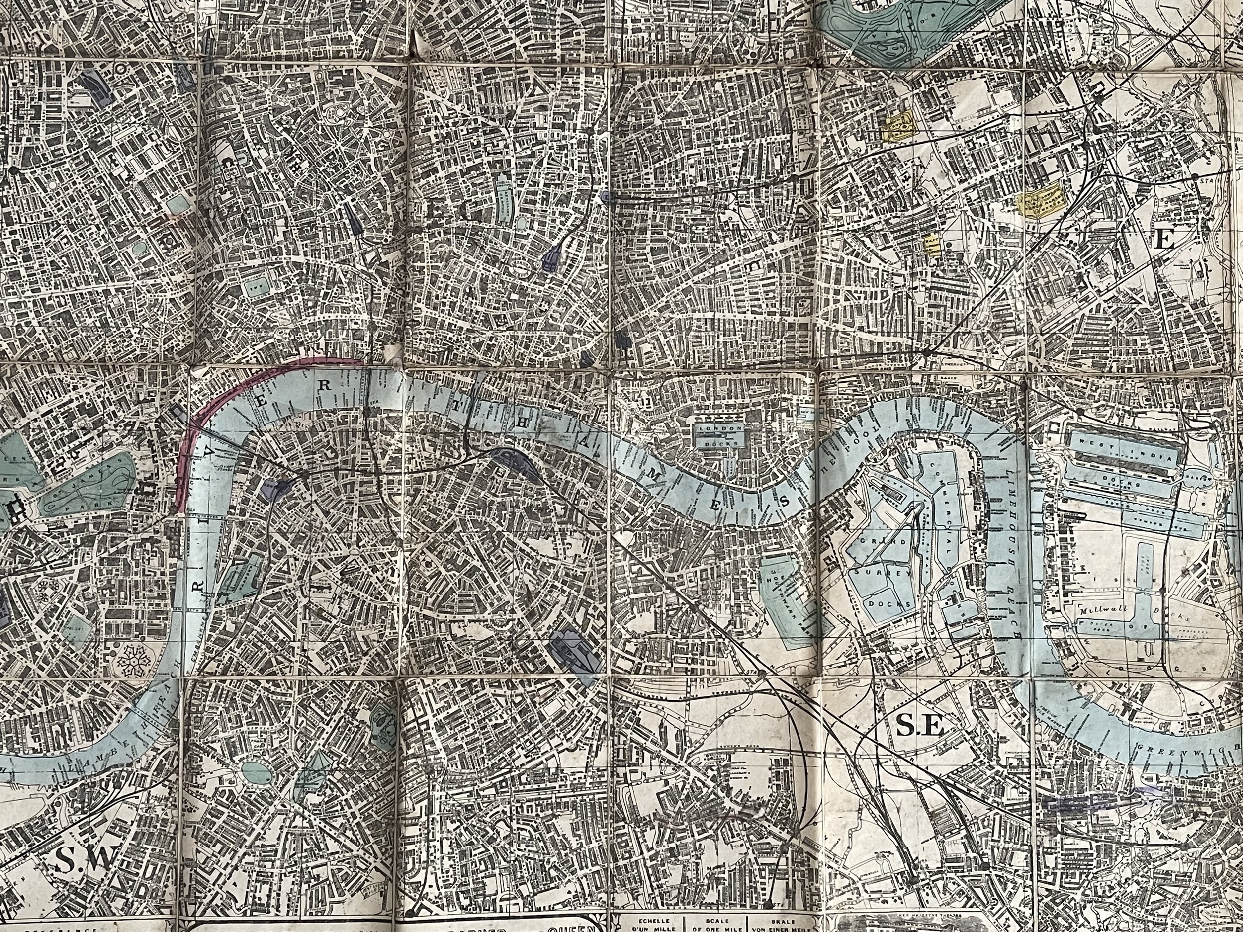
A thoroughly decorative 1877 plan or map of London, England by James Wyld. Cantered on Blackfriars Bridge, the map coves central London from Islington to North Brixton and from the East India Docks to Holland Park. Roads, parks, rail lines, important buildings, and neighbourhoods are noted. To the left and right of centre, the English language title is repeated in French and German, respectively.
This map is notable for its remarkable border, with floral corner flourishes and vignette illustrations of London landmarks, including, among others, Buckingham Palace, the British Museum, the Bank of England, London Bridge, and the Houses of Parliament.
Among the border vignettes, in a place of prominence just to the right of the title, can be found a self-promotional view entitled, 'Mr. Wyld's Model of the Earth in Leicester Square.' This is Wyld's Great Globe, an attraction built in 1851, the year this map was issued, in Leicester Square, which was then a private pleasure garden. It consisted of specially construction dome containing great sphere approximately 19 meters in diameter. On the interior walls of the sphere was a plaster of Paris scale model of the Earth. Scaffolding was erected at multiple levels so viewers could examine various locations in greater detail. The globe was a great success throughout its first year, but in subsequent years interest declined. The globe was deconstructed and sold for scrap in 1862. It was not until the 1935 construction of the Mapparium at the Mary Baker Eddy Library in Boson that a larger globe was constructed.
The map was printed in 40 sections that were clearly designed to be dissected and mounted on linen, an event where here, apparently never occurred. This map was issued in 1877. There were 15 additional editions from 1851 with numerous updates and revisions to about 1877.
Wyld I, James (1790 - 1836) and James Wyld II (1812 - 1887)
James Wyld I (1790 - 1836) and his son James Wyld II (November 20, 1812 - 1887) were the principles of English mapmaking dynasty active in London during much of the 19th century. The elder Wyld was a map publisher under William Faden and did considerable work on the Ordinance Survey.
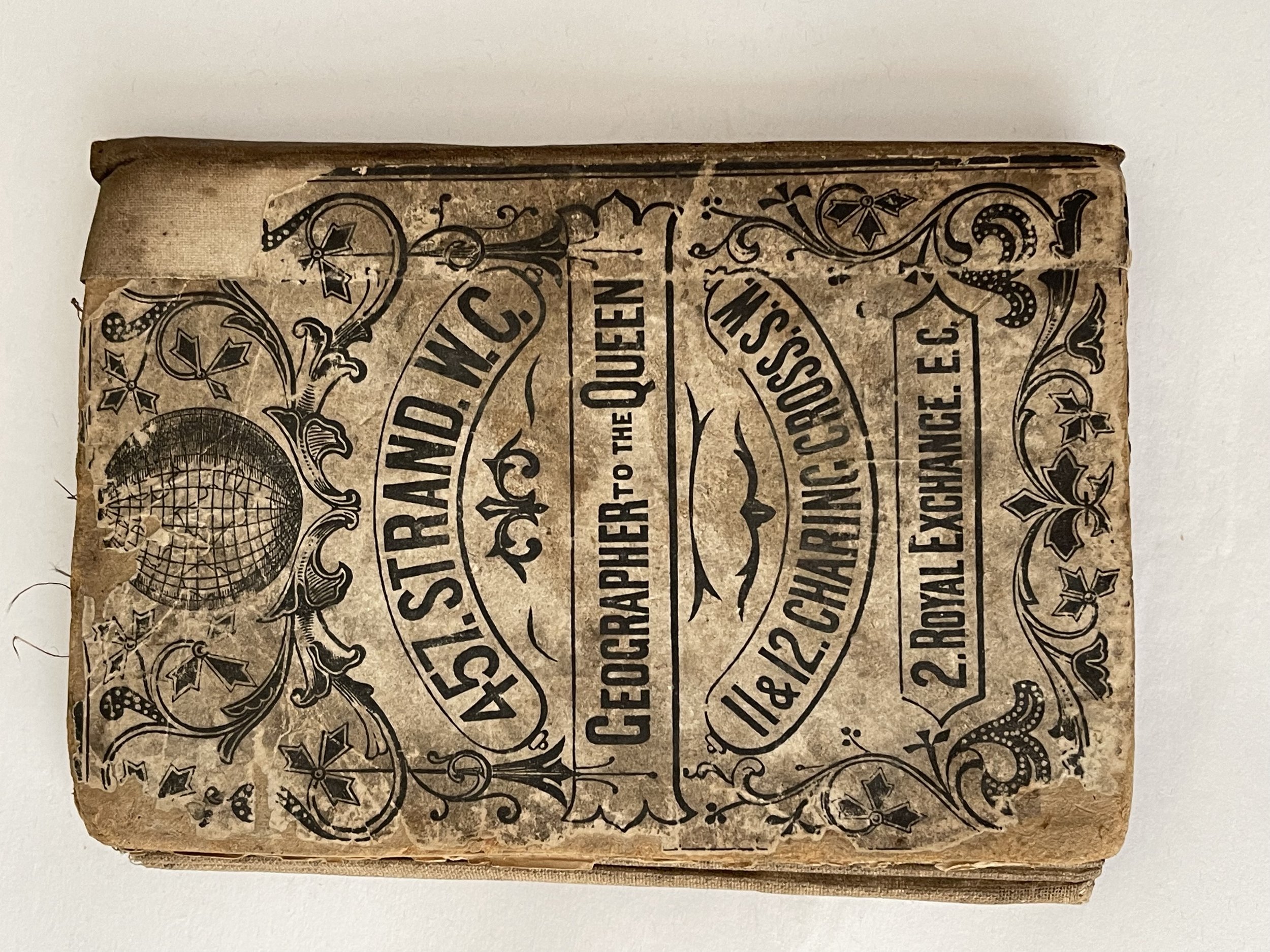
On Faden's retirement, Wyld took over Faden's workshop acquiring many of his plates. Wyld's work can often be distinguished from his son's maps through his imprint, which he signed as 'Successor to Faden'. Following in his father's footsteps the younger Wyld joined the Royal Geographical Society in 1830 at the tender age of 18. When his father died in 1836, James Wyld II was prepared to fully take over and expand his father's considerable cartographic enterprise. Like his father and Faden, Wyld II held the title of official Geographer to the Crown, in this case, Queen Victoria.
In 1852 he moved operations from William Faden's old office at Charing Cross East (1837 - 1852) to a new larger space at 475 Strand. Wyld II also chose to remove Faden's name from all of his updated map plates. Wyld II continued to update and republish both his father's work and the work of William Faden well into the late 1880s.
One of Wyld's most eccentric and notable achievements is his 1851 construction of a globe 19 meters (60 feet) in diameter in the heart of Leicester Square, London. In the 1840s Wyld also embarked upon a political career, being elected to parliament in 1847 and again in 1857. He died in 1887 following a prolific and distinguished career. After Wyld II's death, the family business was briefly taken over by James John Cooper Wyld (1844 - 1907), his son, who ran the firm from 1887 to 1893 before selling the business to Edward Stanford. All three Wylds are notable for producing, in addition to their atlas maps, short run maps expounding upon important historical events - illustrating history as it was happening - among them are maps related to the California Gold Rush, the New South Wales Gold Rush, the Scramble for Africa, the Oregon Question, and more.
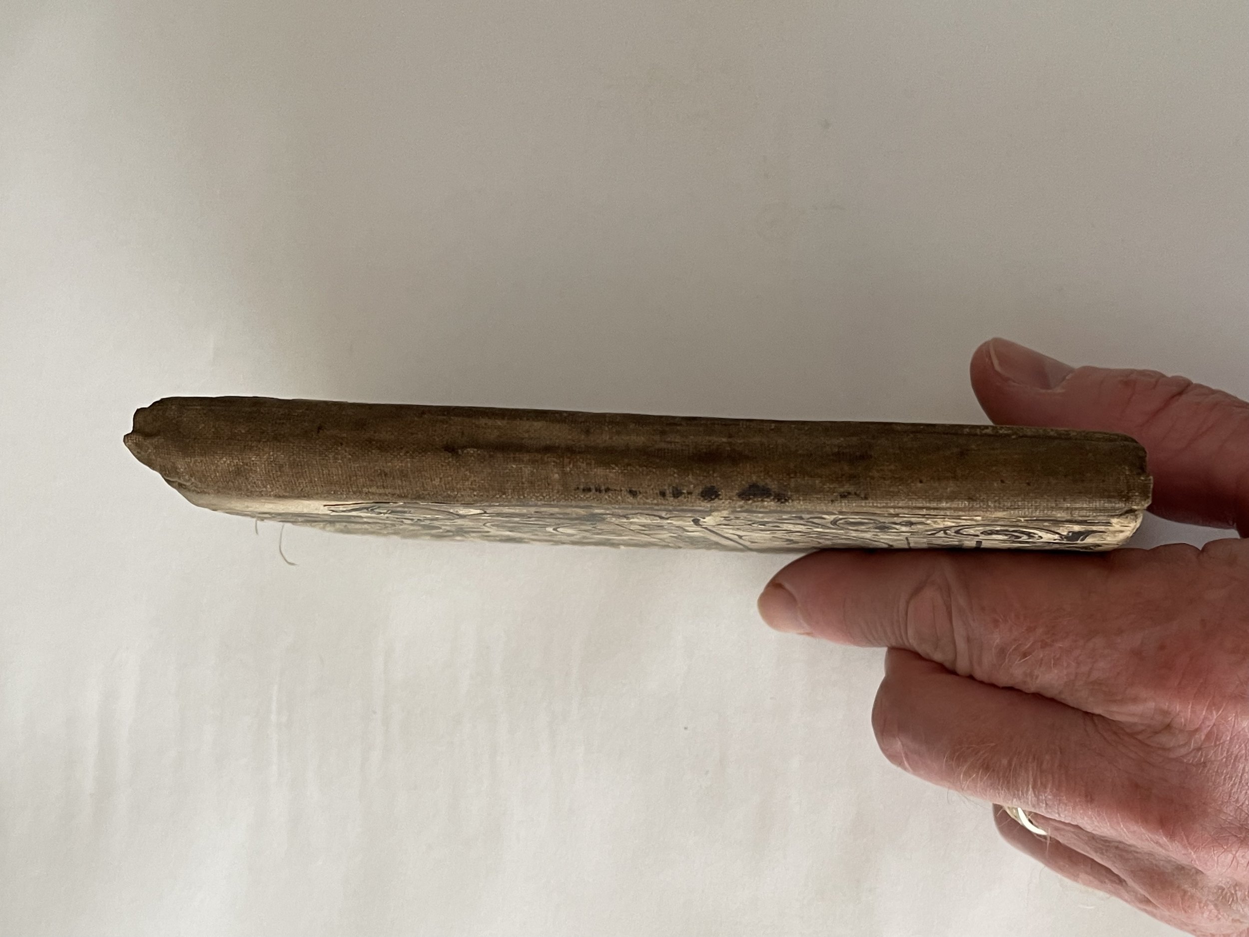
This map has wear and tear, staining commensurate with its age but the engraving is very beautifully clear, is intact, and has survived.
Incredibly detailed, rare and collectable map of London from 1877. A scarce survivor from the era.
A thoroughly decorative 1877 plan or map of London, England by James Wyld. Cantered on Blackfriars Bridge, the map coves central London from Islington to North Brixton and from the East India Docks to Holland Park. Roads, parks, rail lines, important buildings, and neighbourhoods are noted. To the left and right of centre, the English language title is repeated in French and German, respectively.
This map is notable for its remarkable border, with floral corner flourishes and vignette illustrations of London landmarks, including, among others, Buckingham Palace, the British Museum, the Bank of England, London Bridge, and the Houses of Parliament.
Among the border vignettes, in a place of prominence just to the right of the title, can be found a self-promotional view entitled, 'Mr. Wyld's Model of the Earth in Leicester Square.' This is Wyld's Great Globe, an attraction built in 1851, the year this map was issued, in Leicester Square, which was then a private pleasure garden. It consisted of specially construction dome containing great sphere approximately 19 meters in diameter. On the interior walls of the sphere was a plaster of Paris scale model of the Earth. Scaffolding was erected at multiple levels so viewers could examine various locations in greater detail. The globe was a great success throughout its first year, but in subsequent years interest declined. The globe was deconstructed and sold for scrap in 1862. It was not until the 1935 construction of the Mapparium at the Mary Baker Eddy Library in Boson that a larger globe was constructed.
The map was printed in 40 sections that were clearly designed to be dissected and mounted on linen, an event where here, apparently never occurred. This map was issued in 1877. There were 15 additional editions from 1851 with numerous updates and revisions to about 1877.
Wyld I, James (1790 - 1836) and James Wyld II (1812 - 1887)
James Wyld I (1790 - 1836) and his son James Wyld II (November 20, 1812 - 1887) were the principles of English mapmaking dynasty active in London during much of the 19th century. The elder Wyld was a map publisher under William Faden and did considerable work on the Ordinance Survey.
On Faden's retirement, Wyld took over Faden's workshop acquiring many of his plates. Wyld's work can often be distinguished from his son's maps through his imprint, which he signed as 'Successor to Faden'. Following in his father's footsteps the younger Wyld joined the Royal Geographical Society in 1830 at the tender age of 18. When his father died in 1836, James Wyld II was prepared to fully take over and expand his father's considerable cartographic enterprise. Like his father and Faden, Wyld II held the title of official Geographer to the Crown, in this case, Queen Victoria.
In 1852 he moved operations from William Faden's old office at Charing Cross East (1837 - 1852) to a new larger space at 475 Strand. Wyld II also chose to remove Faden's name from all of his updated map plates. Wyld II continued to update and republish both his father's work and the work of William Faden well into the late 1880s.
One of Wyld's most eccentric and notable achievements is his 1851 construction of a globe 19 meters (60 feet) in diameter in the heart of Leicester Square, London. In the 1840s Wyld also embarked upon a political career, being elected to parliament in 1847 and again in 1857. He died in 1887 following a prolific and distinguished career. After Wyld II's death, the family business was briefly taken over by James John Cooper Wyld (1844 - 1907), his son, who ran the firm from 1887 to 1893 before selling the business to Edward Stanford. All three Wylds are notable for producing, in addition to their atlas maps, short run maps expounding upon important historical events - illustrating history as it was happening - among them are maps related to the California Gold Rush, the New South Wales Gold Rush, the Scramble for Africa, the Oregon Question, and more.
This map has wear and tear, staining commensurate with its age but the engraving is very beautifully clear, is intact, and has survived.
Code : A863
Cartographer : Cartographer / Engraver / Publisher: James Wyld
Date : Publication Place / Date - 1877
Size : Sheet size: Image Size: 95 X 56 cm
Availability : Available
Type - Genuine - Antique
Grading A-
Where Applicable - Folds as issued. Light box photo shows the folio leaf centre margin hinge ‘glue’, this is not visible otherwise.
Tracked postage, in casement. Please contact me for postal quotation outside of the UK.