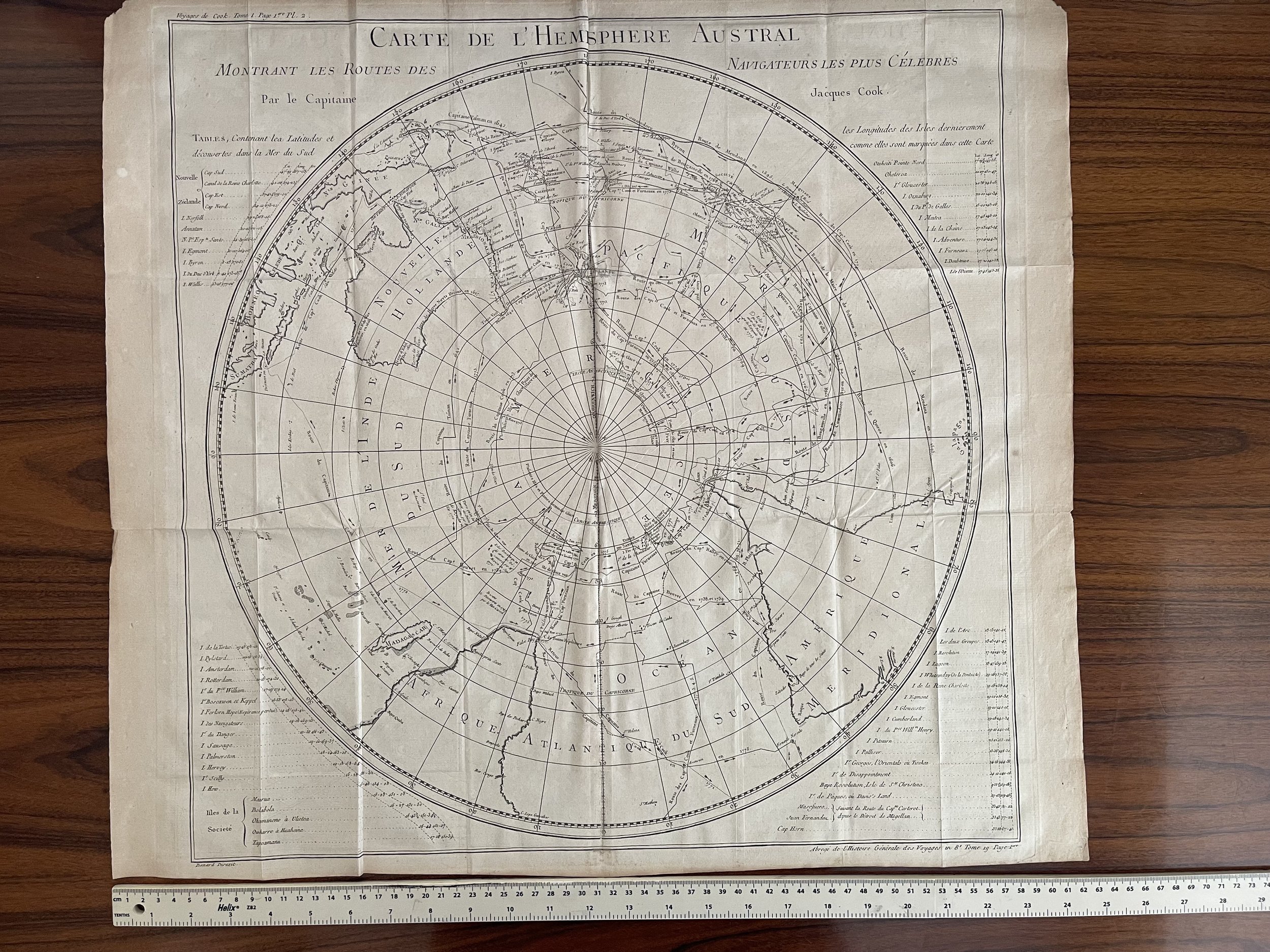

Southern Hemisphere, Australia, Africa, South America, map - Captain Cook - Jacques-Nicolas Bellin / Jaques Renaud Benard - 1775
Highly detailed large format map of the Southern Hemisphere, showing the tracks of the major voyages of exploration in the Southern Hemisphere from 1595 to 1775.
The map was prepared to illustrate the French edition of Cook's report of his voyages in the region. The map includes the coastlines of Australia, New Zealand and part of SE Asia, Africa and South America. The primary feature of the map is the remarkably detailed depiction of the various voyages in the Southern Hemisphere, including the voyages of Mendana (1595), Quiros (1606), Le Maire and Schoeten (1616), Tasman (1642), Halley (1700), Roggewein (1722), Bouvet (1738-39), Carteret (1767), Wallis (1767), Byron (1768), Bouganville (1768) Cook (1770-75), and others.
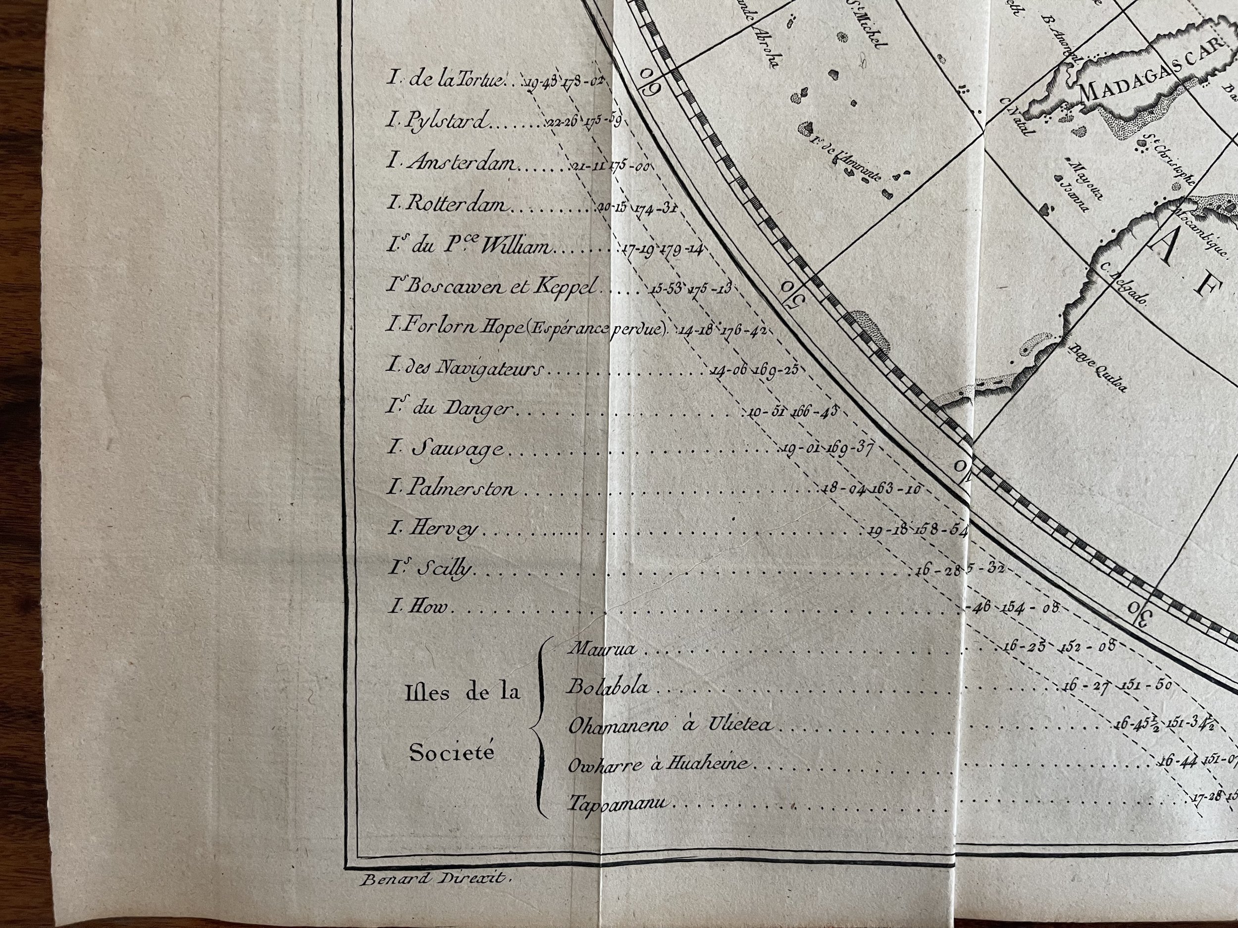
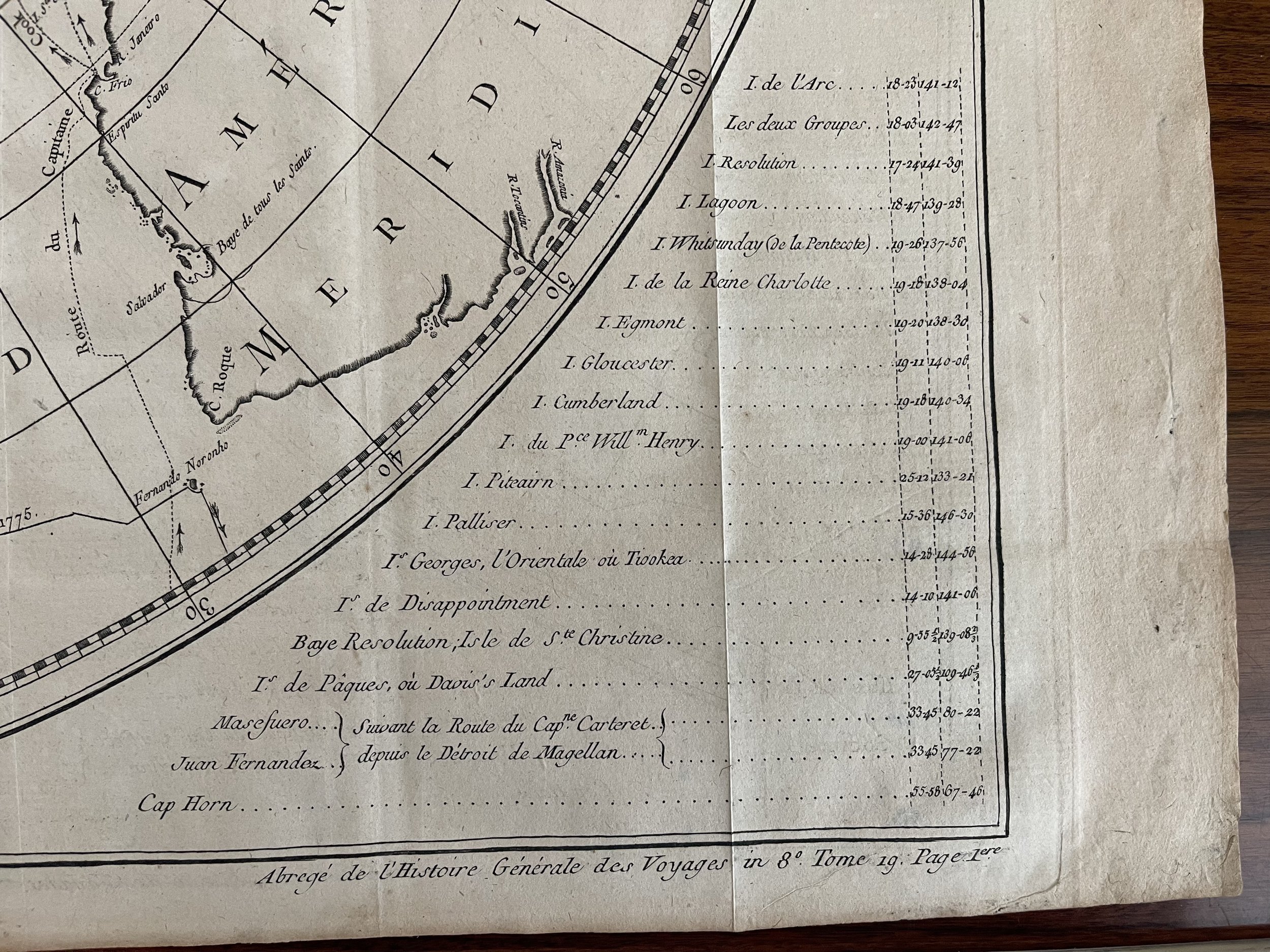
In addition to the map is a detailed set of tables of Latitudes and Discoveries, covering approximately 60 islands, bays, and other locales. A highly collectable map.
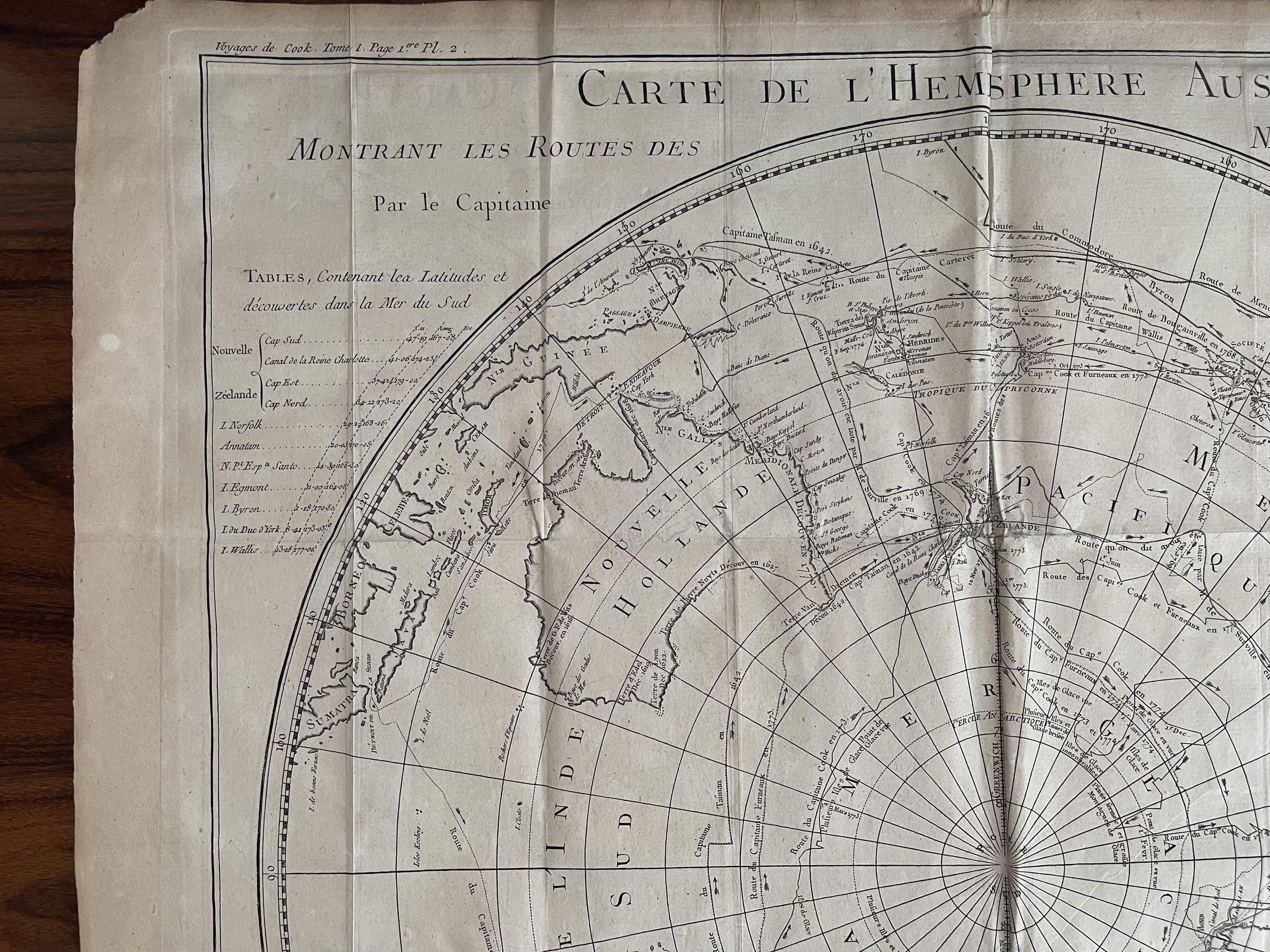
Highly detailed large format map of the Southern Hemisphere, showing the tracks of the major voyages of exploration in the Southern Hemisphere from 1595 to 1775.
The map was prepared to illustrate the French edition of Cook's report of his voyages in the region. The map includes the coastlines of Australia, New Zealand and part of SE Asia, Africa and South America. The primary feature of the map is the remarkably detailed depiction of the various voyages in the Southern Hemisphere, including the voyages of Mendana (1595), Quiros (1606), Le Maire and Schoeten (1616), Tasman (1642), Halley (1700), Roggewein (1722), Bouvet (1738-39), Carteret (1767), Wallis (1767), Byron (1768), Bouganville (1768) Cook (1770-75), and others.
In addition to the map is a detailed set of tables of Latitudes and Discoveries, covering approximately 60 islands, bays, and other locales. A highly collectable map.
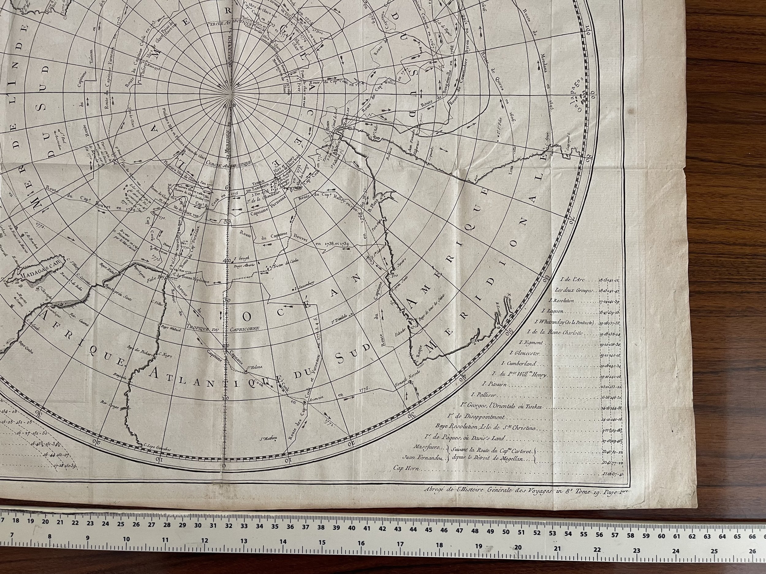
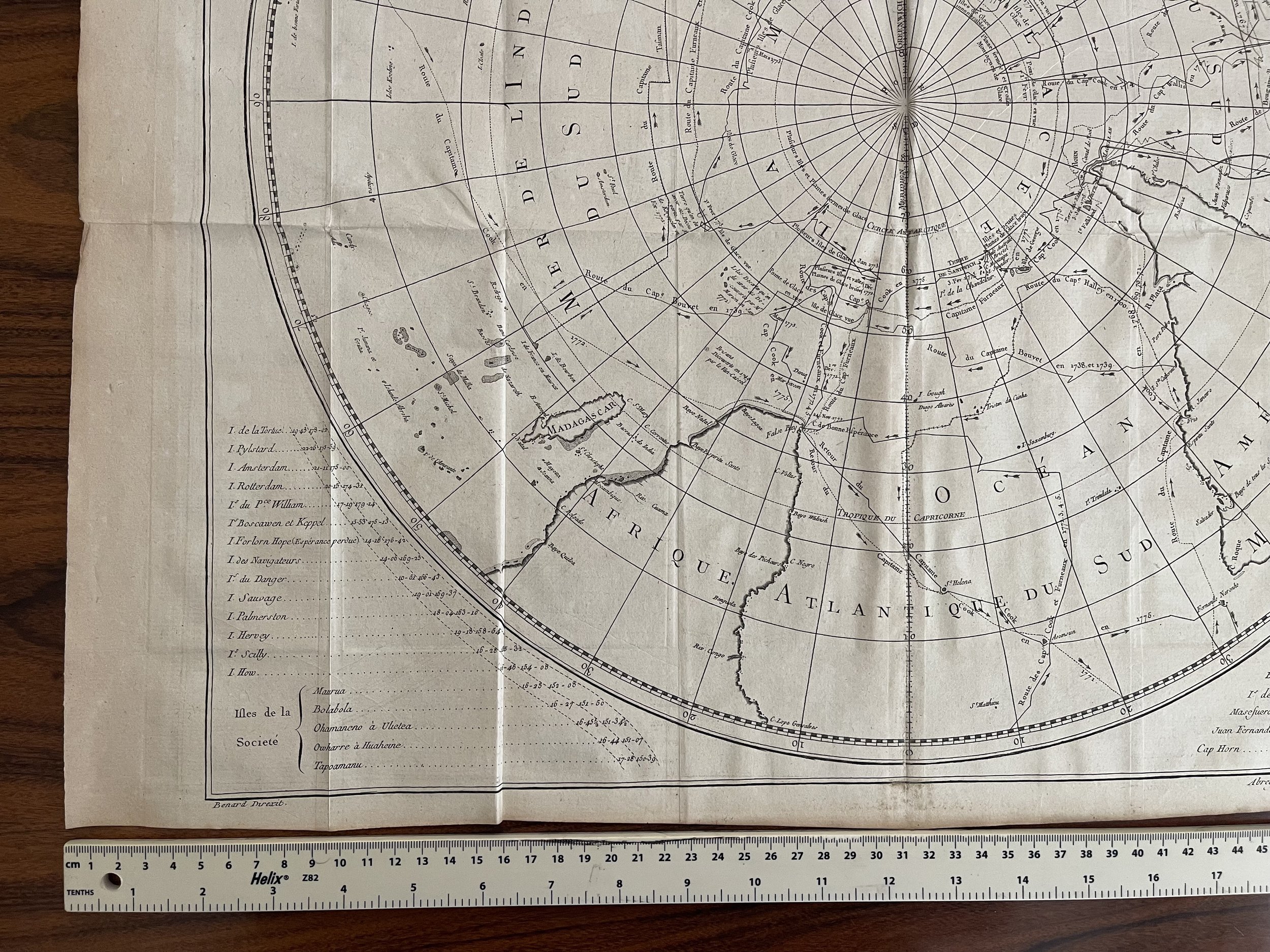
Code : A6
Cartographer : Cartographer / engraver: Jacques-Nicolas Bellin / Jaques Renaud Benard
Date : Paris 1775
Size : Sheet size: 22 x 22 inches
Availability : Available
Type - Genuine Antique
Grading - B+