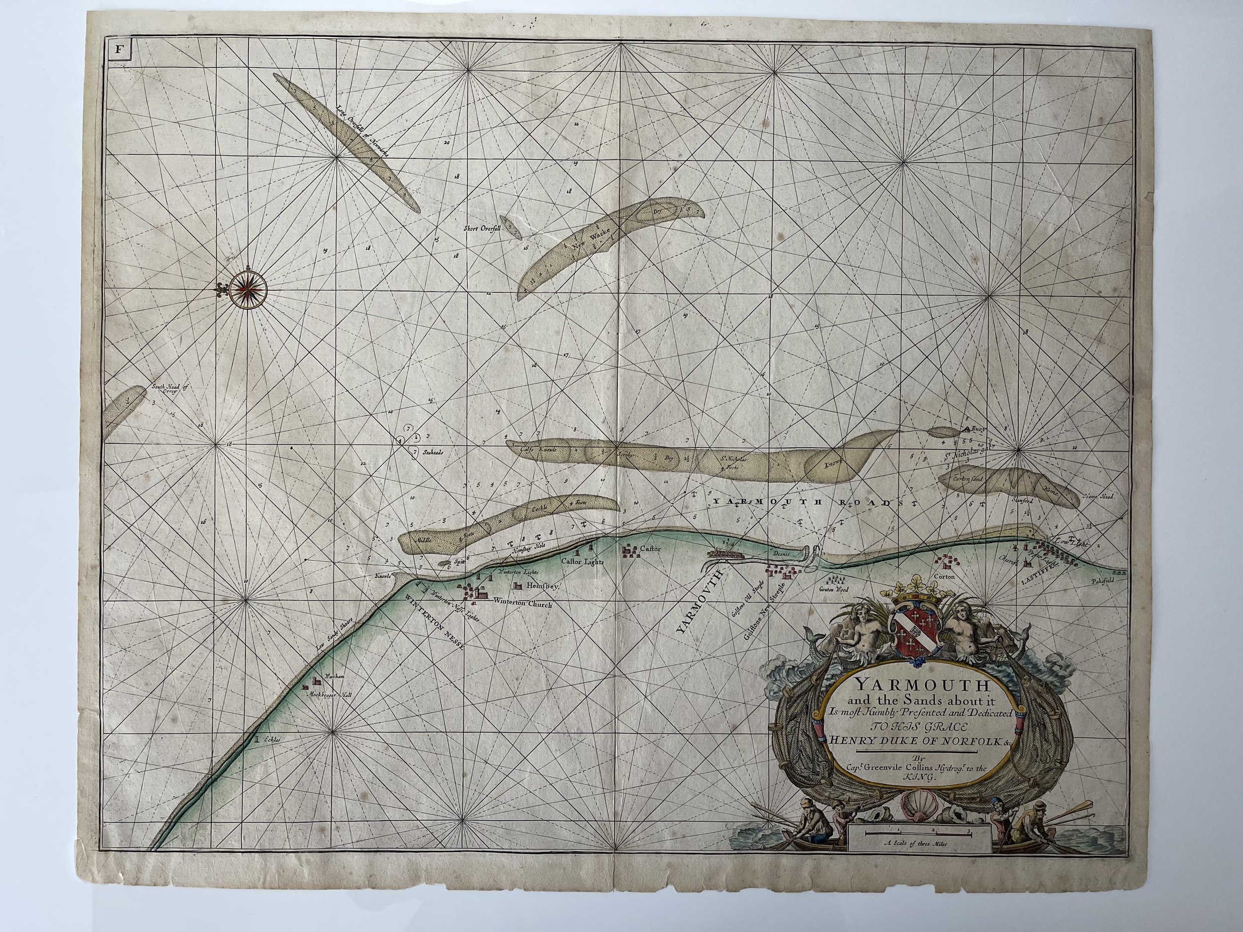
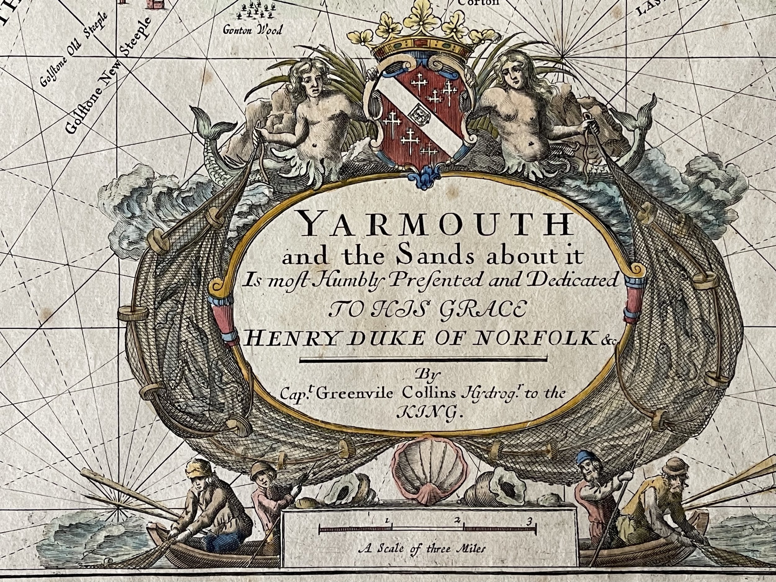

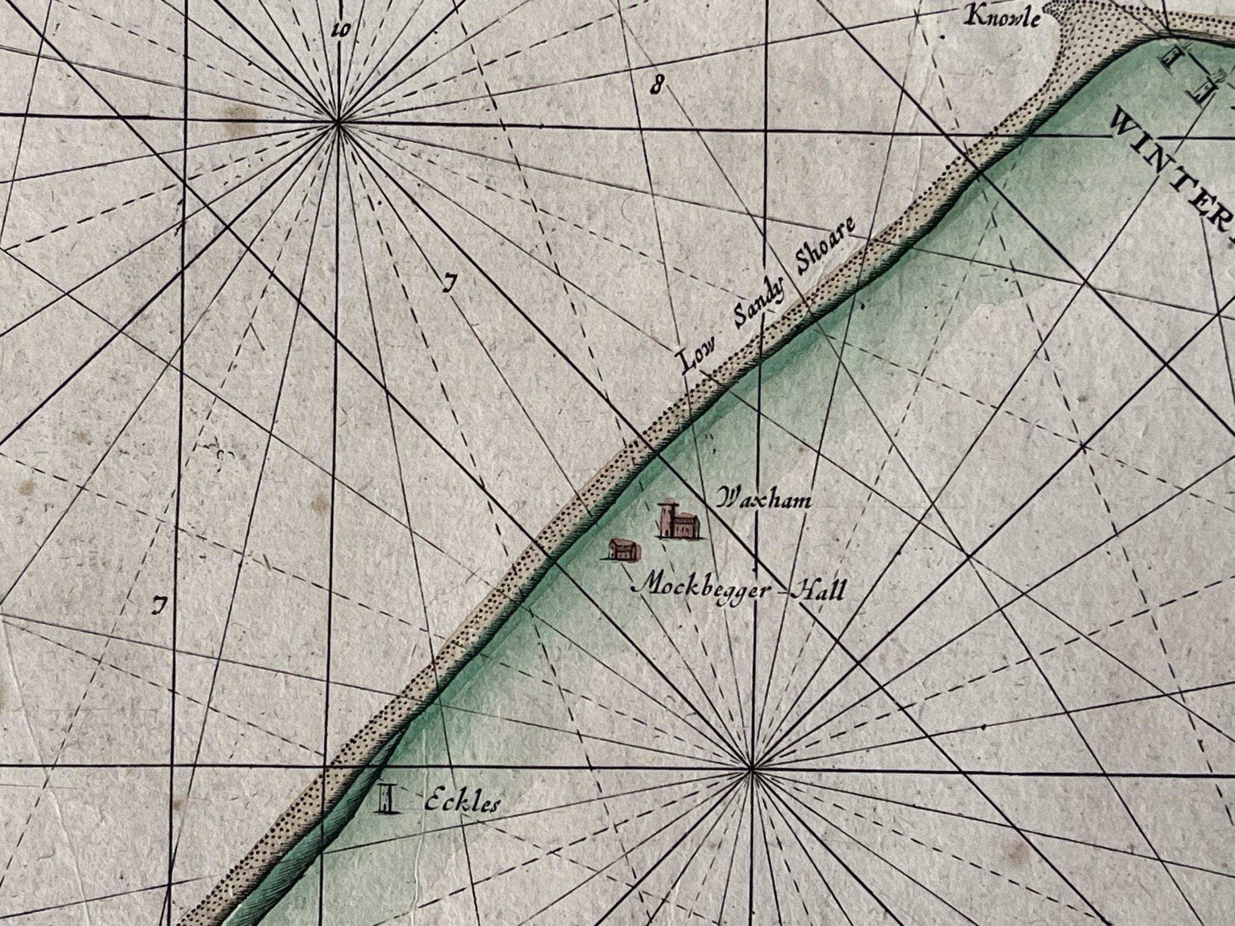
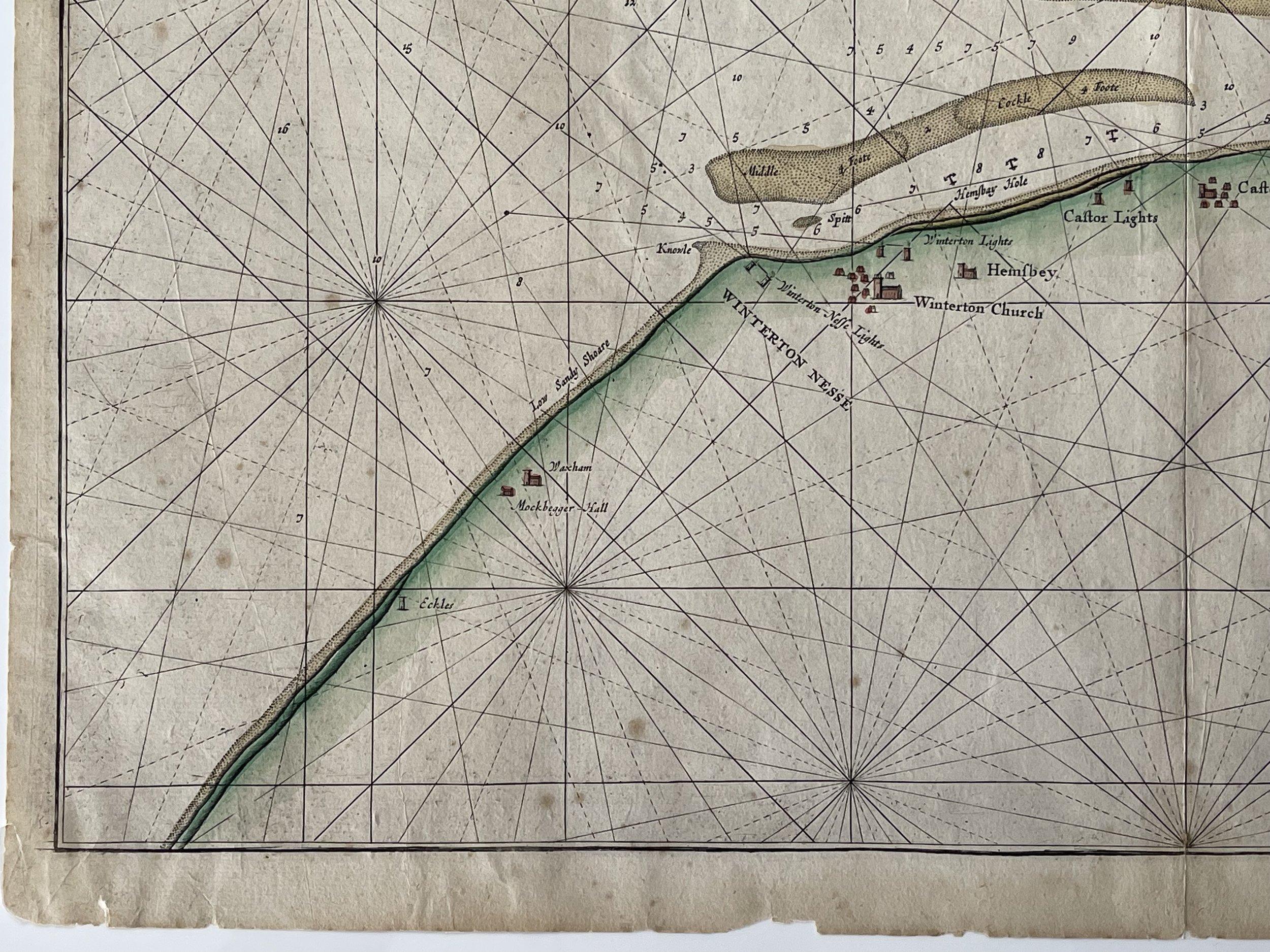
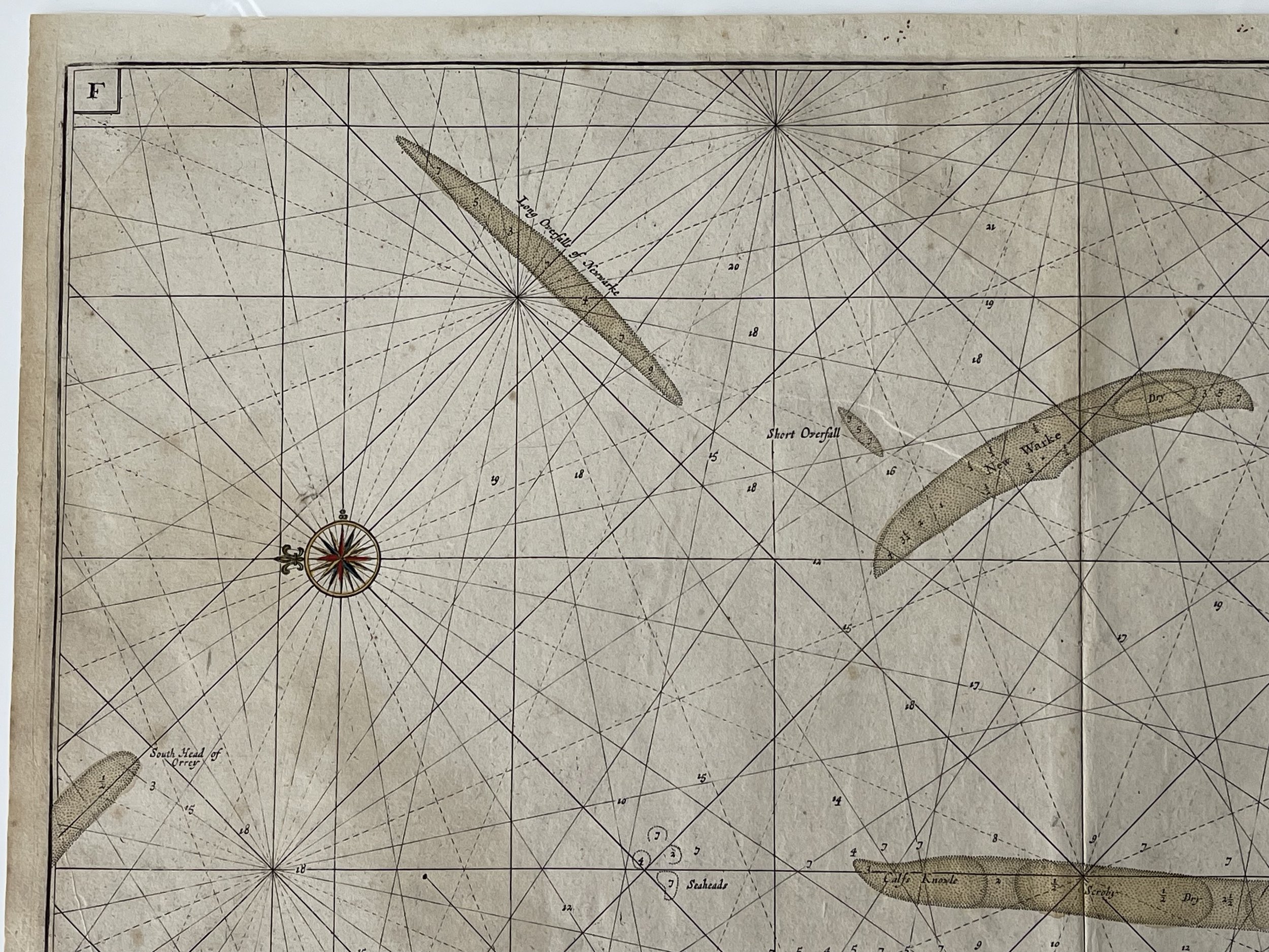
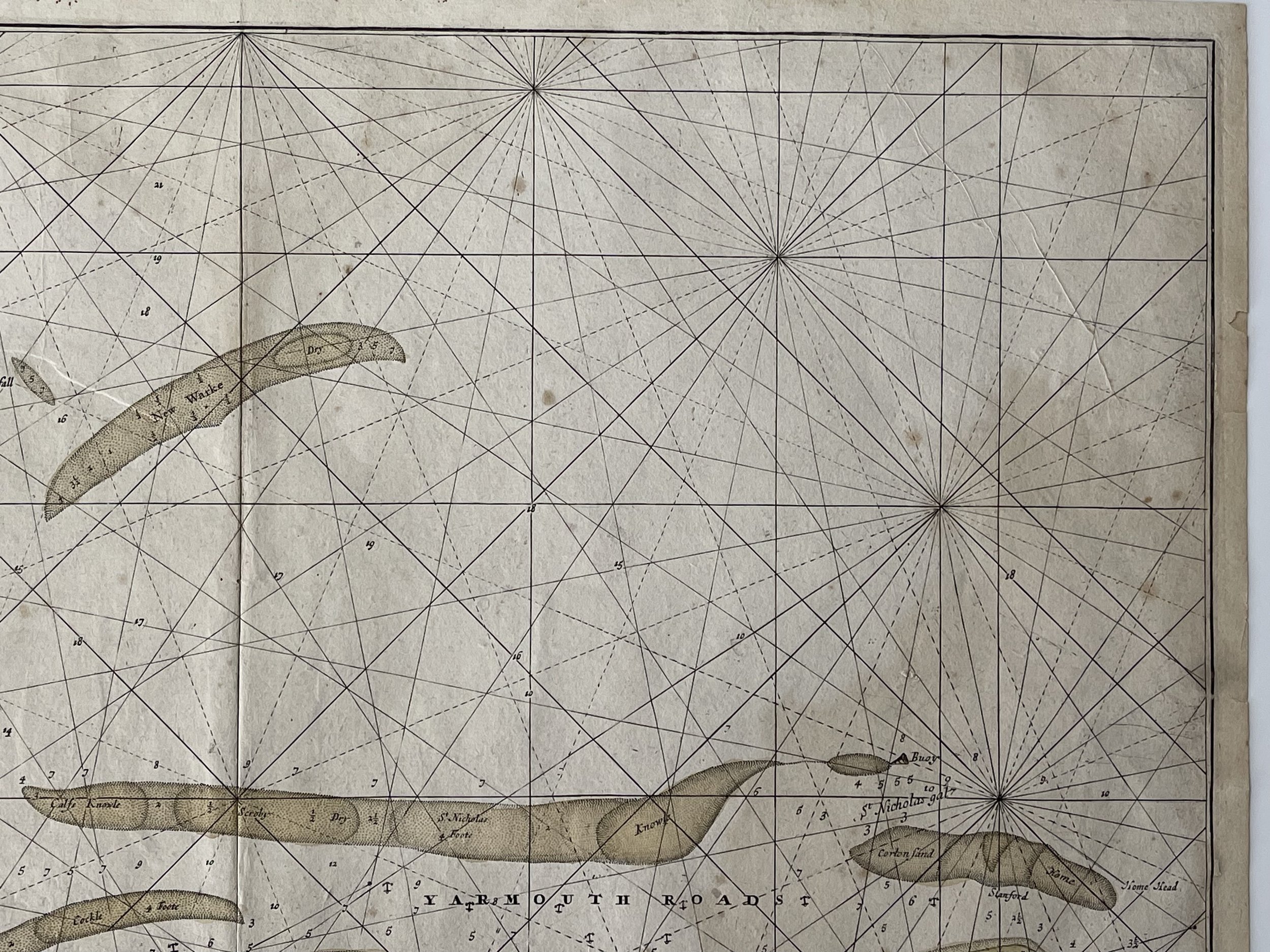
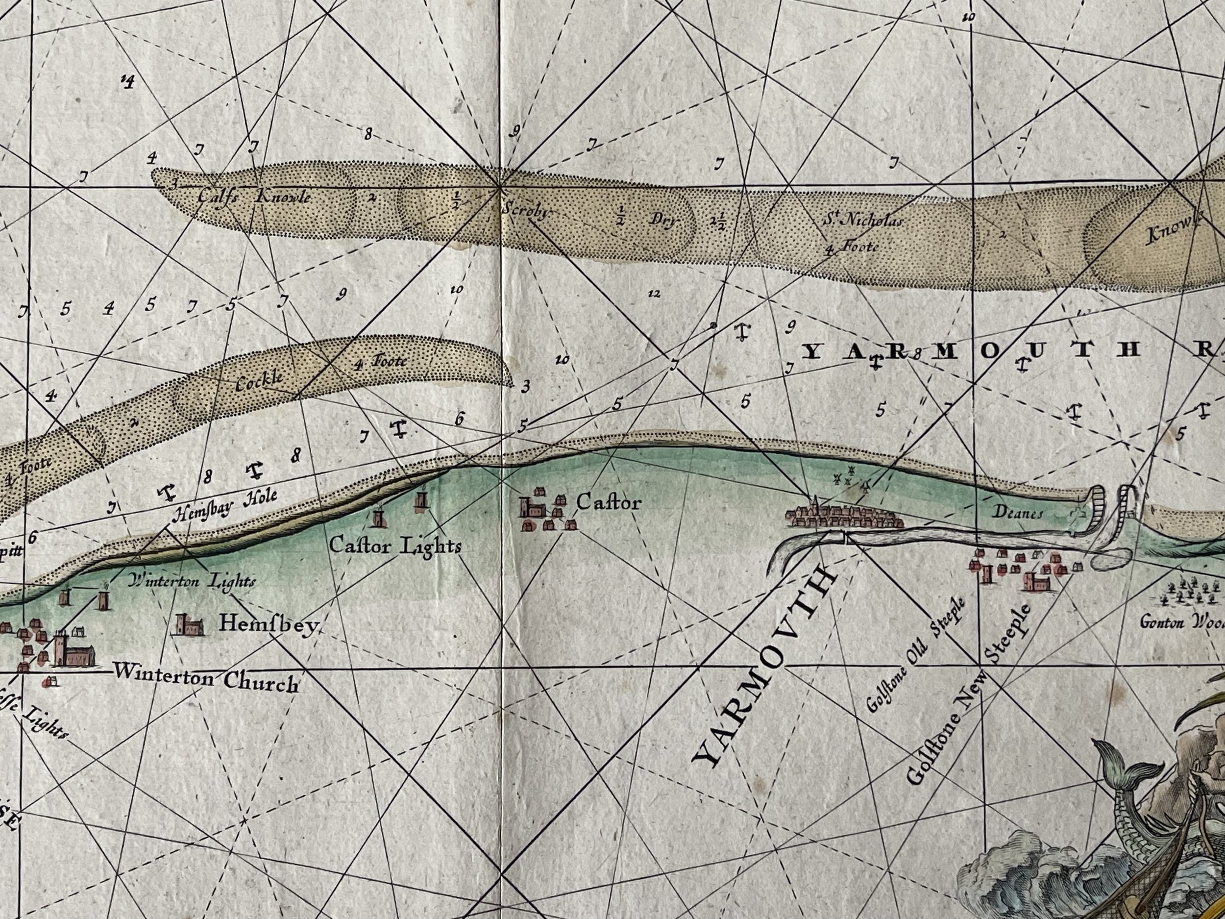
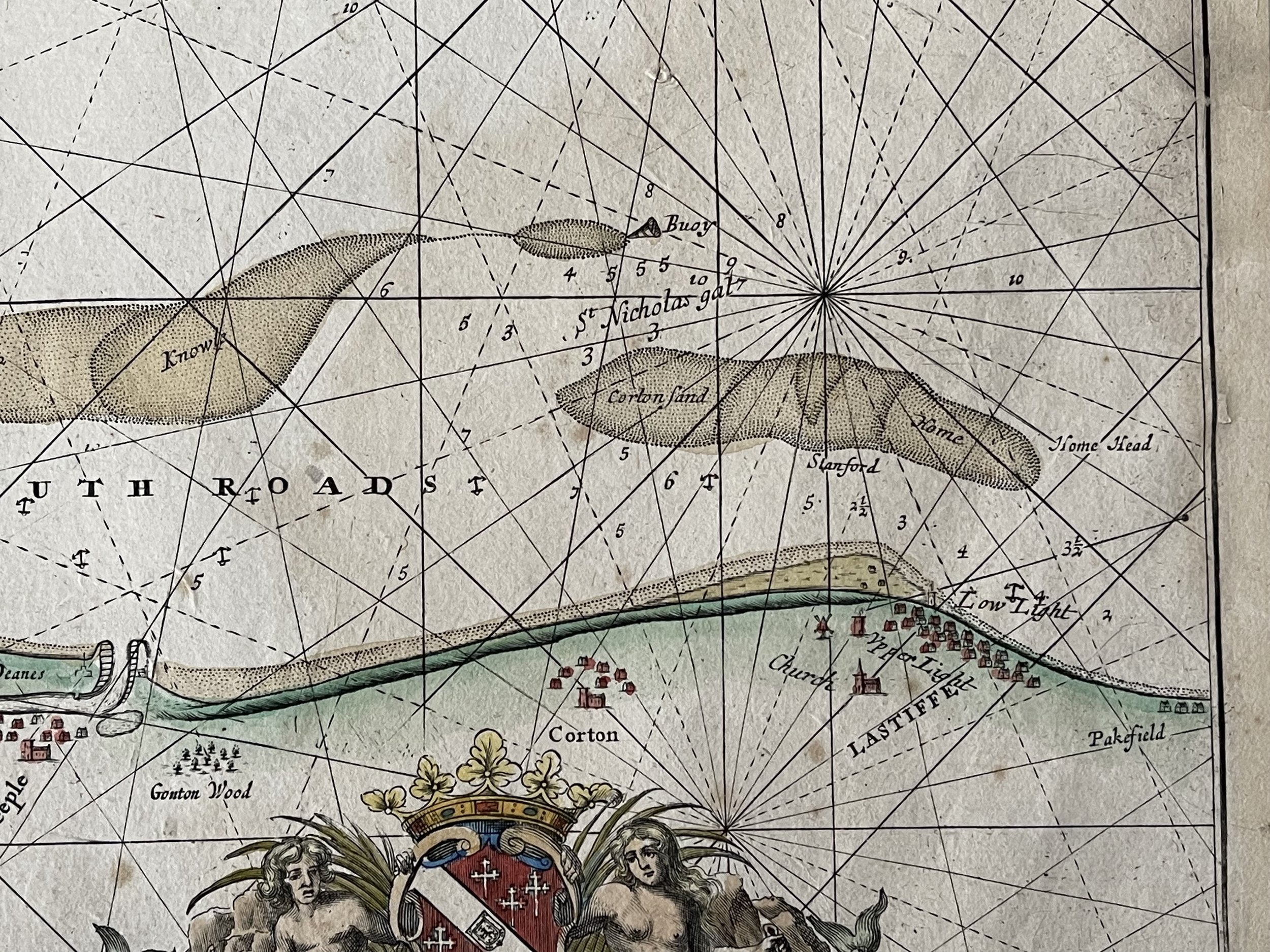

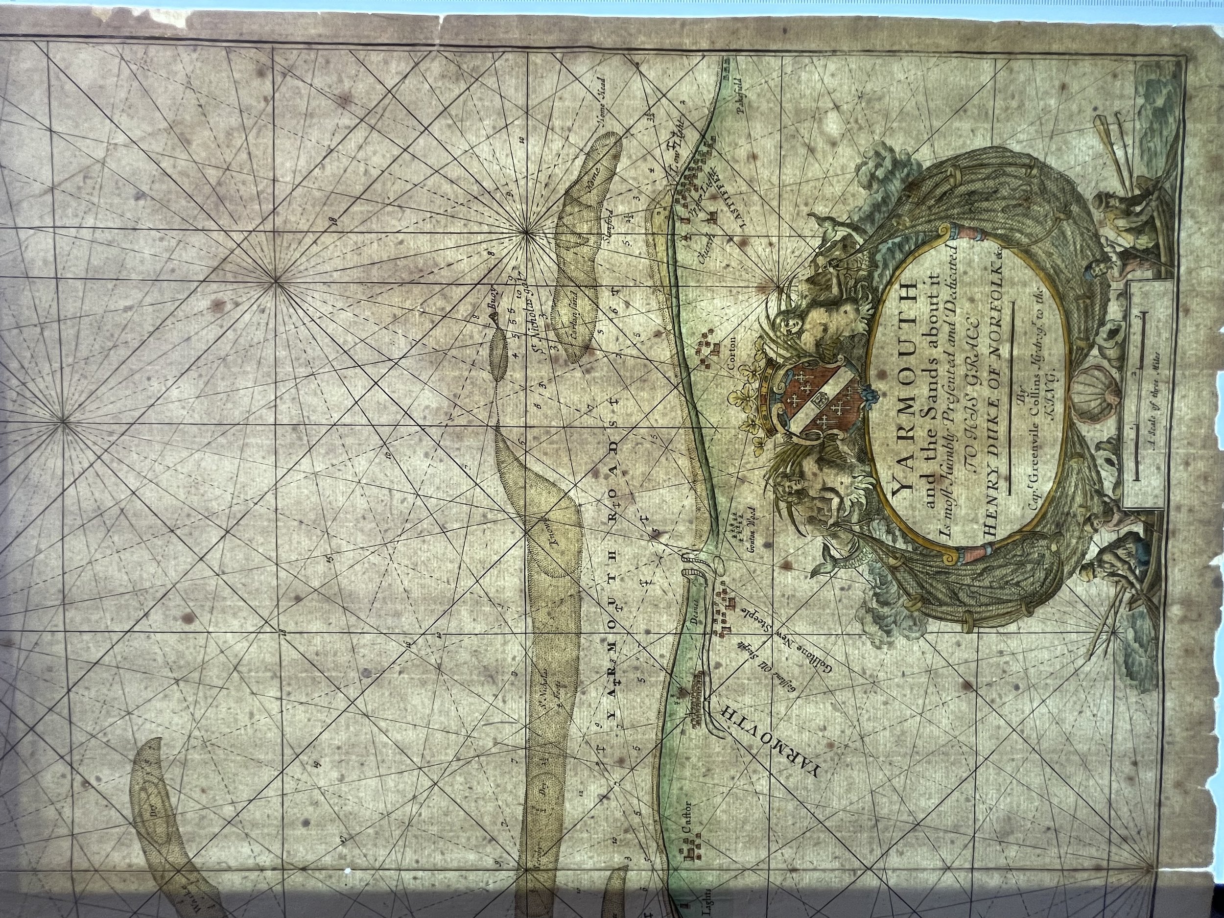
Yarmouth and the Sands About it - Captain Greenvile Collins - Chart F -Circa 1750
This sea chart beautifully depicts the coastline of Great Yarmouth, a town on the eastern coast of England. It spans from Lowestoft to Winterton-on-Sea, featuring prominent locations such as Great Yarmouth, Corton, Gorleston-on-Sea, and Caister-on-Sea. The intricately illustrated chart includes rhumb lines, a compass rose, and an ornate title cartouche. Along with detailing sandbanks and anchorages, it also indicates water depths. Chart F in Yarmouth takes a more focused approach on the local industry by displaying it within a "heraldic" framework adorned with bountiful fishing nets. The mermen depicted in this rendition replace the putti commonly seen in other versions.
Created by Captain Greenville Collins, this chart was first published in 1693 by Freeman Collins in London as part of Great Britain's Coasting Pilot. Updates were made and the chart was reissued until 1792.
Greenvile Collins (1643 – c. 25 March 1694) (also spelt Greenvill or Greenville) was an officer of the Royal Navy and prominent hydrographer, who compiled Great Britain's Coasting Pilot, the first survey of the country's coast undertaken by a Briton.
Collins then undertook another Mediterranean tour as master of the Leopard; this voyage ran through the whole of 1680 and into the first few months of the year following. Henry Fitzroy, Charles II's natural son and later Duke of Grafton, accompanied Collins during that voyage. Earlier, Collins had gained the king's attention with the quality of his Arctic journal keeping.
With this access, Collins began to lobby in 1680 for support for his proposals to undertake an improved survey of the country's coasts. Prior to this time nautical charts were often defective, and there was no centralised system for collecting and disseminating the better maps made by experienced seamen. In the Spring of 1681, Collins gained the king's preferment to survey the country's coasts. For the survey, the Admiralty supplied Collins with the 8-gun yacht HMS Merlin for the first two years and then the yacht HMS Monmouth until 1686. His surveying was carried out under the supervision of Trinity House, who also supported the project with financial contributions. Samuel Pepys insisted that Collins be made a younger brother of Trinity House.
Collins eventually spent seven years on the survey, at first on the Merlin and Monmouth, later aboard the Martin and Younge Spragge. As well as his own observations, he likely included existing charts and seamen's sketches and notes, and published charts as they were completed. Collins began gathering engraved copper plates with which to eventually print his charts with while he was engaged on the survey and continued gathering more plates in the years following. In 1693, he finally published his results in a folio volume of two parts, Great Britain's Coasting Pilot, containing sailing directions, tide tables, coastal views and about forty-nine charts. The charts were not completely accurate, but with all their shortcomings they were an enormous advance on anything before them and entitle Collins to rank not only with the earliest, but with the best of English hydrographers. The work covered England and Scotland, and though Collins proposed a further study to cover Ireland, the plan came to nothing. Collins recorded that he had spent £40 on instruments and charged £80 for the 120 manuscript maps he delivered. With his claim for expenses set at £200 per annum, and his wages of £394 10s., he claimed a total of £1914 10s. for his work, which was eventually paid in arrears. The cost was more than three times the original estimate. His cousin, Freeman Collins, printed the Coasting Pilot, which Richard Mount sold. Mount's subsequent firm then went on to publish twenty-one further editions of the pilot throughout the nineteenth century. The Sudbrook Press published the book as a reduced facsimile in 1964, followed by Early English Books first in microfilm and then online.
The engraving has some light foxing present but otherwise in good order considering its age and use. Pricing and grading commensurate.
Code : A810
Cartographer : Cartographer / Engraver / Publisher: Freeman Collins - Captain Greenville Collins
Date : Publication Place / Date - 1750
Size : Sheet size: approx 57 x 45 Cm
Availability : Available
Type - Genuine - Antique
Grading A-
Where Applicable - Folds as issued. Light box photo shows the folio leaf centre margin hinge ‘glue’, this is not visible otherwise.
Tracked postage, in casement. Please contact me for postal quotation outside of the UK.